
Rejs 30 941 138
Zanurzenie w wyspie i Amazonii
| Region rejsu : Karaiby |
| Firma : Oceania Cruises |
| Statek : Insignia |
| Data rozpoczęcia : czw. 15 sty 2026 |
| Data zakończenia : niedz. 15 lut 2026 |
| Liczba nocy : 31 noc |


Harmonogram
| Dzień | Data | Port | Wypłynięcie | Odpłynięcie |
|---|---|---|---|---|
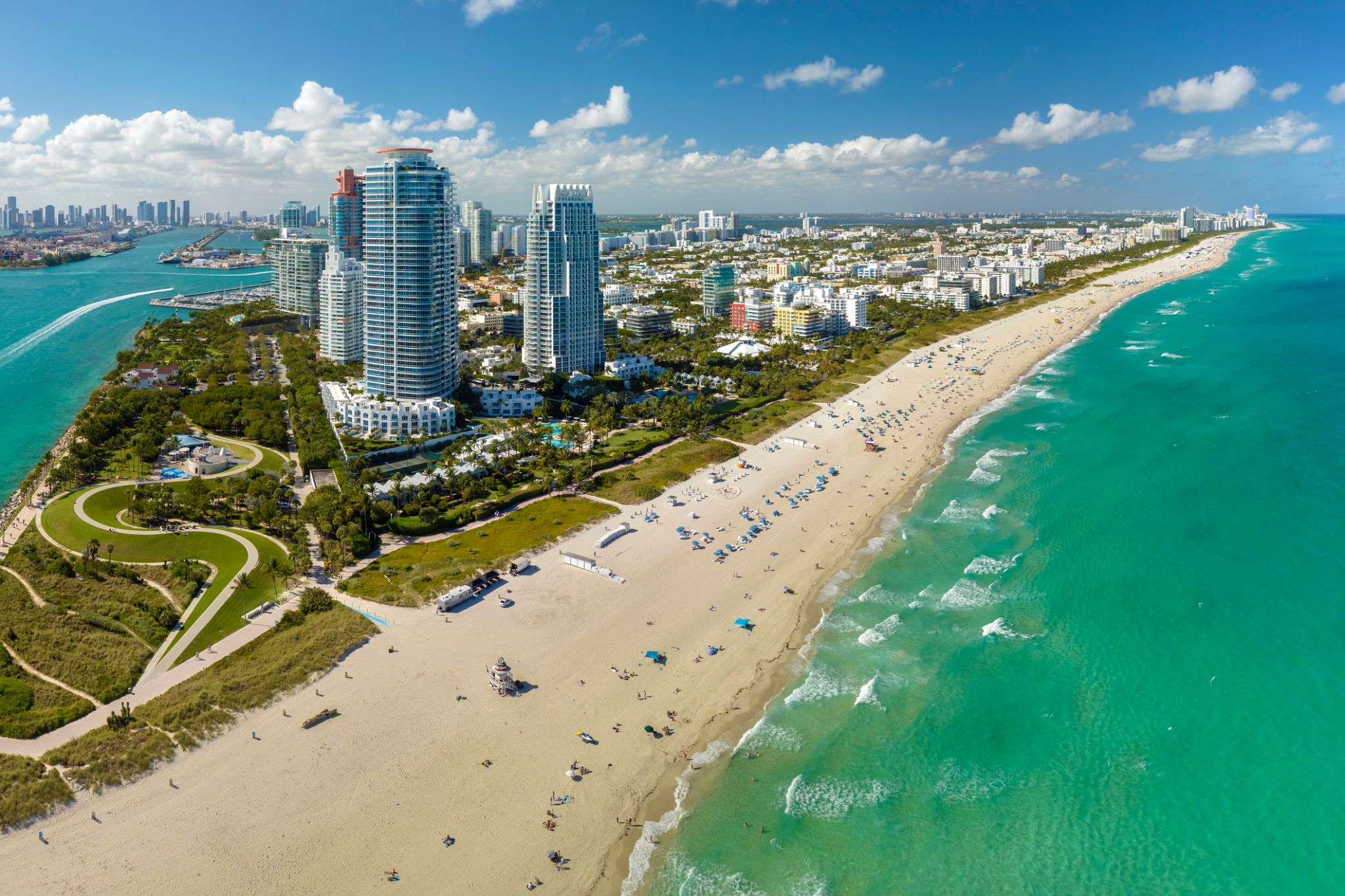
| 1 | 15.01 czw. | Miami / USA | 07:00 | 17:00 |
| 2 | 16.01 pt. | Dzień na morzu / Morze | ||
| 3 | 17.01 sob. | Dzień na morzu / Morze | ||
| 4 | 18.01 niedz. | Aruba (Oranjestad) / Aruba | 11:00 | 22:00 |
| 5 | 19.01 pon. | Curaçao / Curacao | 07:00 | 17:00 |
| 6 | 20.01 wt. | Dzień na morzu / Morze | ||
| 7 | 21.01 śr. | Port w Hiszpanii / Trinidad and Tobago | 07:00 | 17:00 |
| 8 | 22.01 czw. | Saint-Georges / French Guiana | 07:00 | 17:00 |
| 9 | 23.01 pt. | Castries / Saint Lucia | 07:00 | 17:00 |
| 10 | 24.01 sob. | Kingstown | 07:00 | 17:00 |
| 11 | 25.01 niedz. | Róża / Dominica | 07:00 | 17:00 |
| 12 | 26.01 pon. | Fort-de-France, Martynika (wyspa) / Martynika | 07:00 | 17:00 |
| 13 | 27.01 wt. | Bridgetown / Barbados | 07:00 | 17:00 |
| 14 | 28.01 śr. | Dzień na morzu / Morze | ||
| 15 | 29.01 czw. | Dzień na morzu / Morze | ||
| 16 | 30.01 pt. | Dzień na morzu / Morze | ||
| 17 | 31.01 sob. | Santarem / Brazylia | 12:00 | 20:00 |
| 18 | 1.02 niedz. | Паринтинс Parintins / Brazylia | 08:00 | 16:00 |
| 19 | 2.02 pon. | Manaus / Brazylia | 09:00 | |
| 20 | 3.02 wt. | Manaus / Brazylia | 16:00 | |
| 21 | 4.02 śr. | Wioska Boca de Valeria / Brazylia | 11:00 | 18:00 |
| 22 | 5.02 czw. | Alter do Chao / Brazylia | 07:00 | 16:00 |
| 23 | 6.02 pt. | Dzień na morzu / Morze | ||
| 24 | 7.02 sob. | Dzień na morzu / Morze | ||
| 25 | 8.02 niedz. | Devil’s Point / Bahamy | 07:00 | 16:00 |
| 26 | 9.02 pon. | Dzień na morzu / Morze | ||
| 27 | 10.02 wt. | Scarborough / Trinidad and Tobago | 07:00 | 17:00 |
| 28 | 11.02 śr. | Port w Hiszpanii / Trinidad and Tobago | 08:00 | 17:00 |
| 29 | 12.02 czw. | Saint-Georges / French Guiana | 07:00 | 17:00 |
| 30 | 13.02 pt. | Kingstown | 07:00 | 17:00 |
| 31 | 14.02 sob. | Castries / Saint Lucia | 07:00 | 18:00 |
| 32 | 15.02 niedz. | Bridgetown / Barbados | 07:00 | 18:00 |


-
 Dzień 1: 07:00-17:00
Miami / USA
Miami, officially the City of Miami, is the cultural, economic and financial center of South Florida. Miami is the seat of Miami-Dade County, the most populous county in Florida. The city covers an area of about 56.6 square miles (147 km2), between the Everglades to the west and Biscayne Bay on the east; with a 2017 estimated population of 463,347, Miami is the sixth most densely populated major city in the United States. The Miami metropolitan area is home to 6.1 million people and the seventh-largest metropolitan area in the nation. Miami's metro area is the second-most populous metropolis in the southeastern United States and fourth-largest urban area in the U.S.
Miami is a major center, and a leader in finance, commerce, culture, media, entertainment, the arts, and international trade. The Miami Metropolitan Area is by far the largest urban economy in Florida and the 12th largest in the United States with a GDP of $344.9 billion as of 2017. In 2012, Miami was classified as an "Alpha−" level world city in the World Cities Study Group's inventory. In 2010, Miami ranked seventh in the United States and 33rd among global cities in terms of business activity, human capital, information exchange, cultural experience, and political engagement. In 2008, Forbes magazine ranked Miami "America's Cleanest City", for its year-round good air quality, vast green spaces, clean drinking water, clean streets, and citywide recycling programs. According to a 2009 UBS study of 73 world cities, Miami was ranked as the richest city in the United States, and the world's seventh-richest city in terms of purchasing power. Miami is nicknamed the "Capital of Latin America" and is the largest city with a Cuban-American plurality.
Greater Downtown Miami has one of the largest concentrations of international banks in the United States, and is home to many large national and international companies. The Civic Center is a major center for hospitals, research institutes, medical centers, and biotechnology industries. For more than two decades, the Port of Miami, known as the "Cruise Capital of the World", has been the number one cruise passenger port in the world. It accommodates some of the world's largest cruise ships and operations, and is the busiest port in both passenger traffic and cruise lines. Metropolitan Miami is also a major tourism hub in the southeastern U.S. for international visitors, ranking number two in the country after New York City.
-
 Dzień 2:
Dzień na morzu / Morze
-
Dzień 3:
Dzień na morzu / Morze
-
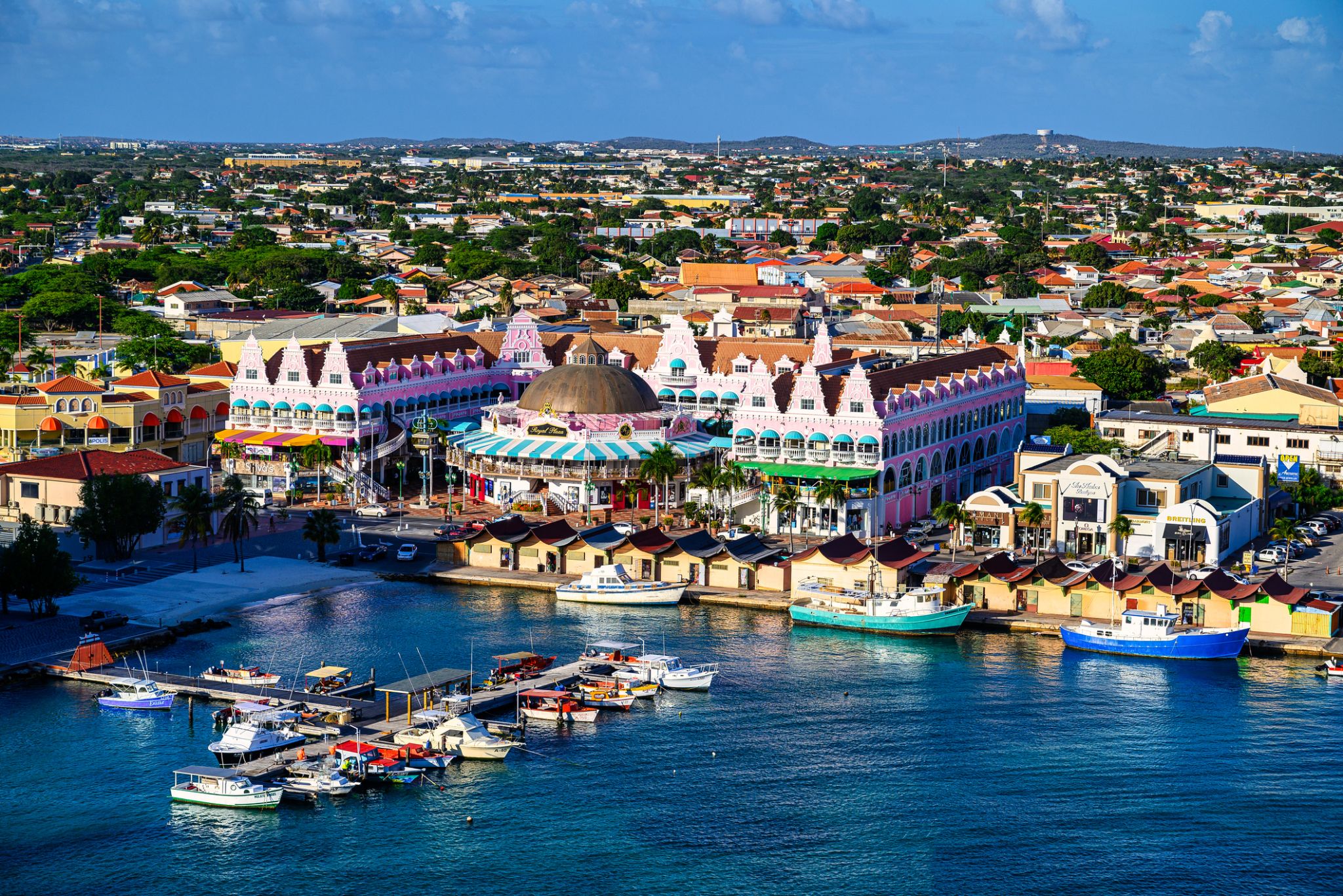 Dzień 4: 11:00-22:00
Aruba (Oranjestad) / Aruba
Aruba is an island and a constituent country of the Kingdom of the Netherlands in the southern Caribbean Sea, located about 1,600 kilometres (990 mi) west of the main part of the Lesser Antilles and 29 kilometres (18 mi) north of the coast of Venezuela. It measures 32 kilometres (20 mi) long from its northwestern to its southeastern end and 10 kilometres (6 mi) across at its widest point. Together with Bonaire and Curaçao, Aruba forms a group referred to as the ABC islands. Collectively, Aruba and the other Dutch islands in the Caribbean are often called the Dutch Caribbean.
Aruba is one of the four countries that form the Kingdom of the Netherlands, along with the Netherlands, Curaçao, and Sint Maarten; the citizens of these countries are all Dutch nationals. Aruba has no administrative subdivisions, but, for census purposes, is divided into eight regions. Its capital is Oranjestad.
Unlike much of the Caribbean region, Aruba has a dry climate and an arid, cactus-strewn landscape. This climate has helped tourism as visitors to the island can reliably expect warm, sunny weather. It has a land area of 179 km2(69.1 sq mi) and is densely populated, with a total of 102,484 inhabitants at the 2010 Census. It lies outside Hurricane Alley.
-
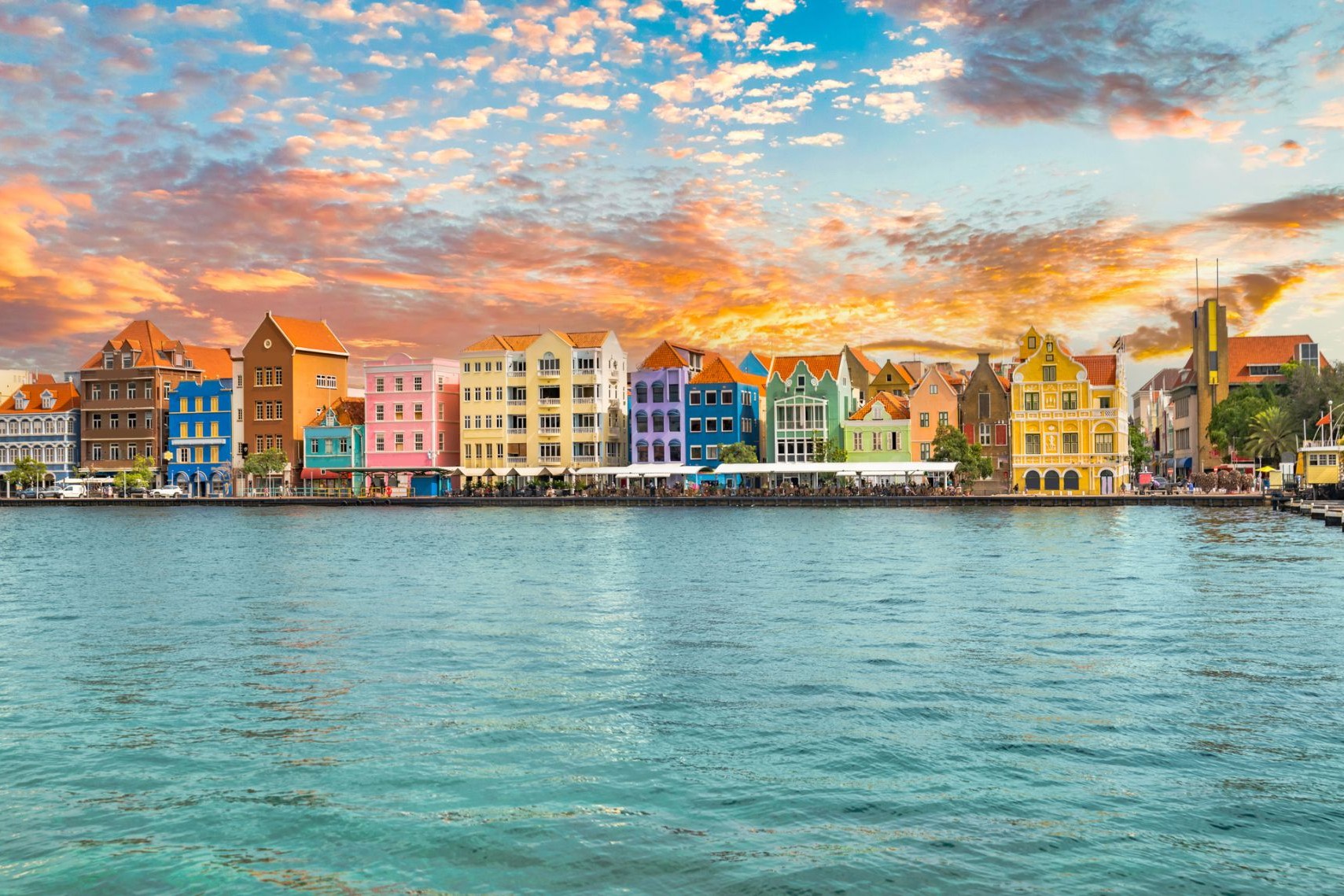
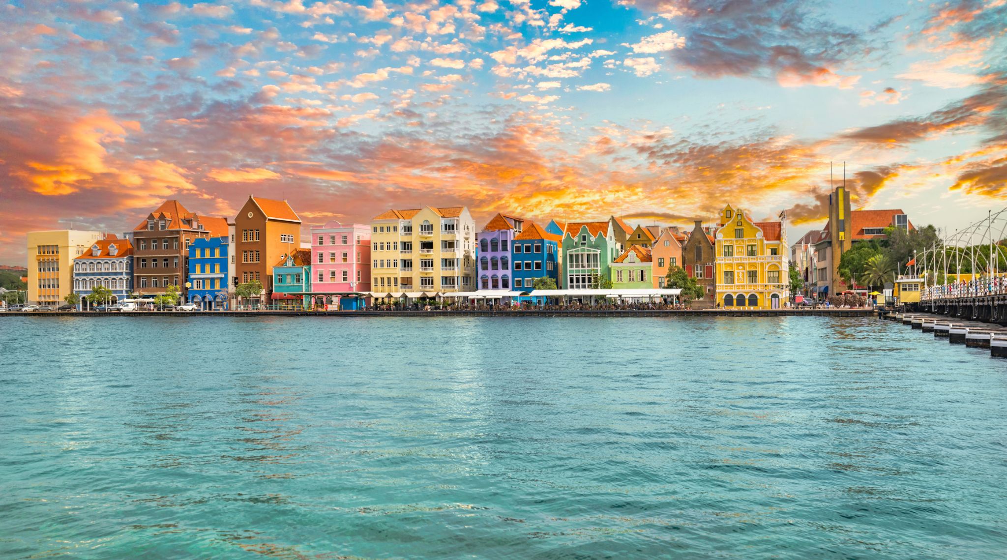 Dzień 5: 07:00-17:00
Curaçao / Curacao
Curaçao jest wyspą w Małych Antylach na południowym Morzu Karaibskim i w regionie Karaibów Holenderskich, około 65 km (40 mil) na północ od wybrzeża Wenezueli. Jest krajem składowym (hol. land) Królestwa Niderlandów.
-
Dzień 6:
Dzień na morzu / Morze
-
 Dzień 7: 07:00-17:00
Port w Hiszpanii / Trinidad and Tobago
-
Dzień 8: 07:00-17:00
Saint-Georges / French Guiana
-
 Dzień 9: 07:00-17:00
Castries / Saint Lucia
-
Dzień 10: 07:00-17:00
Kingstown
-
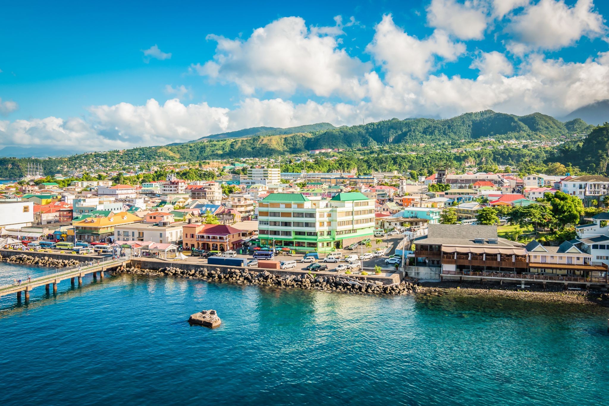
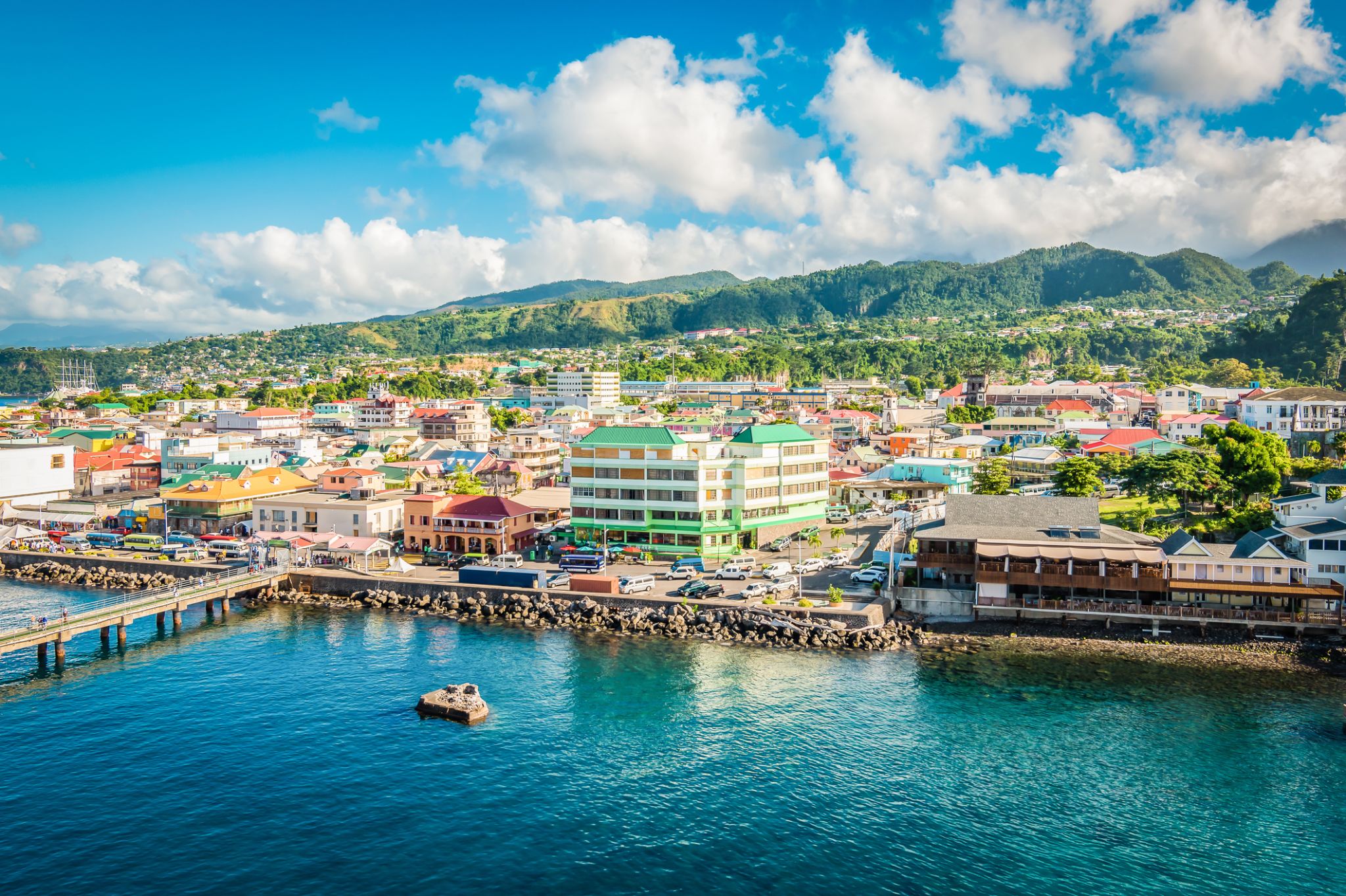 Dzień 11: 07:00-17:00
Róża / Dominica
Dominica, officially the Commonwealth of Dominica, is an island country in the West Indies. The capital, Roseau, is located on the western side of the island. It is part of the Windward Islands in the Lesser Antilles archipelago in the Caribbean Sea. The island is located near Guadeloupe to the northwest and Martinique to the south-southeast. Its area is 750 km2 (290 sq mi), and the highest point is Morne Diablotins, at 1,447 m (4,747 ft) in elevation. The population was 71,293 at the 2011 census. The Commonwealth of Dominica is one of the Caribbean's few republics.
The island was originally inhabited by the Kalinago and later colonised by Europeans, predominantly by the French from the 1690s to 1763. Columbus is said to have passed the island on Sunday 3 November 1493, and the island's name is derived from the Latin for "Sunday". Great Britain took possession in 1763 after the Seven Years' War, and it gradually established English as its official language. The island republic gained independence in 1978.
Its name is pronounced with emphasis on the third syllable, related to its French name of Dominique. Dominica has been nicknamed the "Nature Isle of the Caribbean" for its natural environment. It is the youngest island in the Lesser Antilles, and in fact it is still being formed by geothermal-volcanic activity, as evidenced by the world's second-largest hot spring, called Boiling Lake. The island has lush mountainous rainforests, and it is the home of many rare plants, animals, and bird species. There are xeric areas in some of the western coastal regions, but heavy rainfall occurs inland. The Sisserou parrot, also known as the imperial amazon and found only on Dominica, is the island's national bird and featured on the national flag, which is one of only two national flags containing the color purple.
-
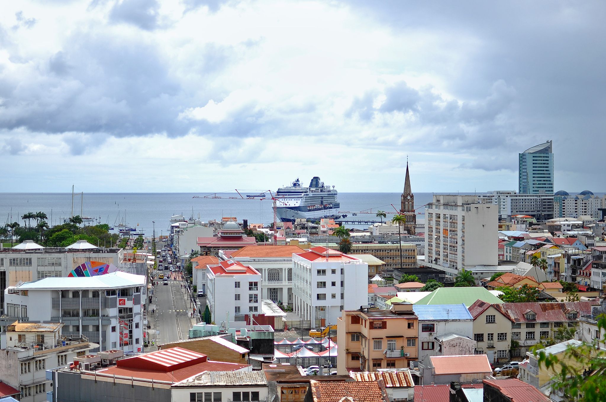 Dzień 12: 07:00-17:00
Fort-de-France, Martynika (wyspa) / Martynika
Fort-de-France – Serce Martyniki
Fort-de-France to stolica wyspy Martynika, położona na jej południowym zachodzie. To malownicze miasto portowe łączy francuską elegancję z karaibską egzotyką. Spacerując po jego ulicach, można podziwiać starą architekturę, atmosferę lokalnych rynków i zapierające dech w piersiach widoki na zatokę. Główną atrakcją architektoniczną jest cytadela Fort-de-France, z której roztacza się panoramiczny widok na miasto i wyspę.
Dla turystów Fort-de-France oferuje bogate doświadczenie kulturowe: odwiedziny w muzeach, w tym w Muzeum Martyniki, poznawanie lokalnej kuchni i tradycji. Natura wyspy zachwyca: białe plaże, palmy, tropikalne lasy i wulkaniczne góry – wszystko to sprawia, że Fort-de-France jest idealnym miejscem na relaks i odkrywanie unikalnej karaibskiej kultury. -
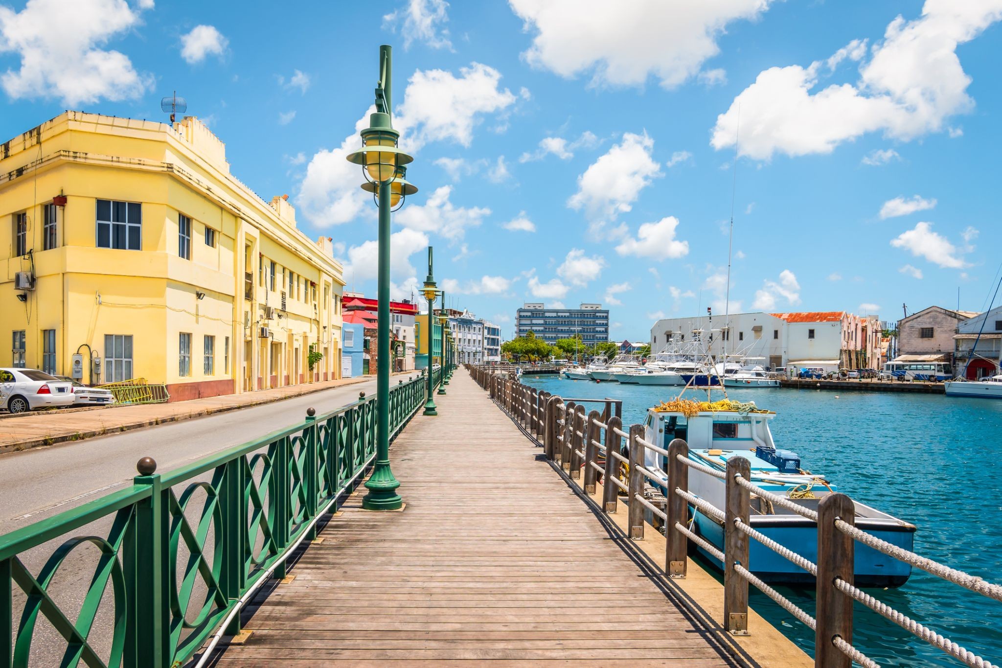
 Dzień 13: 07:00-17:00
Bridgetown / Barbados
Bridgetown to stolica i największe miasto Barbadosu. Dawniej znane jako „Miasto św. Michała” (The Town of Saint Michael), obszar Greater Bridgetown znajduje się w parafii św. Michała. Miejscowi czasami nazywają je „Miastem” (The City), ale najczęściej po prostu „Town”. W 2014 roku populacja aglomeracji wynosiła około 110 000 mieszkańców.
Port Bridgetown znajduje się w zatoce Carlisle (13.106°N 59.632°W) na południowo-zachodnim wybrzeżu wyspy. Części obszaru Greater Bridgetown, ogólnie zdefiniowane przez obwodnicę (ABC Highway), leżą blisko granic sąsiednich parafii Christ Church i St. James. Międzynarodowe lotnisko Grantley Adams znajduje się 16 kilometrów na południowy wschód od centrum Bridgetown i oferuje codzienne loty do głównych miast Wielkiej Brytanii, USA, Kanady i Karaibów. Obecnie nie ma już lokalnych władz miejskich; Bridgetown jest okręgiem wyborczym w parlamencie krajowym. W latach 50. i 60. XX wieku, podczas istnienia Federacji Brytyjskich Terytoriów Indyjskich, Bridgetown było jednym z trzech miast rozważanych jako możliwa stolica federacji.
Obecna lokalizacja miasta została założona przez angielskich osadników w 1628 roku; wcześniejsza osada pod nadzorem Sir Williama Courtena znajdowała się w St. James Town. Bridgetown jest ważnym celem turystycznym na Karaibach, a także znaczącym centrum finansowym, informatycznym, konferencyjnym i portem dla statków wycieczkowych. 25 czerwca 2011 roku „Historyczne Bridgetown i jego garnizon” zostały wpisane na listę światowego dziedzictwa UNESCO.
-
Dzień 14:
Dzień na morzu / Morze
-
Dzień 15:
Dzień na morzu / Morze
-
Dzień 16:
Dzień na morzu / Morze
-
Dzień 17: 12:00-20:00
Santarem / Brazylia
-
Dzień 18: 08:00-16:00
Паринтинс Parintins / Brazylia
Parintins is a municipality in the far east of the Amazonas state, Brazil. It is part of a microregion also named Parintins. The population for the entire municipality was 109,150 (2005) and its area is 5,952 km². The city is located on Tupinambarana island in the Amazon River. Parintins is known for a popular folklore festival held there each June called Boi-Bumbá.
-
Dzień 19: 09:00
Manaus / Brazylia
Manaus, previously known as Manaós before 1939 and formerly Barra do Rio Negro, is the capital city of the state of Amazonas in the North Region of Brazil. It is situated near the confluence of the Negro and Solimões rivers. With a population of more than 2 million, it is the most populous city of both the Brazilian state of Amazonas and the Amazon rainforest.
The city was founded in 1669 as the Fort of São José do Rio Negro. It was elevated to a town in 1832 with the name of "Manaus", an altered spelling of the indigenous Manaós peoples, and legally transformed into a city on October 24, 1848, with the name of Cidade da Barra do Rio Negro, Portuguese for "The City of the Margins of the Black River". On September 4, 1856 it returned to its original name.
Manaus is located in the middle of the Amazon rainforest, and access to the city is primarily by boat or airplane. This isolation helped preserve both the natural environment as well as the culture of the city. The culture of Manaus, more than in any other urban area of Brazil, preserves the habits of Native Brazilian tribes. The city is the main access point for visiting the fauna and flora of the Brazilian Amazon. Few places in the world afford such a variety of plants, birds, insects, and fishes.
It was known at the beginning of the century, as "Heart of the Amazon" and "City of the Forest". Currently its main economic engine is the Industrial Park of Manaus, a Free Economic Zone. The city has a free port and an international airport. Its manufactures include electronics, chemical products, and soap; there are distilling and ship construction industries. Manaus also exports Brazil nuts, rubber, jute and rosewood oil. It has a cathedral, opera house, zoologicaland botanical gardens, an ecopark and regional and native peoples museums.
With a population of 2,145,444 people in 2018, Manaus is the most populous city in the Brazilian Amazon area and the 7th most populous in the country. It is located on the north bank of the Negro River, 18 km (11 mi) above the meeting of the rivers where the Negro merges with the Solimões, to form the Amazon proper. Manaus is 1,400 km (900 mi) inland from the Atlantic Ocean. It is the hub of tourism for the rivers, the jungle lodges and the river cruises.
The Solimões and Negro rivers meet just east of Manaus and join to form the Amazon River (using the Brazilian definition of the river; elsewhere, Solimões is considered the upper part of the Amazon). Rubber made it the richest city in South America during the late 1800s. Rubber also helped Manaus earn its nickname, the "Paris of the Tropics". Many wealthy European families settled in Manaus and brought their love for sophisticated European art, architectureand culture with them. Manaus is also a duty-free zone, which has encouraged development in the region.
-
Dzień 20: 16:00
Manaus / Brazylia
Manaus, previously known as Manaós before 1939 and formerly Barra do Rio Negro, is the capital city of the state of Amazonas in the North Region of Brazil. It is situated near the confluence of the Negro and Solimões rivers. With a population of more than 2 million, it is the most populous city of both the Brazilian state of Amazonas and the Amazon rainforest.
The city was founded in 1669 as the Fort of São José do Rio Negro. It was elevated to a town in 1832 with the name of "Manaus", an altered spelling of the indigenous Manaós peoples, and legally transformed into a city on October 24, 1848, with the name of Cidade da Barra do Rio Negro, Portuguese for "The City of the Margins of the Black River". On September 4, 1856 it returned to its original name.
Manaus is located in the middle of the Amazon rainforest, and access to the city is primarily by boat or airplane. This isolation helped preserve both the natural environment as well as the culture of the city. The culture of Manaus, more than in any other urban area of Brazil, preserves the habits of Native Brazilian tribes. The city is the main access point for visiting the fauna and flora of the Brazilian Amazon. Few places in the world afford such a variety of plants, birds, insects, and fishes.
It was known at the beginning of the century, as "Heart of the Amazon" and "City of the Forest". Currently its main economic engine is the Industrial Park of Manaus, a Free Economic Zone. The city has a free port and an international airport. Its manufactures include electronics, chemical products, and soap; there are distilling and ship construction industries. Manaus also exports Brazil nuts, rubber, jute and rosewood oil. It has a cathedral, opera house, zoologicaland botanical gardens, an ecopark and regional and native peoples museums.
With a population of 2,145,444 people in 2018, Manaus is the most populous city in the Brazilian Amazon area and the 7th most populous in the country. It is located on the north bank of the Negro River, 18 km (11 mi) above the meeting of the rivers where the Negro merges with the Solimões, to form the Amazon proper. Manaus is 1,400 km (900 mi) inland from the Atlantic Ocean. It is the hub of tourism for the rivers, the jungle lodges and the river cruises.
The Solimões and Negro rivers meet just east of Manaus and join to form the Amazon River (using the Brazilian definition of the river; elsewhere, Solimões is considered the upper part of the Amazon). Rubber made it the richest city in South America during the late 1800s. Rubber also helped Manaus earn its nickname, the "Paris of the Tropics". Many wealthy European families settled in Manaus and brought their love for sophisticated European art, architectureand culture with them. Manaus is also a duty-free zone, which has encouraged development in the region.
-
Dzień 21: 11:00-18:00
Wioska Boca de Valeria / Brazylia
-
 Dzień 22: 07:00-16:00
Alter do Chao / Brazylia
-
Dzień 23:
Dzień na morzu / Morze
-
Dzień 24:
Dzień na morzu / Morze
-
Dzień 25: 07:00-16:00
Devil’s Point / Bahamy
-
Dzień 26:
Dzień na morzu / Morze
-
 Dzień 27: 07:00-17:00
Scarborough / Trinidad and Tobago
Scarborough (Tobago) to urokliwe miasteczko położone na wschodnim wybrzeżu wyspy Tobago na Morzu Karaibskim. Jako stolica wyspy, stanowi centrum życia kulturalnego i historycznego regionu. Miasto słynie z malowniczych uliczek, tętniących życiem targowisk i zabytkowych budynków, które harmonijnie współistnieją z nowoczesną architekturą. Do najważniejszych atrakcji należy kościół św. Anny z 1770 roku, będący ważnym elementem dziedzictwa miasta. Popularnością cieszy się również lokalny targ, na którym można kupić świeże owoce, przyprawy i rękodzieło.
Poza bogactwem kulturowym Scarborough oferuje piękne widoki przyrodnicze. W pobliżu znajdują się plaże z białym piaskiem i krystalicznie czystą wodą, idealne do kąpieli i nurkowania. Szczególnie popularna wśród turystów jest zatoka Pleasant, znana z pięknych krajobrazów i podwodnego świata. Scarborough to doskonała baza wypadowa do odkrywania rezerwatów przyrody Tobago i aktywnego wypoczynku.
-
Dzień 28: 08:00-17:00
Port w Hiszpanii / Trinidad and Tobago
-
Dzień 29: 07:00-17:00
Saint-Georges / French Guiana
-
Dzień 30: 07:00-17:00
Kingstown
-
Dzień 31: 07:00-18:00
Castries / Saint Lucia
-
Dzień 32: 07:00-18:00
Bridgetown / Barbados
Bridgetown to stolica i największe miasto Barbadosu. Dawniej znane jako „Miasto św. Michała” (The Town of Saint Michael), obszar Greater Bridgetown znajduje się w parafii św. Michała. Miejscowi czasami nazywają je „Miastem” (The City), ale najczęściej po prostu „Town”. W 2014 roku populacja aglomeracji wynosiła około 110 000 mieszkańców.
Port Bridgetown znajduje się w zatoce Carlisle (13.106°N 59.632°W) na południowo-zachodnim wybrzeżu wyspy. Części obszaru Greater Bridgetown, ogólnie zdefiniowane przez obwodnicę (ABC Highway), leżą blisko granic sąsiednich parafii Christ Church i St. James. Międzynarodowe lotnisko Grantley Adams znajduje się 16 kilometrów na południowy wschód od centrum Bridgetown i oferuje codzienne loty do głównych miast Wielkiej Brytanii, USA, Kanady i Karaibów. Obecnie nie ma już lokalnych władz miejskich; Bridgetown jest okręgiem wyborczym w parlamencie krajowym. W latach 50. i 60. XX wieku, podczas istnienia Federacji Brytyjskich Terytoriów Indyjskich, Bridgetown było jednym z trzech miast rozważanych jako możliwa stolica federacji.
Obecna lokalizacja miasta została założona przez angielskich osadników w 1628 roku; wcześniejsza osada pod nadzorem Sir Williama Courtena znajdowała się w St. James Town. Bridgetown jest ważnym celem turystycznym na Karaibach, a także znaczącym centrum finansowym, informatycznym, konferencyjnym i portem dla statków wycieczkowych. 25 czerwca 2011 roku „Historyczne Bridgetown i jego garnizon” zostały wpisane na listę światowego dziedzictwa UNESCO.