| Region rejsu : Północna Europa |
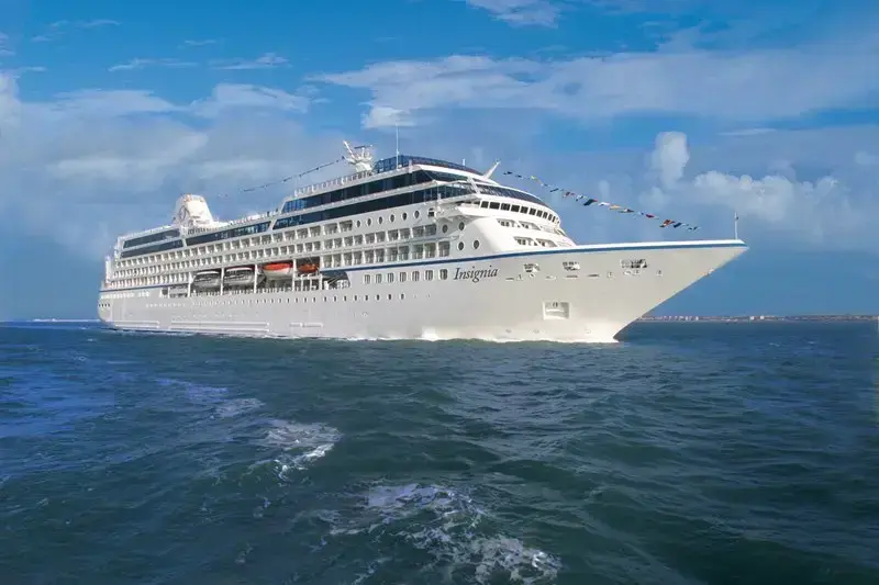
| Firma : Oceania Cruises |
| Statek : Insignia |
| Data rozpoczęcia : pt. 24 lip 2026 |
| Data zakończenia : sob. 29 sie 2026 |
| Liczba nocy : 36 nocy |
| Dzień | Data | Port | Wypłynięcie | Odpłynięcie |
|---|---|---|---|---|
| 1 | 24.07 pt. | Reykjavik / Islandia | 07:00 | 21:00 |
| 2 | 25.07 sob. | Heimaey Vestmannaeyjar Islandia | 08:00 | 17:00 |
| 3 | 26.07 niedz. | Dzień na morzu / Morze | ||
| 4 | 27.07 pon. | Torshavn / Faroe Islands | 07:00 | 17:00 |
| 5 | 28.07 wt. | Runavík Рунавик / Faroe Islands | 07:00 | 16:00 |
| 6 | 29.07 śr. | Djupivogur / Islandia | 10:00 | 20:00 |
| 7 | 30.07 czw. | Eskifjordur / Islandia | 07:00 | 16:00 |
| 8 | 31.07 pt. | Akureyri / Islandia | 10:00 | 19:00 |
| 9 | 1.08 sob. | Isafjordur / Islandia | 09:00 | 19:00 |
| 10 | 2.08 niedz. | Grundarfjordur / Islandia | 08:00 | 18:00 |
| 11 | 3.08 pon. | Reykjavik / Islandia | 07:00 | |
| 12 | 4.08 wt. | Reykjavik / Islandia | 10:00 | |
| 13 | 5.08 śr. | Dzień na morzu / Morze | ||
| 14 | 6.08 czw. | Kirkwall / Wielka Brytania | 11:00 | 19:00 |
| 15 | 7.08 pt. | Ullapool / Scotland | 07:00 | 16:00 |
| 16 | 8.08 sob. | Killibegs / Irlandia | 10:00 | 18:00 |
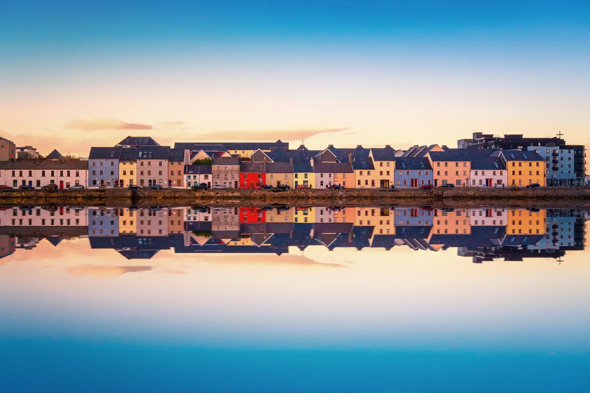
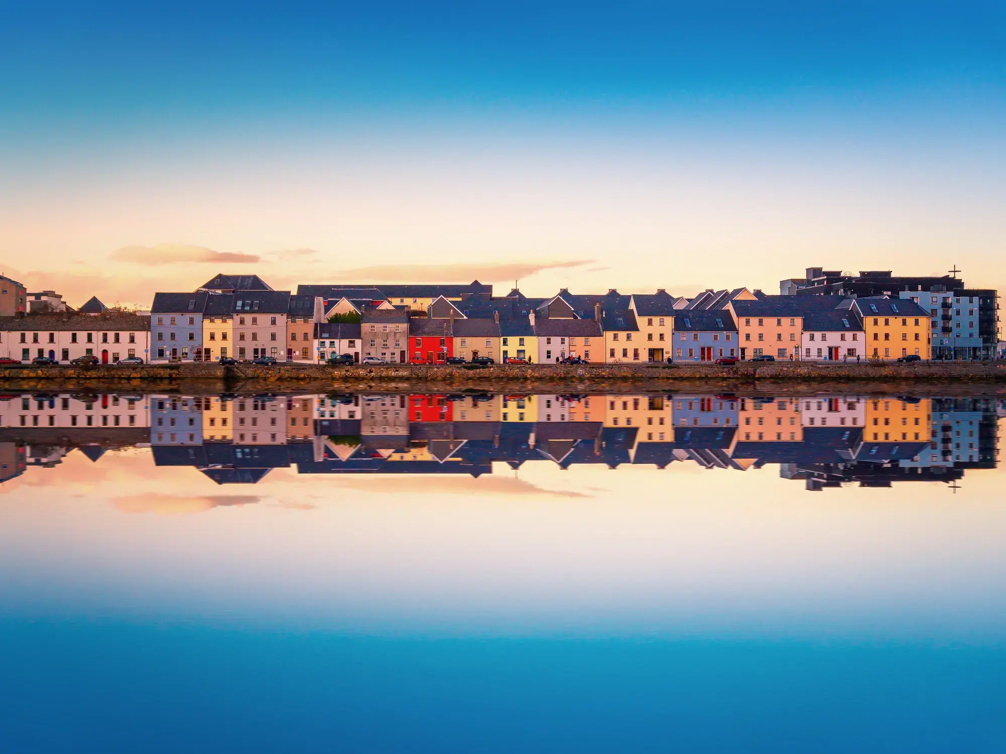
| 17 | 9.08 niedz. | Galway / Irlandia | 08:00 | 19:00 |
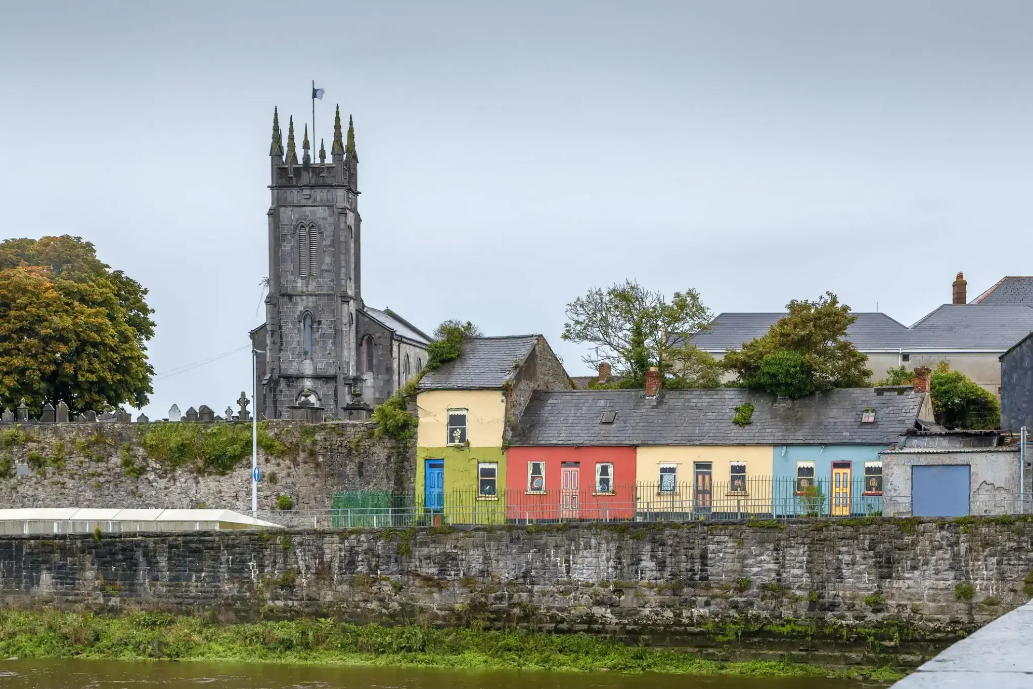
| 18 | 10.08 pon. | Foynes, Limerick / Irlandia | 07:00 | 19:00 |
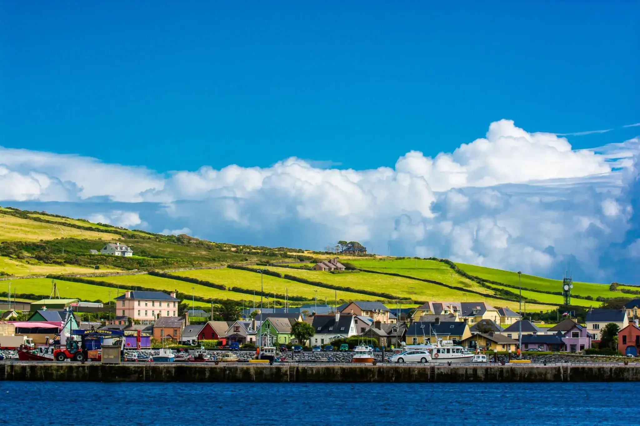
| 19 | 11.08 wt. | Dingle / Irlandia | 08:00 | 20:00 |
| 20 | 12.08 śr. | Bantry / Irlandia | 07:00 | 19:00 |
| 21 | 13.08 czw. | Cork / Irlandia | 07:00 | 19:00 |
| 22 | 14.08 pt. | Dzień na morzu / Morze | ||
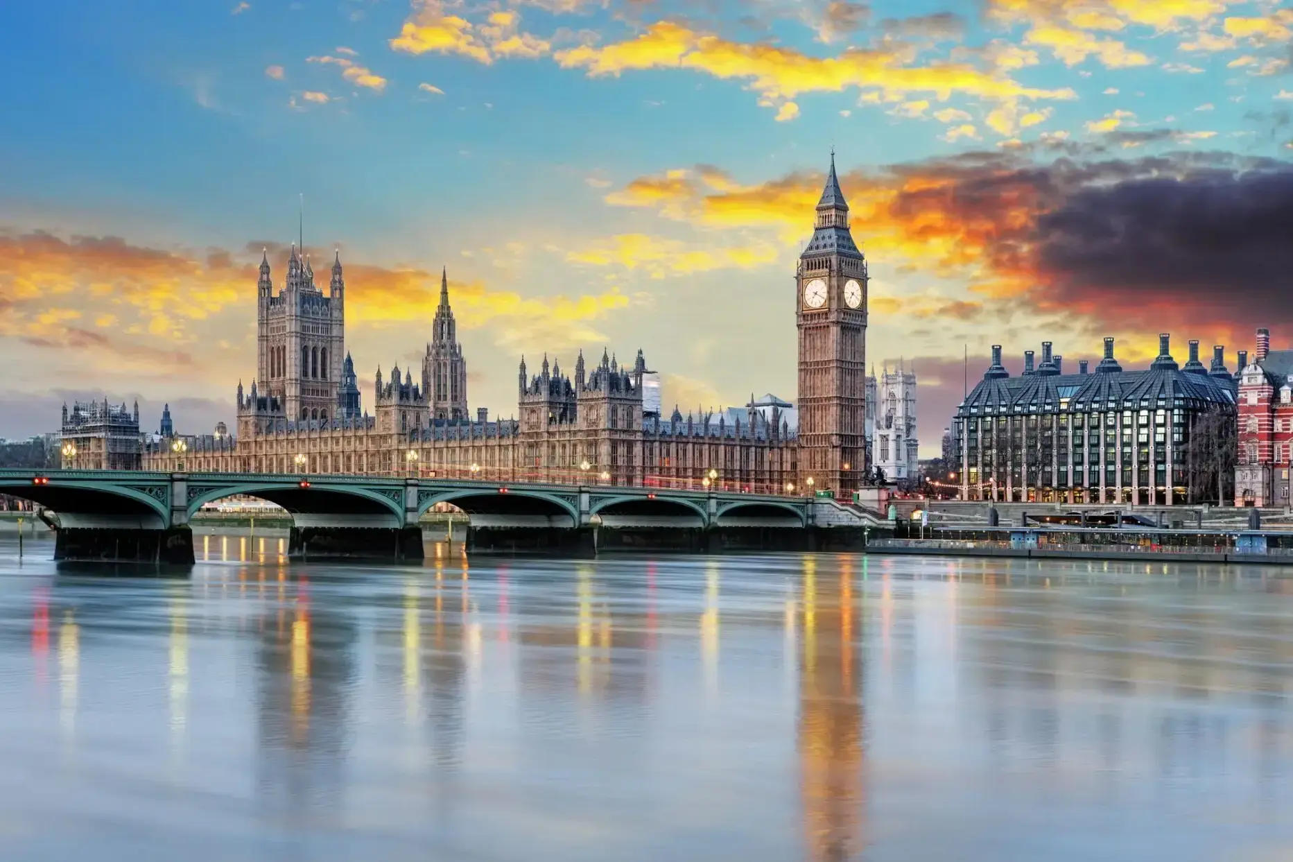
| 23 | 15.08 sob. | Londyn / Wielka Brytania | 07:00 | 17:00 |
| 24 | 16.08 niedz. | Dzień na morzu / Morze | ||
| 25 | 17.08 pon. | Dzień na morzu / Morze | ||
| 26 | 18.08 wt. | Rosendal / Norway | 07:00 | 17:00 |
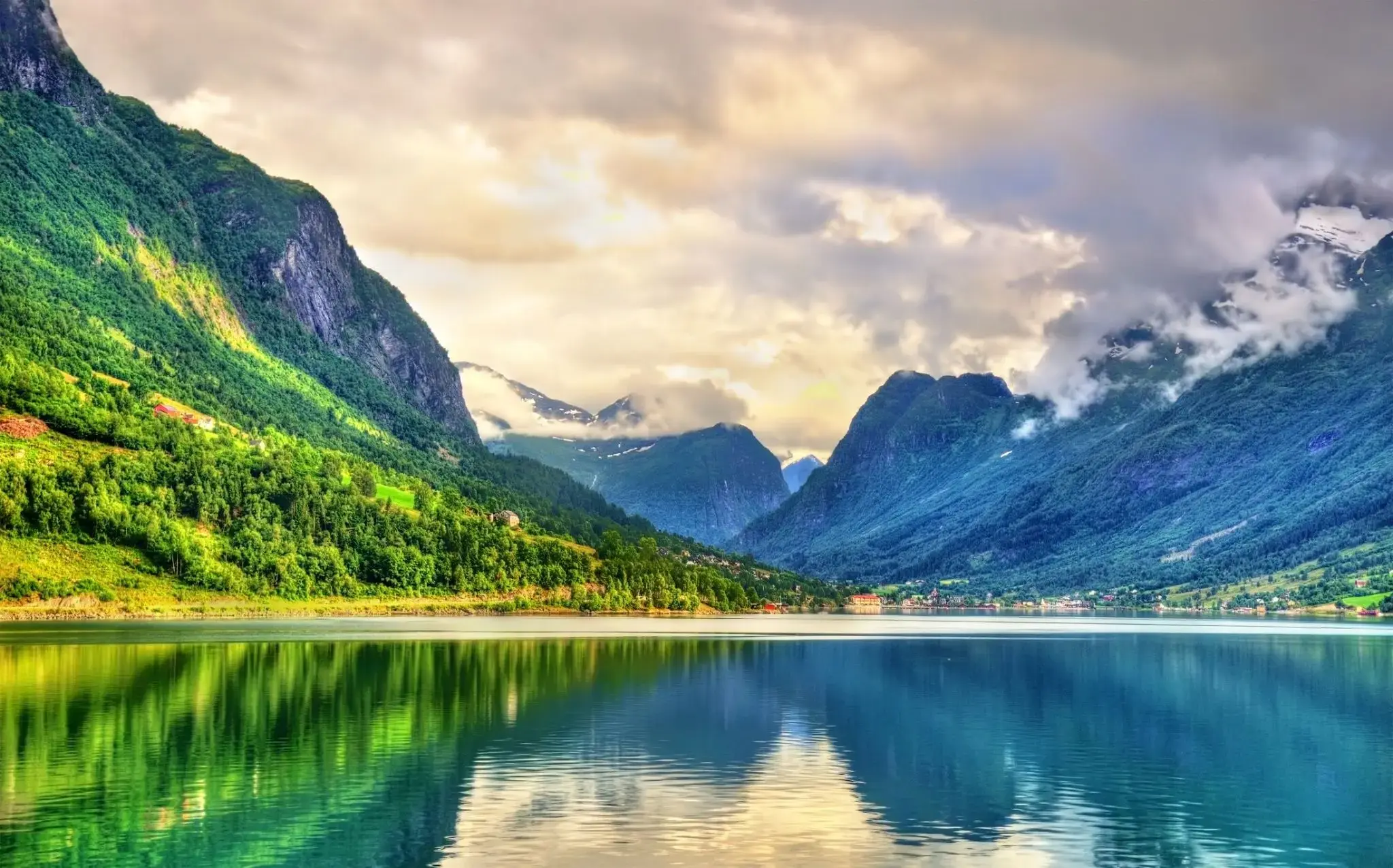
| 27 | 19.08 śr. | Nordfjorden / Norway | 11:00 | 19:00 |
| 28 | 20.08 czw. | Olesunn / Norway | 07:00 | |
| 29 | 21.08 pt. | Olesunn / Norway | 17:00 | |
| 30 | 22.08 sob. | Molde / Norway | 07:00 | 17:00 |
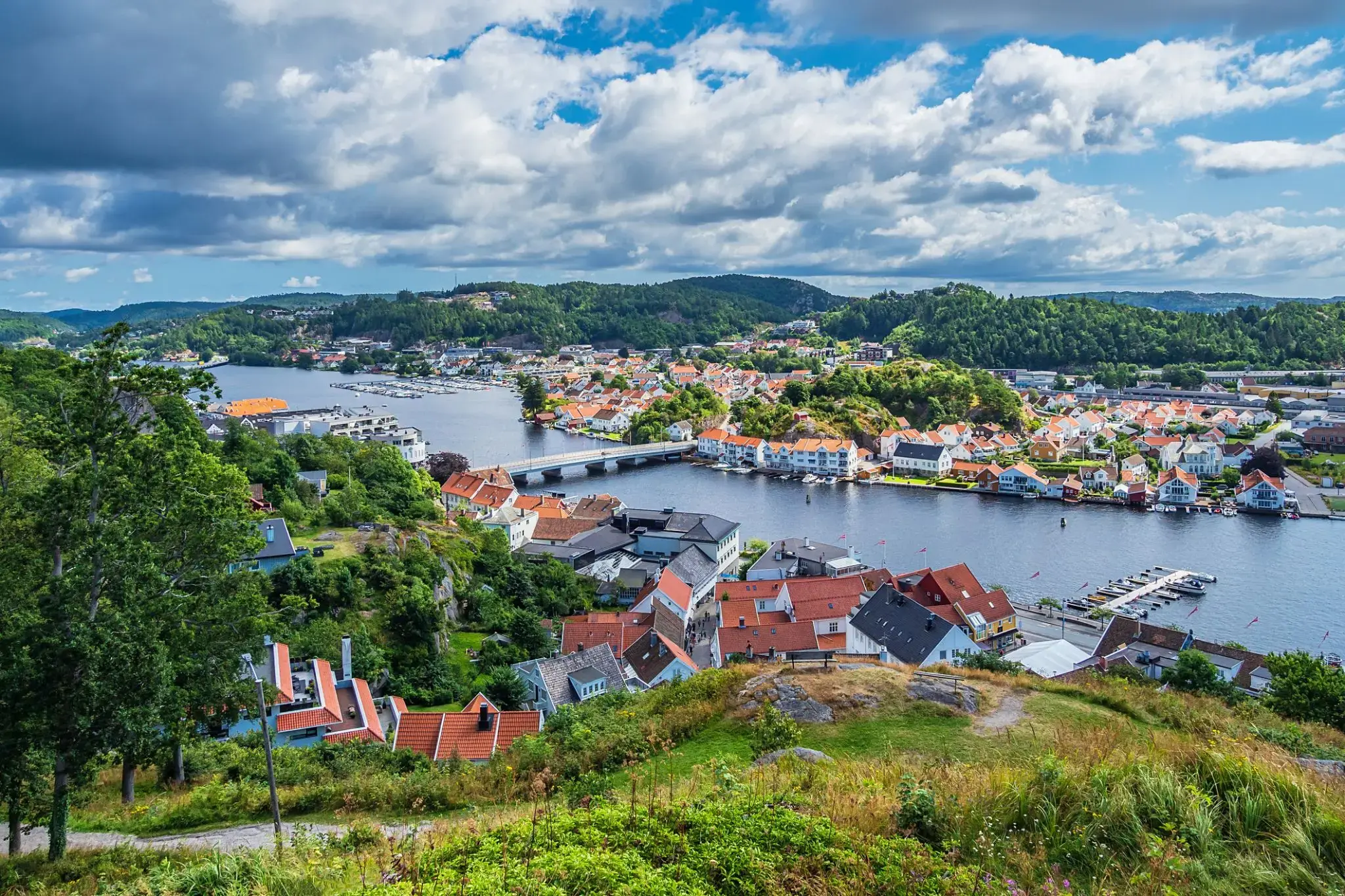
| 31 | 23.08 niedz. | Kristiansand / Norway | 07:00 | 17:00 |
| 32 | 24.08 pon. | Måløy | 07:00 | 16:00 |
| 33 | 25.08 wt. | Stavanger / Norway | 11:00 | 18:00 |
| 34 | 26.08 śr. | Mandal | 07:00 | 16:00 |
| 35 | 27.08 czw. | Kopenhaga / Denmark | 10:00 | |
| 36 | 28.08 pt. | Kopenhaga / Denmark | 12:00 | |
| 37 | 29.08 sob. | Osło / Norway | 07:00 | 17:00 |
Twój Świat w cenie
Dzięki Twojemu Światu w cenie, będziesz cieszyć się szeroką gamą udogodnień, zapewniających najwyższy komfort i wartość rejsów ultra-premium.
Niezapomniane doznania kulinarne w licznych, wykwintnych restauracjach — wszystko bez dodatkowych opłat.
Bezpłatne kawy specjalistyczne, napoje gazowane, świeżo wyciskane soki oraz woda gazowana i niegazowana Vero Water® serwowane na całym statku.
Nielimitowany, bezpłatny dostęp do Wi-Fi w apartamentach, kabinach i wszystkich pomieszczeniach ogólnodostępnych.
Posiłki serwowane w pokoju z doskonałym wyborem dań na ciepło i zimno.
Koktajle, koktajle mleczne, gelato i firmowe lody Humphry Slocombe — zawsze w cenie.
Grupowe zajęcia fitness w Aquamar® Spa + Vitality Center są bezpłatne.
Napiwki są wliczone w cenę dla Twojej wygody.
Pranie jest bezpłatne dla wszystkich gości.
Dzięki bezpłatnym pralniom samoobsługowym na pokładzie, a także usługom prania i prasowania dla kategorii Concierge i Suite, zawsze będziesz wyglądać olśniewająco. Oprócz naszej charakterystycznej, spersonalizowanej obsługi, zapewnimy Ci wzbogacający rejs bez ukrytych kosztów i prowizji.
Podnieś poziom swoich wrażeń
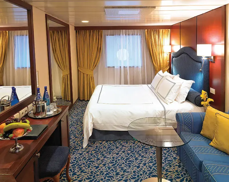
Kajuty Concierge Level Veranda oferują niezrównane połączenie luksusu, przywilejów i wartości. Bogactwo udogodnień i ekskluzywnych korzyści sprawi, że Twoje wrażenia będą jeszcze bardziej wzniosłe — od dań do wyboru z The Grand Dining Room, przez bezpłatne usługi pralnicze, po nieograniczony dostęp do tarasu Aquamar Spa.
Na pokładzie Oceania Marina i Oceania Riviera możesz również skorzystać z usług dedykowanego Concierge i ekskluzywnego dostępu do prywatnego salonu Concierge Lounge.
Kajuty Concierge Level Veranda, zlokalizowane w najbardziej pożądanych miejscach statku, to coś więcej niż tylko kabiny — to niezapomniane przeżycie.
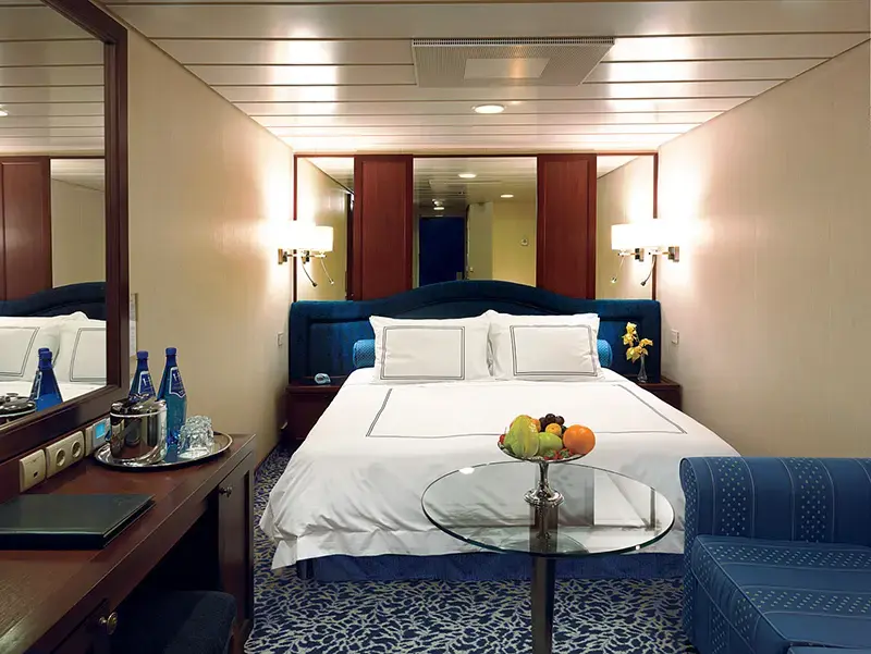
Concierge Level Veranda — Ekskluzywne przywileje
Rozszerzone menu posiłków do pokoju na lunch i kolację z The Grand Dining Room
Usługi pralnicze — do 3 sztuk bagażu na kabinę
Ekskluzywny dostęp do prywatnego salonu Concierge Lounge na statkach Oceania Marina, Oceania Riviera, Oceania Vista i Oceania Allura za pomocą karty-klucza, oferujący bezpłatne napoje, kawę, przekąski i usługi dedykowanego Concierge'a
Powitalna butelka wyśmienitego włoskiego Prosecco
Priorytetowe rezerwacje online w restauracjach specjalistycznych
Nieograniczony dostęp do tarasu Aquamar Spa
Torba z logo Oceania Cruises
Kaszmirowe koce na kolana — idealne do relaksu i przytulania
Prasowanie odzieży po wejściu na pokład
Bezpłatna usługa czyszczenia butów
Depozyt i płatności – Oceania Cruises
Depozyt ogólny:
W przypadku apartamentów typu Owner’s, Vista i Oceania Suites wymagany jest depozyt w wysokości 20% ceny rejsu od osoby.
W przypadku wszystkich pozostałych kategorii apartamentów/kabin, depozyt wynosi 500 USD od osoby.
W przypadku Grand Voyages depozyt wynosi 1500 USD od osoby.
Terminy depozytu i płatności końcowej:
Rezerwacje dokonane na ponad 150 dni przed rejsem:
Depozyt w wysokości 20% w przypadku apartamentów typu Owner’s, Vista i Oceania Suites oraz 500 USD w przypadku wszystkich pozostałych kategorii wymagany jest w ciągu 5 dni od rezerwacji.
Rezerwacje dokonane na 90–120 dni przed rejsem:
Pełna płatność wymagana w ciągu 3 dni od rezerwacji.
Rezerwacje dokonane na 0–90 dni przed rejsem:
Pełna płatność wymagana w dniu rezerwacji.
Ważne:
Rezerwacje, które nie zostaną wpłacone lub opłacone w całości zgodnie z niniejszym harmonogramem, zostaną automatycznie anulowane. O ile nie zaznaczono inaczej, płatność końcowa musi wpłynąć do Oceania Cruises na 150 dni przed wypłynięciem w przypadku rejsów krótszych niż 15 dni oraz na 150 dni w przypadku rejsów trwających 15 dni lub dłużej.
Oceania Cruises zastrzega sobie prawo do anulowania rezerwacji, które nie zostały w pełni opłacone w momencie płatności końcowej.
Informacje dodatkowe:
Dane paszportowe i specjalne prośby dotyczące usług pokładowych należy przesłać w momencie płatności końcowej.
Płatności można dokonać czekiem osobistym, kartą American Express, Discover, MasterCard lub Visa.
Dla wygody płatność końcowa może zostać automatycznie pobrana z karty kredytowej użytej do wpłaty początkowej.
Oceania Cruises nie ponosi odpowiedzialności za opłaty walutowe ani opłaty transakcyjne pobierane niezależnie przez banki wystawiające karty. Opłaty te nie przysługują Oceania Cruises.
Płatności kartami kredytowymi osób trzecich są akceptowane wyłącznie po uzyskaniu ważnej autoryzacji od posiadacza karty.
Depozyt i płatność – rejsy 180-dniowe
W przypadku rejsów 180-dniowych wymagany jest depozyt w wysokości 20% ceny rejsu od osoby za wszystkie apartamenty i kabiny w ciągu 7 dni od rezerwacji.
Ostateczna płatność musi zostać otrzymana najpóźniej 181 dni przed wypłynięciem, wraz z danymi paszportowymi i wszelkimi specjalnymi prośbami o usługi na pokładzie.
W przeciwnym razie rezerwacja może zostać natychmiast anulowana, a naliczone zostaną stosowne kary.
Forma płatności (FORMA PŁATNOŚCI)
Oceania Cruises akceptuje płatności za rezerwacje kartą kredytową/debetową lub przelewem bankowym.
Niestety, czeki osobiste nie są akceptowane.
Karty kredytowe/debetowe:
Akceptowane są karty American Express, Visa i Mastercard.
Uwaga: Oceania Cruises nie ponosi odpowiedzialności za opłaty za wymianę waluty/transakcje naliczane przez bank wystawiający kartę.
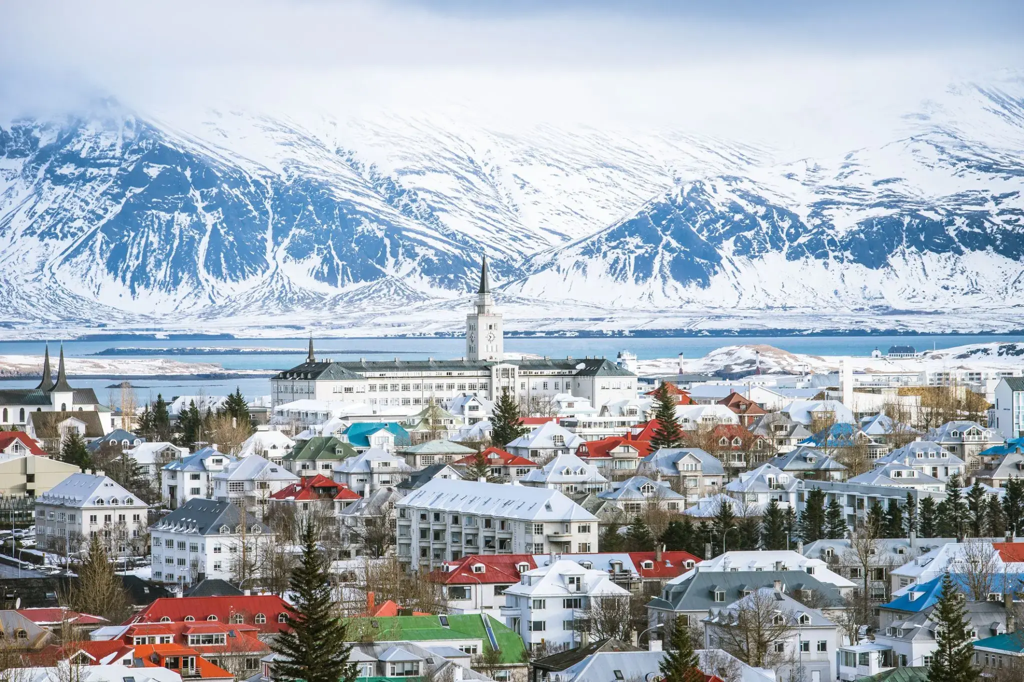
Reykjavík is the capital and largest city of Iceland. It is located in southwestern Iceland, on the southern shore of Faxa Bay. Its latitude is 64°08' N, making it the world's northernmost capital of a sovereign state. With a population of around 123,300 (and over 216,940 in the Capital Region), it is the heart of Iceland's cultural, economic and governmental activity, and is a popular tourist destination.
Reykjavík is believed to be the location of the first permanent settlement in Iceland, which, according to Ingólfr Arnarson, was established in AD 874. Until the 19th century, there was no urban development in the city location. The city was founded in 1786 as an official trading town and grew steadily over the following decades, as it transformed into a regional and later national centre of commerce, population, and governmental activities. It is among the cleanest, greenest, and safest cities in the world.

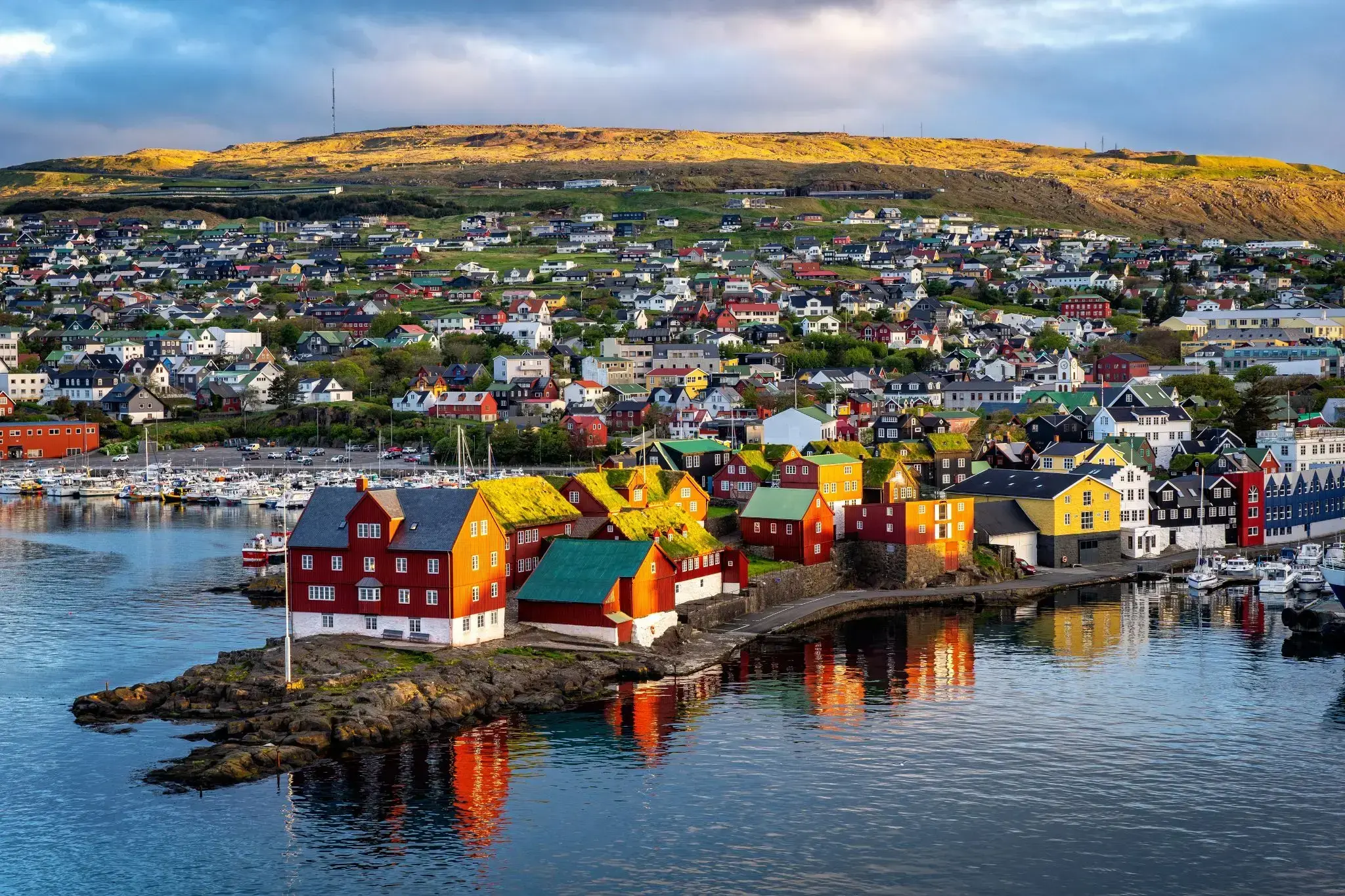
Tórshavn is the capital and largest town of the Faroe Islands. Tórshavn is in the southern part on the east coast of Streymoy. To the northwest of the city lies the 347-meter-high (1,138 ft) mountain Húsareyn, and to the southwest, the 350-meter-high (1,150 ft) Kirkjubøreyn. They are separated by the Sandá River. The town proper has a population of 13,089 (2017), and the greater urban area a population of 21,000.
The Norse established their parliament on the Tinganes peninsula in AD 850.[3] Tórshavn thus became the capital of the Faroe Islands and has remained so ever since. All through the Middle Ages the narrow peninsula jutting out into the sea made up the main part of Tórshavn. Early on, Tórshavn became the centre of the islands' trade monopoly, thereby being the only legal place for the islanders to sell and buy goods. In 1856, the trade monopoly was abolished and the islands were left open to free trade.

Eskifjordur to mały, ale malowniczy fiord położony we wschodniej Islandii, który przyciąga turystów swoją naturalną urodą i spokojną atmosferą. Otoczony wysokimi górami, Eskifjordur to idealne miejsce dla tych, którzy szukają ciszy i spokoju z dala od zatłoczonych szlaków turystycznych. Odwiedzający mogą cieszyć się świeżym powietrzem i zapierającymi dech w piersiach widokami na fiord, który łączy się z Oceanem Atlantyckim. Tradycyjne islandzkie domy z dachami pokrytymi torfem dodają temu spokojnemu miastu uroku.
Miasto słynie również ze swojego dziedzictwa kulturowego i historii. W pobliskich wioskach można zapoznać się z tradycyjnym stylem życia miejscowych mieszkańców, a kilka interesujących muzeów, w tym muzeum rybołówstwa, opowiada historię przemysłu rybnego w regionie. Eskifjordur jest również doskonałą bazą do zwiedzania wschodniej Islandii, oferując możliwość pieszych wędrówek, wędkowania i obserwacji dzikiej przyrody, w tym lokalnych ptaków i ssaków morskich.
Akureyri is a town in northern Iceland. It is Iceland's Fifth largest municipality.
Nicknamed the Capital of North Iceland, Akureyri is an important port and fishing centre. The area where Akureyri is located was settled in the 9th century but did not receive a municipal charter until 1786. The town was the site of Alliedunits during World War II. Further growth occurred after the war as the Icelandic population increasingly moved to urban areas.
The area has a relatively mild climate because of geographical factors, and the town's ice-free harbour has played a significant role in its history.
Isafjörður, meaning ice fjord or fjord of ice, ice in plural genitive) is a town in the northwest of Iceland.
The oldest part of Ísafjörður with the town centre is located on a spit of sand, or eyri, in Skutulsfjörður, a fjord which meets the waters of the larger fjord Ísafjarðardjúp. With a population of about 2,600, Ísafjörður is the largest settlement in the peninsula of Vestfirðir (Westfjords) and the administration centre of the Ísafjarðarbær municipality, which includes – besides Ísafjörður – the nearby villages of Hnífsdalur, Flateyri, Suðureyri, and Þingeyri.
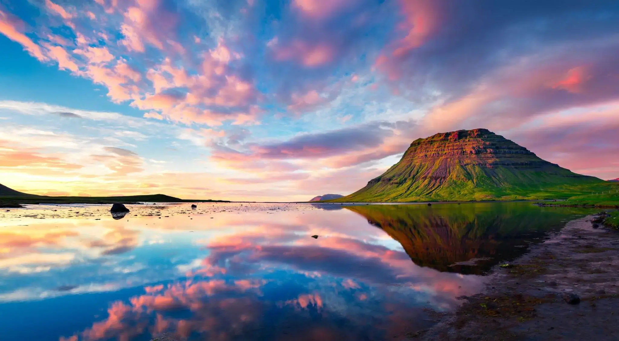
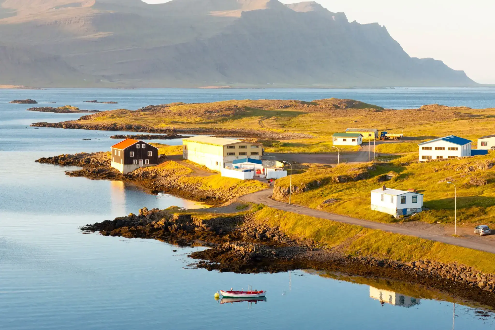
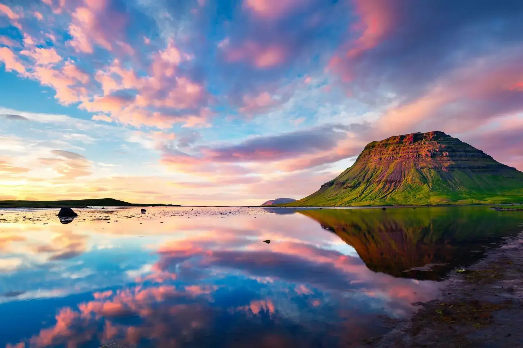
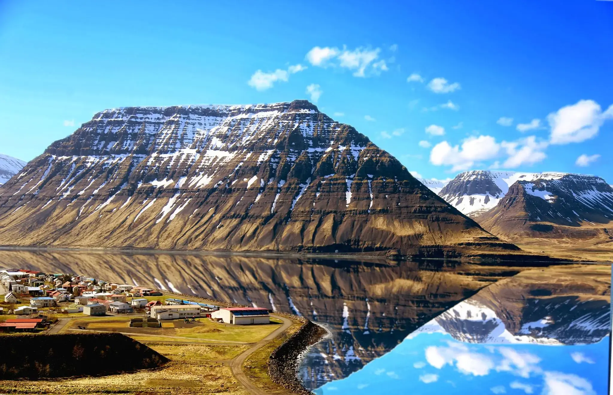
Grundarfjordur to malownicze miasto położone na zachodnim wybrzeżu Islandii, u stóp majestatycznej góry Kirkjufell. To niewielkie osiedle przyciąga turystów zapierającymi dech w piersiach widokami na fiordy i górskie krajobrazy, a także unikalną przyrodą, w tym licznymi wodospadami i geotermalnymi źródłami. Jedną z głównych atrakcji w regionie jest góra Kirkjufell, która stała się słynna dzięki swojemu charakterystycznemu sylwetce i popularności wśród fotografów. Grundarfjordur jest doskonałym punktem wyjścia do odkrywania pobliskich miejsc przyrodniczych, takich jak Park Narodowy Skaftafell i lodowiec Skaftatall.
Dla miłośników aktywnego wypoczynku Grundarfjordur oferuje wspaniałe możliwości wędkarstwa, pieszych wędrówek i obserwacji ptaków. W mieście znajdują się także przytulne kawiarnie i restauracje serwujące świeże owoce morza oraz tradycyjne islandzkie dania. Dodatkowo Grundarfjordur znajduje się blisko głównych tras turystycznych Islandii, co czyni go dogodnym miejscem na postój w drodze do słynnych cudów natury kraju.
Reykjavík is the capital and largest city of Iceland. It is located in southwestern Iceland, on the southern shore of Faxa Bay. Its latitude is 64°08' N, making it the world's northernmost capital of a sovereign state. With a population of around 123,300 (and over 216,940 in the Capital Region), it is the heart of Iceland's cultural, economic and governmental activity, and is a popular tourist destination.
Reykjavík is believed to be the location of the first permanent settlement in Iceland, which, according to Ingólfr Arnarson, was established in AD 874. Until the 19th century, there was no urban development in the city location. The city was founded in 1786 as an official trading town and grew steadily over the following decades, as it transformed into a regional and later national centre of commerce, population, and governmental activities. It is among the cleanest, greenest, and safest cities in the world.


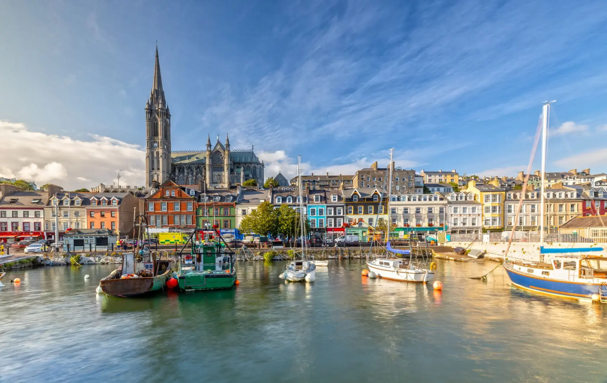
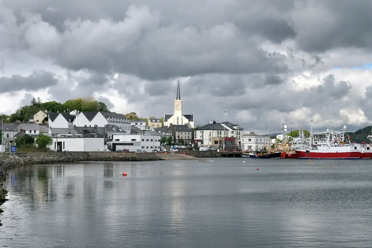
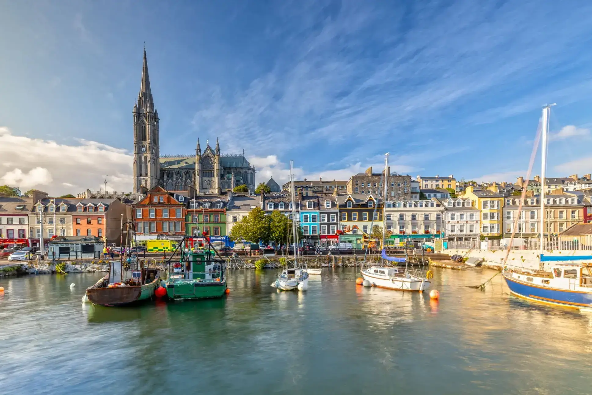
Cork is a city in south-west Ireland, in the province of Munster, which had a population of 125,657 in 2016.
The city is on the River Lee which splits into two channels at the western end and divides the city centre into islands. They reconverge at the eastern end where the quays and docks along the river banks lead outwards towards Lough Mahon and Cork Harbour, one of the largest natural harbours in the world.
Expanded by Viking invaders around 915, the city's charter was granted by Prince John, as Lord of Ireland, in 1185. Cork city was once fully walled, and the remnants of the old medieval town centre can be found around South and North Main streets.
The third largest city on the island of Ireland, the city's cognomen of "the rebel city" originates in its support for the Yorkist cause in the Wars of the Roses. Corkonians often refer to the city as "the real capital", a reference to its opposition to the Anglo-Irish Treaty in the Irish Civil War.

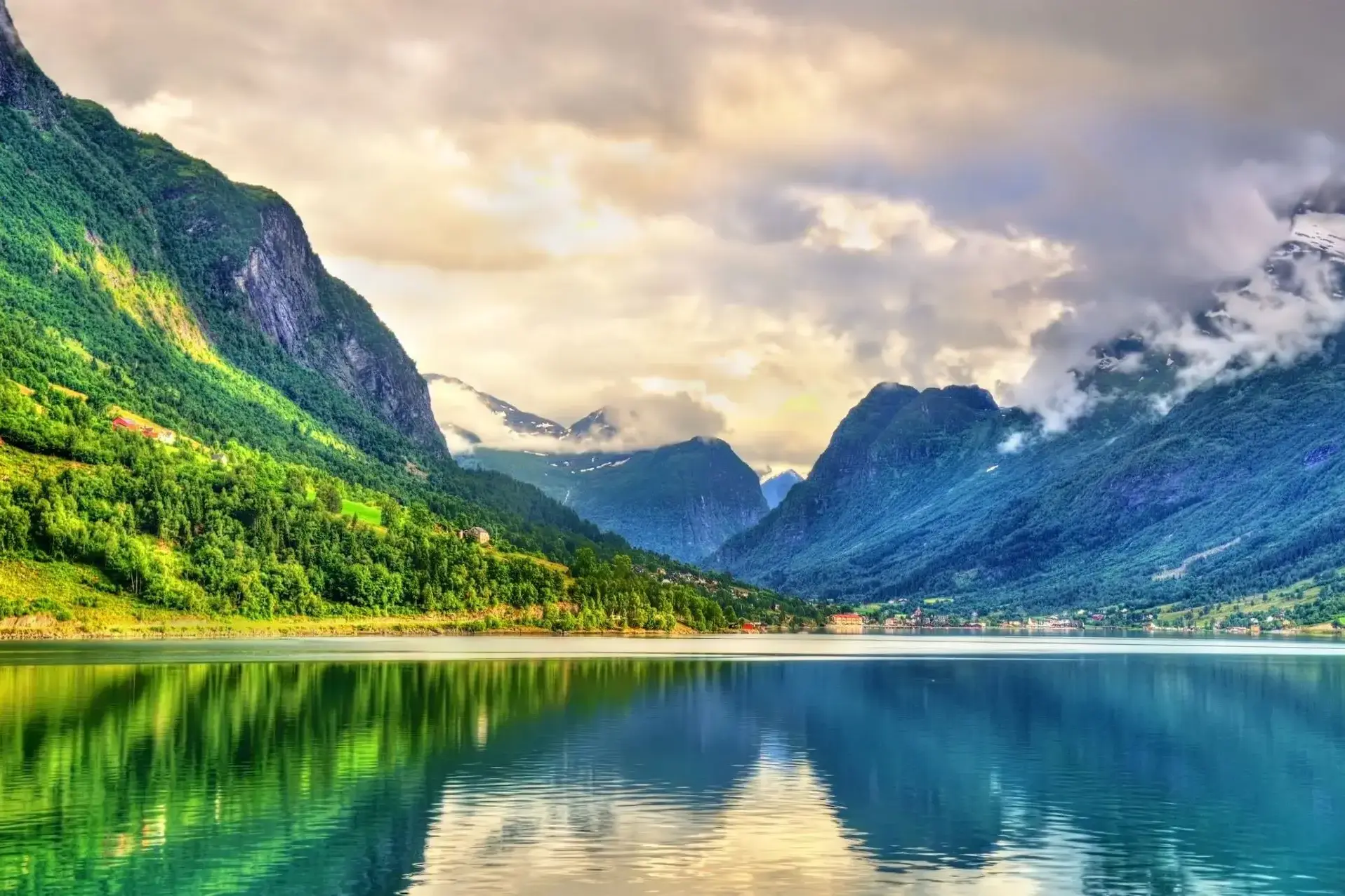
Położony w sercu zachodniego wybrzeża Norwegii, Nordfjorden oferuje podróżnikom zachwycające połączenie majestatycznych fiordów, spokojnych wiosek i bogatego dziedzictwa kulturowego. Rozciągający się na ponad 100 kilometrów, fiord ten słynie z dramatycznych klifów i krystalicznie czystych wód, które zapraszają do zwiedzania łodzią, kajakiem lub na malowniczych wędrówkach. Miłośnicy przyrody będą oczarowani spokojną atmosferą i zapierającymi dech w piersiach widokami, podczas gdy entuzjaści historii mogą odkryć urokliwe tradycyjne gospodarstwa i wielowiekowe osady wzdłuż brzegów fiordu.
Goście Nordfjorden mogą korzystać z szerokiej gamy aktywności na świeżym powietrzu — od wędrówek po lodowcu Jostedalsbreen po wędkowanie w spokojnych zatokach. Region słynie również z barwnych lokalnych festiwali i serdecznej gościnności, co czyni go idealnym miejscem zarówno dla rodzin, jak i podróżników indywidualnych. Niezależnie od tego, czy szukasz przygody, czy relaksu, Nordfjorden obiecuje autentyczne norweskie doświadczenie pełne naturalnego piękna i bogactwa kulturowego.
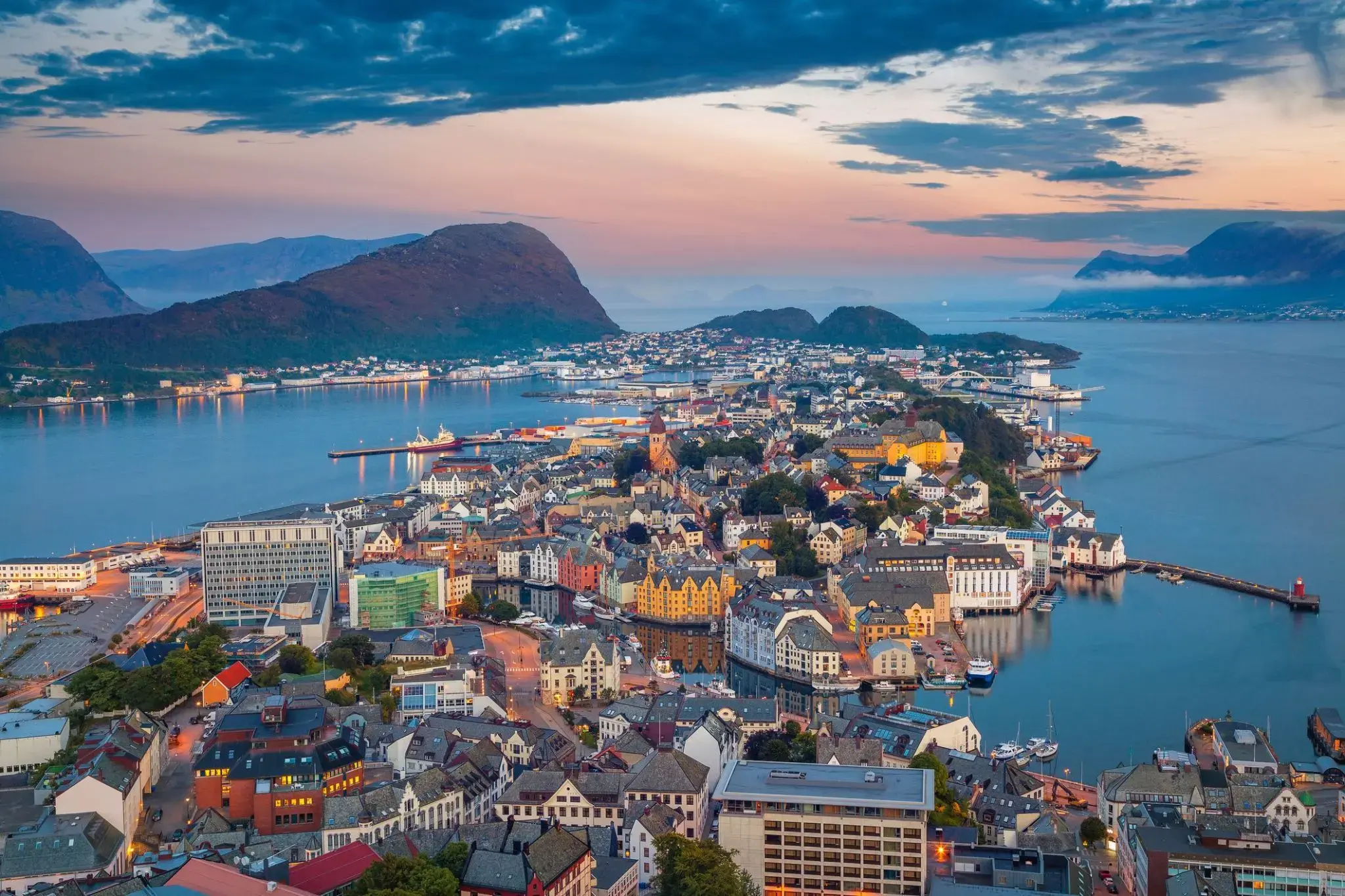
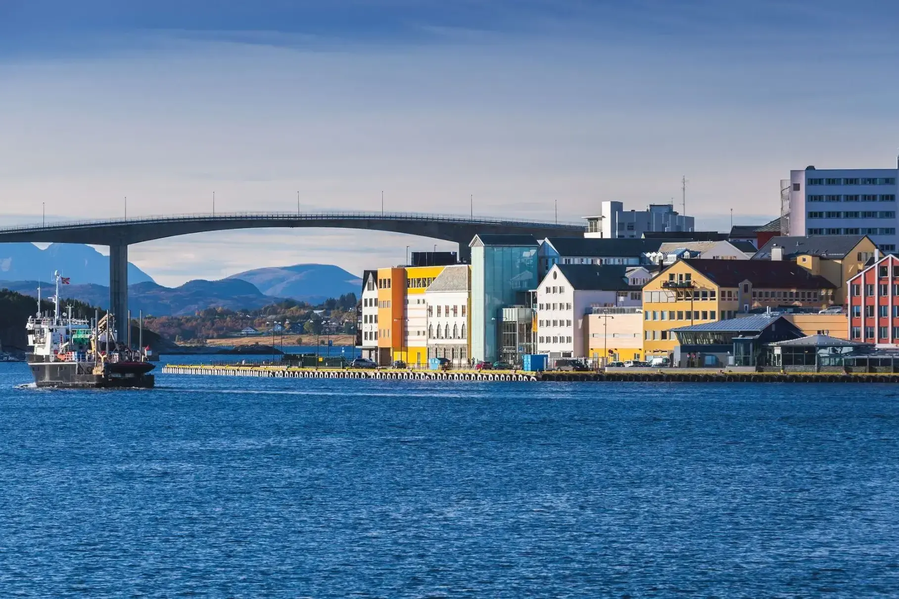
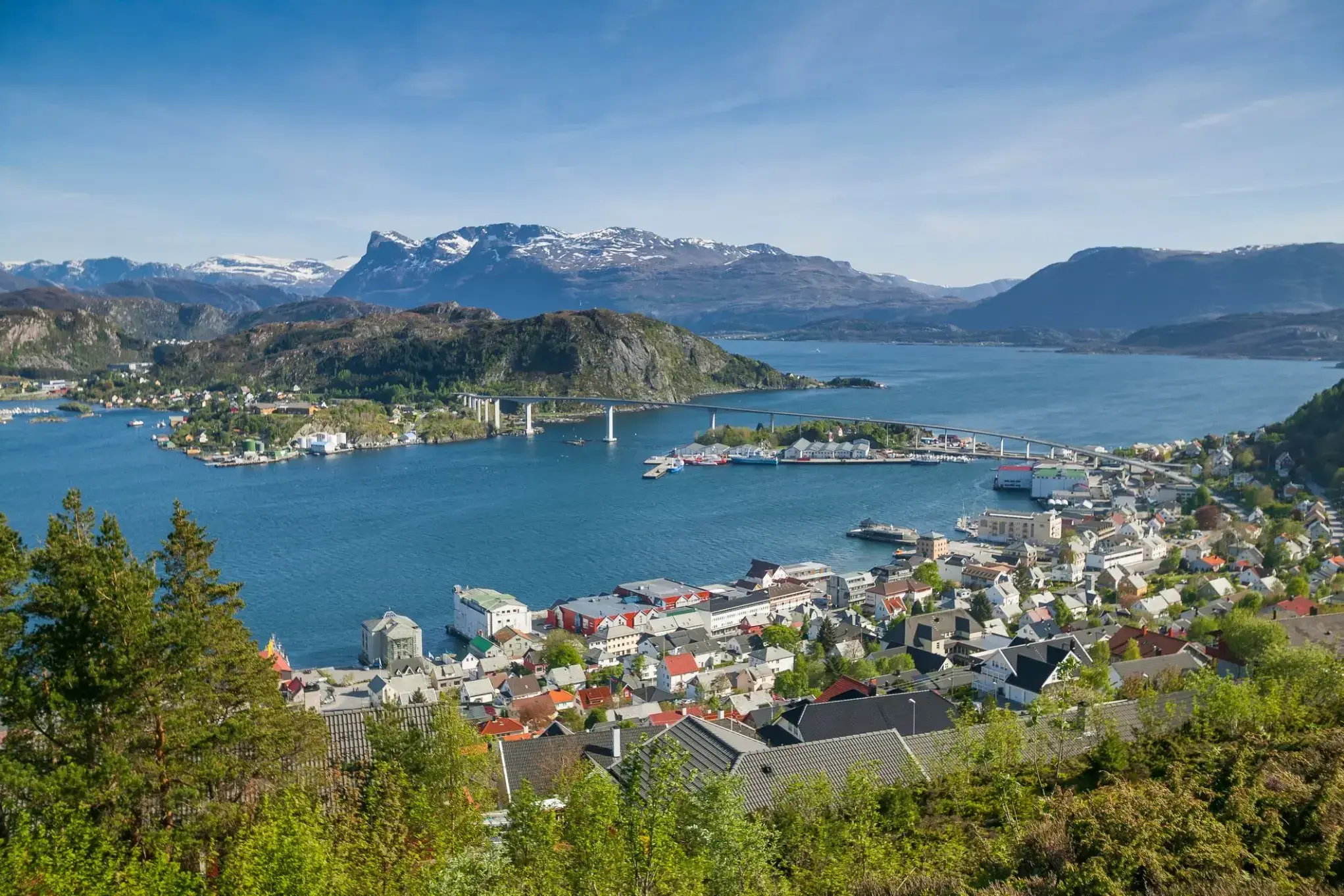
Розташований між величними фіордами та відкритим морем, Олесунн захоплює відвідувачів унікальним поєднанням природної краси та виразної архітектури. Відомий своїм вражаючим стилем модерн, відновленим після руйнівної пожежі 1904 року, місто пропонує чарівну атмосферу, де різнобарвні будівлі вздовж набережної створюють мальовничий краєвид, не схожий на жодне інше місце в Норвегії.
Любителі пригод та культури знайдуть у Олесунні багато цікавого. Від підйому на оглядовий майданчик на пагорбі Аксла з панорамним видом на архіпелаг до відвідування місцевих музеїв та свіжих рибних ринків — це прибережне місто запрошує мандрівників поринути у морську спадщину та захопливі ландшафти Норвегії. Чи то круїз фіордами, чи прогулянка вузькими вуличками — кожна мить у Олесунні обіцяє незабутні враження.
Molde to malownicze miasto na zachodnim wybrzeżu Norwegii, położone nad brzegiem fiordu Romsdalsfjord. Znane z zachwycających krajobrazów, miasto często nazywane jest „Miastem Róż” z powodu licznych ogrodów różanych, które ozdabiają jego ulice i parki. Molde otoczone jest szczytami górskimi i zielonymi wzgórzami, co tworzy unikalne połączenie widoków górskich i morskich. Jednym z najbardziej znanych widoków jest ten z góry Vesterhorn, skąd rozciąga się panorama 222 górskich szczytów, tworzących imponujący krajobraz.
Molde słynie również z życia kulturalnego i historii. W mieście odbywa się międzynarodowy festiwal jazzowy, który przyciąga muzyków i turystów z całego świata. Miasto oferuje turystom wiele możliwości aktywnego wypoczynku, takich jak wędrówki malowniczymi szlakami, wędkarstwo i rejsy po fiordzie. Zabytki historyczne, takie jak Kościół Molde, oraz bliskość naturalnych atrakcji, takich jak Droga Atlantycka, sprawiają, że Molde jest idealnym miejscem dla tych, którzy chcą połączyć wypoczynek na łonie natury z odkrywaniem kultury i historii.
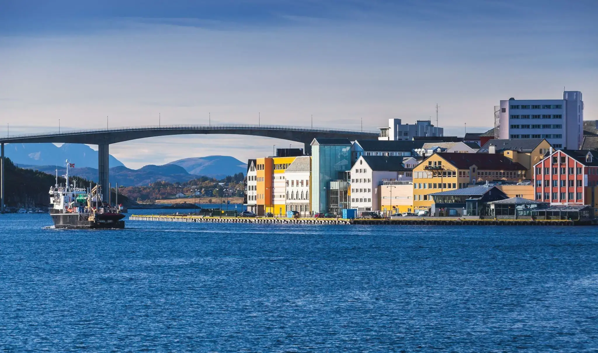
Najbardziej wysunięte na południe wybrzeże Norwegii zaprasza Cię do odkrycia niezwykłego miasta Kristiansand. To urocze miasteczko otoczone jest z trzech stron morzem. Jest to piąte co do wielkości miasto w kraju, a mimo że jego centrum mieści się na niewielkim obszarze zaledwie 1 km², Kristiansand ma wiele do zaoferowania swoim gościom. Nie chodzi tylko o niezwykle czyste norweskie powietrze, ale także o wiele innych interesujących atrakcji.
Wśród nich znajduje się największe zoo w Norwegii, w którym mieszka 80 gatunków zwierząt. Pobyt tutaj ucieszy zarówno dzieci, jak i dorosłych. Możesz przejechać się na karuzelach, pośmiać się w cyrku, a także wybrać się całą rodziną na rejs po morzu lub spędzić czas na placu zabaw.

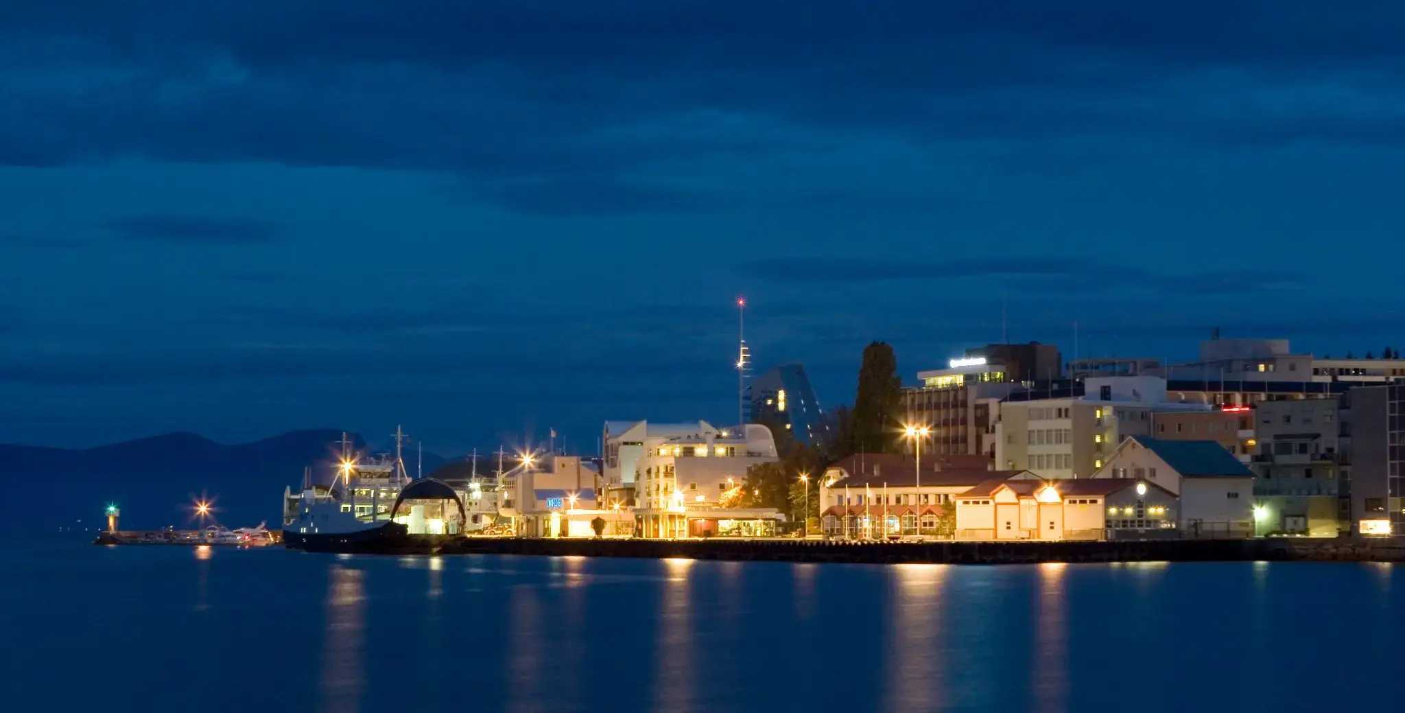
Stavanger is a city and municipality in Norway. It is the third largest city and metropolitan area in Norway (through conurbation with neighbouring Sandnes) and the administrative centre of Rogaland county. The municipality is the fourth most populous in Norway. Located on the Stavanger Peninsula in Southwest Norway, Stavanger counts its official founding year as 1125, the year the Stavanger Cathedral was completed. Stavanger's core is to a large degree 18th- and 19th-century wooden houses that are protected and considered part of the city's cultural heritage. This has caused the town centre and inner city to retain a small-town character with an unusually high ratio of detached houses, and has contributed significantly to spreading the city's population growth to outlying parts of Greater Stavanger.
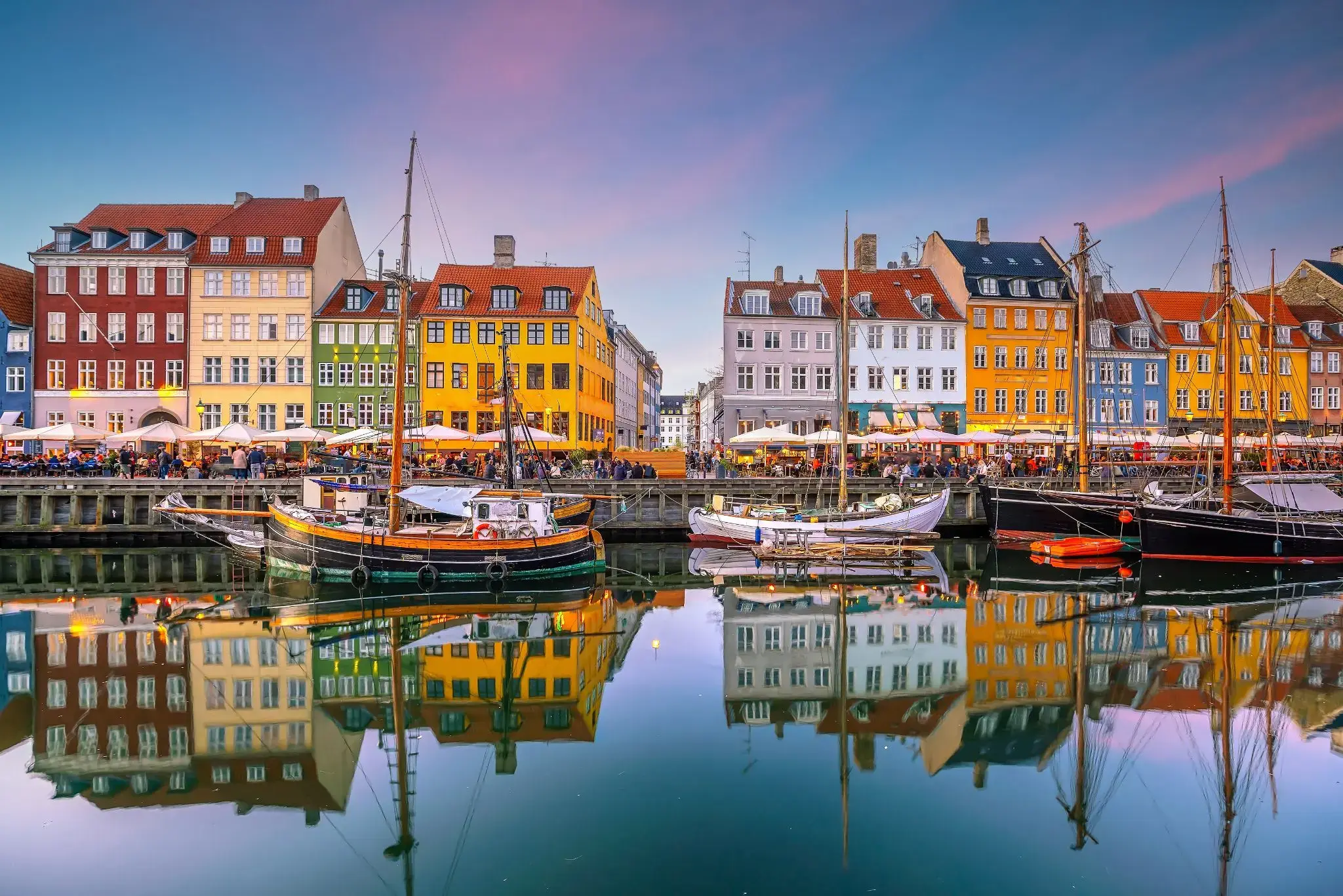
the capital and chief port of Denmark, a city that occupies the eastern part of Zealand and northern part of the island of Amager; population 518,574 (2009).
the capital and chief port of Denmark, a city that occupies the eastern part of Zealand and northern part of the island of Amager; population 518,574 (2009).
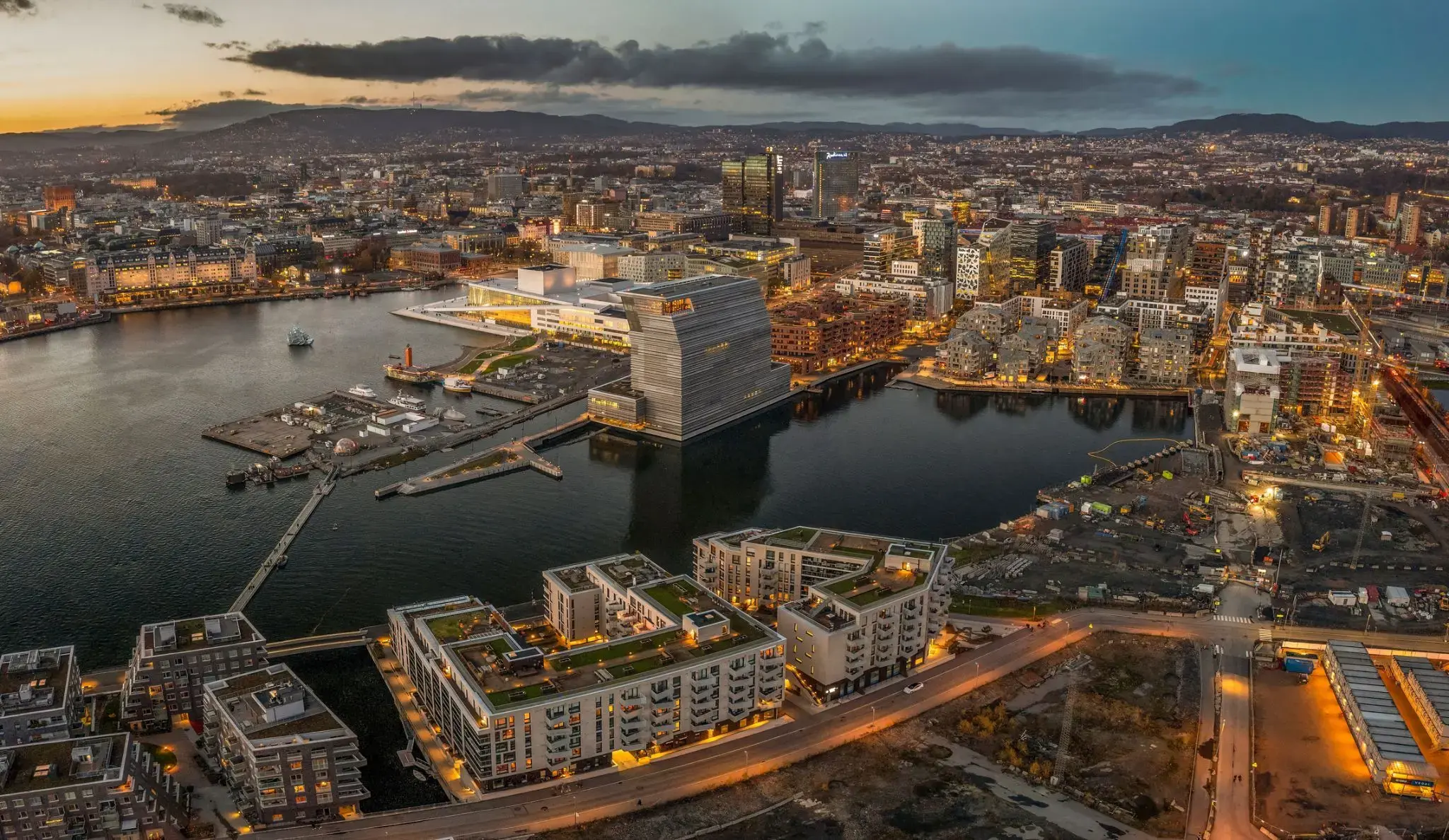
Oslo is the capital and most populous city of Norway. It constitutes both a county and a municipality. Founded in the year 1040 as Ánslo, and established as a trading place in 1048 by Harald Hardrada, the city was elevated to a bishopric in 1070 and a capital under Haakon V of Norway around 1300. Personal unions with Denmark from 1397 to 1523 and again from 1536 to 1814 reduced its influence, and with Sweden from 1814 to 1905 it functioned as a co-official capital. After being destroyed by a fire in 1624, during the reign of King Christian IV, a new city was built closer to Akershus Fortress and named Christiania in the king's honour. It was established as a municipality on 1 January 1838. The city's name was spelled Kristiania between 1877 and 1897 by state and municipal authorities. In 1925 the city was renamed Oslo.