| Region rejsu : Afryka, Rejsy po Pacyfiku |
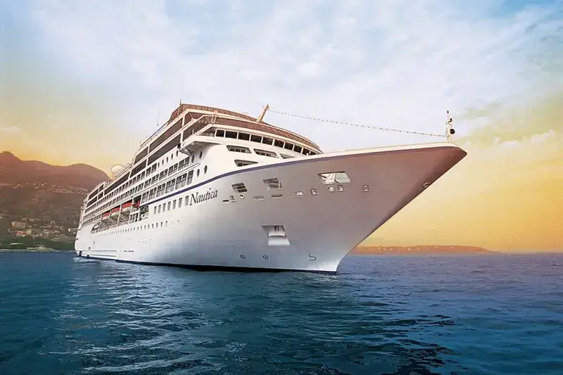
| Firma : Oceania Cruises |
| Statek : Nautica |
| Data rozpoczęcia : pon. 21 gru 2026 |
| Data zakończenia : wt. 05 sty 2027 |
| Liczba nocy : 15 nocy |
| Dzień | Data | Port | Wypłynięcie | Odpłynięcie |
|---|---|---|---|---|
| 1 | 21.12 pon. | Limbe / Cameroon | 17:00 | |
| 2 | 22.12 wt. | Dzień na morzu / Morze | ||
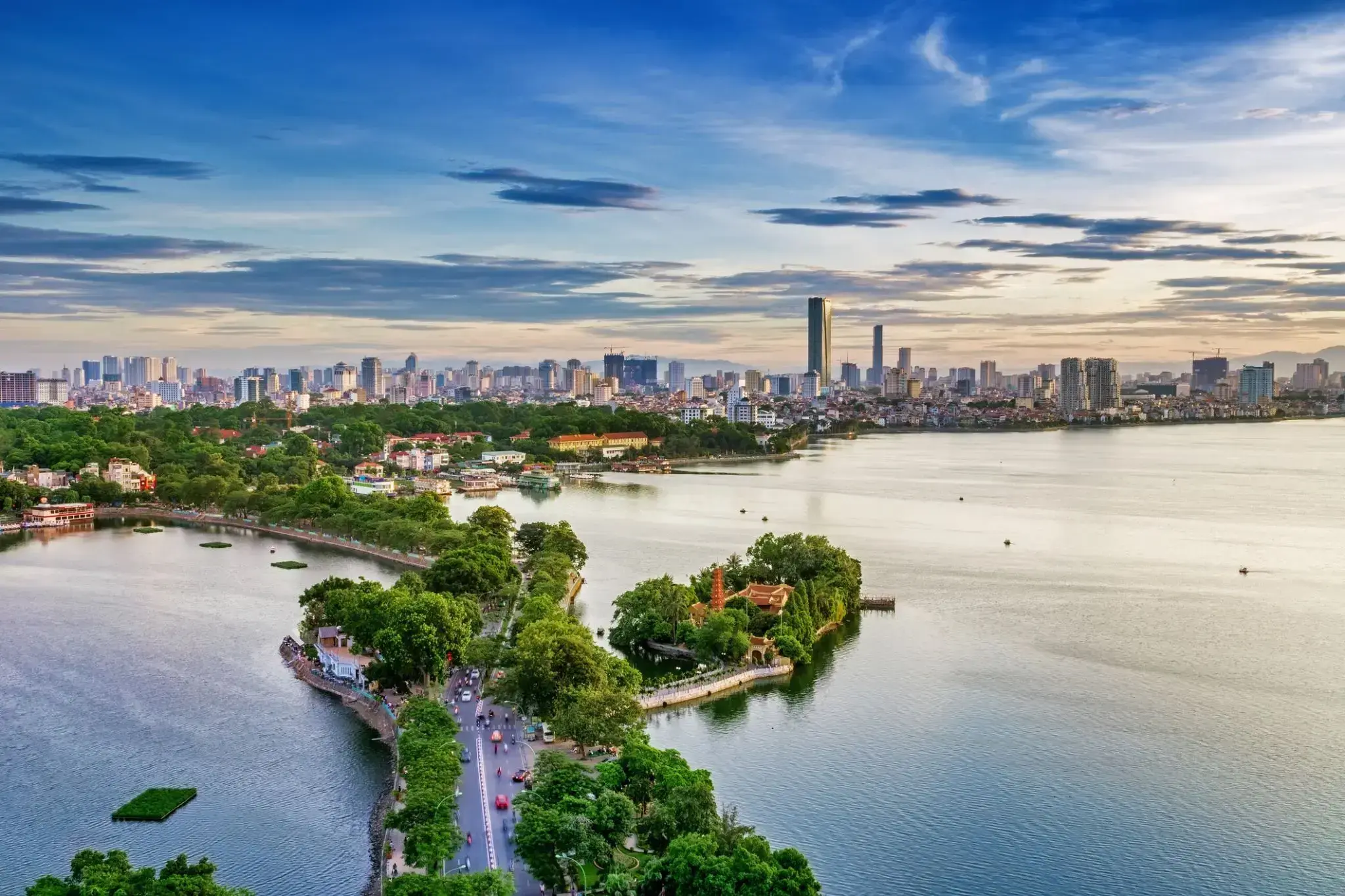
| 3 | 23.12 śr. | Hanoi / Vietnam | 07:00 | 19:00 |
| 4 | 24.12 czw. | Sanya / Chiny | 12:00 | 20:00 |
| 5 | 25.12 pt. | Da Nang / Vietnam | 07:00 | |
| 6 | 26.12 sob. | Da Nang / Vietnam | 13:00 | |
| 7 | 27.12 niedz. | Pomarańczowa linia / Vietnam | 10:30 | 18:00 |
| 8 | 28.12 pon. | Dzień na morzu / Morze | ||
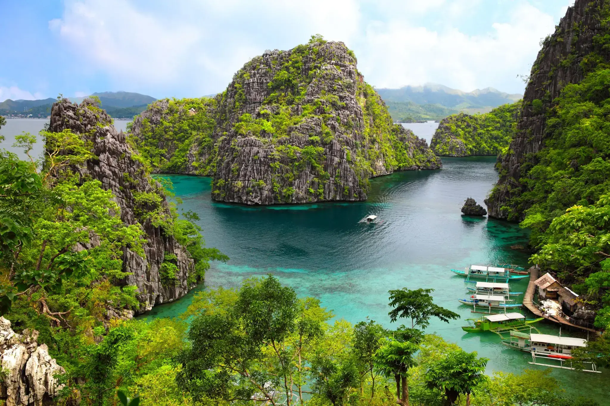
| 9 | 29.12 wt. | Coron Island / Philippine Islands | 12:00 | 20:00 |
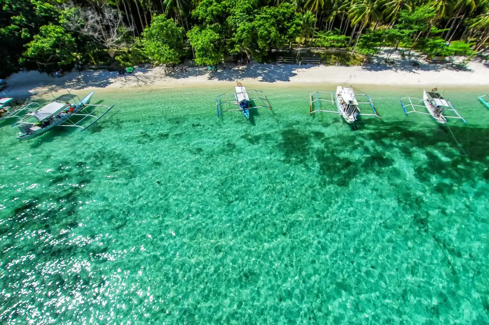
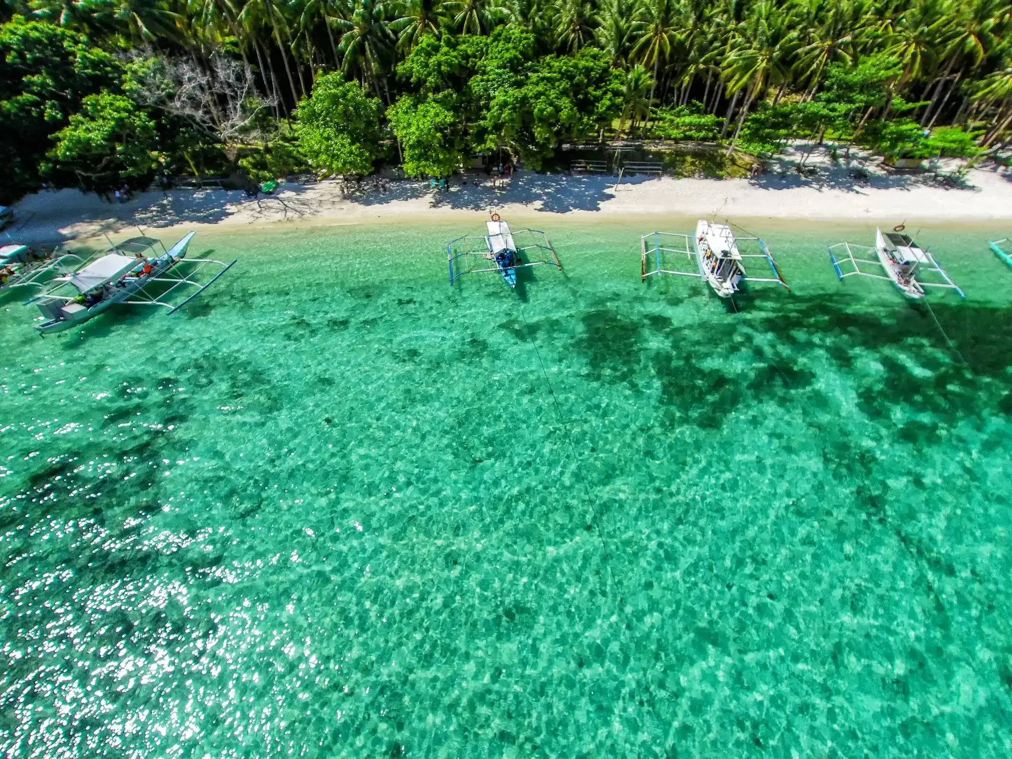
| 10 | 30.12 śr. | WYSPA BORACAY | 07:00 | 15:00 |
| 11 | 31.12 czw. | Puerto Princesa / Philippine Islands | 07:00 | 15:00 |
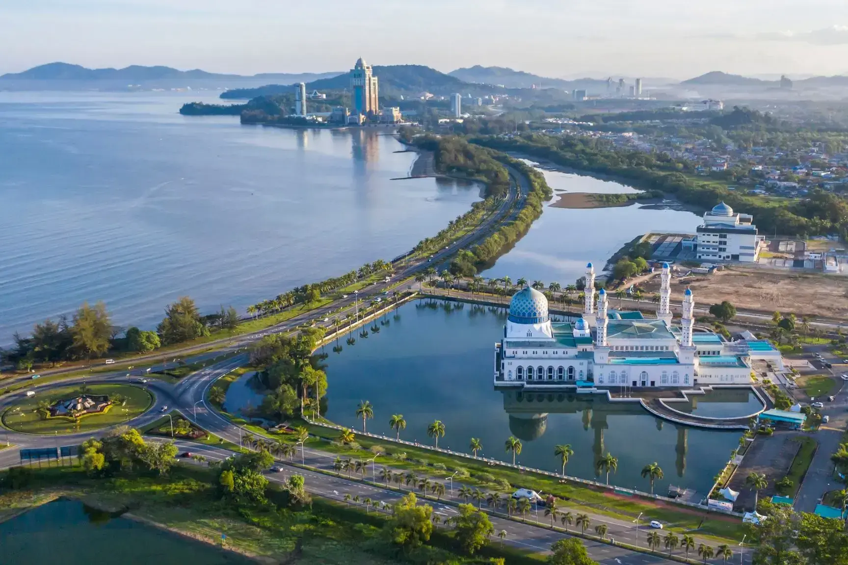
| 12 | 1.01 pt. | Kota Kinabalu / Malaysia | 11:00 | 20:00 |
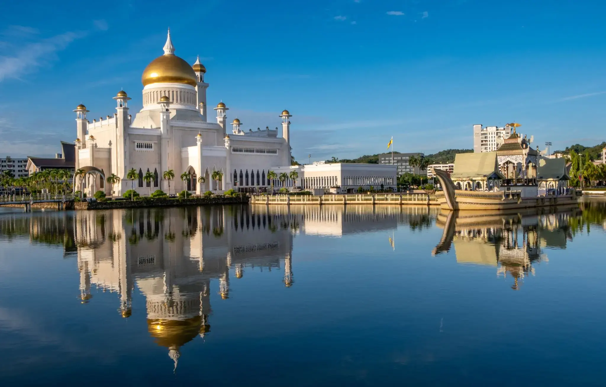
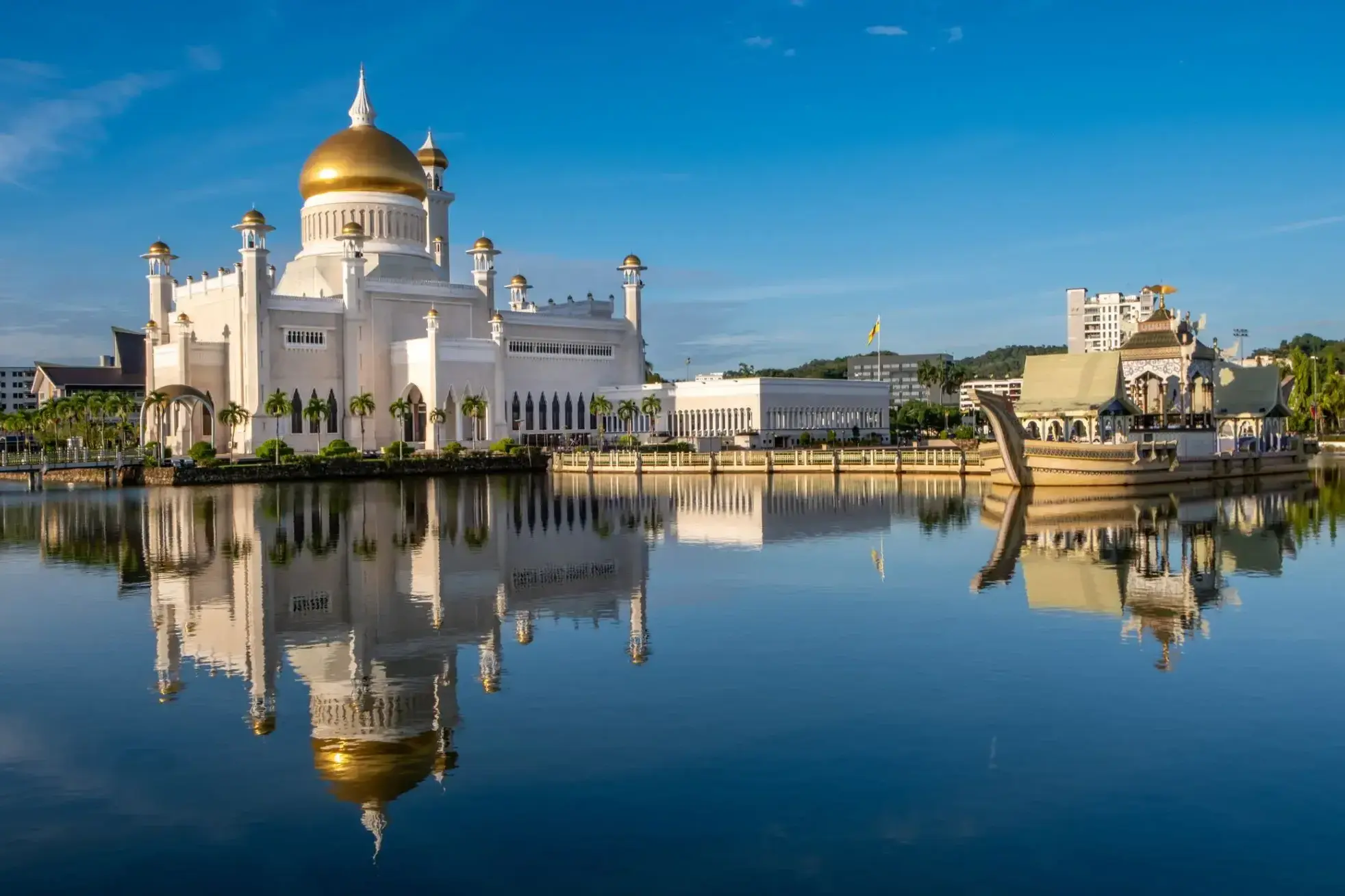
| 13 | 2.01 sob. | Bandar-Seri-Begawan / Brunei | 07:00 | 15:00 |
| 14 | 3.01 niedz. | Dzień na morzu / Morze | ||
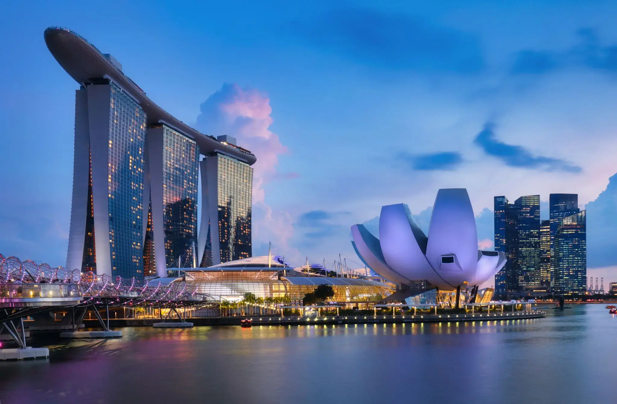
| 15 | 4.01 pon. | Singapur / Singapur | 13:00 | |
| 16 | 5.01 wt. | Singapur / Singapur | 17:00 |
Twój Świat w cenie
Dzięki Twojemu Światu w cenie, będziesz cieszyć się szeroką gamą udogodnień, zapewniających najwyższy komfort i wartość rejsów ultra-premium.
Niezapomniane doznania kulinarne w licznych, wykwintnych restauracjach — wszystko bez dodatkowych opłat.
Bezpłatne kawy specjalistyczne, napoje gazowane, świeżo wyciskane soki oraz woda gazowana i niegazowana Vero Water® serwowane na całym statku.
Nielimitowany, bezpłatny dostęp do Wi-Fi w apartamentach, kabinach i wszystkich pomieszczeniach ogólnodostępnych.
Posiłki serwowane w pokoju z doskonałym wyborem dań na ciepło i zimno.
Koktajle, koktajle mleczne, gelato i firmowe lody Humphry Slocombe — zawsze w cenie.
Grupowe zajęcia fitness w Aquamar® Spa + Vitality Center są bezpłatne.
Napiwki są wliczone w cenę dla Twojej wygody.
Pranie jest bezpłatne dla wszystkich gości.
Dzięki bezpłatnym pralniom samoobsługowym na pokładzie, a także usługom prania i prasowania dla kategorii Concierge i Suite, zawsze będziesz wyglądać olśniewająco. Oprócz naszej charakterystycznej, spersonalizowanej obsługi, zapewnimy Ci wzbogacający rejs bez ukrytych kosztów i prowizji.
Podnieś poziom swoich wrażeń
Kajuty Concierge Level Veranda oferują niezrównane połączenie luksusu, przywilejów i wartości. Bogactwo udogodnień i ekskluzywnych korzyści sprawi, że Twoje wrażenia będą jeszcze bardziej wzniosłe — od dań do wyboru z The Grand Dining Room, przez bezpłatne usługi pralnicze, po nieograniczony dostęp do tarasu Aquamar Spa.
Na pokładzie Oceania Marina i Oceania Riviera możesz również skorzystać z usług dedykowanego Concierge i ekskluzywnego dostępu do prywatnego salonu Concierge Lounge.
Kajuty Concierge Level Veranda, zlokalizowane w najbardziej pożądanych miejscach statku, to coś więcej niż tylko kabiny — to niezapomniane przeżycie.
Concierge Level Veranda — Ekskluzywne przywileje
Rozszerzone menu posiłków do pokoju na lunch i kolację z The Grand Dining Room
Usługi pralnicze — do 3 sztuk bagażu na kabinę
Ekskluzywny dostęp do prywatnego salonu Concierge Lounge na statkach Oceania Marina, Oceania Riviera, Oceania Vista i Oceania Allura za pomocą karty-klucza, oferujący bezpłatne napoje, kawę, przekąski i usługi dedykowanego Concierge'a
Powitalna butelka wyśmienitego włoskiego Prosecco
Priorytetowe rezerwacje online w restauracjach specjalistycznych
Nieograniczony dostęp do tarasu Aquamar Spa
Torba z logo Oceania Cruises
Kaszmirowe koce na kolana — idealne do relaksu i przytulania
Prasowanie odzieży po wejściu na pokład
Bezpłatna usługa czyszczenia butów
Depozyt i płatności – Oceania Cruises
Depozyt ogólny:
W przypadku apartamentów typu Owner’s, Vista i Oceania Suites wymagany jest depozyt w wysokości 20% ceny rejsu od osoby.
W przypadku wszystkich pozostałych kategorii apartamentów/kabin, depozyt wynosi 500 USD od osoby.
W przypadku Grand Voyages depozyt wynosi 1500 USD od osoby.
Terminy depozytu i płatności końcowej:
Rezerwacje dokonane na ponad 150 dni przed rejsem:
Depozyt w wysokości 20% w przypadku apartamentów typu Owner’s, Vista i Oceania Suites oraz 500 USD w przypadku wszystkich pozostałych kategorii wymagany jest w ciągu 5 dni od rezerwacji.
Rezerwacje dokonane na 90–120 dni przed rejsem:
Pełna płatność wymagana w ciągu 3 dni od rezerwacji.
Rezerwacje dokonane na 0–90 dni przed rejsem:
Pełna płatność wymagana w dniu rezerwacji.
Ważne:
Rezerwacje, które nie zostaną wpłacone lub opłacone w całości zgodnie z niniejszym harmonogramem, zostaną automatycznie anulowane. O ile nie zaznaczono inaczej, płatność końcowa musi wpłynąć do Oceania Cruises na 150 dni przed wypłynięciem w przypadku rejsów krótszych niż 15 dni oraz na 150 dni w przypadku rejsów trwających 15 dni lub dłużej.
Oceania Cruises zastrzega sobie prawo do anulowania rezerwacji, które nie zostały w pełni opłacone w momencie płatności końcowej.
Informacje dodatkowe:
Dane paszportowe i specjalne prośby dotyczące usług pokładowych należy przesłać w momencie płatności końcowej.
Płatności można dokonać czekiem osobistym, kartą American Express, Discover, MasterCard lub Visa.
Dla wygody płatność końcowa może zostać automatycznie pobrana z karty kredytowej użytej do wpłaty początkowej.
Oceania Cruises nie ponosi odpowiedzialności za opłaty walutowe ani opłaty transakcyjne pobierane niezależnie przez banki wystawiające karty. Opłaty te nie przysługują Oceania Cruises.
Płatności kartami kredytowymi osób trzecich są akceptowane wyłącznie po uzyskaniu ważnej autoryzacji od posiadacza karty.
Depozyt i płatność – rejsy 180-dniowe
W przypadku rejsów 180-dniowych wymagany jest depozyt w wysokości 20% ceny rejsu od osoby za wszystkie apartamenty i kabiny w ciągu 7 dni od rezerwacji.
Ostateczna płatność musi zostać otrzymana najpóźniej 181 dni przed wypłynięciem, wraz z danymi paszportowymi i wszelkimi specjalnymi prośbami o usługi na pokładzie.
W przeciwnym razie rezerwacja może zostać natychmiast anulowana, a naliczone zostaną stosowne kary.
Forma płatności (FORMA PŁATNOŚCI)
Oceania Cruises akceptuje płatności za rezerwacje kartą kredytową/debetową lub przelewem bankowym.
Niestety, czeki osobiste nie są akceptowane.
Karty kredytowe/debetowe:
Akceptowane są karty American Express, Visa i Mastercard.
Uwaga: Oceania Cruises nie ponosi odpowiedzialności za opłaty za wymianę waluty/transakcje naliczane przez bank wystawiający kartę.


Hanoi to stolica Wietnamu, miasto z tysiącletnią historią, dawniej znane jako Thang Long, co oznacza „Miasto Wzbijającego się Smoka”. Pomimo wielu pagód, zabytków architektury i gwarnych dzielnic handlowych, nie ma tu tłumów turystów, co pozwala cieszyć się jego urokiem bez pośpiechu i zgiełku.

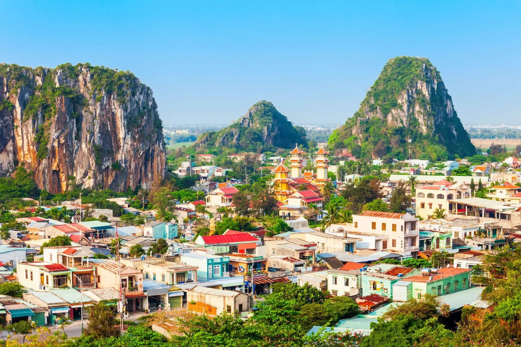
Ciepła morska bryza i miękki piasek sprawiają, że Da Nang to idealne miejsce dla tych, którzy szukają relaksu nad morzem i lekkości w każdym kroku. Tutaj nowoczesne kawiarnie sąsiadują z tradycyjnymi targami, a wieczorna promenada wypełnia się światłami i aromatem świeżych owoców morza. Można spacerować długimi plażami My Khe i Non Nuoc, które należą do najlepszych w Azji, oraz odkrywać przytulne zakątki z wietnamską kawą i uśmiechami mieszkańców.
Dla miłośników historii i natury Da Nang oferuje wyjątkowe trasy do Marmurowych Gór z jaskiniami i pagodami, skąd rozciągają się zapierające dech w piersiach widoki na wybrzeże. Stąd łatwo dotrzeć do starożytnego miasta Hoi An, które zachowało klimat przeszłości, lub wybrać się na przejażdżkę przełęczą Hai Van, gdzie każdy zakręt odkrywa nowe panoramy gór i morza. Miasto łączy relaksujący wypoczynek na plaży z możliwością odkrycia piękna Wietnamu i zaczerpnięcia świeżego, morskiego powietrza, które napełnia energią i lekkością.
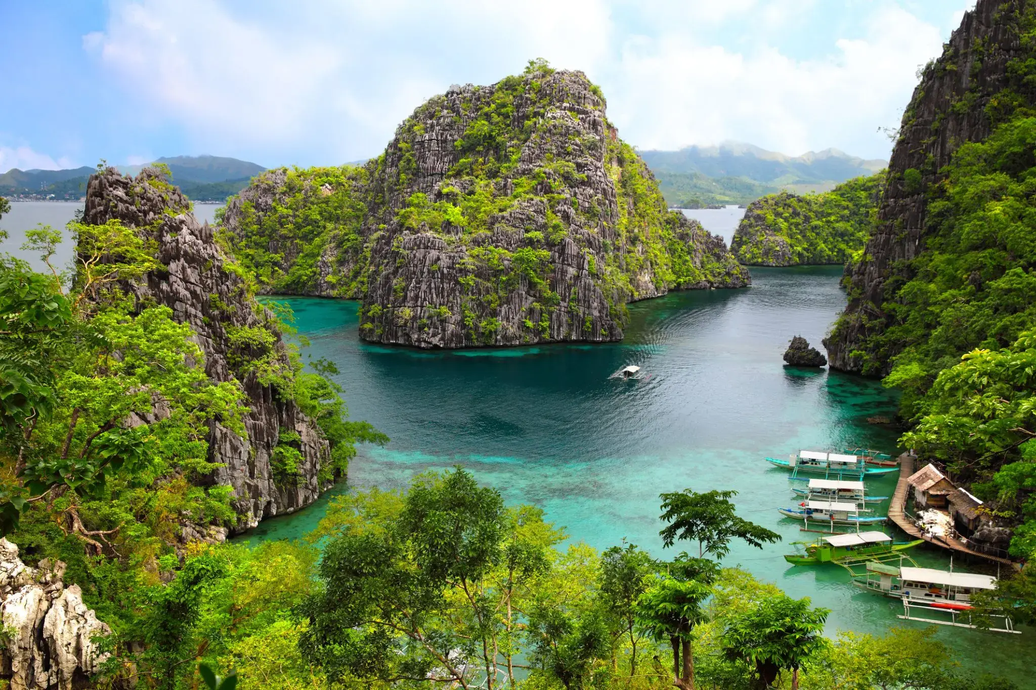
Puerto Princesa to miasto na filipińskiej wyspie Palawan, szeroko znane dzięki jednej z cudów natury — Podziemnej Rzece Puerto Princesa, wpisanej na listę światowego dziedzictwa UNESCO. Ten system jaskiń i podziemnych rzek, przebiegający przez wapienne formacje, przyciąga podróżnych z całego świata możliwością rejsu łodzią i podziwiania stalaktytów, stalagmitów oraz unikalnej ekosystemu. Miasto jest również doskonałą bazą wypadową do odkrywania niezwykłej przyrody Palawanu: tropikalnych lasów, wybrzeży i rezerwatów przyrody.
Poza atrakcjami przyrodniczymi, Puerto Princesa słynie z czystych ulic, przyjaznej atmosfery i dobrze rozwiniętej infrastruktury turystycznej. Można tu skosztować świeżych owoców morza, odwiedzić nocne targi lub wybrać się na wycieczki po wyspach w zatoce Honda. Miasto aktywnie rozwija ekoturystykę, dbając o równowagę między rozwojem a ochroną środowiska. Dla podróżników poszukujących połączenia przygody, relaksu i lokalnej kultury, Puerto Princesa staje się coraz bardziej atrakcyjnym kierunkiem.
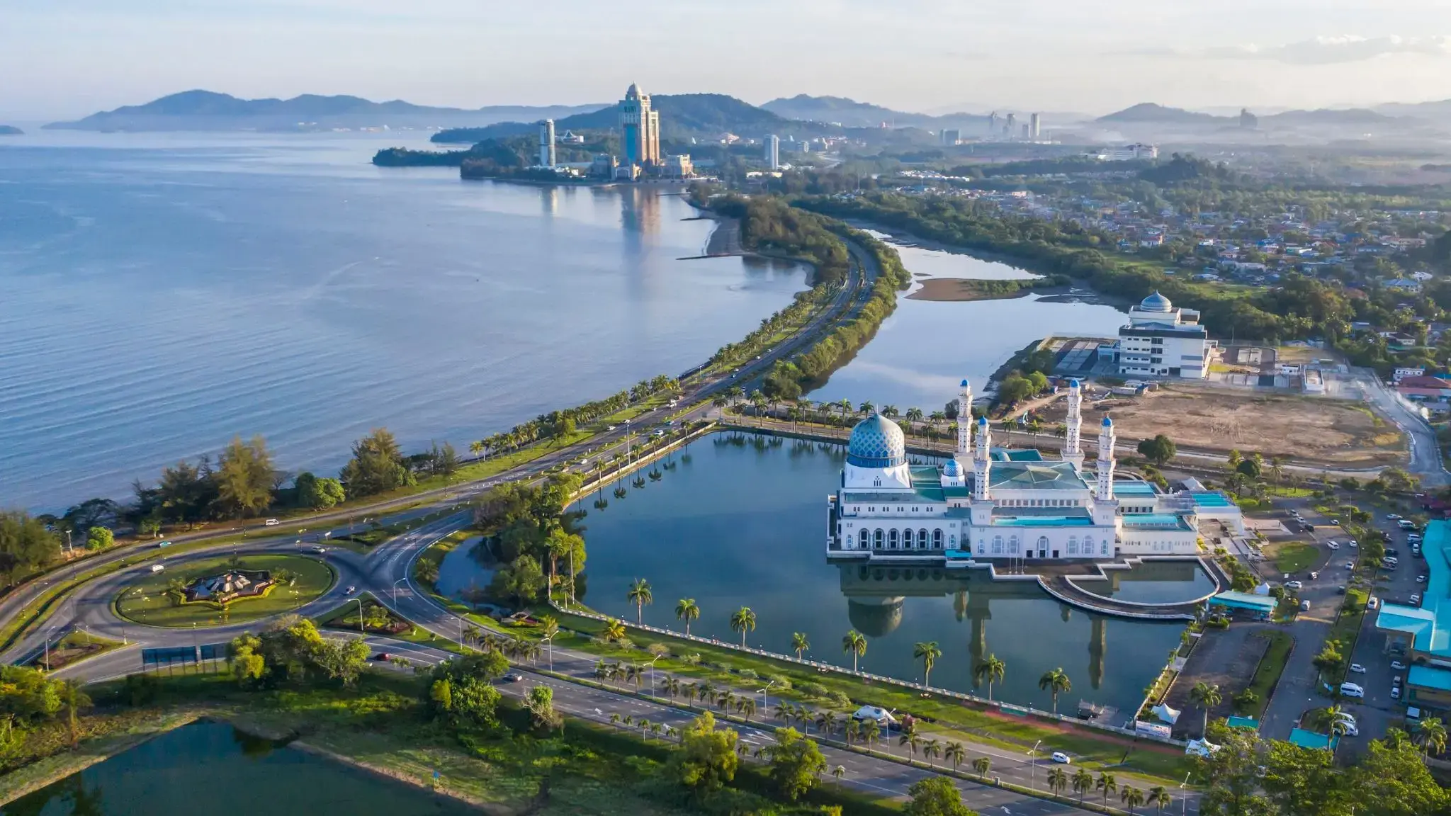
Kota Kinabalu, dawniej znane jako Jesselton, jest stolicą stanu Sabah w Malezji oraz dystryktu Kota Kinabalu. Miasto leży na północno-zachodnim wybrzeżu Borneo nad Morzem Południowochińskim, w pobliżu Parku Narodowego Tunku Abdul Rahman i góry Kinabalu. Metropolia liczy ponad 600 tysięcy mieszkańców.
W XV wieku obszar był pod wpływem Imperium Brunei. W XIX wieku Brytyjska Kompania Północnego Borneo założyła osadę Jesselton, która po zniszczeniach II wojny światowej stała się stolicą Północnego Borneo. W 1967 roku nazwa miasta zmieniona na Kota Kinabalu. Status miasta nadano w 2000 roku.
Dziś Kota Kinabalu jest ważnym ośrodkiem przemysłowym i turystycznym Wschodniej Malezji oraz popularnym punktem wyjścia dla turystów odwiedzających Sabah i Borneo. Miasto szybko się rozwija dzięki turystyce i gospodarce.