
Rejs 30 941 428
Epicki zachodni i południowy Pacyfik
| Region rejsu : Azja |
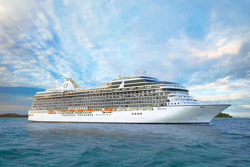
| Firma : Oceania Cruises |
| Statek : Riviera |
| Data rozpoczęcia : śr. 08 paź 2025 |
| Data zakończenia : niedz. 28 gru 2025 |
| Liczba nocy : 81 noc |


Harmonogram
| Dzień | Data | Port | Wypłynięcie | Odpłynięcie |
|---|---|---|---|---|
| 1 | 8.10 śr. | Yokohama (Tokio) / Japonia | 19:00 | |
| 2 | 9.10 czw. | Nagoya / Japonia | 09:30 | 17:30 |
| 3 | 10.10 pt. | Kioto | 09:30 | |
| 4 | 11.10 sob. | Kioto | 12:00 | |
| 5 | 12.10 niedz. | Hiroszima / Japonia | 10:00 | 17:30 |
| 6 | 13.10 pon. | Kagoshima / Japonia | 13:00 | 21:00 |
| 7 | 14.10 wt. | Dzień na morzu / Morze | ||
| 8 | 15.10 śr. | Szanghaj / Chiny | 10:30 | |
| 9 | 16.10 czw. | Szanghaj / Chiny | 23:00 | |
| 10 | 17.10 pt. | Dzień na morzu / Morze | ||
| 11 | 18.10 sob. | Naha / Japonia | 07:00 | 14:30 |
| 12 | 19.10 niedz. | Tajpej / Taiwan | 09:30 | 17:00 |
| 13 | 20.10 pon. | Kaohsiung / Taiwan | 08:00 | 16:00 |
| 14 | 21.10 wt. | Limbe / Cameroon | 14:00 | |
| 15 | 22.10 śr. | Limbe / Cameroon | ||
| 16 | 23.10 czw. | Limbe / Cameroon | 13:00 | |
| 17 | 24.10 pt. | Haikou | 10:00 | 18:00 |
| 18 | 25.10 sob. | Hanoi / Vietnam | 07:00 | 19:00 |
| 19 | 26.10 niedz. | Sanya / Chiny | 11:00 | 20:00 |
| 20 | 27.10 pon. | Da Nang / Vietnam | 08:00 | 17:00 |
| 21 | 28.10 wt. | Dzień na morzu / Morze | ||
| 22 | 29.10 śr. | Ho Chi Minh / Vietnam | 08:00 | |
| 23 | 30.10 czw. | Ho Chi Minh / Vietnam | 16:00 | |
| 24 | 31.10 pt. | Dzień na morzu / Morze | ||
| 25 | 1.11 sob. | Singapur / Singapur | 10:00 | |
| 26 | 2.11 niedz. | Singapur / Singapur | 18:00 | |
| 27 | 3.11 pon. | Dzień na morzu / Morze | ||
| 28 | 4.11 wt. | Wyspa Samui / Koh Samui / Thailand | 07:00 | 18:00 |
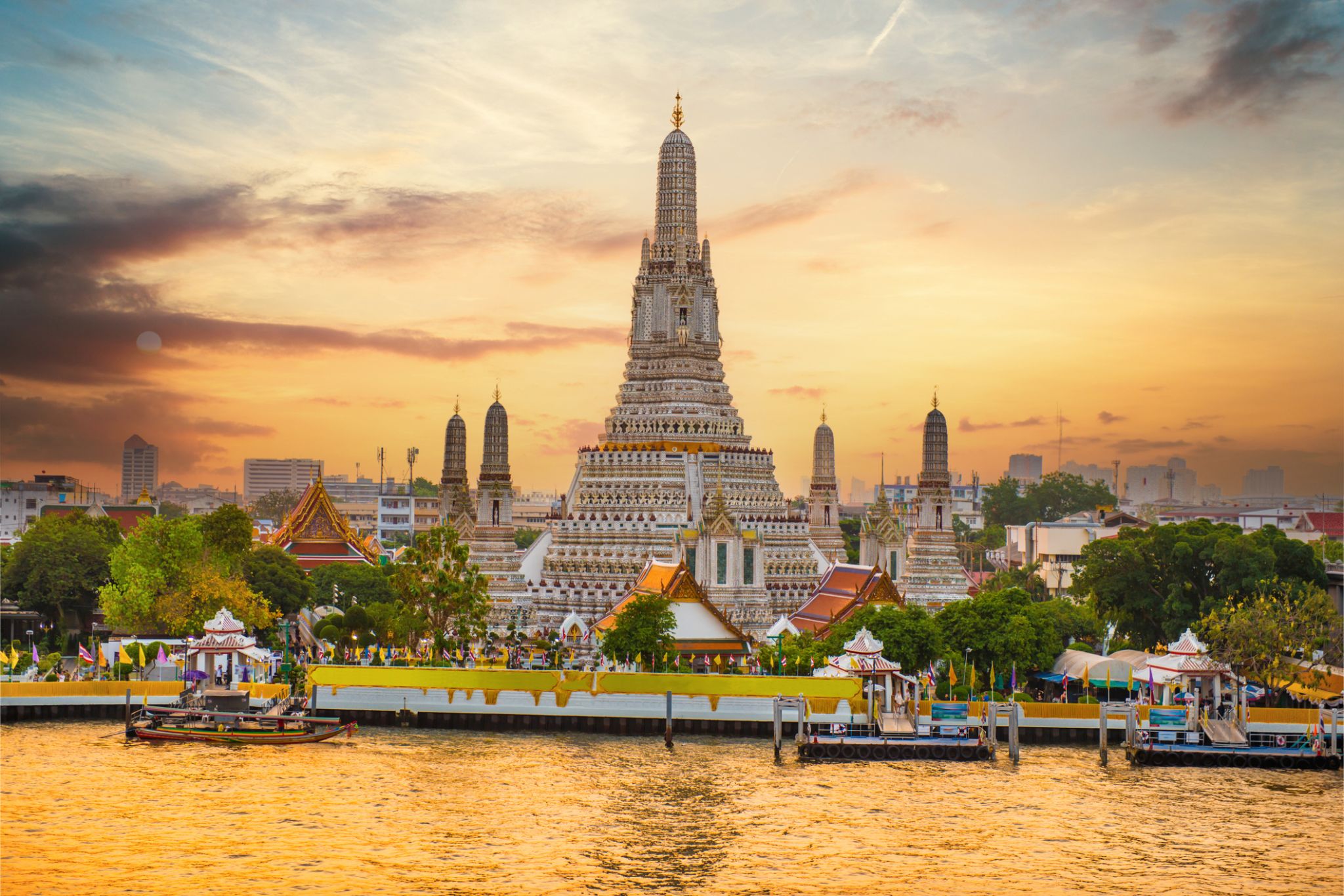
| 29 | 5.11 śr. | Bangkok / Thailand | 10:00 | |
| 30 | 6.11 czw. | Bangkok / Thailand | ||
| 31 | 7.11 pt. | Bangkok / Thailand | 16:00 | |
| 32 | 8.11 sob. | Wyspa Samui / Koh Samui / Thailand | 07:00 | 14:00 |
| 33 | 9.11 niedz. | Dzień na morzu / Morze | ||
| 34 | 10.11 pon. | Malakka / Malaysia | 12:00 | 20:00 |
| 35 | 11.11 wt. | Kuala Lumpur / Malaysia | 07:00 | 20:00 |
| 36 | 12.11 śr. | Georgetown / Cayman Islands | 10:00 | 20:00 |
| 37 | 13.11 czw. | Kuah / Malaysia | 08:00 | 18:00 |
| 38 | 14.11 pt. | Phuket / Thailand | 07:00 | |
| 39 | 15.11 sob. | Phuket / Thailand | 17:00 | |
| 40 | 16.11 niedz. | Dzień na morzu / Morze | ||
| 41 | 17.11 pon. | Singapur / Singapur | 07:00 | |
| 42 | 18.11 wt. | Singapur / Singapur | 16:00 | |
| 43 | 19.11 śr. | Dzień na morzu / Morze | ||
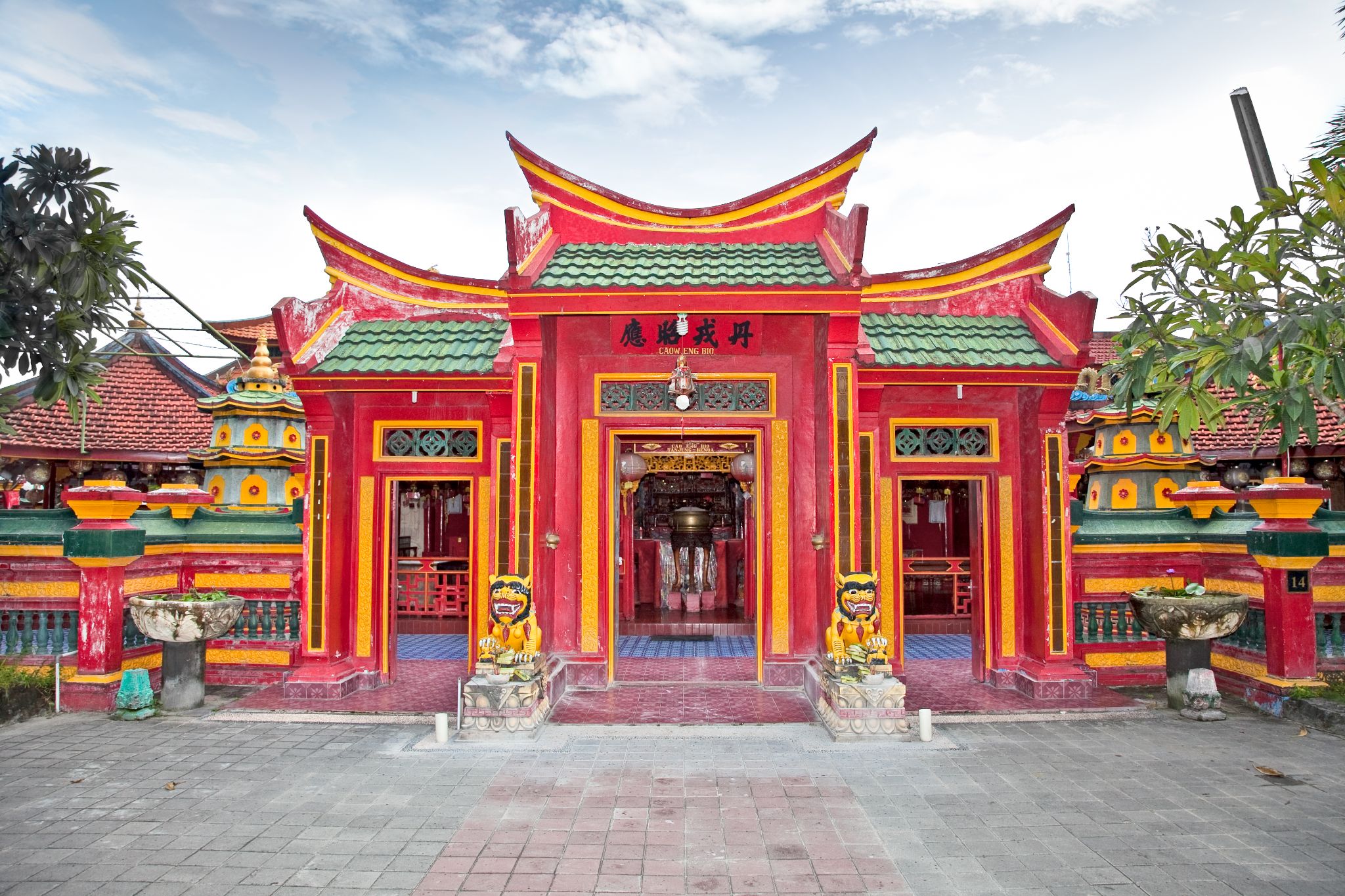
| 44 | 20.11 czw. | Surabaya / Indonezja | 13:00 | 21:00 |
| 45 | 21.11 pt. | Tanjung Benoit / Indonezja | 18:00 | |
| 46 | 22.11 sob. | Tanjung Benoit / Indonezja | 23:59 | |
| 47 | 23.11 niedz. | Praya / Cape Verde | 07:00 | 15:00 |
| 48 | 24.11 pon. | Waingapu | 13:00 | 21:00 |
| 49 | 25.11 wt. | Komoda / Indonezja | 07:00 | 15:30 |
| 50 | 26.11 śr. | Dzień na morzu / Morze | ||
| 51 | 27.11 czw. | Dzień na morzu / Morze | ||
| 52 | 28.11 pt. | Dzień na morzu / Morze | ||
| 53 | 29.11 sob. | Pert | 07:00 | 20:30 |
| 54 | 30.11 niedz. | Busselton | 08:00 | 17:00 |
| 55 | 1.12 pon. | Albany / Australia | 11:00 | 19:00 |
| 56 | 2.12 wt. | Dzień na morzu / Morze | ||
| 57 | 3.12 śr. | Dzień na morzu / Morze | ||
| 58 | 4.12 czw. | Pennesho / Australia | 07:00 | 18:00 |
| 59 | 5.12 pt. | Adelaida / Australia | 07:00 | 22:00 |
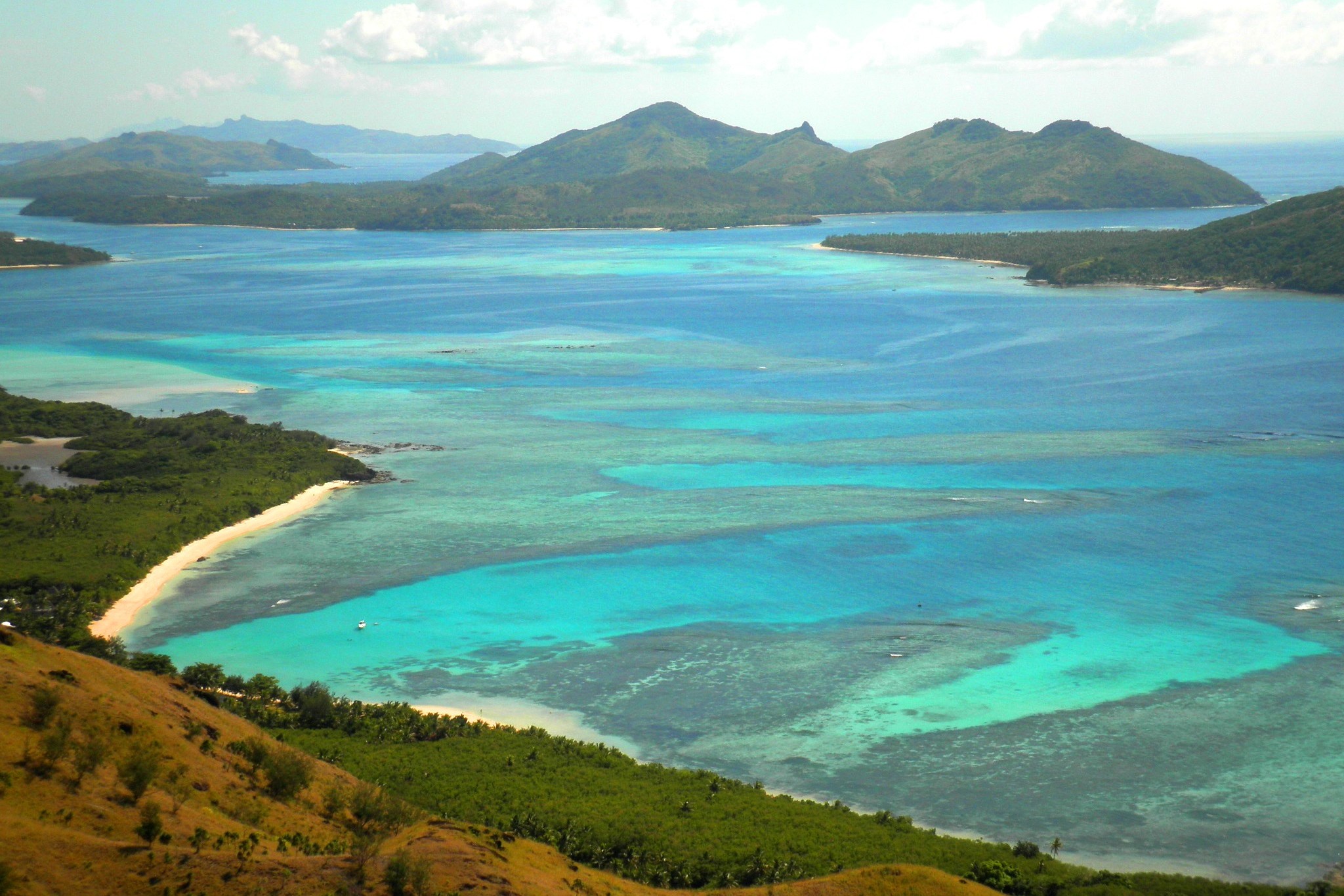
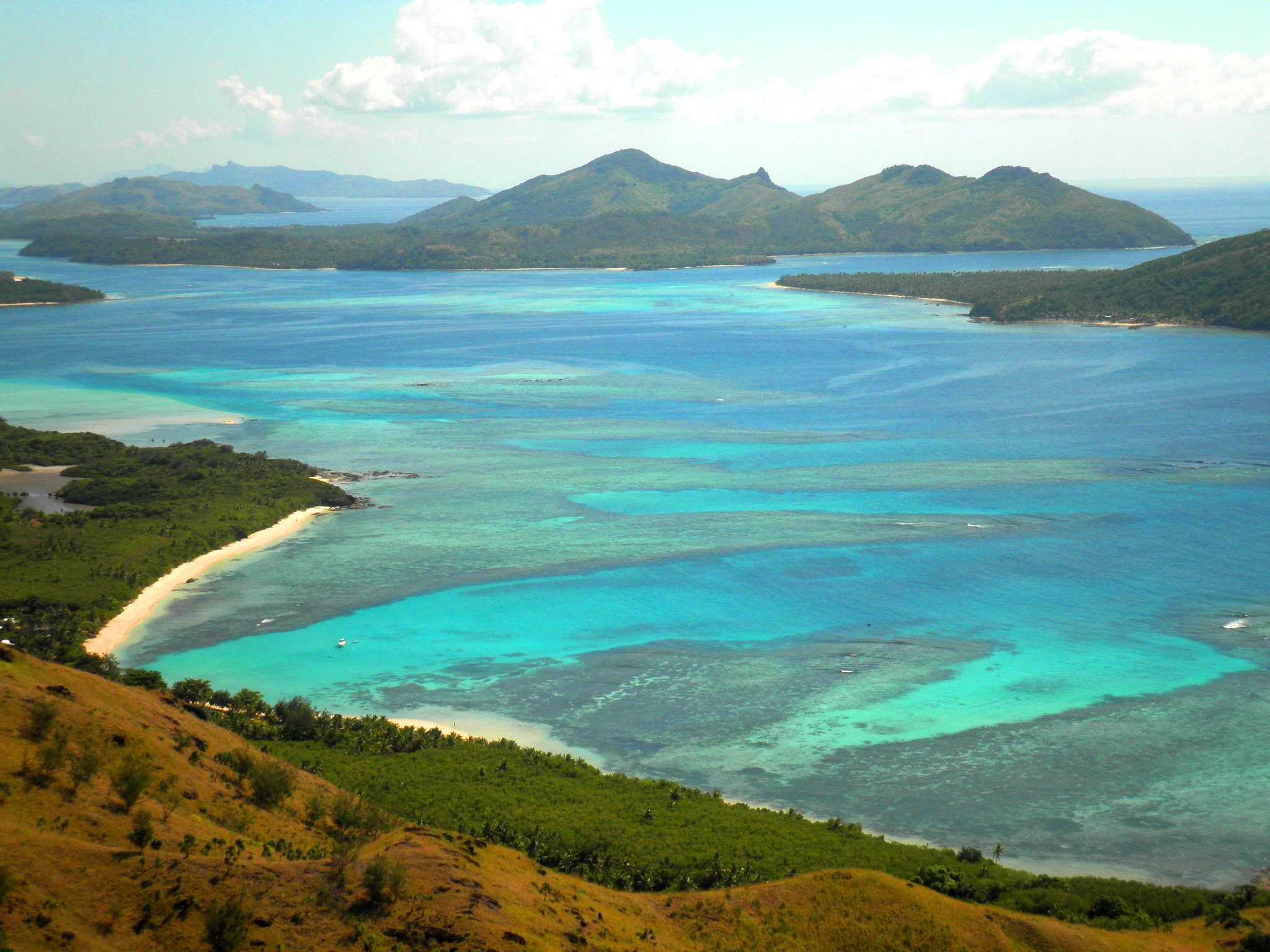
| 60 | 6.12 sob. | Dzień na morzu / Morze | ||
| 61 | 7.12 niedz. | Melbourne / Australia | 07:00 | 17:00 |
| 62 | 8.12 pon. | Bernie (Tasmania) / Australia / New Zealand | 08:00 | 16:00 |
| 63 | 9.12 wt. | Dzień na morzu / Morze | ||
| 64 | 10.12 śr. | Sydnej / Australia | 07:00 | 18:45 |
| 65 | 11.12 czw. | Dzień na morzu / Morze | ||
| 66 | 12.12 pt. | Dzień na morzu / Morze | ||
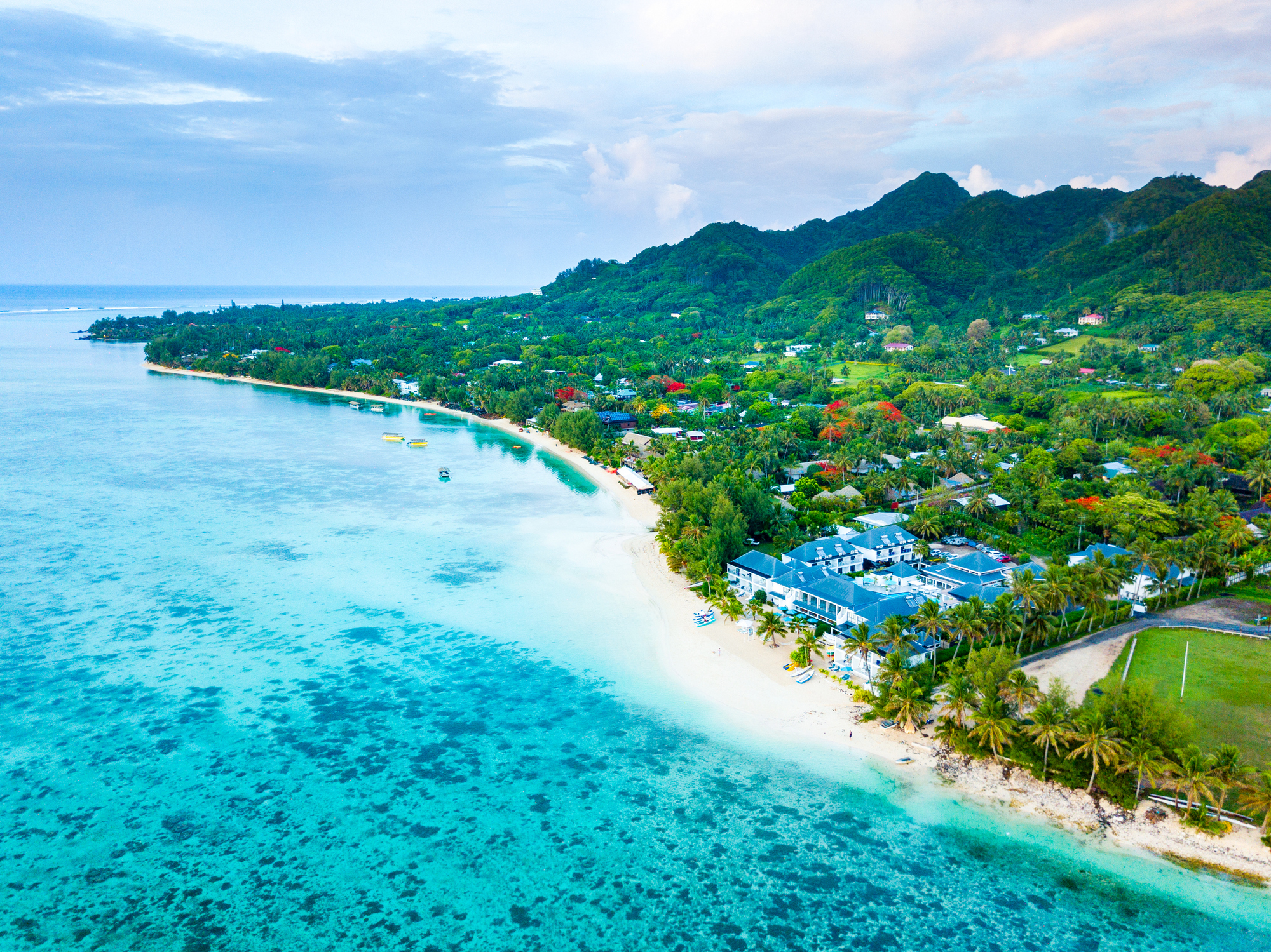
| 67 | 13.12 sob. | Numea / Nowa Kaledonia | 08:00 | 16:00 |
| 68 | 14.12 niedz. | Jezioro Misteri / Kanada | 08:00 | 17:00 |
| 69 | 15.12 pon. | Dzień na morzu / Morze | ||
| 70 | 16.12 wt. | Lautoka / Fiji | 07:00 | 17:00 |
| 71 | 17.12 śr. | Suchy / Fiji | 07:00 | 17:00 |
| 72 | 18.12 czw. | Dzień na morzu / Morze | ||
| 73 | 19.12 pt. | Nukualofa / Tonga | 07:00 | 18:00 |
| 74 | 20.12 sob. | Neiafu (Vavaʻu) Неиафу / Tonga | 07:00 | 14:30 |
| 75 | 21.12 niedz. | |||
| 75 | 21.12 niedz. | Apia / Samoa | 13:00 | 21:00 |
| 75 | 21.12 niedz. | ZAPŁATA / American Samoa | 07:00 | 15:00 |
| 76 | 22.12 pon. | Dzień na morzu / Morze | ||
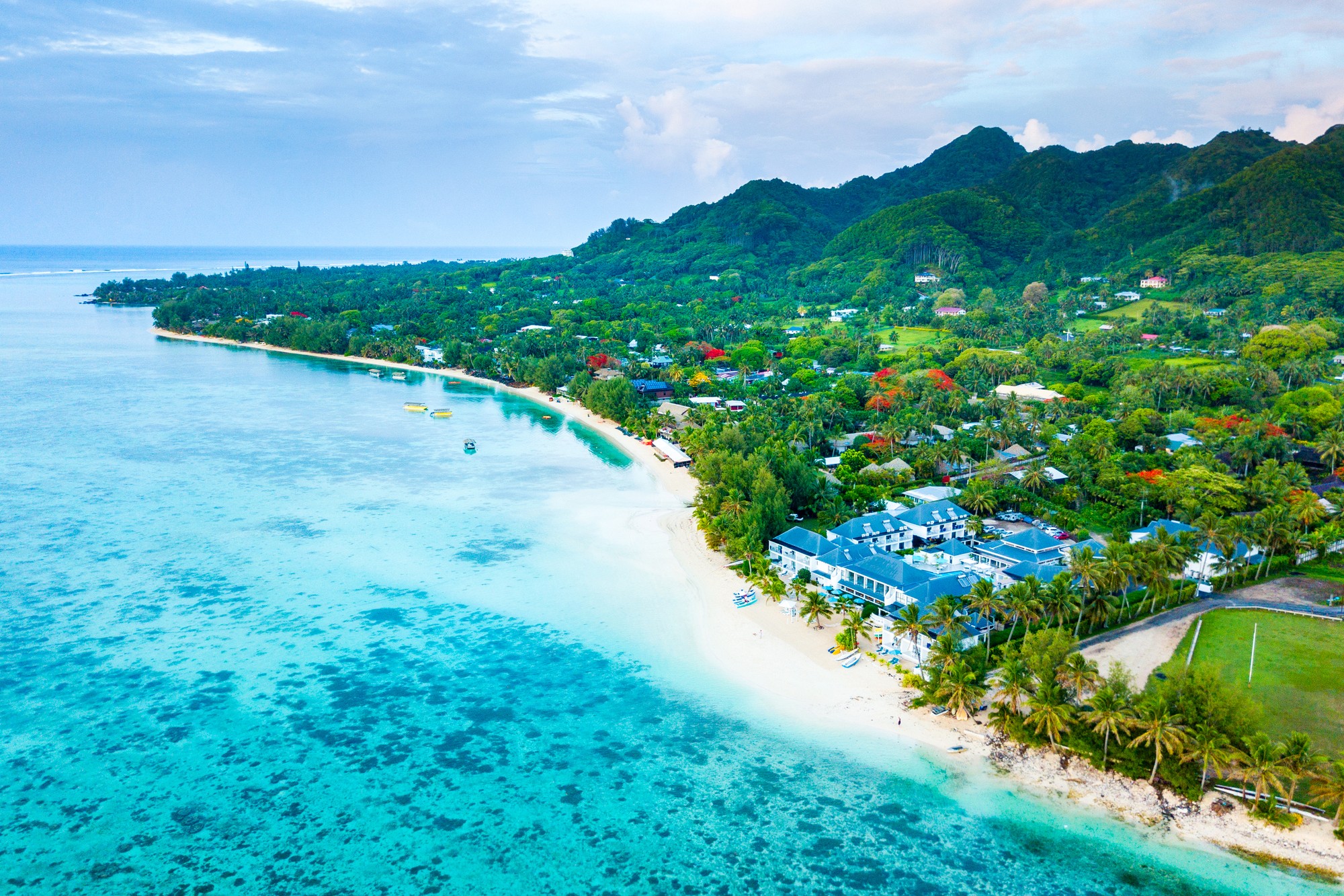
| 77 | 23.12 wt. | Rarotonga / Wyspy Cooka | 12:00 | 21:00 |
| 78 | 24.12 śr. | Dzień na morzu / Morze | ||
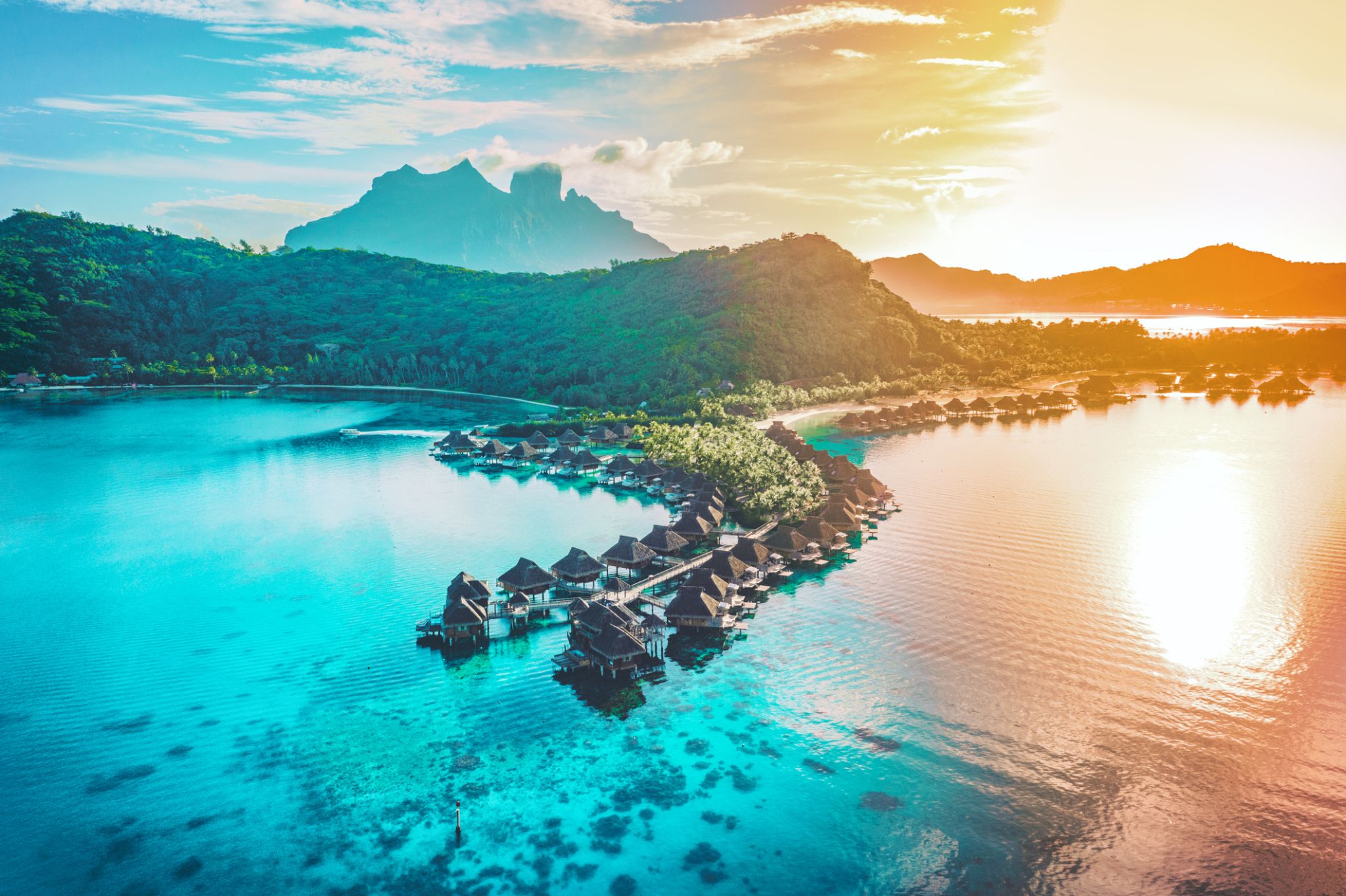
| 79 | 25.12 czw. | Bora Bora, Society Islands / French Polynesia | 07:00 | 18:00 |
| 80 | 26.12 pt. | Huahine | 07:00 | 19:00 |
| 81 | 27.12 sob. | Moorea, Wyspy Towarzystwa / French Polynesia | 07:00 | 18:00 |
| 81 | 27.12 sob. | Papeete Papeete / French Polynesia | 21:00 | |
| 82 | 28.12 niedz. | Papeete Papeete / French Polynesia |
-
 Dzień 1: 19:00
Yokohama (Tokio) / Japonia
Tokyo, officially Tokyo Metropolis, one of the 47 prefectures of Japan, has served as the Japanese capital since 1869. As of 2014, the Greater Tokyo Arearanked as the most populous metropolitan area in the world. The urban area houses the seat of the Emperor of Japan, of the Japanese government and of the National Diet. Tokyo forms part of the Kantō region on the southeastern side of Japan's main island, Honshu, and includes the Izu Islands and Ogasawara Islands. Tokyo was formerly named Edo when Shōgun Tokugawa Ieyasu made the city his headquarters in 1603. It became the capital after Emperor Meiji moved his seat to the city from Kyoto in 1868; at that time Edo was renamed Tokyo. Tokyo Metropolis formed in 1943 from the merger of the former Tokyo Prefecture and the city of Tokyo. Tokyo is often referred to as a city but is officially known and governed as a "metropolitan prefecture", which differs from and combines elements of a city and a prefecture, a characteristic unique to Tokyo.
The 23 Special Wards of Tokyo were formerly Tokyo City. On July 1, 1943, it merged with Tokyo Prefecture and became Tokyo Metropolis with an additional 26 municipalities in the western part of the prefecture, and the Izu islandsand Ogasawara islands south of Tokyo. The population of the special wards is over 9 million people, with the total population of Tokyo Metropolis exceeding 13.8 million. The prefecture is part of the world's most populous metropolitan area called the Greater Tokyo Area with over 38 million people and the world's largest urban agglomeration economy. As of 2011, Tokyo hosted 51 of the Fortune Global 500 companies, the highest number of any city in the world at that time. Tokyo ranked third (twice) in the International Financial Centres Development Index. The city is home to various television networks such as Fuji TV, Tokyo MX, TV Tokyo, TV Asahi, Nippon Television, NHK and the Tokyo Broadcasting System.
-
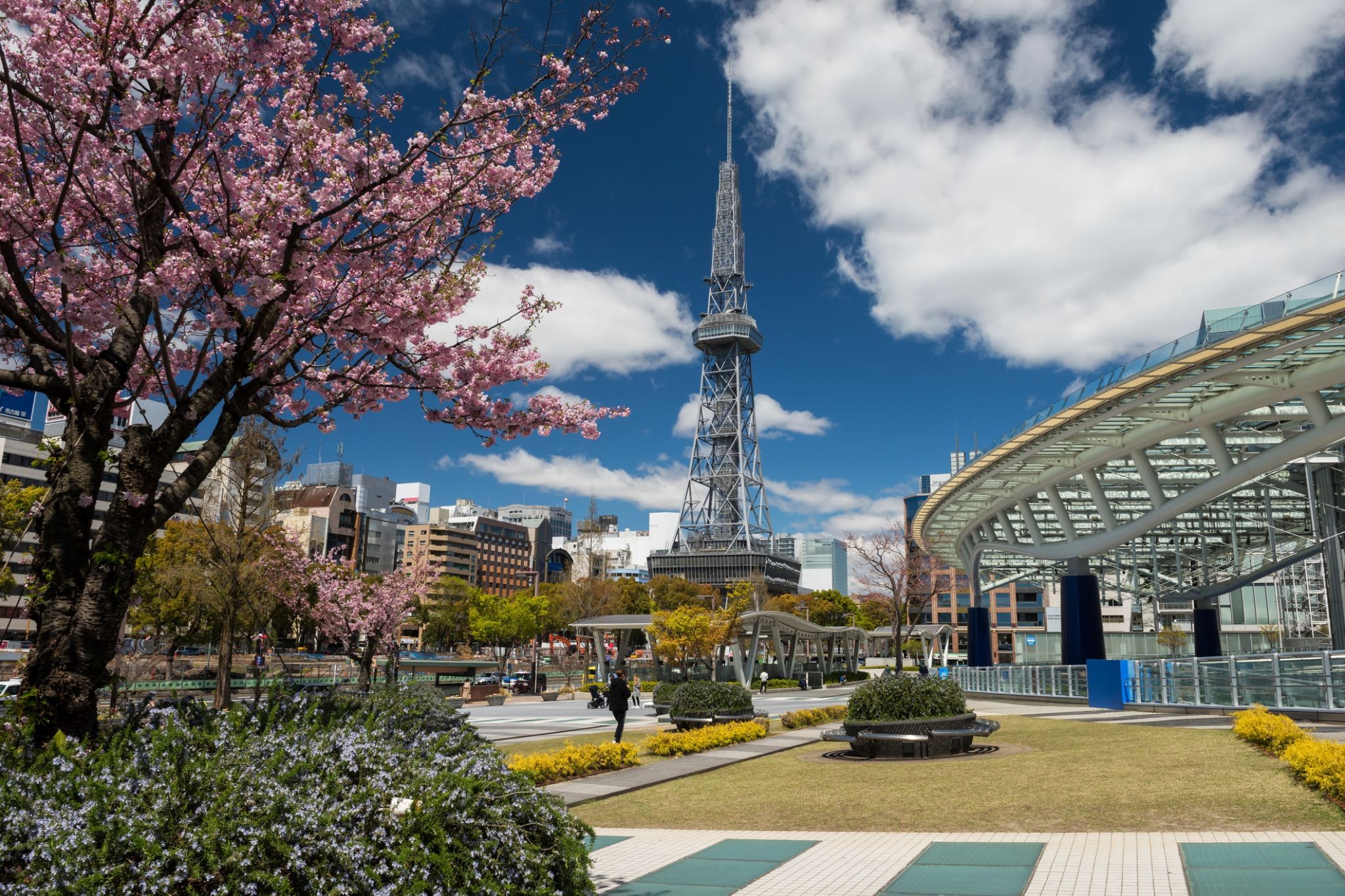
 Dzień 2: 09:30-17:30
Nagoya / Japonia
Nagoya is the largest city in the Chūbu region of Japan. It is Japan's fourth-largest incorporated city and the third-most-populous urban area. It is located on the Pacific coast on central Honshu. It is the capital of Aichi Prefectureand is one of Japan's major ports along with those of Tokyo, Osaka, Kobe, Yokohama, Chiba, and Kitakyushu. It is also the center of Japan's third-largest metropolitan region, known as the Chūkyō metropolitan area. As of 2015, 2.28 million people lived in the city, part of Chūkyō Metropolitan Area's 10.11 million people. It is also one of the 50 largest urban areas in the world.
-
 Dzień 3: 09:30
Kioto
-
Dzień 4: 12:00
Kioto
-
 Dzień 5: 10:00-17:30
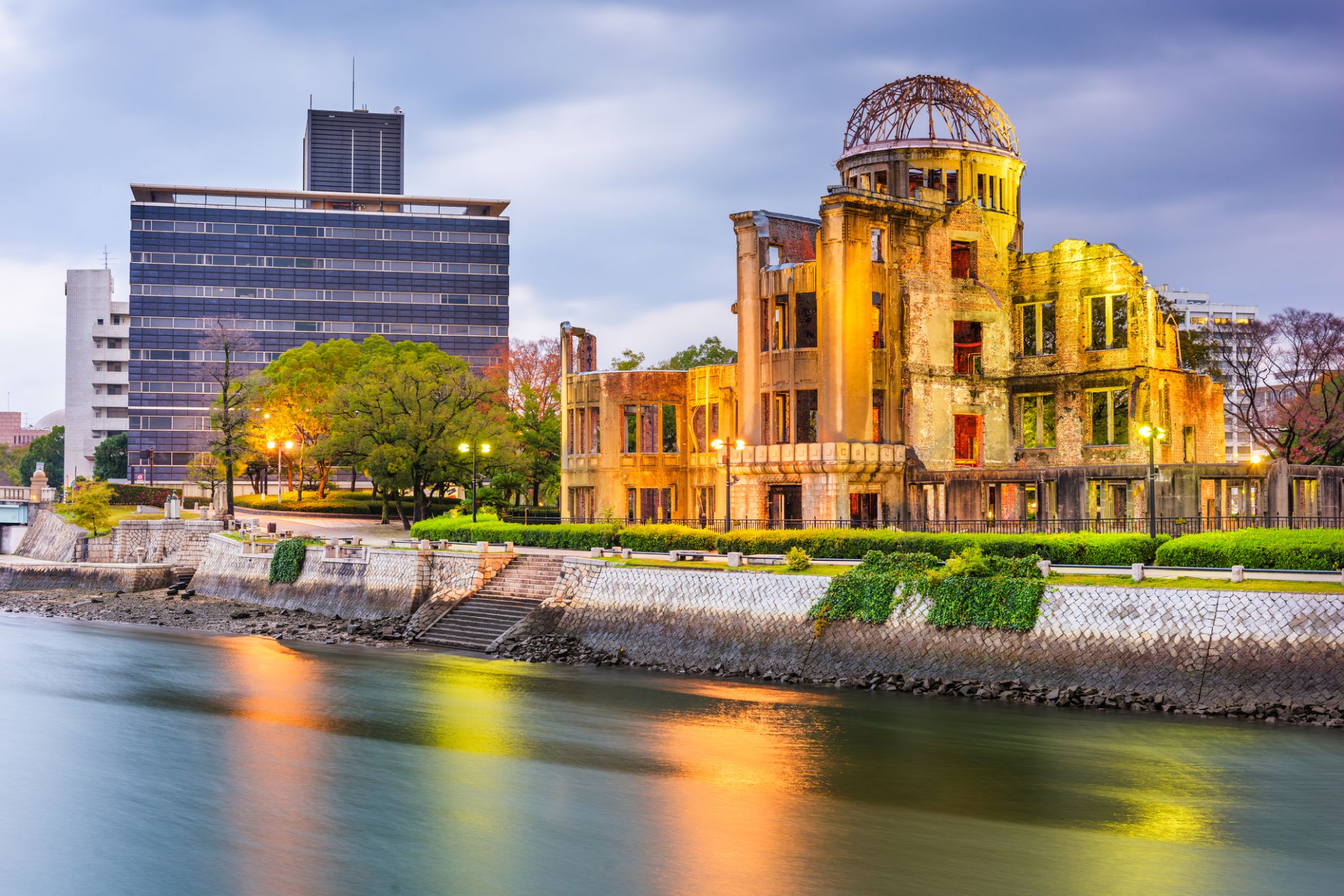
Hiroszima / Japonia
a city in southwestern Japan, on the southern coast of the island of Honshu; population 1,144,572 (2007). It was the target of the first atom bomb, which was dropped by the US on August 6, 1945, and resulted in the deaths of about one third of the city's population of 300,000. This, with a second attack on Nagasaki three days later, led to Japan's surrender and to the end of World War II.
-
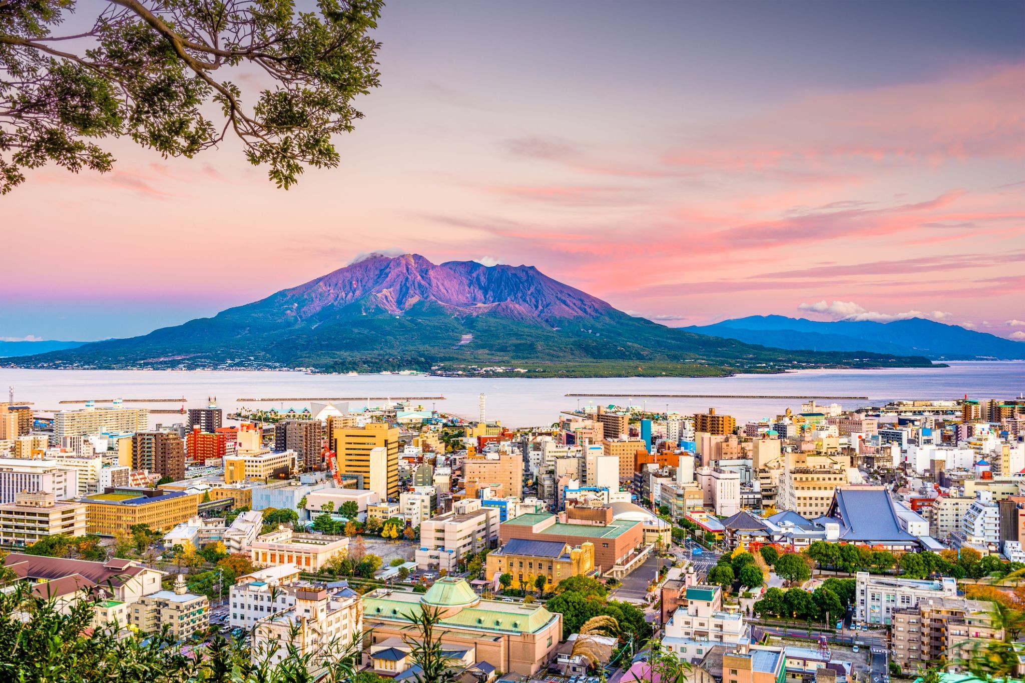
 Dzień 6: 13:00-21:00
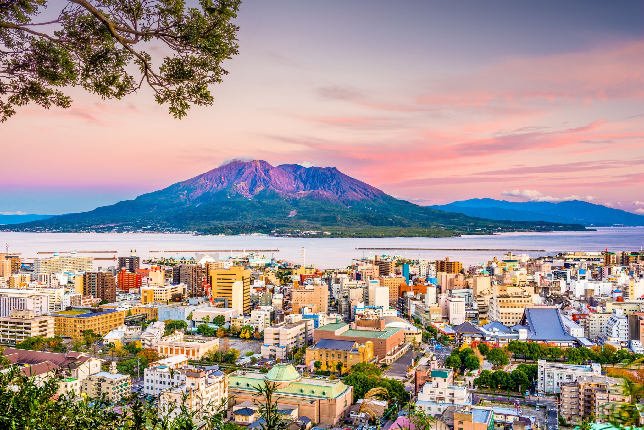
Kagoshima / Japonia
Kagoshima is the capital city of Kagoshima Prefecture at the south western tip of the island of Kyushu in Japan, and the largest city in the prefecture by some margin. It has been nicknamed the "Naples of the Eastern world" for its bay location (Aira Caldera), hot climate, and emblematic stratovolcano, Sakurajima. The city was officially founded on April 1, 1889.
-
 Dzień 7:
Dzień na morzu / Morze
-
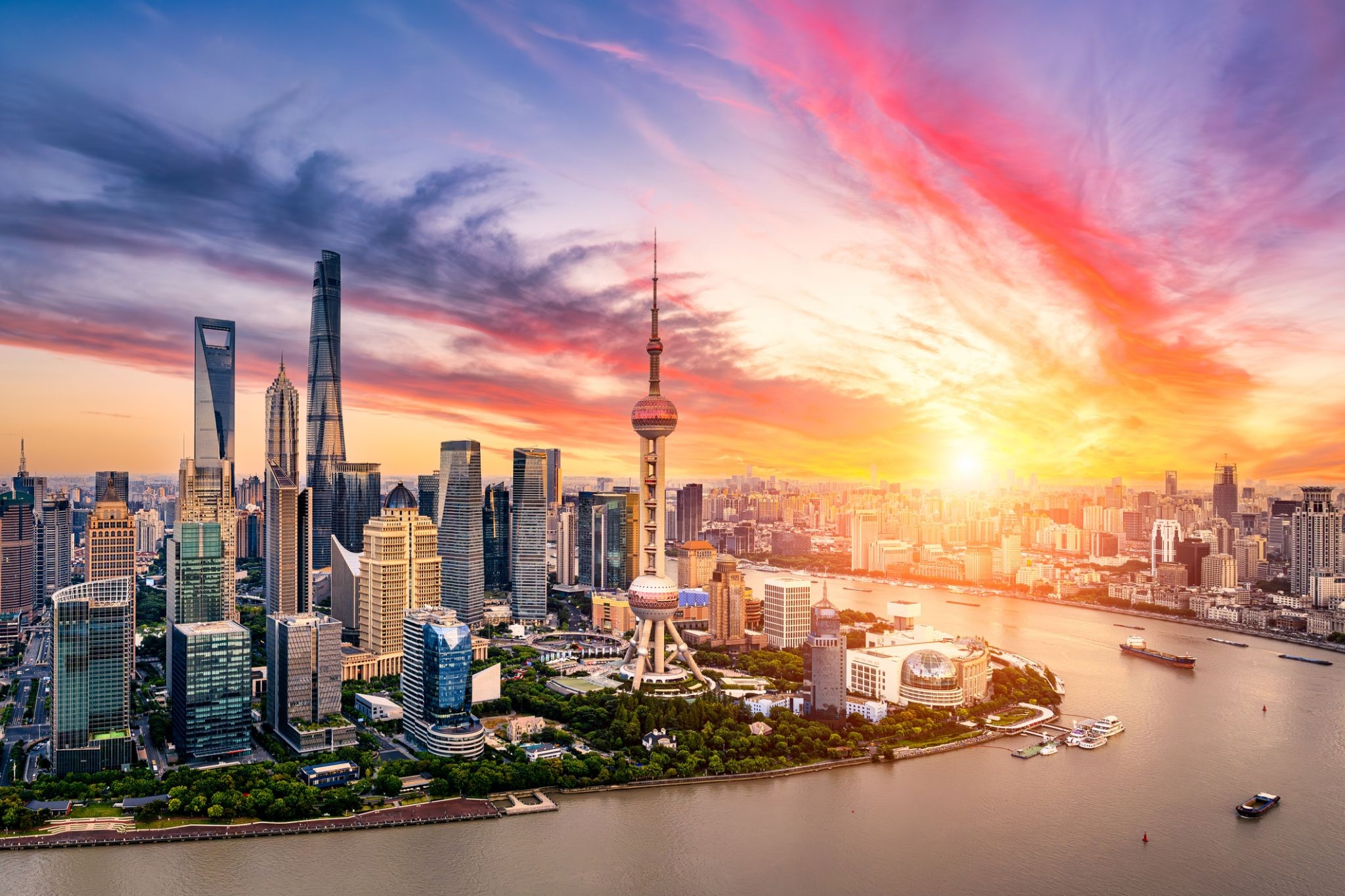
 Dzień 8: 10:30
Szanghaj / Chiny
Shanghai is one of the four municipalities under the direct administration of the central government of the Republic of China, the largest city in China by population, and the second most populous city proper in the world, with a population of 24.18 million as of 2017. It is a global financial centre and transport hub, with the world's busiest container port. Located in the Yangtze River Delta, it sits on the south edge of the estuary of the Yangtze in the middle portion of the East Chinacoast. The municipality borders the provinces of Jiangsu and Zhejiang to the north, south and west, and is bounded to the east by the East China Sea.
As a major administrative, shipping and trading city, Shanghai grew in importance in the 19th century due to trade and recognition of its favourable port location and economic potential. The city was one of five treaty ports forced open to foreign trade following the British victory over China in the First Opium War. The subsequent 1842 Treaty of Nankingand 1844 Treaty of Whampoa allowed the establishment of the Shanghai International Settlement and the French Concession. The city then flourished as a centre of commerce between China and other parts of the world (predominantly the Occident), and became the primary financial hub of the Asia-Pacific region in the 1930s. However, with the Communist Party takeover of the mainland in 1949, trade was limited to other socialist countries, and the city's global influence declined. In the 1990s, the economic reforms introduced by Deng Xiaoping resulted in an intense re-development of the city, aiding the return of finance and foreign investment to the city. It has since re-emerged as a hub for international trade and finance; it is the home of the Shanghai Stock Exchange, one of the world's largest by market capitalization.
Shanghai has been described as the "showpiece" of the booming economy of mainland China; renowned for its Lujiazui skyline, and museums and historic buildings, such as those along The Bund, as well as the City God Templeand the Yu Garden.
-
Dzień 9: 23:00
Szanghaj / Chiny
Shanghai is one of the four municipalities under the direct administration of the central government of the Republic of China, the largest city in China by population, and the second most populous city proper in the world, with a population of 24.18 million as of 2017. It is a global financial centre and transport hub, with the world's busiest container port. Located in the Yangtze River Delta, it sits on the south edge of the estuary of the Yangtze in the middle portion of the East Chinacoast. The municipality borders the provinces of Jiangsu and Zhejiang to the north, south and west, and is bounded to the east by the East China Sea.
As a major administrative, shipping and trading city, Shanghai grew in importance in the 19th century due to trade and recognition of its favourable port location and economic potential. The city was one of five treaty ports forced open to foreign trade following the British victory over China in the First Opium War. The subsequent 1842 Treaty of Nankingand 1844 Treaty of Whampoa allowed the establishment of the Shanghai International Settlement and the French Concession. The city then flourished as a centre of commerce between China and other parts of the world (predominantly the Occident), and became the primary financial hub of the Asia-Pacific region in the 1930s. However, with the Communist Party takeover of the mainland in 1949, trade was limited to other socialist countries, and the city's global influence declined. In the 1990s, the economic reforms introduced by Deng Xiaoping resulted in an intense re-development of the city, aiding the return of finance and foreign investment to the city. It has since re-emerged as a hub for international trade and finance; it is the home of the Shanghai Stock Exchange, one of the world's largest by market capitalization.
Shanghai has been described as the "showpiece" of the booming economy of mainland China; renowned for its Lujiazui skyline, and museums and historic buildings, such as those along The Bund, as well as the City God Templeand the Yu Garden.
-
Dzień 10:
Dzień na morzu / Morze
-
 Dzień 11: 07:00-14:30
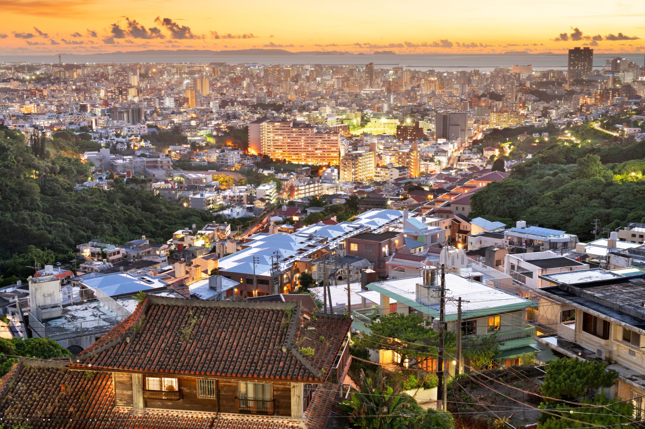
Naha / Japonia
Naha — brama do kultury Riukiu i rytmów tropikalnej Japonii
Naha to główne miasto wyspy Okinawa i kulturalne serce dawnego Królestwa Riukiu. Mimo nowoczesnych budynków i ruchliwych ulic, miasto starannie pielęgnuje ślady swojej unikalnej przeszłości. Jedną z głównych atrakcji jest zamek Shuri — historyczna rezydencja królów Riukiu i obiekt Światowego Dziedzictwa UNESCO, częściowo odbudowany po pożarze w 2019 roku. W Naha znajduje się również słynna ulica Kokusai-dori — centrum handlu, gastronomii i rozrywki, gdzie można spróbować tradycyjnych dań Okinawy i zakupić rękodzieło lokalnych rzemieślników.
Miasto cieszy się ciepłym klimatem przez cały rok i stanowi punkt wyjścia do białych plaż i raf koralowych południowych wysp. W pobliżu centrum znajduje się ogród Fukushu-en — malowniczy chiński ogród przypominający o historycznych związkach Okinawy z Chinami. Targ Matsuyama i zabytkowa dzielnica Tsuboya, znana z ceramiki, pozwalają poczuć codzienne życie mieszkańców wyspy. Naha to idealne połączenie historii, kuchni i spokojnego, wyspiarskiego rytmu, jakiego nie znajdziesz nigdzie indziej w Japonii.
-
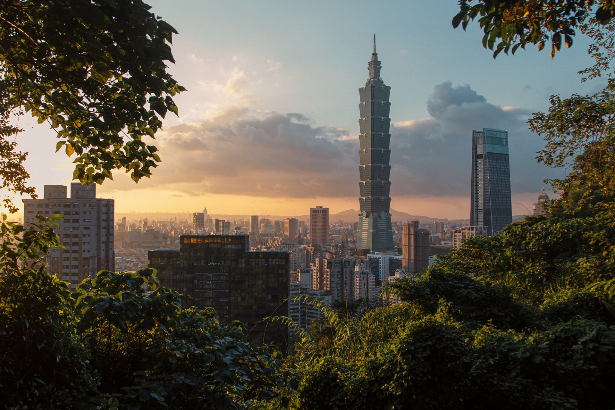 Dzień 12: 09:30-17:00
Tajpej / Taiwan
Taiwan it is a state in East Asia. It includes the neighbors of the Republic of China and the Philippines to the south. It is not a member of the United Nations.
The island of Taiwan was formerly known as the island of mass migration. The island was annexed in 1683 by the Qing dynasty, the last dynasty. The Qing ceded Taiwan to Japan in 1895 after the Sino-Japanese War. The Republic of China (ROC) was established after the fall of the Qing dynasty. The following is the Japanese surrender to the Allies in 1945; However, it’s not a problem, but it’s not a problem. It has been up to 99% of its de facto territory. The United States of America is the United States of America in the United States of America until 1971, when it’s lost.
-
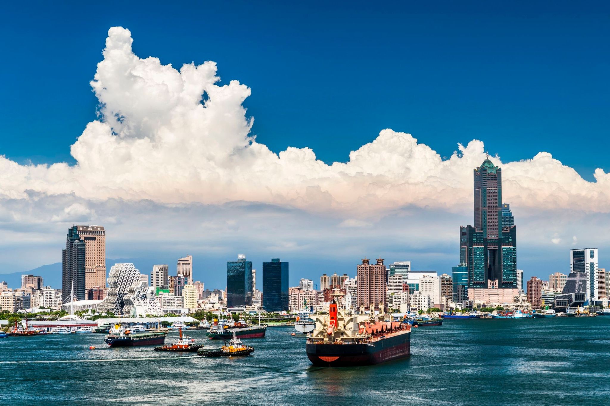
 Dzień 13: 08:00-16:00
Kaohsiung / Taiwan
Kaohsiung — Morskie wrota Tajwanu z sercem metropolii i duszą tropików
Witamy w Kaohsiung — dynamicznym mieście na południowym wybrzeżu Tajwanu, gdzie energia portu łączy się z spokojem oceanicznych krajobrazów. To nie tylko centrum przemysłowe, ale także kulturalne serce, które zachwyca łagodnym klimatem, obfitą naturą i tętniącą życiem atmosferą. W 2009 roku Kaohsiung było gospodarzem Światowych Igrzysk, co umocniło jego status jako ważnego międzynarodowego centrum. Tutaj niemal codziennie świeci słońce, a horyzont, na którym spotykają się góry, zatoki i nowoczesne budynki, zachwyca za każdym razem.
Turyści znajdą tutaj wiele ciekawych atrakcji: od spokojnych spacerów wzdłuż Rzeki Miłości po zapierające dech w piersiach widoki z szczytu góry Shoushan. Miasto oferuje również ogromną różnorodność kulturową, od starożytnych ulic dzielnicy Zuoyin po wieś Meinong, gdzie można podziwiać tradycyjne rzemiosło. Kaohsiung to nie tylko punkt na mapie, ale podróż do atmosfery, w której natura, historia i nowoczesność łączą się w unikalne doświadczenie.
-
 Dzień 14: 14:00
Limbe / Cameroon
-
Dzień 15:
Limbe / Cameroon
-
Dzień 16: 13:00
Limbe / Cameroon
-
Dzień 17: 10:00-18:00
Haikou
-
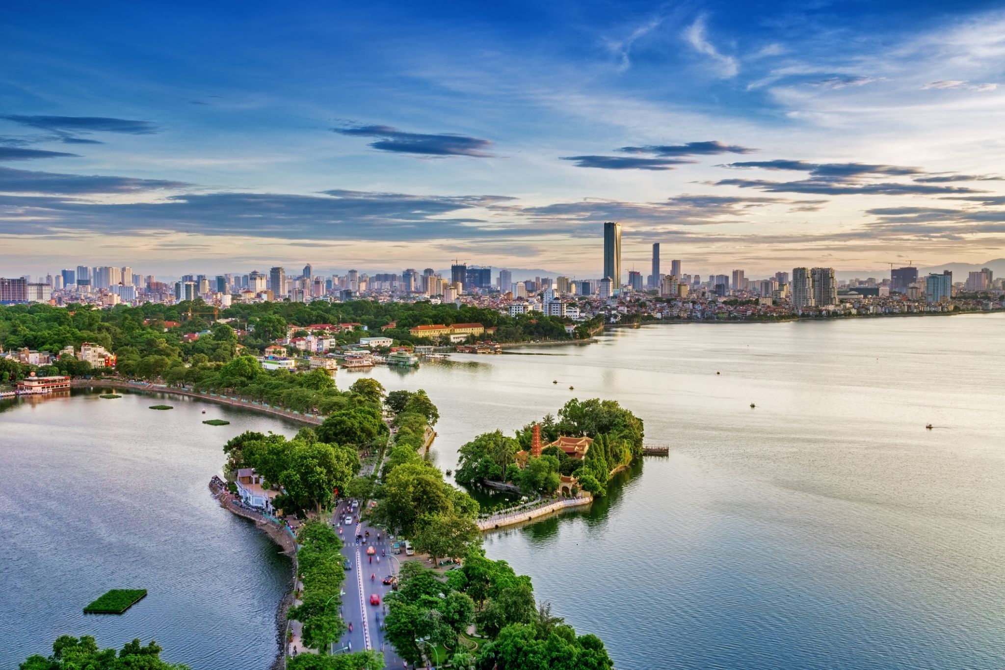 Dzień 18: 07:00-19:00
Hanoi / Vietnam
Hanoi to stolica Wietnamu, miasto z tysiącletnią historią, dawniej znane jako Thang Long, co oznacza „Miasto Wzbijającego się Smoka”. Pomimo wielu pagód, zabytków architektury i gwarnych dzielnic handlowych, nie ma tu tłumów turystów, co pozwala cieszyć się jego urokiem bez pośpiechu i zgiełku.
-
Dzień 19: 11:00-20:00
Sanya / Chiny
-
 Dzień 20: 08:00-17:00
Da Nang / Vietnam
Da Nang is the fifth largest city in Vietnam after Ho Chi Minh City, Hanoi, Haiphong and Can Tho in terms of urbanization and economy. Located on the coast of the South China Sea at the mouth of the Han River, it is one of Vietnam's most important port cities. As one of the country's five direct-controlled municipalities, it is under the direct administration of the central government.
Da Nang is the commercial and educational centre of Central Vietnam, as well as being the largest city in the region. In addition to its well-sheltered, easily accessible port, Da Nang's location on the path of National Route 1A and the North–South Railway makes it a hub for transportation. It is located within 100 km (62 mi) of several UNESCO World Heritage Sites, including the Imperial City of Hue, the Old Town of Hoi An, and the My Son ruins. The city was previously known as Cửa Hàn during early Đại Việt settlement, and as Tourane (or Turon) during French colonial rule. Before 1997, the city was part of Quang Nam-Da Nang Province.
On 1 January 1997, Da Nang was separated from Quảng Nam Province to become one of four independent (centrally controlled) municipalities in Vietnam. Da Nang is listed as a first class city, and has a higher urbanization ratio than any of Vietnam's other provinces or centrally governed cities.
-
Dzień 21:
Dzień na morzu / Morze
-
 Dzień 22: 08:00
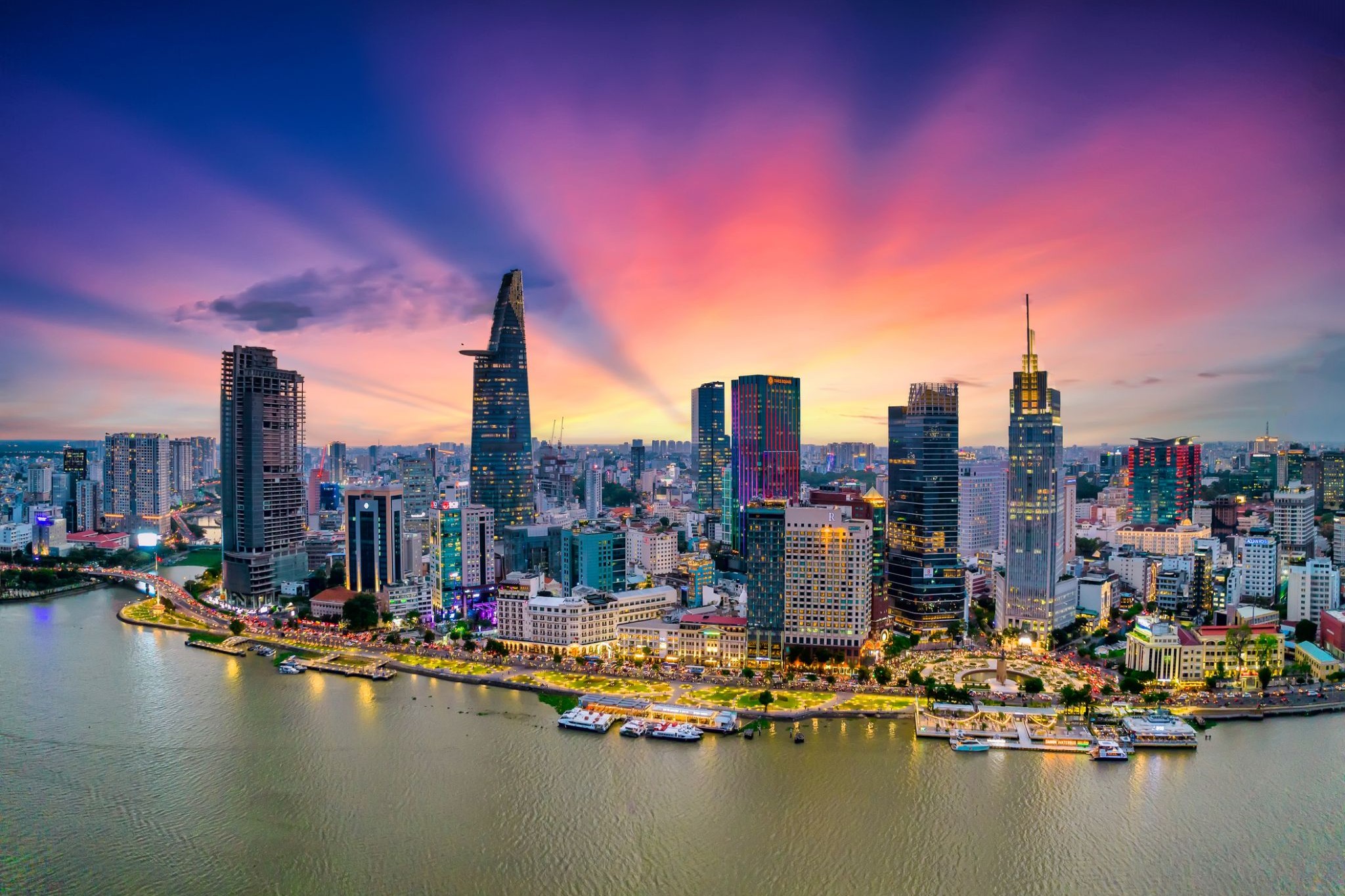
Ho Chi Minh / Vietnam
Ho Chi Minh, znane również pod swoją dawną nazwą Sajgon, jest najludniejszym miastem Wietnamu z populacją 8,4 miliona (13 milionów w obszarze metropolitalnym) według stanu na 2017 rok. Położona w południowo-wschodnim Wietnamie metropolia otacza rzekę Sajgon i zajmuje powierzchnię około 2061 kilometrów kwadratowych (796 mil kwadratowych).
Pod nazwą Sajgon było stolicą Indochin Francuskich od 1887 do 1902 roku i ponownie od 1945 do 1954 roku. Sajgon stał się później stolicą Wietnamu Południowego od 1955 roku aż do jego upadku w 1975 roku. 2 lipca 1976 roku Sajgon połączył się z otaczającą prowincją Gia Định i został oficjalnie przemianowany na Ho Chi Minh City na cześć przywódcy rewolucyjnego Hồ Chí Minha (chociaż nazwa Sài Gòn jest nadal powszechnie używana).
Ho Chi Minh City jest centrum finansowym Wietnamu i jest klasyfikowane jako miasto światowe Beta+ przez Globalization and World Cities Research Network. Jest siedzibą Giełdy Papierów Wartościowych w Ho Chi Minh City, największej giełdy papierów wartościowych pod względem całkowitej kapitalizacji rynkowej w Wietnamie oraz siedzibą wielu krajowych i międzynarodowych banków i firm.
Ho Chi Minh City jest najczęściej odwiedzanym miastem w Wietnamie, z 6,3 miliona odwiedzających w 2017 roku. Wiele znanych międzynarodowym turystom zabytków miasta to między innymi targ Bến Thành, ratusz w Ho Chi Minh City, bazylika katedralna Notre-Dame w Sajgonie, Pałac Niepodległości i Teatr Miejski. Głównym lotniskiem pasażerskim obsługującym obszar metropolitalny jest międzynarodowe lotnisko Tân Sơn Nhất, najbardziej ruchliwe lotnisko w Wietnamie, które w 2017 roku obsłużyło 36 milionów pasażerów.
-
Dzień 23: 16:00
Ho Chi Minh / Vietnam
Ho Chi Minh, znane również pod swoją dawną nazwą Sajgon, jest najludniejszym miastem Wietnamu z populacją 8,4 miliona (13 milionów w obszarze metropolitalnym) według stanu na 2017 rok. Położona w południowo-wschodnim Wietnamie metropolia otacza rzekę Sajgon i zajmuje powierzchnię około 2061 kilometrów kwadratowych (796 mil kwadratowych).
Pod nazwą Sajgon było stolicą Indochin Francuskich od 1887 do 1902 roku i ponownie od 1945 do 1954 roku. Sajgon stał się później stolicą Wietnamu Południowego od 1955 roku aż do jego upadku w 1975 roku. 2 lipca 1976 roku Sajgon połączył się z otaczającą prowincją Gia Định i został oficjalnie przemianowany na Ho Chi Minh City na cześć przywódcy rewolucyjnego Hồ Chí Minha (chociaż nazwa Sài Gòn jest nadal powszechnie używana).
Ho Chi Minh City jest centrum finansowym Wietnamu i jest klasyfikowane jako miasto światowe Beta+ przez Globalization and World Cities Research Network. Jest siedzibą Giełdy Papierów Wartościowych w Ho Chi Minh City, największej giełdy papierów wartościowych pod względem całkowitej kapitalizacji rynkowej w Wietnamie oraz siedzibą wielu krajowych i międzynarodowych banków i firm.
Ho Chi Minh City jest najczęściej odwiedzanym miastem w Wietnamie, z 6,3 miliona odwiedzających w 2017 roku. Wiele znanych międzynarodowym turystom zabytków miasta to między innymi targ Bến Thành, ratusz w Ho Chi Minh City, bazylika katedralna Notre-Dame w Sajgonie, Pałac Niepodległości i Teatr Miejski. Głównym lotniskiem pasażerskim obsługującym obszar metropolitalny jest międzynarodowe lotnisko Tân Sơn Nhất, najbardziej ruchliwe lotnisko w Wietnamie, które w 2017 roku obsłużyło 36 milionów pasażerów.
-
Dzień 24:
Dzień na morzu / Morze
-
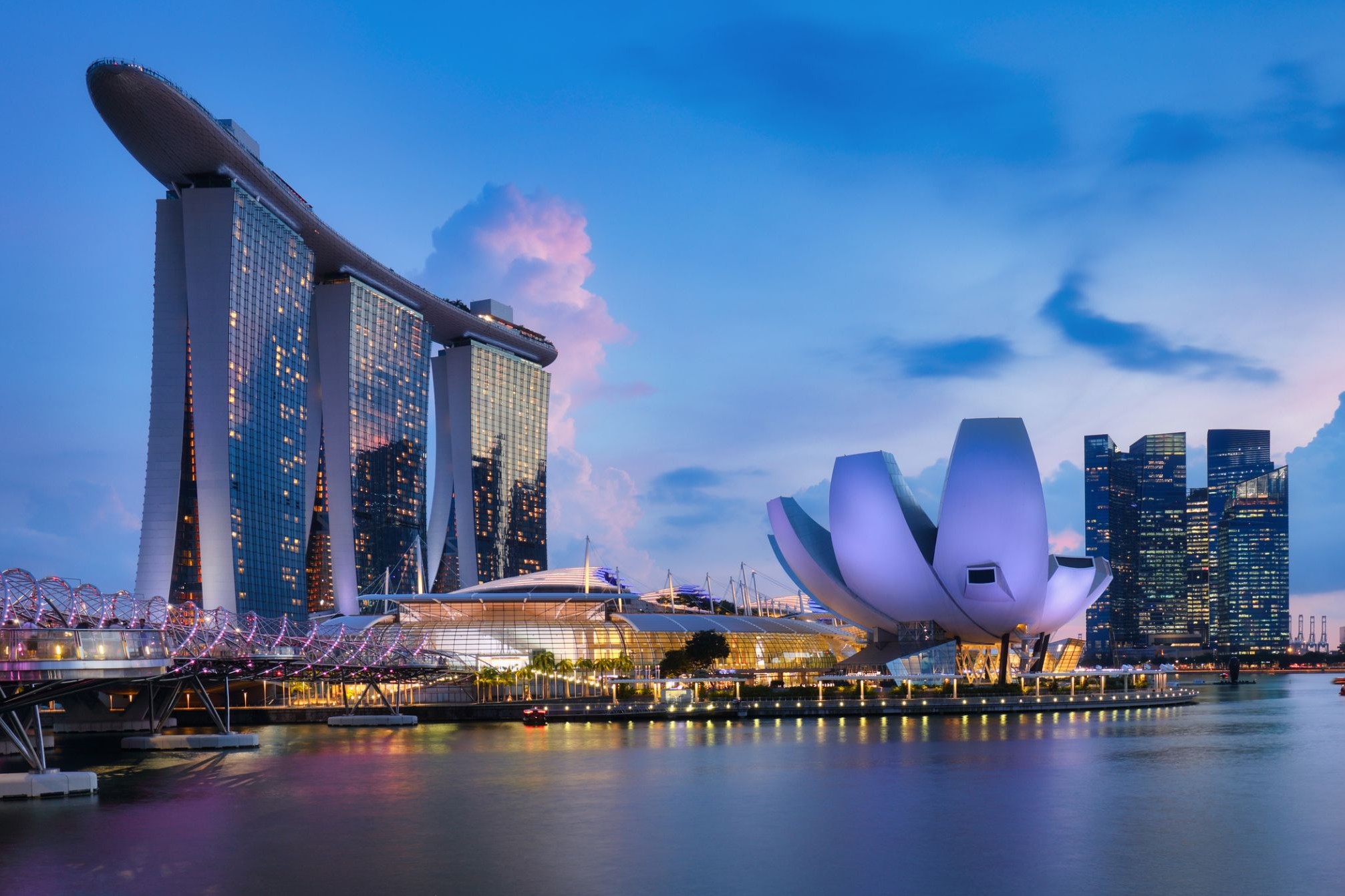
 Dzień 25: 10:00
Singapur / Singapur
-
Dzień 26: 18:00
Singapur / Singapur
-
Dzień 27:
Dzień na morzu / Morze
-
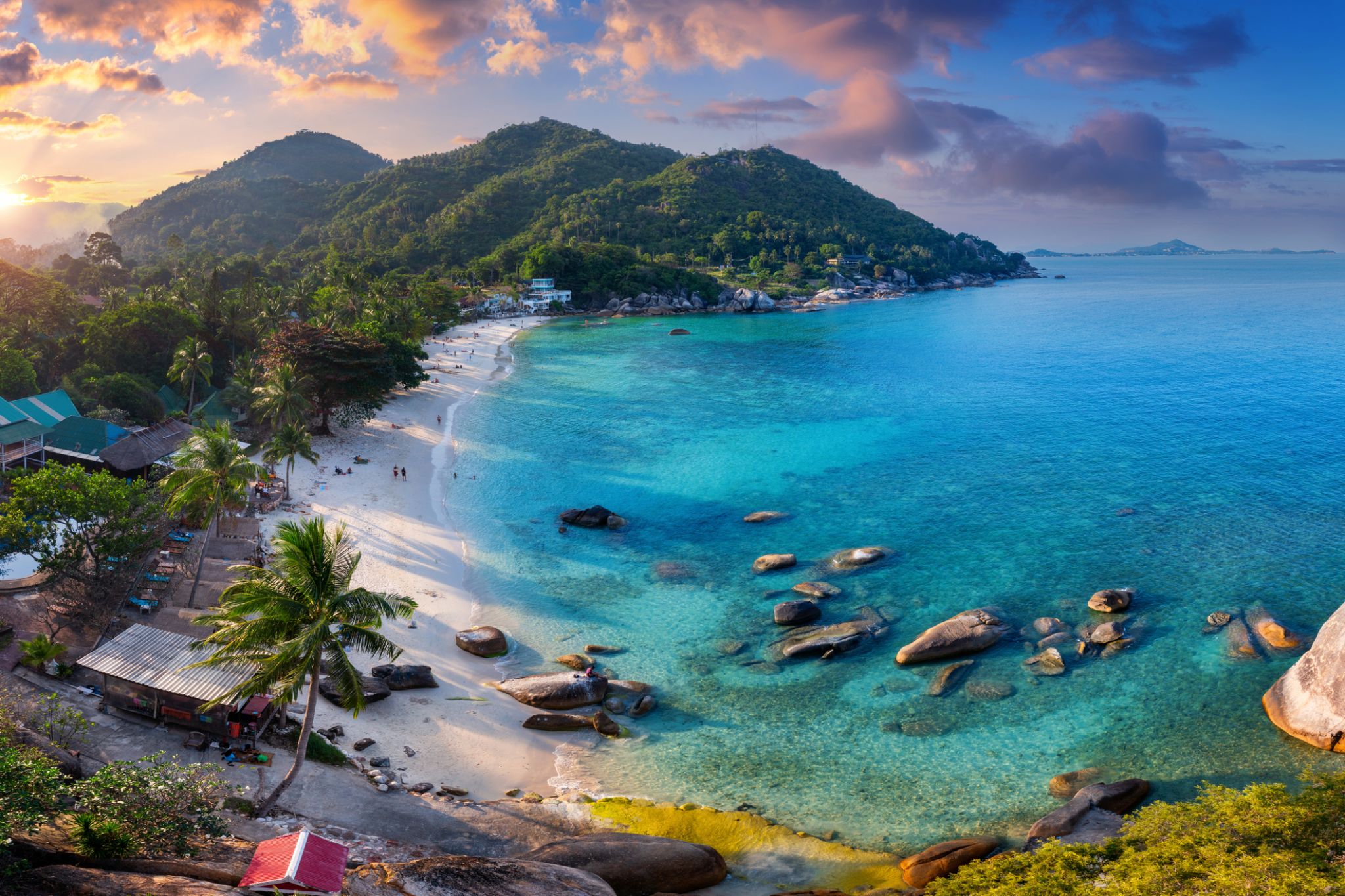 Dzień 28: 07:00-18:00
Wyspa Samui / Koh Samui / Thailand
Wśród tropikalnych wysp Tajlandii Koh Samui wyróżnia się swoją unikalną naturą i atmosferą. Ta wyspa przyciąga podróżnych z całego świata swoimi białymi, piaszczystymi plażami, malowniczymi wodospadami i gęstymi dżunglami. To idealne miejsce na relaks, niezależnie od tego, czy chodzi o sport wodny, odkrywanie natury, czy po prostu cieszenie się ciszą i pięknem.
Dodatkowo, Koh Samui jest znana ze swojego dziedzictwa kulturowego, w tym wielu buddyjskich świątyń i sanktuariów. Jedną z najbardziej znanych jest Świątynia Wielkiego Buddy, która jest nie tylko centrum religijnym, ale także jedną z głównych atrakcji wyspy. Lokalne jedzenie, w tym świeże owoce morza i egzotyczne owoce, sprawi, że podróż będzie jeszcze bardziej ekscytująca i smaczna.
-
 Dzień 29: 10:00
Bangkok / Thailand
Bangkok is the capital and most populous city of Thailand. It is known in Thai as Krung Thep Maha Nakhon or simply Krung Thep. The city occupies 1,568.7 square kilometres (605.7 sq mi) in the Chao Phraya River delta in central Thailand, and has a population of over eight million, or 12.6 percent of the country's population. Over fourteen million people (22.2 percent) lived within the surrounding Bangkok Metropolitan Region at the 2010 census, making Bangkok the nation's primate city, significantly dwarfing Thailand's other urban centres in terms of importance.
-
Dzień 30:
Bangkok / Thailand
Bangkok is the capital and most populous city of Thailand. It is known in Thai as Krung Thep Maha Nakhon or simply Krung Thep. The city occupies 1,568.7 square kilometres (605.7 sq mi) in the Chao Phraya River delta in central Thailand, and has a population of over eight million, or 12.6 percent of the country's population. Over fourteen million people (22.2 percent) lived within the surrounding Bangkok Metropolitan Region at the 2010 census, making Bangkok the nation's primate city, significantly dwarfing Thailand's other urban centres in terms of importance.
-
Dzień 31: 16:00
Bangkok / Thailand
Bangkok is the capital and most populous city of Thailand. It is known in Thai as Krung Thep Maha Nakhon or simply Krung Thep. The city occupies 1,568.7 square kilometres (605.7 sq mi) in the Chao Phraya River delta in central Thailand, and has a population of over eight million, or 12.6 percent of the country's population. Over fourteen million people (22.2 percent) lived within the surrounding Bangkok Metropolitan Region at the 2010 census, making Bangkok the nation's primate city, significantly dwarfing Thailand's other urban centres in terms of importance.
-
Dzień 32: 07:00-14:00
Wyspa Samui / Koh Samui / Thailand
Wśród tropikalnych wysp Tajlandii Koh Samui wyróżnia się swoją unikalną naturą i atmosferą. Ta wyspa przyciąga podróżnych z całego świata swoimi białymi, piaszczystymi plażami, malowniczymi wodospadami i gęstymi dżunglami. To idealne miejsce na relaks, niezależnie od tego, czy chodzi o sport wodny, odkrywanie natury, czy po prostu cieszenie się ciszą i pięknem.
Dodatkowo, Koh Samui jest znana ze swojego dziedzictwa kulturowego, w tym wielu buddyjskich świątyń i sanktuariów. Jedną z najbardziej znanych jest Świątynia Wielkiego Buddy, która jest nie tylko centrum religijnym, ale także jedną z głównych atrakcji wyspy. Lokalne jedzenie, w tym świeże owoce morza i egzotyczne owoce, sprawi, że podróż będzie jeszcze bardziej ekscytująca i smaczna.
-
Dzień 33:
Dzień na morzu / Morze
-
Dzień 34: 12:00-20:00
Malakka / Malaysia
-
 Dzień 35: 07:00-20:00
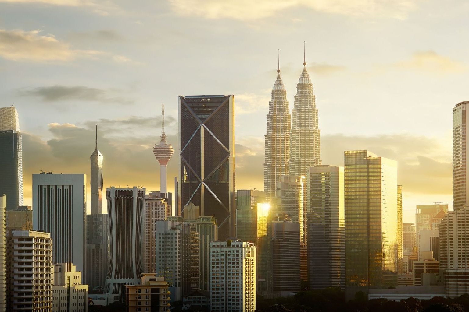
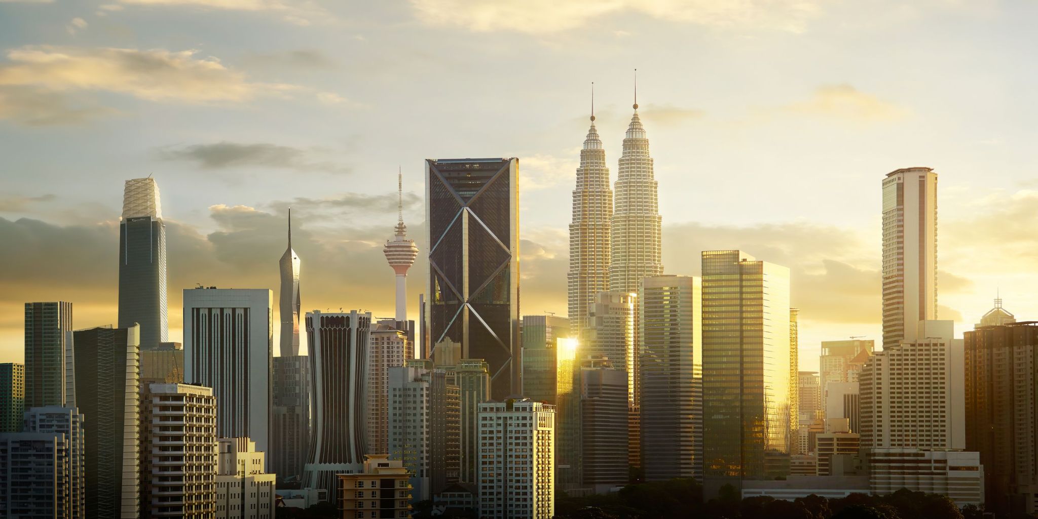
Kuala Lumpur / Malaysia
Kuala Lumpur to dynamiczna stolica Malezji, gdzie futurystyczne drapacze chmur stoją obok kolonialnych budynków i tradycyjnych targowisk. Miasto powstało w połowie XIX wieku u zbiegu rzek Klang i Gombak jako osada górnicza, a dziś jest największym centrum gospodarczym i kulturalnym kraju. Jego wizytówką są bliźniacze wieże Petronas, niegdyś najwyższe budynki na świecie, które nadal pozostają symbolem malezyjskiego postępu i innowacji.
Dla turystów Kuala Lumpur oferuje różnorodne wrażenia: od porannego spaceru po kolonialnym placu Merdeka po wieczorne zakupy w ultranowoczesnej dzielnicy Bukit Bintang. Można odwiedzić Muzeum Sztuki Islamskiej, skosztować ulicznego jedzenia w okolicy Jalan Alor, zobaczyć hinduistyczną świątynię w jaskiniach Batu lub odpocząć w cieniu tropikalnych drzew w Ogrodach Jeziora. Miasto, wzbogacone kulturami malajską, chińską i indyjską, zaprasza do odkrywania go poprzez architekturę, kuchnię i rytm współczesnego życia.
-
 Dzień 36: 10:00-20:00
Georgetown / Cayman Islands
Georgetown to stolica Kajmanów, położona na wyspie Grand Cayman w Morzu Karaibskim. To malownicze miasto słynie z pięknych plaż, krystalicznie czystych wód i przytulnej atmosfery. W centrum Georgetown znajduje się tętniąca życiem nadbrzeżna promenada z sklepami, restauracjami i kawiarniami, gdzie turyści mogą skosztować lokalnych przysmaków i kupić produkty od miejscowych rzemieślników. Miasto jest również znane ze swojej kolonialnej architektury oraz zabytkowych budowli, w tym starożytnej katolickiej katedry Świętej Teresy i Muzeum Kajmanów, gdzie można dowiedzieć się więcej o kulturze i historii regionu.
Dla tych, którzy szukają przygód, Georgetown nie zawiedzie. Lokalne wody kryją ogrody koralowe, w których można spotkać nie tylko ryby, ale także majestatyczne żółwie, z którymi można pływać. Snorkeling i nurkowanie w tych okolicach to nie tylko aktywność, ale także szansa na zobaczenie nieskazitelnego ekosystemu Morza Karaibskiego. Miłośnicy historii i przyrody mogą odkrywać szlaki po wyspie, przechodzące przez jej zielone zakątki, starożytne rafy i wodospady, co pozwala połączyć badanie przyrody z odkrywaniem kultury.
-
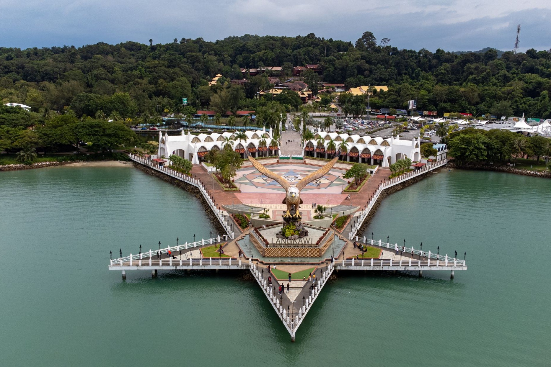
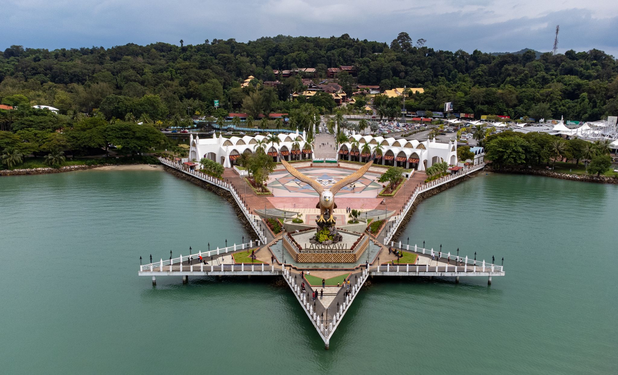 Dzień 37: 08:00-18:00
Kuah / Malaysia
-
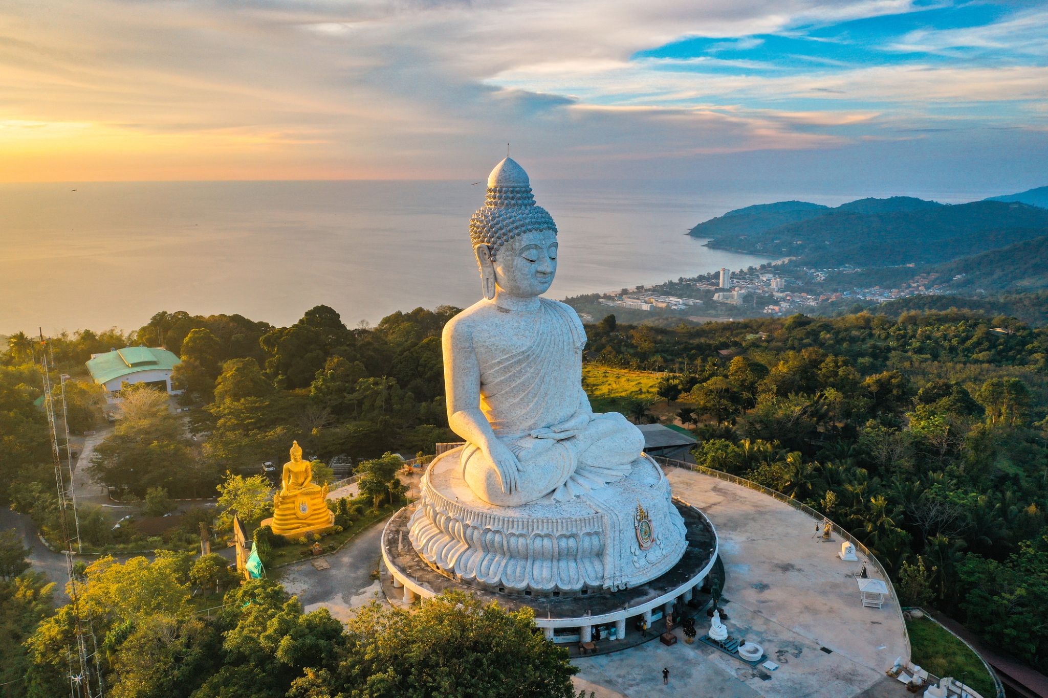 Dzień 38: 07:00
Phuket / Thailand
Phuket is one of the southern provinces (changwat) of Thailand. It consists of the island of Phuket, the country's largest island, and another 32 smaller islands off its coast. It lies off the west coast of Thailand in the Andaman Sea. Phuket Island is connected by the Sarasin Bridge to Phang Nga Province to the north. The next nearest province is Krabi, to the east across Phang Nga Bay.
-
Dzień 39: 17:00
Phuket / Thailand
Phuket is one of the southern provinces (changwat) of Thailand. It consists of the island of Phuket, the country's largest island, and another 32 smaller islands off its coast. It lies off the west coast of Thailand in the Andaman Sea. Phuket Island is connected by the Sarasin Bridge to Phang Nga Province to the north. The next nearest province is Krabi, to the east across Phang Nga Bay.
-
Dzień 40:
Dzień na morzu / Morze
-
Dzień 41: 07:00
Singapur / Singapur
-
Dzień 42: 16:00
Singapur / Singapur
-
Dzień 43:
Dzień na morzu / Morze
-
 Dzień 44: 13:00-21:00
Surabaya / Indonezja
-
 Dzień 45: 18:00
Tanjung Benoit / Indonezja
-
Dzień 46: 23:59
Tanjung Benoit / Indonezja
-
Dzień 47: 07:00-15:00
Praya / Cape Verde
-
Dzień 48: 13:00-21:00
Waingapu
-
 Dzień 49: 07:00-15:30
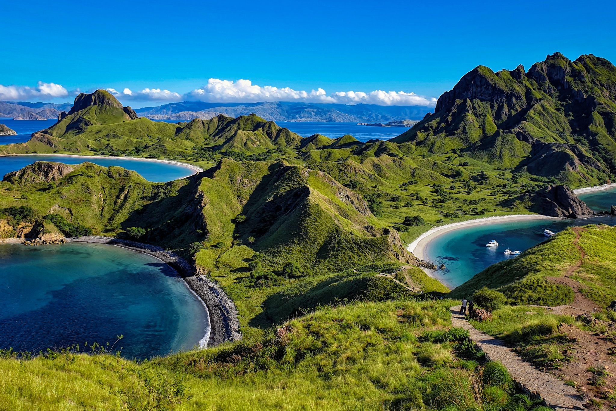
Komoda / Indonezja
Komodo is one of the 17,508 islands that comprise the Republic of Indonesia. The island is particularly notable as the habitat of the Komodo dragon, the largest lizard on Earth, which is named after the island. Komodo Island has a surface area of 390 square kilometres and a human population of over two thousand. The people of the island are descendants of former convicts who were exiled to the island and who have mixed with Bugis from Sulawesi. The people are primarily adherents of Islam but there are also Christian and Hindu congregations.
Komodo is part of the Lesser Sunda chain of islands and forms part of the Komodo National Park. In addition, the island is a popular destination for diving. Administratively, it is part of the East Nusa Tenggara province.
-
Dzień 50:
Dzień na morzu / Morze
-
Dzień 51:
Dzień na morzu / Morze
-
Dzień 52:
Dzień na morzu / Morze
-
Dzień 53: 07:00-20:30
Pert
-
Dzień 54: 08:00-17:00
Busselton
-
 Dzień 55: 11:00-19:00
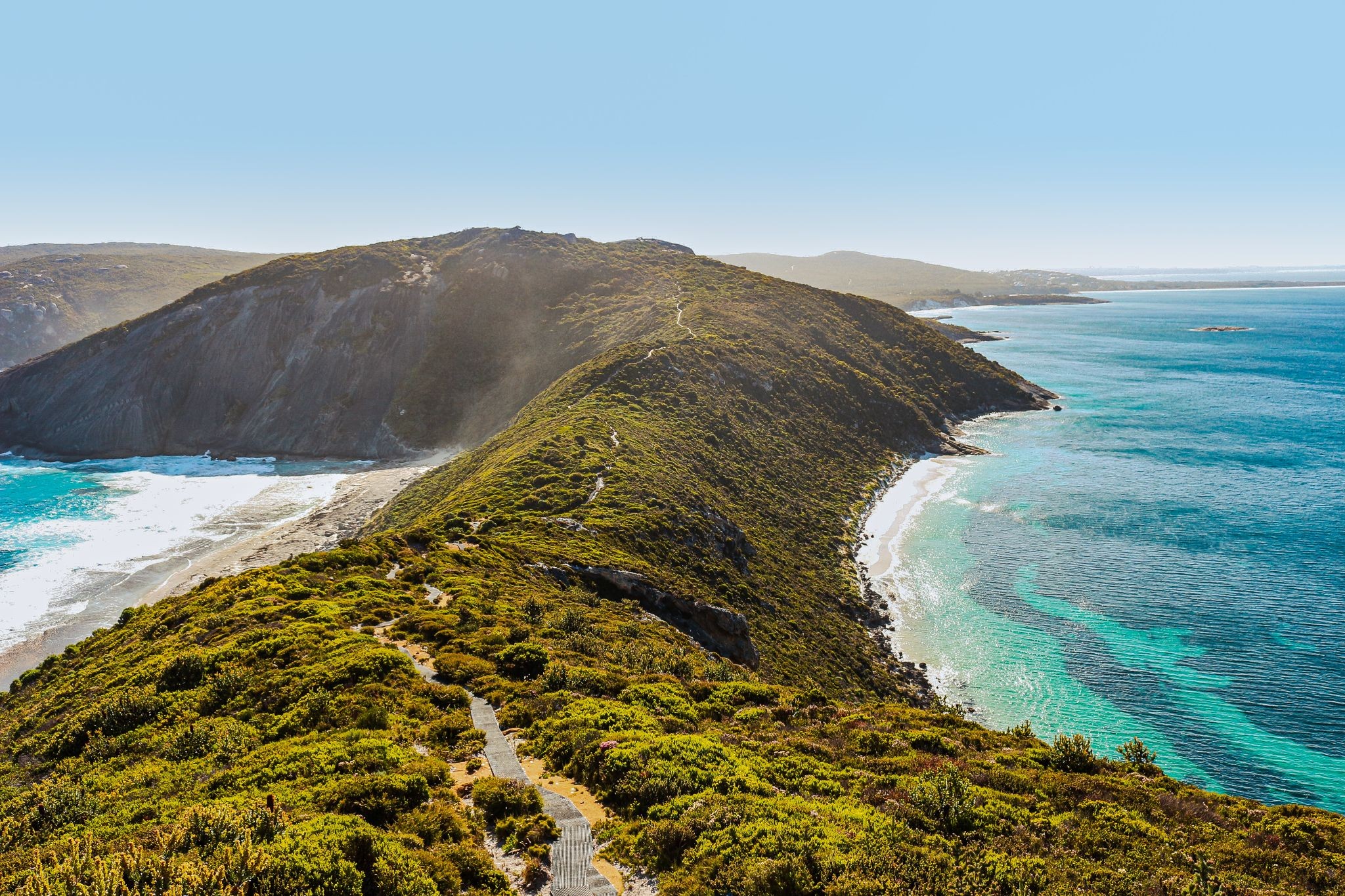
Albany / Australia
Albany is a port city in the Great Southern region of Western Australia, 418 km SE of Perth, the state capital. Albany is the oldest colonial settlement in Western Australia, predating Perth and Fremantle by over two years.
The city centre is at the northern edge of Princess Royal Harbour, which is a part of King George Sound. The central business district is bounded by Mount Clarence to the east and Mount Melville to the west. The city is in the local government area of the City of Albany.
-
Dzień 56:
Dzień na morzu / Morze
-
Dzień 57:
Dzień na morzu / Morze
-
Dzień 58: 07:00-18:00
Pennesho / Australia
-
 Dzień 59: 07:00-22:00
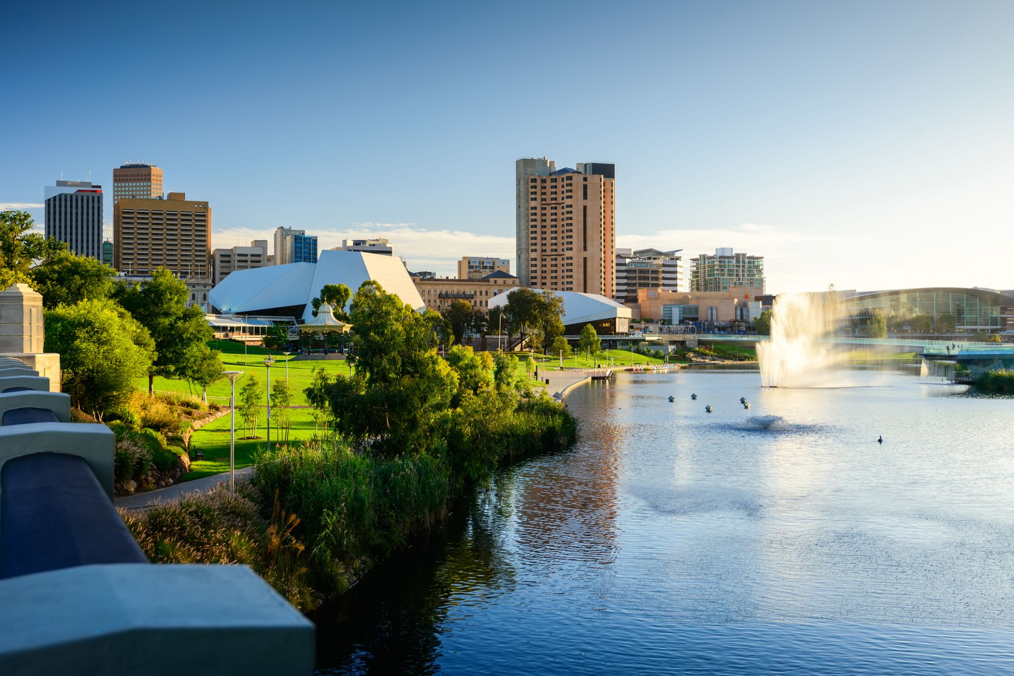
Adelaida / Australia
Adelaide is the capital city of the state of South Australia, and the fifth-most populous city of Australia. In June 2017, Adelaide had an estimated resident population of 1,333,927. Adelaide is home to more than 75 percent of the South Australian population, making it the most centralised population of any state in Australia.
-
Dzień 60:
Dzień na morzu / Morze
-
 Dzień 61: 07:00-17:00
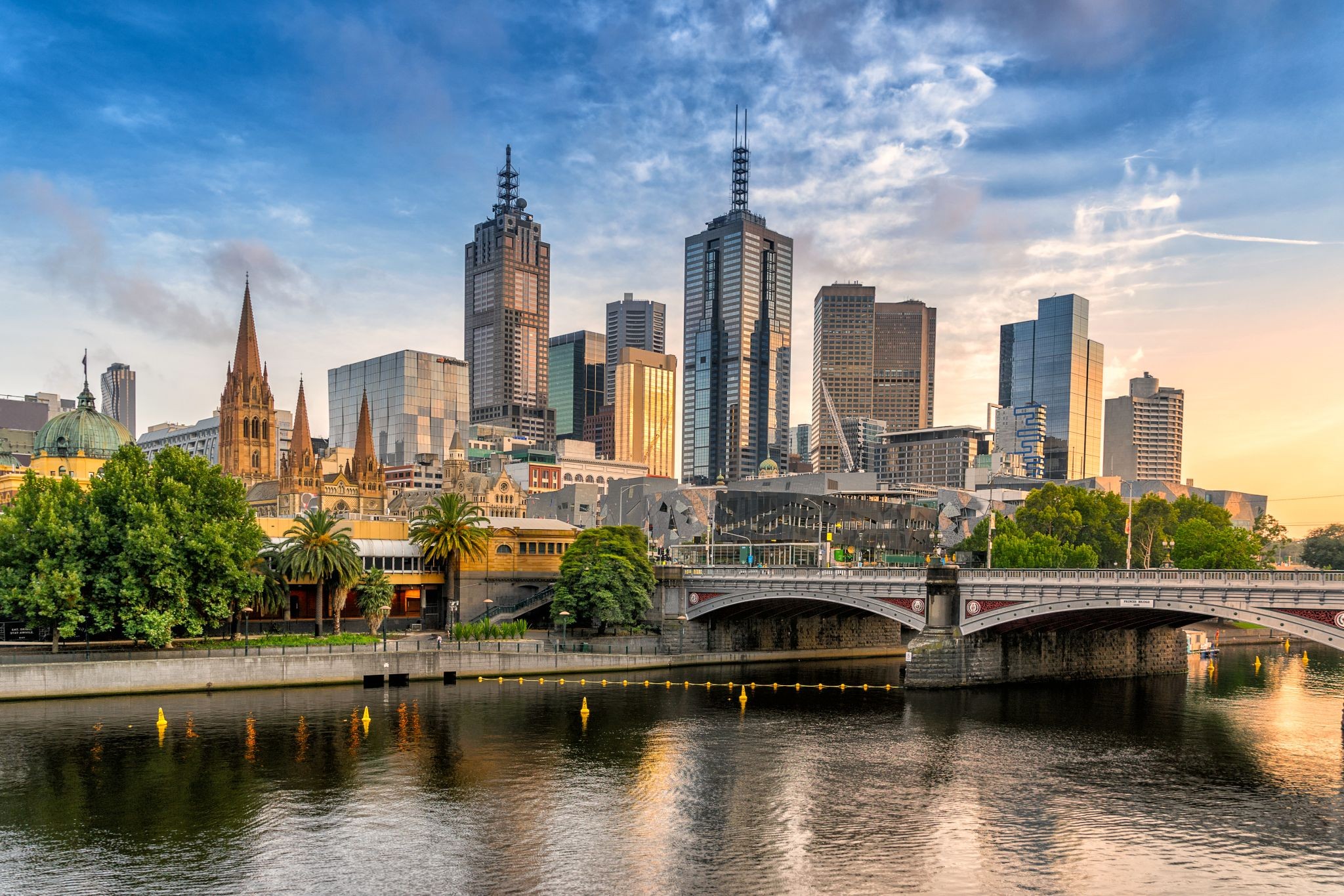
Melbourne / Australia
Melbourne is the capital and most populous city of the Australian state of Victoria, and the second most populous city in Australia and Oceania. Its name refers to an urban agglomeration of 9,992.5 km2 (3,858.1 sq mi), comprising a metropolitan area with 31 municipalities, and is also the common name for its city centre. The city occupies much of the coastline of Port Phillip bay and spreads into the hinterlands towards the Dandenong and Macedon ranges, Mornington Peninsula and Yarra Valley. It has a population of approximately 4.9 million (19% of the population of Australia), and its inhabitants are referred to as "Melburnians".
The city was founded on 30 August 1835, in what was the British colony of New South Wales, by free settlers from the colony of Van Diemen’s Land. It was incorporated as a Crown settlement in 1837 and named in honour of the British Prime Minister, William Lamb, 2nd Viscount Melbourne. It was declared a city by Queen Victoria in 1847, after which it became the capital of the new colony of Victoria in 1851. In the wake of the 1850s Victorian gold rush, the city entered the "Marvellous Melbourne" boom period, transforming into one of the most important cities in the British Empire and one of the largest and wealthiest in the world. After the federation of Australia in 1901, it served as interim seat of government of the new nation until Canberra became the permanent capital in 1927. Today, it is a leading financial centre in the Asia-Pacific region and ranks 20th in the Global Financial Centres Index.
-
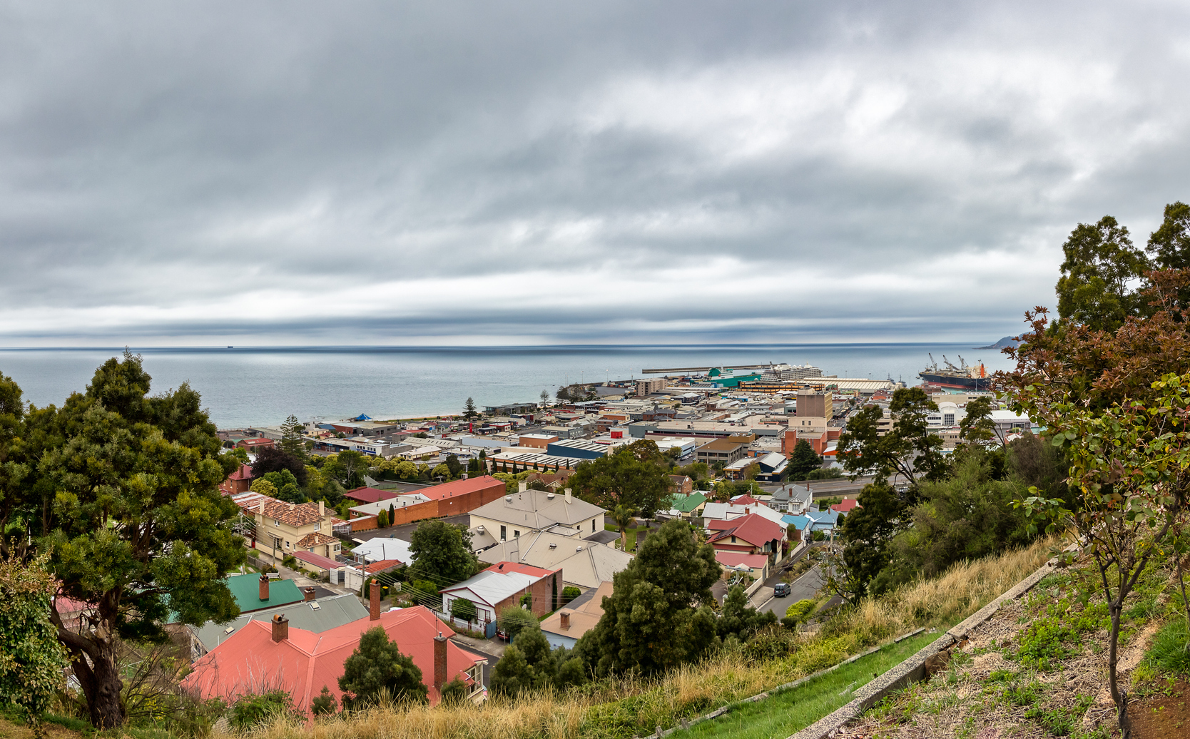 Dzień 62: 08:00-16:00
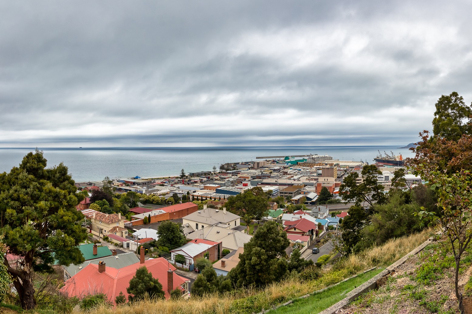
Bernie (Tasmania) / Australia / New Zealand
Burnie is a port city on the northwest coast of the island of Tasmania in Australia. The first settlements appeared in 1827, and in 1840 the city received its current name. The city's port is the fifth most significant in the country. The main industrial facilities in the city are a pulp and paper mill and a cheese factory. Burnie is a rather picturesque city, with a quiet way of life and friendly locals.
-
Dzień 63:
Dzień na morzu / Morze
-
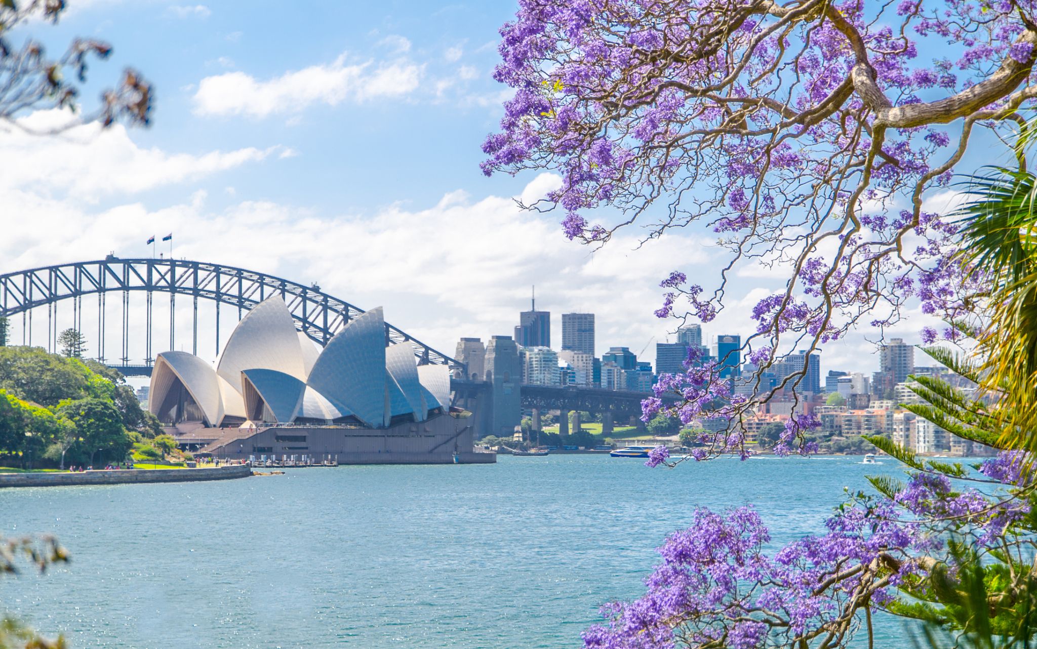 Dzień 64: 07:00-18:45
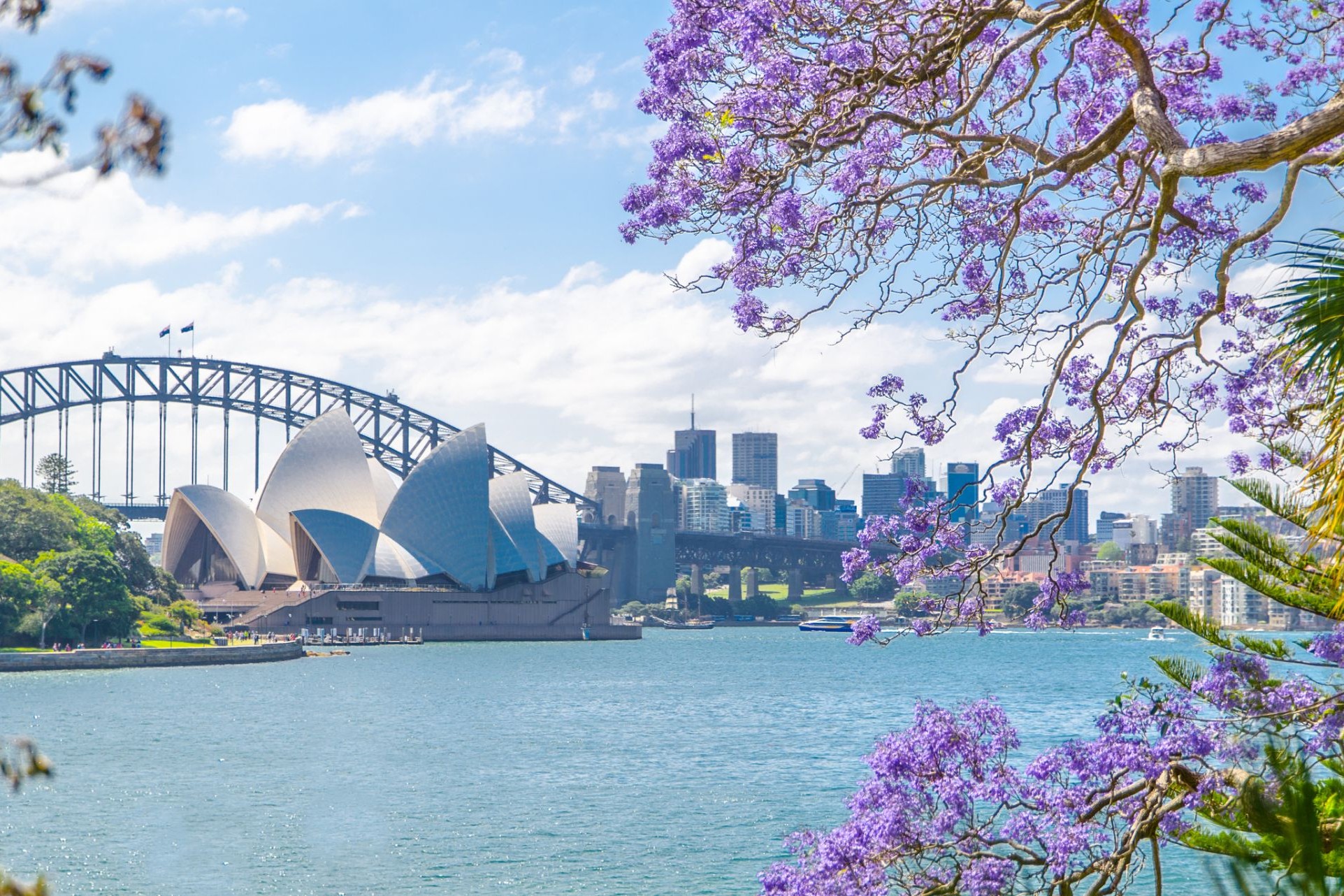
Sydnej / Australia
Sydney is the state capital of New South Wales and the most populous city in Australiaand Oceania. Located on Australia's east coast, the metropolis surrounds Port Jackson and extends about 70 km (43.5 mi) on its periphery towards the Blue Mountains to the west, Hawkesbury to the north, and Macarthur to the south. Sydney is made up of 658 suburbs, 40 local government areas and 15 contiguous regions. Residents of the city are known as "Sydneysiders". As of June 2017, Sydney's estimated metropolitan population was 5,131,326, and is home to approximately 65% of the state's population.
-
Dzień 65:
Dzień na morzu / Morze
-
Dzień 66:
Dzień na morzu / Morze
-
 Dzień 67: 08:00-16:00
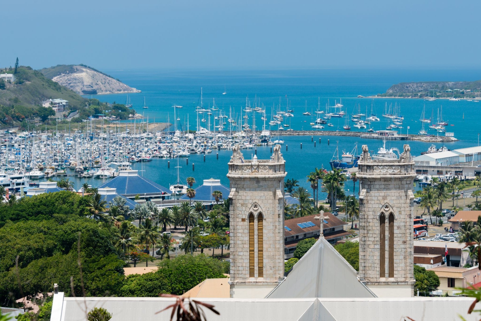
Numea / Nowa Kaledonia
Nouméa is the capital and largest city of the French special collectivity of New Caledonia. It is situated on a peninsula in the south of New Caledonia's main island, Grande Terre, and is home to the majority of the island's European, Polynesian (Wallisians, Futunians, Tahitians), Indonesian, and Vietnamesepopulations, as well as many Melanesians, Ni-Vanuatu and Kanaks who work in one of the South Pacific's most industrialised cities. The city lies on a protected deepwater harbour that serves as the chief port for New Caledonia.
At the August 2014 census, there were 179,509 inhabitants in the metropolitan area of Greater Nouméa (French: agglomération du Grand Nouméa), 99,926 of whom lived in the city (commune) of Nouméa proper. 66.8% of the population of New Caledonia live in Greater Nouméa, which covers the communes of Nouméa, Le Mont-Dore, Dumbéa and Païta.
-
 Dzień 68: 08:00-17:00
Jezioro Misteri / Kanada
-
Dzień 69:
Dzień na morzu / Morze
-
 Dzień 70: 07:00-17:00
Lautoka / Fiji
-
 Dzień 71: 07:00-17:00
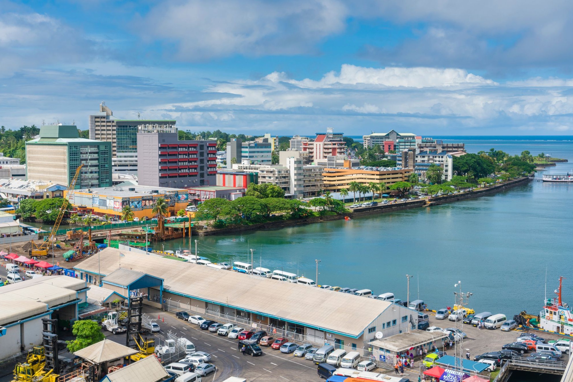
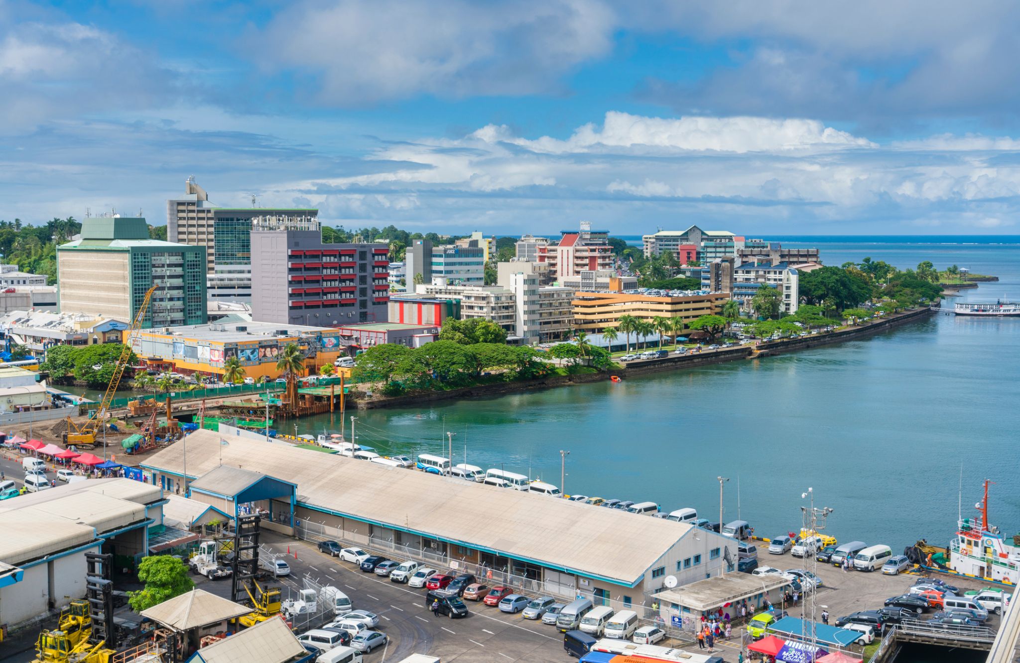
Suchy / Fiji
Suva is the capital and largest metropolitan city in Fiji. It is located on the southeast coast of the island of Viti Levu, in the Rewa Province, Central Division.
In 1877, it was decided to make Suva the capital of Fiji, as the geography of former main European settlement at Levuka on the island of Ovalau, Lomaiviti province proved too restrictive. The administration of the colony was moved from Levuka to Suva in 1882.
At the 2007 census, the city of Suva had a population of 85,691. Including independent suburbs, the population of the Greater Suva urban area was 172,399 at the 2007 census. Suva, along with the bordering towns of Lami, Nasinu, and Nausori have a total urban population of around 330,000, over a third of the nation's population. This urban complex (not including Lami) is known also as the Suva-Nausori corridor.
Suva is the political, economic, and cultural centre of Fiji. It is also the economic and cultural capital of the Pacific, hosting the majority of regional headquarters of major corporations, as well as international agencies and diplomatic missions in the region. The city also has a thriving arts and performance scene, with a growing reputation as the region’s fashion capital.
-
Dzień 72:
Dzień na morzu / Morze
-
 Dzień 73: 07:00-18:00
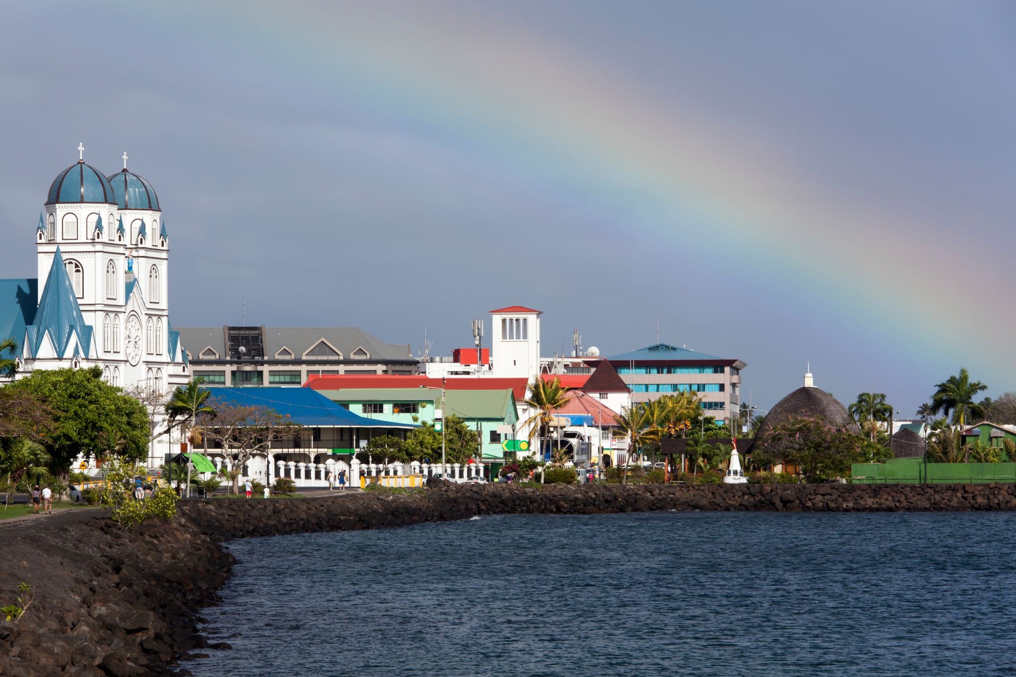
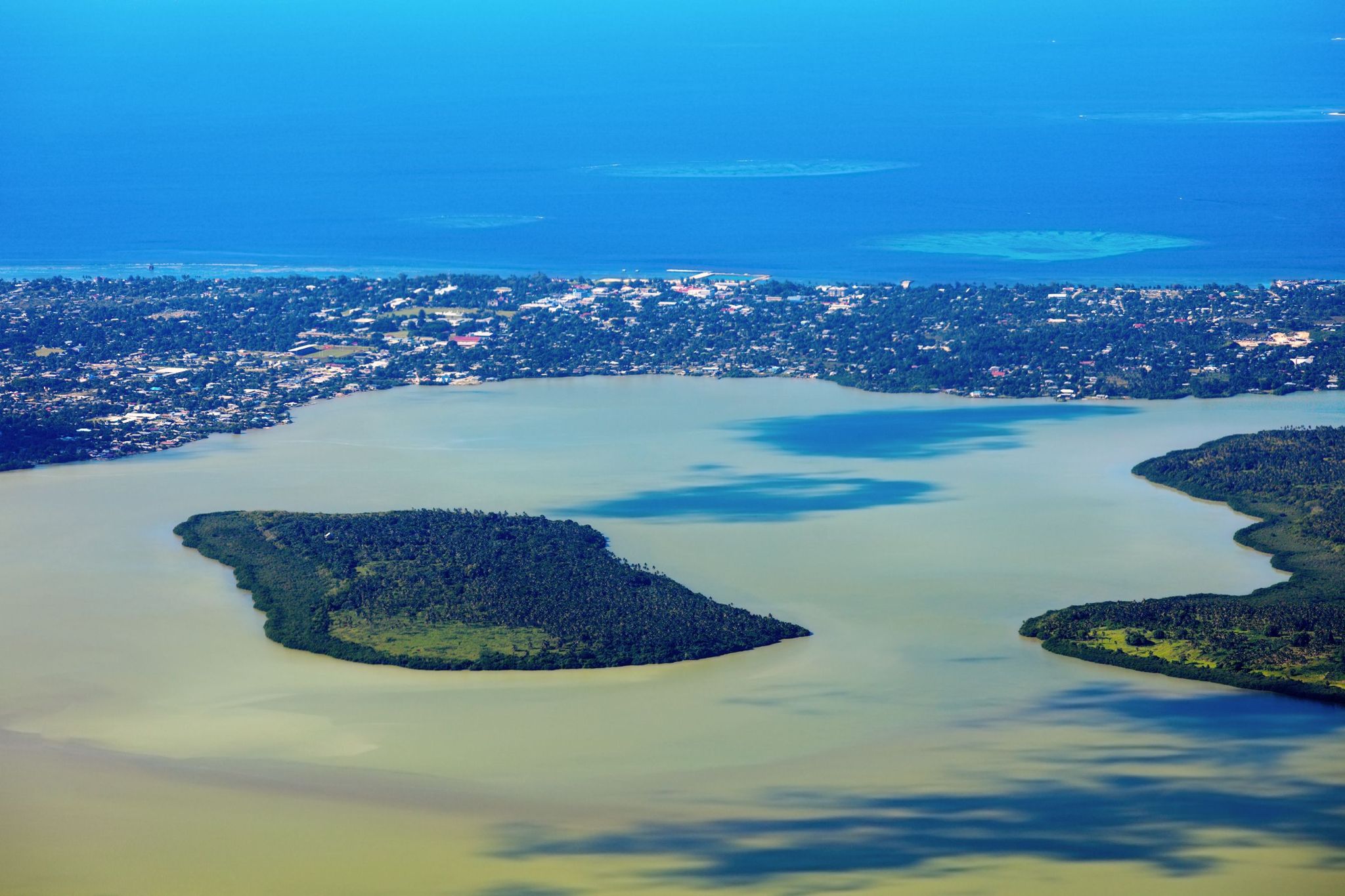
Nukualofa / Tonga
Nukuʻalofa to przytulna stolica Tonga, położona na północnym wybrzeżu wyspy Tongatapu. Miasto jest politycznym, kulturalnym i gospodarczym centrum kraju, zachowując przy tym urok tropikalnego spokoju. Jedną z głównych atrakcji jest Pałac Królewski, wybudowany w 1867 roku, w którym do dziś mieszka monarcha Tonga. Spacerując po Nukuʻalofie, turyści mogą cieszyć się kolorowymi targami, na których lokalni sprzedawcy oferują świeże owoce tropikalne, rękodzieło i biżuterię z muszelek.
Poza dziedzictwem historycznym, Nukuʻalofa przyciąga bliskością do naturalnych cudów. Zaledwie kilka kilometrów od centrum znajdują się dramatyczne klify Haʻatafu, popularne wśród miłośników surfingu, a także starożytne megalityczne konstrukcje, takie jak trzymetrowy łuk Haʻamonga ʻa Maui, znany jako "Polinezyjski Stonehenge". Nukuʻalofa to idealne miejsce dla tych, którzy szukają połączenia autentycznej kultury, spokojnej atmosfery i zachwycających krajobrazów.
-
Dzień 74: 07:00-14:30
Neiafu (Vavaʻu) Неиафу / Tonga
-
Dzień 75:
-
 Dzień 75: 13:00-21:00
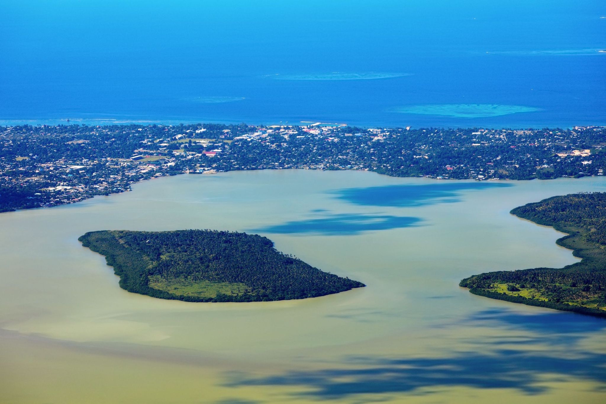
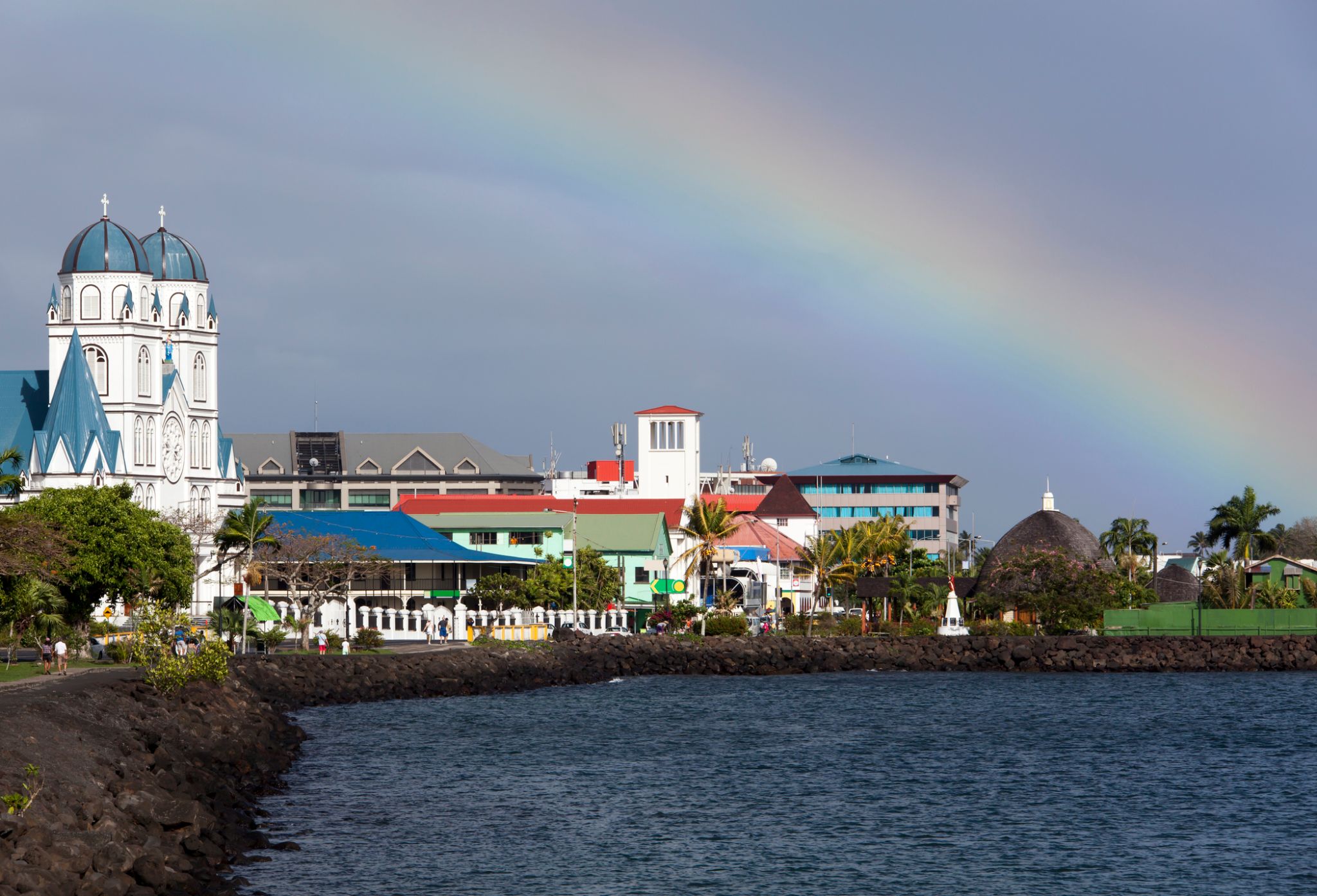
Apia / Samoa
Apia is the capital and the largest city of Samoa. From 1900 to 1919, it was the capital of German Samoa. The city is located on the central north coast of Upolu, Samoa's second largest island. Apia is the only city in Samoa and falls within the political district (itūmālō) of Tuamasaga.
The Apia Urban Area has a population of 36,735 (2011 census) and is generally referred to as the City of Apia. The geographic boundaries of Apia Urban Area is mainly from Letogo village to the new industrialized region of Apia known as Vaitele.
-
Dzień 75: 07:00-15:00
ZAPŁATA / American Samoa
-
Dzień 76:
Dzień na morzu / Morze
-
 Dzień 77: 12:00-21:00
Rarotonga / Wyspy Cooka
Rarotonga is the most populous island of the Cook Islands, with a population of 10,572 (census 2011), out of the country's total resident population of 14,974. Captain John Dibbs, master of the colonial brig Endeavour, is credited as the European discoverer on 25 July 1823, while transporting the missionary Rev. John Williams.
The Cook Islands' Parliament buildings and international airport are on Rarotonga. Rarotonga is a very popular tourist destination with many resorts, hotels and motels. The chief town, Avarua, on the north coast, is the capital of the Cook Islands.
-
Dzień 78:
Dzień na morzu / Morze
-
 Dzień 79: 07:00-18:00
Bora Bora, Society Islands / French Polynesia
-
Dzień 80: 07:00-19:00
Huahine
-
 Dzień 81: 07:00-18:00
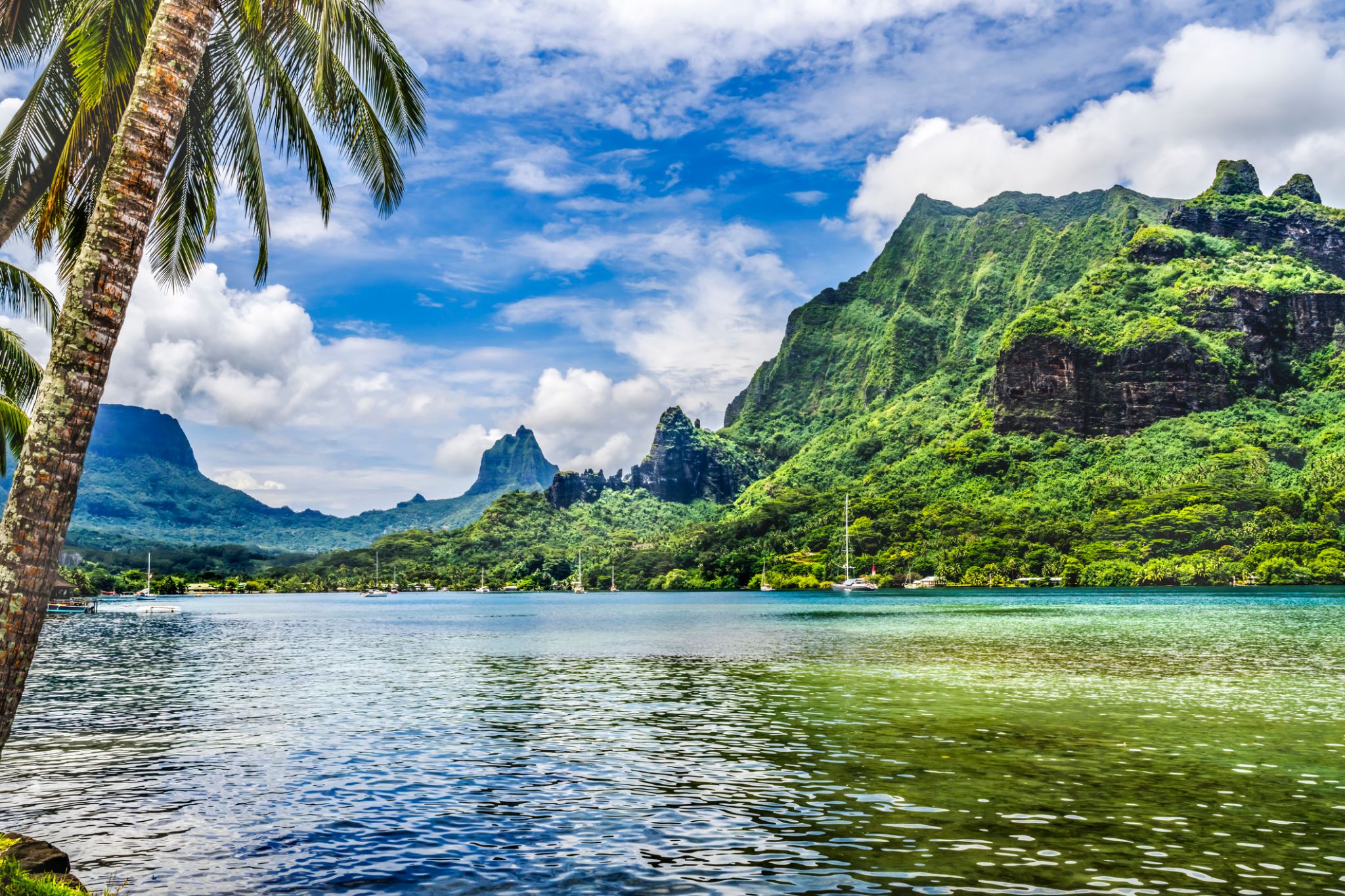
Moorea, Wyspy Towarzystwa / French Polynesia
The island was formed as a volcano 1.5 to 2.5 million years ago, the result of a Society hotspot in the mantle under the oceanic plate that formed the whole of the Society Archipelago. It is theorized that the current bays were formerly river basins that filled during the Holocene searise.
Mo'orea is about 10 miles in width from the west to the east. There are two small, nearly symmetrical bays on the north shore. The one to the west is called 'Ōpūnohu Bay, which is not very populated but many travelers have come into the bay. The main surrounding communes of the bay are Piha'ena in the east and Papetō'ai to the west. The one to the east is Cook's Bay, also called Pao Pao Bay since the largest commune of Mo'orea is at the bottom of the bay. The other communes are Piha'ena to the west and busy Maharepa to the east. The highest point is Mount Tohi'e'a, near the center of Mo'orea. It dominates the vista from the two bays and can be seen from Tahiti. There are also hiking trails in the mountains. The Vai'are Bay is another small inlet, smaller than the two main bays, on the east shore. This bay has been settled a lot and has a lot of business. The main village is located just south of the bay.
-
 Dzień 81: 21:00
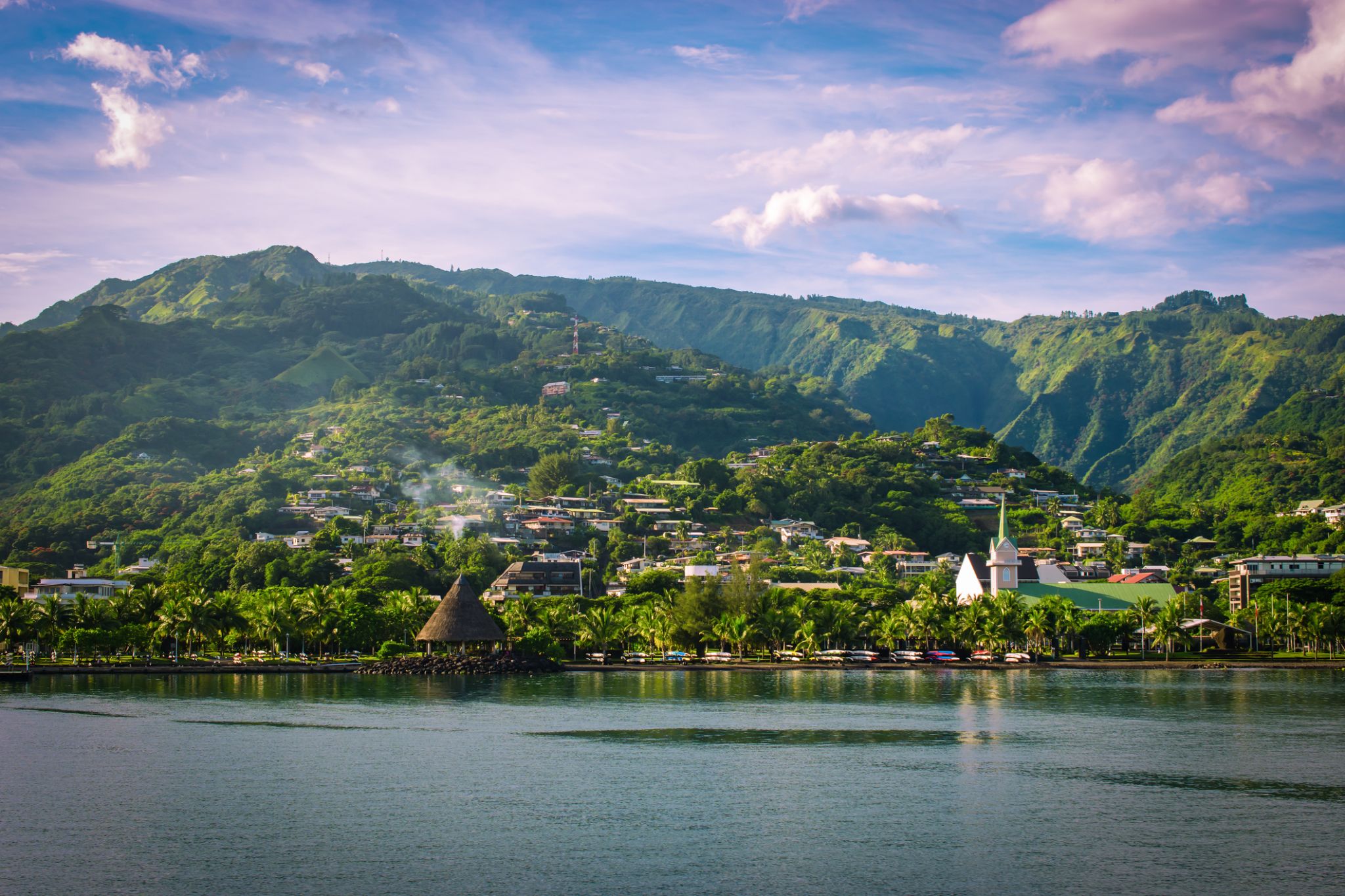
Papeete Papeete / French Polynesia
Papeete is the capital city of French Polynesia, an overseas collectivity of France in the Pacific Ocean. The commune of Papeete is located on the island of Tahiti, in the administrative subdivision of the Windward Islands, of which Papeete is the administrative capital. The French High Commissioner also resides in Papeete. It is the primary center of Tahitian and French Polynesian public and private governmental, commercial, industrial and financial services, the hub of French Polynesian tourism and a commonly used port of call. The Windward Islands are themselves part of the Society Islands. The name Papeete means "water from a basket".
The urban area of Papeete had a total population of 136,771 inhabitants at the August 2017 census, 26,926 of whom lived in the commune of Papeete proper.
-
Dzień 82:
Papeete Papeete / French Polynesia
Papeete is the capital city of French Polynesia, an overseas collectivity of France in the Pacific Ocean. The commune of Papeete is located on the island of Tahiti, in the administrative subdivision of the Windward Islands, of which Papeete is the administrative capital. The French High Commissioner also resides in Papeete. It is the primary center of Tahitian and French Polynesian public and private governmental, commercial, industrial and financial services, the hub of French Polynesian tourism and a commonly used port of call. The Windward Islands are themselves part of the Society Islands. The name Papeete means "water from a basket".
The urban area of Papeete had a total population of 136,771 inhabitants at the August 2017 census, 26,926 of whom lived in the commune of Papeete proper.