
Rejs 30 941 438
Atole do ziem aborygeńskich
| Region rejsu : Oceania |
| Firma : Oceania Cruises |
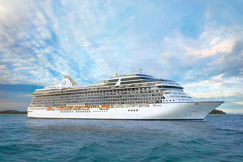
| Statek : Riviera |
| Data rozpoczęcia : wt. 06 sty 2026 |
| Data zakończenia : niedz. 08 lut 2026 |
| Liczba nocy : 33 nocy |


Harmonogram
| Dzień | Data | Port | Wypłynięcie | Odpłynięcie |
|---|---|---|---|---|
| 1 | 6.01 wt. | Papeete Papeete / French Polynesia | ||
| 2 | 7.01 śr. | Papeete Papeete / French Polynesia | 04:00 | |
| 2 | 7.01 śr. | Moorea, Wyspy Towarzystwa / French Polynesia | 08:00 | 16:00 |
| 3 | 8.01 czw. | Huahine | 07:00 | 17:00 |
| 4 | 9.01 pt. | Bora Bora, Society Islands / French Polynesia | 07:00 | 18:00 |
| 5 | 10.01 sob. | Dzień na morzu / Morze | ||
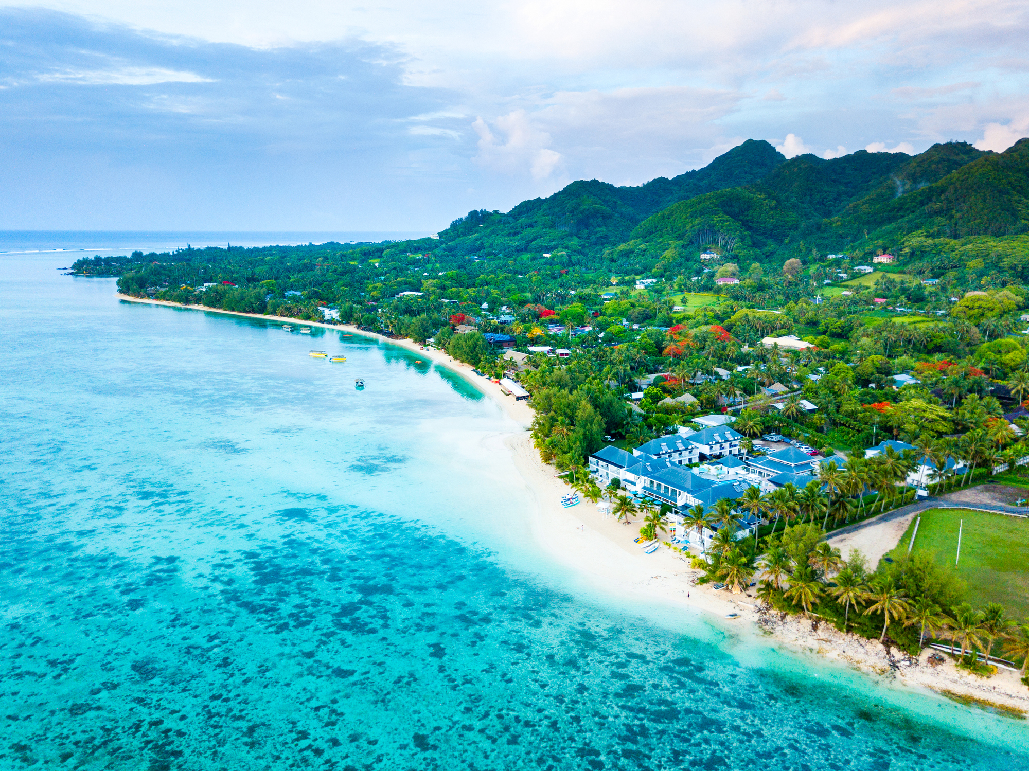
| 6 | 11.01 niedz. | Rarotonga / Wyspy Cooka | 07:00 | 17:00 |
| 7 | 12.01 pon. | Dzień na morzu / Morze | ||
| 8 | 13.01 wt. | Alofi O. Niue / Niue | 07:00 | 16:00 |
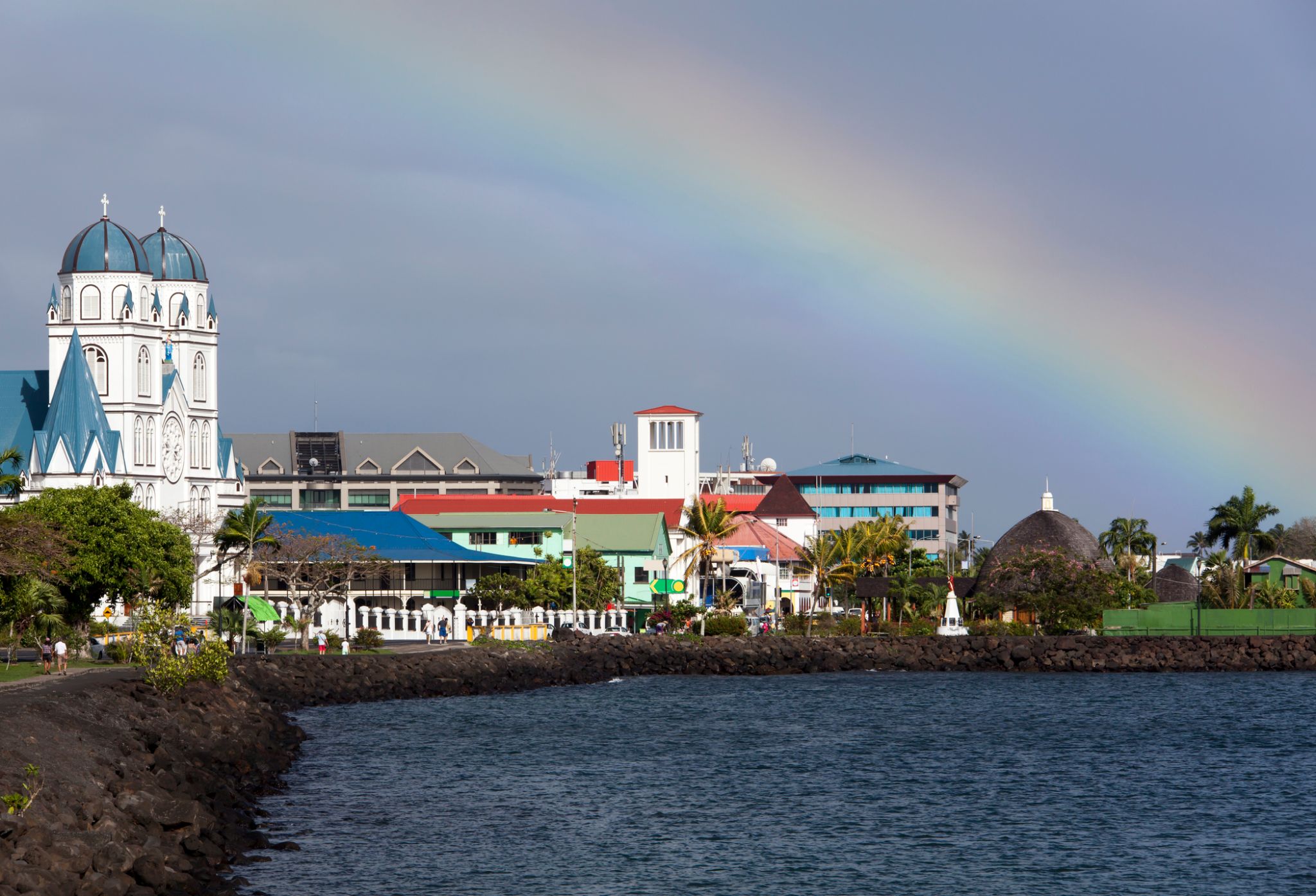
| 9 | 14.01 śr. | Pago-Pago / Samoa | 11:00 | 21:00 |
| 10 | 15.01 czw. | |||
| 11 | 16.01 pt. | Apia / Samoa | 07:00 | 16:00 |
| 12 | 17.01 sob. | Dzień na morzu / Morze | ||
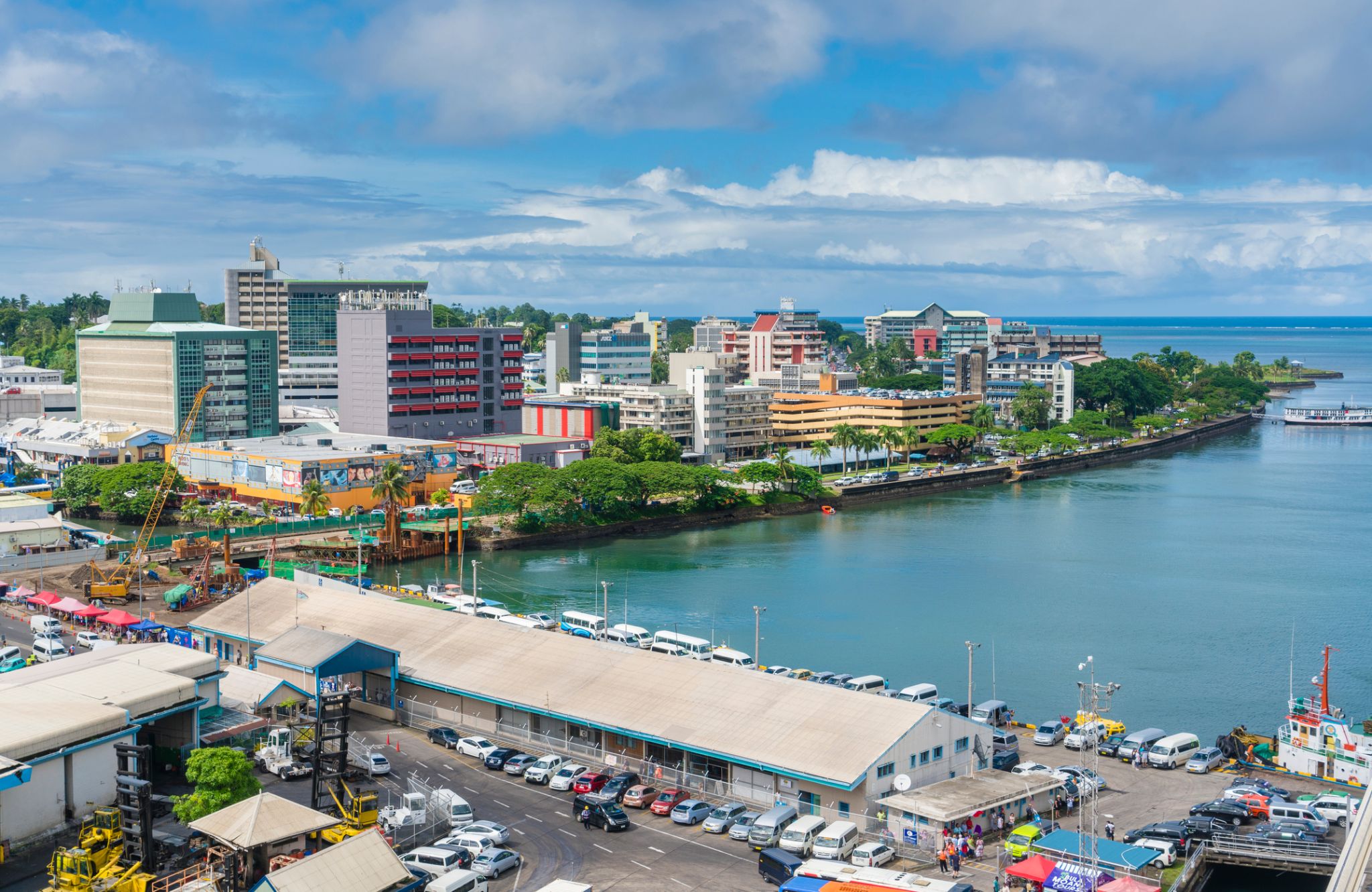
| 13 | 18.01 niedz. | Suchy / Fiji | 08:00 | 20:00 |
| 14 | 19.01 pon. | Dzień na morzu / Morze | ||
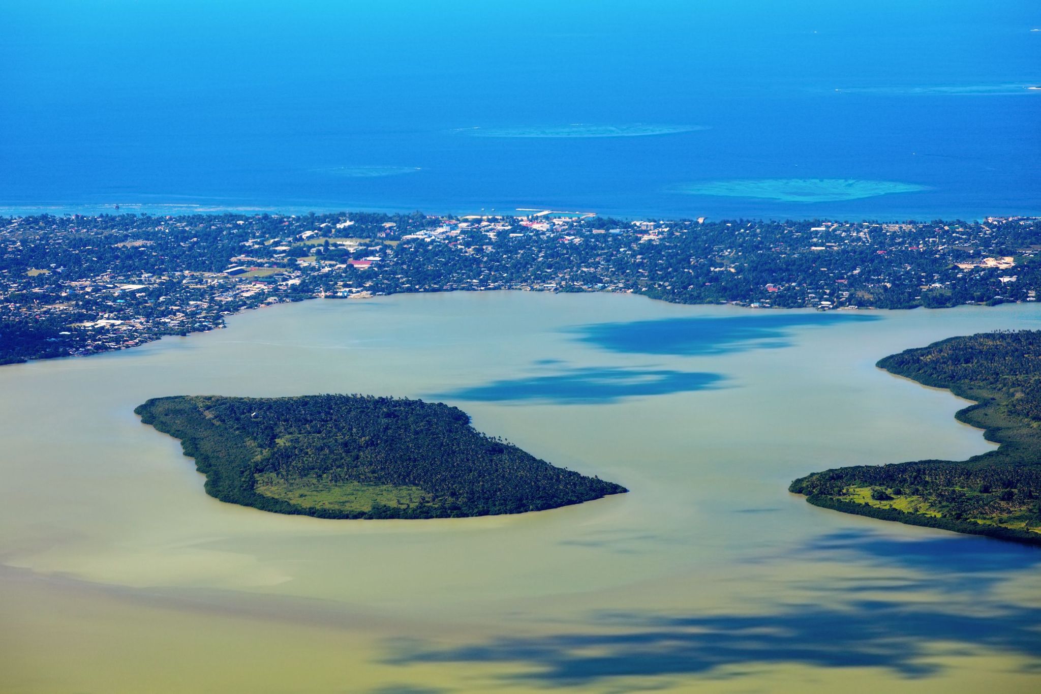
| 15 | 20.01 wt. | Nukualofa / Tonga | 07:00 | 16:00 |
| 16 | 21.01 śr. | Dzień na morzu / Morze | ||
| 17 | 22.01 czw. | Dzień na morzu / Morze | ||
| 18 | 23.01 pt. | Kokcen-Houl / Honduras | 08:00 | 19:00 |
| 19 | 24.01 sob. | Okland / Nowa Zelandia | 08:00 | |
| 20 | 25.01 niedz. | Okland / Nowa Zelandia | 20:00 | |
| 21 | 26.01 pon. | Rotorua | 09:00 | 16:00 |
| 22 | 27.01 wt. | Нейпир / Nowa Zelandia | 11:00 | 19:00 |
| 23 | 28.01 śr. | Wellington / Nowa Zelandia | 10:00 | 20:00 |
| 24 | 29.01 czw. | Christchurch / Nowa Zelandia | 08:00 | 19:00 |
| 25 | 30.01 pt. | Danidin / Nowa Zelandia | 08:00 | 16:00 |
| 26 | 31.01 sob. | Dzień na morzu / Morze | ||
| 27 | 1.02 niedz. | Dzień na morzu / Morze | ||
| 28 | 2.02 pon. | Dzień na morzu / Morze | ||
| 29 | 3.02 wt. | Tasmania (Hobart) / Australia | 07:00 | 20:00 |
| 30 | 4.02 śr. | Dzień na morzu / Morze | ||
| 31 | 5.02 czw. | Melbourne / Australia | 07:00 | |
| 32 | 6.02 pt. | Melbourne / Australia | 16:00 | |
| 33 | 7.02 sob. | Dzień na morzu / Morze | ||
| 34 | 8.02 niedz. | Sydnej / Australia | 07:00 | 20:00 |
-
 Dzień 1:
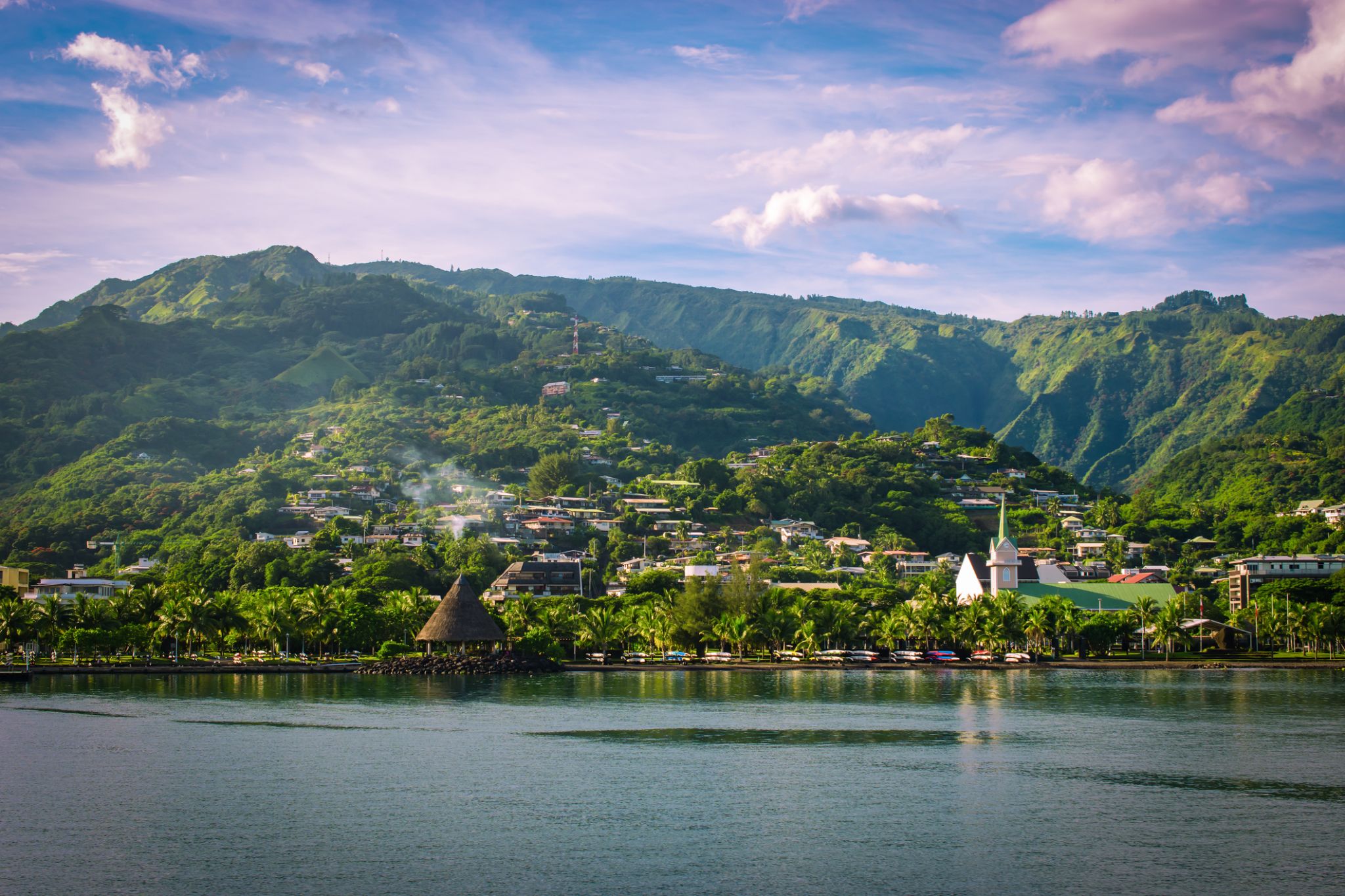
Papeete Papeete / French Polynesia
Papeete is the capital city of French Polynesia, an overseas collectivity of France in the Pacific Ocean. The commune of Papeete is located on the island of Tahiti, in the administrative subdivision of the Windward Islands, of which Papeete is the administrative capital. The French High Commissioner also resides in Papeete. It is the primary center of Tahitian and French Polynesian public and private governmental, commercial, industrial and financial services, the hub of French Polynesian tourism and a commonly used port of call. The Windward Islands are themselves part of the Society Islands. The name Papeete means "water from a basket".
The urban area of Papeete had a total population of 136,771 inhabitants at the August 2017 census, 26,926 of whom lived in the commune of Papeete proper.
-
Dzień 2: 04:00
Papeete Papeete / French Polynesia
Papeete is the capital city of French Polynesia, an overseas collectivity of France in the Pacific Ocean. The commune of Papeete is located on the island of Tahiti, in the administrative subdivision of the Windward Islands, of which Papeete is the administrative capital. The French High Commissioner also resides in Papeete. It is the primary center of Tahitian and French Polynesian public and private governmental, commercial, industrial and financial services, the hub of French Polynesian tourism and a commonly used port of call. The Windward Islands are themselves part of the Society Islands. The name Papeete means "water from a basket".
The urban area of Papeete had a total population of 136,771 inhabitants at the August 2017 census, 26,926 of whom lived in the commune of Papeete proper.
-
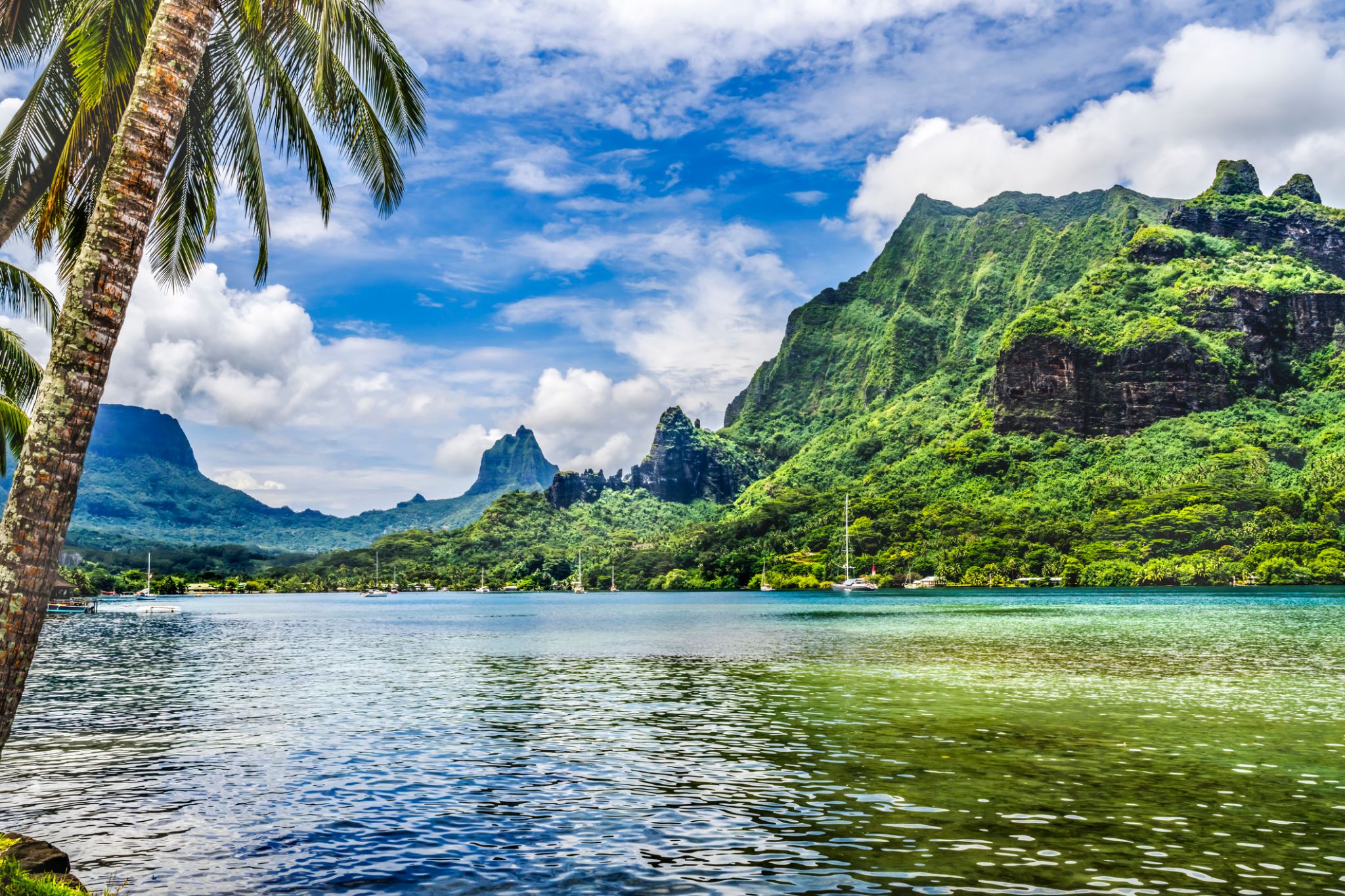 Dzień 2: 08:00-16:00
Moorea, Wyspy Towarzystwa / French Polynesia
The island was formed as a volcano 1.5 to 2.5 million years ago, the result of a Society hotspot in the mantle under the oceanic plate that formed the whole of the Society Archipelago. It is theorized that the current bays were formerly river basins that filled during the Holocene searise.
Mo'orea is about 10 miles in width from the west to the east. There are two small, nearly symmetrical bays on the north shore. The one to the west is called 'Ōpūnohu Bay, which is not very populated but many travelers have come into the bay. The main surrounding communes of the bay are Piha'ena in the east and Papetō'ai to the west. The one to the east is Cook's Bay, also called Pao Pao Bay since the largest commune of Mo'orea is at the bottom of the bay. The other communes are Piha'ena to the west and busy Maharepa to the east. The highest point is Mount Tohi'e'a, near the center of Mo'orea. It dominates the vista from the two bays and can be seen from Tahiti. There are also hiking trails in the mountains. The Vai'are Bay is another small inlet, smaller than the two main bays, on the east shore. This bay has been settled a lot and has a lot of business. The main village is located just south of the bay.
-
 Dzień 3: 07:00-17:00
Huahine
-
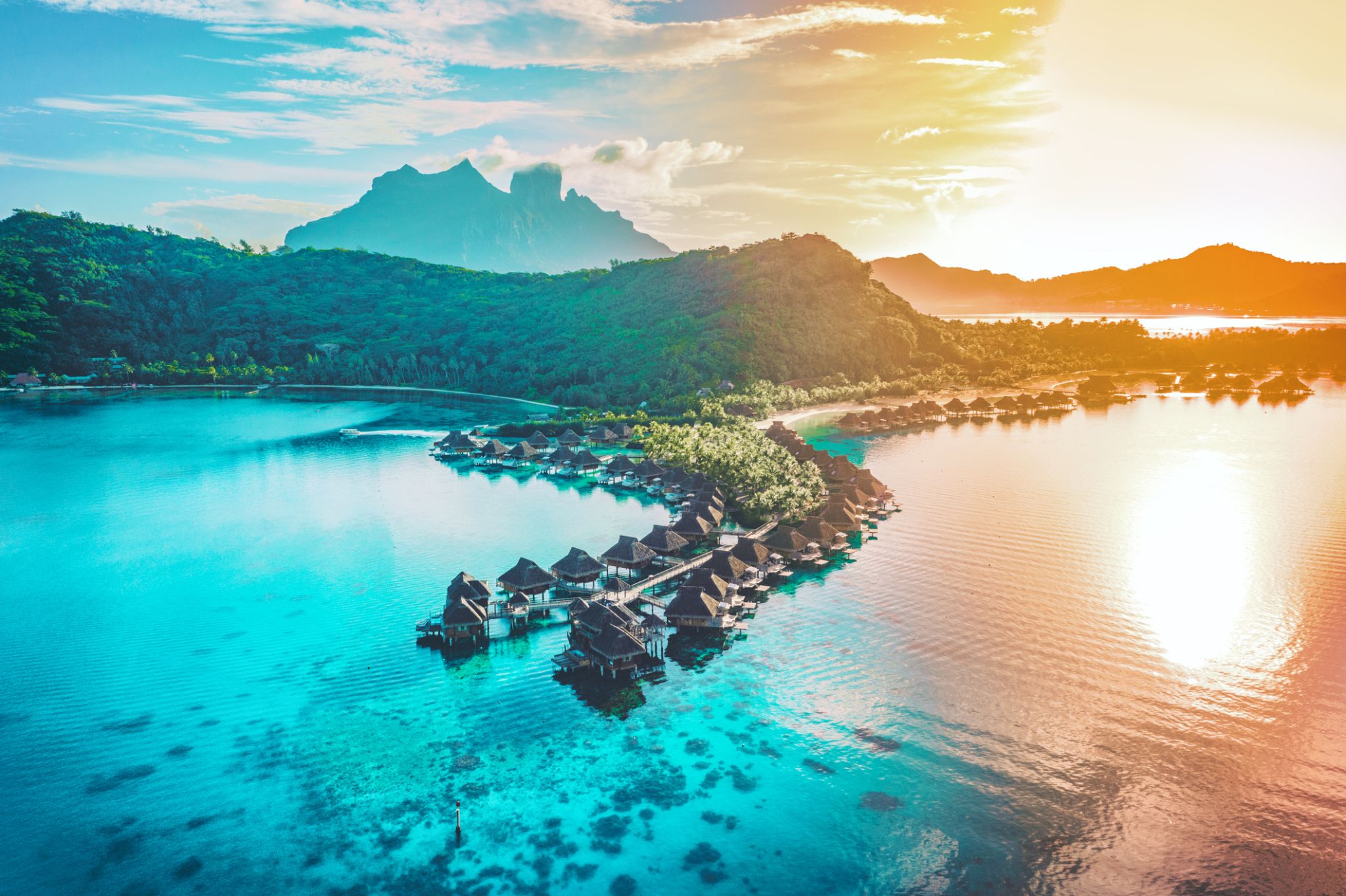 Dzień 4: 07:00-18:00
Bora Bora, Society Islands / French Polynesia
-
 Dzień 5:
Dzień na morzu / Morze
-
 Dzień 6: 07:00-17:00
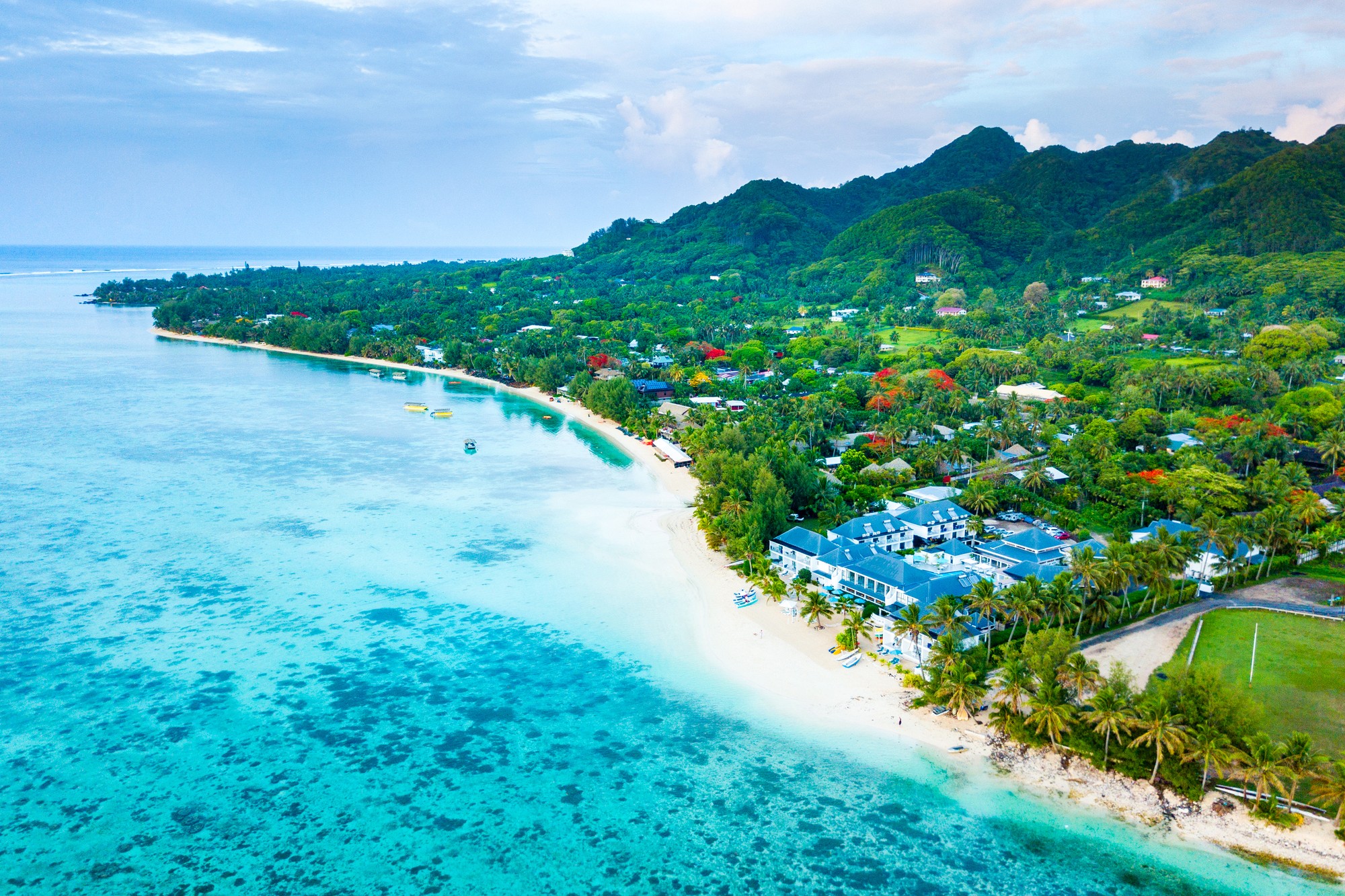
Rarotonga / Wyspy Cooka
Rarotonga is the most populous island of the Cook Islands, with a population of 10,572 (census 2011), out of the country's total resident population of 14,974. Captain John Dibbs, master of the colonial brig Endeavour, is credited as the European discoverer on 25 July 1823, while transporting the missionary Rev. John Williams.
The Cook Islands' Parliament buildings and international airport are on Rarotonga. Rarotonga is a very popular tourist destination with many resorts, hotels and motels. The chief town, Avarua, on the north coast, is the capital of the Cook Islands.
-
Dzień 7:
Dzień na morzu / Morze
-
Dzień 8: 07:00-16:00
Alofi O. Niue / Niue
-
 Dzień 9: 11:00-21:00
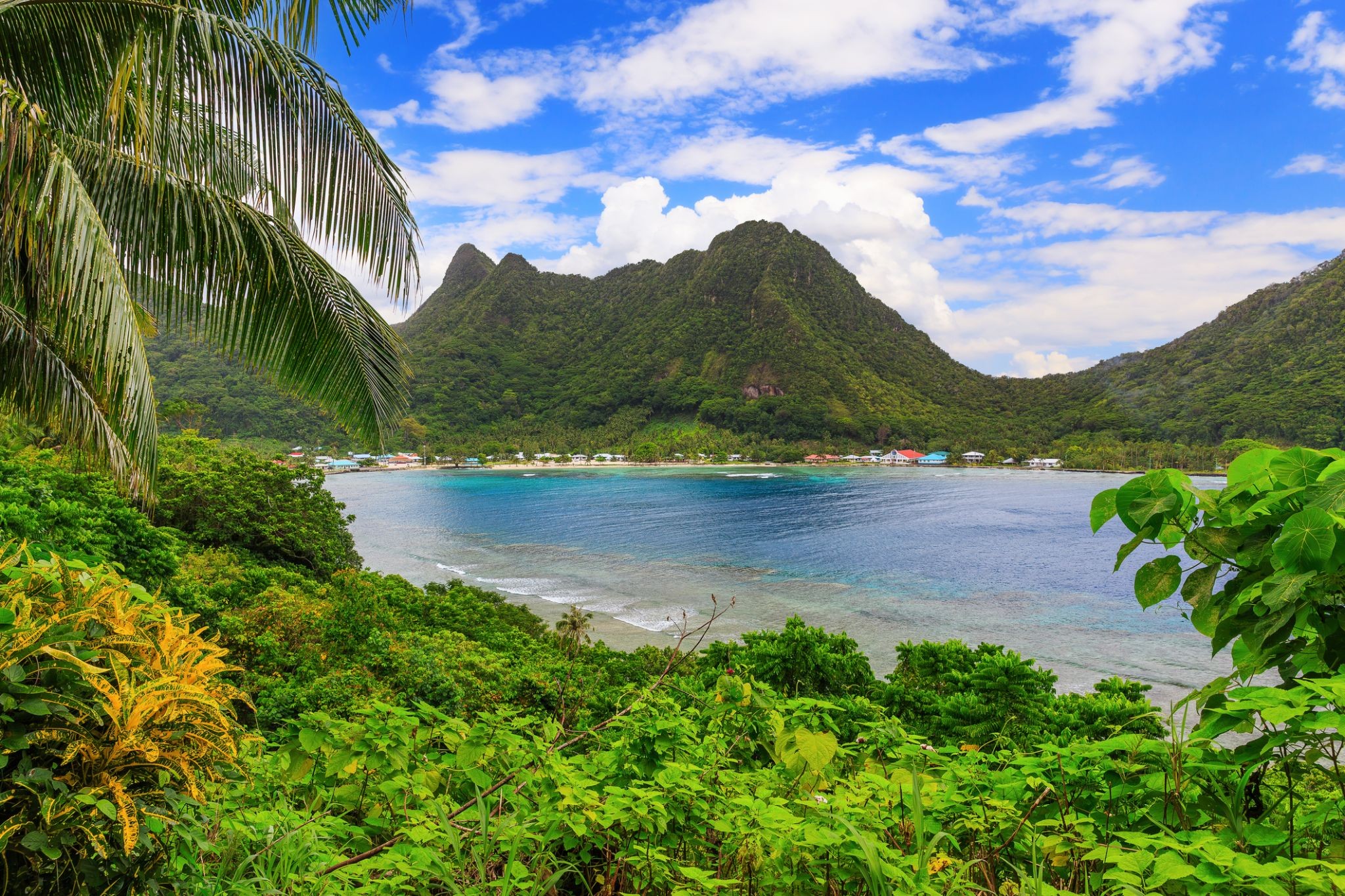
Pago-Pago / Samoa
Pago Pago is the territorial capital of American Samoa. It is in Maoputasi County on the main island of American Samoa, Tutuila. It is home to one of the best and deepest natural deepwater harbors in the South Pacific Ocean, sheltered from wind and rough seas, and strategically located. The harbor is also one of the best protected in the South Pacific, which gives American Samoa a natural advantage with respect to landing fish for processing. Tourism, entertainment, food, and tunacanning are its main industries. Pago Pago was the world's 4th largest tuna processor as of 1993. It was home to two of the largest tuna companies in the world: Chicken of the Sea and StarKist, which exported an estimated $445 million in canned tuna to the U.S. mainland.
Pago Pago is the only modern urban center in American Samoa. The Greater Pago Pago Metropolitan Area encompasses several villages strung together along Pago Pago Harbor. One of the villages is itself named Pago Pago, and in 2010 had a population of 3,656. The constituent villages are, in order, Utulei, Fagatogo, Malaloa, Pago Pago, Satala and Atu'u. Fagatogo is the downtown area referred to as Town and is home to the legislature, while the executive is located in Utulei. In Fagatogo is the Fono, Police Department, Port of Pago Pago, many shops and hotels. The Greater Pago Pago Area was home to 8,000 residents in 2000.
Rainmaker Mountain (Mount Pioa) is located in Pago Pago, and gives the city the highest annual rainfall of any harbor in the world.
-
Dzień 10:
-
 Dzień 11: 07:00-16:00
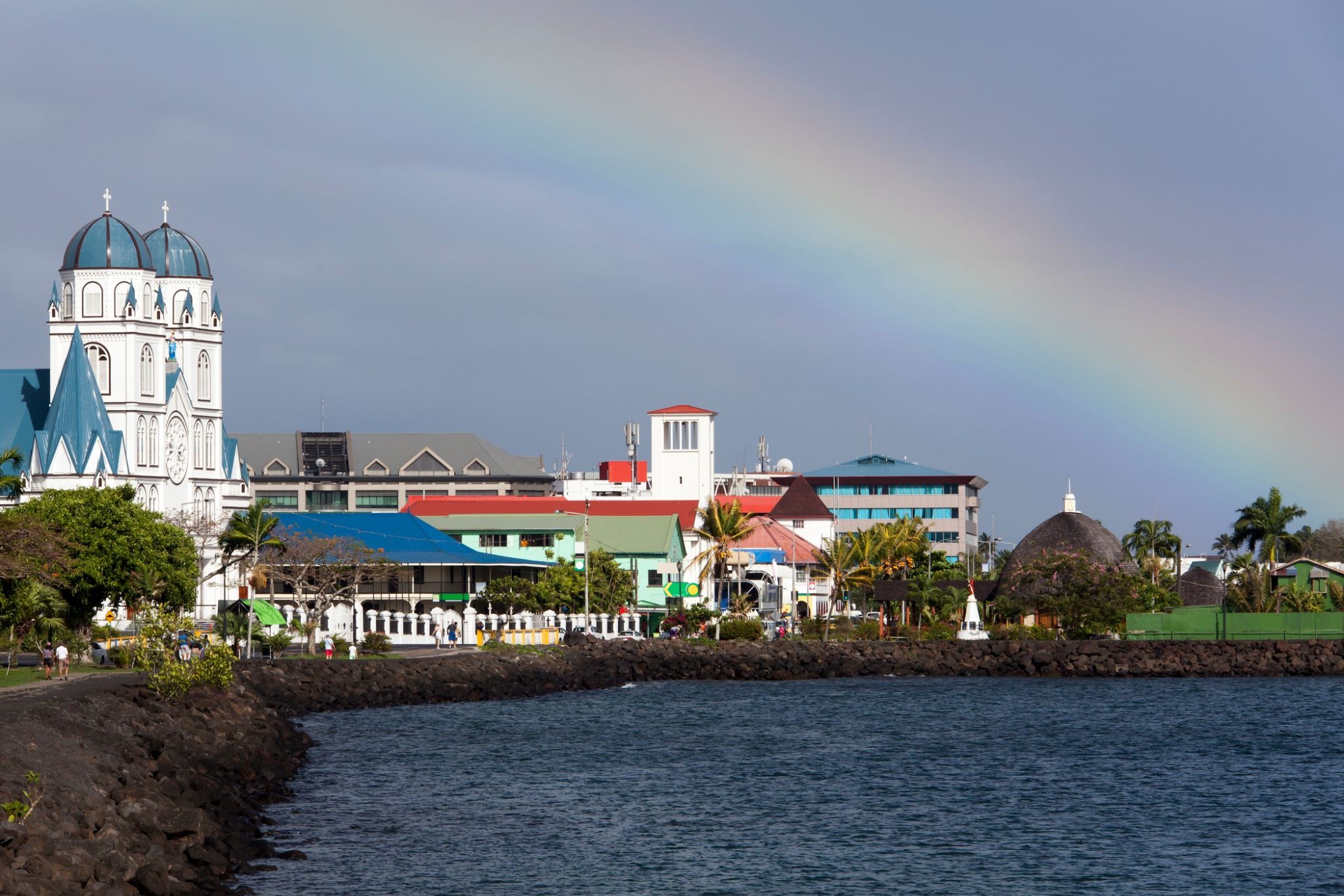
Apia / Samoa
Apia is the capital and the largest city of Samoa. From 1900 to 1919, it was the capital of German Samoa. The city is located on the central north coast of Upolu, Samoa's second largest island. Apia is the only city in Samoa and falls within the political district (itūmālō) of Tuamasaga.
The Apia Urban Area has a population of 36,735 (2011 census) and is generally referred to as the City of Apia. The geographic boundaries of Apia Urban Area is mainly from Letogo village to the new industrialized region of Apia known as Vaitele.
-
Dzień 12:
Dzień na morzu / Morze
-
 Dzień 13: 08:00-20:00
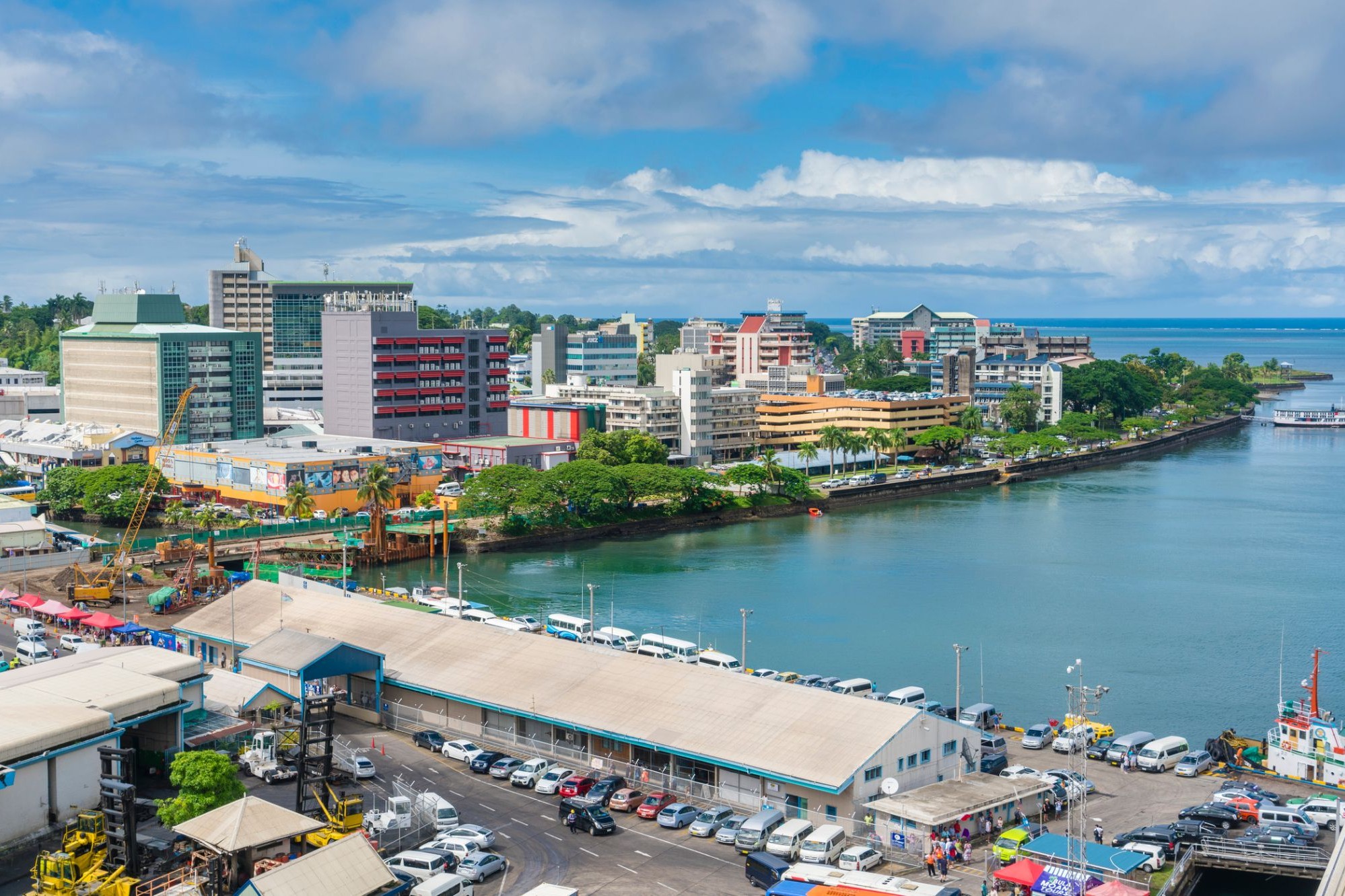
Suchy / Fiji
Suva is the capital and largest metropolitan city in Fiji. It is located on the southeast coast of the island of Viti Levu, in the Rewa Province, Central Division.
In 1877, it was decided to make Suva the capital of Fiji, as the geography of former main European settlement at Levuka on the island of Ovalau, Lomaiviti province proved too restrictive. The administration of the colony was moved from Levuka to Suva in 1882.
At the 2007 census, the city of Suva had a population of 85,691. Including independent suburbs, the population of the Greater Suva urban area was 172,399 at the 2007 census. Suva, along with the bordering towns of Lami, Nasinu, and Nausori have a total urban population of around 330,000, over a third of the nation's population. This urban complex (not including Lami) is known also as the Suva-Nausori corridor.
Suva is the political, economic, and cultural centre of Fiji. It is also the economic and cultural capital of the Pacific, hosting the majority of regional headquarters of major corporations, as well as international agencies and diplomatic missions in the region. The city also has a thriving arts and performance scene, with a growing reputation as the region’s fashion capital.
-
Dzień 14:
Dzień na morzu / Morze
-
 Dzień 15: 07:00-16:00
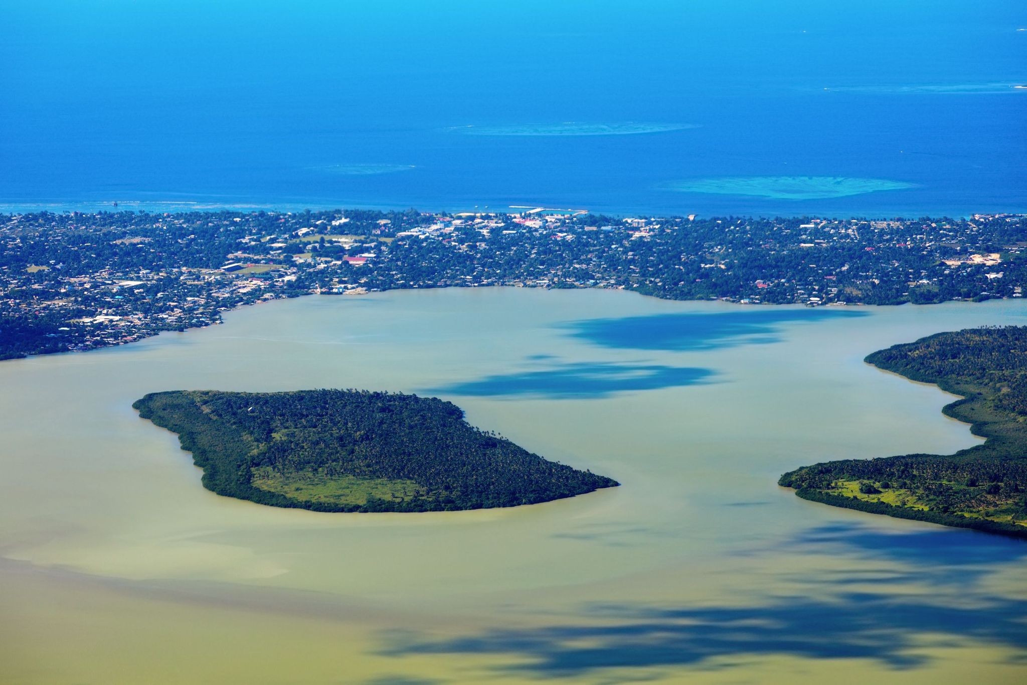
Nukualofa / Tonga
Nukuʻalofa to przytulna stolica Tonga, położona na północnym wybrzeżu wyspy Tongatapu. Miasto jest politycznym, kulturalnym i gospodarczym centrum kraju, zachowując przy tym urok tropikalnego spokoju. Jedną z głównych atrakcji jest Pałac Królewski, wybudowany w 1867 roku, w którym do dziś mieszka monarcha Tonga. Spacerując po Nukuʻalofie, turyści mogą cieszyć się kolorowymi targami, na których lokalni sprzedawcy oferują świeże owoce tropikalne, rękodzieło i biżuterię z muszelek.
Poza dziedzictwem historycznym, Nukuʻalofa przyciąga bliskością do naturalnych cudów. Zaledwie kilka kilometrów od centrum znajdują się dramatyczne klify Haʻatafu, popularne wśród miłośników surfingu, a także starożytne megalityczne konstrukcje, takie jak trzymetrowy łuk Haʻamonga ʻa Maui, znany jako "Polinezyjski Stonehenge". Nukuʻalofa to idealne miejsce dla tych, którzy szukają połączenia autentycznej kultury, spokojnej atmosfery i zachwycających krajobrazów.
-
Dzień 16:
Dzień na morzu / Morze
-
Dzień 17:
Dzień na morzu / Morze
-
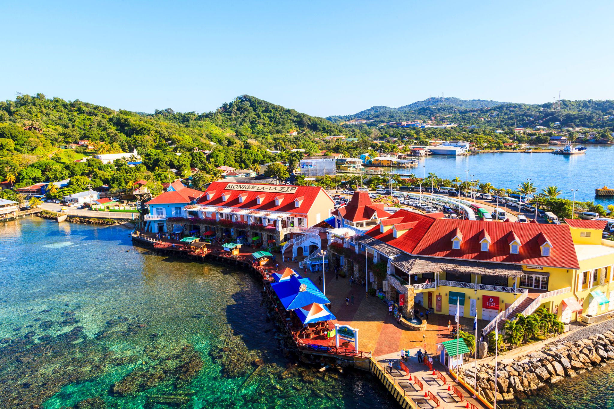 Dzień 18: 08:00-19:00
Kokcen-Houl / Honduras
-
 Dzień 19: 08:00
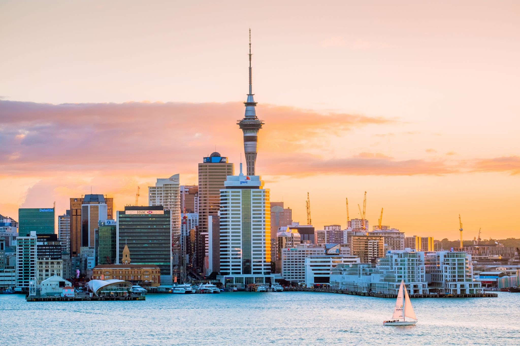
Okland / Nowa Zelandia
-
Dzień 20: 20:00
Okland / Nowa Zelandia
-
Dzień 21: 09:00-16:00
Rotorua
-
 Dzień 22: 11:00-19:00
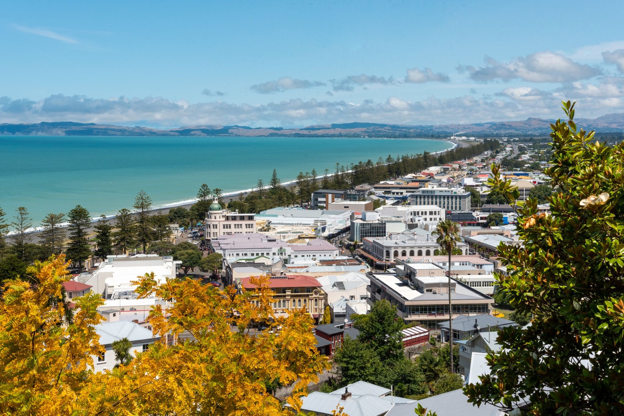
Нейпир / Nowa Zelandia
Napier is a New Zealand city with a seaport, located in Hawke's Bay on the eastern coast of the North Island. The population of Napier is about 63,900 as of the June 2018. About 18 kilometres (11 mi) south of Napier is the inland city of Hastings. These two neighbouring cities are often called "The Bay Cities" or "The Twin Cities" of New Zealand. The total population of the Napier-Hastings Urban Area is 134,500 people, which makes it the sixth-largest urban area in New Zealand, closely followed by Dunedin (122,000), and trailing Tauranga(141,600).
Napier is about 320 kilometres (200 mi) northeast of the capital city of Wellington. Napier (63,900) has a smaller population than its neighbouring city of Hastings (70,600) but is seen as the main centre due to it being closer in distance to both the seaport and the main airport that service Hawke's Bay, and Hastings' population figure includes 13,000 people living in Havelock North, which is often considered a town in its own right. The City of Napier has a land area of 106 square kilometres (41 sq mi) and a population density of 540.0 per square kilometre.
Napier is the nexus of the largest wool centre in the Southern Hemisphere, and it has the primary export seaport for northeastern New Zealand – which is the largest producer of apples, pears, and stone fruit in New Zealand. Napier has also become an important grape and wine production area, with the grapes grown around Hastings and Napier being sent through the Port of Napier for export. Large amounts of sheep's wool, frozen meat, wood pulp, and timber also pass through Napier annually for export. Smaller amounts of these materials are shipped via road and railway to the large metropolitan areas of New Zealand itself, such as Auckland, Wellington and Hamilton.
Napier is a popular tourist city, with a unique concentration of 1930s Art Deco architecture, built after much of the city was razed in the 1931 Hawke's Bay earthquake. It also has one of the most photographed tourist attractions in the country, a statue on Marine Parade called Pania of the Reef. Thousands of people flock to Napier every February for the Tremains Art Deco Weekend event, a celebration of its Art Deco heritage and history. Other notable tourist events attracting many outsiders to the region annually include F.A.W.C! Food and Wine Classic events, and the Mission Estate Concert at Mission Estate and Winery in the suburb of Taradale.
-
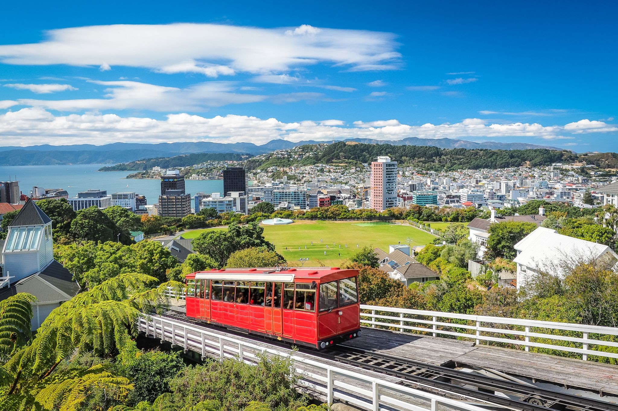
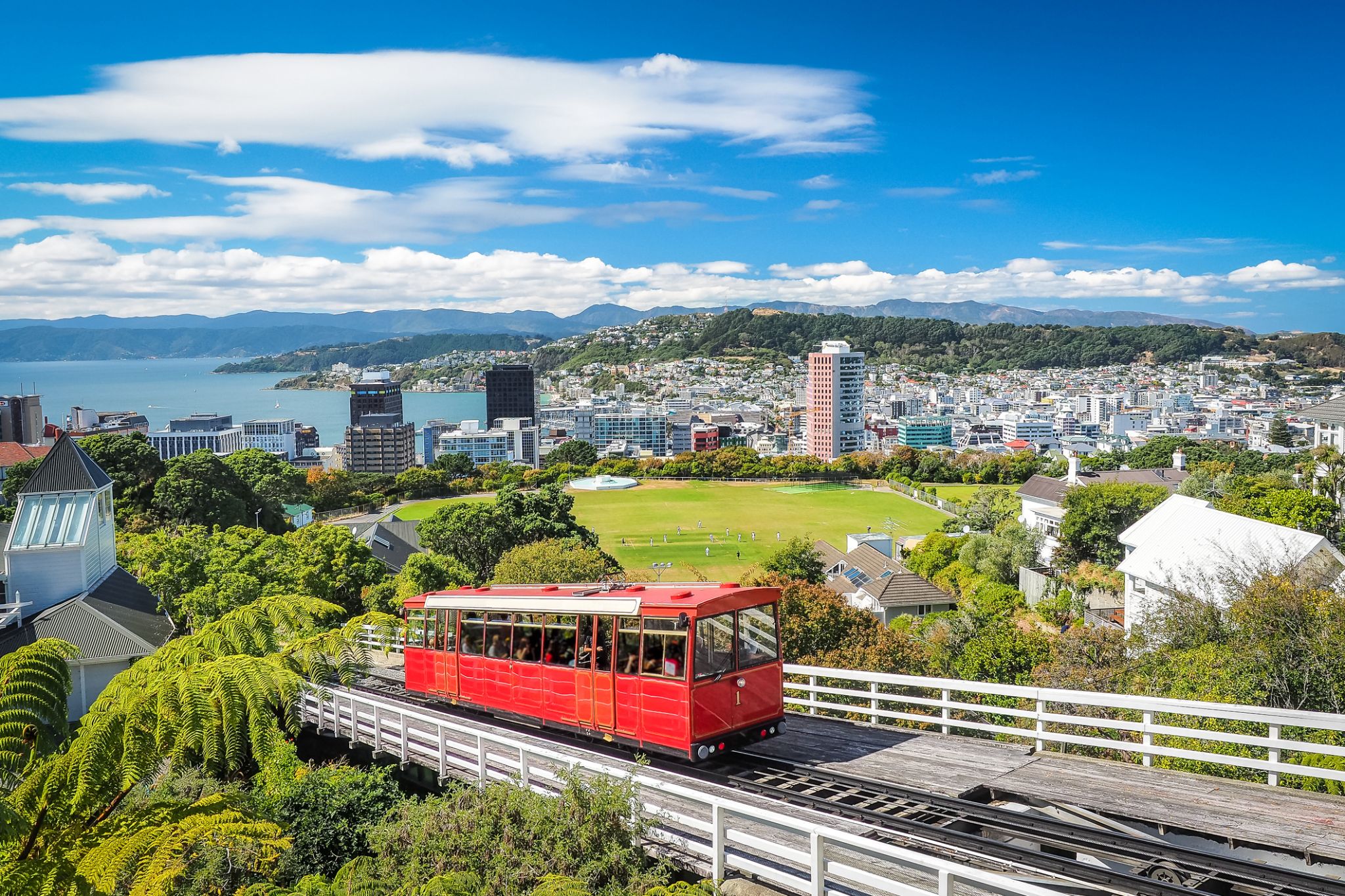 Dzień 23: 10:00-20:00
Wellington / Nowa Zelandia
-
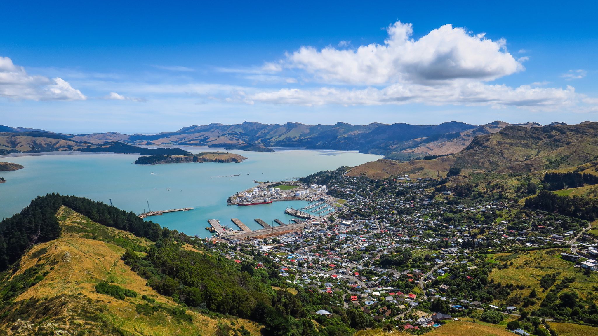 Dzień 24: 08:00-19:00
Christchurch / Nowa Zelandia
-
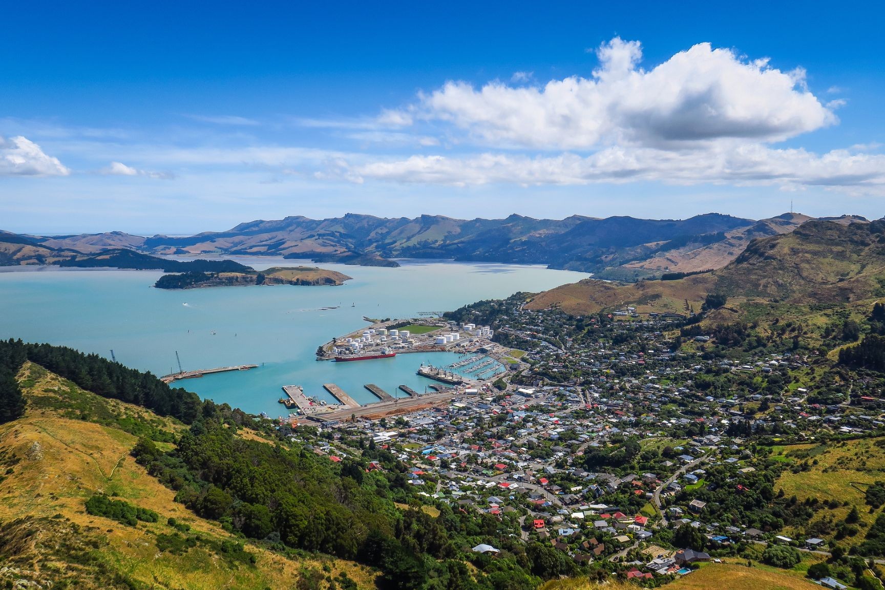
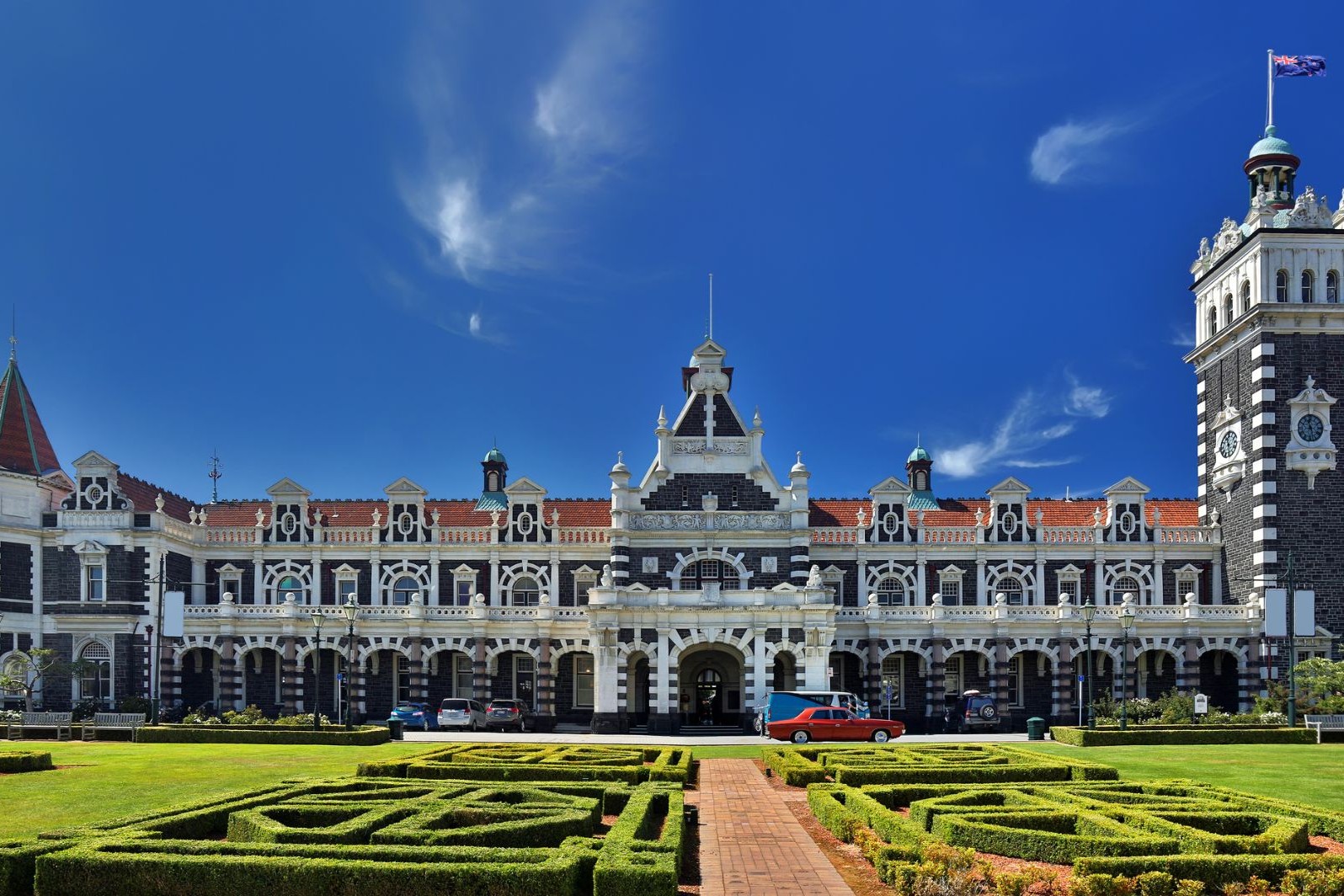
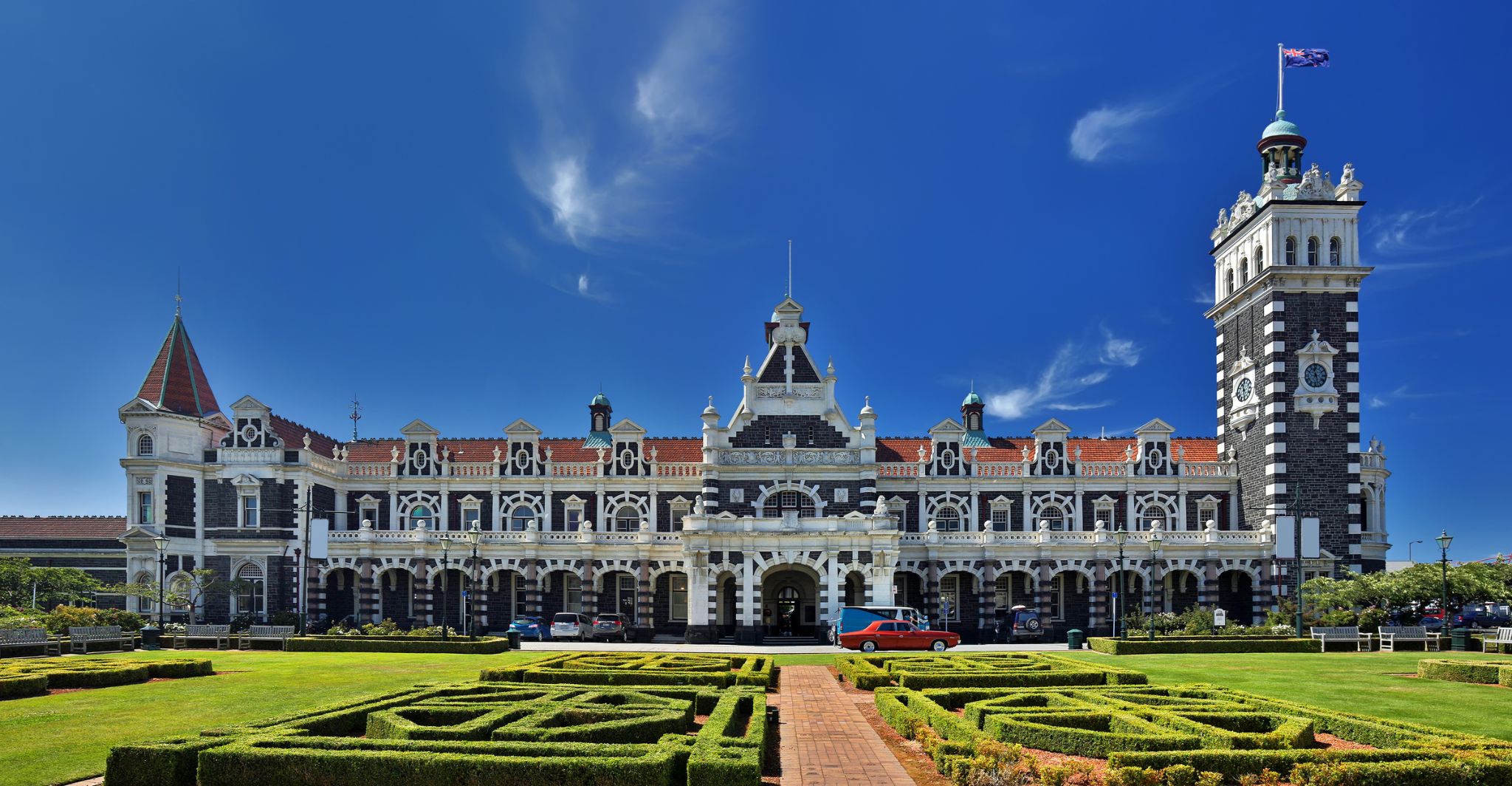 Dzień 25: 08:00-16:00
Danidin / Nowa Zelandia
-
Dzień 26:
Dzień na morzu / Morze
-
Dzień 27:
Dzień na morzu / Morze
-
Dzień 28:
Dzień na morzu / Morze
-
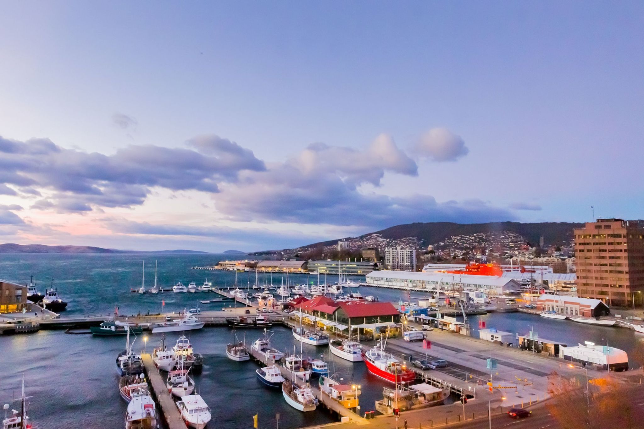 Dzień 29: 07:00-20:00
Tasmania (Hobart) / Australia
Hobart is the capital and most populous city of the Australian island state of Tasmania. With a population of approximately 225,000 (over 40% of Tasmania's population), it is the least populated Australian state capital city, and second smallest if territories are taken into account (after Darwin, Northern Territory). Founded in 1804 as a British penal colony, Hobart, formerly known as Hobart Town or Hobarton, is Australia's second oldest capital city after Sydney, New South Wales. Prior to British settlement, the Hobart area had been occupied for possibly as long as 35,000 years, by the semi-nomadic Mouheneener tribe, a sub-group of the Nuennone, or South-East tribe. The descendants of these Aboriginal Tasmanians often refer to themselves as 'Palawa'.
-
Dzień 30:
Dzień na morzu / Morze
-
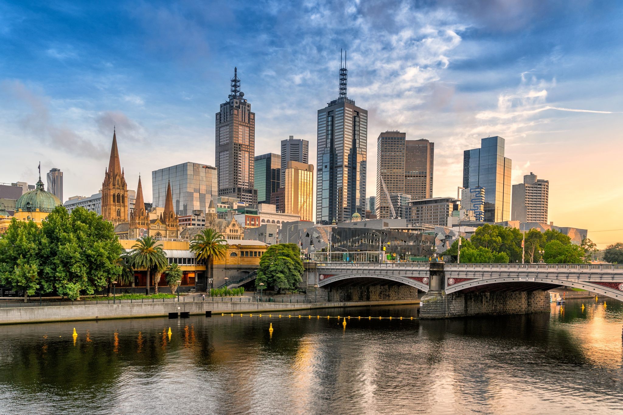
 Dzień 31: 07:00
Melbourne / Australia
Melbourne is the capital and most populous city of the Australian state of Victoria, and the second most populous city in Australia and Oceania. Its name refers to an urban agglomeration of 9,992.5 km2 (3,858.1 sq mi), comprising a metropolitan area with 31 municipalities, and is also the common name for its city centre. The city occupies much of the coastline of Port Phillip bay and spreads into the hinterlands towards the Dandenong and Macedon ranges, Mornington Peninsula and Yarra Valley. It has a population of approximately 4.9 million (19% of the population of Australia), and its inhabitants are referred to as "Melburnians".
The city was founded on 30 August 1835, in what was the British colony of New South Wales, by free settlers from the colony of Van Diemen’s Land. It was incorporated as a Crown settlement in 1837 and named in honour of the British Prime Minister, William Lamb, 2nd Viscount Melbourne. It was declared a city by Queen Victoria in 1847, after which it became the capital of the new colony of Victoria in 1851. In the wake of the 1850s Victorian gold rush, the city entered the "Marvellous Melbourne" boom period, transforming into one of the most important cities in the British Empire and one of the largest and wealthiest in the world. After the federation of Australia in 1901, it served as interim seat of government of the new nation until Canberra became the permanent capital in 1927. Today, it is a leading financial centre in the Asia-Pacific region and ranks 20th in the Global Financial Centres Index.
-
Dzień 32: 16:00
Melbourne / Australia
Melbourne is the capital and most populous city of the Australian state of Victoria, and the second most populous city in Australia and Oceania. Its name refers to an urban agglomeration of 9,992.5 km2 (3,858.1 sq mi), comprising a metropolitan area with 31 municipalities, and is also the common name for its city centre. The city occupies much of the coastline of Port Phillip bay and spreads into the hinterlands towards the Dandenong and Macedon ranges, Mornington Peninsula and Yarra Valley. It has a population of approximately 4.9 million (19% of the population of Australia), and its inhabitants are referred to as "Melburnians".
The city was founded on 30 August 1835, in what was the British colony of New South Wales, by free settlers from the colony of Van Diemen’s Land. It was incorporated as a Crown settlement in 1837 and named in honour of the British Prime Minister, William Lamb, 2nd Viscount Melbourne. It was declared a city by Queen Victoria in 1847, after which it became the capital of the new colony of Victoria in 1851. In the wake of the 1850s Victorian gold rush, the city entered the "Marvellous Melbourne" boom period, transforming into one of the most important cities in the British Empire and one of the largest and wealthiest in the world. After the federation of Australia in 1901, it served as interim seat of government of the new nation until Canberra became the permanent capital in 1927. Today, it is a leading financial centre in the Asia-Pacific region and ranks 20th in the Global Financial Centres Index.
-
Dzień 33:
Dzień na morzu / Morze
-
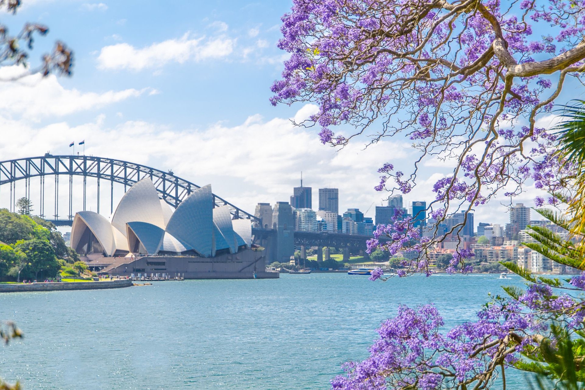
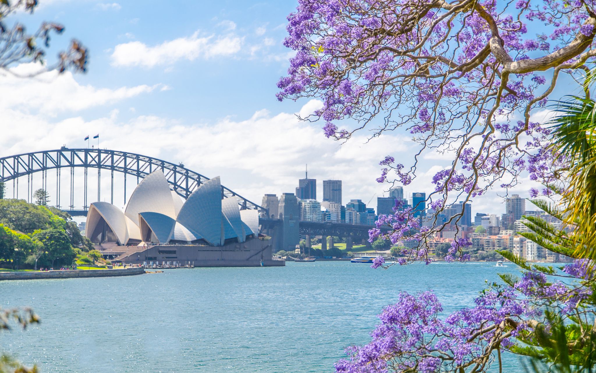 Dzień 34: 07:00-20:00
Sydnej / Australia
Sydney is the state capital of New South Wales and the most populous city in Australiaand Oceania. Located on Australia's east coast, the metropolis surrounds Port Jackson and extends about 70 km (43.5 mi) on its periphery towards the Blue Mountains to the west, Hawkesbury to the north, and Macarthur to the south. Sydney is made up of 658 suburbs, 40 local government areas and 15 contiguous regions. Residents of the city are known as "Sydneysiders". As of June 2017, Sydney's estimated metropolitan population was 5,131,326, and is home to approximately 65% of the state's population.