
Rejs 30 941 603
Koło Ameryki Południowej
| Region rejsu : Karaiby |
| Firma : Oceania Cruises |
| Statek : VISTA |
| Data rozpoczęcia : wt. 06 sty 2026 |
| Data zakończenia : sob. 07 mar 2026 |
| Liczba nocy : 60 nocy |


Harmonogram
| Dzień | Data | Port | Wypłynięcie | Odpłynięcie |
|---|---|---|---|---|
| 1 | 6.01 wt. | Miami / USA | 07:00 | 18:00 |
| 2 | 7.01 śr. | Dzień na morzu / Morze | ||
| 3 | 8.01 czw. | Dzień na morzu / Morze | ||
| 4 | 9.01 pt. | Gustavia / Saint Bartholomew Island | 09:00 | 17:00 |
| 5 | 10.01 sob. | Róża / Dominica | 07:00 | 17:00 |
| 6 | 11.01 niedz. | Bridgetown / Barbados | 07:00 | 17:00 |
| 7 | 12.01 pon. | Dzień na morzu / Morze | ||
| 8 | 13.01 wt. | Devil’s Point / Bahamy | 10:00 | 17:00 |
| 9 | 14.01 śr. | Dzień na morzu / Morze | ||
| 10 | 15.01 czw. | Belen / Brazylia | 08:00 | 16:00 |
| 11 | 16.01 pt. | Dzień na morzu / Morze | ||
| 12 | 17.01 sob. | Fortaleza / Brazylia | 11:00 | 20:00 |
| 13 | 18.01 niedz. | Dzień na morzu / Morze | ||
| 14 | 19.01 pon. | Dzień na morzu / Morze | ||
| 15 | 20.01 wt. | Salwador / Brazylia | 07:00 | 18:00 |
| 16 | 21.01 śr. | Dzień na morzu / Morze | ||
| 17 | 22.01 czw. | Armacao dos Buzios / Brazylia | 10:00 | 19:00 |
| 18 | 23.01 pt. | Rio de Janeiro / Brazylia | 08:00 | |
| 19 | 24.01 sob. | Rio de Janeiro / Brazylia | ||
| 20 | 25.01 niedz. | Rio de Janeiro / Brazylia | 18:00 | |
| 21 | 26.01 pon. | Wielka Wyspa Ilha Grande / Brazylia | 07:00 | 18:00 |
| 22 | 27.01 wt. | Santos / Brazylia | 07:00 | 18:00 |
| 23 | 28.01 śr. | Porto Belo / Brazylia | 09:00 | 18:00 |
| 24 | 29.01 czw. | Dzień na morzu / Morze | ||
| 25 | 30.01 pt. | Rio Grande - Rio Grande do Sul / Brazylia | 07:00 | 16:00 |
| 26 | 31.01 sob. | Punta del Este / Uruguay | 08:00 | 18:00 |
| 27 | 1.02 niedz. | Montevideo / Uruguay | 07:00 | 20:00 |
| 28 | 2.02 pon. | Buenos Aires / Argentyna | 08:00 | |
| 29 | 3.02 wt. | Buenos Aires / Argentyna | 18:00 | |
| 30 | 4.02 śr. | Montevideo / Uruguay | 07:00 | 18:00 |
| 31 | 5.02 czw. | Dzień na morzu / Morze | ||
| 32 | 6.02 pt. | Dzień na morzu / Morze | ||
| 33 | 7.02 sob. | Port Stanley, Falklandy / Falkland islands | 07:00 | 18:00 |
| 34 | 8.02 niedz. | Dzień na morzu / Morze | ||
| 35 | 9.02 pon. | Ushuaia / Argentyna | 07:00 | 16:00 |
| 36 | 10.02 wt. | Punta Arenas / Chile | 09:00 | 18:00 |
| 37 | 11.02 śr. | Dzień na morzu / Morze | ||
| 38 | 12.02 czw. | Dzień na morzu / Morze | ||
| 39 | 13.02 pt. | Puerto Montt / Chile | 08:00 | 16:00 |
| 40 | 14.02 sob. | Dzień na morzu / Morze | ||
| 41 | 15.02 niedz. | Santiago de Chile | 08:00 | 17:00 |
| 42 | 16.02 pon. | Coquimbo / Chile | 08:00 | 17:00 |
| 43 | 17.02 wt. | Dzień na morzu / Morze | ||
| 44 | 18.02 śr. | Iquique | 08:00 | 18:00 |
| 45 | 19.02 czw. | Dzień na morzu / Morze | ||
| 46 | 20.02 pt. | LINIE PISCO NAZCA | 07:00 | 19:00 |
| 47 | 21.02 sob. | Lima / Peru | 06:00 | 17:00 |
| 48 | 22.02 niedz. | Salaverry / Peru | 10:00 | 19:00 |
| 49 | 23.02 pon. | Dzień na morzu / Morze | ||
| 50 | 24.02 wt. | Manta / Ecuador | 07:00 | 17:00 |
| 51 | 25.02 śr. | Dzień na morzu / Morze | ||
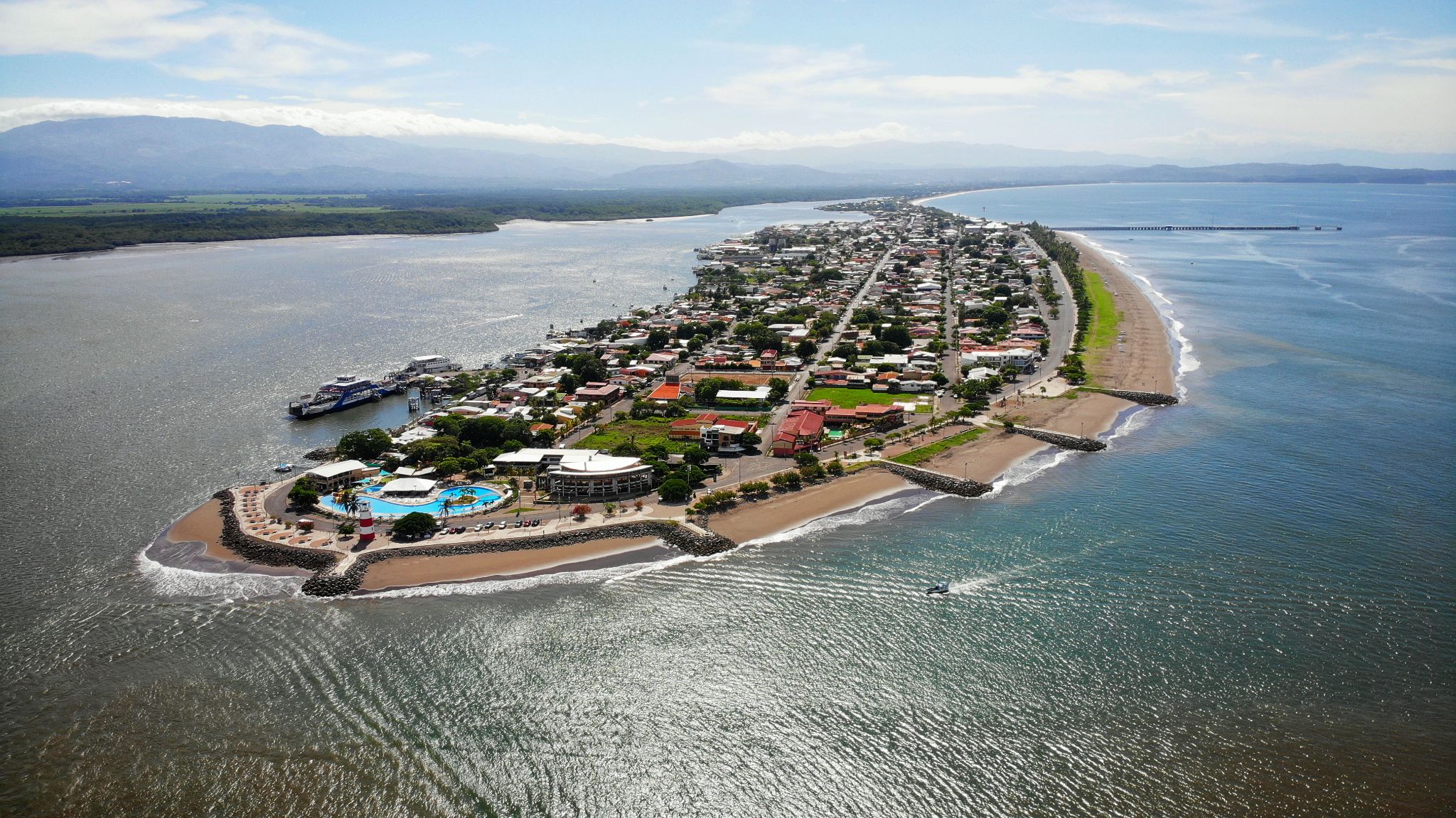
| 52 | 26.02 czw. | Puntarenas / Costa Rica | 09:00 | 18:00 |
| 53 | 27.02 pt. | Cruz del Sur / Peru | 07:00 | 16:00 |
| 54 | 28.02 sob. | Acajutla / Salvador | 08:00 | 16:00 |
| 55 | 1.03 niedz. | Dzień na morzu / Morze | ||
| 56 | 2.03 pon. | Acapulco / Meksyk | 07:00 | 16:00 |
| 57 | 3.03 wt. | Dzień na morzu / Morze | ||
| 58 | 4.03 śr. | Cabo San Lucas / Meksyk | 07:00 | 18:00 |
| 59 | 5.03 czw. | Dzień na morzu / Morze | ||
| 60 | 6.03 pt. | Ensenada / Meksyk | 10:00 | 18:00 |
| 61 | 7.03 sob. | San Diego, Kalifornia / USA | 06:00 | 18:00 |
-
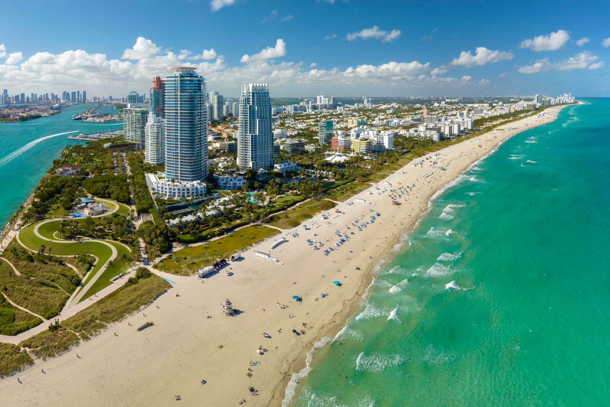 Dzień 1: 07:00-18:00
Miami / USA
Miami, officially the City of Miami, is the cultural, economic and financial center of South Florida. Miami is the seat of Miami-Dade County, the most populous county in Florida. The city covers an area of about 56.6 square miles (147 km2), between the Everglades to the west and Biscayne Bay on the east; with a 2017 estimated population of 463,347, Miami is the sixth most densely populated major city in the United States. The Miami metropolitan area is home to 6.1 million people and the seventh-largest metropolitan area in the nation. Miami's metro area is the second-most populous metropolis in the southeastern United States and fourth-largest urban area in the U.S.
Miami is a major center, and a leader in finance, commerce, culture, media, entertainment, the arts, and international trade. The Miami Metropolitan Area is by far the largest urban economy in Florida and the 12th largest in the United States with a GDP of $344.9 billion as of 2017. In 2012, Miami was classified as an "Alpha−" level world city in the World Cities Study Group's inventory. In 2010, Miami ranked seventh in the United States and 33rd among global cities in terms of business activity, human capital, information exchange, cultural experience, and political engagement. In 2008, Forbes magazine ranked Miami "America's Cleanest City", for its year-round good air quality, vast green spaces, clean drinking water, clean streets, and citywide recycling programs. According to a 2009 UBS study of 73 world cities, Miami was ranked as the richest city in the United States, and the world's seventh-richest city in terms of purchasing power. Miami is nicknamed the "Capital of Latin America" and is the largest city with a Cuban-American plurality.
Greater Downtown Miami has one of the largest concentrations of international banks in the United States, and is home to many large national and international companies. The Civic Center is a major center for hospitals, research institutes, medical centers, and biotechnology industries. For more than two decades, the Port of Miami, known as the "Cruise Capital of the World", has been the number one cruise passenger port in the world. It accommodates some of the world's largest cruise ships and operations, and is the busiest port in both passenger traffic and cruise lines. Metropolitan Miami is also a major tourism hub in the southeastern U.S. for international visitors, ranking number two in the country after New York City.
-
 Dzień 2:
Dzień na morzu / Morze
-
Dzień 3:
Dzień na morzu / Morze
-
 Dzień 4: 09:00-17:00
Gustavia / Saint Bartholomew Island
-
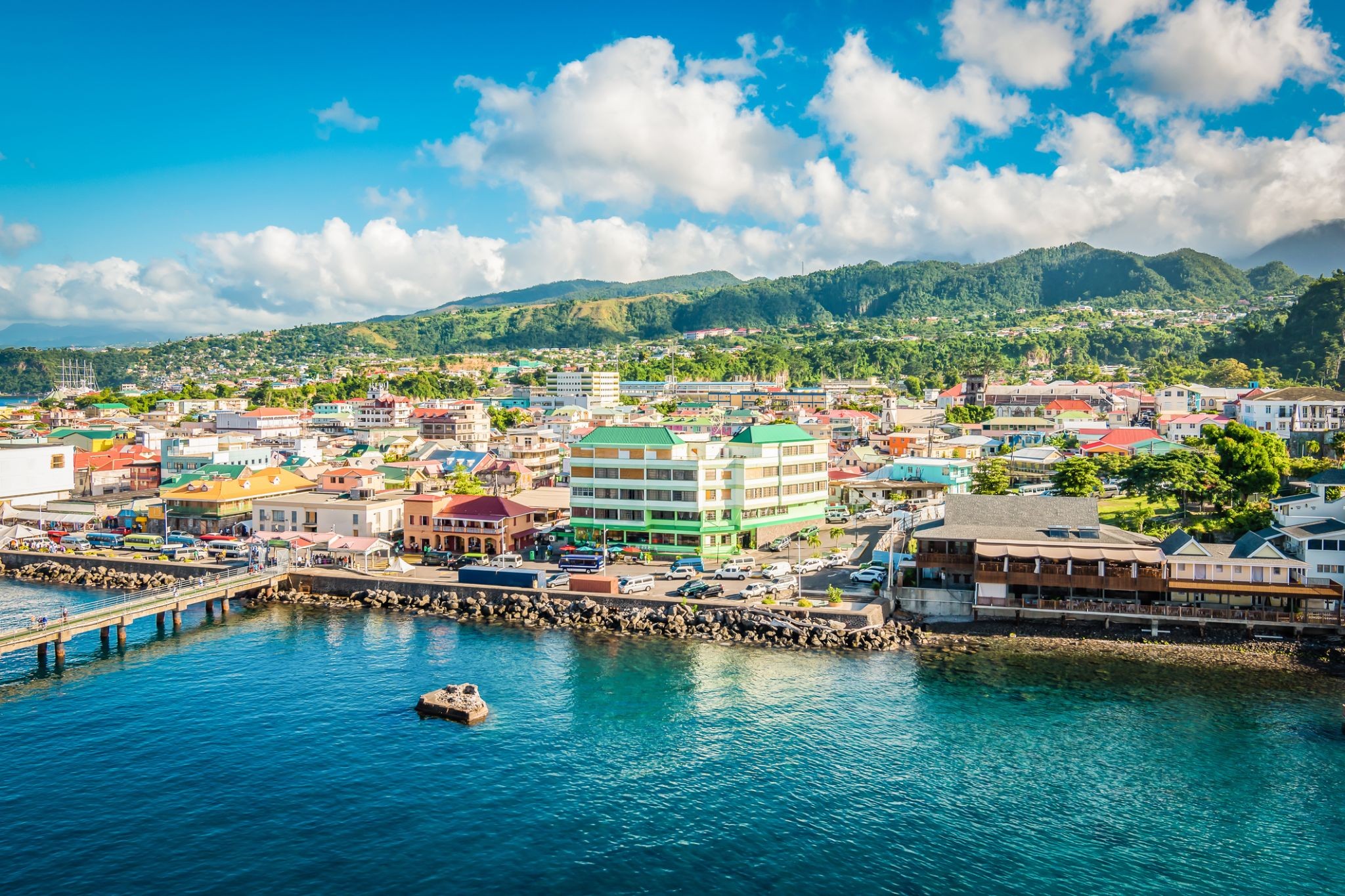
 Dzień 5: 07:00-17:00
Róża / Dominica
Dominica, officially the Commonwealth of Dominica, is an island country in the West Indies. The capital, Roseau, is located on the western side of the island. It is part of the Windward Islands in the Lesser Antilles archipelago in the Caribbean Sea. The island is located near Guadeloupe to the northwest and Martinique to the south-southeast. Its area is 750 km2 (290 sq mi), and the highest point is Morne Diablotins, at 1,447 m (4,747 ft) in elevation. The population was 71,293 at the 2011 census. The Commonwealth of Dominica is one of the Caribbean's few republics.
The island was originally inhabited by the Kalinago and later colonised by Europeans, predominantly by the French from the 1690s to 1763. Columbus is said to have passed the island on Sunday 3 November 1493, and the island's name is derived from the Latin for "Sunday". Great Britain took possession in 1763 after the Seven Years' War, and it gradually established English as its official language. The island republic gained independence in 1978.
Its name is pronounced with emphasis on the third syllable, related to its French name of Dominique. Dominica has been nicknamed the "Nature Isle of the Caribbean" for its natural environment. It is the youngest island in the Lesser Antilles, and in fact it is still being formed by geothermal-volcanic activity, as evidenced by the world's second-largest hot spring, called Boiling Lake. The island has lush mountainous rainforests, and it is the home of many rare plants, animals, and bird species. There are xeric areas in some of the western coastal regions, but heavy rainfall occurs inland. The Sisserou parrot, also known as the imperial amazon and found only on Dominica, is the island's national bird and featured on the national flag, which is one of only two national flags containing the color purple.
-
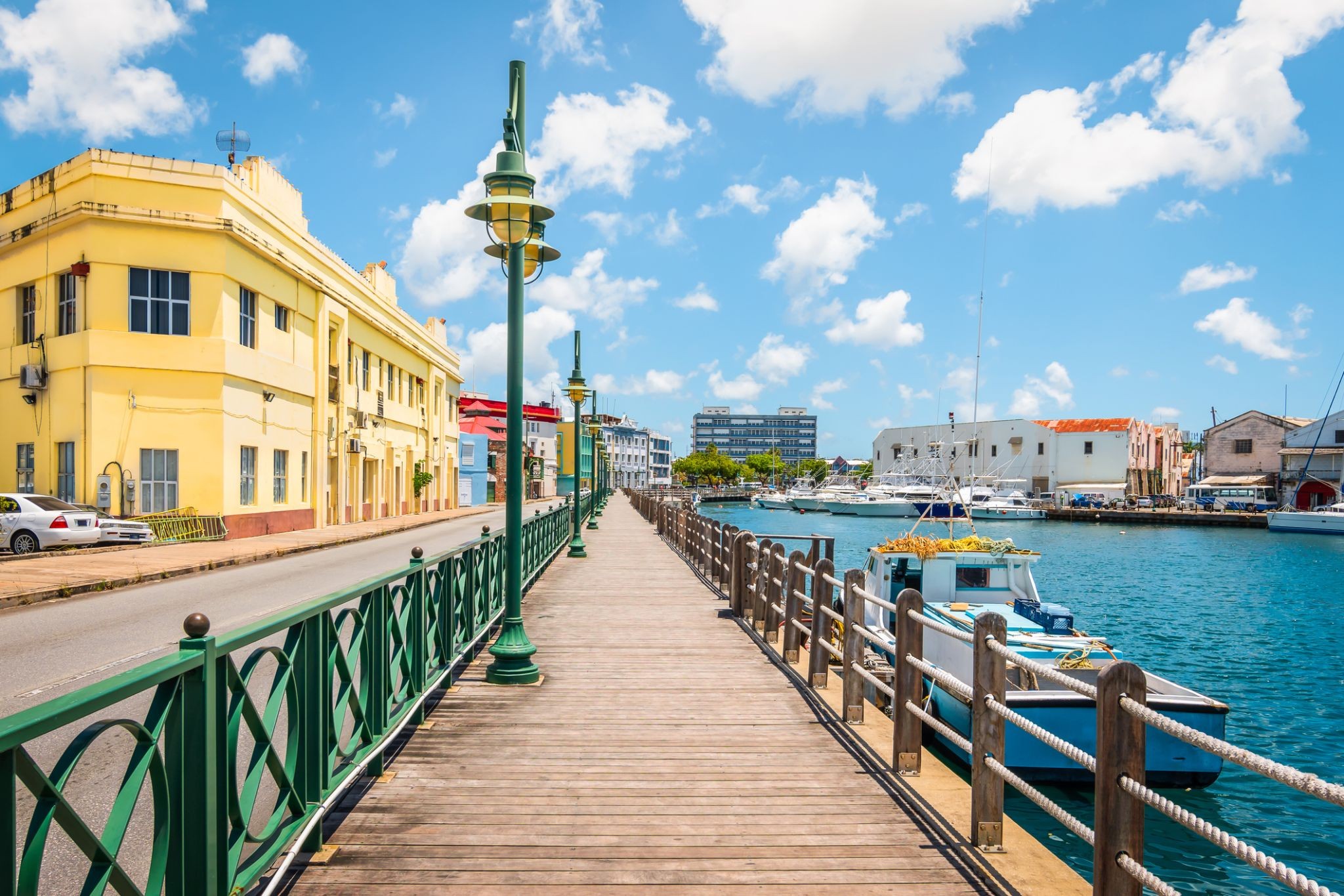
 Dzień 6: 07:00-17:00
Bridgetown / Barbados
Bridgetown to stolica i największe miasto Barbadosu. Dawniej znane jako „Miasto św. Michała” (The Town of Saint Michael), obszar Greater Bridgetown znajduje się w parafii św. Michała. Miejscowi czasami nazywają je „Miastem” (The City), ale najczęściej po prostu „Town”. W 2014 roku populacja aglomeracji wynosiła około 110 000 mieszkańców.
Port Bridgetown znajduje się w zatoce Carlisle (13.106°N 59.632°W) na południowo-zachodnim wybrzeżu wyspy. Części obszaru Greater Bridgetown, ogólnie zdefiniowane przez obwodnicę (ABC Highway), leżą blisko granic sąsiednich parafii Christ Church i St. James. Międzynarodowe lotnisko Grantley Adams znajduje się 16 kilometrów na południowy wschód od centrum Bridgetown i oferuje codzienne loty do głównych miast Wielkiej Brytanii, USA, Kanady i Karaibów. Obecnie nie ma już lokalnych władz miejskich; Bridgetown jest okręgiem wyborczym w parlamencie krajowym. W latach 50. i 60. XX wieku, podczas istnienia Federacji Brytyjskich Terytoriów Indyjskich, Bridgetown było jednym z trzech miast rozważanych jako możliwa stolica federacji.
Obecna lokalizacja miasta została założona przez angielskich osadników w 1628 roku; wcześniejsza osada pod nadzorem Sir Williama Courtena znajdowała się w St. James Town. Bridgetown jest ważnym celem turystycznym na Karaibach, a także znaczącym centrum finansowym, informatycznym, konferencyjnym i portem dla statków wycieczkowych. 25 czerwca 2011 roku „Historyczne Bridgetown i jego garnizon” zostały wpisane na listę światowego dziedzictwa UNESCO.
-
Dzień 7:
Dzień na morzu / Morze
-
Dzień 8: 10:00-17:00
Devil’s Point / Bahamy
-
Dzień 9:
Dzień na morzu / Morze
-
Dzień 10: 08:00-16:00
Belen / Brazylia
-
Dzień 11:
Dzień na morzu / Morze
-
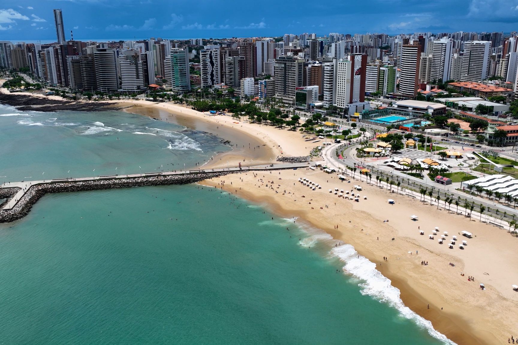
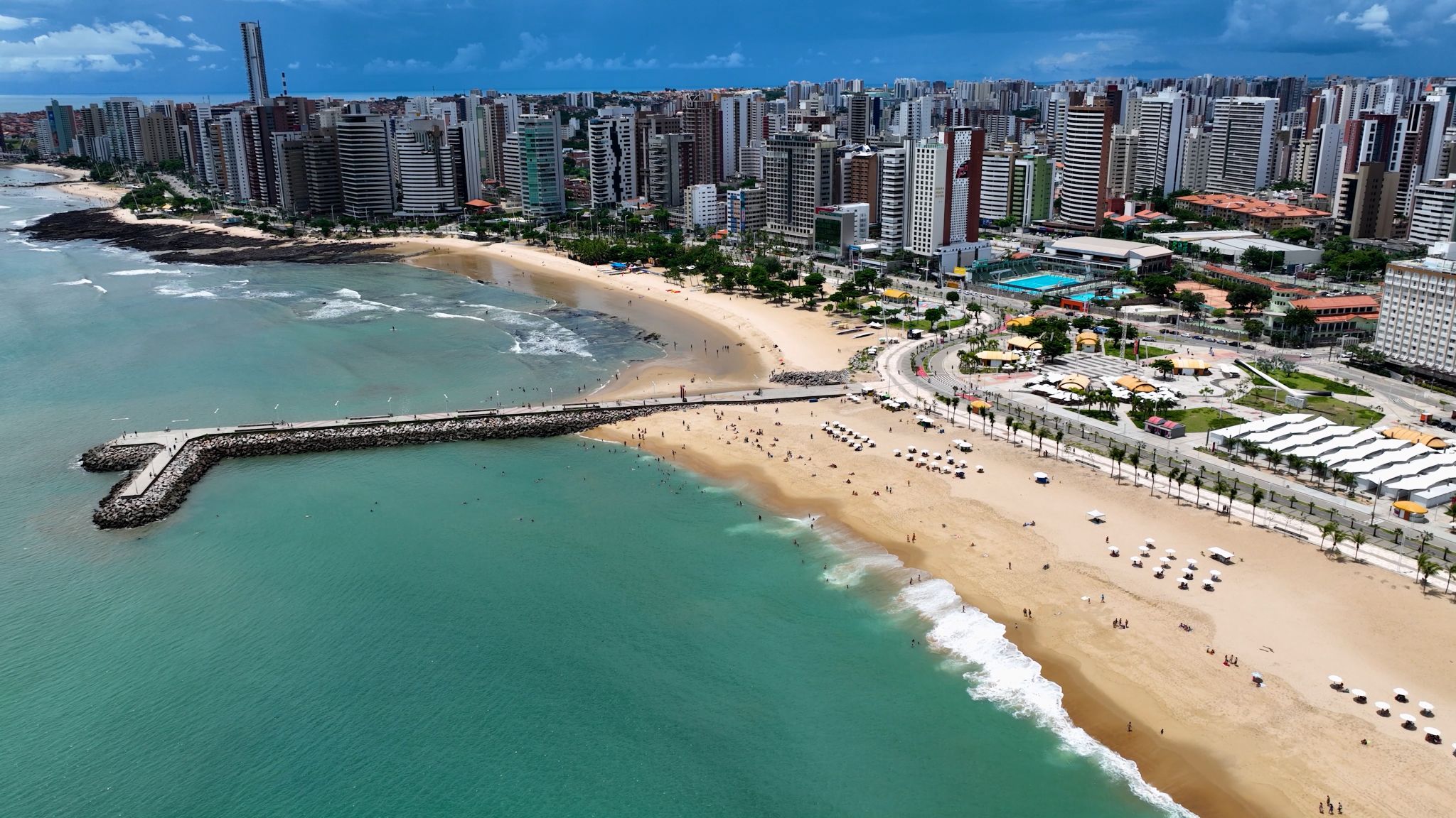 Dzień 12: 11:00-20:00
Fortaleza / Brazylia
Fortaleza is the capital of the state of Ceará, which is located in the northeast of Brazil. Translated from Portuguese, "Fortaleza" means "fortress." As the fifth-largest city in Brazil, it is also considered one of the most important cities in the region. Visiting Fortaleza, you can admire many famous buildings, such as the José de Alencar Theater, the Fortaleza Cathedral, the Palácio da Luz, and many other fascinating places. Like all cities in Brazil, Fortaleza delights its guests with a special energy and cheerfulness.
-
Dzień 13:
Dzień na morzu / Morze
-
Dzień 14:
Dzień na morzu / Morze
-
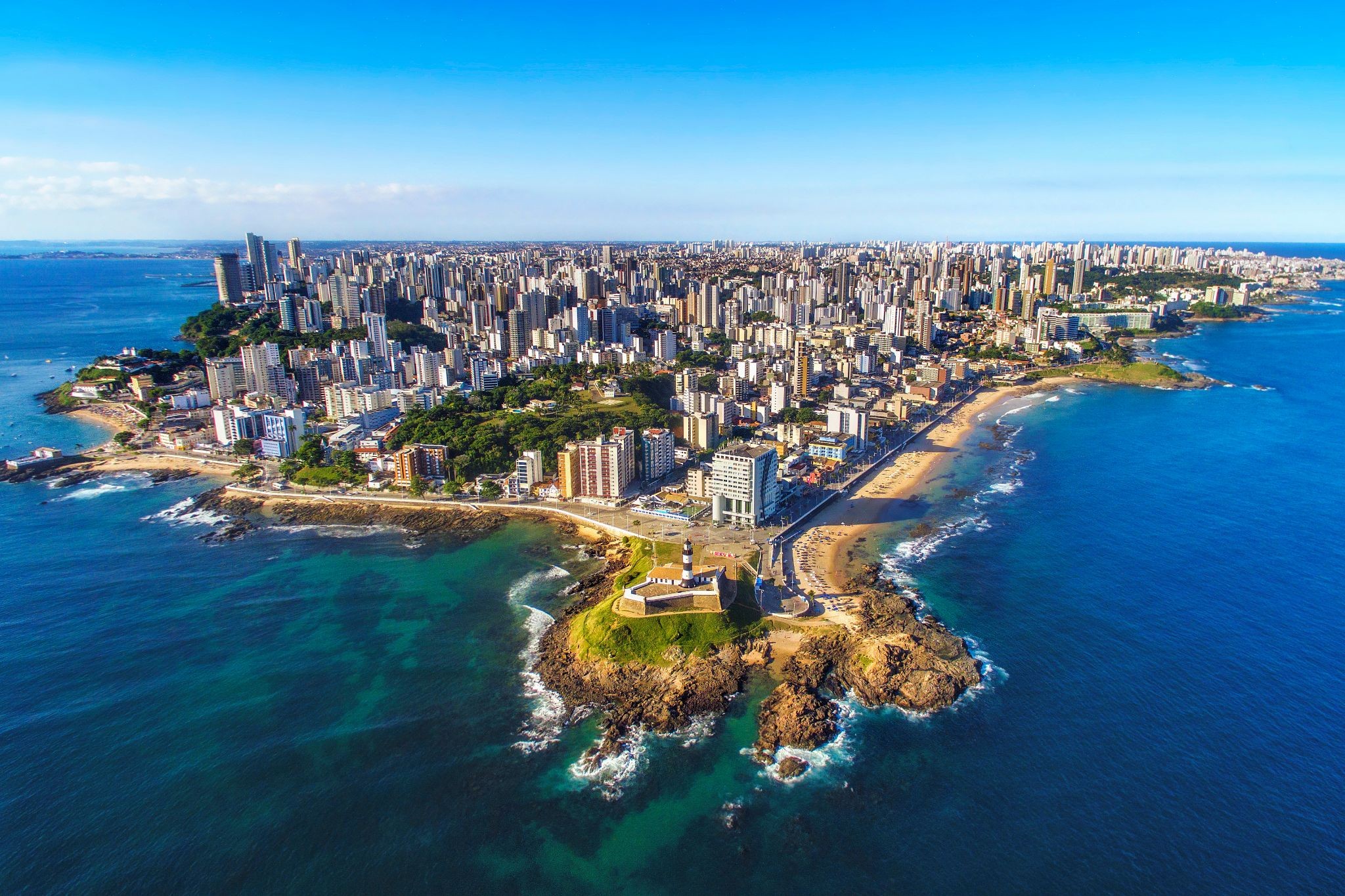
 Dzień 15: 07:00-18:00
Salwador / Brazylia
Salvador is the capital of Bahia state and was formerly the first capital of Brazil. Salvador is known for its endless number of churches, as well as for being a land of majestic fortresses. After visiting these places, it is also worth taking a look at the Chapada Diamantina National Park – the most interesting natural park in Brazil. In Salvador, there reigns an atmosphere of joy, revelry, and holidays – this is due to the fact that the local population was influenced by Africa. In Salvador, you can always admire the natural beauty of this area. You will be enchanted by the sensuality of this land, and you will be able to discover a piece of its mysterious power.
-
Dzień 16:
Dzień na morzu / Morze
-
Dzień 17: 10:00-19:00
Armacao dos Buzios / Brazylia
Armação dos Búzios, często nazywane po prostu Búzios, to nadmorskie miasteczko i gmina w stanie Rio de Janeiro w Brazylii. W 2012 roku liczyło 23 463 mieszkańców i zajmowało powierzchnię 69 km². Dziś Búzios jest popularnym miejscem wypoczynku, szczególnie wśród Brazylijczyków i Argentyńczyków.
Na początku XX wieku Búzios było niemal nieznaną wioską rybacką. Pozostało takie aż do 1964 roku, kiedy to francuska aktorka Brigitte Bardot odwiedziła Búzios. Od tego czasu miejsce to stało się popularne wśród wyższych sfer Rio de Janeiro, pragnących uciec od miejskiego zgiełku i cieszyć się ponad 23 plażami, które oferuje półwysep. Miasto rozwinęło się w międzynarodowy cel turystyczny.
Dziś półwysep oferuje spokój, bezpośredni kontakt z naturą i malownicze widoki. Plaże po zachodniej stronie oferują spokojne, przejrzyste wody, podczas gdy te po wschodniej stronie, zwrócone ku otwartemu morzu, są bardziej dzikie i przyciągają surferów oraz entuzjastów sportów wodnych. Azeda, Ferradura, João Fernandes i Armação to jedne z najpopularniejszych plaż w mieście. Wieczorem główna ulica Búzios, Rua das Pedras, oferuje aktywne życie nocne oraz szeroki wybór sklepów i restauracji.
-
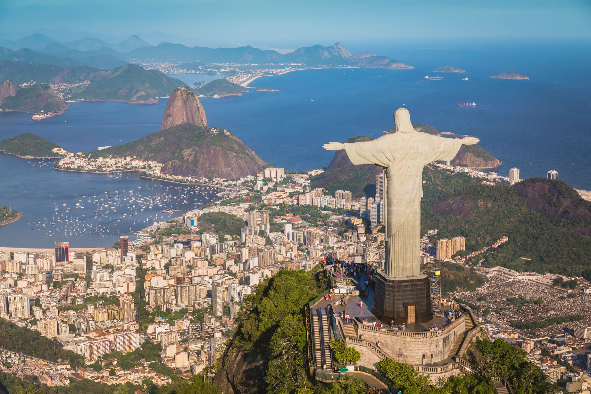 Dzień 18: 08:00
Rio de Janeiro / Brazylia
Rio de Janeiro is the second-most populous municipality in Brazil and the sixth-most populous in the Americas. The metropolis is anchor to the Rio de Janeiro metropolitan area, the second-most populous metropolitan area in Brazil and sixth-most populous in the Americas. Rio de Janeiro is the capital of the state of Rio de Janeiro, Brazil's third-most populous state. Part of the city has been designated as a World Heritage Site, named "Rio de Janeiro: CariocaLandscapes between the Mountain and the Sea", by UNESCO on 1 July 2012 as a Cultural Landscape.
Founded in 1565 by the Portuguese, the city was initially the seat of the Captaincy of Rio de Janeiro, a domain of the Portuguese Empire. Later, in 1763, it became the capital of the State of Brazil, a state of the Portuguese Empire. In 1808, when the Portuguese Royal Court transferred itself from Portugal to Brazil, Rio de Janeiro became the chosen seat of the court of Queen Maria I of Portugal, who subsequently, in 1815, under the leadership of her son, the Prince Regent, and future King João VI of Portugal, raised Brazil to the dignity of a kingdom, within the United Kingdom of Portugal, Brazil, and Algarves. Rio stayed the capital of the pluricontinental Lusitanian monarchy until 1822, when the War of Brazilian Independence began. This is one of the few instances in history that the capital of a colonising country officially shifted to a city in one of its colonies. Rio de Janeiro subsequently served as the capital of the independent monarchy, the Empire of Brazil, until 1889, and then the capital of a republican Brazil until 1960 when the capital was transferred to Brasília.
-
Dzień 19:
Rio de Janeiro / Brazylia
Rio de Janeiro is the second-most populous municipality in Brazil and the sixth-most populous in the Americas. The metropolis is anchor to the Rio de Janeiro metropolitan area, the second-most populous metropolitan area in Brazil and sixth-most populous in the Americas. Rio de Janeiro is the capital of the state of Rio de Janeiro, Brazil's third-most populous state. Part of the city has been designated as a World Heritage Site, named "Rio de Janeiro: CariocaLandscapes between the Mountain and the Sea", by UNESCO on 1 July 2012 as a Cultural Landscape.
Founded in 1565 by the Portuguese, the city was initially the seat of the Captaincy of Rio de Janeiro, a domain of the Portuguese Empire. Later, in 1763, it became the capital of the State of Brazil, a state of the Portuguese Empire. In 1808, when the Portuguese Royal Court transferred itself from Portugal to Brazil, Rio de Janeiro became the chosen seat of the court of Queen Maria I of Portugal, who subsequently, in 1815, under the leadership of her son, the Prince Regent, and future King João VI of Portugal, raised Brazil to the dignity of a kingdom, within the United Kingdom of Portugal, Brazil, and Algarves. Rio stayed the capital of the pluricontinental Lusitanian monarchy until 1822, when the War of Brazilian Independence began. This is one of the few instances in history that the capital of a colonising country officially shifted to a city in one of its colonies. Rio de Janeiro subsequently served as the capital of the independent monarchy, the Empire of Brazil, until 1889, and then the capital of a republican Brazil until 1960 when the capital was transferred to Brasília.
-
Dzień 20: 18:00
Rio de Janeiro / Brazylia
Rio de Janeiro is the second-most populous municipality in Brazil and the sixth-most populous in the Americas. The metropolis is anchor to the Rio de Janeiro metropolitan area, the second-most populous metropolitan area in Brazil and sixth-most populous in the Americas. Rio de Janeiro is the capital of the state of Rio de Janeiro, Brazil's third-most populous state. Part of the city has been designated as a World Heritage Site, named "Rio de Janeiro: CariocaLandscapes between the Mountain and the Sea", by UNESCO on 1 July 2012 as a Cultural Landscape.
Founded in 1565 by the Portuguese, the city was initially the seat of the Captaincy of Rio de Janeiro, a domain of the Portuguese Empire. Later, in 1763, it became the capital of the State of Brazil, a state of the Portuguese Empire. In 1808, when the Portuguese Royal Court transferred itself from Portugal to Brazil, Rio de Janeiro became the chosen seat of the court of Queen Maria I of Portugal, who subsequently, in 1815, under the leadership of her son, the Prince Regent, and future King João VI of Portugal, raised Brazil to the dignity of a kingdom, within the United Kingdom of Portugal, Brazil, and Algarves. Rio stayed the capital of the pluricontinental Lusitanian monarchy until 1822, when the War of Brazilian Independence began. This is one of the few instances in history that the capital of a colonising country officially shifted to a city in one of its colonies. Rio de Janeiro subsequently served as the capital of the independent monarchy, the Empire of Brazil, until 1889, and then the capital of a republican Brazil until 1960 when the capital was transferred to Brasília.
-
Dzień 21: 07:00-18:00
Wielka Wyspa Ilha Grande / Brazylia
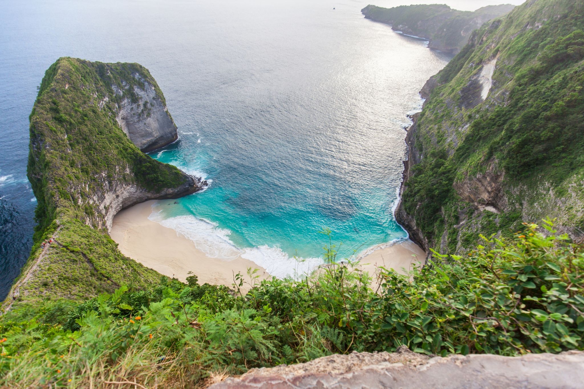
Wśród szmaragdowych fal u wybrzeży Brazylii kryje się Ilha Grande, która zachwyca dziką naturą i prawdziwym duchem przygody. Ta wyspa w stanie Rio de Janeiro niegdyś pełniła funkcję więzienia i kolonii dla trędowatych, a dziś jest idealnym miejscem dla tych, którzy chcą uciec od miejskiego zgiełku. Nie ma tu samochodów – zamiast dróg są ścieżki prowadzące przez dżunglę do plaż z białym piaskiem, krystalicznych lagun i wodospadów ukrytych w tropikalnym lesie.
Podróżni mogą odkrywać ponad 100 plaż, w tym słynną Lopes Mendes – uznawaną za jedną z najpiękniejszych na świecie. Rejsy do opuszczonych więzień, nurkowanie przy wrakach statków oraz wędrówki przez lasy Atlantyckie oferują niezliczone możliwości aktywnego wypoczynku. Ilha Grande to nie tylko kurort, ale żywe muzeum przyrody i historii, gdzie każdy krok przynosi coś nowego.
-
 Dzień 22: 07:00-18:00
Santos / Brazylia
-
Dzień 23: 09:00-18:00
Porto Belo / Brazylia
-
Dzień 24:
Dzień na morzu / Morze
-
Dzień 25: 07:00-16:00
Rio Grande - Rio Grande do Sul / Brazylia
-
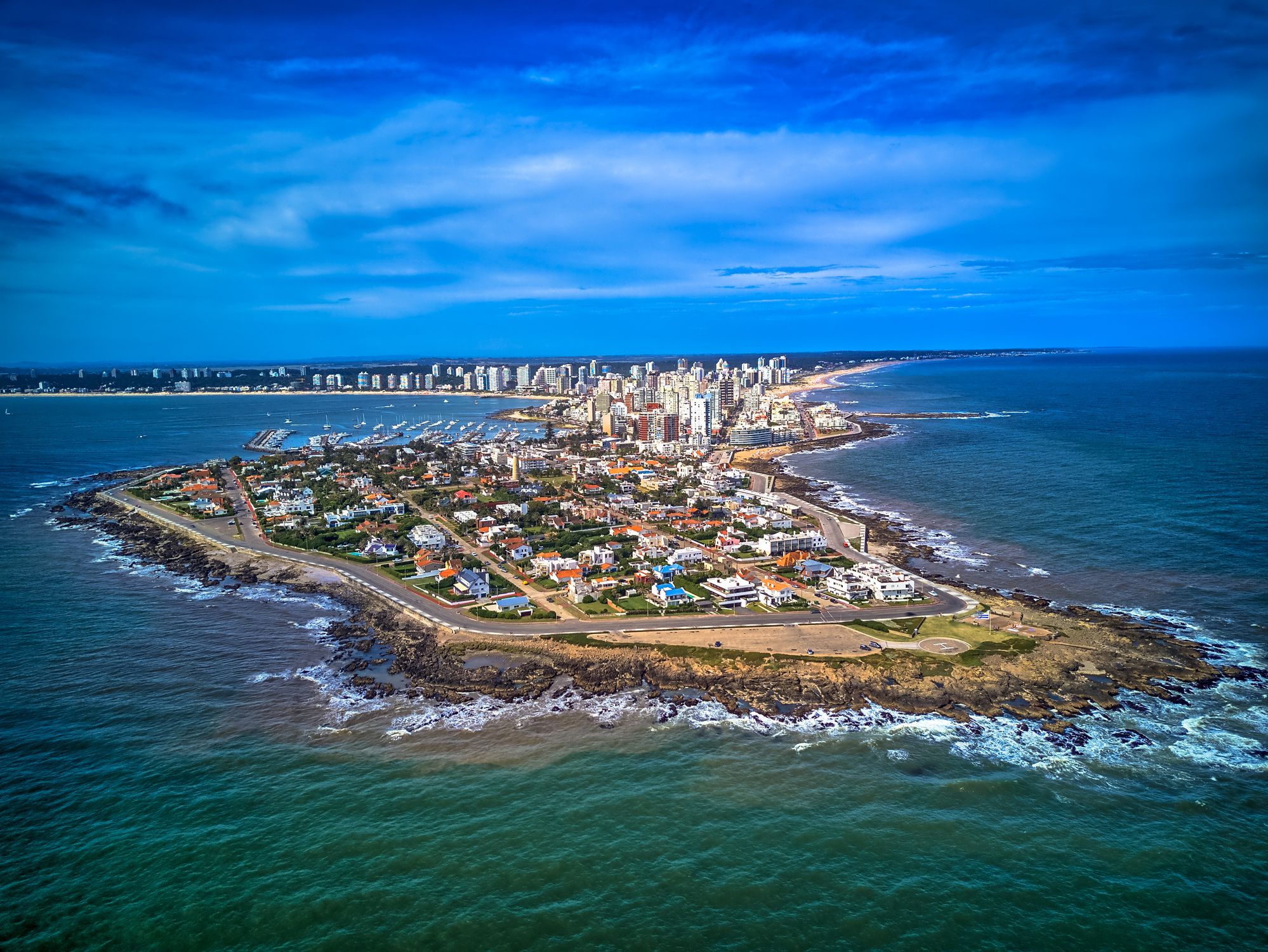 Dzień 26: 08:00-18:00
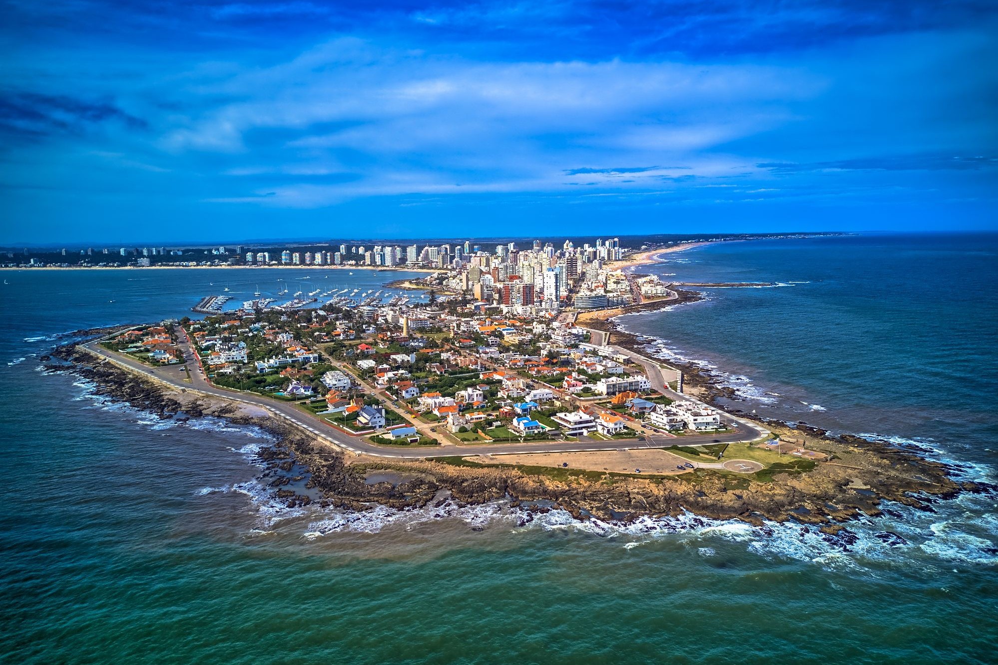
Punta del Este / Uruguay
Punta del Este — urugwajski kurort nad Atlantykiem
Punta del Este to jeden z najsłynniejszych kurortów Ameryki Południowej, położony na południowym wybrzeżu Urugwaju, gdzie spotykają się wody Oceanu Atlantyckiego i estuarium La Platy. Miasto słynie z kontrastów — luksusowe dzielnice z nowoczesnymi wieżowcami, jachtami i wykwintnymi restauracjami sąsiadują z cichymi, piaszczystymi plażami, malowniczymi wydmami i falami idealnymi do surfowania. Nazywane jest „Monako Ameryki Południowej” ze względu na swoją luksusową infrastrukturę i popularność wśród międzynarodowych celebrytów.
Poza plażami, Punta del Este oferuje wiele atrakcji kulturalnych i przyrodniczych: rzeźba „La Mano”, która stała się symbolem miasta, muzeum sztuki współczesnej Ralli oraz pobliskie wyspy z fokami. Warto też odwiedzić artystyczną dzielnicę La Barra lub podziwiać zachód słońca przy latarni morskiej. W sezonie letnim (grudzień–luty) miasto tętni życiem, przyciągając turystów z całego świata szukających słońca, komfortu i dynamicznego życia nocnego.
-
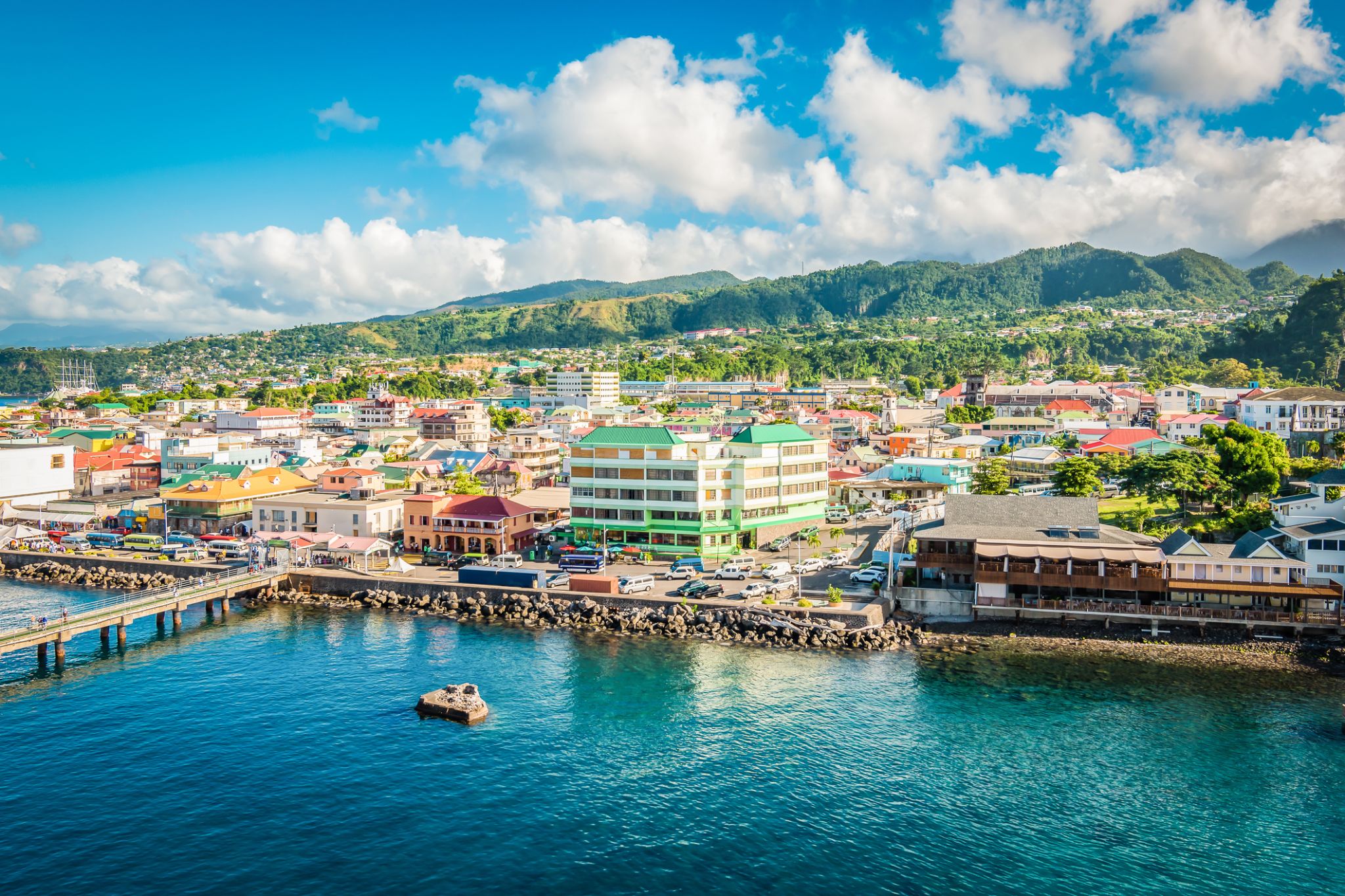
 Dzień 27: 07:00-20:00
Montevideo / Uruguay
Montevideo is the capital and largest city of Uruguay. According to the 2011 census, the city proper has a population of 1,319,108 (about one-third of the country's total population) in an area of 201 square kilometres (78 sq mi). The southernmost capital city in the Americas, Montevideo is situated on the southern coast of the country, on the northeastern bank of the Río de la Plata.
The city was established in 1724 by a Spanish soldier, Bruno Mauricio de Zabala, as a strategic move amidst the Spanish-Portuguese dispute over the platine region. It was also under brief British rule in 1807. Montevideo is the seat of the administrative headquarters of Mercosur and ALADI, Latin America’s leading trade blocs, a position that entailed comparisons to the role of Brussels in Europe.
-
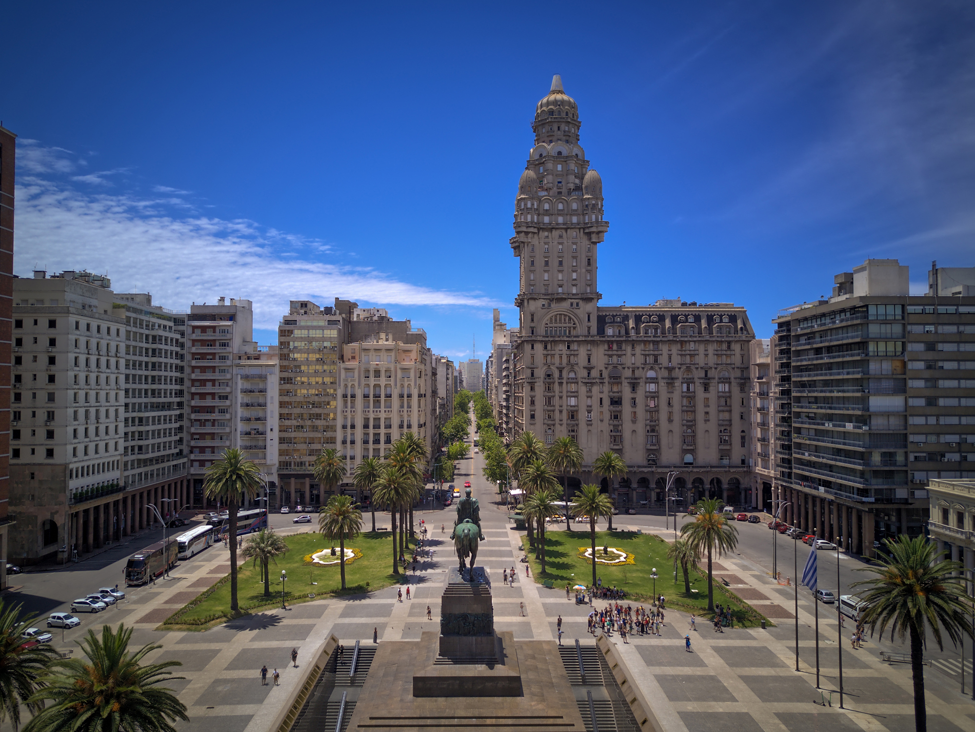
 Dzień 28: 08:00
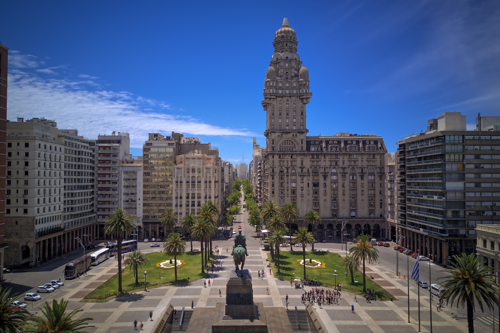
Buenos Aires / Argentyna
the capital city and chief port of Argentina, in the eastern central part of the country, on the Plata River; population 3,042,600 (est. 2008).
-
Dzień 29: 18:00
Buenos Aires / Argentyna
the capital city and chief port of Argentina, in the eastern central part of the country, on the Plata River; population 3,042,600 (est. 2008).
-
Dzień 30: 07:00-18:00
Montevideo / Uruguay
Montevideo is the capital and largest city of Uruguay. According to the 2011 census, the city proper has a population of 1,319,108 (about one-third of the country's total population) in an area of 201 square kilometres (78 sq mi). The southernmost capital city in the Americas, Montevideo is situated on the southern coast of the country, on the northeastern bank of the Río de la Plata.
The city was established in 1724 by a Spanish soldier, Bruno Mauricio de Zabala, as a strategic move amidst the Spanish-Portuguese dispute over the platine region. It was also under brief British rule in 1807. Montevideo is the seat of the administrative headquarters of Mercosur and ALADI, Latin America’s leading trade blocs, a position that entailed comparisons to the role of Brussels in Europe.
-
Dzień 31:
Dzień na morzu / Morze
-
Dzień 32:
Dzień na morzu / Morze
-
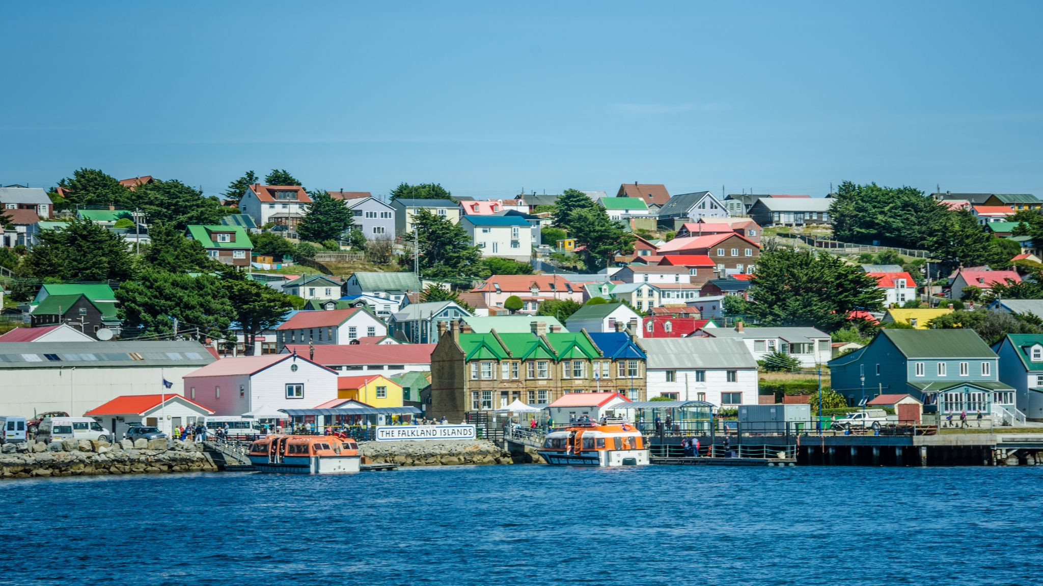 Dzień 33: 07:00-18:00
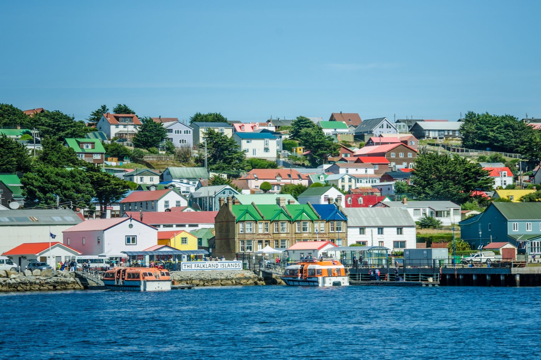
Port Stanley, Falklandy / Falkland islands
Stanley is the capital of the Falkland Islands. It is located on the island of East Falkland, on a north-facing slope in one of the wettest parts of the islands. At the 2016 census, the town had a population of 2,460 the entire population of the Falkland Islands was 3,398 on Census Day on 9 October 2016
Stanley is represented by five members of the Legislative Assembly of the Falkland Islands, currently Stacy Bragger, Barry Elsby, Mark Pollard, Roger Spink and Leona Vidal Roberts.
Stanley is the main shopping centre on the islands and the hub of East Falkland's road network. Attractions include the Falkland Islands Museum, Government House – built in 1845 and home to the Governor of the Falkland Islands – and a golf course, as well as a whale-bone arch, a totem pole, several war memorials and the shipwrecks in its harbour. The Falkland Islands Company owns several shops. Stanley has four pubs, 11 hotels and guesthouses, three restaurants, a fish and chip shop and the main tourist office. There are three churches, including the Anglican Christ Church Cathedral, the southernmost Anglican cathedral in the world, and the Roman Catholic St. Mary's Church. A bomb disposal unit in the town is a legacy of the Falklands War.
The town hall serves as a post office, philatelic bureau, law court and dance hall. The police station also contains the islands' only prison, with a capacity of 13 in the cells.
The community centre includes a swimming pool (the only public one in the islands), a sports centre, library, and school. A grass football pitch is located by the community centre and hosts regular games.
Stanley Racecourse, located on the west side of Stanley, holds a two-day horse racing meeting every year on 26 and 27 December. The Christmas races have been held here for over 100 years.
Stanley Golf Course has an 18-hole course and a club house. It is also located to the west of Stanley.
King Edward VII Memorial Hospital is the islands' main hospital, with doctors' practice and surgery, radiology department, dental surgery and emergency facilities.
Several bus and taxi companies operate out of Stanley.
Stanley is also home to the Falkland Islands Radio Station (FIRS), the Stanley office of the British Antarctic Survey, and the office of the weekly Penguin News newspaper.
A nursery and garden centre is also here, in whose greenhouses some of the islands' vegetables are grown.
-
Dzień 34:
Dzień na morzu / Morze
-
 Dzień 35: 07:00-16:00
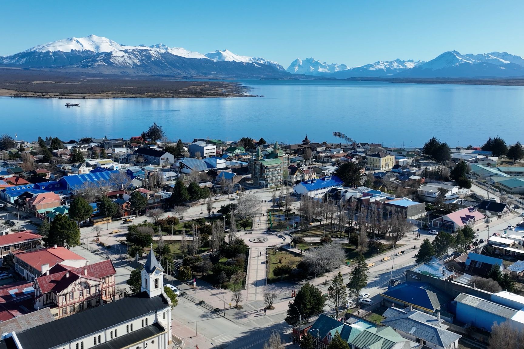
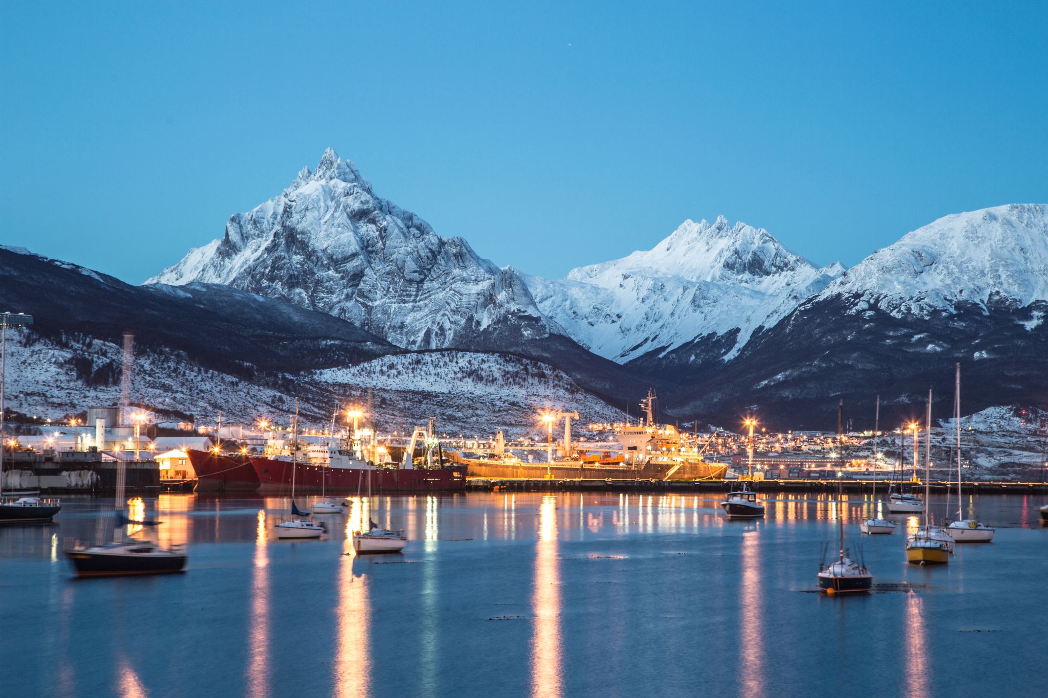
Ushuaia / Argentyna
Ushuaia is the capital of Tierra del Fuego, Antártida e Islas del Atlántico Sur Province, Argentina. It is commonly regarded as the southernmost city in the world. Ushuaia is located in a wide bay on the southern coast of Isla Grande de Tierra del Fuego, bounded on the north by the Martial mountain range, and on the south by the Beagle Channel. It is the only municipality in the Department of Ushuaia, which has an area of 9,390 km2 (3,625 sq mi). It was founded October 12 of 1884 by Augusto Lasserreand is located on the shores of the Beagle Channel surrounded by the mountain range of the Martial Glacier, in the Bay of Ushuaia. Besides being an administrative center, it is a light industrial port and tourist hub.
-
 Dzień 36: 09:00-18:00
Punta Arenas / Chile
-
Dzień 37:
Dzień na morzu / Morze
-
Dzień 38:
Dzień na morzu / Morze
-
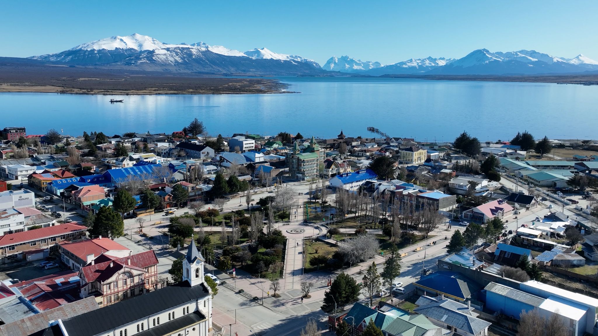
 Dzień 39: 08:00-16:00
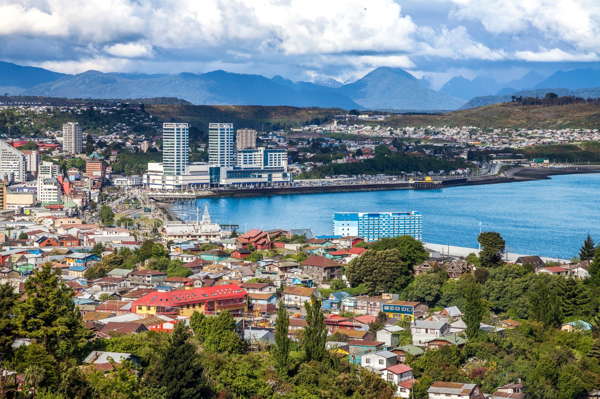
Puerto Montt / Chile
Puerto Montt is a port city and commune in southern Chile, located at the northern end of the Reloncaví Sound in the Llanquihue Province, Los Lagos Region, 1,055 km to the south of the capital, Santiago. The commune spans an area of 1,673 km2 (646 sq mi) and has a population of 245,902 in 2017. It is bounded by the communes of Puerto Varas to the north, Cochamó to the east and southeast, Calbuco to the southwest and Maullín and Los Muermos to the west.
Founded as late as 1853 during the German colonization of southern Chile, Puerto Montt soon outgrew older neighboring cities due to its strategic position at the southern end of the Chilean Central Valley being a gateway city into Chiloé Archipelago, Llanquihue and Nahuel Huapi lakes and Western Patagonia.
Puerto Montt has gained renown and grown significantly due to the rise of Chile as the second largest salmon producer of the world during the 1990s and 2000s. However, the Chilean salmon aquaculture crisis of the late 2000s resulted at least temporarily in severe unemployment and exposed weaknesses in the local economy. The city's cultural heritage mixes elements of Chiloé culture with German heritage although the city has attracted a significant number of newcomers from all over Chile in the last 30 years due to employment opportunities.
-
Dzień 40:
Dzień na morzu / Morze
-
Dzień 41: 08:00-17:00
Santiago de Chile
-
Dzień 42: 08:00-17:00
Coquimbo / Chile
Coquimbo is a port city, commune and capital of the Elqui Province, located on the Pan-American Highway, in the Coquimbo Region of Chile. Coquimbo is situated in a valley 10 km (6 mi) south of La Serena, with which it forms Greater La Serena with more than 400,000 inhabitants. The commune spans an area around the harbor of 1,429.3 km2 (552 sq mi). The average temperature in the city lies around 14 °C (57 °F), and precipitation is low.
-
Dzień 43:
Dzień na morzu / Morze
-
Dzień 44: 08:00-18:00
Iquique
-
Dzień 45:
Dzień na morzu / Morze
-
Dzień 46: 07:00-19:00
LINIE PISCO NAZCA
-
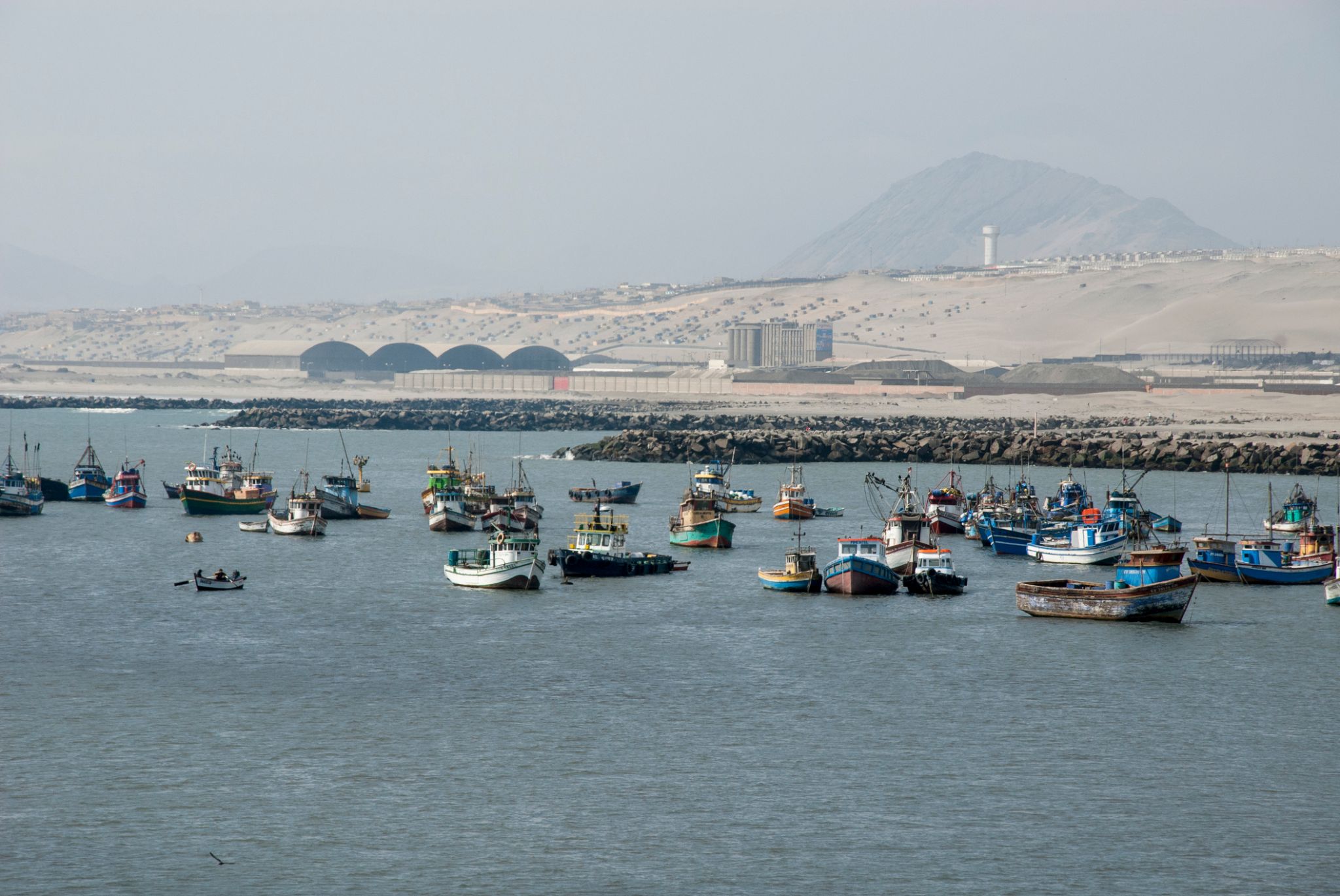
 Dzień 47: 06:00-17:00
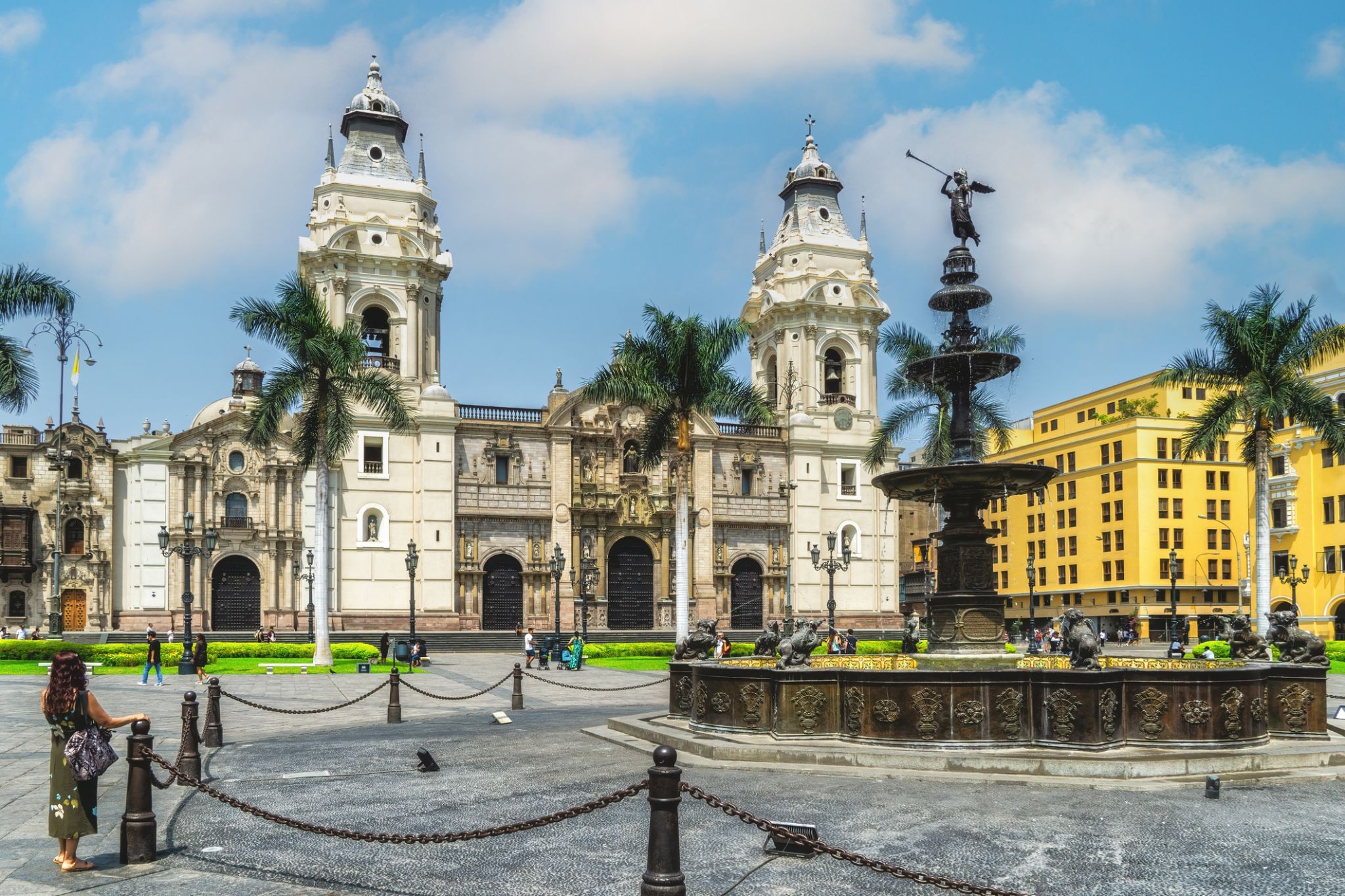
Lima / Peru
Lima jest stolicą i największym miastem Peru. Położona jest w dolinach rzek Chillón, Rímac i Lurín, w środkowej przybrzeżnej części kraju, z widokiem na Ocean Spokojny. Wraz z portem morskim Callao tworzy ciągły obszar miejski znany jako Obszar Metropolitalny Limy. Z populacją ponad 9 milionów mieszkańców, Lima jest najludniejszym obszarem metropolitalnym Peru i trzecim co do wielkości miastem w obu Amerykach (według definicji "samego miasta"), za São Paulo i Meksykiem.
Lima została założona przez hiszpańskiego konkwistadora Francisco Pizarro 18 stycznia 1535 roku jako Ciudad de los Reyes. Stała się stolicą i najważniejszym miastem Wicekrólestwa Peru. Po peruwiańskiej wojnie o niepodległość stała się stolicą Republiki Peru. Około jednej trzeciej ludności kraju mieszka w obszarze metropolitalnym.
-
 Dzień 48: 10:00-19:00
Salaverry / Peru
-
Dzień 49:
Dzień na morzu / Morze
-
 Dzień 50: 07:00-17:00
Manta / Ecuador
Manta
-
Dzień 51:
Dzień na morzu / Morze
-
 Dzień 52: 09:00-18:00
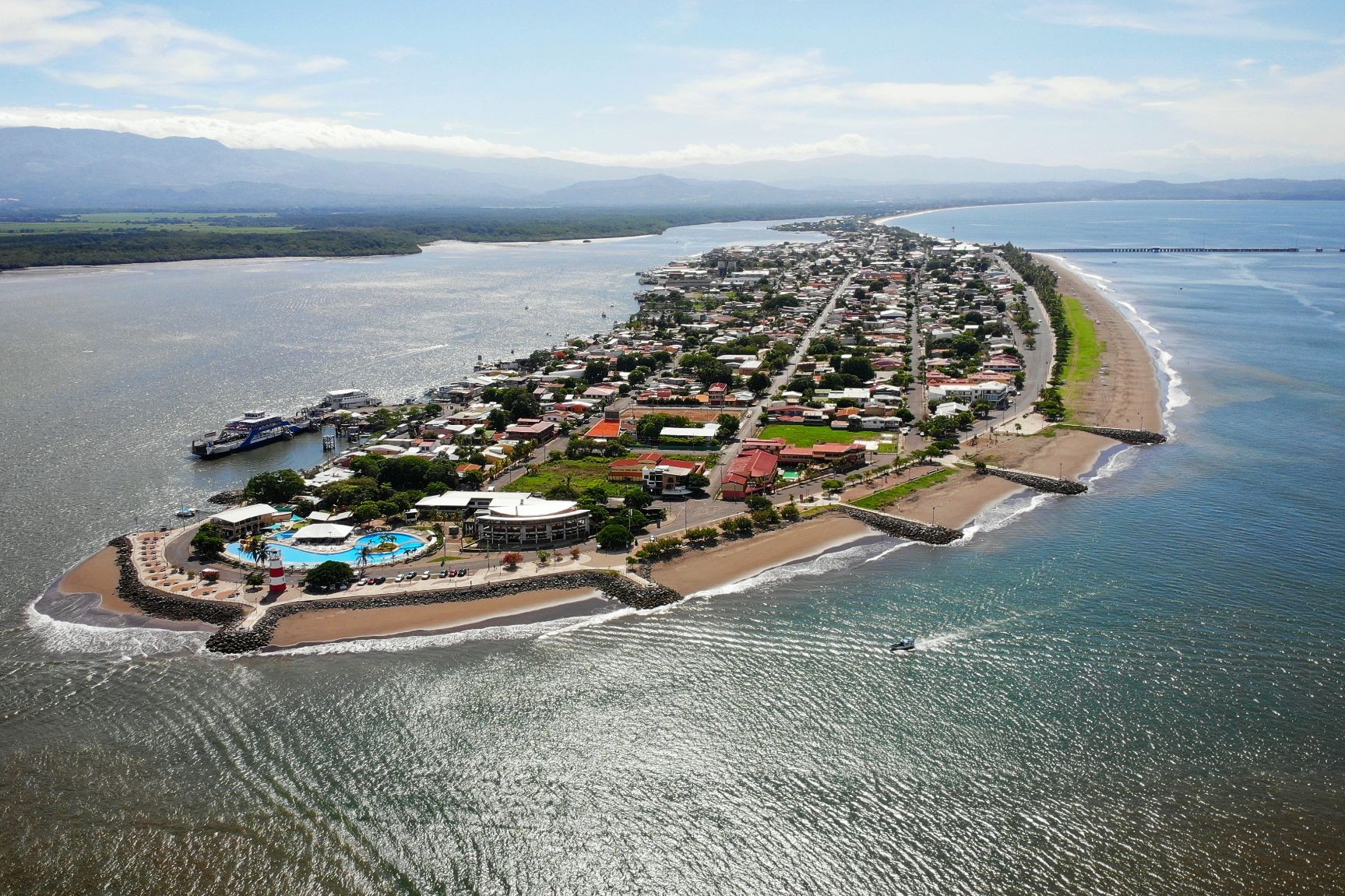
Puntarenas / Costa Rica
Puntarenas is the capital and largest city in the Province of Puntarenas, on the Pacific coast of Costa Rica.
-
Dzień 53: 07:00-16:00
Cruz del Sur / Peru
-
 Dzień 54: 08:00-16:00
Acajutla / Salvador
-
Dzień 55:
Dzień na morzu / Morze
-
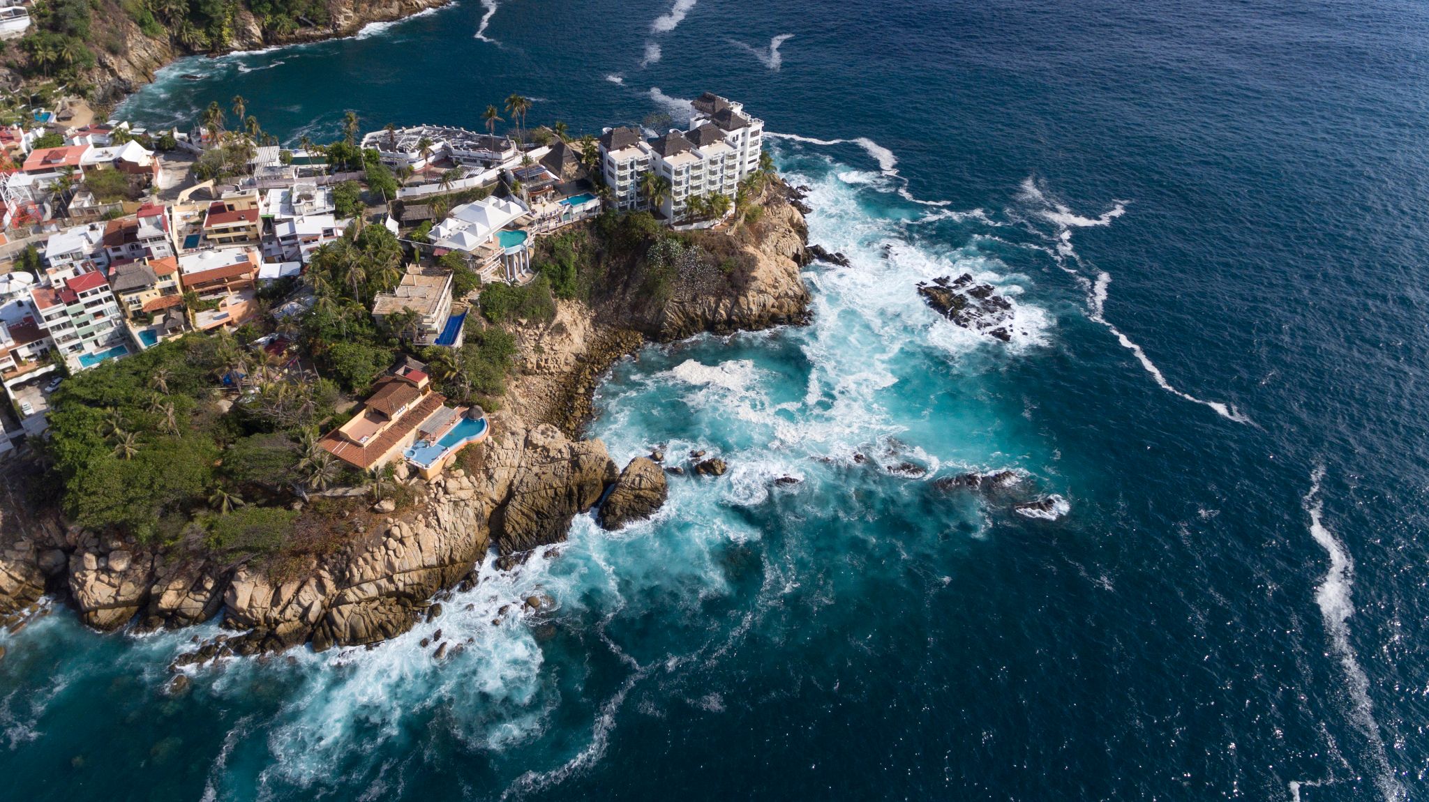 Dzień 56: 07:00-16:00
Acapulco / Meksyk
-
Dzień 57:
Dzień na morzu / Morze
-
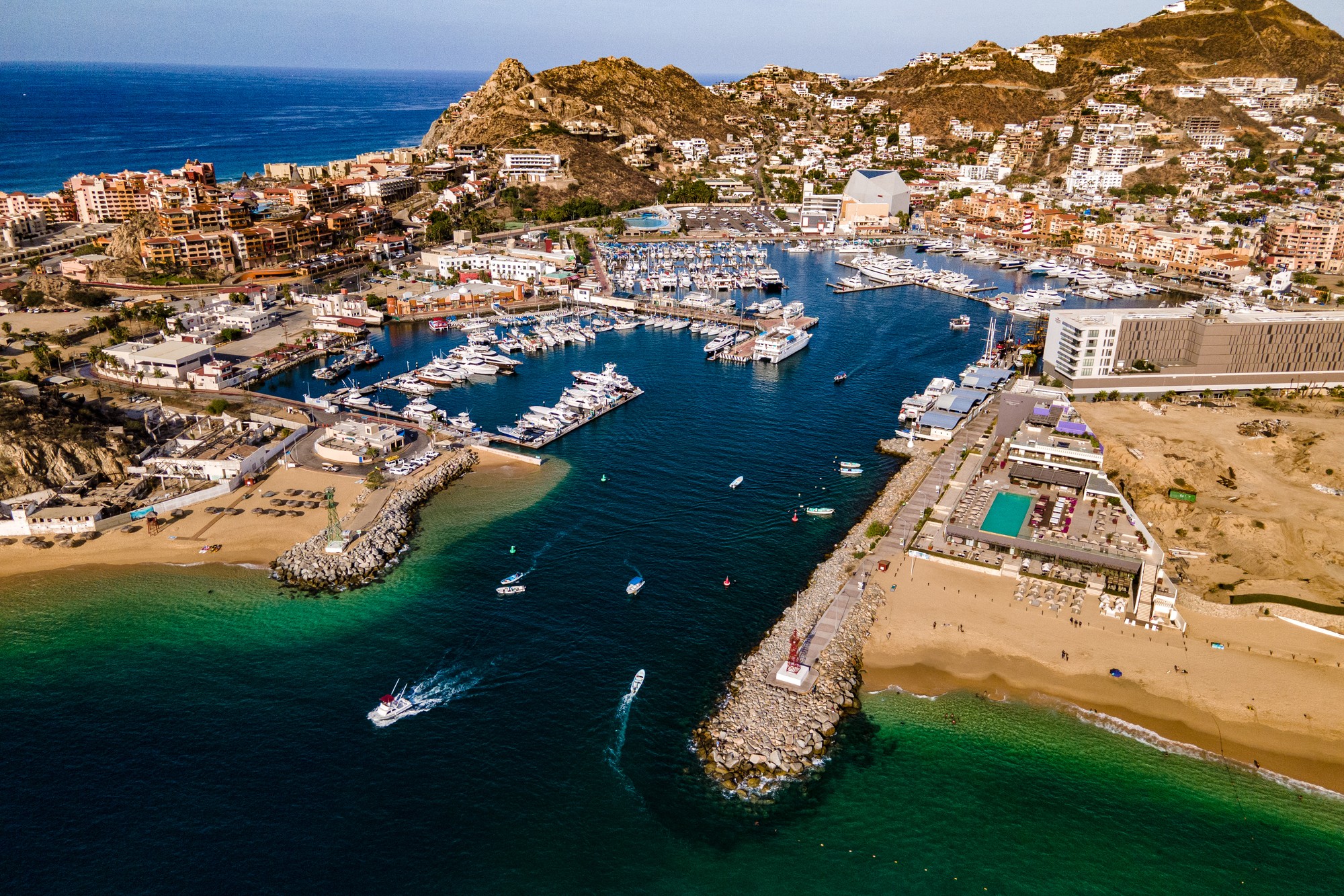
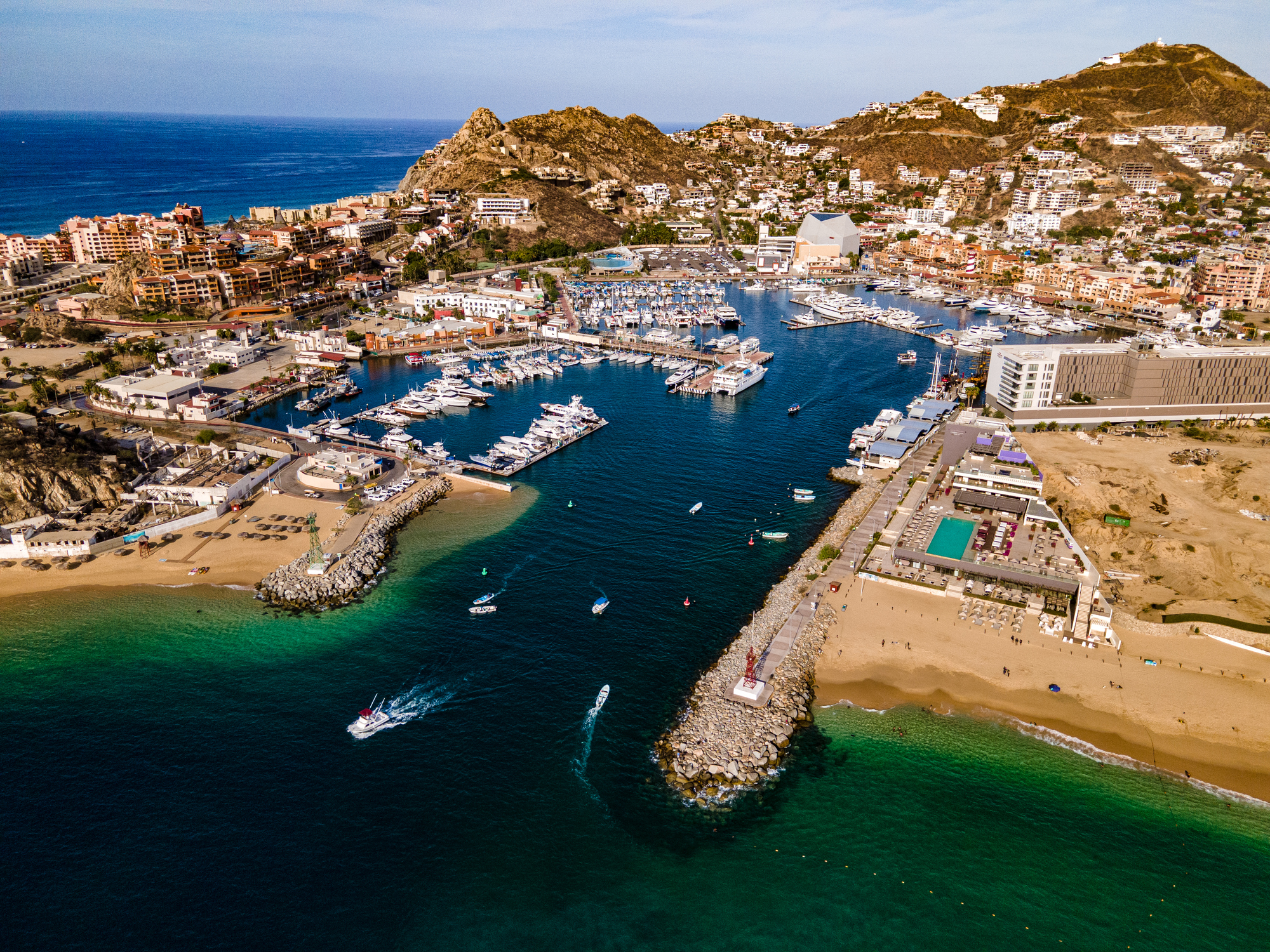 Dzień 58: 07:00-18:00
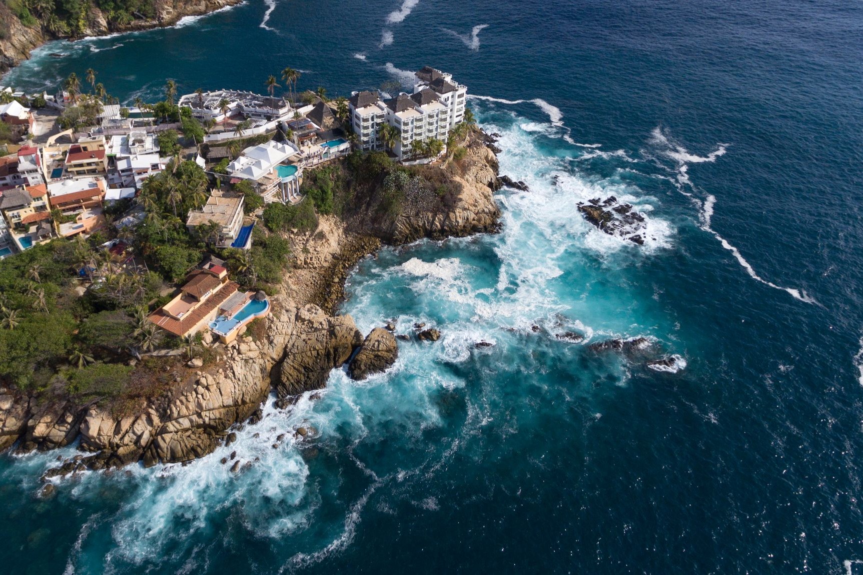
Cabo San Lucas / Meksyk
Cabo San Lucas or simply Cabo, is a resort city at the southern tip of the Baja California Peninsula, in the Mexican state of Baja California Sur. As of 2015, the population of the city was 81,111 inhabitants. Cabo San Lucas together with San José del Cabo is known as Los Cabos. Together they form a metropolitan area of 305,983 inhabitants.
Cabo has been rated as one of Mexico's top 5 tourist destinations; it is known for its beaches, scuba diving locations, balnearios, the sea arch El Arco de Cabo San Lucas, and marine life. The Los Cabos Corridor has become a heavily trafficked vacation destination for tourists, with numerous resorts and timeshares along the coast between Cabo San Lucas and San José del Cabo.
Cabo houses a range of wildlife, including rays, sharks, birds, and a range of fish, such as mahi-mahi (dorado), and striped marlin.
-
Dzień 59:
Dzień na morzu / Morze
-
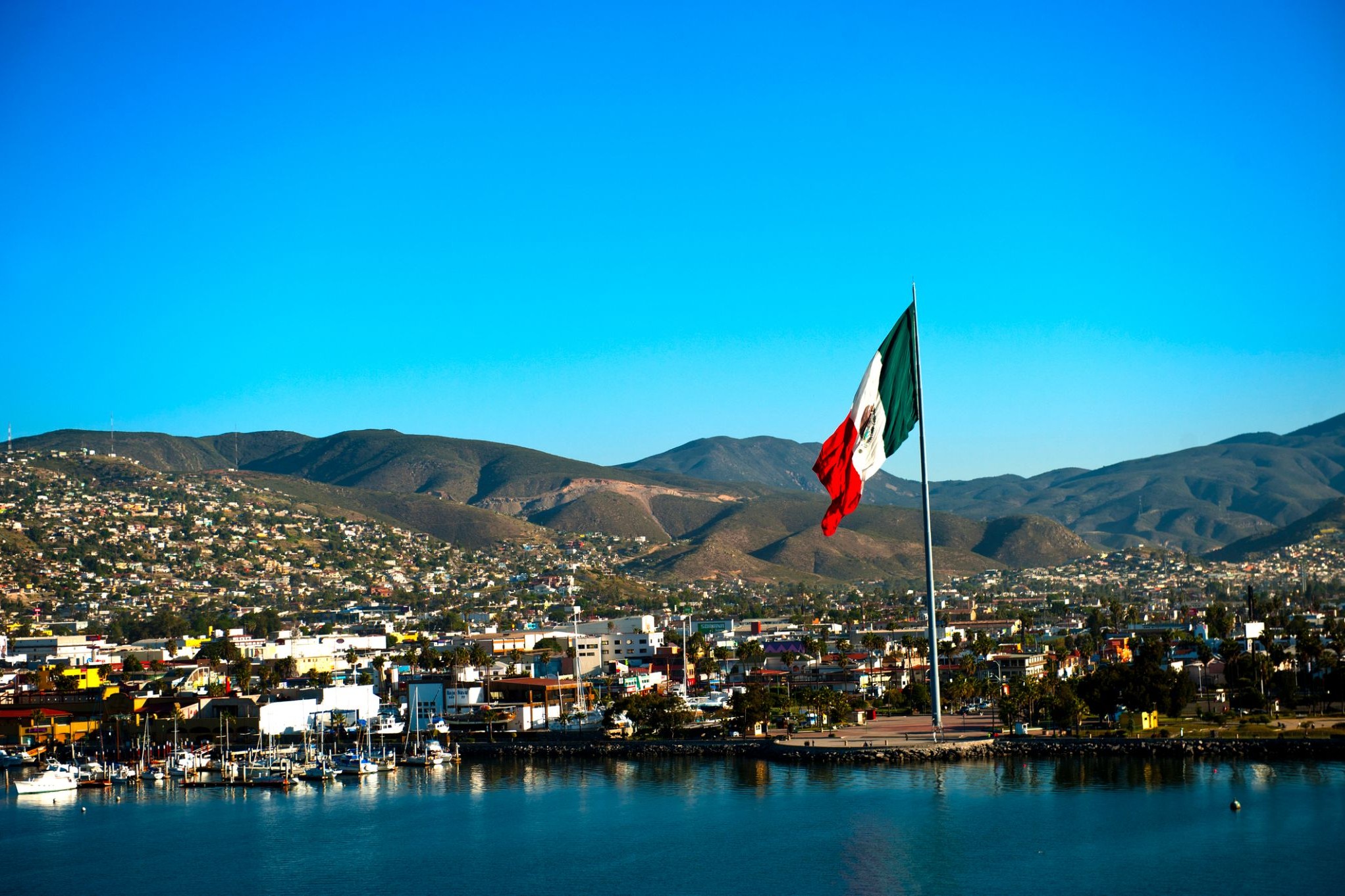
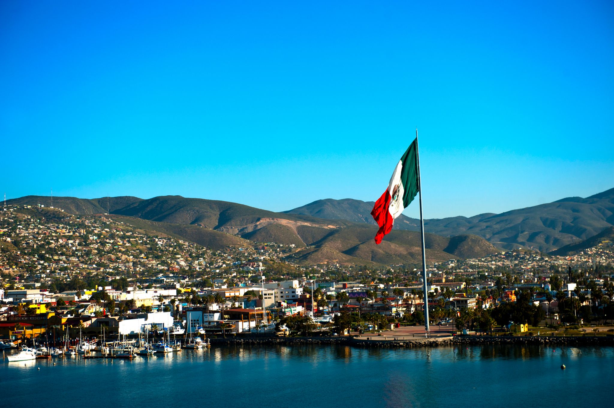 Dzień 60: 10:00-18:00
Ensenada / Meksyk
Jednym z największych miast meksykańskiego stanu Kalifornia Dolna jest Ensenada, stolica gminy o tej samej nazwie. Ensenada nazywana jest „Kopciuszkiem Pacyfiku” i znajduje się tutaj największy port rybacki w regionie. Pomimo tego, że obszar ten jest podatny na susze, Ensenada leży w sercu stanu winiarskiego, a produkowane tu wina uważane są za najlepsze w Meksyku.
W okolicach Ensenady znajdują się również znane plaże do uprawiania windsurfingu, w tym plaża San Miguel na północnym wybrzeżu miasta. Główna ulica miasta – La Primera – to klasyczna turystyczna promenada z licznymi barami, hotelami, sklepami i klubami. La Primera jest zawsze pełna turystów i mieszkańców. Ensenada słynie również z wędkarstwa sportowego, które uprawiane jest tu już od ponad 50 lat. Co roku przyjeżdżają tu miłośnicy połowów z całego świata.
-
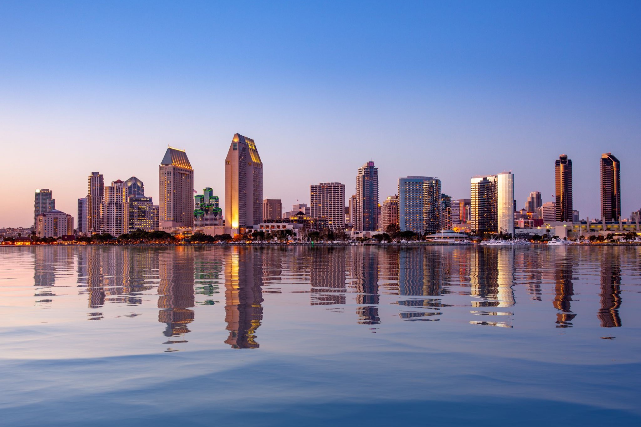
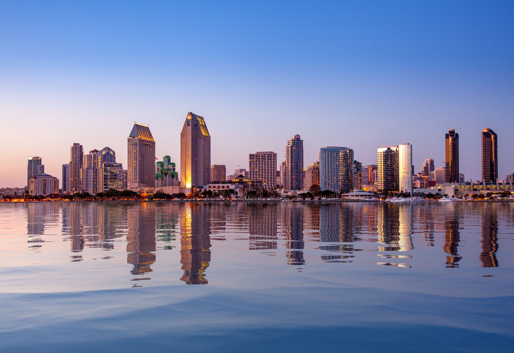 Dzień 61: 06:00-18:00
San Diego, Kalifornia / USA