| Region rejsu : Karaiby, kanał Panamski |
| Firma : Azamara Cruises |
| Statek : Azamara Onward |
| Data rozpoczęcia : śr. 05 sty 2028 |
| Data zakończenia : czw. 29 cze 2028 |
| Liczba nocy : 176 nocy |
| Dzień | Data | Port | Wypłynięcie | Odpłynięcie |
|---|---|---|---|---|
| 1 | 5.01 śr. | Miami / USA | 18:00 | |
| 2 | 6.01 czw. | Dzień na morzu / Morze | ||
| 3 | 7.01 pt. | Dzień na morzu / Morze | ||
| 4 | 8.01 sob. | Aruba (Oranjestad) / Aruba | 13:30 | 22:00 |
| 5 | 9.01 niedz. | Curaçao / Curacao | 08:00 | 22:00 |
| 6 | 10.01 pon. | Dzień na morzu / Morze | 15:00 | |
| 7 | 11.01 wt. | Cartagena (Bolívar) / Kolumbia | 08:00 | |
| 8 | 12.01 śr. | Cartagena (Bolívar) / Kolumbia | 13:00 | |
| 9 | 13.01 czw. | Dwukropek / Panama | 08:00 | 16:00 |
| 10 | 14.01 pt. | Kanał Panamski / Panama | 16:05 | 23:59 |
| 11 | 15.01 sob. | Panama City, Floryda / USA | 02:00 | 17:00 |
| 12 | 16.01 niedz. | Dzień na morzu / Morze | ||
| 13 | 17.01 pon. | Manta / Ecuador | 08:00 | 13:30 |
| 14 | 18.01 wt. | Dzień na morzu / Morze | ||
| 15 | 19.01 śr. | Callao / Peru | 13:00 | |
| 16 | 20.01 czw. | Callao / Peru | 09:00 | 17:00 |
| 17 | 21.01 pt. | Dzień na morzu / Morze | ||
| 18 | 22.01 sob. | Dzień na morzu / Morze | ||
| 19 | 23.01 niedz. | Dzień na morzu / Morze | ||
| 20 | 24.01 pon. | Dzień na morzu / Morze | ||
| 21 | 25.01 wt. | Dzień na morzu / Morze | ||
| 22 | 26.01 śr. | Wyspa Wielkanocna / Chile | 08:00 | |
| 23 | 27.01 czw. | Wyspa Wielkanocna / Chile | 13:00 | |
| 24 | 28.01 pt. | Dzień na morzu / Morze | ||
| 25 | 29.01 sob. | Dzień na morzu / Morze | ||
| 26 | 30.01 niedz. | Oh. Pitcairn | 09:00 | 17:00 |
| 27 | 31.01 pon. | Dzień na morzu / Morze | 15:00 | |
| 28 | 1.02 wt. | Dzień na morzu / Morze | ||
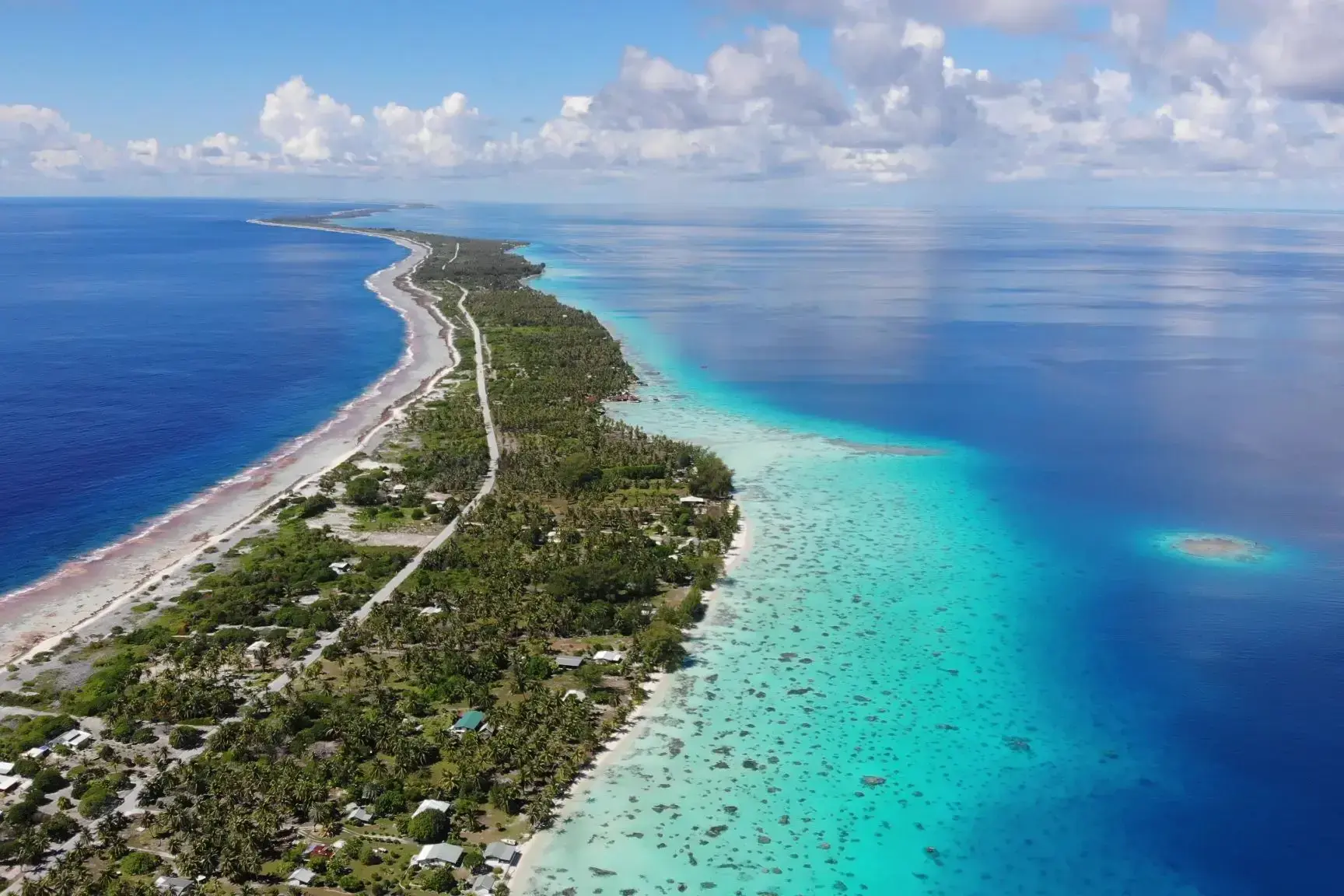
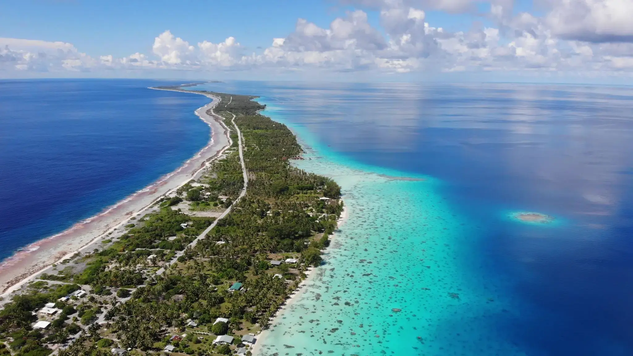
| 29 | 2.02 śr. | Fakarava / French Polynesia | 09:00 | 14:00 |
| 30 | 3.02 czw. | Moorea, Wyspy Towarzystwa / French Polynesia | 09:00 | |
| 31 | 4.02 pt. | Papeete Papeete / French Polynesia | 18:00 | |
| 32 | 5.02 sob. | Moorea, Wyspy Towarzystwa / French Polynesia | 15:30 | |
| 33 | 6.02 niedz. | Papeete Papeete / French Polynesia | 09:00 | 18:00 |
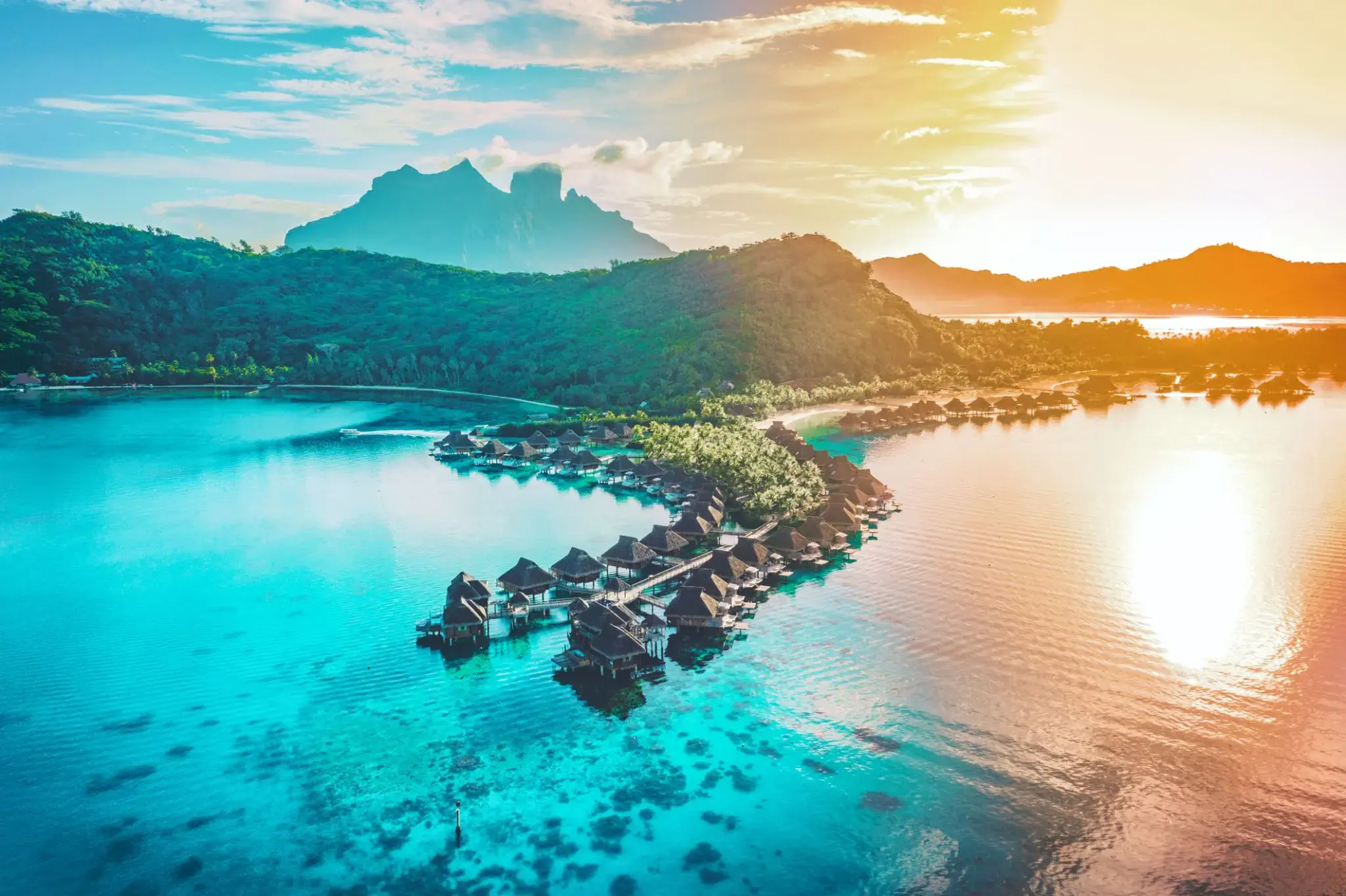
| 34 | 7.02 pon. | Bora Bora, Society Islands / French Polynesia | 08:00 | |
| 35 | 8.02 wt. | Bora Bora, Society Islands / French Polynesia | 18:00 | |
| 36 | 9.02 śr. | Dzień na morzu / Morze | 15:00 | |
| 37 | 10.02 czw. | Dzień na morzu / Morze | ||
| 38 | 11.02 pt. | Dzień na morzu / Morze | 15:00 | |
| 39 | 12.02 sob. | Dzień na morzu / Morze | ||
| 40 | 13.02 niedz. | Dzień na morzu / Morze | ||
| 41 | 14.02 pon. | Dzień na morzu / Morze | ||
| 42 | 15.02 wt. | Dzień na morzu / Morze | ||
| 43 | 16.02 śr. | Kokcen-Houl / Honduras | 08:00 | 19:00 |
| 44 | 17.02 czw. | Okland / Nowa Zelandia | 07:00 | 18:00 |
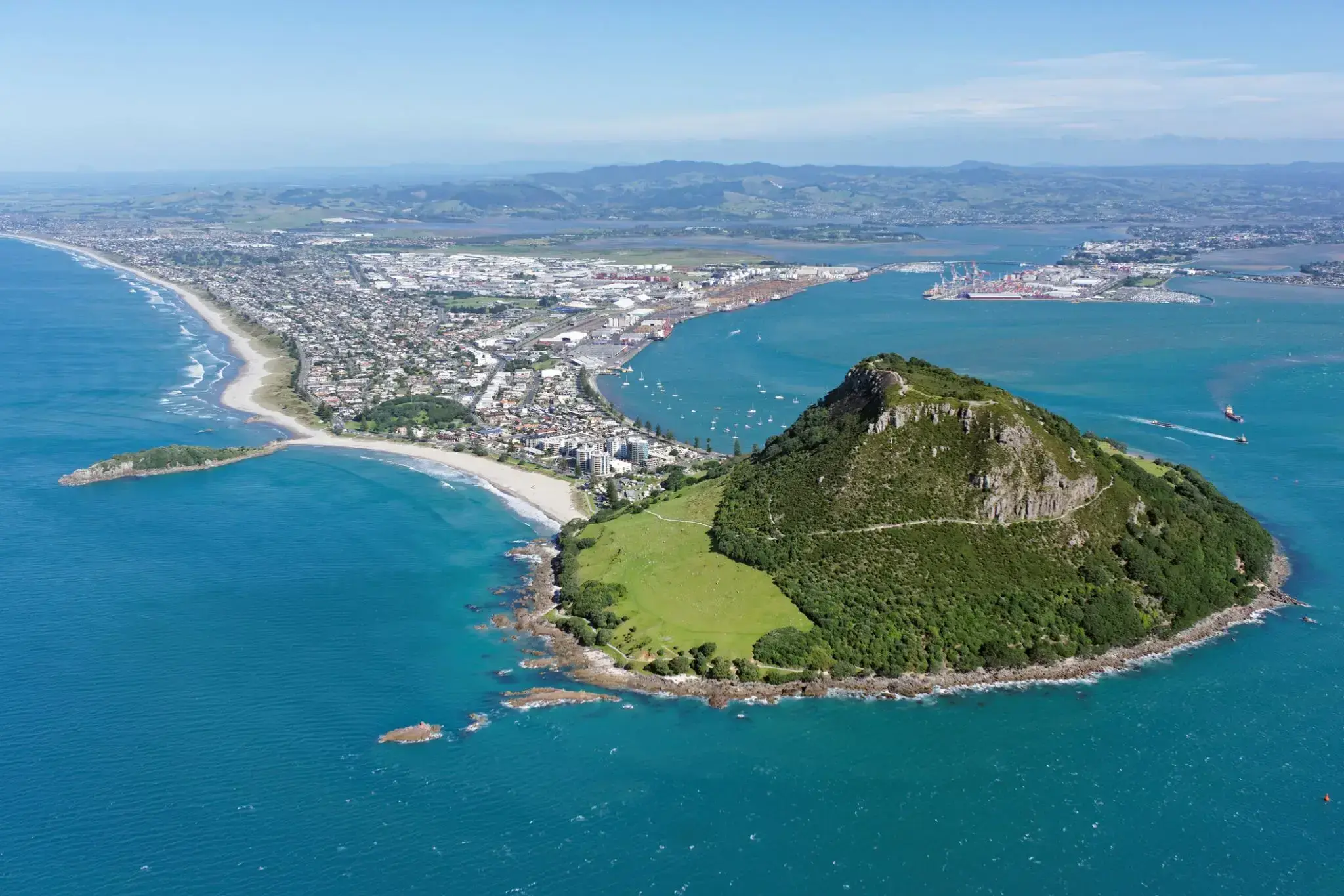
| 45 | 18.02 pt. | Toranga / Nowa Zelandia | 08:00 | 18:00 |
| 46 | 19.02 sob. | Нейпир / Nowa Zelandia | 14:00 | 21:00 |
| 47 | 20.02 niedz. | Wellington / Nowa Zelandia | 13:00 | 22:00 |
| 48 | 21.02 pon. | Goal Goal / Australia | 08:00 | 17:00 |
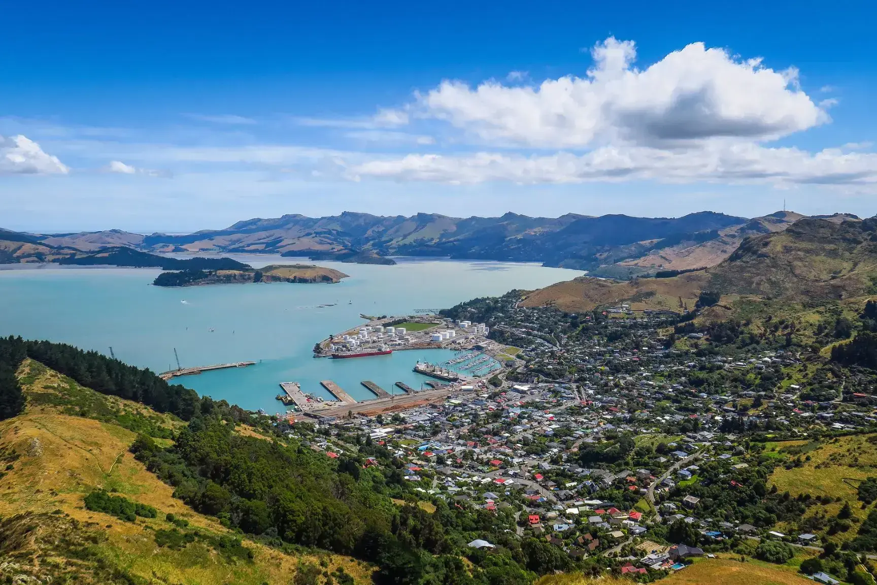
| 49 | 22.02 wt. | Christchurch / Nowa Zelandia | 08:00 | 17:00 |
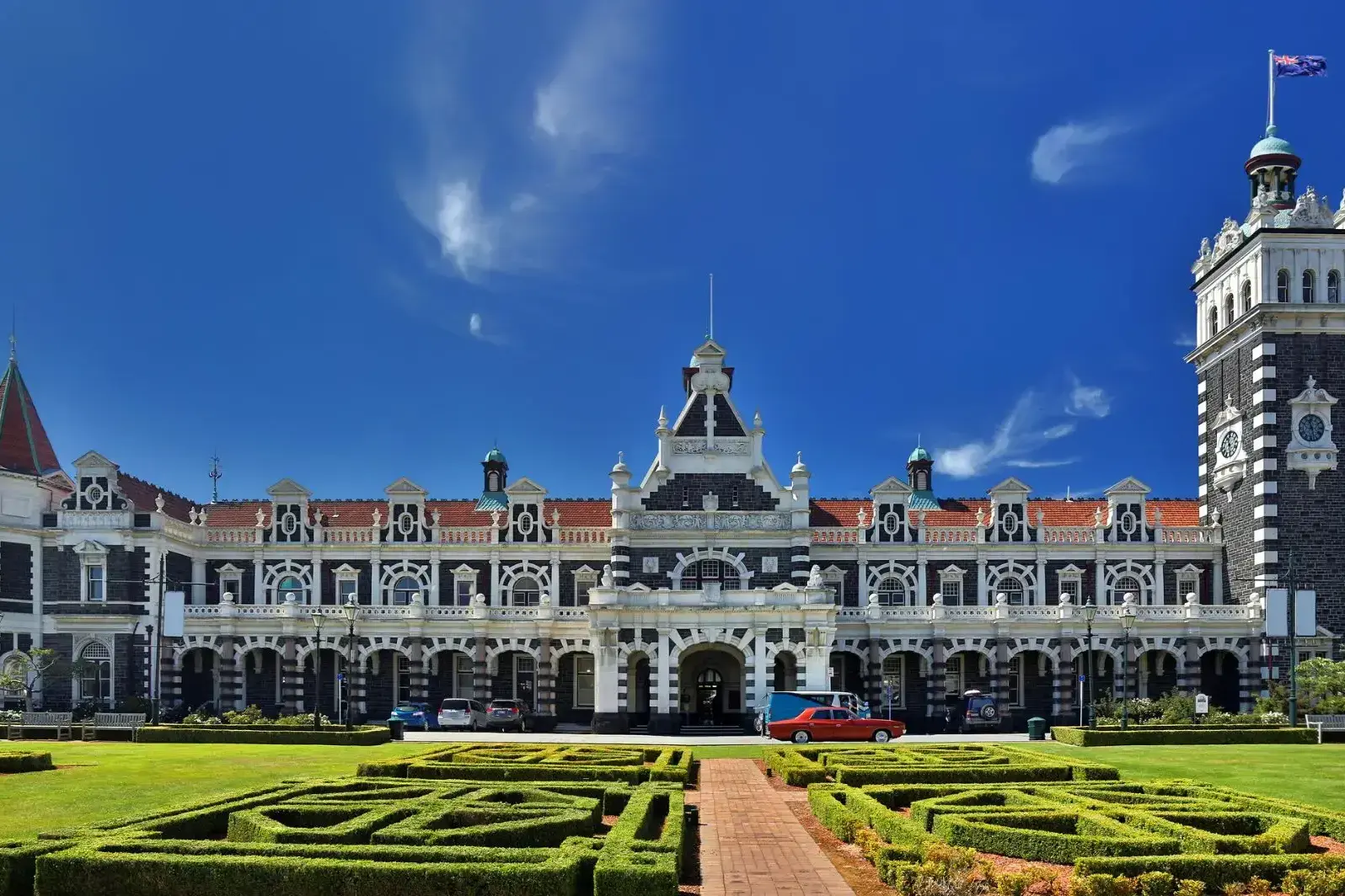
| 50 | 23.02 śr. | Danidin / Nowa Zelandia | 07:30 | 16:00 |
| 51 | 24.02 czw. | Milford-Sound / Nowa Zelandia | 16:00 | 19:00 |
| 52 | 25.02 pt. | Dzień na morzu / Morze | ||
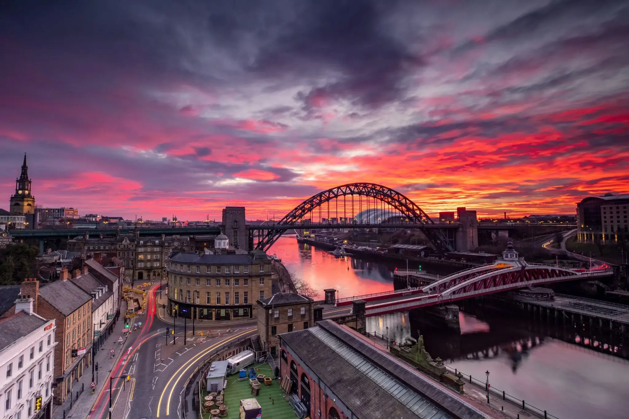
| 53 | 26.02 sob. | Dzień na morzu / Morze | ||
| 54 | 27.02 niedz. | Gobarta na Tasmanii / Australia | 08:00 | |
| 55 | 28.02 pon. | Gobarta na Tasmanii / Australia | 22:00 | |
| 56 | 29.02 wt. | Dzień na morzu / Morze | ||
| 57 | 1.03 śr. | Eden Valley / Australia | 07:30 | 14:00 |
| 58 | 2.03 czw. | Sydnej / Australia | 08:00 | |
| 59 | 3.03 pt. | Sydnej / Australia | 09:00 | 22:00 |
| 60 | 4.03 sob. | Newcastle / Wielka Brytania | 08:00 | 20:00 |
| 61 | 5.03 niedz. | Dzień na morzu / Morze | ||
| 62 | 6.03 pon. | Mooloolaba / Australia | 08:00 | 20:00 |
| 63 | 7.03 wt. | Dzień na morzu / Morze | ||
| 64 | 8.03 śr. | Plaża Airlie w Queensland / Australia | 08:00 | 17:00 |
| 65 | 9.03 czw. | Cairns / Australia | 13:00 | |
| 66 | 10.03 pt. | Cairns / Australia | 20:00 | |
| 67 | 11.03 sob. | Dzień na morzu / Morze | ||
| 68 | 12.03 niedz. | Dzień na morzu / Morze | ||
| 69 | 13.03 pon. | Dzień na morzu / Morze | ||
| 70 | 14.03 wt. | Darwin / Australia | 08:00 | |
| 71 | 15.03 śr. | Darwin / Australia | 13:00 | |
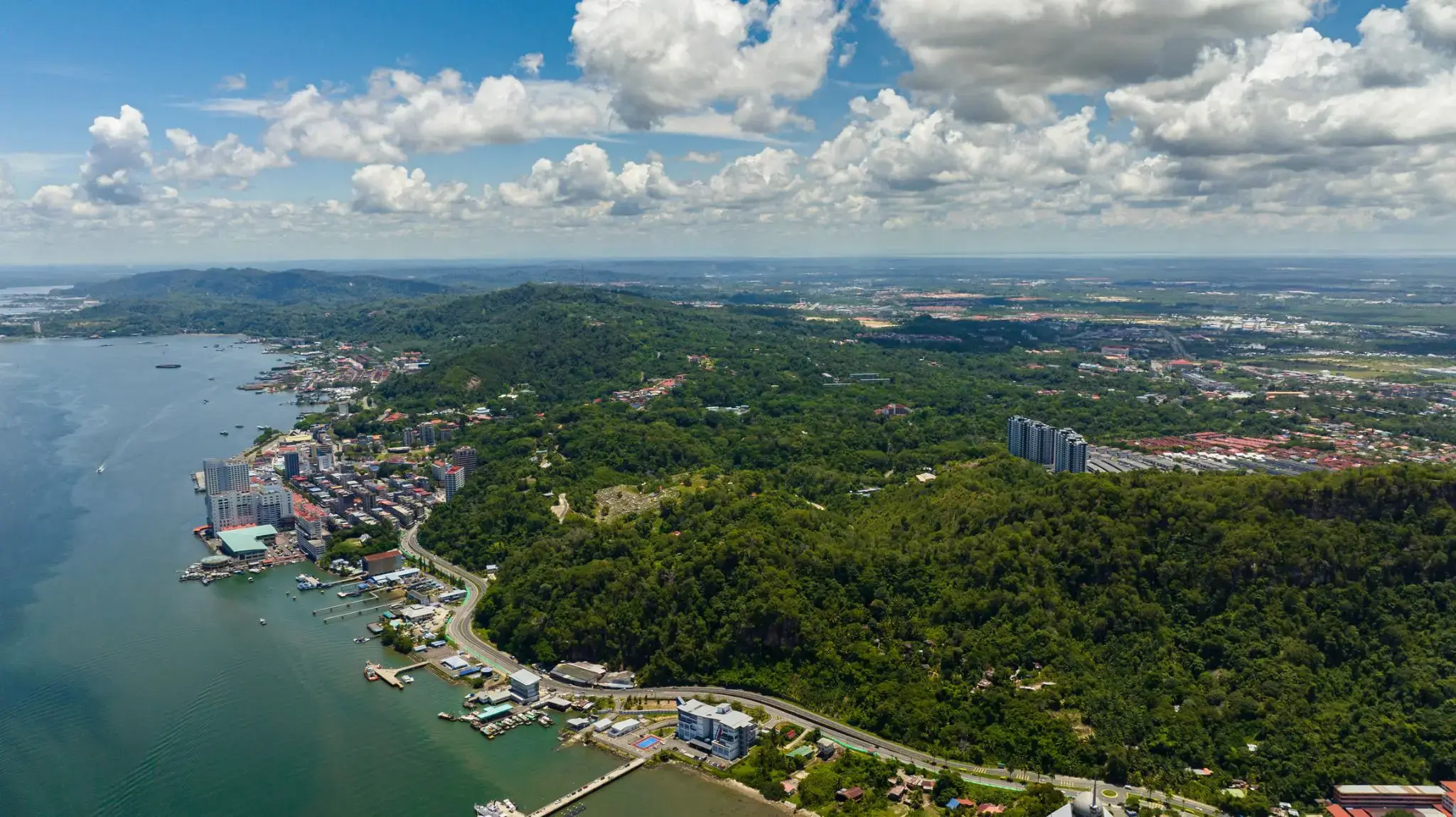
| 72 | 16.03 czw. | Dzień na morzu / Morze | ||
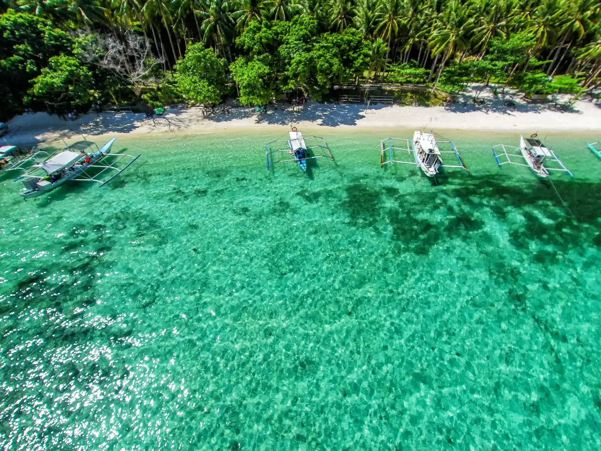
| 73 | 17.03 pt. | WYSPA KOMODO | 13:00 | 17:00 |
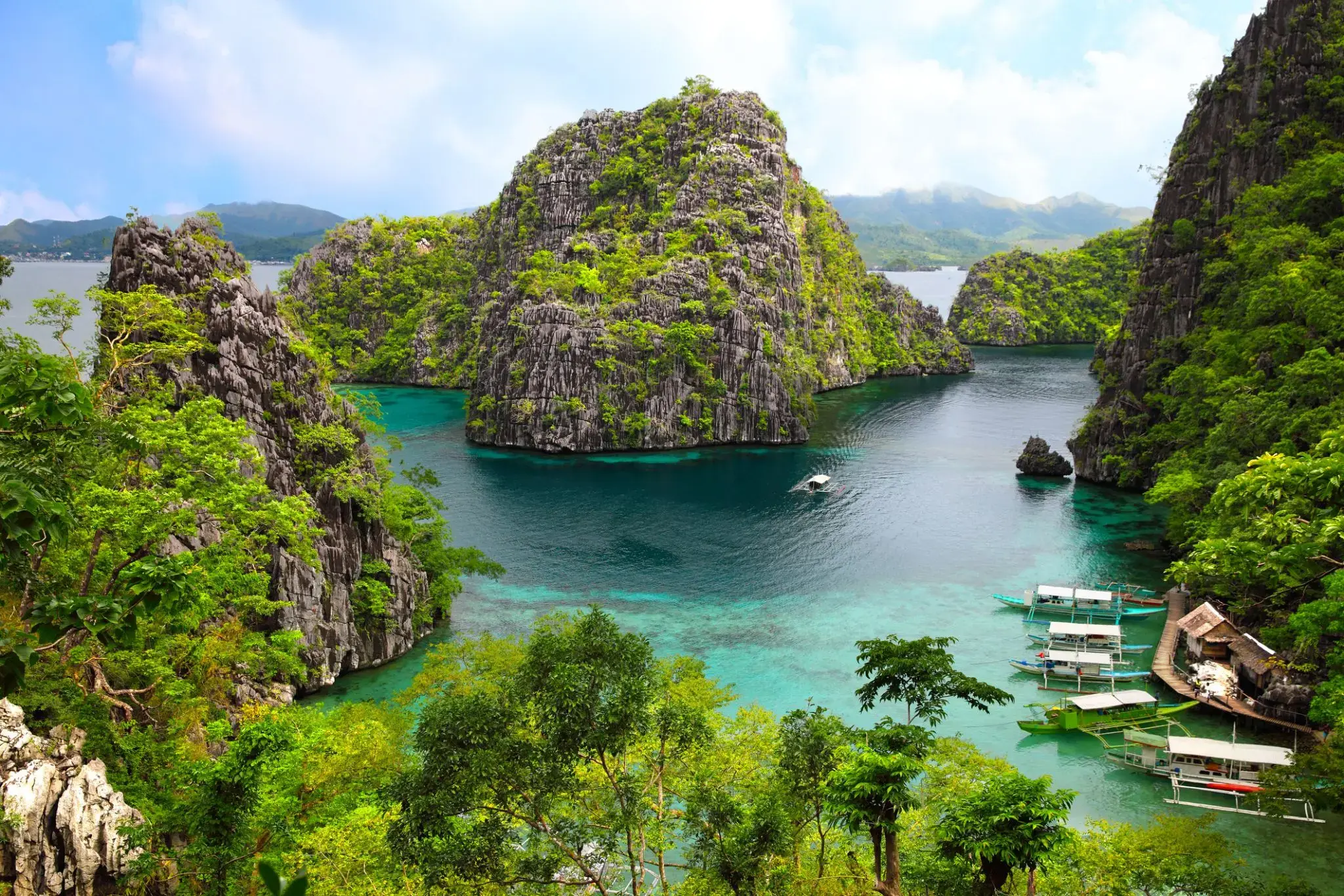
| 74 | 18.03 sob. | Tanjung Benoit / Indonezja | 13:30 | |
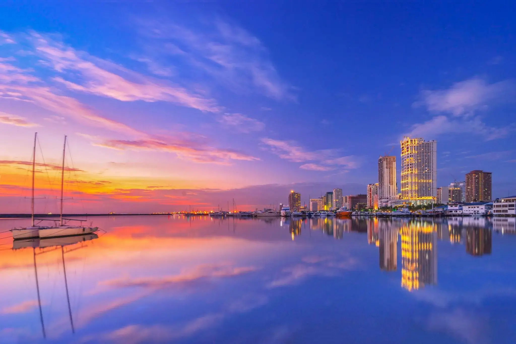
| 75 | 19.03 niedz. | Tanjung Benoit / Indonezja | 09:00 | 22:00 |
| 76 | 20.03 pon. | Chelukan-Bawang | 08:00 | 16:00 |
| 77 | 21.03 wt. | Dzień na morzu / Morze | ||
| 78 | 22.03 śr. | Dzień na morzu / Morze | ||
| 79 | 23.03 czw. | Sandakan / Malaysia | 08:00 | 17:00 |
| 80 | 24.03 pt. | Puerto Princesa / Philippine Islands | 10:30 | 17:30 |
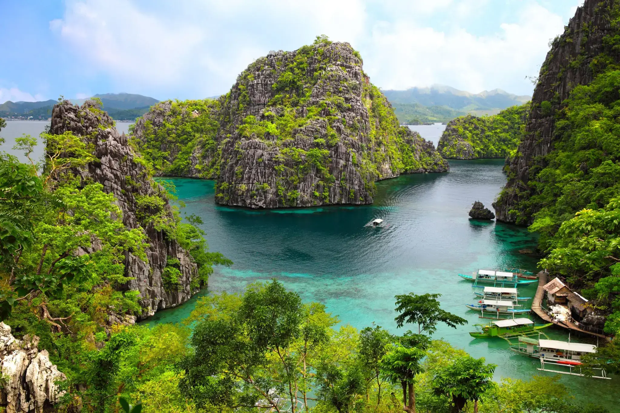
| 81 | 25.03 sob. | Coron Island / Philippine Islands | 13:00 | 19:00 |
| 82 | 26.03 niedz. | Manila / Philippine Islands | 09:30 | |
| 83 | 27.03 pon. | Manila / Philippine Islands | 14:00 | |
| 84 | 28.03 wt. | Dzień na morzu / Morze | ||
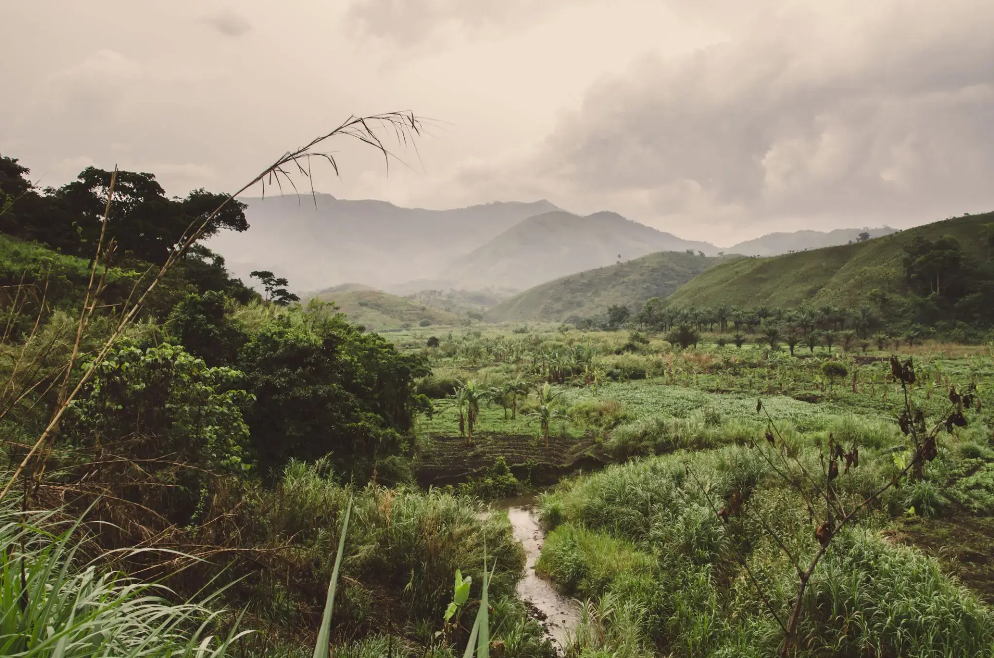
| 85 | 29.03 śr. | Limbe / Cameroon | 08:00 | |
| 86 | 30.03 czw. | Limbe / Cameroon | 09:00 | 20:00 |
| 87 | 31.03 pt. | Dzień na morzu / Morze | ||
| 88 | 1.04 sob. | Da Nang / Vietnam | 08:00 | 20:00 |
| 89 | 2.04 niedz. | Dzień na morzu / Morze | ||
| 90 | 3.04 pon. | Ho Chi Minh / Vietnam | 10:00 | |
| 91 | 4.04 wt. | Ho Chi Minh / Vietnam | 14:00 | |
| 92 | 5.04 śr. | Dzień na morzu / Morze | ||
| 93 | 6.04 czw. | Bangkok / Thailand | 08:00 | |
| 94 | 7.04 pt. | Bangkok / Thailand | ||
| 95 | 8.04 sob. | Bangkok / Thailand | 14:00 | |
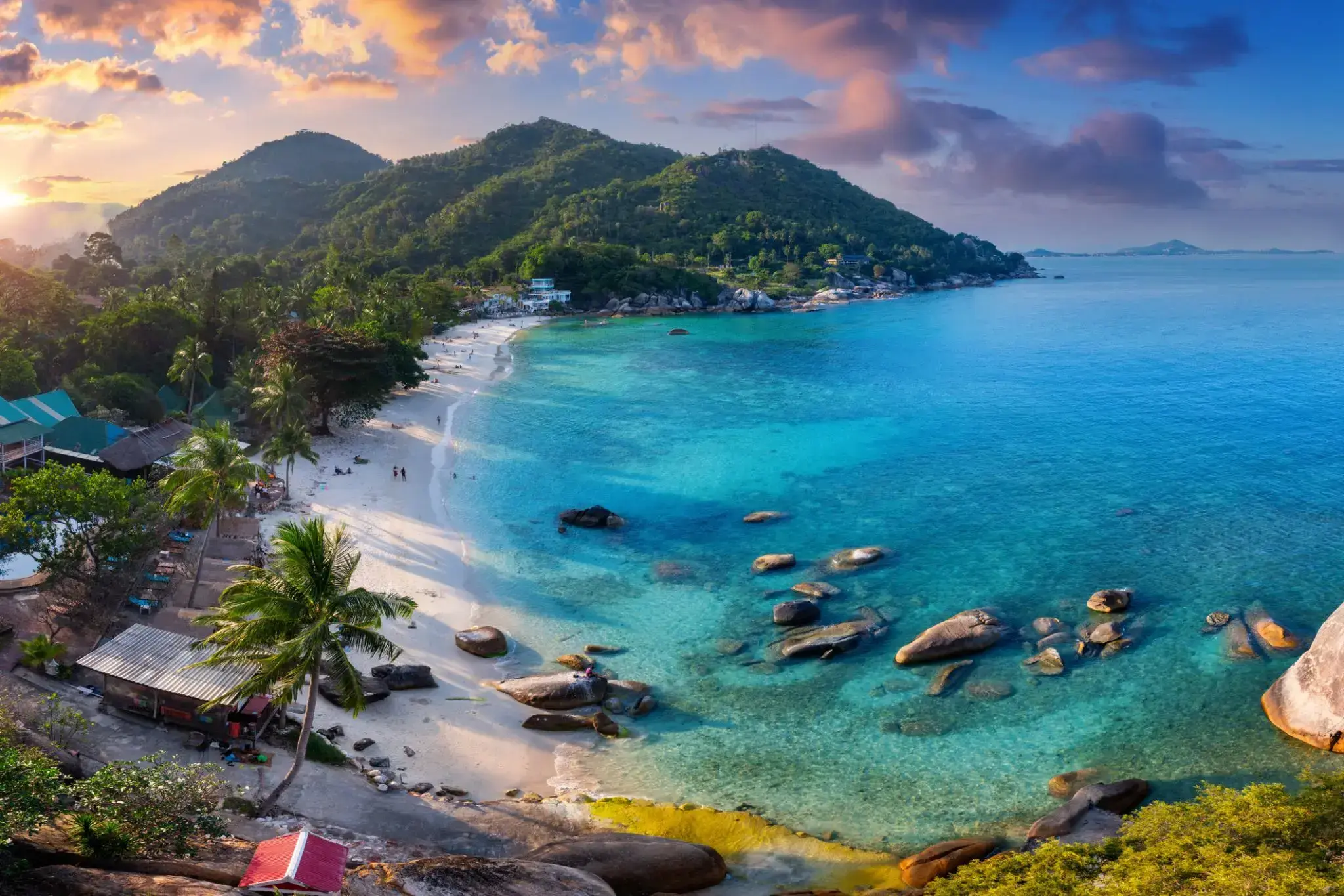
| 96 | 9.04 niedz. | Wyspa Samui / Koh Samui / Thailand | 08:00 | 14:00 |
| 97 | 10.04 pon. | Dzień na morzu / Morze | ||
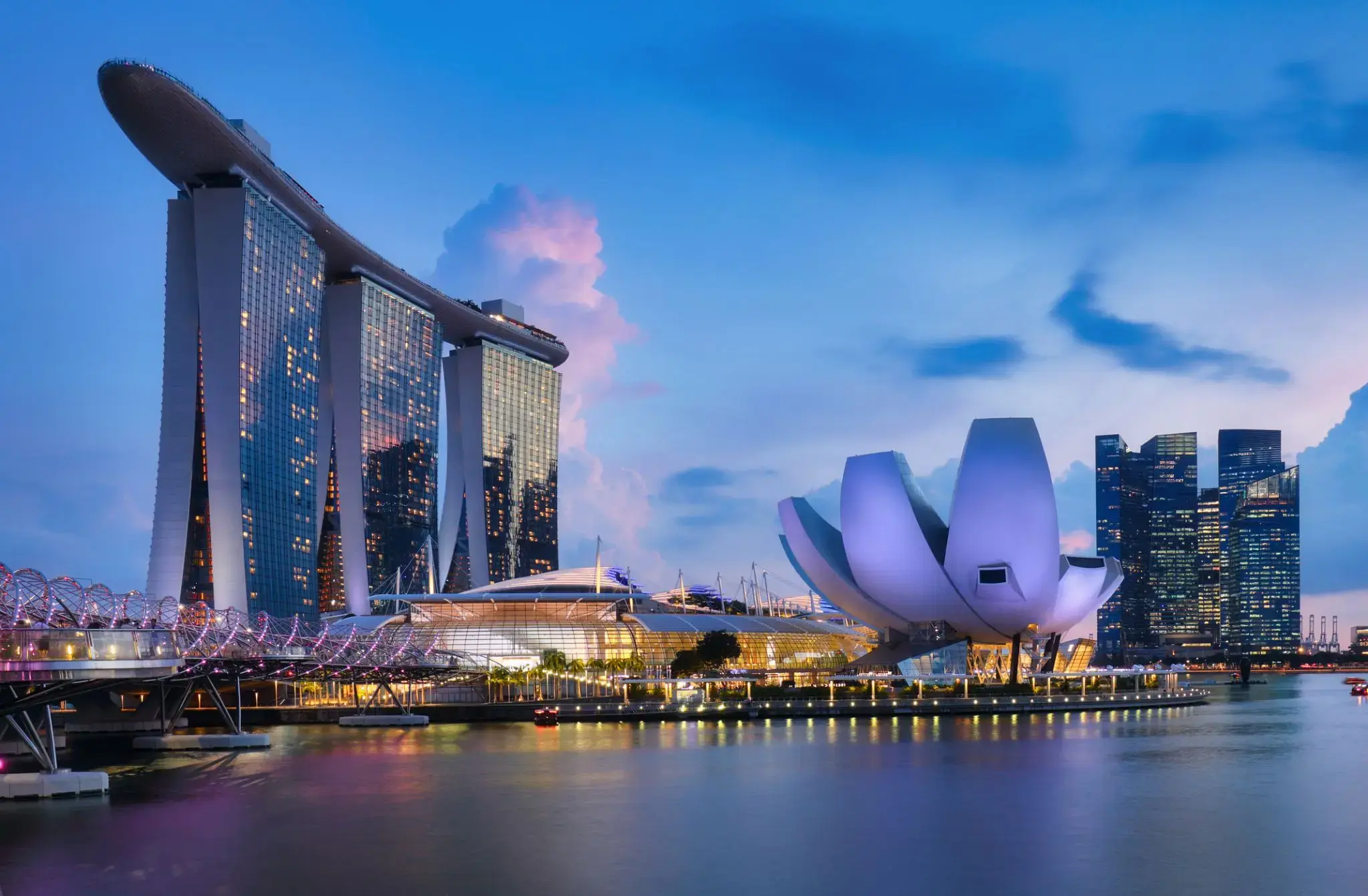
| 98 | 11.04 wt. | Singapur / Singapur | 08:00 | |
| 99 | 12.04 śr. | Singapur / Singapur | 09:00 | 17:00 |
| 100 | 13.04 czw. | Kuala Lumpur / Malaysia | 08:00 | 20:00 |
| 101 | 14.04 pt. | Dzień na morzu / Morze | ||
| 102 | 15.04 sob. | Sabang / Indonezja | 08:00 | 17:00 |
| 103 | 16.04 niedz. | Dzień na morzu / Morze | ||
| 104 | 17.04 pon. | Dzień na morzu / Morze | ||
| 105 | 18.04 wt. | Hambantota / Sri Lanka | 08:00 | 18:00 |
| 106 | 19.04 śr. | Colombo / Sri Lanka | 08:00 | 20:00 |
| 107 | 20.04 czw. | Kochi / Indie | 17:00 | |
| 108 | 21.04 pt. | Kochi / Indie | 22:00 | |
| 109 | 22.04 sob. | Dzień na morzu / Morze | ||
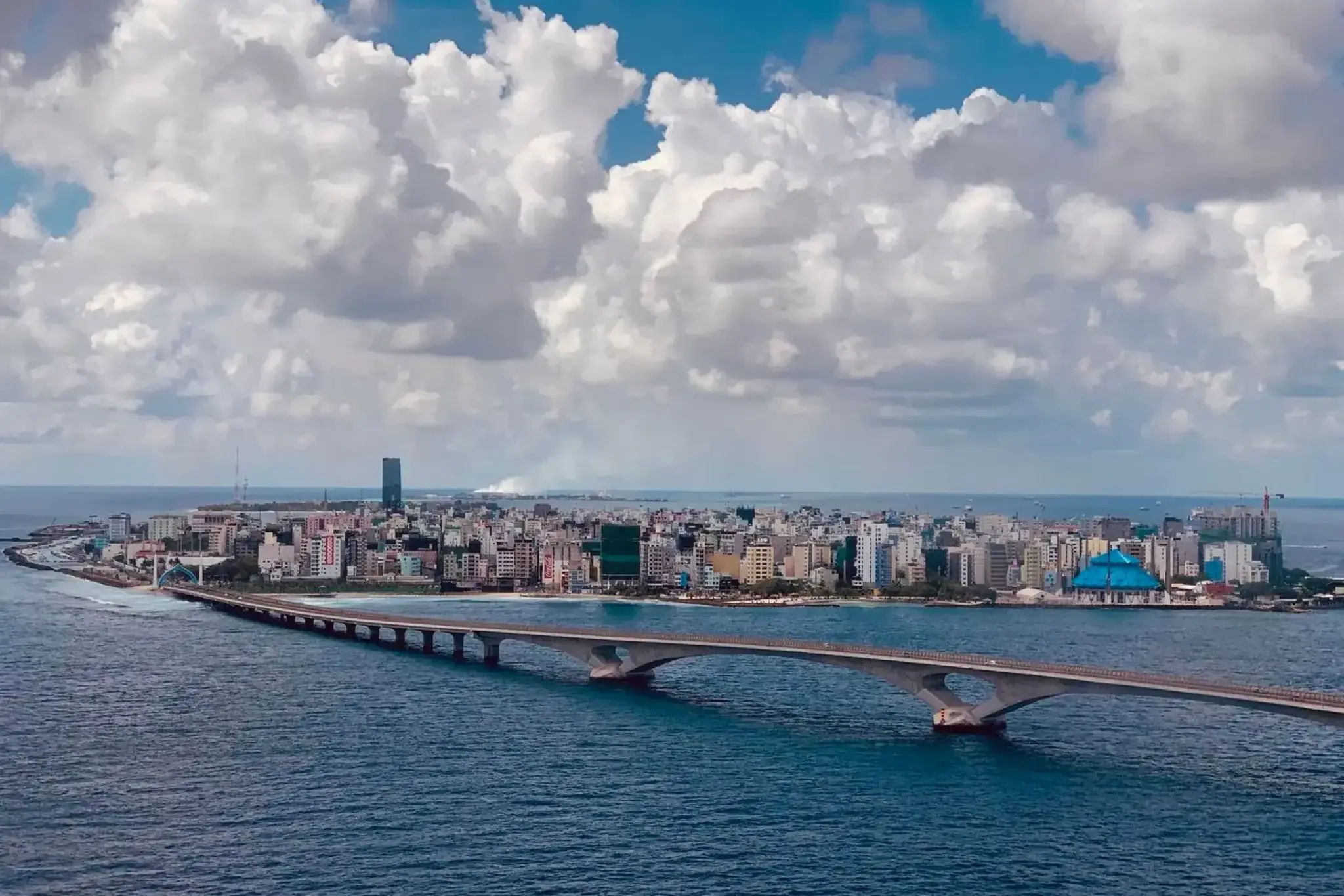
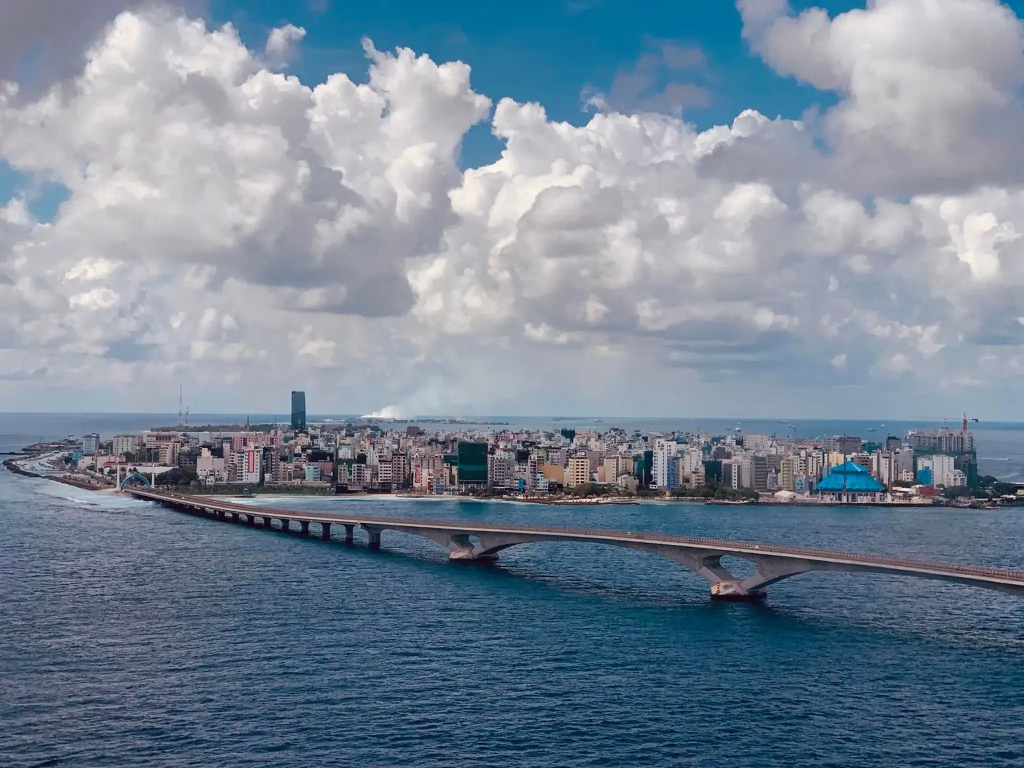
| 110 | 23.04 niedz. | Male / Maldives | 08:00 | 17:00 |
| 111 | 24.04 pon. | Dzień na morzu / Morze | ||
| 112 | 25.04 wt. | Dzień na morzu / Morze | ||
| 113 | 26.04 śr. | Dzień na morzu / Morze | ||
| 114 | 27.04 czw. | Dzień na morzu / Morze | ||
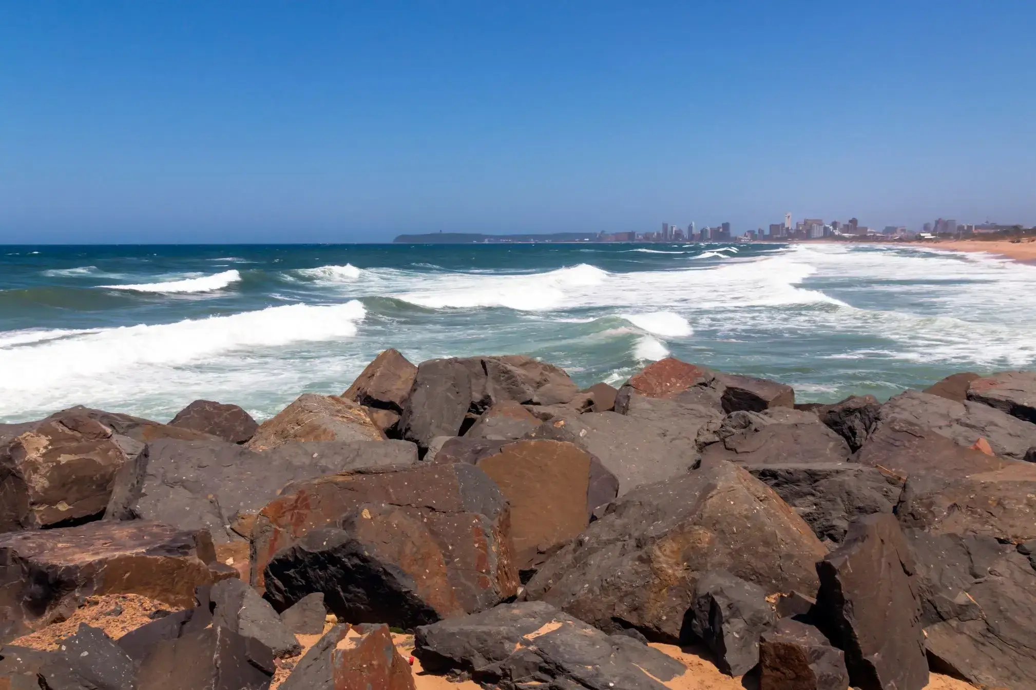
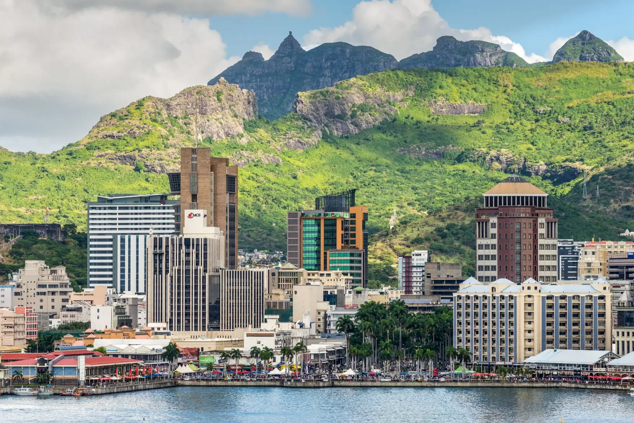
| 115 | 28.04 pt. | Port Louis / Mauritius | 13:00 | |
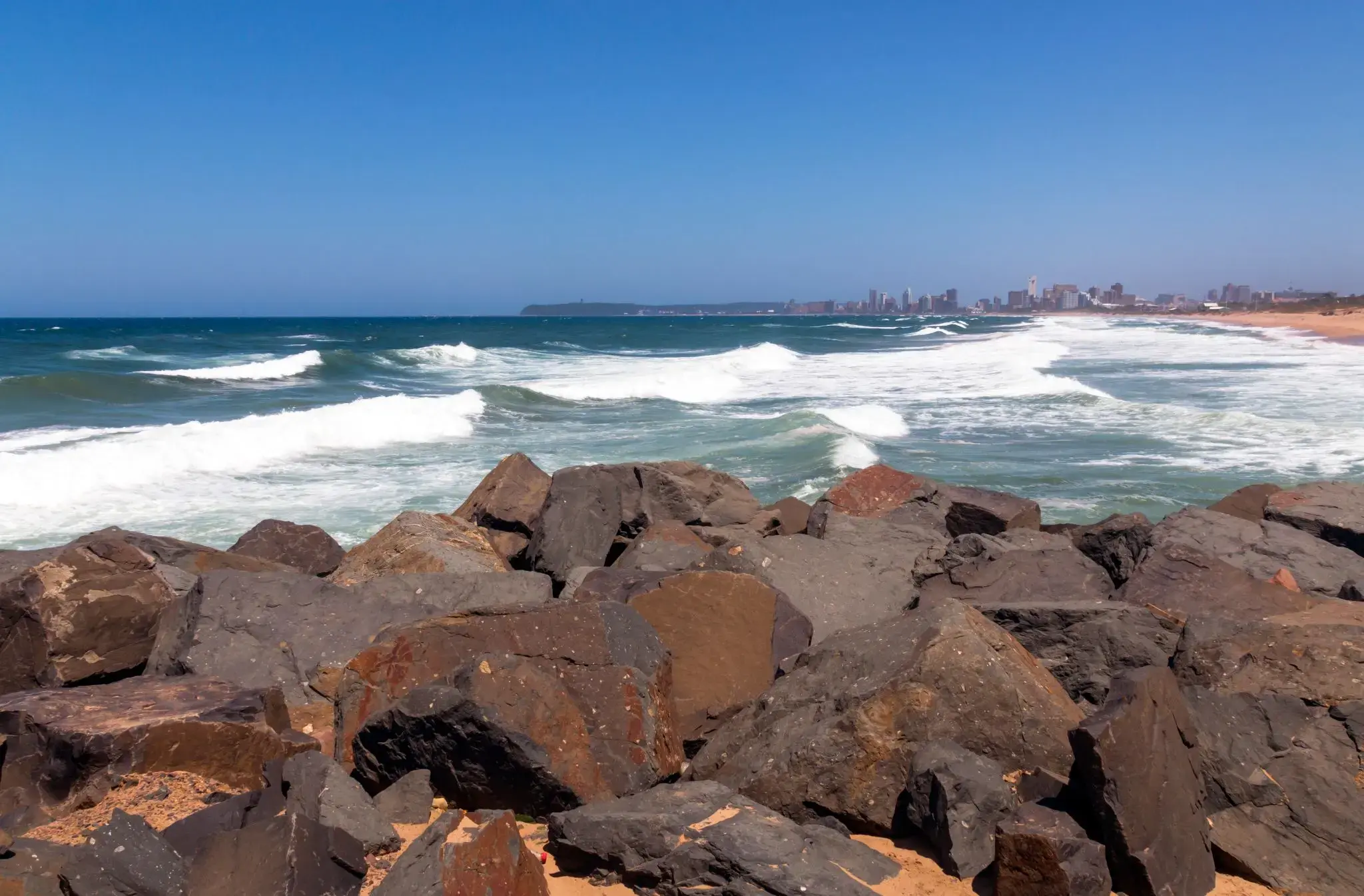
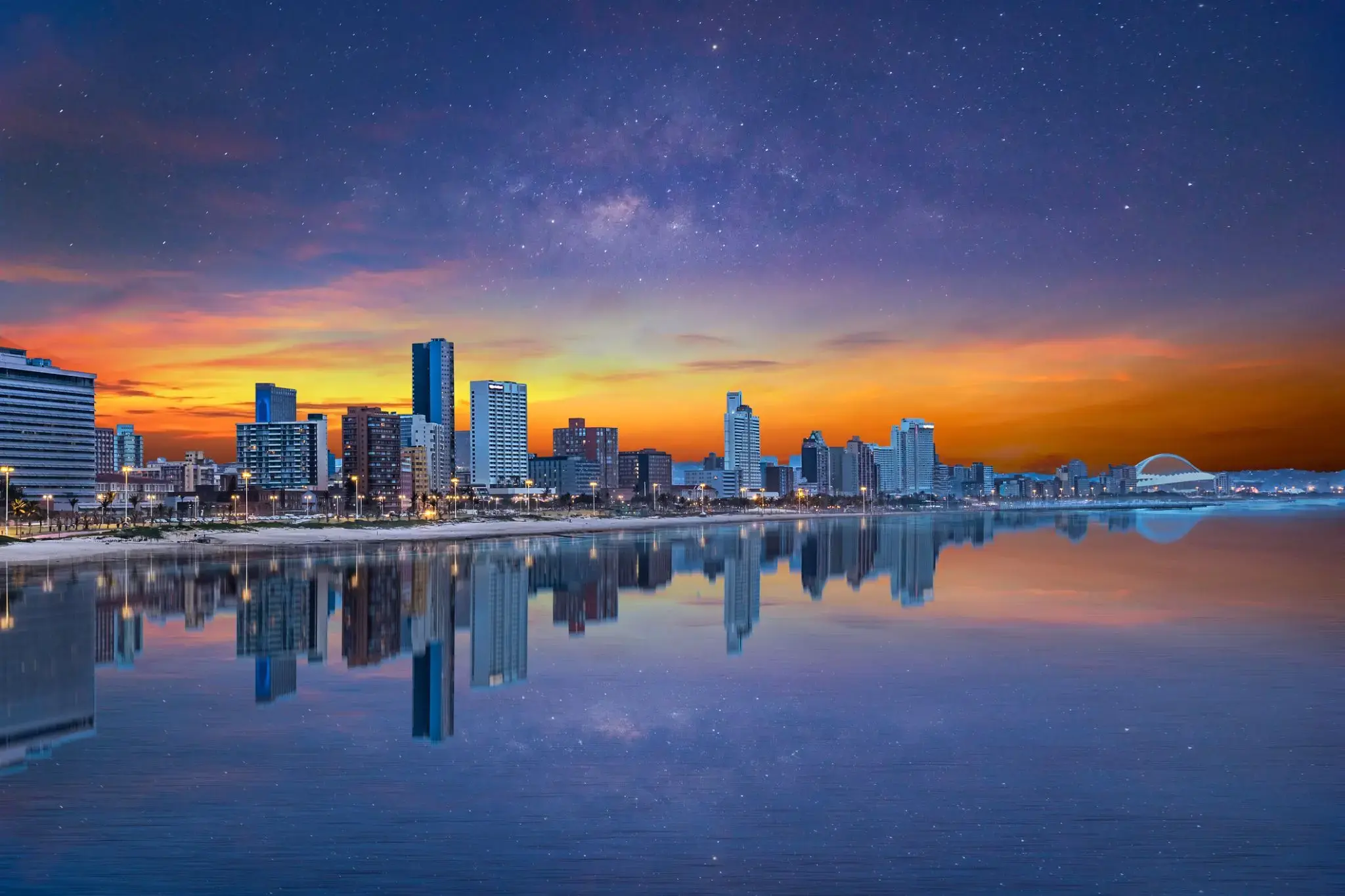
| 116 | 29.04 sob. | Port Louis / Mauritius | 08:00 | 21:00 |
| 117 | 30.04 niedz. | PUNKT ŻÓŁTY | 08:00 | 18:00 |
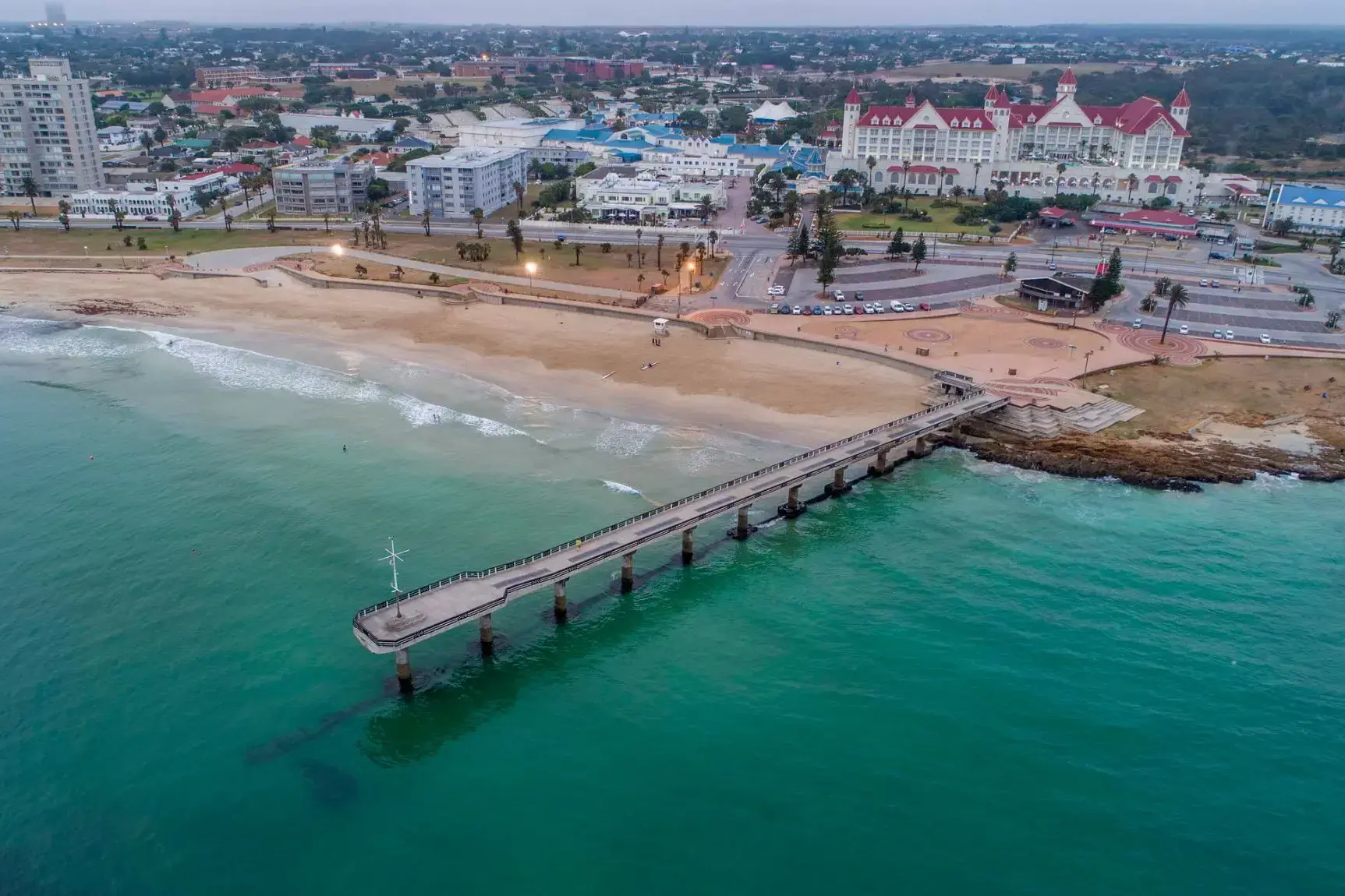
| 118 | 1.05 pon. | Dzień na morzu / Morze | ||
| 119 | 2.05 wt. | Tolanaro Tolanaro / Madagascar | 08:00 | 18:00 |
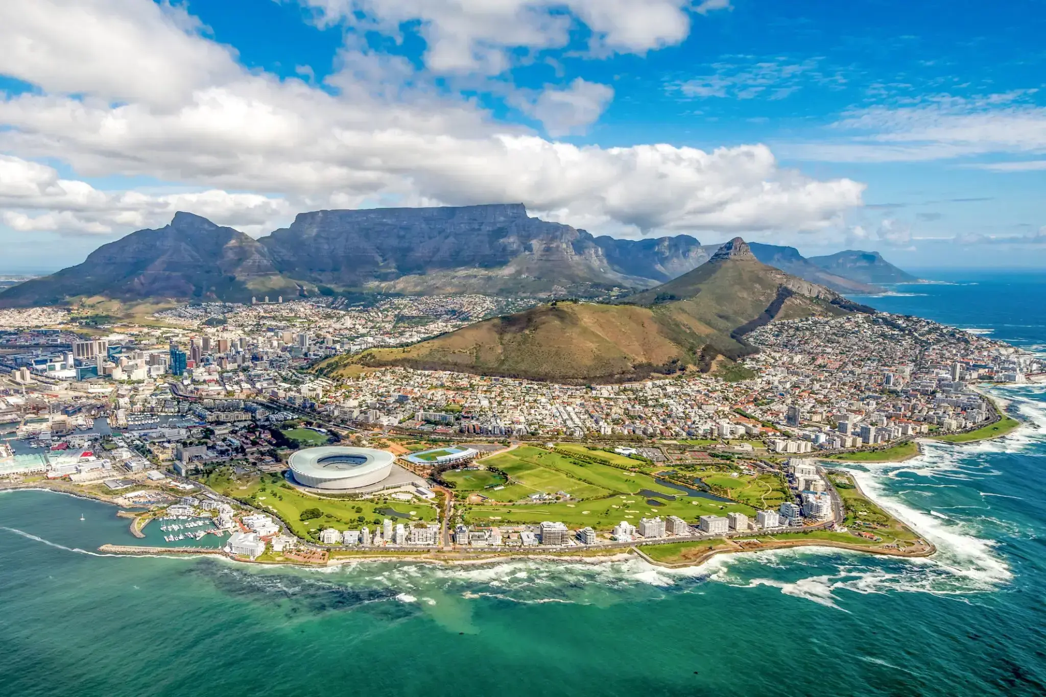
| 120 | 3.05 śr. | Dzień na morzu / Morze | ||
| 121 | 4.05 czw. | Dzień na morzu / Morze | ||
| 122 | 5.05 pt. | Richards Bay / South Africa | 07:00 | 20:00 |
| 123 | 6.05 sob. | Durban / South Africa | 08:00 | 20:00 |
| 124 | 7.05 niedz. | Dzień na morzu / Morze | ||
| 125 | 8.05 pon. | Port Elizabeth / South Africa | 07:00 | 20:00 |
| 126 | 9.05 wt. | Dzień na morzu / Morze | ||
| 127 | 10.05 śr. | Kapsztad / South Africa | 08:00 | |
| 128 | 11.05 czw. | Kapsztad / South Africa | 07:00 | 20:00 |
| 129 | 12.05 pt. | Dzień na morzu / Morze | ||
| 130 | 13.05 sob. | Luderitz / Namibia | 08:00 | 16:00 |
| 131 | 14.05 niedz. | Walvis Bay/Zatoka Walwis / Namibia | 11:00 | |
| 132 | 15.05 pon. | Walvis Bay/Zatoka Walwis / Namibia | 20:00 | |
| 133 | 16.05 wt. | Dzień na morzu / Morze | ||
| 134 | 17.05 śr. | Dzień na morzu / Morze | ||
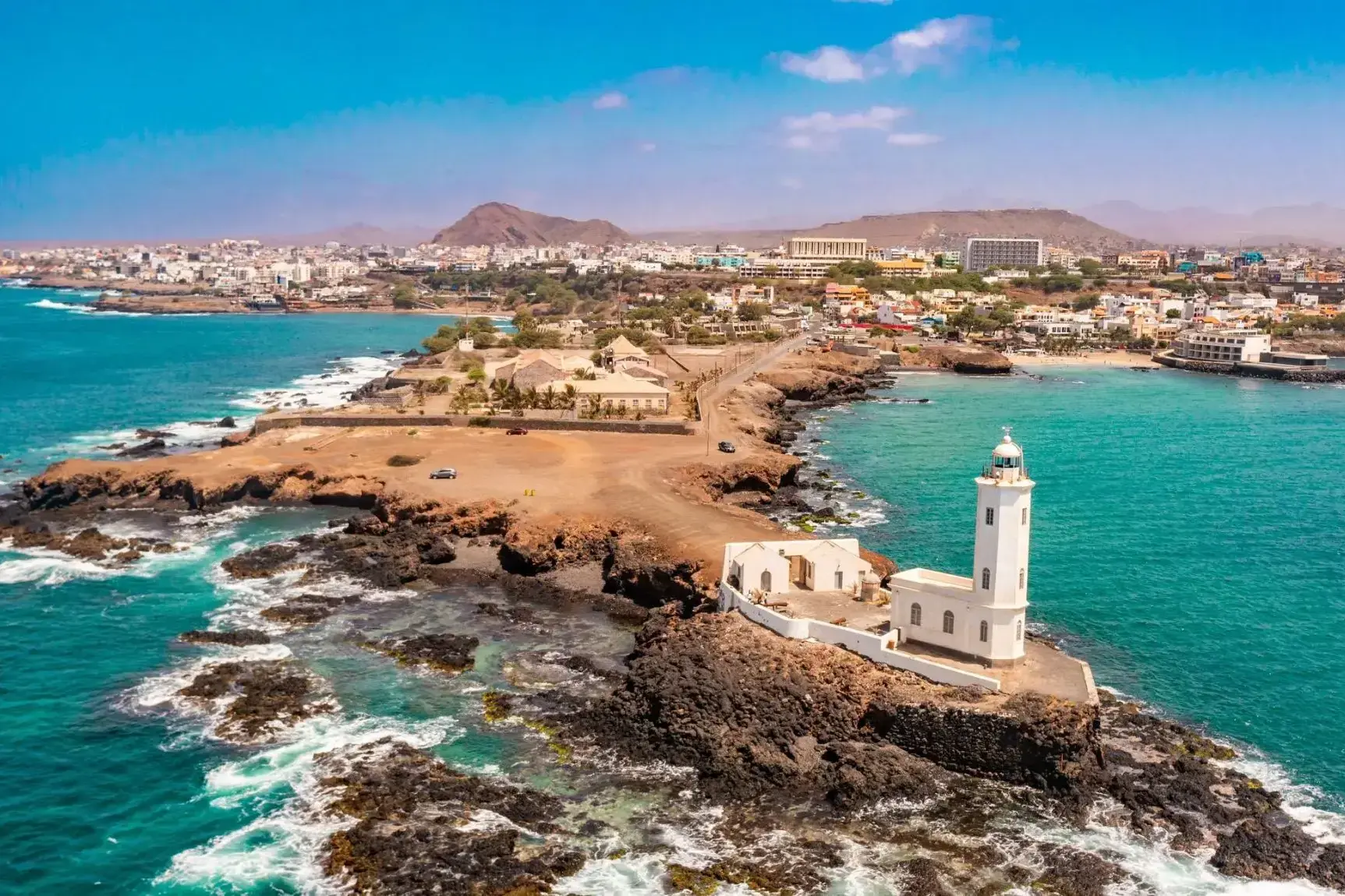
| 135 | 18.05 czw. | Dzień na morzu / Morze | ||
| 136 | 19.05 pt. | Jamestown / Saint Helena | 08:00 | 17:00 |
| 137 | 20.05 sob. | Dzień na morzu / Morze | ||
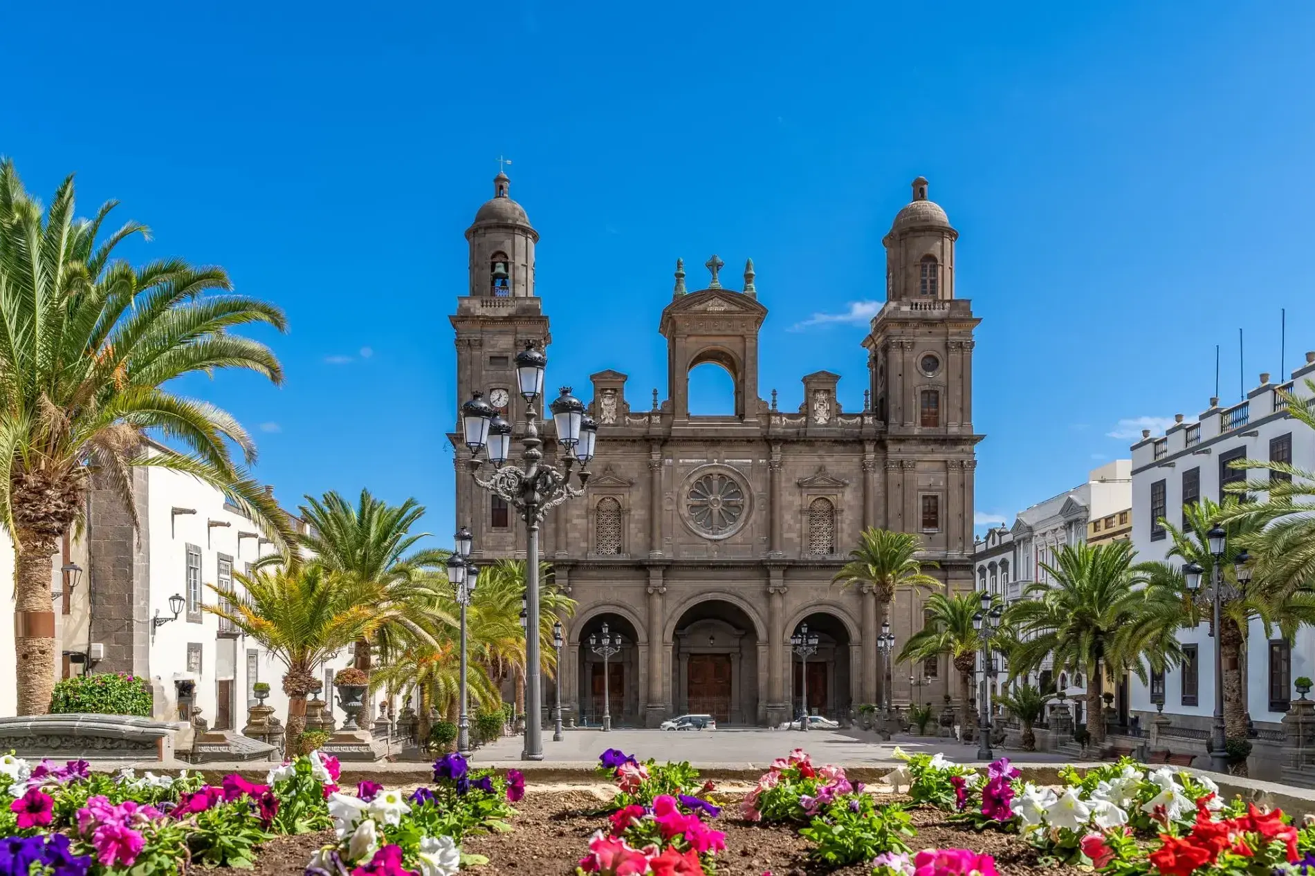
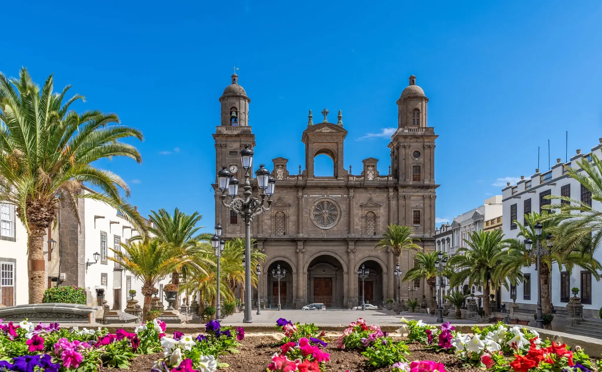
| 138 | 21.05 niedz. | Dzień na morzu / Morze | ||
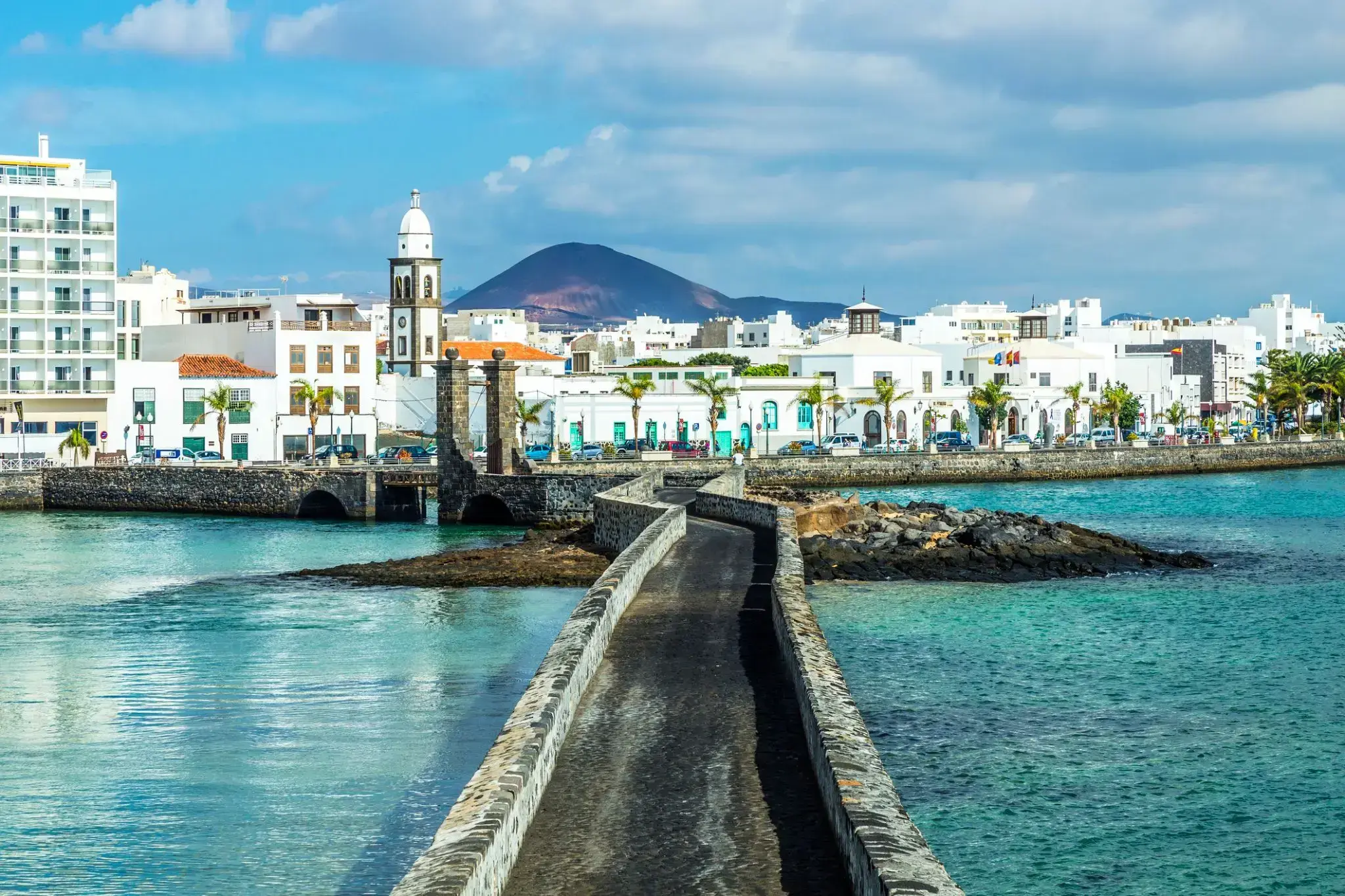
| 139 | 22.05 pon. | Dzień na morzu / Morze | ||
| 140 | 23.05 wt. | Dzień na morzu / Morze | ||
| 141 | 24.05 śr. | Dzień na morzu / Morze | ||
| 142 | 25.05 czw. | Praia / Cape Verde | 09:00 | 17:00 |
| 143 | 26.05 pt. | Dzień na morzu / Morze | ||
| 144 | 27.05 sob. | Dzień na morzu / Morze | ||
| 145 | 28.05 niedz. | Las Palmas (Gran Canaria) / Hiszpania | 06:00 | 20:00 |
| 146 | 29.05 pon. | Arresife / Hiszpania | 08:00 | 17:00 |
| 147 | 30.05 wt. | Agadir / Morocco | 08:00 | 14:00 |
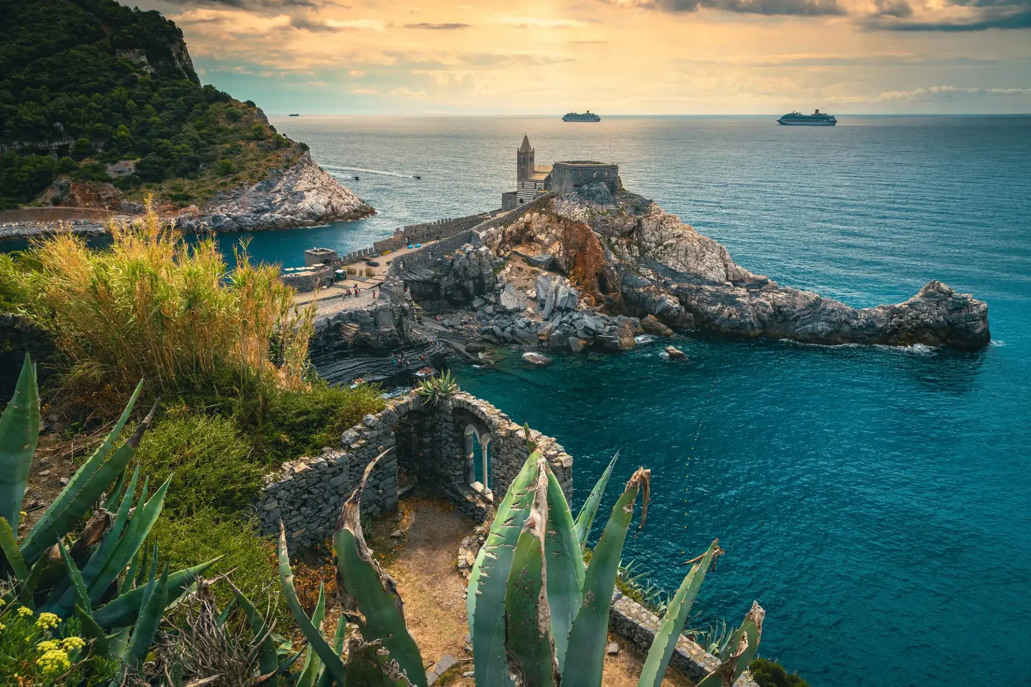
| 148 | 31.05 śr. | Casablanka / Morocco | 09:00 | 22:00 |
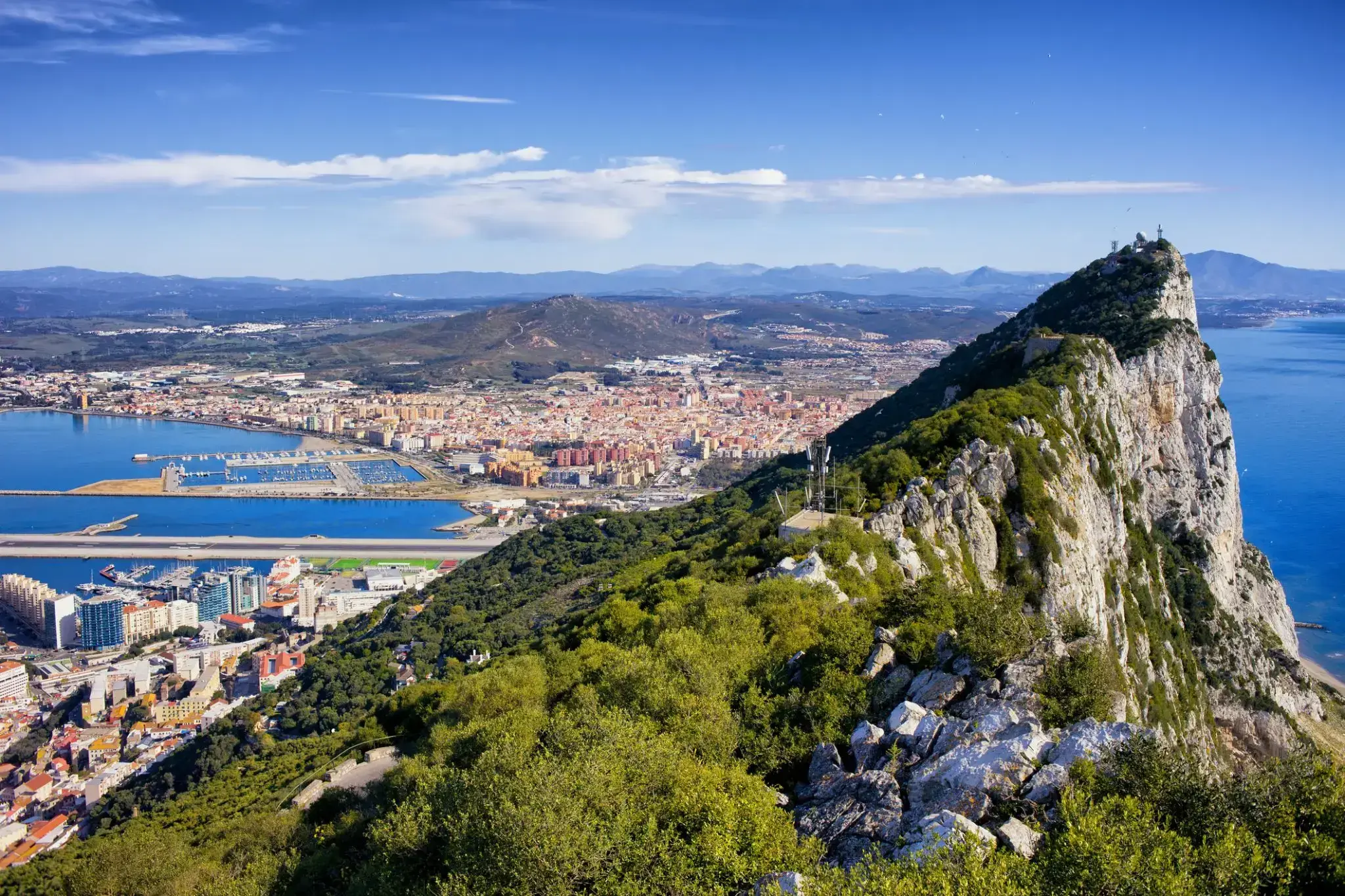
| 149 | 1.06 czw. | Gibraltar / Wielka Brytania | 13:00 | 22:00 |
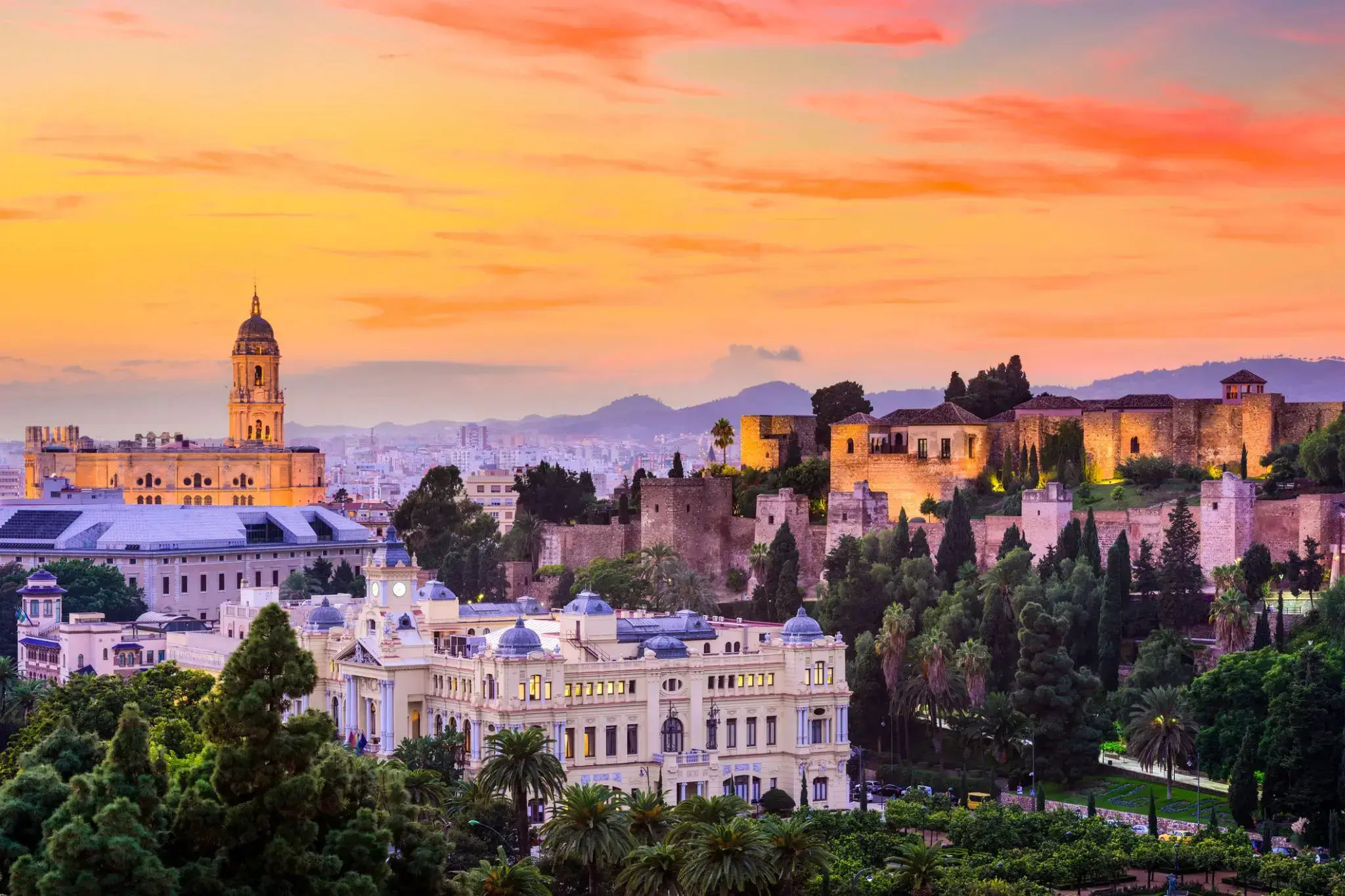
| 150 | 2.06 pt. | Malaga / Hiszpania | 08:00 | 22:00 |
| 151 | 3.06 sob. | Dzień na morzu / Morze | ||
| 152 | 4.06 niedz. | Barcelona / Hiszpania | 06:00 | 20:00 |
| 153 | 5.06 pon. | Marsylia / Francja | 09:30 | 20:00 |
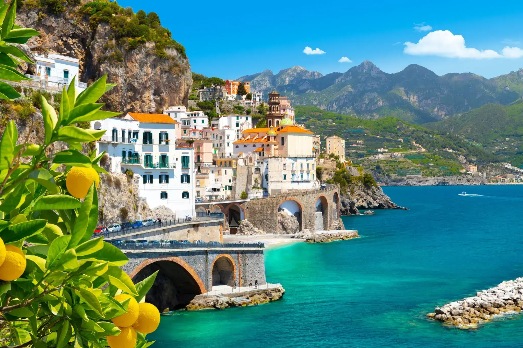
| 154 | 6.06 wt. | Nicea / Francja | 07:00 | 22:00 |
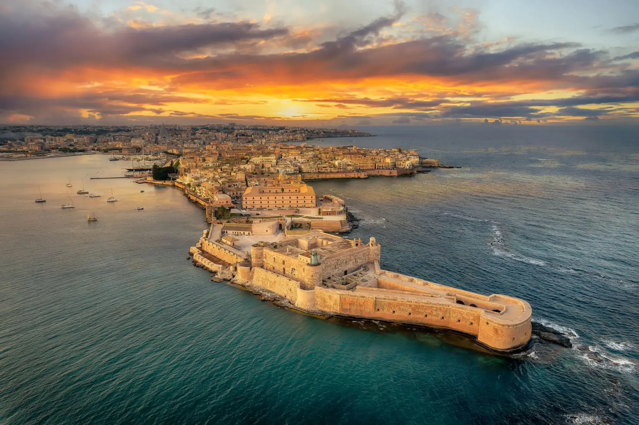
| 155 | 7.06 śr. | Portovenere / Włochy | 08:00 | 20:00 |
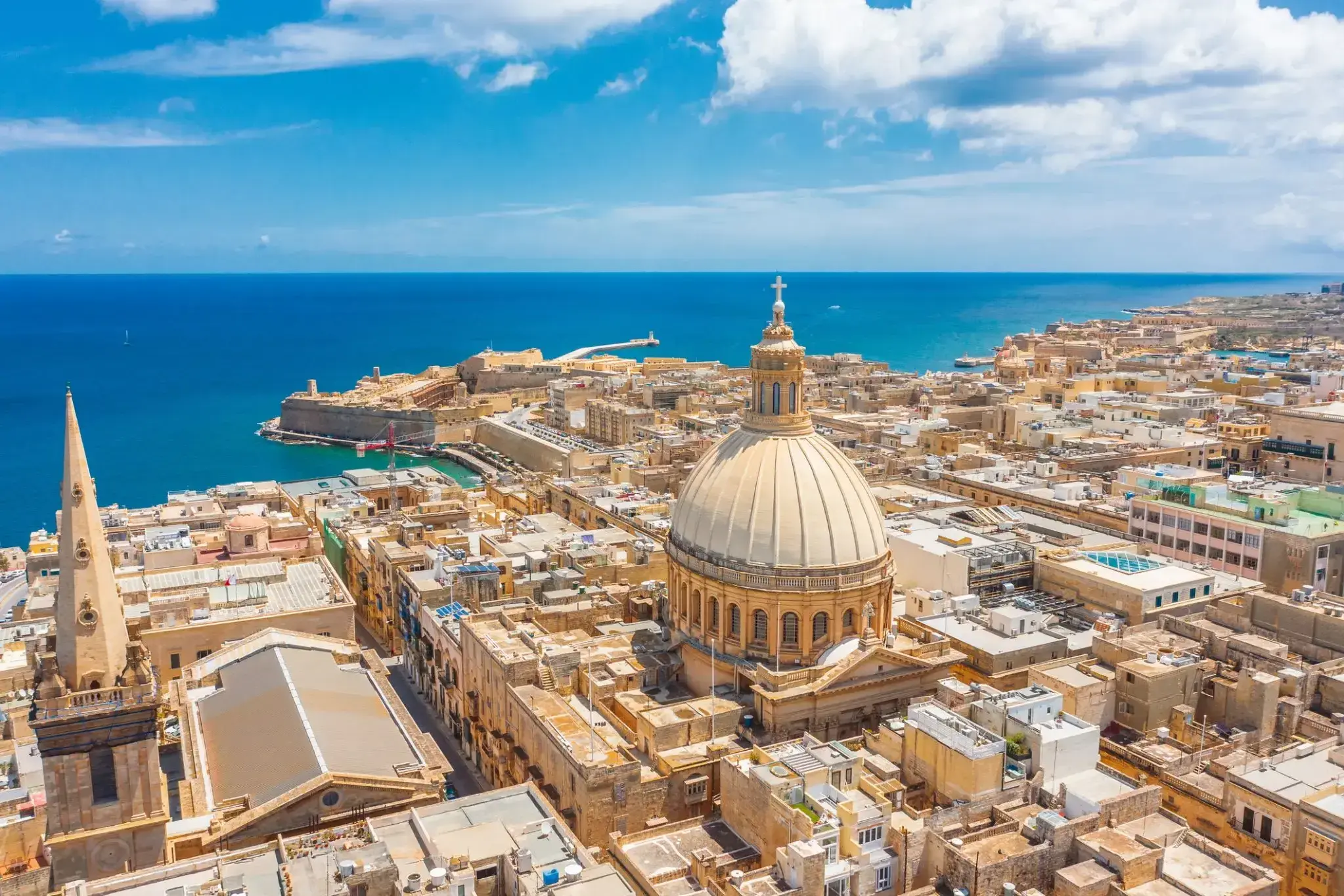
| 156 | 8.06 czw. | FLORENCJA PISA | 08:00 | |
| 157 | 9.06 pt. | FLORENCJA PISA | 22:00 | |
| 158 | 10.06 sob. | Porto Santo Stefano | 08:00 | 18:00 |
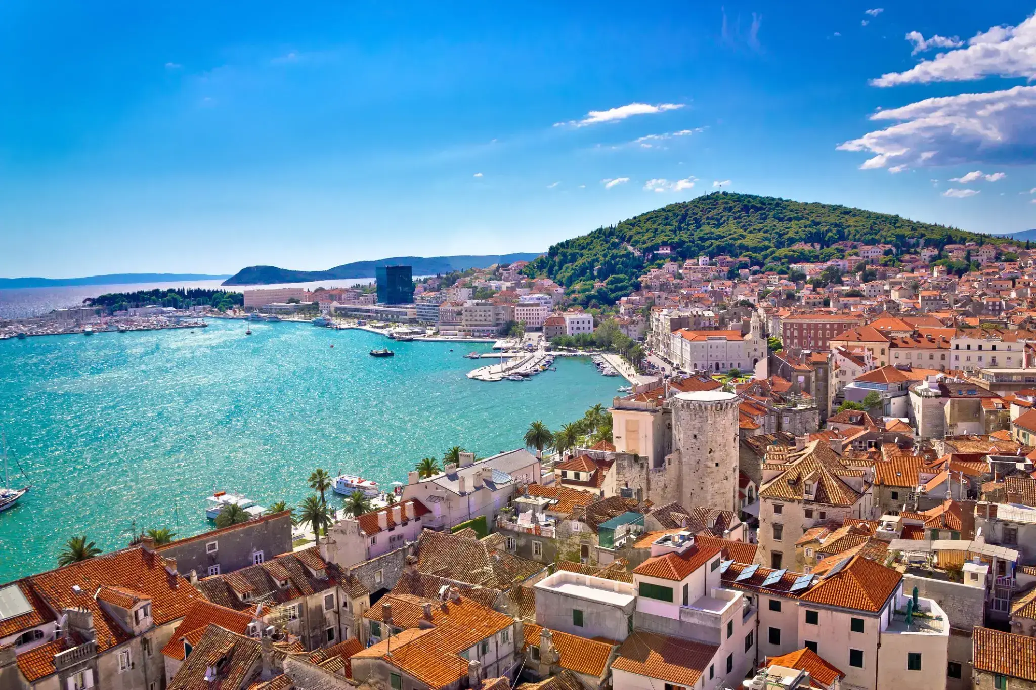
| 159 | 11.06 niedz. | Rzym (Civitavecchia) / Włochy | 06:00 | 20:00 |
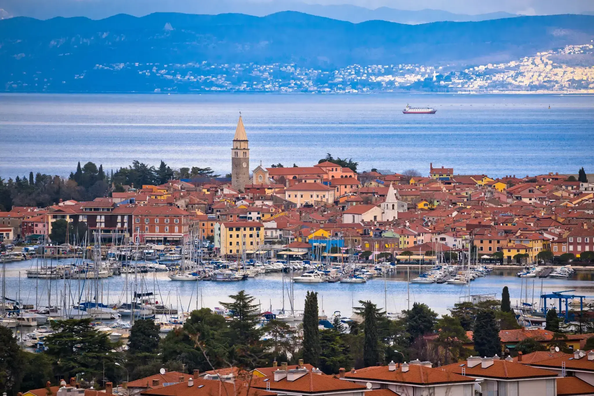
| 160 | 12.06 pon. | Sorrento, Capri / Włochy | 09:00 | 22:00 |
| 161 | 13.06 wt. | Amalfi / Włochy | 08:00 | 20:00 |
| 162 | 14.06 śr. | Syracuse / Włochy | 13:00 | 22:00 |
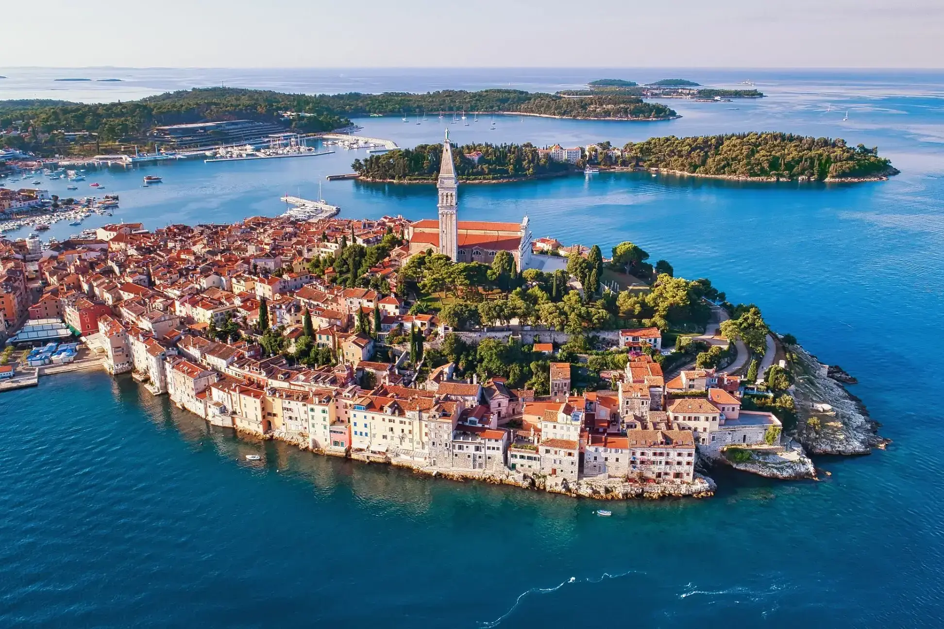
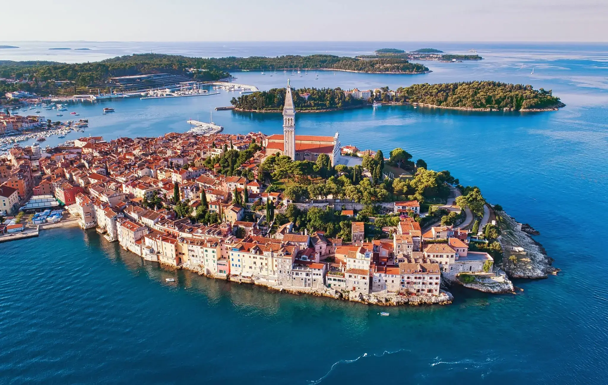
| 163 | 15.06 czw. | Valletta / Malta | 08:00 | 22:00 |
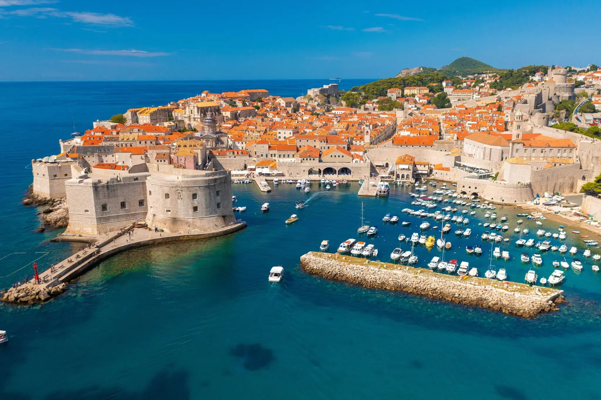
| 164 | 16.06 pt. | Dzień na morzu / Morze | ||
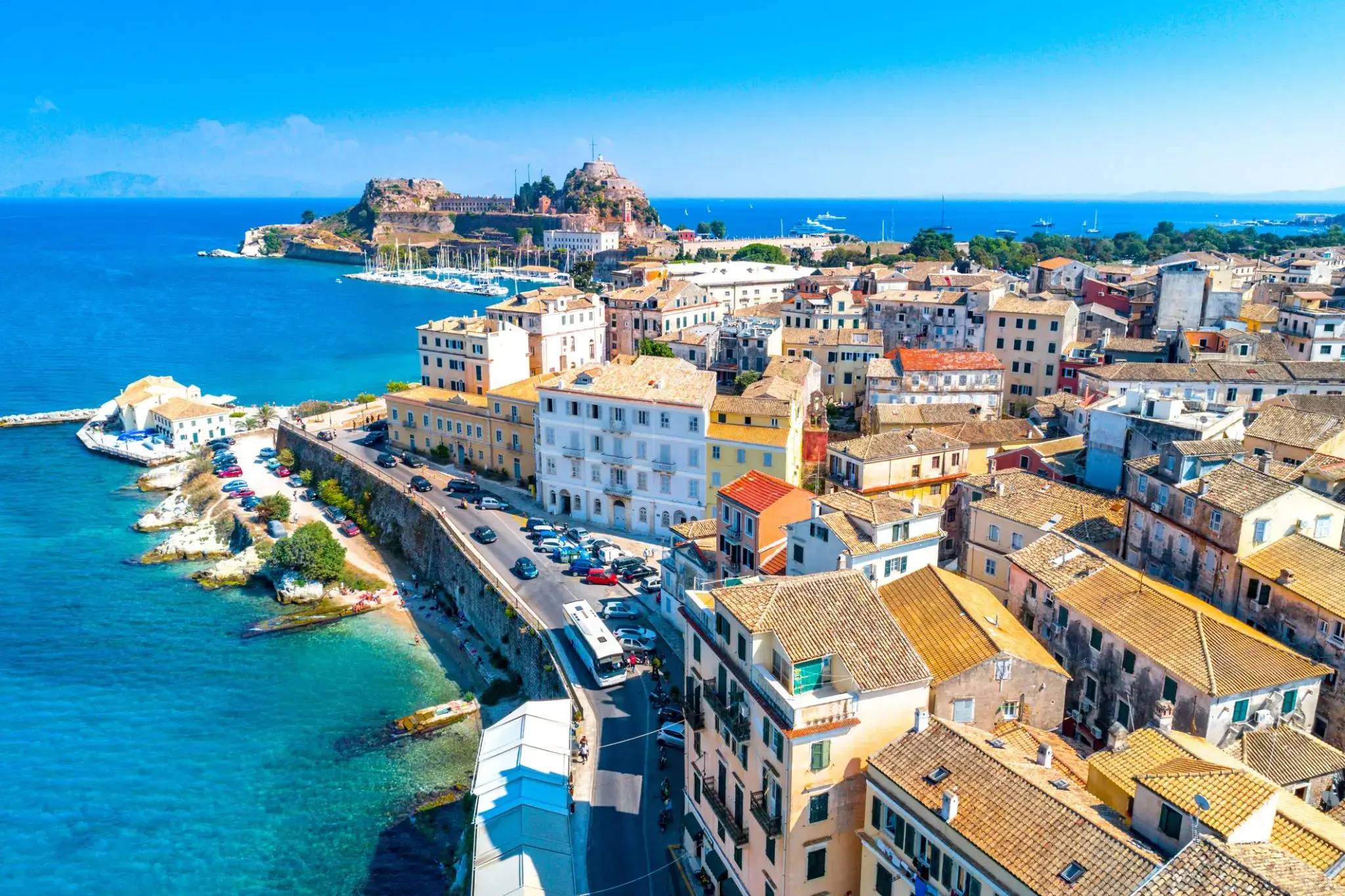
| 165 | 17.06 sob. | Kotor / Czarna Góra | 09:30 | 20:00 |
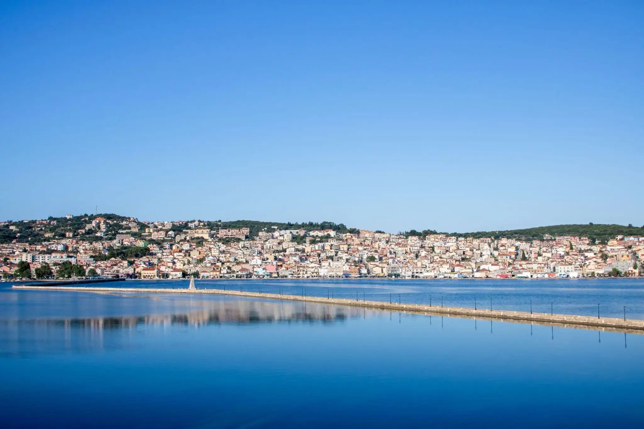
| 166 | 18.06 niedz. | Split / Chorwacja | 08:00 | 18:00 |
| 167 | 19.06 pon. | Miedź / Slovenia | 09:00 | 22:00 |
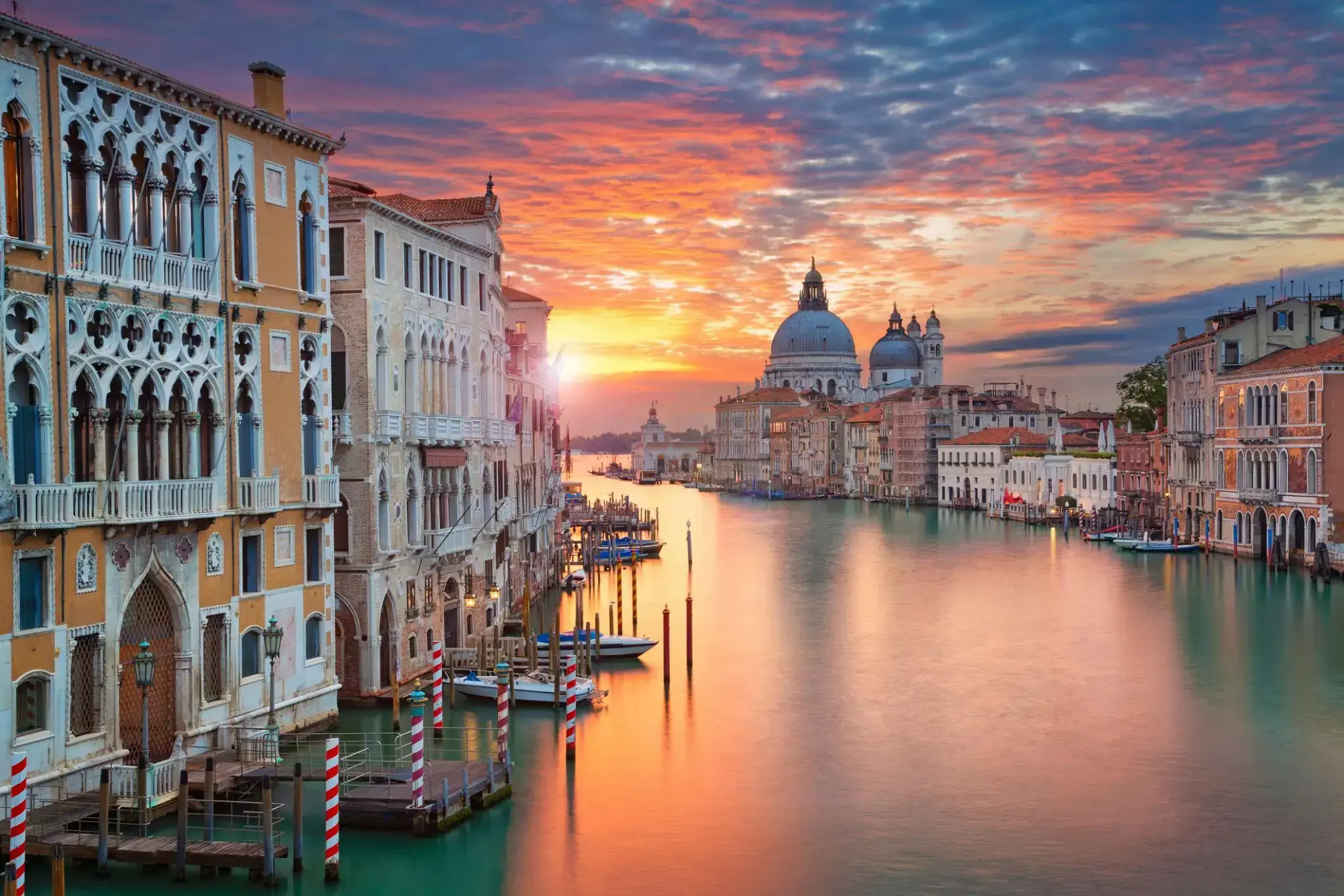
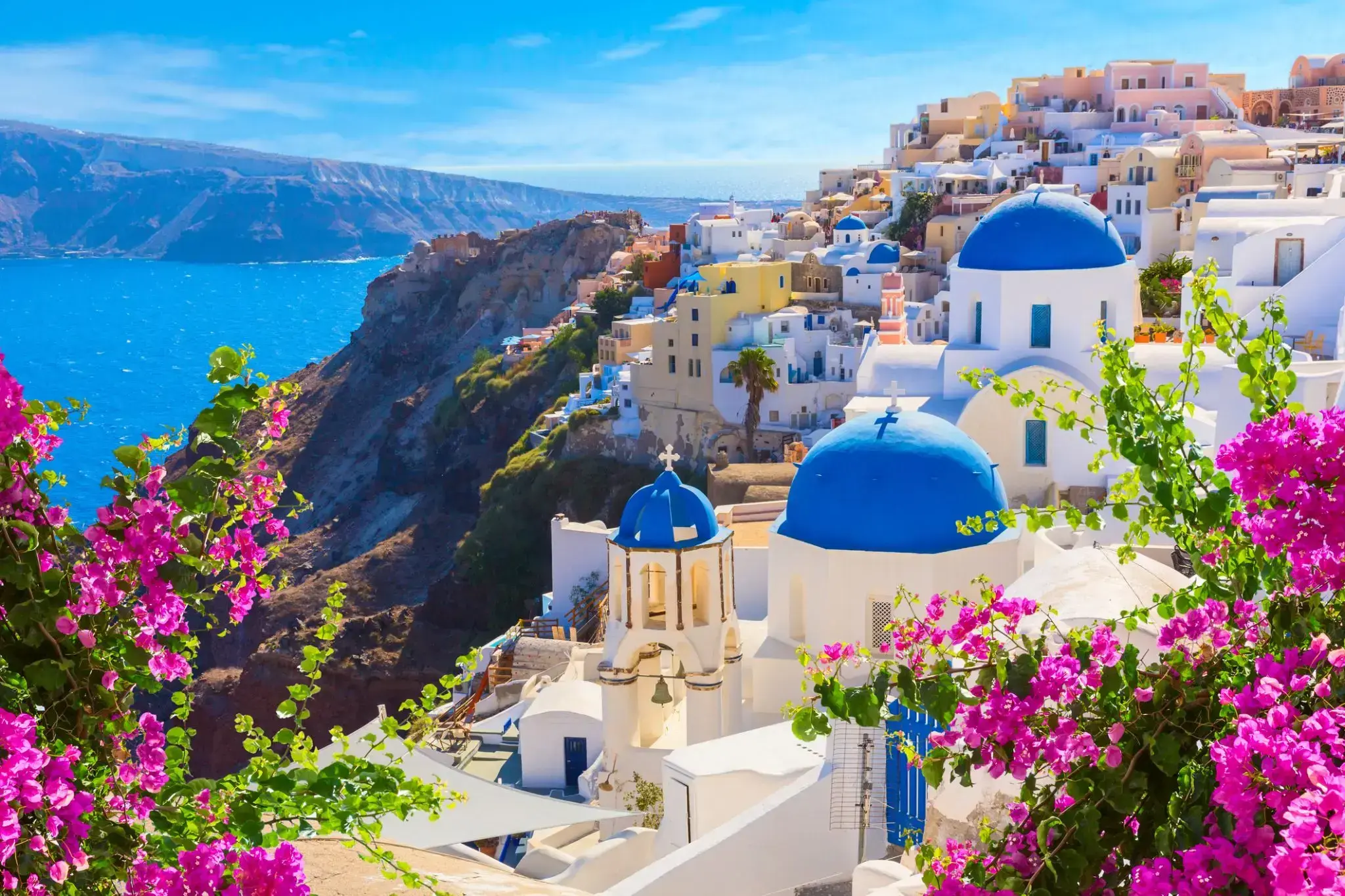
| 168 | 20.06 wt. | Wenecja / Włochy | 08:00 | |
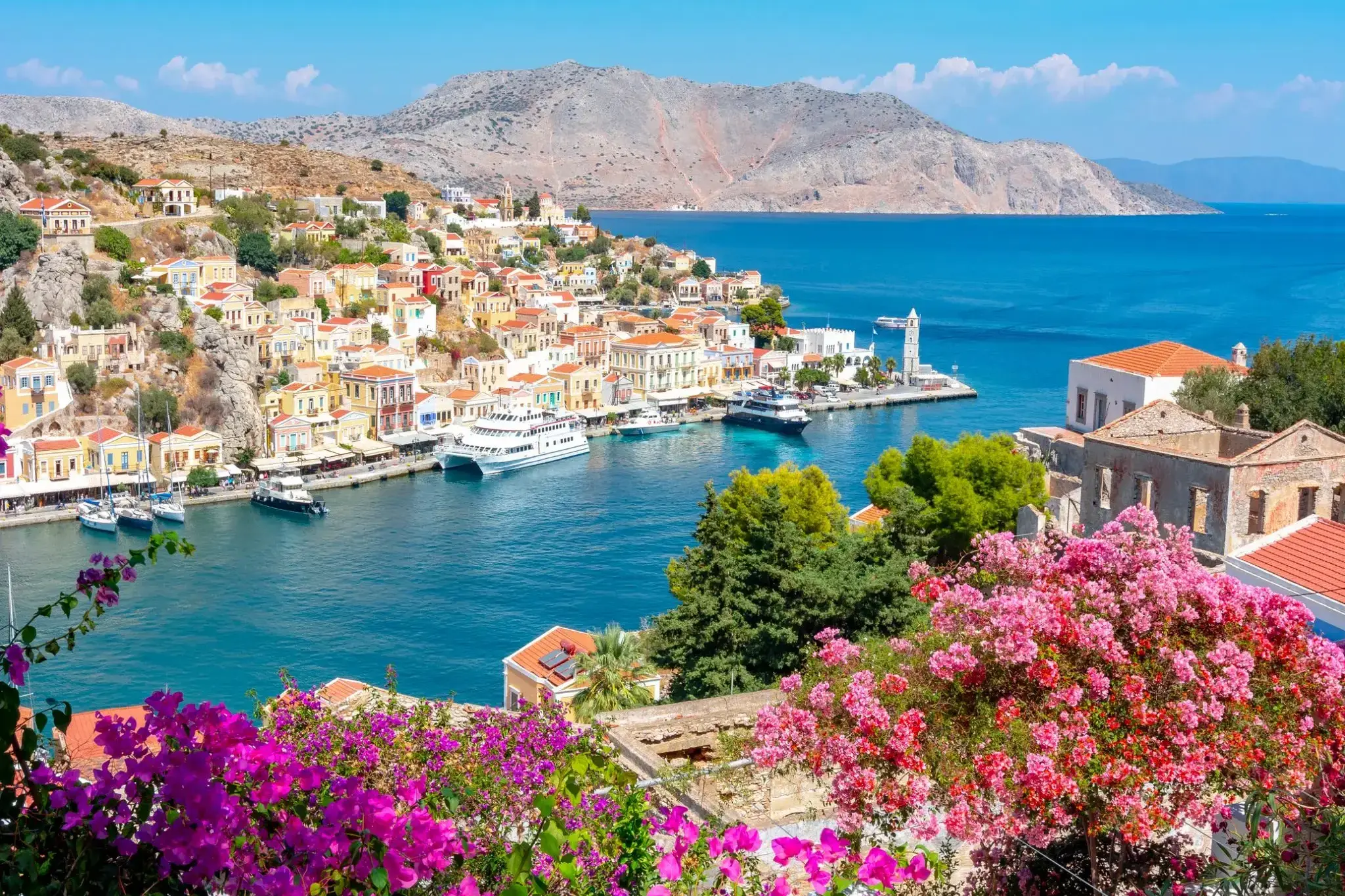
| 169 | 21.06 śr. | Wenecja / Włochy | 07:00 | 20:00 |
| 170 | 22.06 czw. | Rovinj / Chorwacja | 08:00 | 14:00 |
| 171 | 23.06 pt. | Dubrownik / Chorwacja | 08:00 | 21:00 |
| 172 | 24.06 sob. | Korfu / Grecja | 13:00 | 22:00 |
| 173 | 25.06 niedz. | Argostoli, Kefalonia (Wyspy Jońskie) / Grecja | 08:00 | 16:00 |
| 174 | 26.06 pon. | Monemwasia / Grecja | 09:30 | 20:00 |
| 175 | 27.06 wt. | Santorini, Cyklady / Grecja | 08:00 | 20:00 |
| 176 | 28.06 śr. | Rodos / Grecja | 08:00 | 22:00 |
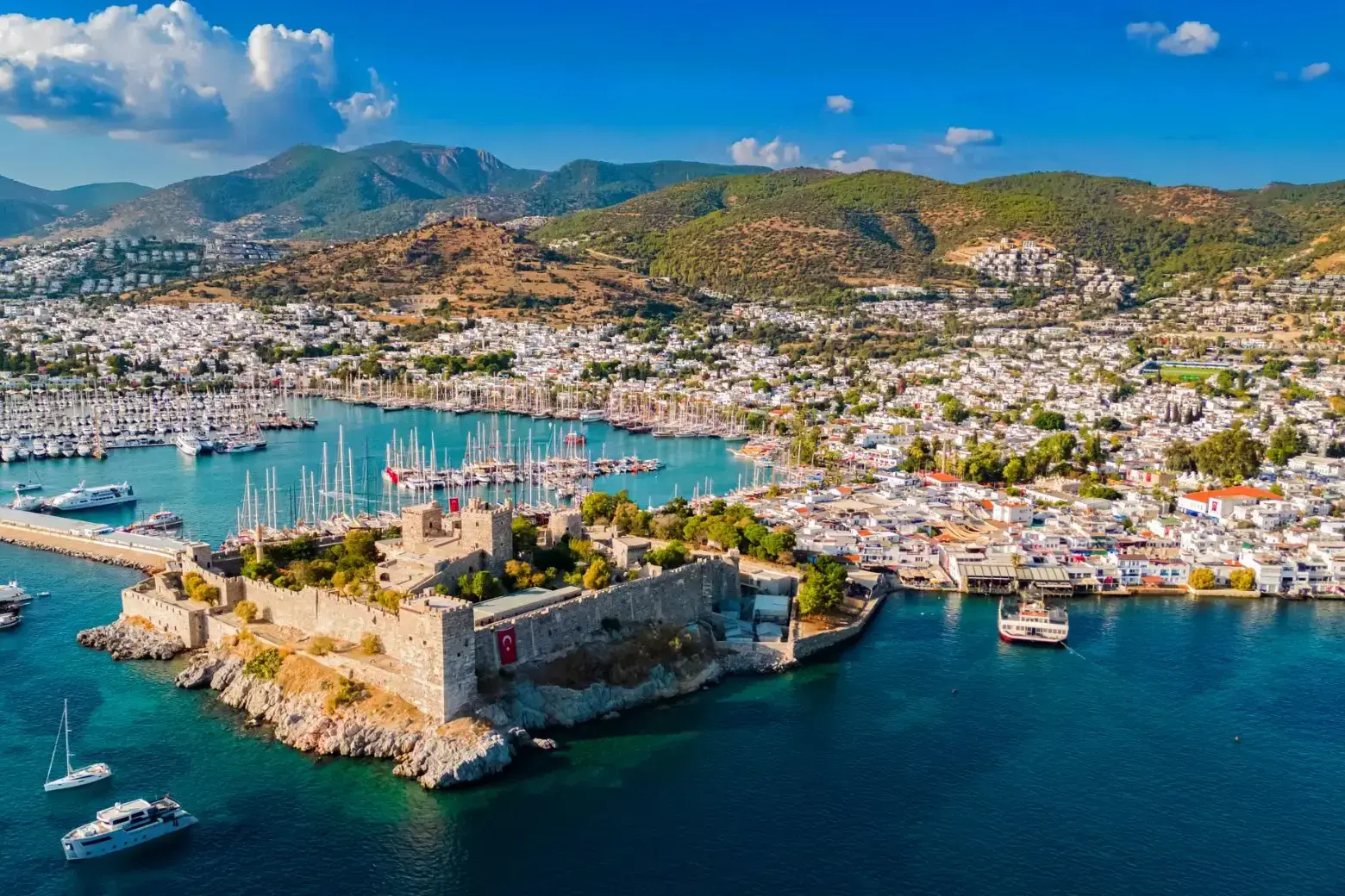
| 177 | 29.06 czw. | Bodrum / Turcja | 08:00 | 20:00 |
| 178 | 30.06 pt. | Syros / Grecja | 08:00 | 17:00 |
| 179 | 1.07 sob. | Pireus (Ateny) / Grecja | 05:00 |

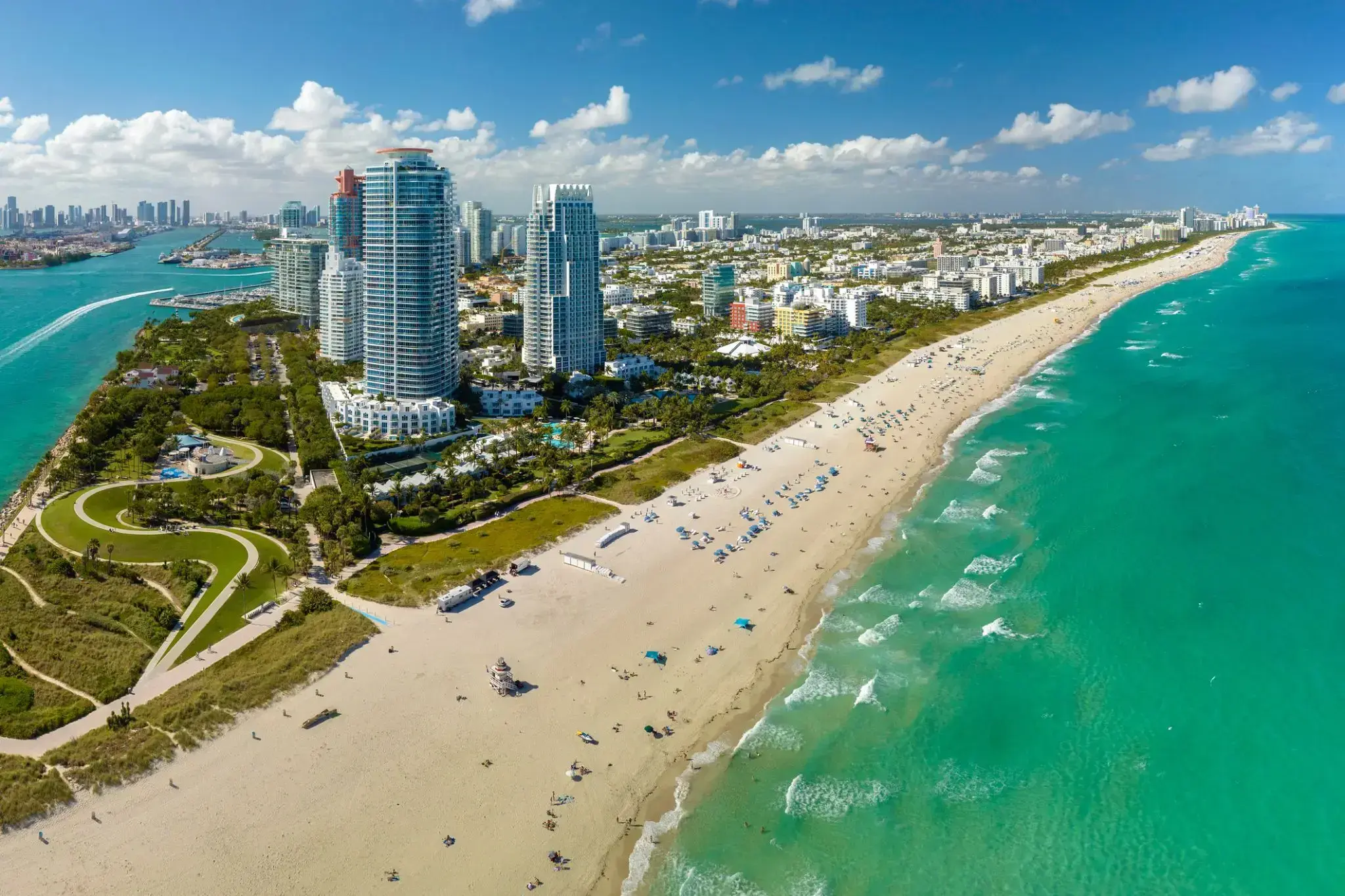
Miami, officially the City of Miami, is the cultural, economic and financial center of South Florida. Miami is the seat of Miami-Dade County, the most populous county in Florida. The city covers an area of about 56.6 square miles (147 km2), between the Everglades to the west and Biscayne Bay on the east; with a 2017 estimated population of 463,347, Miami is the sixth most densely populated major city in the United States. The Miami metropolitan area is home to 6.1 million people and the seventh-largest metropolitan area in the nation. Miami's metro area is the second-most populous metropolis in the southeastern United States and fourth-largest urban area in the U.S.
Miami is a major center, and a leader in finance, commerce, culture, media, entertainment, the arts, and international trade. The Miami Metropolitan Area is by far the largest urban economy in Florida and the 12th largest in the United States with a GDP of $344.9 billion as of 2017. In 2012, Miami was classified as an "Alpha−" level world city in the World Cities Study Group's inventory. In 2010, Miami ranked seventh in the United States and 33rd among global cities in terms of business activity, human capital, information exchange, cultural experience, and political engagement. In 2008, Forbes magazine ranked Miami "America's Cleanest City", for its year-round good air quality, vast green spaces, clean drinking water, clean streets, and citywide recycling programs. According to a 2009 UBS study of 73 world cities, Miami was ranked as the richest city in the United States, and the world's seventh-richest city in terms of purchasing power. Miami is nicknamed the "Capital of Latin America" and is the largest city with a Cuban-American plurality.
Greater Downtown Miami has one of the largest concentrations of international banks in the United States, and is home to many large national and international companies. The Civic Center is a major center for hospitals, research institutes, medical centers, and biotechnology industries. For more than two decades, the Port of Miami, known as the "Cruise Capital of the World", has been the number one cruise passenger port in the world. It accommodates some of the world's largest cruise ships and operations, and is the busiest port in both passenger traffic and cruise lines. Metropolitan Miami is also a major tourism hub in the southeastern U.S. for international visitors, ranking number two in the country after New York City.

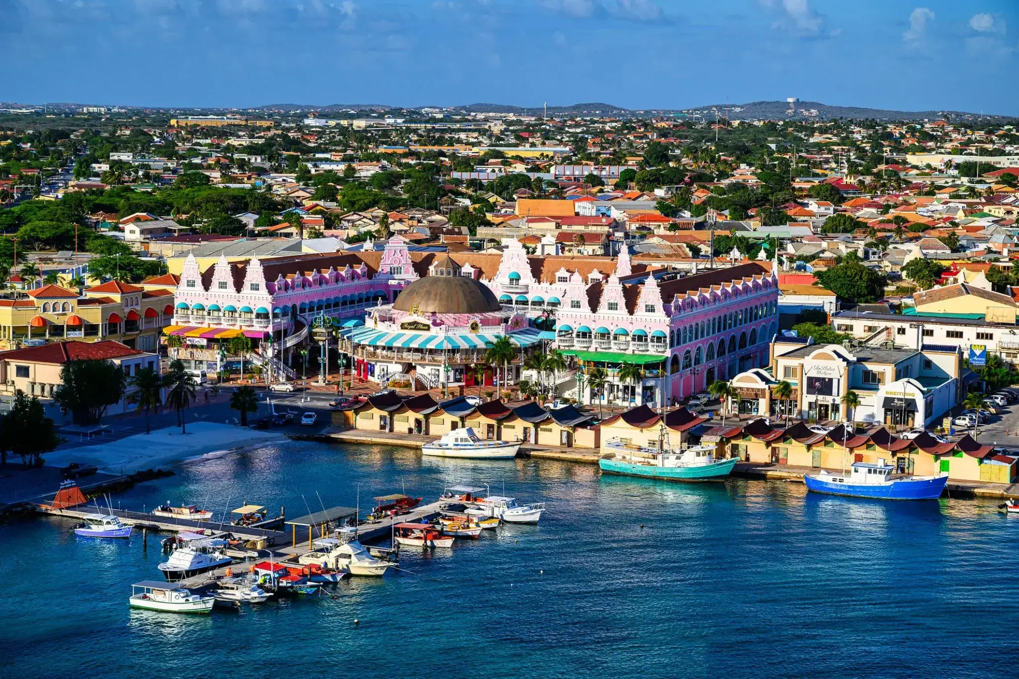
Aruba is an island and a constituent country of the Kingdom of the Netherlands in the southern Caribbean Sea, located about 1,600 kilometres (990 mi) west of the main part of the Lesser Antilles and 29 kilometres (18 mi) north of the coast of Venezuela. It measures 32 kilometres (20 mi) long from its northwestern to its southeastern end and 10 kilometres (6 mi) across at its widest point. Together with Bonaire and Curaçao, Aruba forms a group referred to as the ABC islands. Collectively, Aruba and the other Dutch islands in the Caribbean are often called the Dutch Caribbean.
Aruba is one of the four countries that form the Kingdom of the Netherlands, along with the Netherlands, Curaçao, and Sint Maarten; the citizens of these countries are all Dutch nationals. Aruba has no administrative subdivisions, but, for census purposes, is divided into eight regions. Its capital is Oranjestad.
Unlike much of the Caribbean region, Aruba has a dry climate and an arid, cactus-strewn landscape. This climate has helped tourism as visitors to the island can reliably expect warm, sunny weather. It has a land area of 179 km2(69.1 sq mi) and is densely populated, with a total of 102,484 inhabitants at the 2010 Census. It lies outside Hurricane Alley.
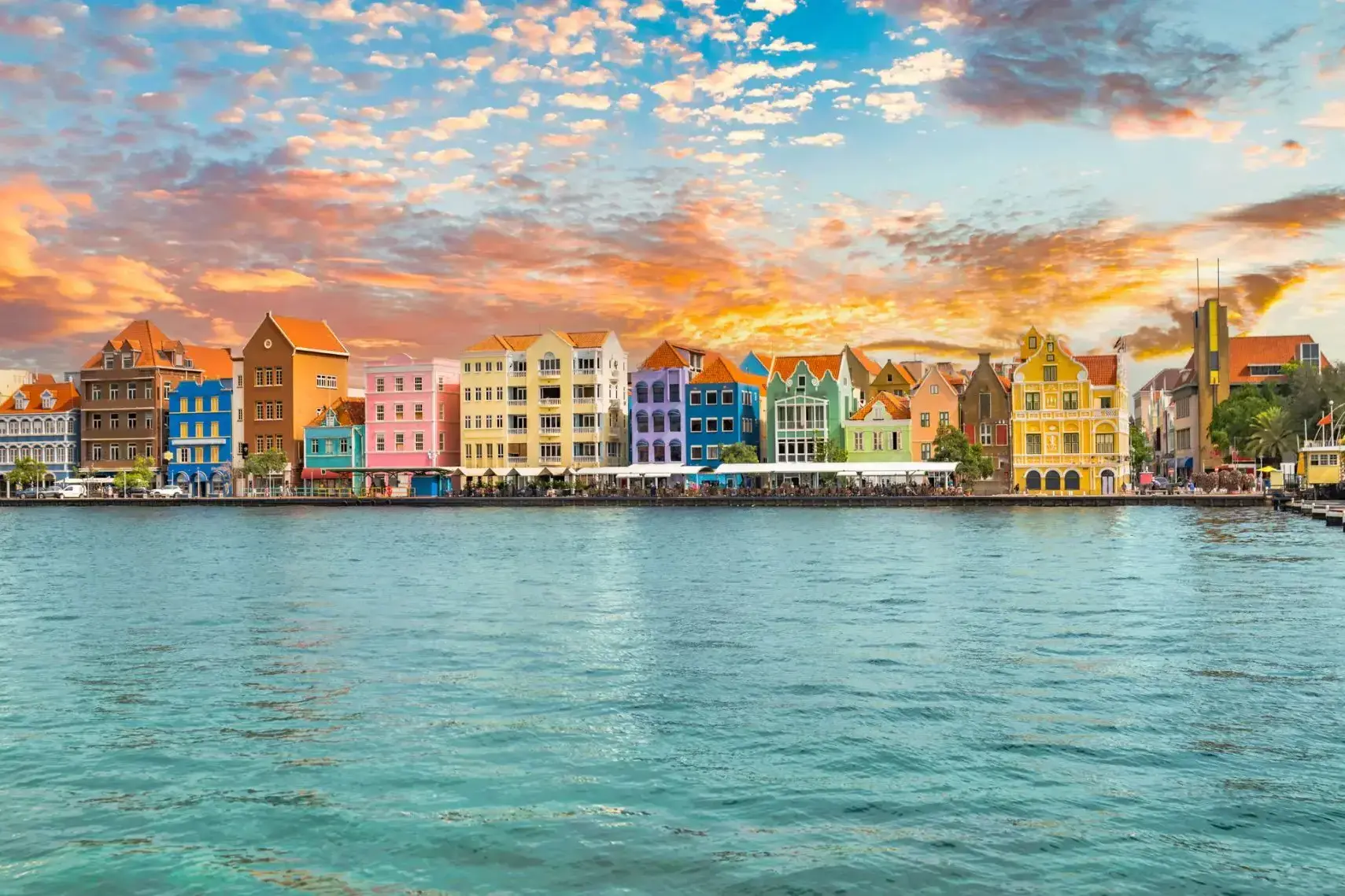
Curaçao jest wyspą w Małych Antylach na południowym Morzu Karaibskim i w regionie Karaibów Holenderskich, około 65 km (40 mil) na północ od wybrzeża Wenezueli. Jest krajem składowym (hol. land) Królestwa Niderlandów.
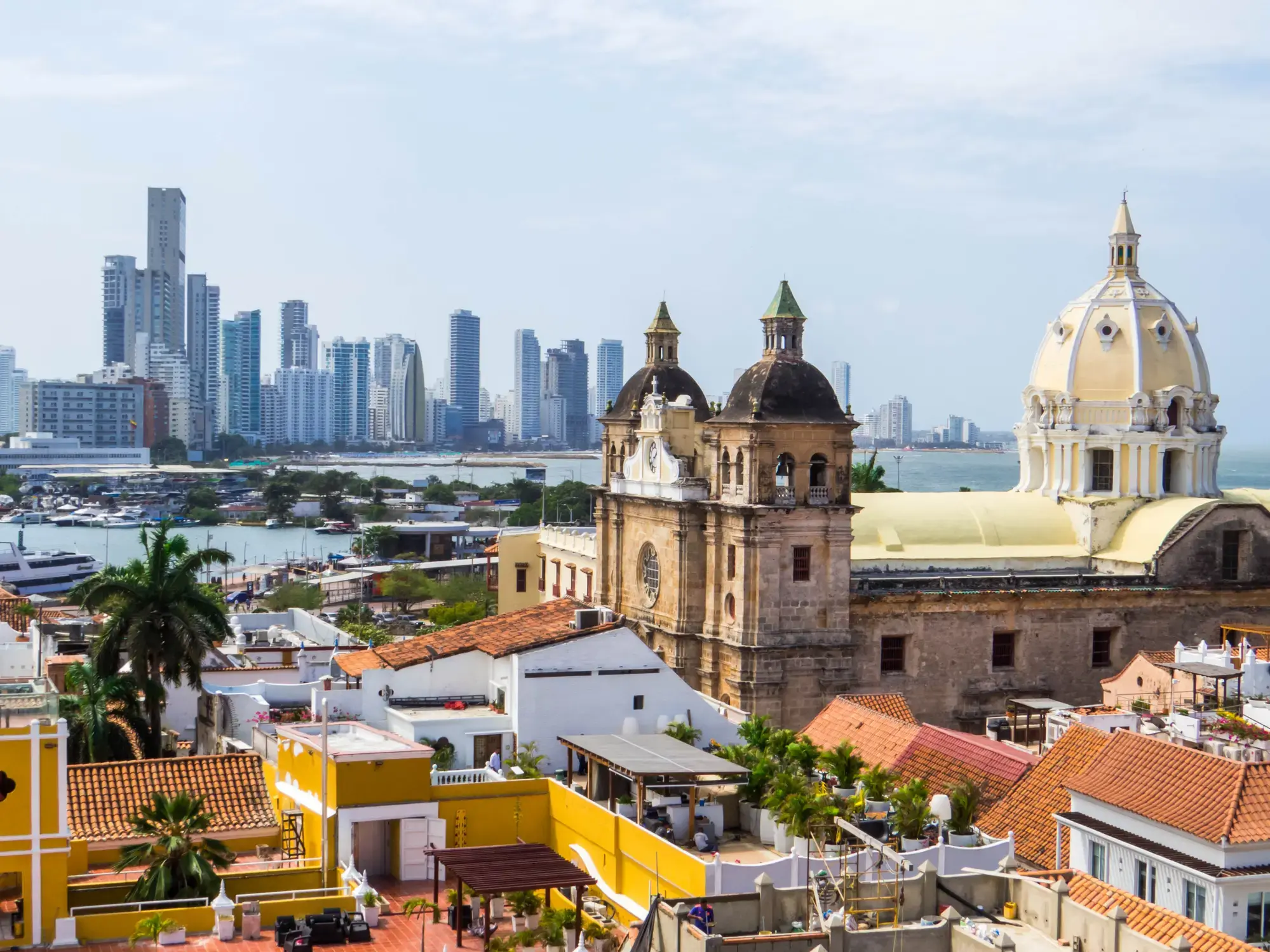
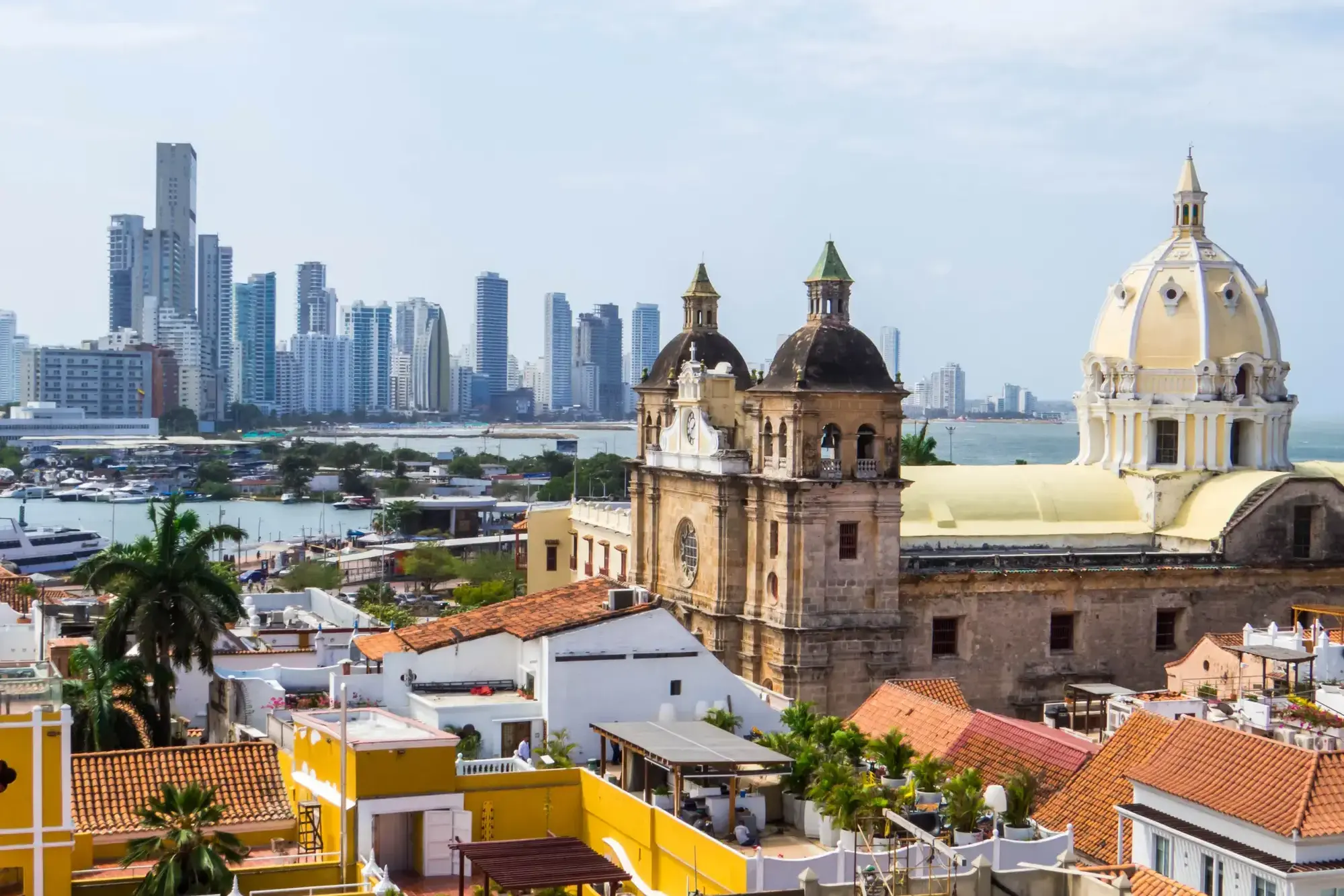
Starożytne mury forteczne, uliczni muzycy i karaibskie słońce tworzą niepowtarzalną atmosferę w Cartagenie (Bolívar) – perle kolumbijskiego wybrzeża. Miasto wpisane na listę światowego dziedzictwa UNESCO zachwyca kolonialną architekturą, uroczymi dziedzińcami i aromatem świeżo parzonej kawy z licznych kawiarni.
Zanurz się w tętniący życiem rytm Cartageny, spacerując brukowanymi uliczkami Starego Miasta, gdzie każdy zakątek kryje opowieści o piratach i hiszpańskich konkwistadorach. Zachód słońca przy starożytnej twierdzy Castillo San Felipe de Barajas to idealne zakończenie dnia pełnego kultury, historii i tropikalnego uroku.
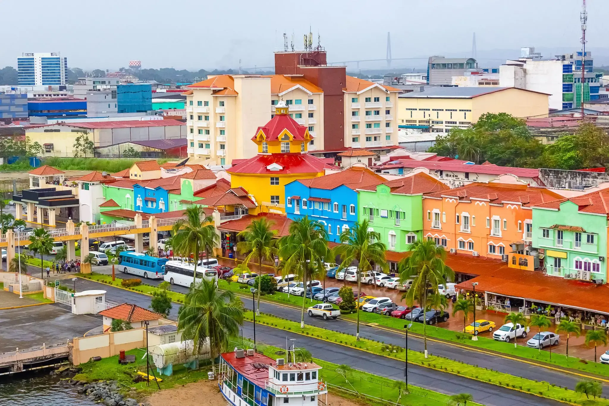
Colon
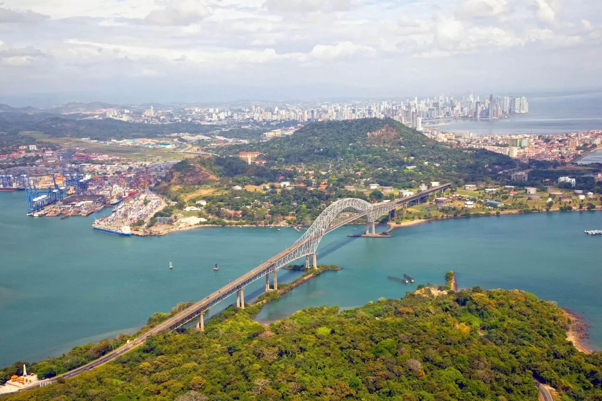
The Panama Canal is an artificial 82 km (51 mi) waterway in Panama that connects the Atlantic Ocean with the Pacific Ocean. The canal cuts across the Isthmus of Panama and is a conduit for maritime trade. Canal locks are at each end to lift ships up to Gatun Lake, an artificial lake created to reduce the amount of excavation work required for the canal, 26 m (85 ft) above sea level, and then lower the ships at the other end. The original locks are 34 m (110 ft) wide. A third, wider lane of locks was constructed between September 2007 and May 2016. The expanded canal began commercial operation on June 26, 2016. The new locks allow transit of larger, post-Panamax ships, capable of handling more cargo.
France began work on the canal in 1881, but stopped due to engineering problems and a high worker mortality rate. The United States took over the project in 1904 and opened the canal on August 15, 1914. One of the largest and most difficult engineering projects ever undertaken, the Panama Canal shortcut greatly reduced the time for ships to travel between the Atlantic and Pacific Oceans, enabling them to avoid the lengthy, hazardous Cape Horn route around the southernmost tip of South America via the Drake Passage or Strait of Magellan.
Colombia, France, and later the United States controlled the territory surrounding the canal during construction. The US continued to control the canal and surrounding Panama Canal Zone until the 1977 Torrijos–Carter Treatiesprovided for handover to Panama. After a period of joint American–Panamanian control, in 1999, the canal was taken over by the Panamanian government. It is now managed and operated by the government-owned Panama Canal Authority.
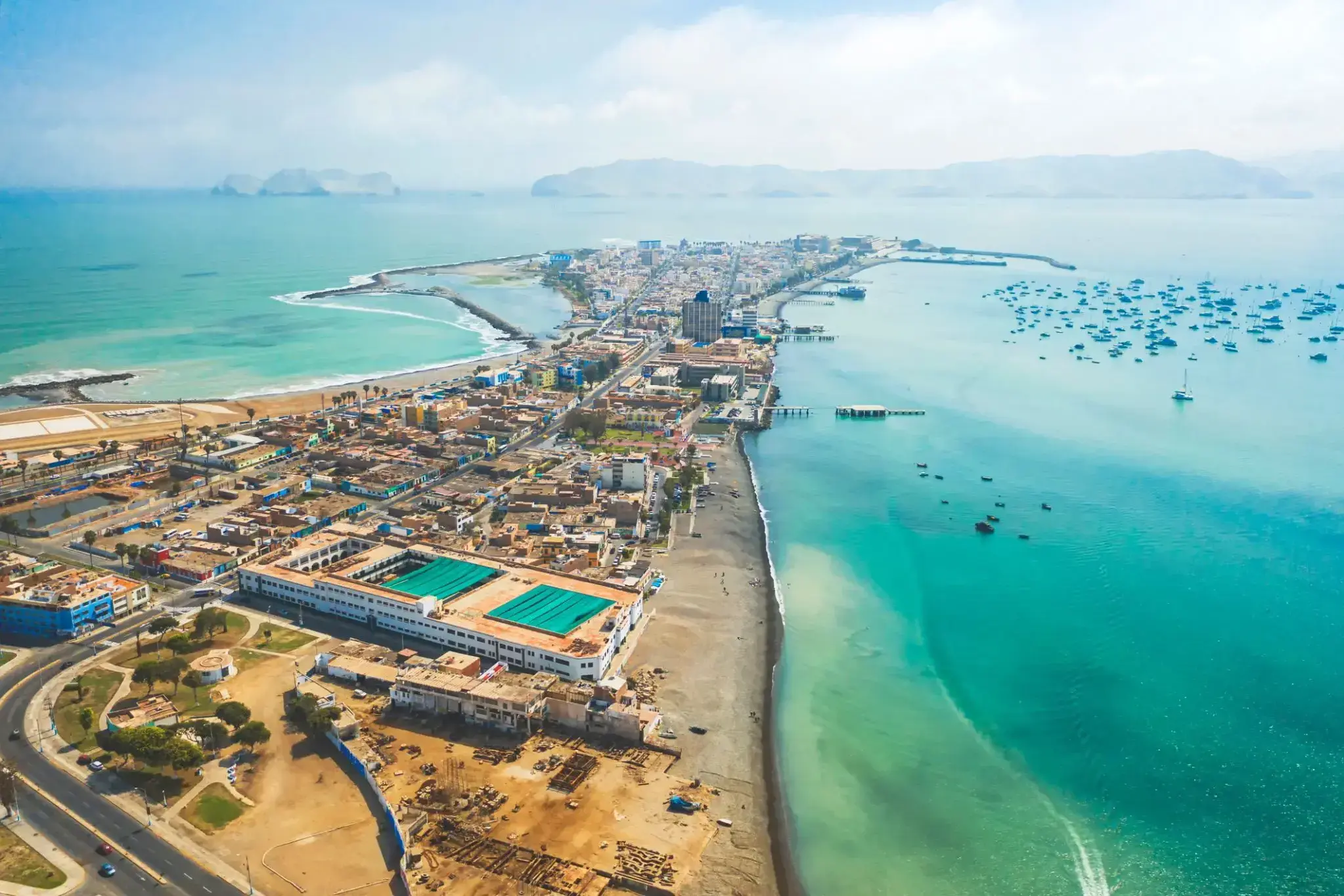
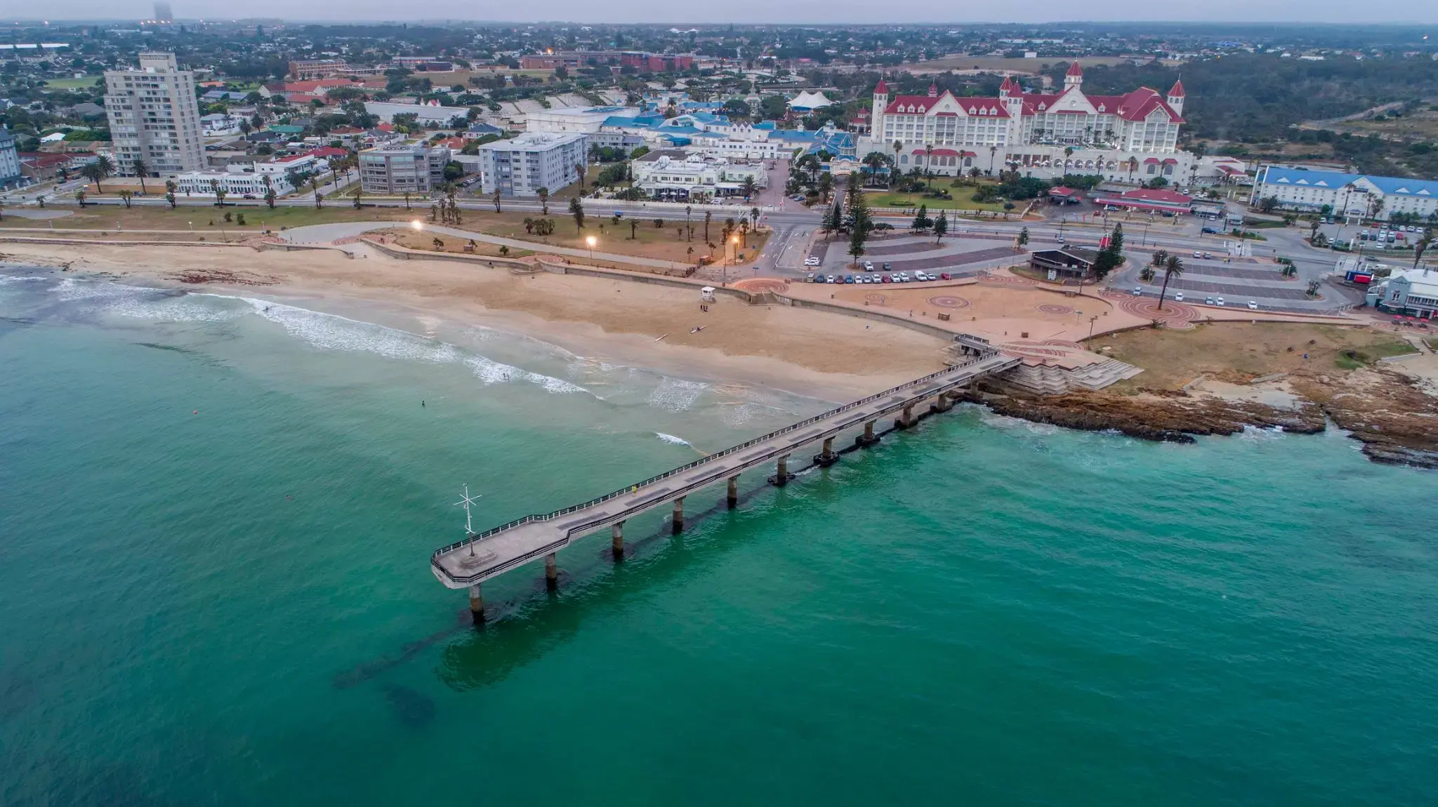
Panama City, położone na północno-zachodnim wybrzeżu Florydy, słynie z długich, białych plaż z miękkim, kwarcowym piaskiem i ciepłych, szmaragdowych wód Zatoki Meksykańskiej. To nadmorskie miasto jest popularne zarówno wśród rodzin z dziećmi, jak i miłośników sportów wodnych: można tu uprawiać kajakarstwo, parasailing, nurkowanie i wędkarstwo. Szczególną atrakcją jest promenada — Pier Park — gdzie znajdują się sklepy, restauracje i centra rozrywki.
Poza plażowaniem Panama City oferuje także unikalne atrakcje przyrodnicze. W pobliżu znajduje się rezerwat St. Andrews State Park, gdzie można obserwować delfiny, spacerować ścieżkami wśród wydm i lasów sosnowych lub wybrać się na wycieczkę na wyspę Shell Island, zachowaną w stanie nienaruszonym. Miasto łączy atmosferę kurortu z południowym urokiem, oferując spokojny, a jednocześnie pełen wrażeń wypoczynek.
Manta

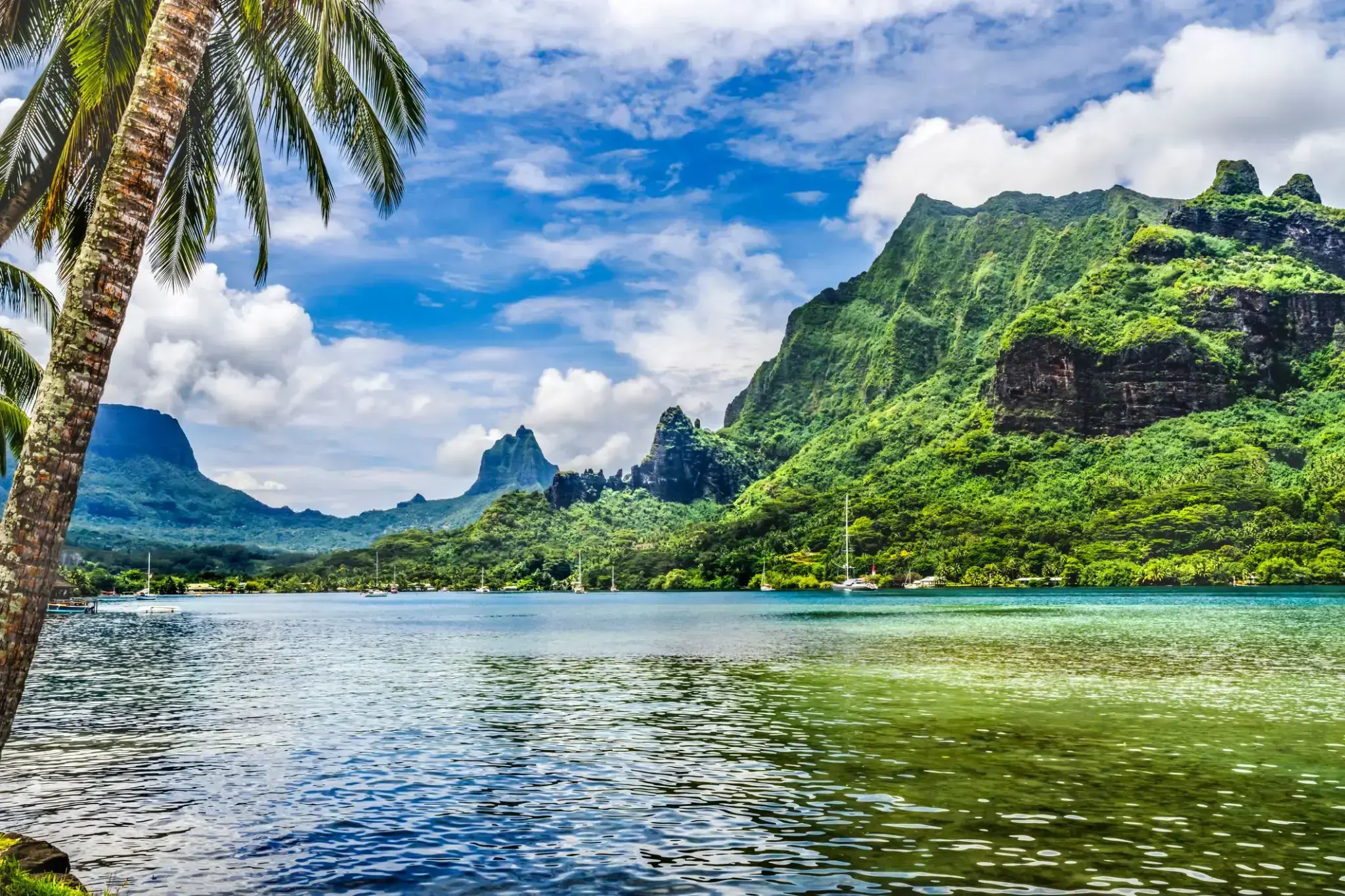
The island was formed as a volcano 1.5 to 2.5 million years ago, the result of a Society hotspot in the mantle under the oceanic plate that formed the whole of the Society Archipelago. It is theorized that the current bays were formerly river basins that filled during the Holocene searise.
Mo'orea is about 10 miles in width from the west to the east. There are two small, nearly symmetrical bays on the north shore. The one to the west is called 'Ōpūnohu Bay, which is not very populated but many travelers have come into the bay. The main surrounding communes of the bay are Piha'ena in the east and Papetō'ai to the west. The one to the east is Cook's Bay, also called Pao Pao Bay since the largest commune of Mo'orea is at the bottom of the bay. The other communes are Piha'ena to the west and busy Maharepa to the east. The highest point is Mount Tohi'e'a, near the center of Mo'orea. It dominates the vista from the two bays and can be seen from Tahiti. There are also hiking trails in the mountains. The Vai'are Bay is another small inlet, smaller than the two main bays, on the east shore. This bay has been settled a lot and has a lot of business. The main village is located just south of the bay.
Papeete is the capital city of French Polynesia, an overseas collectivity of France in the Pacific Ocean. The commune of Papeete is located on the island of Tahiti, in the administrative subdivision of the Windward Islands, of which Papeete is the administrative capital. The French High Commissioner also resides in Papeete. It is the primary center of Tahitian and French Polynesian public and private governmental, commercial, industrial and financial services, the hub of French Polynesian tourism and a commonly used port of call. The Windward Islands are themselves part of the Society Islands. The name Papeete means "water from a basket".
The urban area of Papeete had a total population of 136,771 inhabitants at the August 2017 census, 26,926 of whom lived in the commune of Papeete proper.


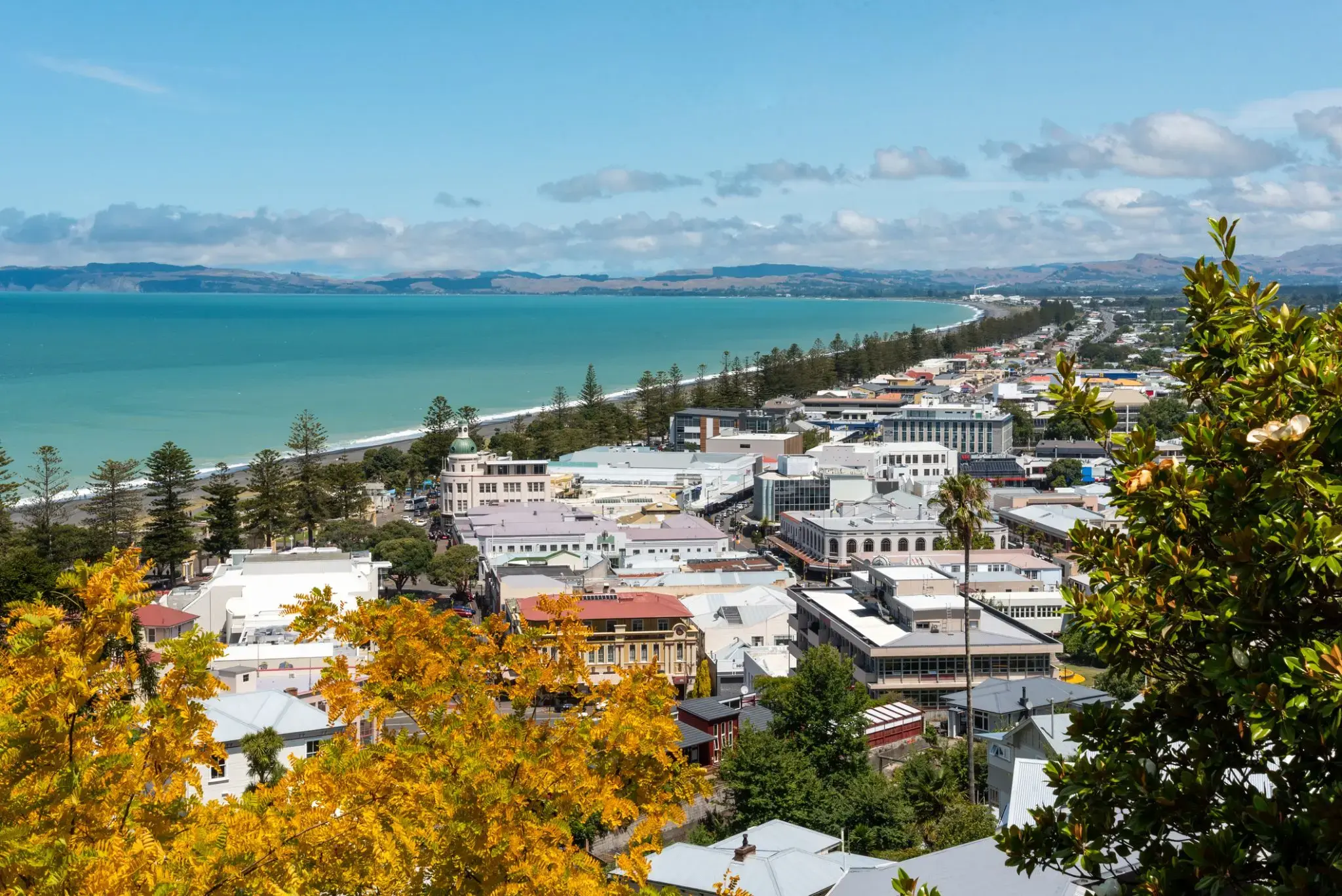
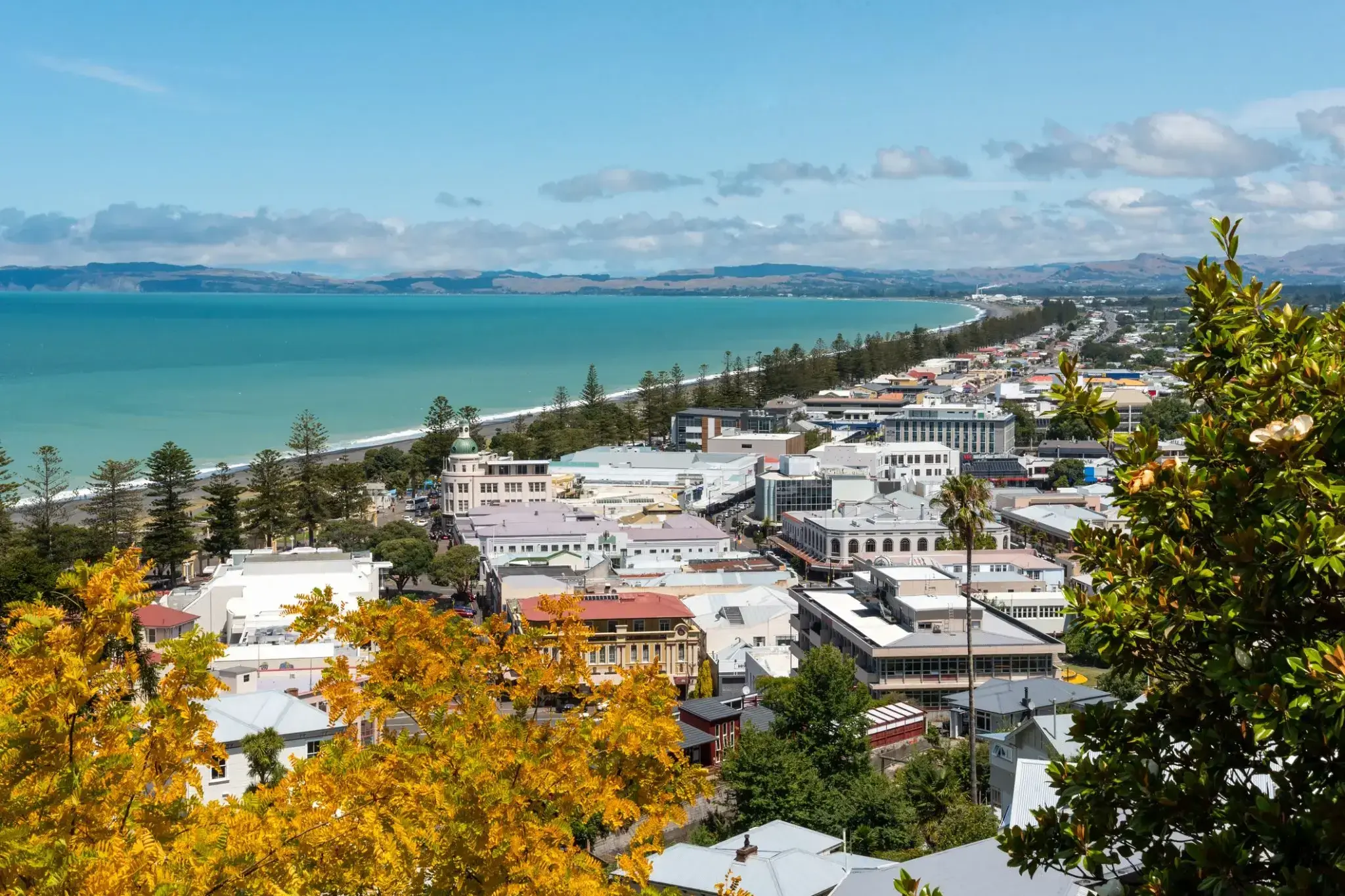
Napier is a New Zealand city with a seaport, located in Hawke's Bay on the eastern coast of the North Island. The population of Napier is about 63,900 as of the June 2018. About 18 kilometres (11 mi) south of Napier is the inland city of Hastings. These two neighbouring cities are often called "The Bay Cities" or "The Twin Cities" of New Zealand. The total population of the Napier-Hastings Urban Area is 134,500 people, which makes it the sixth-largest urban area in New Zealand, closely followed by Dunedin (122,000), and trailing Tauranga(141,600).
Napier is about 320 kilometres (200 mi) northeast of the capital city of Wellington. Napier (63,900) has a smaller population than its neighbouring city of Hastings (70,600) but is seen as the main centre due to it being closer in distance to both the seaport and the main airport that service Hawke's Bay, and Hastings' population figure includes 13,000 people living in Havelock North, which is often considered a town in its own right. The City of Napier has a land area of 106 square kilometres (41 sq mi) and a population density of 540.0 per square kilometre.
Napier is the nexus of the largest wool centre in the Southern Hemisphere, and it has the primary export seaport for northeastern New Zealand – which is the largest producer of apples, pears, and stone fruit in New Zealand. Napier has also become an important grape and wine production area, with the grapes grown around Hastings and Napier being sent through the Port of Napier for export. Large amounts of sheep's wool, frozen meat, wood pulp, and timber also pass through Napier annually for export. Smaller amounts of these materials are shipped via road and railway to the large metropolitan areas of New Zealand itself, such as Auckland, Wellington and Hamilton.
Napier is a popular tourist city, with a unique concentration of 1930s Art Deco architecture, built after much of the city was razed in the 1931 Hawke's Bay earthquake. It also has one of the most photographed tourist attractions in the country, a statue on Marine Parade called Pania of the Reef. Thousands of people flock to Napier every February for the Tremains Art Deco Weekend event, a celebration of its Art Deco heritage and history. Other notable tourist events attracting many outsiders to the region annually include F.A.W.C! Food and Wine Classic events, and the Mission Estate Concert at Mission Estate and Winery in the suburb of Taradale.
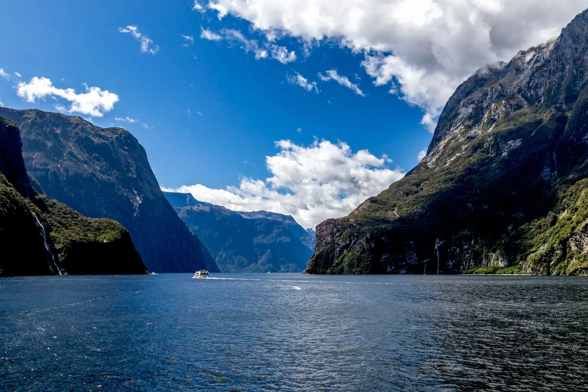
Trudno uwierzyć, że wśród tropikalnych lasów deszczowych i stromych klifów kryje się świat mglistych szczytów i lśniących wodospadów, które w Milford Sound w Nowej Zelandii spadają z wysokości ponad 150 metrów prosto do błękitnych wód fiordu. Ten zakątek Wyspy Południowej zaskakuje swoją mistyczną atmosferą: deszcze padają tu często, ale to one tworzą dziesiątki tymczasowych wodospadów, zamieniając Milford Sound w żywy obraz natury. W wodach fiordu można spotkać delfiny, foki i pingwiny, a przy dobrej pogodzie widać odbicie majestatycznego szczytu Mitre na spokojnej tafli wody.
Najlepszym sposobem, aby poczuć potęgę tego miejsca, jest rejs lub spływ kajakiem obok słynnego wodospadu Stirling i klifów wznoszących się setki metrów nad wodą. Dla bardziej kameralnych wrażeń turyści mogą wybrać się szlakiem Milford Track, jednym z najbardziej malowniczych szlaków pieszych na świecie, prowadzącym przez lasy deszczowe i wiszące mosty do zapierających dech w piersiach widoków na Milford Sound. Tutaj każdy deszcz staje się częścią magii, która pozostaje z wami długo po opuszczeniu tych brzegów.
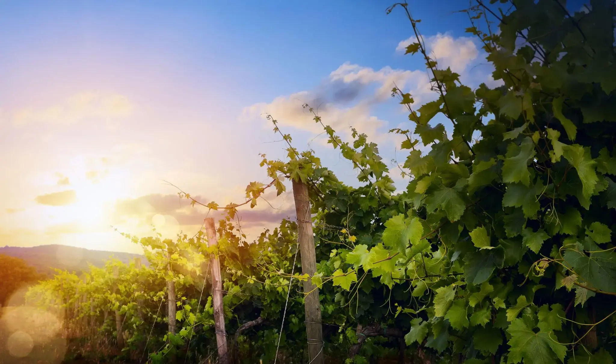
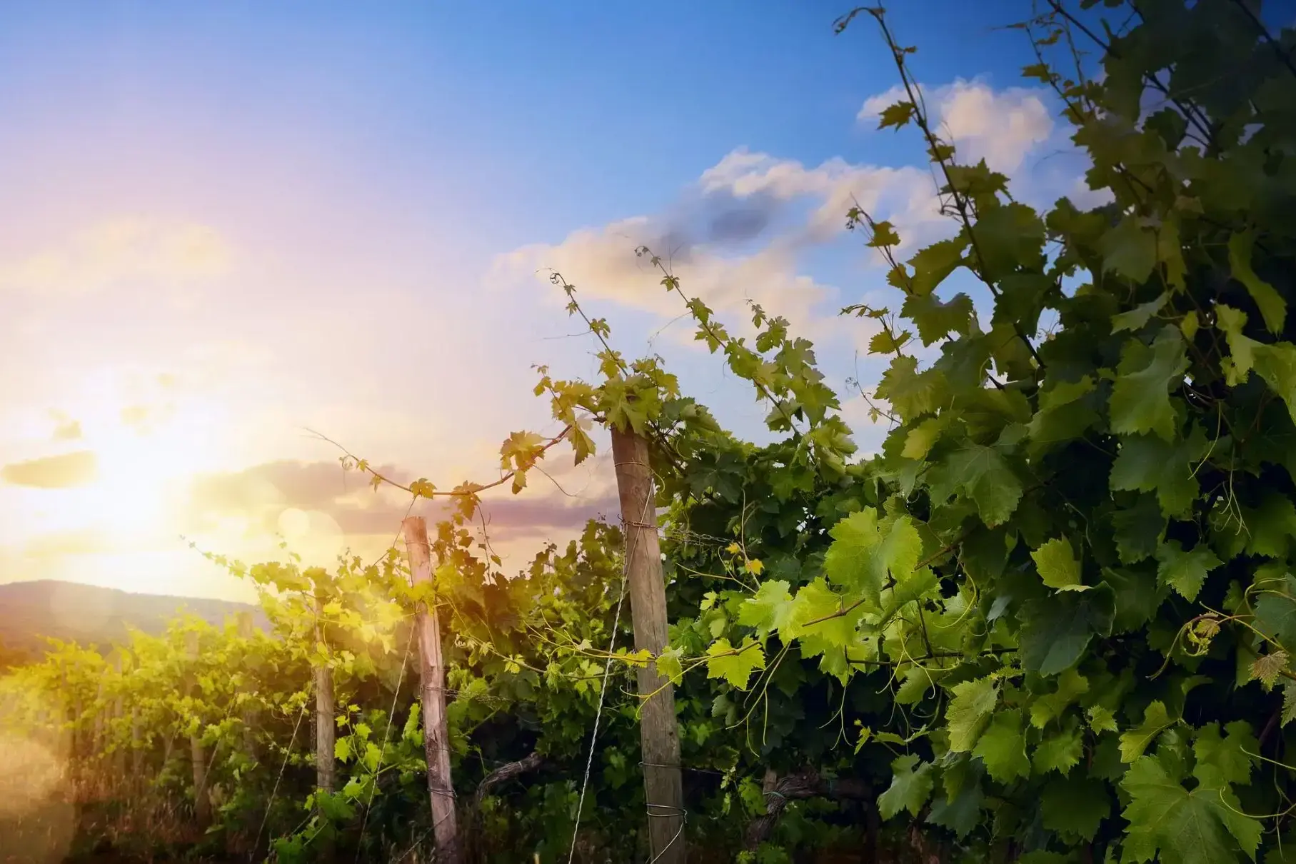
Eden Valley to malownicza dolina położona w sercu Australii, w stanie Południowa Australia. Miejsce to jest znane ze swojej unikalnej naturalnej urody, obfitości dzikiej fauny oraz żyznych ziem rolniczych. W dolinie znajdują się urodzajne gleby, na których uprawia się winorośle, a także produkowane są słynne lokalne wina. Krajobrazy Eden Valley zachwycają zarówno latem, jak i zimą, gdy pagórki pokrywają się zielenią, a na horyzoncie błyszczą ośnieżone szczyty. To także jeden z najlepszych regionów do wycieczek i degustacji win, gdzie turyści mogą nie tylko spróbować miejscowych win, ale również poznać proces ich produkcji.
Dla podróżnych Eden Valley oferuje nie tylko piękno natury, ale również szereg aktywnych zajęć na świeżym powietrzu. Region idealnie nadaje się do pieszych wędrówek, biwakowania i obserwacji dzikiej fauny. Można tu zobaczyć rzadkie gatunki zwierząt, takie jak koale i kangury, a także podziwiać wspaniałe widoki na dolinę z wysokości. Lato w Eden Valley to czas festiwali i wydarzeń kulturalnych, które przyciągają zarówno mieszkańców, jak i turystów. To miejsce dla tych, którzy szukają połączenia natury, przygód i kulinarnych przyjemności, nie oddalając się zbytnio od cywilizacji.
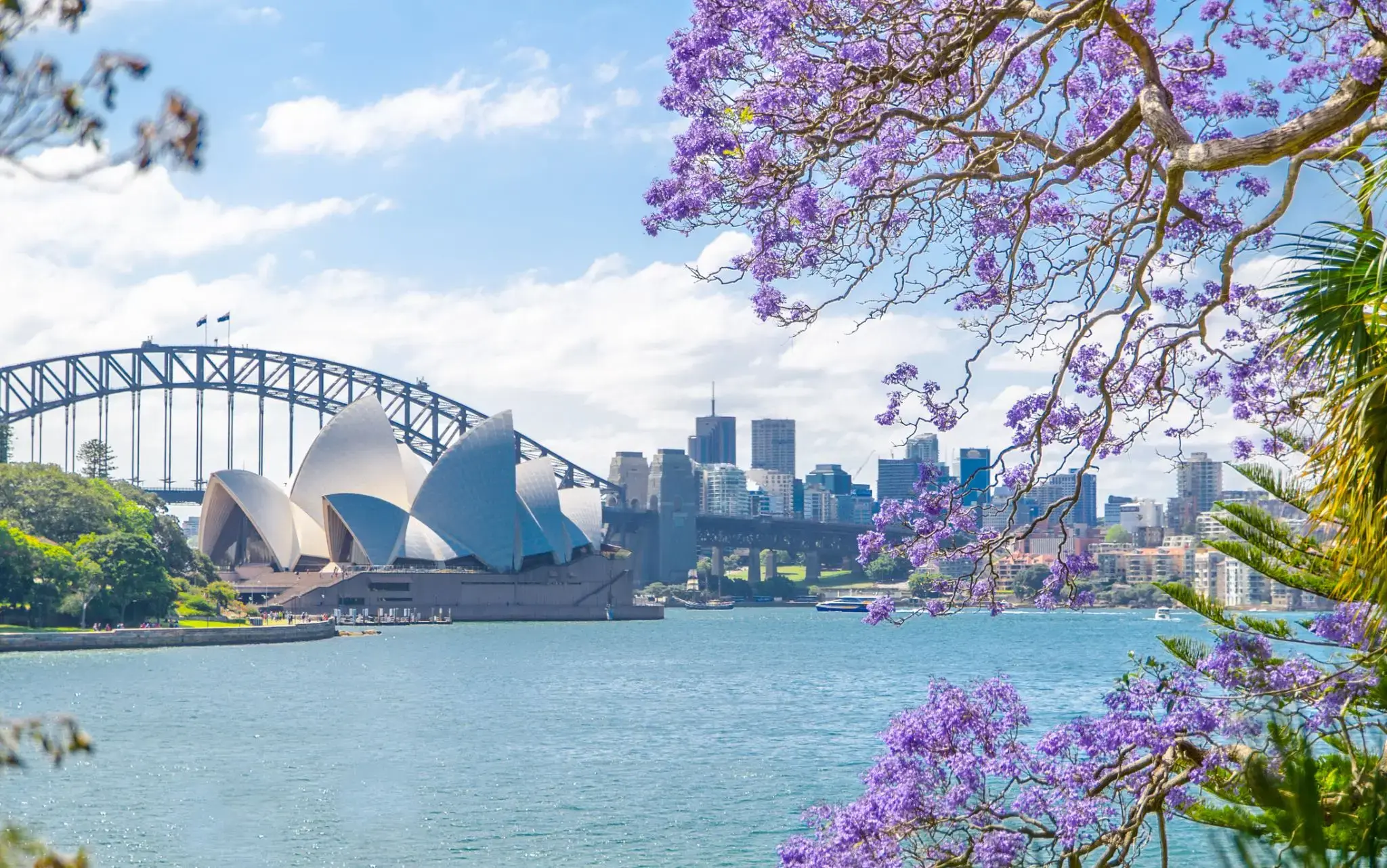
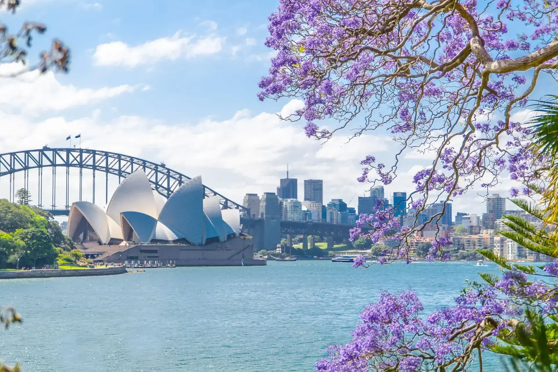
Sydney is the state capital of New South Wales and the most populous city in Australiaand Oceania. Located on Australia's east coast, the metropolis surrounds Port Jackson and extends about 70 km (43.5 mi) on its periphery towards the Blue Mountains to the west, Hawkesbury to the north, and Macarthur to the south. Sydney is made up of 658 suburbs, 40 local government areas and 15 contiguous regions. Residents of the city are known as "Sydneysiders". As of June 2017, Sydney's estimated metropolitan population was 5,131,326, and is home to approximately 65% of the state's population.
Sydney is the state capital of New South Wales and the most populous city in Australiaand Oceania. Located on Australia's east coast, the metropolis surrounds Port Jackson and extends about 70 km (43.5 mi) on its periphery towards the Blue Mountains to the west, Hawkesbury to the north, and Macarthur to the south. Sydney is made up of 658 suburbs, 40 local government areas and 15 contiguous regions. Residents of the city are known as "Sydneysiders". As of June 2017, Sydney's estimated metropolitan population was 5,131,326, and is home to approximately 65% of the state's population.
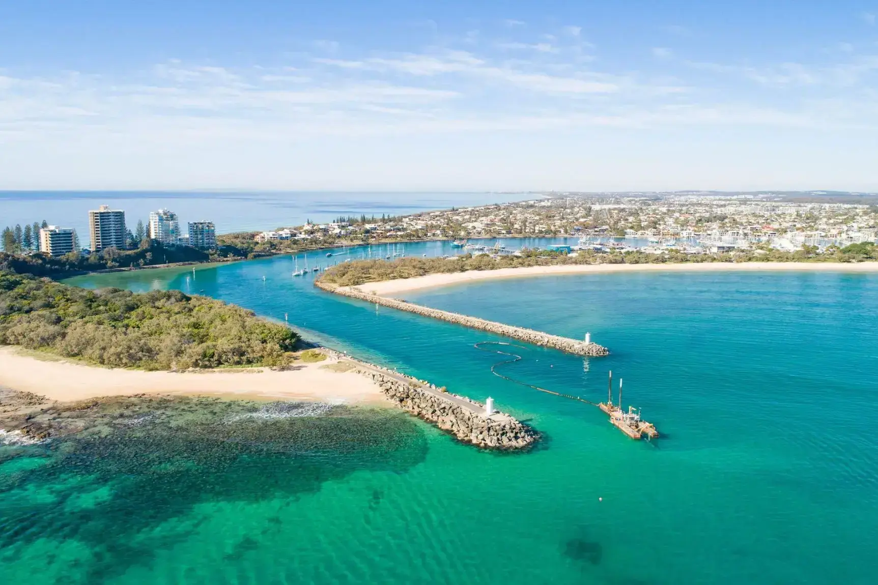
Mooloolaba to malownicze nadmorskie miasto na Wybrzeżu Słońca w Queensland, Australia, znane z doskonałych warunków do wypoczynku na plaży i uprawiania sportów wodnych. Miasto słynie z jednego z najpopularniejszych plaż w regionie, przyciągając turystów czystym piaskiem, spokojnymi wodami oraz doskonałymi warunkami do surfingu, pływania i wędkarstwa. Mooloolaba jest także znana z pięknej promenady z kawiarniami, restauracjami i sklepami, gdzie można skosztować lokalnej kuchni i kupić pamiątki.
Oprócz plaż, Mooloolaba oferuje różnorodne atrakcje przyrodnicze. W okolicach miasta znajduje się Park Narodowy Mooloolaba oraz centrum morskie, gdzie można poznać lokalną florę i faunę, w tym delfiny i żółwie morskie. Dla tych, którzy szukają spokoju i chcą odkrywać unikalne ekosystemy, dostępne są wyspy takie jak Moreton Island. Mooloolaba to idealne miejsce dla aktywnego wypoczynku na świeżym powietrzu oraz dla relaksu nad morzem.
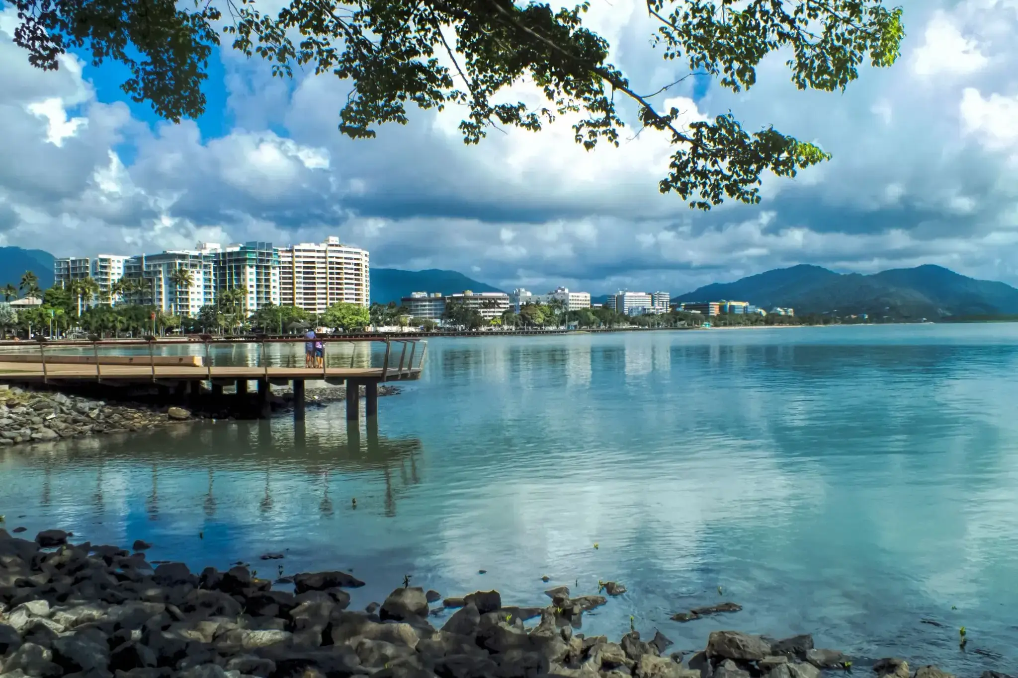
Cairns City is the suburb at the centre of Cairns in the local government area of Cairns Region, Queensland, Australia.It can also be referred to as the Cairns Central Business District (CBD). In the 2011 census, the population of Cairns City was 2,737 people.
Cairns City is the suburb at the centre of Cairns in the local government area of Cairns Region, Queensland, Australia.It can also be referred to as the Cairns Central Business District (CBD). In the 2011 census, the population of Cairns City was 2,737 people.
Darwin is the capital city of the Northern Territory of Australia, situated on the Timor Sea. It is the largest city in the sparsely populated Northern Territory, with a population of 145,916. It is the smallest and most northerly of the Australian capital cities, and acts as the Top End's regional centre.
Darwin is the capital city of the Northern Territory of Australia, situated on the Timor Sea. It is the largest city in the sparsely populated Northern Territory, with a population of 145,916. It is the smallest and most northerly of the Australian capital cities, and acts as the Top End's regional centre.
Puerto Princesa to miasto na filipińskiej wyspie Palawan, szeroko znane dzięki jednej z cudów natury — Podziemnej Rzece Puerto Princesa, wpisanej na listę światowego dziedzictwa UNESCO. Ten system jaskiń i podziemnych rzek, przebiegający przez wapienne formacje, przyciąga podróżnych z całego świata możliwością rejsu łodzią i podziwiania stalaktytów, stalagmitów oraz unikalnej ekosystemu. Miasto jest również doskonałą bazą wypadową do odkrywania niezwykłej przyrody Palawanu: tropikalnych lasów, wybrzeży i rezerwatów przyrody.
Poza atrakcjami przyrodniczymi, Puerto Princesa słynie z czystych ulic, przyjaznej atmosfery i dobrze rozwiniętej infrastruktury turystycznej. Można tu skosztować świeżych owoców morza, odwiedzić nocne targi lub wybrać się na wycieczki po wyspach w zatoce Honda. Miasto aktywnie rozwija ekoturystykę, dbając o równowagę między rozwojem a ochroną środowiska. Dla podróżników poszukujących połączenia przygody, relaksu i lokalnej kultury, Puerto Princesa staje się coraz bardziej atrakcyjnym kierunkiem.
Manila, stolica Filipin, położona jest na wybrzeżu wyspy Luzon, nad Zatoką Manilską. W obrębie starego miasta Intramuros, zbudowanego przez Hiszpanów w 1571 roku, zachowały się hiszpańskie zabytki architektury oraz kościoły. W mieście znajduje się także główny port kraju, który jest ważnym elementem gospodarki Filipin. Manila słynie z przemysłu chemicznego, elektronicznego, tekstylnego, produkcji żywności oraz wyrobów tytoniowych.
Dla turystów ciekawą atrakcją jest dzielnica Chinatown, gdzie można kupić wyroby z pereł i złota. Warto również odwiedzić muzea i bazyliki oraz podziwiać park Rizal. Ponadto Manila to raj dla zakupoholików, ponieważ dostępne są tu wszystkie światowe marki w cenach znacznie niższych niż w Europie.
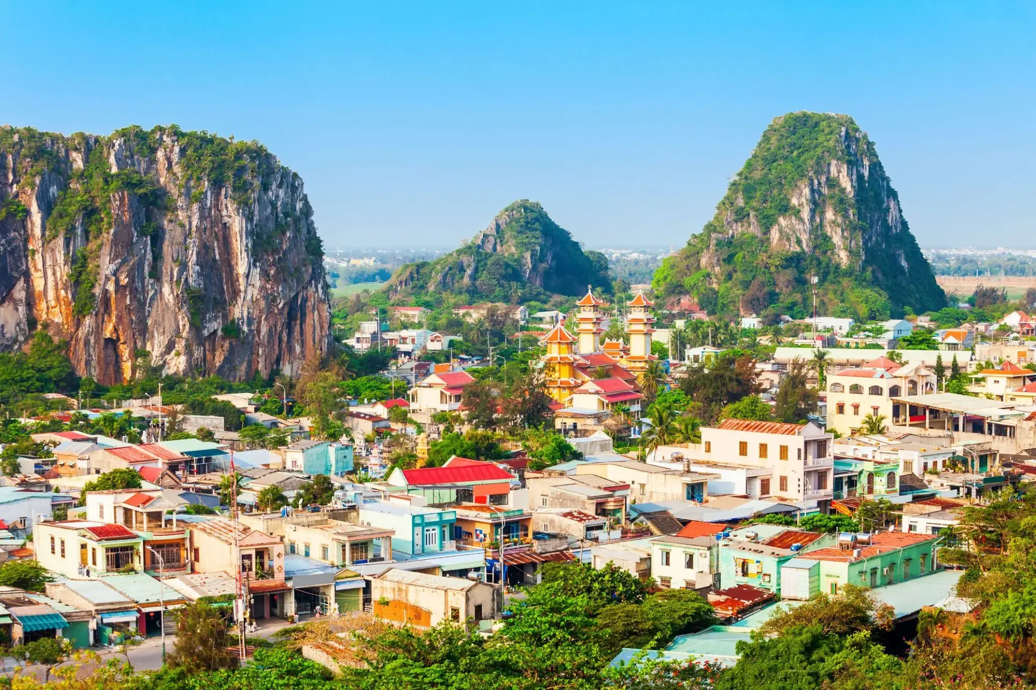
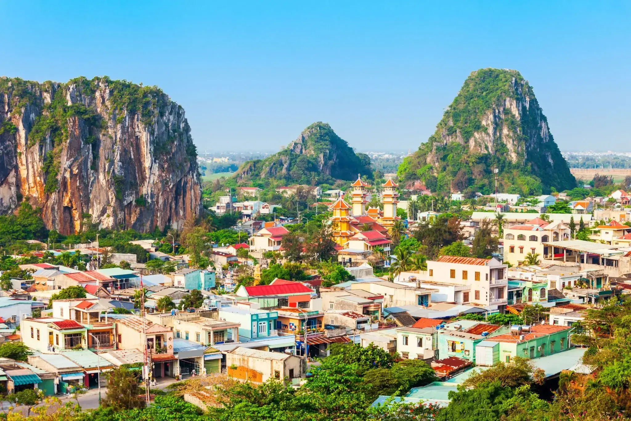
Ciepła morska bryza i miękki piasek sprawiają, że Da Nang to idealne miejsce dla tych, którzy szukają relaksu nad morzem i lekkości w każdym kroku. Tutaj nowoczesne kawiarnie sąsiadują z tradycyjnymi targami, a wieczorna promenada wypełnia się światłami i aromatem świeżych owoców morza. Można spacerować długimi plażami My Khe i Non Nuoc, które należą do najlepszych w Azji, oraz odkrywać przytulne zakątki z wietnamską kawą i uśmiechami mieszkańców.
Dla miłośników historii i natury Da Nang oferuje wyjątkowe trasy do Marmurowych Gór z jaskiniami i pagodami, skąd rozciągają się zapierające dech w piersiach widoki na wybrzeże. Stąd łatwo dotrzeć do starożytnego miasta Hoi An, które zachowało klimat przeszłości, lub wybrać się na przejażdżkę przełęczą Hai Van, gdzie każdy zakręt odkrywa nowe panoramy gór i morza. Miasto łączy relaksujący wypoczynek na plaży z możliwością odkrycia piękna Wietnamu i zaczerpnięcia świeżego, morskiego powietrza, które napełnia energią i lekkością.

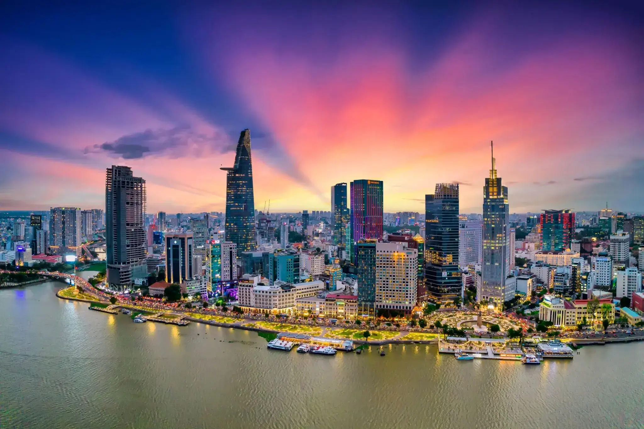
Ho Chi Minh, znane również pod swoją dawną nazwą Sajgon, jest najludniejszym miastem Wietnamu z populacją 8,4 miliona (13 milionów w obszarze metropolitalnym) według stanu na 2017 rok. Położona w południowo-wschodnim Wietnamie metropolia otacza rzekę Sajgon i zajmuje powierzchnię około 2061 kilometrów kwadratowych (796 mil kwadratowych).
Pod nazwą Sajgon było stolicą Indochin Francuskich od 1887 do 1902 roku i ponownie od 1945 do 1954 roku. Sajgon stał się później stolicą Wietnamu Południowego od 1955 roku aż do jego upadku w 1975 roku. 2 lipca 1976 roku Sajgon połączył się z otaczającą prowincją Gia Định i został oficjalnie przemianowany na Ho Chi Minh City na cześć przywódcy rewolucyjnego Hồ Chí Minha (chociaż nazwa Sài Gòn jest nadal powszechnie używana).
Ho Chi Minh City jest centrum finansowym Wietnamu i jest klasyfikowane jako miasto światowe Beta+ przez Globalization and World Cities Research Network. Jest siedzibą Giełdy Papierów Wartościowych w Ho Chi Minh City, największej giełdy papierów wartościowych pod względem całkowitej kapitalizacji rynkowej w Wietnamie oraz siedzibą wielu krajowych i międzynarodowych banków i firm.
Ho Chi Minh City jest najczęściej odwiedzanym miastem w Wietnamie, z 6,3 miliona odwiedzających w 2017 roku. Wiele znanych międzynarodowym turystom zabytków miasta to między innymi targ Bến Thành, ratusz w Ho Chi Minh City, bazylika katedralna Notre-Dame w Sajgonie, Pałac Niepodległości i Teatr Miejski. Głównym lotniskiem pasażerskim obsługującym obszar metropolitalny jest międzynarodowe lotnisko Tân Sơn Nhất, najbardziej ruchliwe lotnisko w Wietnamie, które w 2017 roku obsłużyło 36 milionów pasażerów.
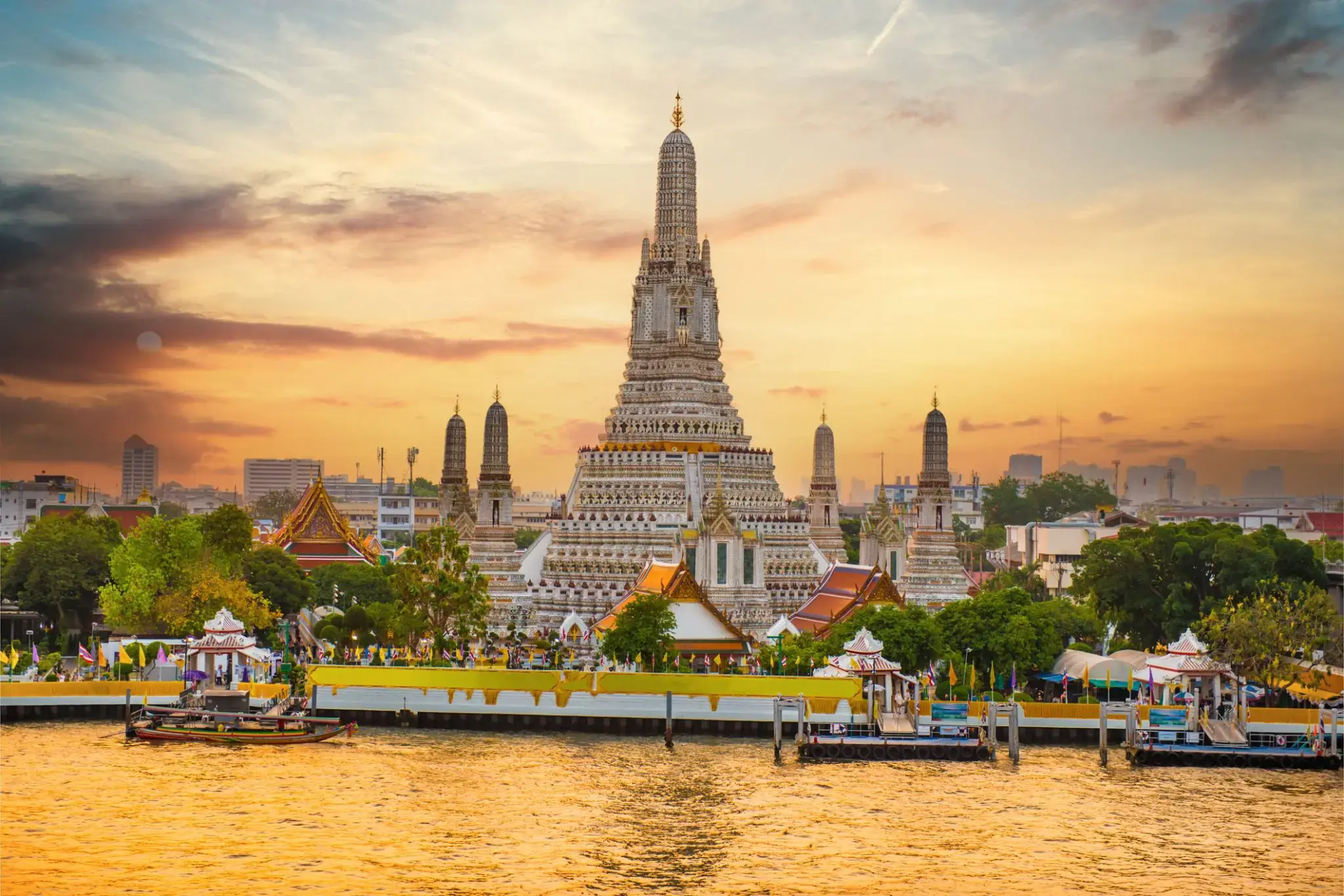
Bangkok is the capital and most populous city of Thailand. It is known in Thai as Krung Thep Maha Nakhon or simply Krung Thep. The city occupies 1,568.7 square kilometres (605.7 sq mi) in the Chao Phraya River delta in central Thailand, and has a population of over eight million, or 12.6 percent of the country's population. Over fourteen million people (22.2 percent) lived within the surrounding Bangkok Metropolitan Region at the 2010 census, making Bangkok the nation's primate city, significantly dwarfing Thailand's other urban centres in terms of importance.
Bangkok is the capital and most populous city of Thailand. It is known in Thai as Krung Thep Maha Nakhon or simply Krung Thep. The city occupies 1,568.7 square kilometres (605.7 sq mi) in the Chao Phraya River delta in central Thailand, and has a population of over eight million, or 12.6 percent of the country's population. Over fourteen million people (22.2 percent) lived within the surrounding Bangkok Metropolitan Region at the 2010 census, making Bangkok the nation's primate city, significantly dwarfing Thailand's other urban centres in terms of importance.
Bangkok is the capital and most populous city of Thailand. It is known in Thai as Krung Thep Maha Nakhon or simply Krung Thep. The city occupies 1,568.7 square kilometres (605.7 sq mi) in the Chao Phraya River delta in central Thailand, and has a population of over eight million, or 12.6 percent of the country's population. Over fourteen million people (22.2 percent) lived within the surrounding Bangkok Metropolitan Region at the 2010 census, making Bangkok the nation's primate city, significantly dwarfing Thailand's other urban centres in terms of importance.

Wśród tropikalnych wysp Tajlandii Koh Samui wyróżnia się swoją unikalną naturą i atmosferą. Ta wyspa przyciąga podróżnych z całego świata swoimi białymi, piaszczystymi plażami, malowniczymi wodospadami i gęstymi dżunglami. To idealne miejsce na relaks, niezależnie od tego, czy chodzi o sport wodny, odkrywanie natury, czy po prostu cieszenie się ciszą i pięknem.
Dodatkowo, Koh Samui jest znana ze swojego dziedzictwa kulturowego, w tym wielu buddyjskich świątyń i sanktuariów. Jedną z najbardziej znanych jest Świątynia Wielkiego Buddy, która jest nie tylko centrum religijnym, ale także jedną z głównych atrakcji wyspy. Lokalne jedzenie, w tym świeże owoce morza i egzotyczne owoce, sprawi, że podróż będzie jeszcze bardziej ekscytująca i smaczna.
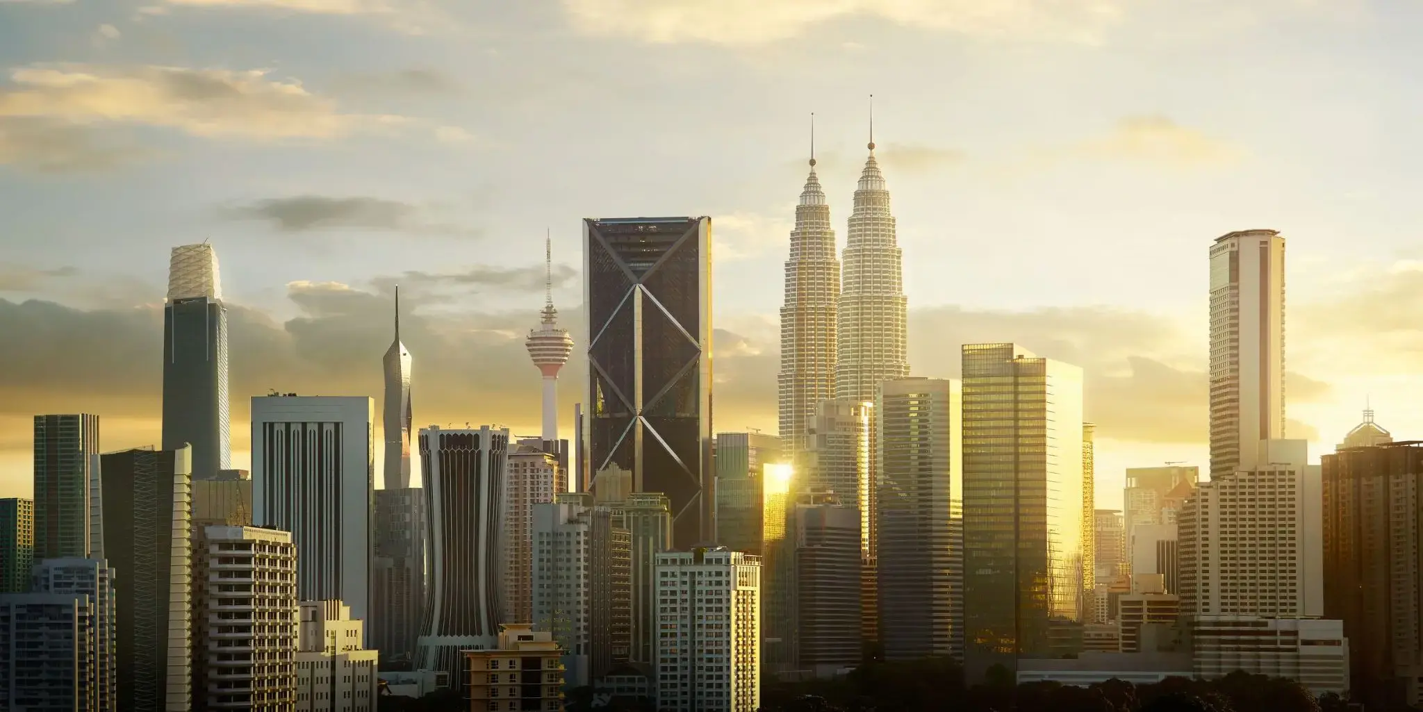
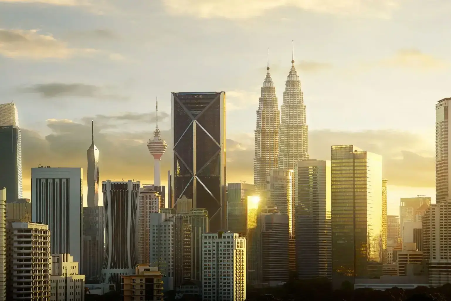
Kuala Lumpur to dynamiczna stolica Malezji, gdzie futurystyczne drapacze chmur stoją obok kolonialnych budynków i tradycyjnych targowisk. Miasto powstało w połowie XIX wieku u zbiegu rzek Klang i Gombak jako osada górnicza, a dziś jest największym centrum gospodarczym i kulturalnym kraju. Jego wizytówką są bliźniacze wieże Petronas, niegdyś najwyższe budynki na świecie, które nadal pozostają symbolem malezyjskiego postępu i innowacji.
Dla turystów Kuala Lumpur oferuje różnorodne wrażenia: od porannego spaceru po kolonialnym placu Merdeka po wieczorne zakupy w ultranowoczesnej dzielnicy Bukit Bintang. Można odwiedzić Muzeum Sztuki Islamskiej, skosztować ulicznego jedzenia w okolicy Jalan Alor, zobaczyć hinduistyczną świątynię w jaskiniach Batu lub odpocząć w cieniu tropikalnych drzew w Ogrodach Jeziora. Miasto, wzbogacone kulturami malajską, chińską i indyjską, zaprasza do odkrywania go poprzez architekturę, kuchnię i rytm współczesnego życia.
Ukryte na południowym wybrzeżu Sri Lanki, Hambantota to brama do regionu, gdzie egzotyczna przyroda spotyka się z nowoczesnymi ambicjami kraju. Opuszczone plaże przechodzą w zielone wzgórza, a urokliwe wioski rybackie sąsiadują z dużymi projektami infrastrukturalnymi, takimi jak nowoczesny port i lotnisko, czyniąc miasto ważnym ośrodkiem strategicznym.
Hambantota to idealne miejsce dla podróżnych szukających nietypowych tras: safari w pobliskim parku narodowym Yala, obserwacja ptaków w rezerwacie Bundala oraz zwiedzanie lokalnych świątyń buddyjskich zapewnią niezapomniane wrażenia. Miejscowa kuchnia, oparta na świeżych owocach morza i aromatycznych przyprawach, dopełnia obraz idealnego wypoczynku z dala od tłumów turystów.
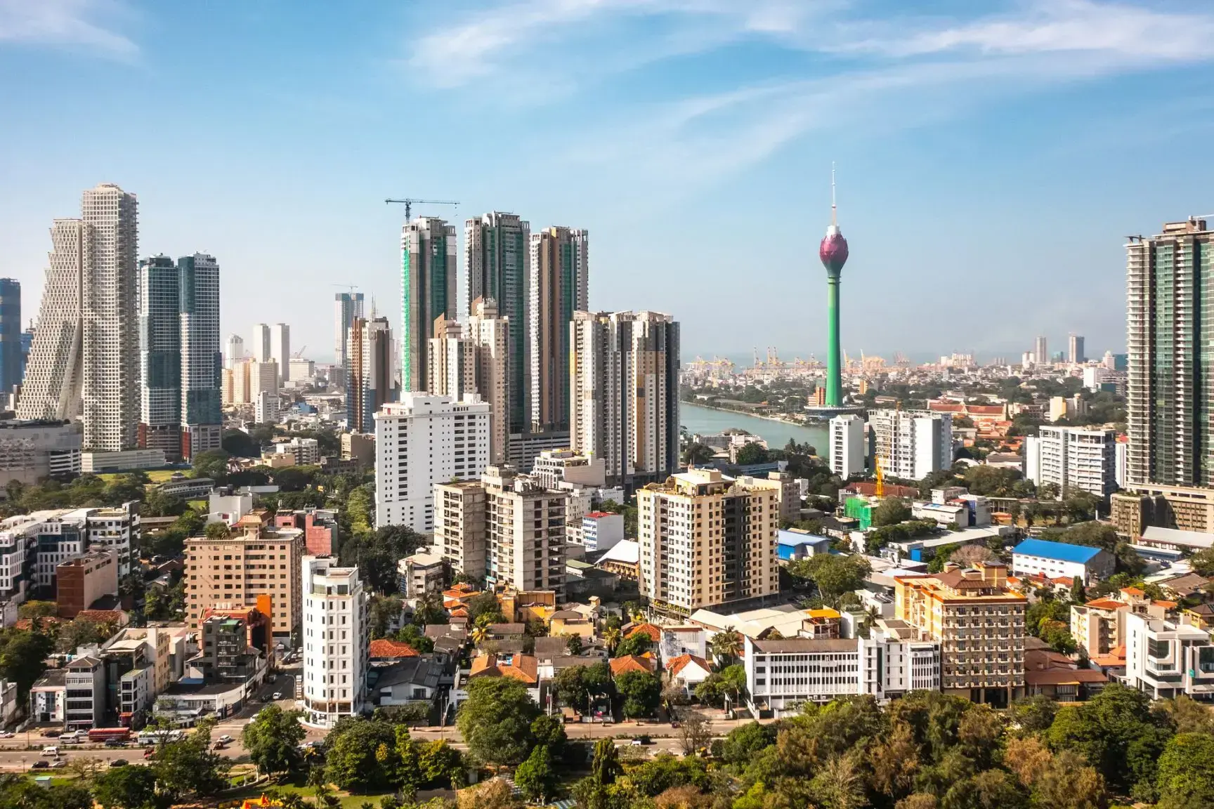
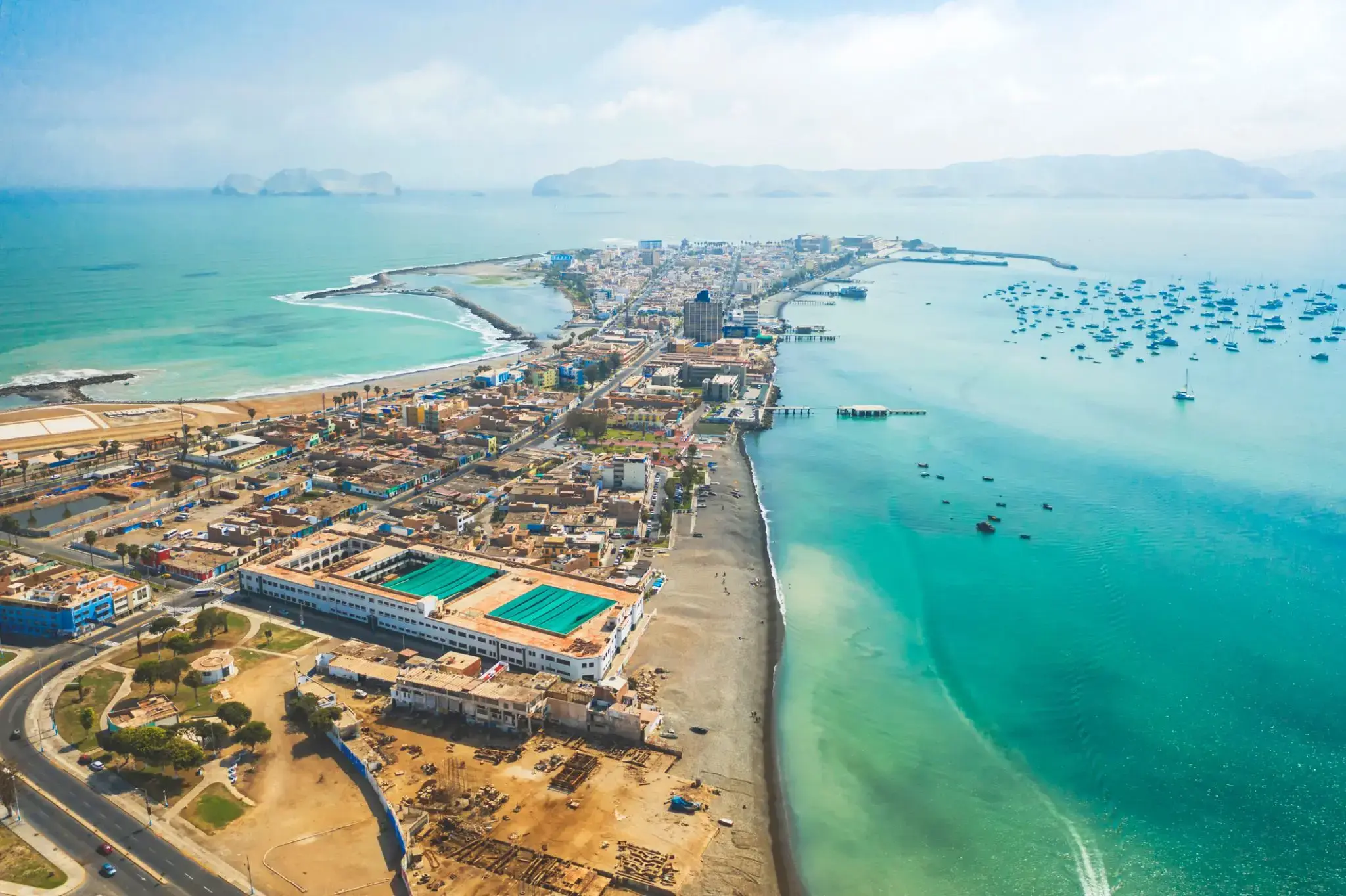
Colombo is the commercial capital and largest city of Sri Lanka. According to the Brookings Institution, Colombo metropolitan area has a population of 5.6 million, and 752,993 in the city proper. It is the financial centre of the island and a popular tourist destination. It is located on the west coast of the island and adjacent to the Greater Colombo area which includes Sri Jayawardenepura Kotte, the legislative capital of Sri Lanka and Dehiwala-Mount Lavinia. Colombo is often referred to as the capital since Sri Jayawardenepura Kotte is within the urban area of, and a suburb of, Colombo. It is also the administrative capital of the Western Province and the district capital of Colombo District. Colombo is a busy and vibrant place with a mixture of modern life and colonial buildings and ruins. It was the legislative capital of Sri Lanka until 1982.
Due to its large harbour and its strategic position along the East-West sea trade routes, Colombo was known to ancient traders 2,000 years ago. It was made the capital of the island when Sri Lanka was ceded to the British Empire in 1815, and its status as capital was retained when the nation became independent in 1948. In 1978, when administrative functions were moved to Sri Jayawardenepura Kotte, Colombo was designated as the commercial capital of Sri Lanka.
a seaport and naval base on the Malabar Coast of southwestern India, in the state of Kerala; population 254,500 (est. 2009).
a seaport and naval base on the Malabar Coast of southwestern India, in the state of Kerala; population 254,500 (est. 2009).
Port Louis to stolica i główny port Mauritiusa, położony na północno-zachodnim wybrzeżu wyspy. Tętniące życiem miasto łączy w sobie dziedzictwo kolonialne, nowoczesne centra biznesowe i barwną kulturę kreolską. W historycznym centrum zachowały się budynki z czasów francuskiego i brytyjskiego panowania. Jedną z najważniejszych atrakcji jest Fort Adelaide (znany także jako Cytadela), z którego rozciąga się panoramiczny widok na miasto i port. W pobliżu znajduje się lokalny targ – barwne serce codziennego życia, pełne przypraw, owoców, tekstyliów i rękodzieła.
Miasto słynie również z muzeów, w tym Muzeum Poczty, gdzie znajduje się pierwsza znaczka Mauritiusa – słynna „Blue Mauritius”. Poza zabytkami, Port Louis oferuje wspaniałe doświadczenia kulinarne, będące mieszanką wpływów kuchni indyjskiej, chińskiej, afrykańskiej i europejskiej. Wieczorem warto wybrać się na spacer promenadą Caudan Waterfront, pełną butików, kawiarni i atrakcji.
Durban is the third most populous city in South Africa—after Johannesburg and Cape Town—and the largest city in the South African province of KwaZulu-Natal. Located on the east coast of South Africa, Durban is famous for being the busiest port in the country. It is also seen as one of the major centres of tourism because of the city's warm subtropical climate and extensive beaches. Durban forms part of the eThekwini Metropolitan Municipality, which includes neighboring towns and has a population of about 3.44 million, making the combined municipality one of the biggest cities on the Indian Ocean coast of the African continent. It is also the second most important manufacturing hub in South Africa after Johannesburg. In 2015, Durban was recognised as one of the New7Wonders Cities (along with Vigan, Doha, La Paz, Havana, Beirut, and Kuala Lumpur).

Cape Town is the oldest city in South Africa, colloquially named the Mother City. It is the legislative capital of South Africa and primate city of the Western Cape province. It forms part of the City of Cape Town metropolitan municipality.
The Parliament of South Africa sits in Cape Town. The other two capitals are located in Pretoria (the administrative capital where the Presidency is based) and Bloemfontein (the judicial capital where the Supreme Court of Appeal is located). The city is known for its harbour, for its natural setting in the Cape Floristic Region, and for landmarks such as Table Mountain and Cape Point. As of 2014, it is the 10th most populous city in Africa and home to 64% of the Western Cape's population. It is one of the most multicultural cities in the world, reflecting its role as a major destination for immigrants and expatriates to South Africa. The city was named the World Design Capital for 2014 by the International Council of Societies of Industrial Design. In 2014, Cape Town was named the best place in the world to visit by both The New York Times and The Daily Telegraph.
Located on the shore of Table Bay, Cape Town, as the oldest urban area in South Africa, was developed by the Dutch East India Company (VOC) as a supply station for Dutch ships sailing to East Africa, India, and the Far East. Jan van Riebeeck's arrival on 6 April 1652 established Dutch Cape Colony, the first permanent European settlement in South Africa. Cape Town outgrew its original purpose as the first European outpost at the Castle of Good Hope, becoming the economic and cultural hub of the Cape Colony. Until the Witwatersrand Gold Rush and the development of Johannesburg, Cape Town was the largest city in South Africa.
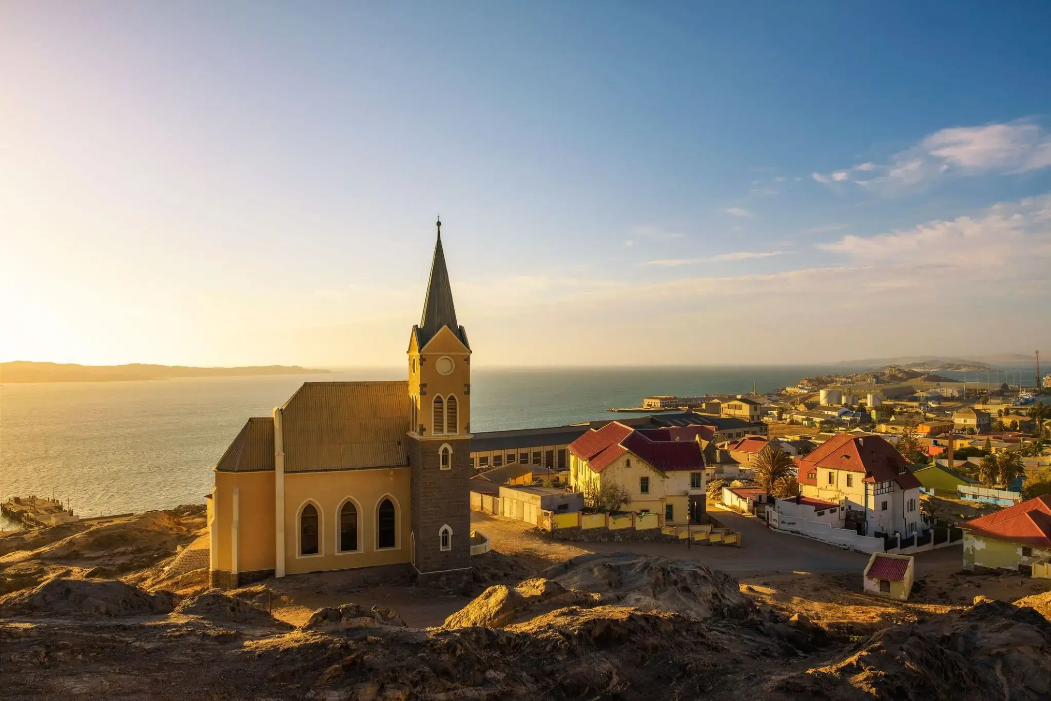
Wąskie brukowane uliczki prowadzą do kolorowych domów w pastelowych odcieniach, witając gości w Luderitz. To miasteczko, położone między pustynnymi wydmami a Oceanem Atlantyckim, zachowało niepowtarzalny urok początku XX wieku. Kolonialna architektura miesza się tutaj z morskim powietrzem, a przytulne kawiarnie przypominają o niemieckiej przeszłości miasta.
Luderitz słynie z zapierających dech w piersiach krajobrazów wybrzeża: turkusowe wody zatoki i skaliste zatoczki płynnie przechodzą w złociste piaski pustyni. Miłośnicy przygód mogą zwiedzać opuszczoną osadę górniczą Kolmanskop lub spacerować po lagunach, gdzie gromadzą się pelikany i flamingi. Ten zakątek Namibii oferuje wyjątkowe połączenie kultury, historii i natury, które warto odkryć.
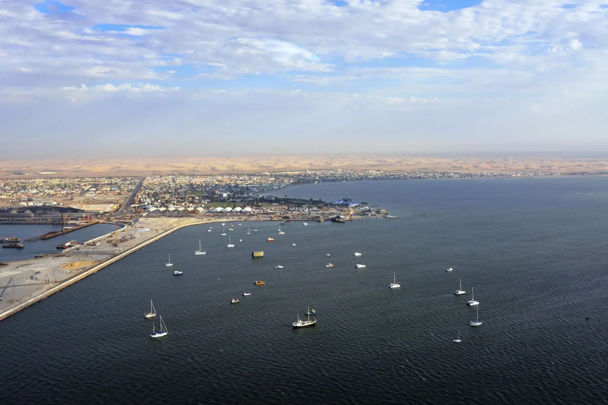
Walvis Bay — morskie wrota Namibii
Walvis Bay, położone nad Oceanem Atlantyckim w Namibii, to wyjątkowe połączenie przemysłowego portu i naturalnego raju. Miasto słynie z rozległej laguny — jednej z największych w Afryce — gdzie przez cały rok można obserwować flamingi, pelikany i inne ptaki wodne. To jedno z najlepszych miejsc w Afryce do obserwacji morskiej fauny: rejsy łodzią pozwalają dostrzec foki, delfiny, a czasem nawet wieloryby. Lagunę chętnie odwiedzają także kitesurferzy i windsurferzy dzięki stałym wiatrom i przestrzeniom wodnym.
Miasto odgrywa kluczową rolę gospodarczą jako największy port Namibii i centrum przemysłu rybnego. Walvis Bay przyciąga jednak nie tylko swoją funkcją, ale też sąsiedztwem z pustynią Namib, której słynne wydmy i księżycowe krajobrazy zaczynają się tuż za miastem. Takie niezwykłe połączenie morza i pustyni czyni to miejsce niezapomnianym punktem na mapie południowo-zachodniej Afryki.

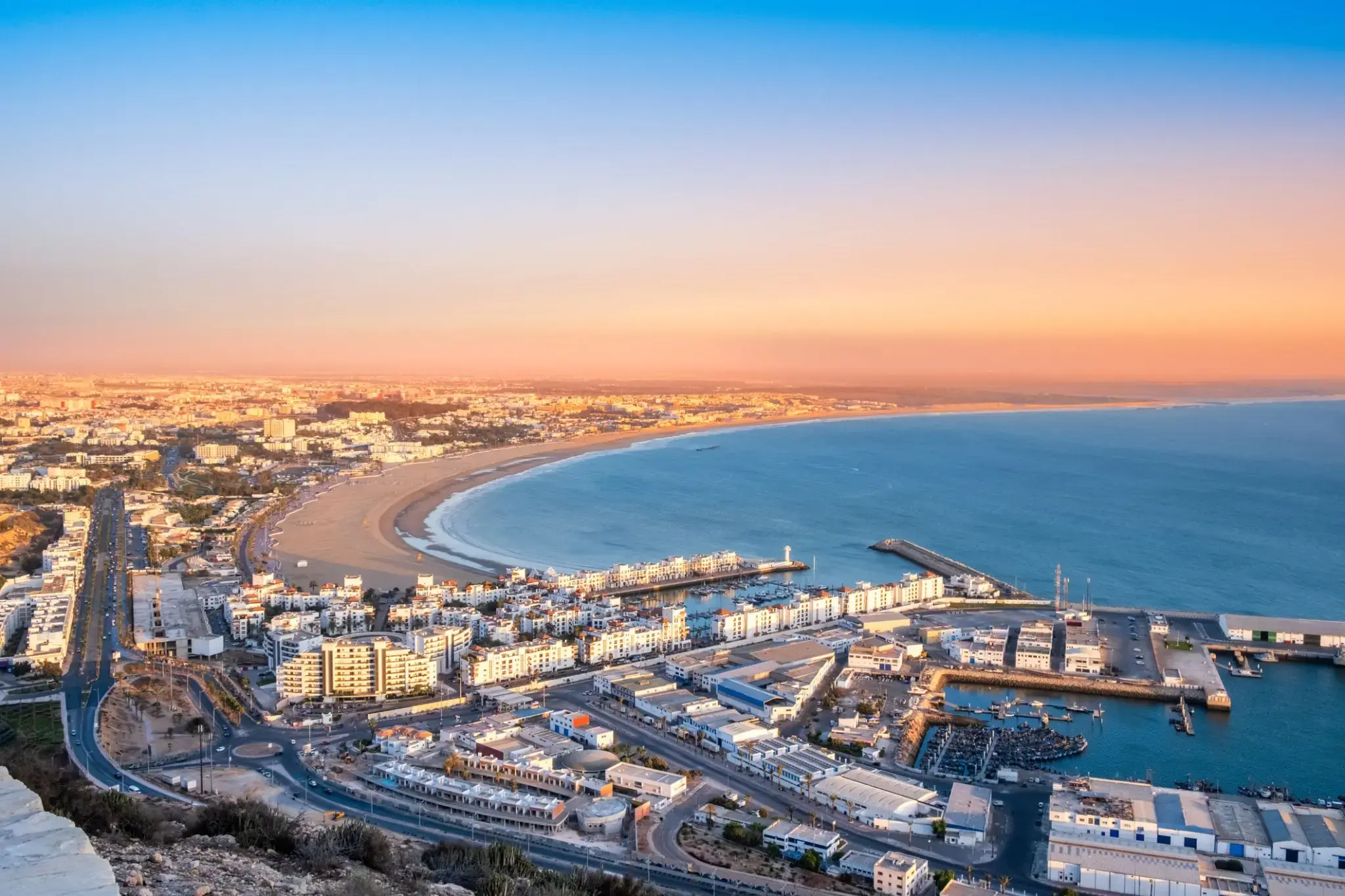
Agadir is the center of modern tourism in Morocco. Agadir Beach stretches for 10 km. The beautiful golden beach, surrounded by eucalyptus greenery and pine trees, is the most beautiful place among all Moroccan resorts. In Agadir, tourists will always find entertainment to their liking. Here you can ride camels or thoroughbred horses, play golf and tennis, smoke hookah, or experience all the delights of sea fishing. In the city's restaurants, you can taste the freshest and most delicious seafood, the assortment of which is simply magnificent: sea bass, sardines, tuna, shrimp, lobsters, crayfish. You can buy alcohol everywhere, but remember to do it before eight in the evening. And don't forget to visit the Medina of Agadir – a city built by an Italian architect. Inside the Medina, there are more than 30 shops and workshops.
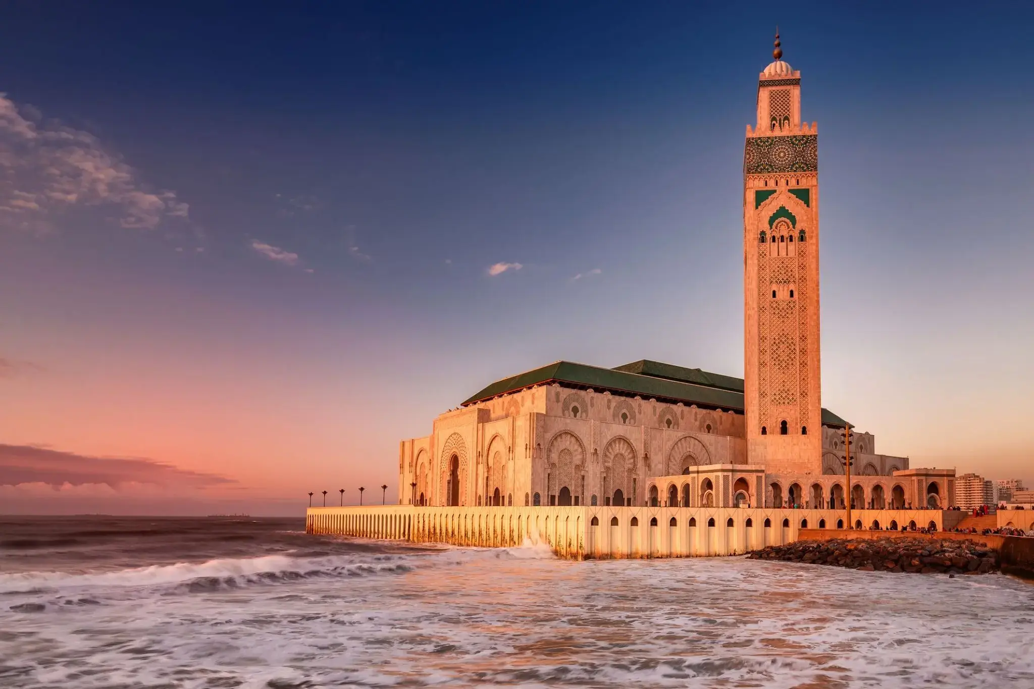
Casablanca położona jest w centralno-zachodniej części Maroka i graniczy z Oceanem Atlantyckim. Jest największym miastem Maroka. To także największe miasto regionu Maghrebu, a także jedno z największych i najważniejszych miast Afryki pod względem gospodarczym i demograficznym.
Casablanca jest głównym portem Maroka i jednym z największych centrów finansowych na kontynencie. Według szacunków z 2014 roku miasto liczy około 3,35 miliona mieszkańców na obszarze miejskim i ponad 6,8 miliona w regionie Casablanca-Settat. Casablanca uważana jest za gospodarcze i biznesowe centrum Maroka, podczas gdy polityczną stolicą kraju pozostaje Rabat.
Wiodące marokańskie firmy oraz liczne międzynarodowe korporacje działające w kraju mają swoje siedziby główne i główne zakłady przemysłowe w Casablanca. Najnowsze dane przemysłowe pokazują, że Casablanca zachowuje swoją historyczną rolę głównej strefy przemysłowej kraju. Port w Casablanca jest jednym z największych sztucznych portów na świecie i drugim co do wielkości portem w Afryce Północnej po Tanger-Med, 40 km na wschód od Tangeru. Casablanca jest także główną bazą morską Królewskiej Marynarki Wojennej Maroka.

Gibraltar is a British Overseas Territory located at the southern tip of the Iberian Peninsula. It has an area of 6.7 km2 (2.6 sq mi) and is bordered to the north by Spain. The landscape is dominated by the Rock of Gibraltar at the foot of which is a densely populated town area, home to over 30,000 people, primarily Gibraltarians. It shares a maritime border with Morocco.
In 1704, Anglo-Dutch forces captured Gibraltar from Spain during the War of the Spanish Succession on behalf of the Habsburg claim to the Spanish throne. The territory was ceded to Great Britain in perpetuity under the Treaty of Utrechtin 1713. During World War II it was an important base for the Royal Navy as it controlled the entrance and exit to the Mediterranean Sea, which is only 8 miles (13 km) wide at this naval choke point. It remains strategically important, with half the world's seaborne trade passing through the strait. Today Gibraltar's economy is based largely on tourism, online gambling, financial services and cargo ship refuelling.
The sovereignty of Gibraltar is a point of contention in Anglo-Spanish relations because Spain asserts a claim to the territory. Gibraltarians rejected proposals for Spanish sovereignty in a 1967 referendum and, in a 2002 referendum, the idea of shared sovereignty was also rejected.

Málaga is a municipality, capital of the Province of Málaga, in the Autonomous Community of Andalusia, Spain. With a population of 569,130 in 2015, it is the second-most populous city of Andalusia and the sixth-largest in Spain. The southernmost large city in Europe, it lies on the Costa del Sol (Coast of the Sun) of the Mediterranean, about 100 kilometres (62.14 miles) east of the Strait of Gibraltar and about 130 km (80.78 mi) north of Africa.
Málaga's history spans about 2,800 years, making it one of the oldest cities in the world. According to most scholars, it was founded about 770 BC by the Phoenicians as Malaka From the 6th century BC the city was under the hegemony of Ancient Carthage, and from 218 BC, it was ruled by the Roman Republic and then empire as Malaca (Latin). After the fall of the empire and the end of Visigothic rule, it was under Islamic rule as Mālaqah for 800 years, but in 1487, the Crown of Castille gained control after the Reconquista. The archaeological remains and monuments from the Phoenician, Roman, Arabic and Christian eras make the historic center of the city an "open museum", displaying its history of nearly 3,000 years.
This important cultural infrastructure and the artistic heritage have culminated in the nomination of Málaga as a candidate for the 2016 European Capital of Culture.
The painter and sculptor Pablo Picasso, Hebrew poet and Jewish philosopher Solomon Ibn Gabirol and the actor Antonio Banderas were born in Málaga. The magnum opus of Cuban composer Ernesto Lecuona, "Malagueña", is named after the music of this region of Spain.
The most important business sectors in Málaga are tourism, construction and technology services, but other sectors such as transportation and logistics are beginning to expand. The Andalusia Technology Park (PTA), located in Málaga, has enjoyed significant growth since its inauguration in 1992. Málaga is the main economic and financial centre of southern Spain, home of the region's largest bank, Unicaja, and the fourth-ranking city in economic activity in Spain behind Madrid, Barcelona and Valencia.
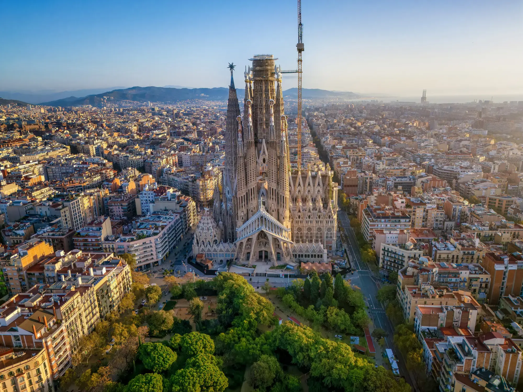
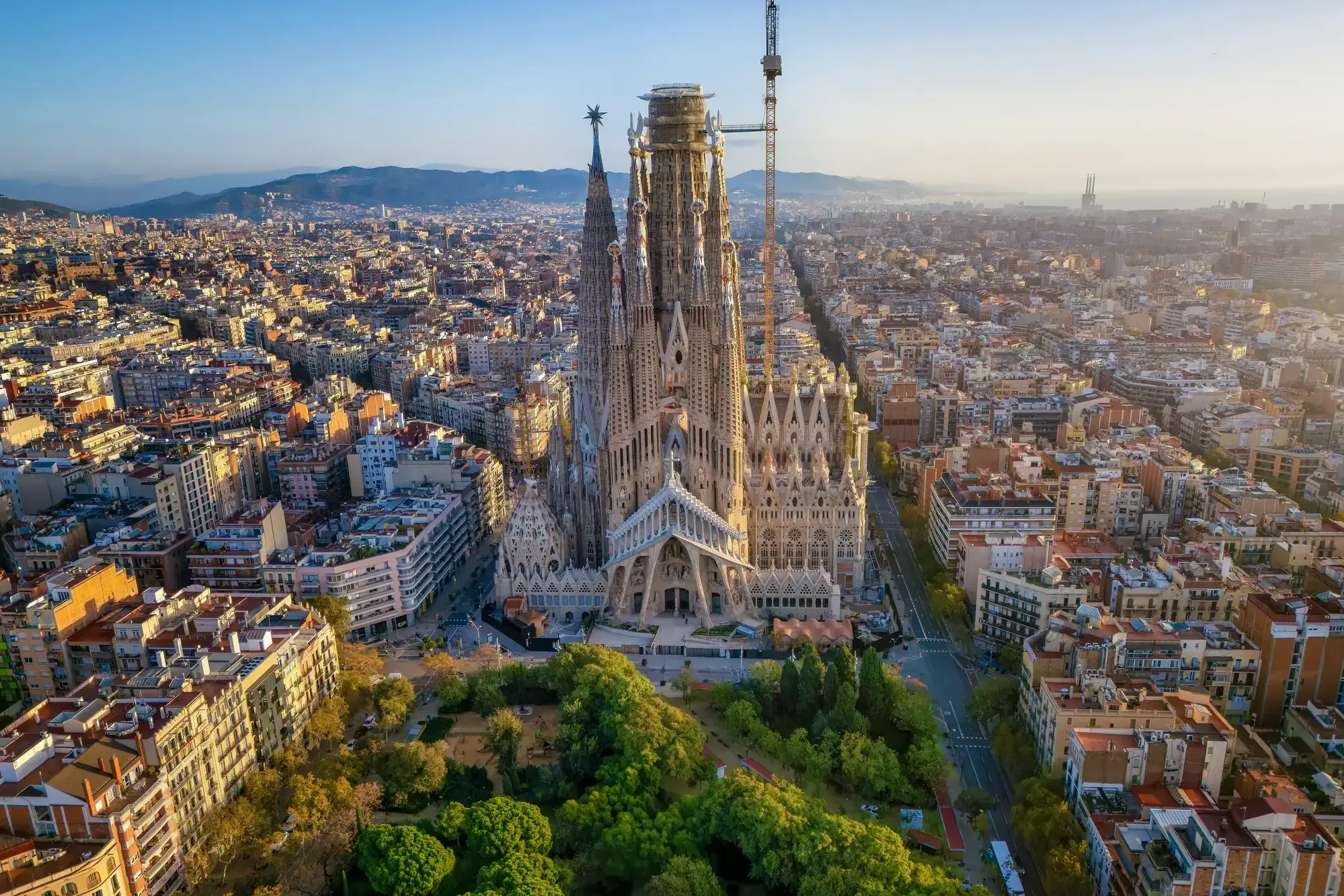
Mając reputację jednego z najatrakcyjniejszych miast w Europie, Barcelona świętuje swoją rolę stolicy Katalonii. Kosmopolityczna i międzynarodowa atmosfera miasta sprawia, że jest to ulubione miejsce wielu ludzi na całym świecie. Miasto jest szczególnie znane ze swojej architektury i sztuki – podróżnicy z całego świata przybywają, aby zobaczyć słynną Sagrada Familia i inne modernistyczne zabytki zaprojektowane przez Gaudiego.
Barcelona to miasto z licznymi i oryginalnymi możliwościami spędzania czasu wolnego, które sprawiają, że chcesz tu wracać. Położona na wybrzeżu Morza Śródziemnego Barcelona słynie z arcydzieł Gaudiego i architektury secesyjnej: jest jednym z najbardziej stylowych miast europejskich.
Miasto jest ośrodkiem nowych trendów w świecie kultury, mody i gastronomii. Dopełnieniem kreatywności artystów i projektantów jest ostrożne podejście do tradycyjnych placówek. Barcelona łączy w sobie urok i spokój historycznego centrum z awangardowymi nowoczesnymi dzielnicami i intensywnym tempem życia w jednym z najczęściej odwiedzanych miast na świecie.

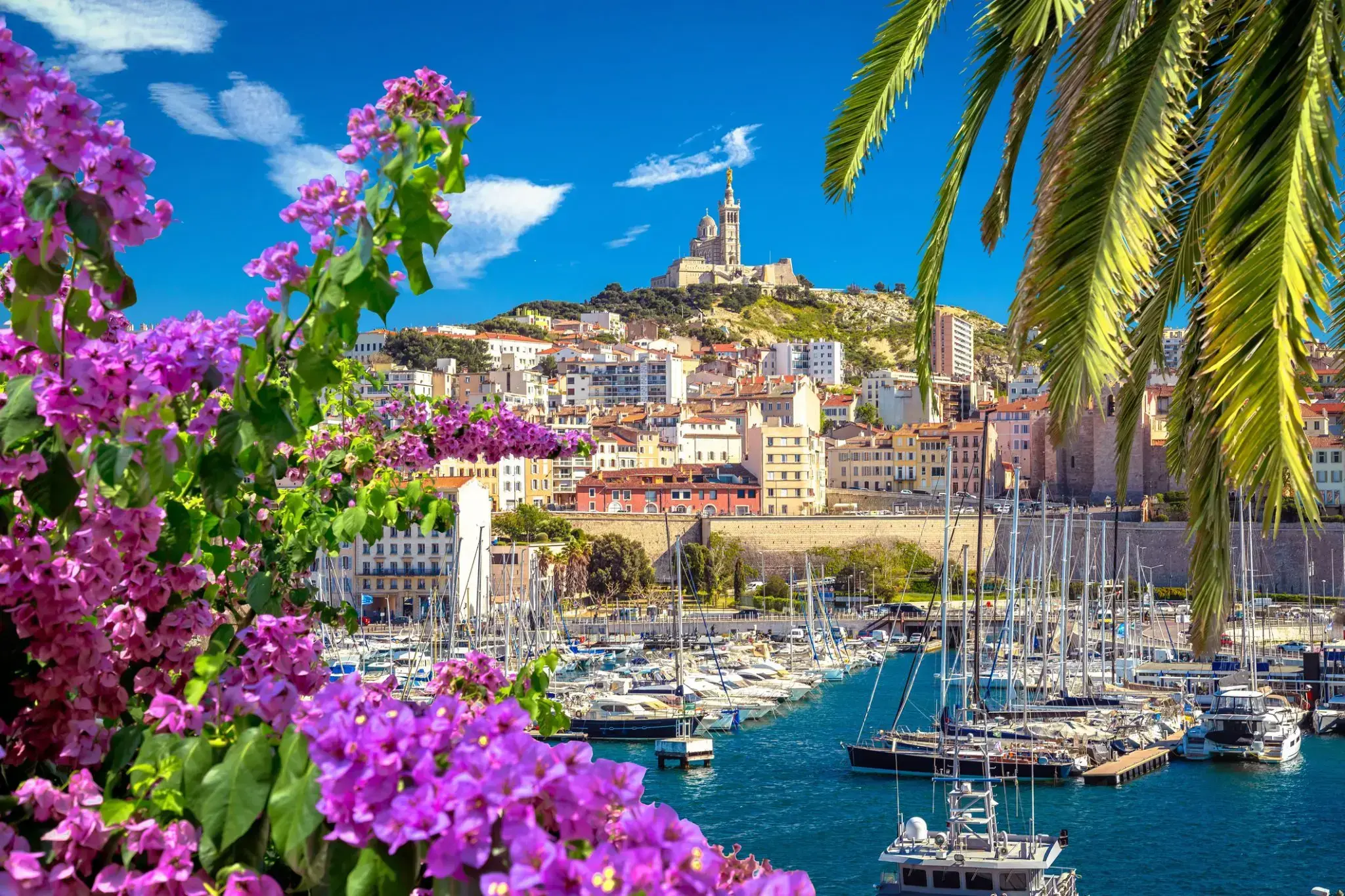
Witamy w gościnnym Prowansie! Bramą do tego regionu jest Marsylia – miasto „Marsylianki”, hymnu Francji, oraz słynnego Zamku If. Symbolem Marsylii jest bazylika Notre-Dame de la Garde. Latem można wziąć udział w oprowadzaniu po francusku (3 EUR), a dopłacając 5 EUR wejść na dach, skąd rozciąga się wspaniała panorama miasta. W pobliżu znajduje się opactwo św. Wiktora z ciekawymi katakumbami.
Rejs turystycznym statkiem na Wyspy Frioul pozwala zobaczyć Zamek If – znany z powieści o hrabim Monte Christo. Kulturalnym sercem Marsylii są Cours Julien i plac Jeana Jaurèsa – pełne księgarni, alternatywnych sklepów, klubów i kawiarni. Dwa razy w tygodniu odbywa się tu wielki targ (czwartek i sobota). Wśród atrakcji miasta znajdują się liczne muzea, galerie i dzieła architektury, a także malownicze zatoki zwane kalankami, uznawane za francuskie fiordy.

Nice is the seventh most populous urban area in France and the capital of the Alpes-Maritimes département. The metropolitan area of Nice extends beyond the administrative city limits, with a population of about 1 million on an area of 721 km2 (278 sq mi). Located in the French Riviera, on the south east coast of France on the Mediterranean Sea, at the foot of the Alps, Nice is the second-largest French city on the Mediterranean coast and the second-largest city in the Provence-Alpes-Côte d'Azur region after Marseille. Nice is approximately 13 kilometres (8.1 mi) from the principality of Monaco and 30 kilometres (19 mi) from the French-Italian border. Nice's airport serves as a gateway to the region.
The city is nicknamed Nice la Belle (Nissa La Bella in Niçard), which means Nice the Beautiful, which is also the title of the unofficial anthem of Nice, written by Menica Rondelly in 1912.
The area of today's Nice contains Terra Amata, an archaeological site which displays evidence of a very early use of fire. Around 350 BC, Greeks of Marseille founded a permanent settlement and called it Nikaia, after Nike, the goddess of victory. Through the ages, the town has changed hands many times. Its strategic location and port significantly contributed to its maritime strength. For centuries it was a dominion of Savoy, and was then part of France between 1792 and 1815, when it was returned to Piedmont-Sardinia until its re-annexation by France in 1860.
The natural environment of the Nice area and its mild Mediterranean climate came to the attention of the English upper classes in the second half of the 18th century, when an increasing number of aristocratic families took to spending their winters there. The city's main seaside promenade, the Promenade des Anglais ("Walkway of the English") owes its name to visitors to the resort. The clear air and soft light have particularly appealed to notable painters, such as Marc Chagall, Henri Matisse, Niki de Saint Phalle and Arman. Their work is commemorated in many of the city's museums, including Musée Marc Chagall, Musée Matisse and Musée des Beaux-Arts. Nice has the second largest hotel capacity in the country and it is one of its most visited cities, receiving 4 million tourists every year. It also has the third busiest airport in France, after the two main Parisian ones. It is the historical capital city of the County of Nice(Comté de Nice).
Rzym – jedno z najstarszych miast świata, niegdyś stolica Cesarstwa Rzymskiego, dziś stolica Włoch. Położony na siedmiu wzgórzach nad Tybrem, zachwyca pięknem i majestatem, którego nie da się oddać słowami – trzeba tu być. Każda rzeźba, fontanna czy budowla to dzieło sztuki pozostawione przez dawnych mistrzów. Najsłynniejsze atrakcje, które przyciągają turystów, to Koloseum – miejsce dawnych walk gladiatorów, Fontanna di Trevi, Schody Hiszpańskie, Bazylika św. Piotra – największy kościół Europy, a także Fora Cesarskie i Forum Romanum.
Sorrento is a town overlooking the Bay of Naples in Southern Italy. A popular tourist destination due to its variety of small antique shops and location on the Amalfi Coast, it can be reached easily from Naples and Pompeii as it is at the south-eastern end of the Circumvesuviana rail line. The town is most commonly known for its small shops selling an arrangement of ceramics, lacework and marquetry (woodwork).
The Sorrentine Peninsula has views of Naples, Vesuvius and the Isle of Capri. The Amalfi Drive, connecting Sorrento and Amalfi, is a narrow road that threads along the high cliffs above the Tyrrhenian Sea.
Ferries and hydrofoils connect the town to Naples, Amalfi, Positano, Capri and Ischia. Sorrento's sea cliffs and luxury hotels have attracted celebrities including Enrico Caruso and Luciano Pavarotti.
Limoncello, a digestif made from lemon rinds, alcohol, water and sugar, is produced in Sorrento. Other agricultural production includes citrus fruit, wine, nuts and olives.
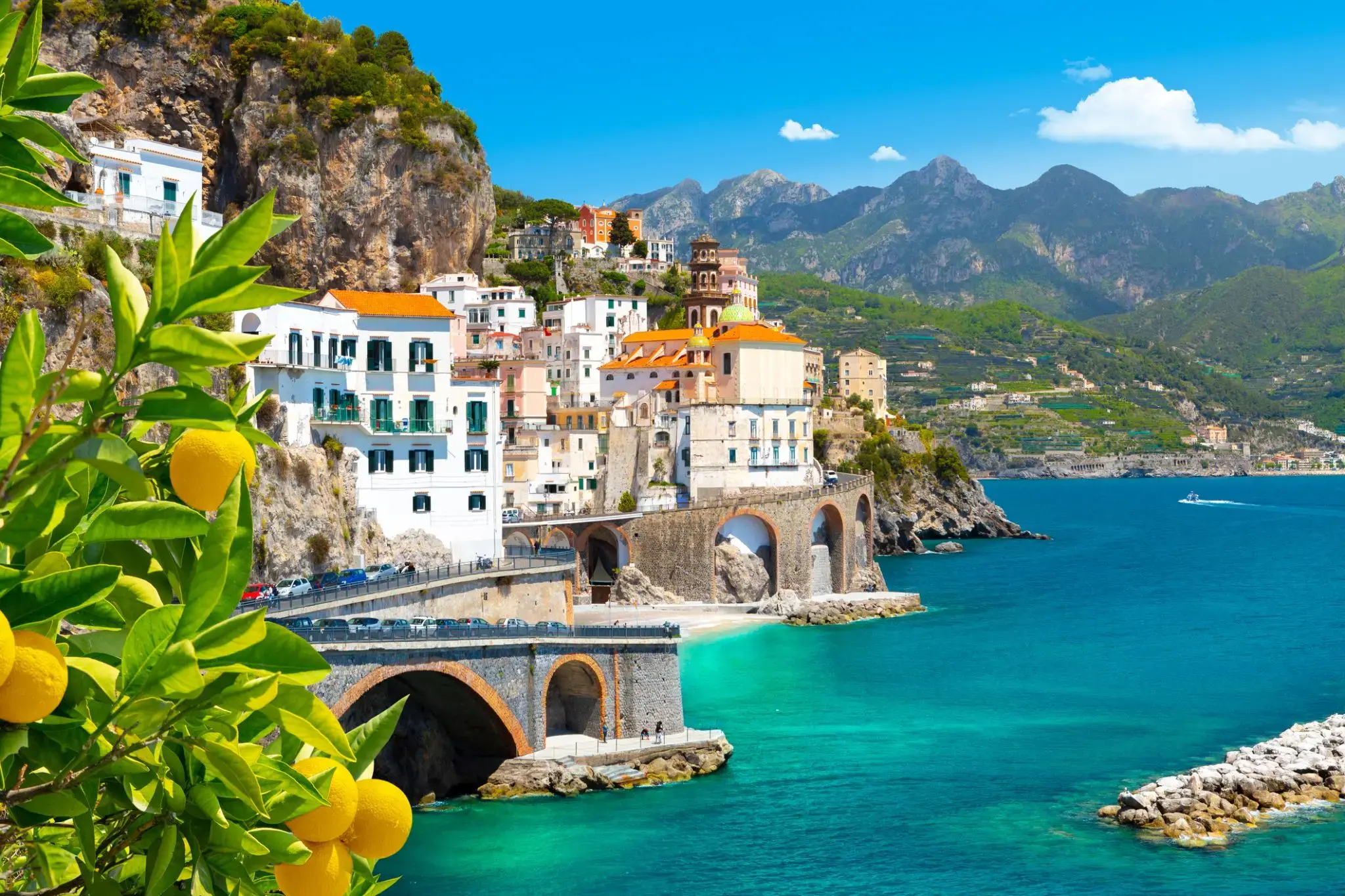
Амальфи это город и коммуна в провинции Салерно, в регионе Кампания, Италия, в заливе Салерно. Он расположен в устье глубокого ущелья, у подножия горы Монето Черрето (1315 метров, 4314 футов), в окружении драматических скал и прибрежных пейзажей. Город Амальфи был столицей морской республики, известной как герцогство Амальфи, важной торговой державой в Средиземноморье между 839 и около 1200 годами.
В 1920-х и 1930-х годах Амальфи был популярным местом отдыха британского высшего класса и аристократии.
Амальфи - главный город побережья, на котором он расположен, называется Costiera Amalfitana (побережье Амальфи) и сегодня является важным туристическим направлением вместе с другими городами на том же побережье, такими как Позитано, Равелло и другие. Амальфи включен в список объектов Всемирного наследия ЮНЕСКО.
Покровителем Амальфи является святой Андрей, апостол, мощи которого хранятся здесь, в соборе Амальфи (Cattedrale di Sant'Andrea / Duomo di Amalfi).

The capital of Malta - Valletta , is the first and almost the only city in Europe, which was once designed by architects and built according to all the rules and norms of construction. Valletta is considered to be one of the most beautiful cities on the Mediterranean. Klaipeda is on the list of the few remaining fortified towns. The center of the city is the Palace of the Grand Master of the Order of Malta, and today the residence of the President of the country, here is the seat of the Maltese Parliament. The list of places to visit in Valletta includes the Castilla Palace, the Admiralty (where the National Museum of Fine Arts is now located, with the largest painting collection in the country), a charming place in the city - the beautiful Hastings Gardens, and this is not the whole list of the riches of the capital of Malta .
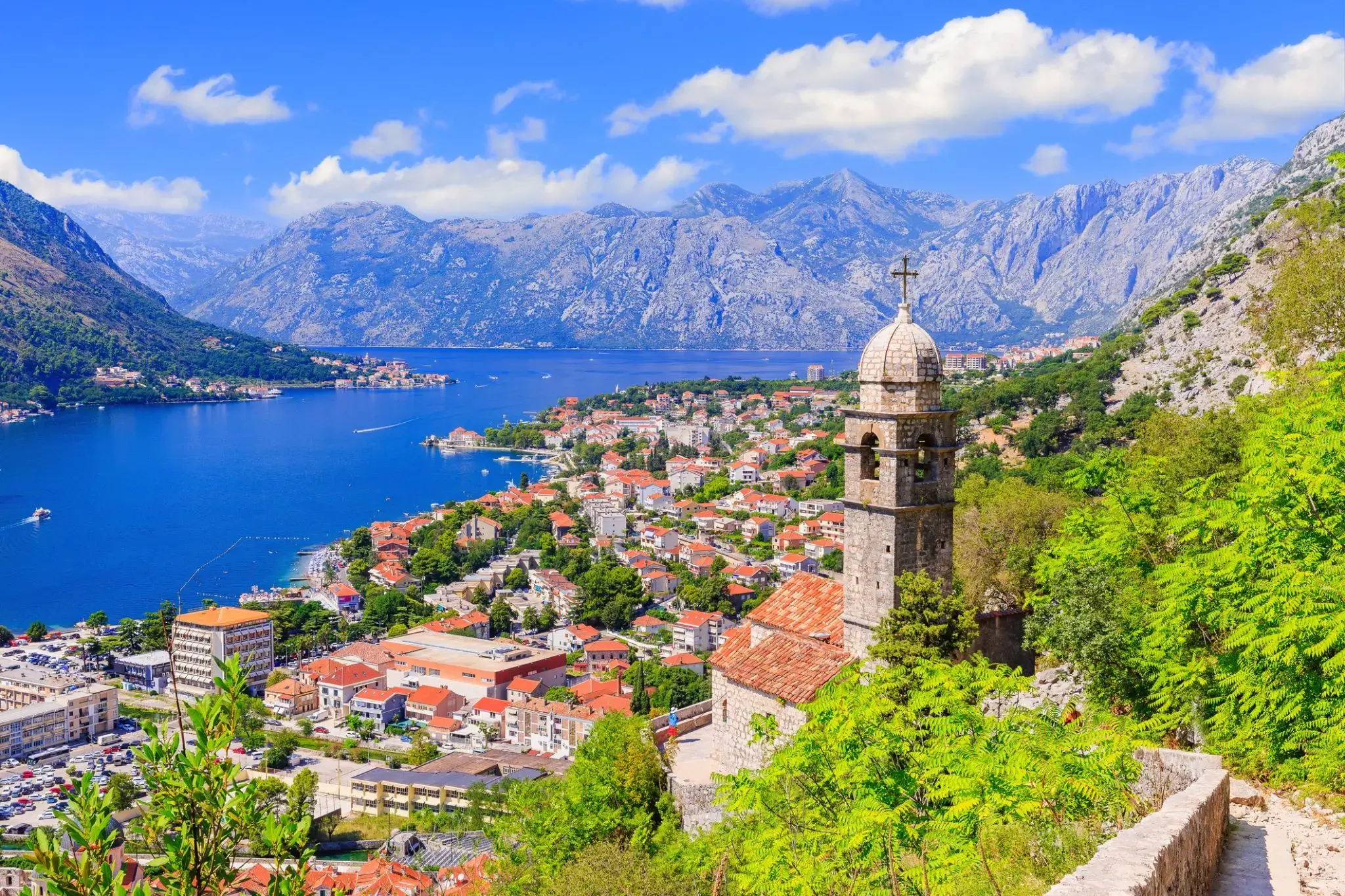
Kotor is a coastal town in Montenegro. It is located in a secluded part of the Gulf of Kotor. The city has a population of 13,510 and is the administrative center of Kotor Municipality.
The old Mediterranean port of Kotor is surrounded by fortifications built during the Venetian period. It is located on the Bay of Kotor (Boka Kotorska), one of the most indented parts of the Adriatic Sea. Some have called it the southern-most fjord in Europe, but it is a ria, a submerged river canyon. Together with the nearly overhanging limestone cliffs of Orjen and Lovćen, Kotor and its surrounding area form an impressive landscape.
Since the early 2000s Kotor has seen an increase in tourists , many of them coming by cruise ship. Visitors are attracted by the natural environment of the Gulf of Kotor and by the old town of Kotor. Kotor is part of the World Heritage Site dubbed the Natural and Culturo-Historical Region of Kotor.
The fortified city of Kotor was also included in UNESCO's World Heritage Site list as part of Venetian Works of Defence between 15th and 17th centuries: Stato da Terra – western Stato da Mar in 201

Split – perła Dalmacji
Split to drugie największe miasto Chorwacji, położone nad Adriatykiem. Jego symbolem jest Pałac Dioklecjana, wpisany na listę UNESCO, otoczony wąskimi uliczkami i katedrą św. Duje.
Miasto tętni życiem na nadmorskiej promenadzie Riva, pełnej kawiarni i restauracji. W okolicy czekają plaże, m.in. słynna Bacvice.
Split to także ważny port, skąd łatwo popłynąć na chorwackie wyspy – Hvar, Brač czy Korčulę. Atmosfera śródziemnomorska i dalmatyńska kuchnia sprawiają, że Split to idealne miejsce na urlop.

Koper is the fifth largest city in Slovenia. Located in the southwestern part of the country, approximately five kilometres (3.1 miles) south of the border with Italy and 20 kilometers (12 miles) from Trieste, Koper is the largest coastal city in the country. It is bordered by the satellite towns of Izola and Ankaran, and anchors the Istrian region. With a unique ecology and biodiversity, it is considered an important national natural resource. It is the oldest recorded urban settlement in Slovenia. The city's Port of Koper is the major contributor to the economy of the eponymous city municipality. With only one percent of Slovenia having a coastline, the influence that the Port of Koper also has on tourism was a factor in Ankaran deciding to leave the municipality in a referendum in 2011 to establish its own. The city is a destination on a number of Mediterranean cruising lines. In 2016, the city expects 65 cruise ship arrivals (for example: Norwegian Spirit, MSC Magnifica, Norwegian Jade, MS Rhapsody of the Seas...) with the season spanning from March to December. Koper is the main urban centre of the Slovenian Istria, with a population of about 25,000.

Wenecja — najbardziej znane i niezwykłe miasto na świecie. Znajduje się na północy Włoch, na wybrzeżu Morza Adriatyckiego. Teren miasta przecina ponad 150 kanałów i strumieni, nad którymi przerzucono ponad 400 mostów.
Wenecja — miasto kurortowe, które jest centrum międzynarodowej turystyki o światowym znaczeniu, miejscem organizacji wystaw artystycznych i architektonicznych oraz międzynarodowych festiwali filmowych. Zupełnie niezwykła atmosfera panująca w mieście zachwyca od pierwszego spojrzenia. Wąskie uliczki z małymi, przytulnymi kawiarenkami, sunące gondole i serenady gondolierów wprowadzają w romantyczny nastrój i przyciągają zakochanych z całego świata.
Dubrovnik is a Croatian city on the Adriatic Sea. It is one of the most prominent tourist destinations in the Mediterranean Sea, a seaport and the centre of Dubrovnik-Neretva County. Its total population is 42,615 (census 2011). In 1979, the city of Dubrovnik joined the UNESCO list of World Heritage sites.
The prosperity of the city was historically based on maritime trade; as the capital of the maritime Republic of Ragusa, it achieved a high level of development, particularly during the 15th and 16th centuries, as it became notable for its wealth and skilled diplomacy.
In 1991, after the break-up of Yugoslavia, Dubrovnik was besieged by Serbian and Montenegrin soldiers of the Yugoslav People's Army (JNA) for seven months and suffered significant damage from shelling. After repair and restoration works in the 1990s and early 2000s, Dubrovnik re-emerged as one of the top tourist destinations in the Mediterranean.
Korfu uchodzi za najpiękniejszą wyspę archipelagu Jońskiego. Wyspa jest niezwykle żyzna – głównymi produktami są oliwa z oliwek, owoce południowe i wino. Stara część miasta Korfu zachwyca malowniczymi uliczkami i architekturą różnych kultur europejskich. Wyspa ma bogatą historię – przez wieki przyciągała najeźdźców, a największy wpływ na jej kulturę wywarły Włochy, co łatwo wytłumaczyć bliskością tego kraju. Korfu odwiedzali m.in. Goethe i Napoleon, a cesarzowa Elżbieta Austriacka mieszkała tu przez długi czas. Klimat sprzyja turystom – nawet latem morska bryza przynosi przyjemne orzeźwienie.
Argostoli to stolica Kefalonii, największej wyspy Archipelagu Jońskiego w Grecji. Miasto, położone na zachodnim wybrzeżu wyspy, słynie z malowniczych nadbrzeży, eleganckich kawiarni i neoklasycznych budynków. W Argostoli znajduje się także wiele historycznych zabytków, w tym Archeologiczne Muzeum Kefalonii oraz plac Valiianos, na którym można zobaczyć ślady zniszczeń pozostałe po trzęsieniu ziemi z 1953 roku, które niemal całkowicie zniszczyło miasto. Spacerując po ulicach, turyści mogą podziwiać harmonijne połączenie tradycyjnej greckiej architektury z nowoczesnością.
Miasto jest również doskonałą bazą wypadową do odkrywania naturalnych piękności Kefalonii. Zaledwie kilka kilometrów od Argostoli znajdują się znane plaże, takie jak Lourdas i Melissani, a także słynna jaskinia Dragonera, gdzie można podziwiać stalaktyty i stalagmity. Z Argostoli łatwo jest również udać się na wycieczki do unikalnych rezerwatów przyrody, takich jak rezerwat żółwi, w którym żyją rzadkie morskie żółwie Caretta caretta. Miasto to idealne miejsce do połączenia turystyki kulturalnej z odkrywaniem naturalnych cudów wyspy.
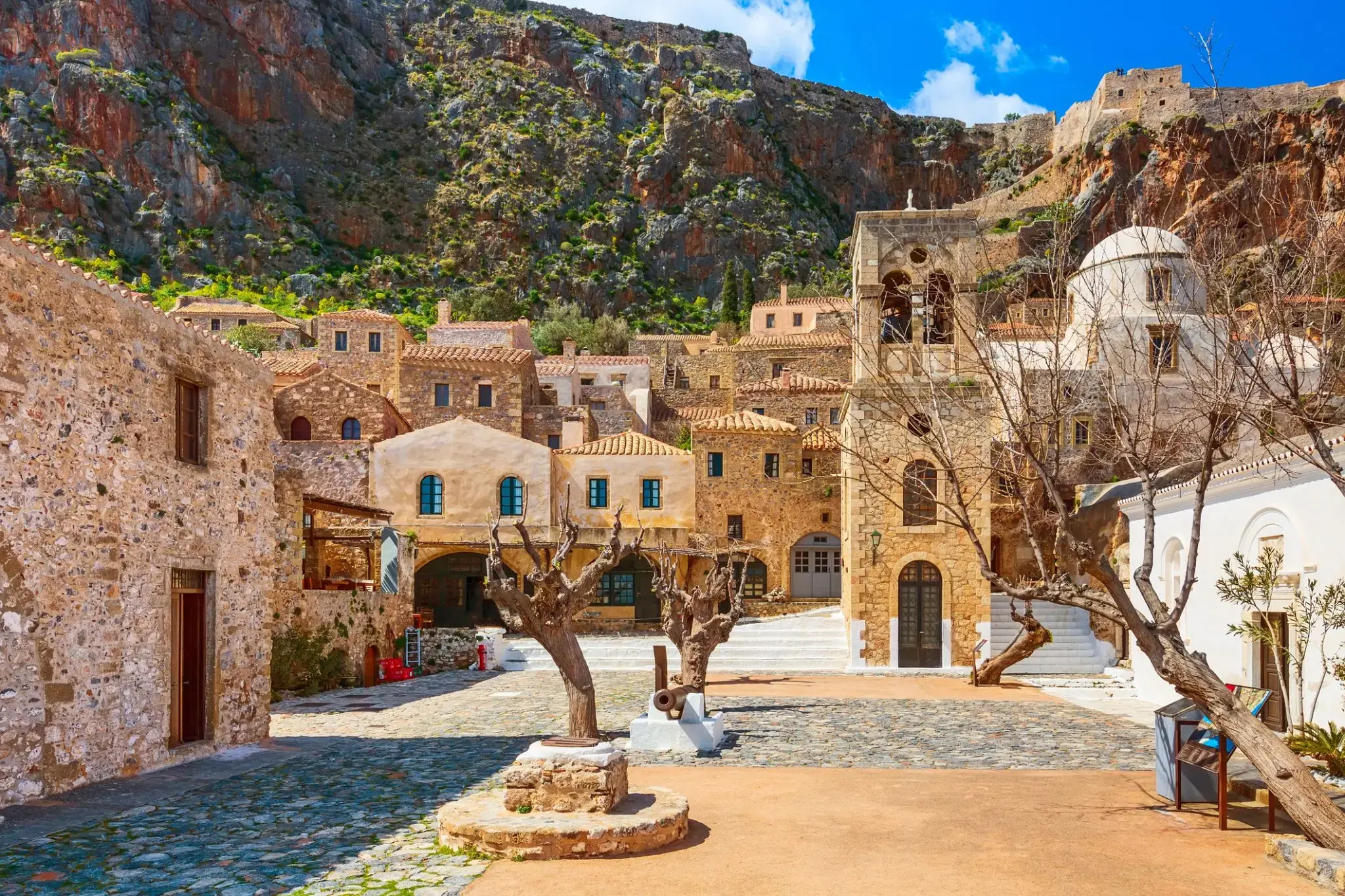
Monemwasia — Skalna twierdza Morza Egejskiego
Monemwasia to unikalne średniowieczne miasto-twierdza, wykute w skale na wyspie u południowo-wschodniego wybrzeża Peloponezu (Lakonia). Prawie niewidoczne z lądu, jego nazwa oznacza „jedno wejście”, co odzwierciedla jego strategiczne znaczenie w czasach Bizancjum, Wenecji i Imperium Osmańskiego.
Dziś Monemwasia zachwyca turystów zachowaną architekturą, brukowanymi uliczkami, bizantyjskimi kościołami i zapierającymi dech w piersiach widokami na Morze Egejskie. To miejsce, gdzie historia i spokój tworzą niepowtarzalną atmosferę

Grecja dzieli się z Tobą pięknem jednego z najczarowniejszych wulkanicznych archipelagów Morza Egejskiego – Santorini. Wulkan wciąż jest aktywny, ale dla turystów stworzono bezpieczne warunki, dzięki czemu można tu śmiało przyjeżdżać. To właśnie jemu zawdzięczamy czarne plaże, krajobrazy ze stwardniałej czerwono-brunatnej lawy, turkusowe widoki morza i kontrastujące z nimi bielone domki. Jeśli odwiedzisz Santorini, nie zapomnij o stanowisku archeologicznym w Akrotiri, gdzie zachowały się pozostałości minojskiej cywilizacji.
Rhodes is the largest of the Dodecanese islands of Greece and is also the island group's historical capital. Administratively the island forms a separate municipality within the Rhodes regional unit, which is part of the South Aegean administrative region. The principal town of the island and seat of the municipality is Rhodes. The city of Rhodes had 50,636 inhabitants in 2011. It is located northeast of Crete, southeast of Athens and just off the Anatolian coast of Turkey. Rhodes' nickname is The island of the Knights, named after the Knights of Saint John of Jerusalem, who once conquered the land.
Historically, Rhodes was famous worldwide for the Colossus of Rhodes, one of the Seven Wonders of the Ancient World. The Medieval Old Town of the City of Rhodes has been declared a World Heritage Site. Today, it is one of the most popular tourist destinations in Europe. The name of the U.S. state of Rhode Island is thought to be based on this island.
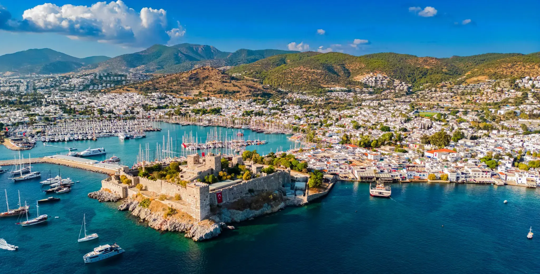
Bodrum is a famous Turkish resort on the Aegean Sea, located in the province of Mugla. The city is located in the extreme southwest of the country, on the coast of ancient Caria, which today is called the Turkish Riviera. Bodrum is perhaps the most international of all cities in Turkey. It is famous for its restaurants, night clubs, the atmosphere of eternal celebration and the bohemian lifestyle. This combination is especially attractive for young people from Europe and liberated Turks who come here in the summer to swim, soak up the sun, and “hang out” in open-air pubs, discos and bars. Curious tourists in these parts are attracted by the desire to get acquainted with the millenary history of the region, to see the ancient and medieval monuments located here.
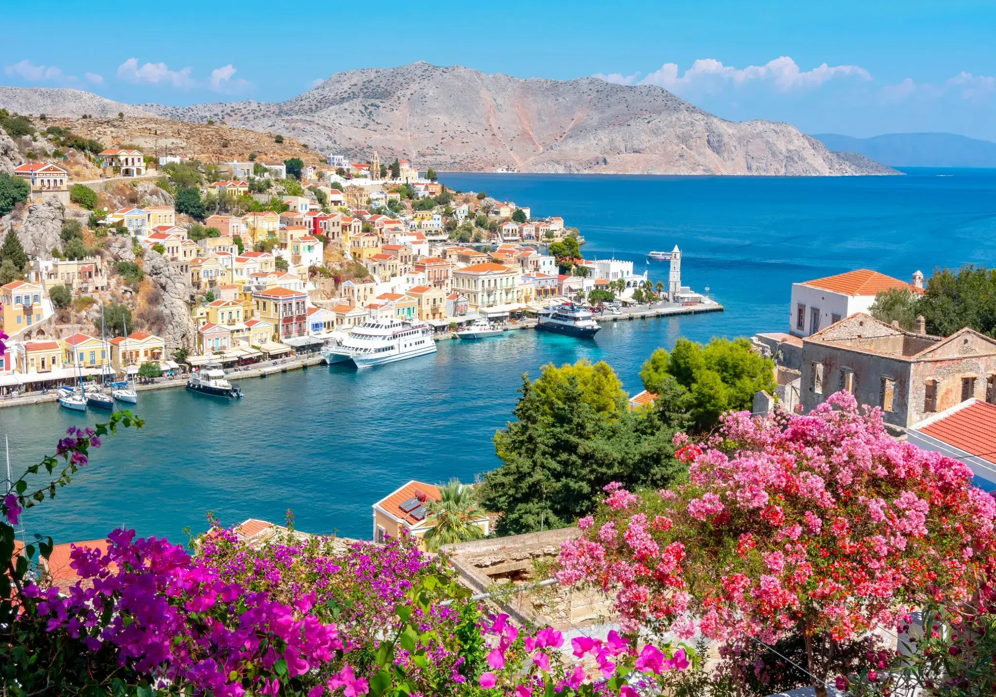
Syros to malownicza wyspa w archipelagu Cyklad, znana z bogatej historii i zróżnicowanej architektury. Jej stolica, Ermoupoli, to jedno z nielicznych greckich miast, w których bizantyjskie kościoły sąsiadują z neoklasycznymi rezydencjami. Dawniej najważniejszy ośrodek morski Grecji, dziś nadal zachowuje elegancki i kulturowo bogaty charakter.
Wyspa idealna dla podróżnych szukających nie tylko plażowego relaksu, ale i autentycznych wrażeń. Urokliwe zatoczki, malownicze szlaki i lokalna kuchnia — od świeżych owoców morza po "lagano", tradycyjny chleb pieczony z oliwą. Ciekawostka: w Ermoupoli znajduje się jeden z najstarszych teatrów w Grecji — teatr Apollon, wzorowany na mediolańskiej La Scali.

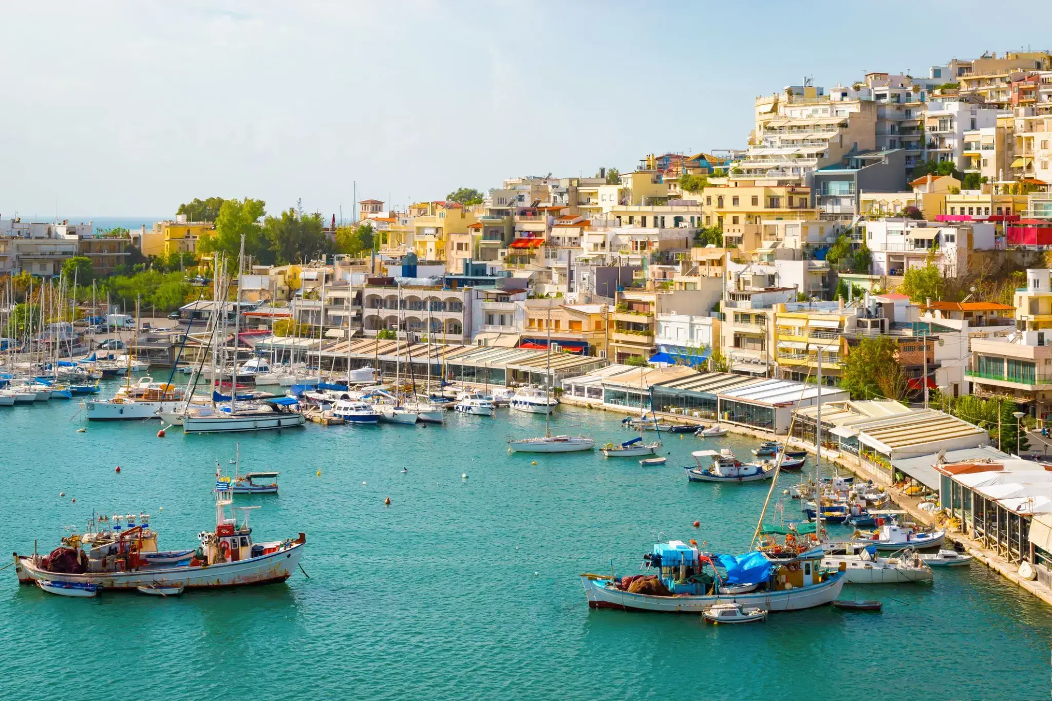
Pireus to stare miasto portowe, będące portem Aten i jednocześnie największym portem Grecji w dniu dzisiejszym. Pireus stanowi część wielkich Aten, które mogą poszczycić się bogactwem atrakcji, w tym unikalnymi zabytkami narodowej sztuki plastycznej.
Ponad dwieście muzeów i galerii, w tym Muzeum Historii Uniwersytetu, Muzeum Archeologiczne Keramejkos i wiele innych, gościnnie powita Państwa w swoich murach i zapozna z kulturą tej okolicy.