| Region rejsu : kanał Panamski, Karaiby |
| Firma : Azamara Cruises |
| Statek : Azamara Onward |
| Data rozpoczęcia : śr. 05 sty 2028 |
| Data zakończenia : śr. 01 mar 2028 |
| Liczba nocy : 56 nocy |
| Dzień | Data | Port | Wypłynięcie | Odpłynięcie |
|---|---|---|---|---|
| 1 | 5.01 śr. | Miami / USA | 18:00 | |
| 2 | 6.01 czw. | Dzień na morzu / Morze | ||
| 3 | 7.01 pt. | Dzień na morzu / Morze | ||
| 4 | 8.01 sob. | Aruba (Oranjestad) / Aruba | 13:30 | 22:00 |
| 5 | 9.01 niedz. | Curaçao / Curacao | 08:00 | 22:00 |
| 6 | 10.01 pon. | Dzień na morzu / Morze | 15:00 | |
| 7 | 11.01 wt. | Cartagena (Bolívar) / Kolumbia | 08:00 | |
| 8 | 12.01 śr. | Cartagena (Bolívar) / Kolumbia | 13:00 | |
| 9 | 13.01 czw. | Dwukropek / Panama | 08:00 | 16:00 |
| 10 | 14.01 pt. | Kanał Panamski / Panama | 16:05 | 23:59 |
| 11 | 15.01 sob. | Panama City, Floryda / USA | 02:00 | 17:00 |
| 12 | 16.01 niedz. | Dzień na morzu / Morze | ||
| 13 | 17.01 pon. | Manta / Ecuador | 08:00 | 13:30 |
| 14 | 18.01 wt. | Dzień na morzu / Morze | ||
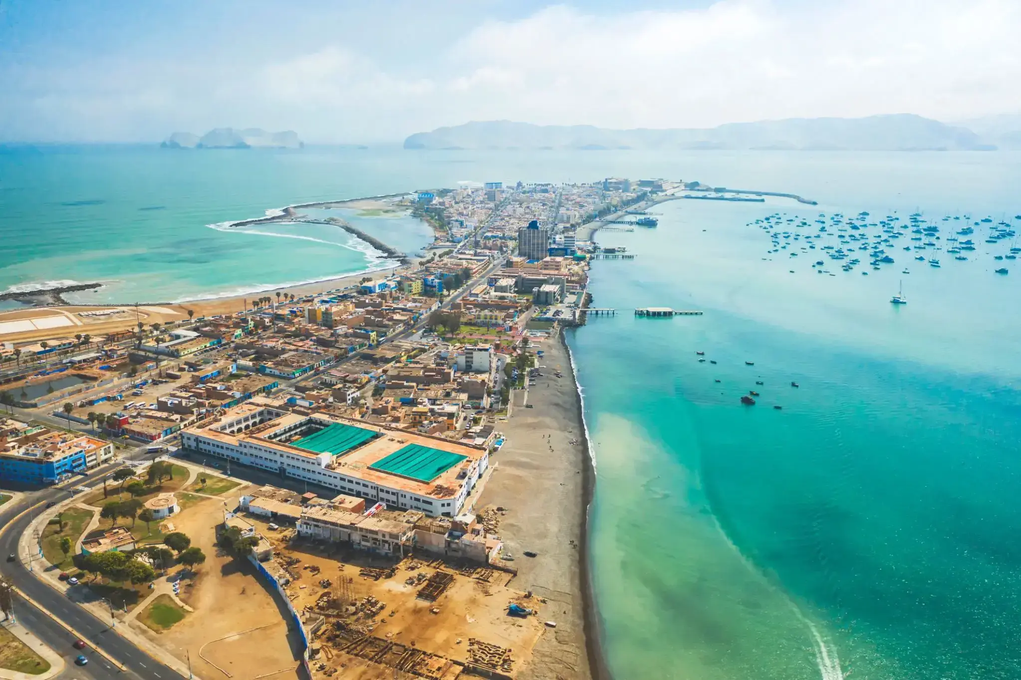
| 15 | 19.01 śr. | Callao / Peru | 13:00 | |
| 16 | 20.01 czw. | Callao / Peru | 09:00 | 17:00 |
| 17 | 21.01 pt. | Dzień na morzu / Morze | ||
| 18 | 22.01 sob. | Dzień na morzu / Morze | ||
| 19 | 23.01 niedz. | Dzień na morzu / Morze | ||
| 20 | 24.01 pon. | Dzień na morzu / Morze | ||
| 21 | 25.01 wt. | Dzień na morzu / Morze | ||
| 22 | 26.01 śr. | Wyspa Wielkanocna / Chile | 08:00 | |
| 23 | 27.01 czw. | Wyspa Wielkanocna / Chile | 13:00 | |
| 24 | 28.01 pt. | Dzień na morzu / Morze | ||
| 25 | 29.01 sob. | Dzień na morzu / Morze | ||
| 26 | 30.01 niedz. | Oh. Pitcairn | 09:00 | 17:00 |
| 27 | 31.01 pon. | Dzień na morzu / Morze | 15:00 | |
| 28 | 1.02 wt. | Dzień na morzu / Morze | ||
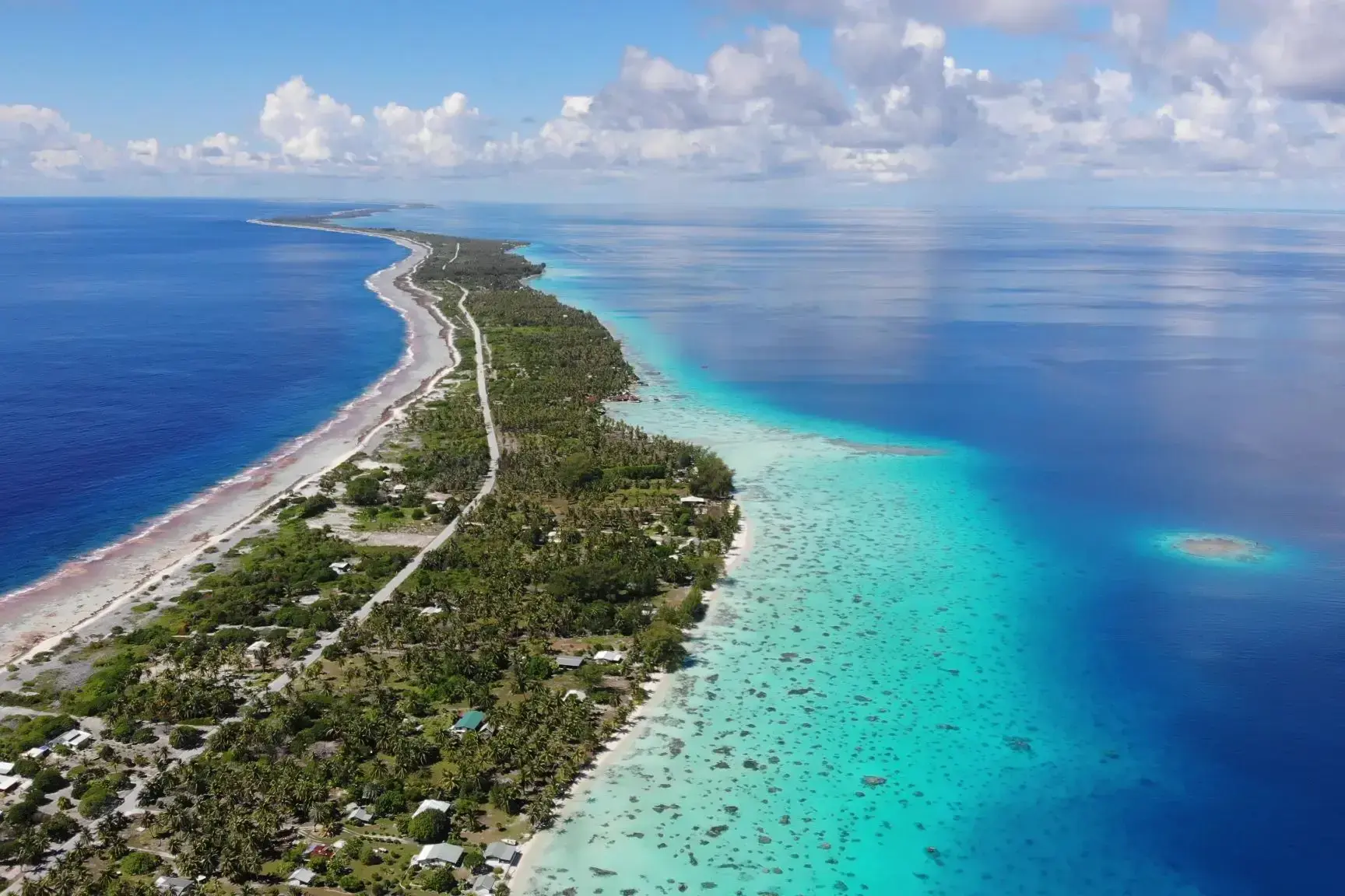
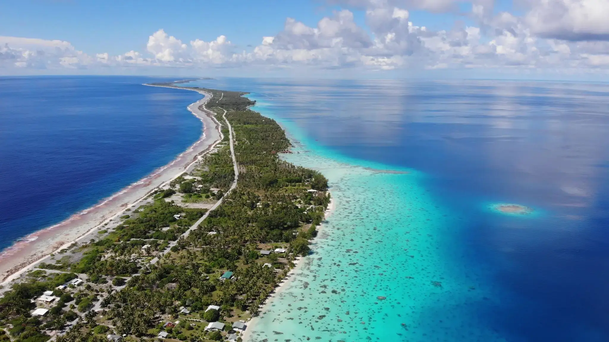
| 29 | 2.02 śr. | Fakarava / French Polynesia | 09:00 | 14:00 |
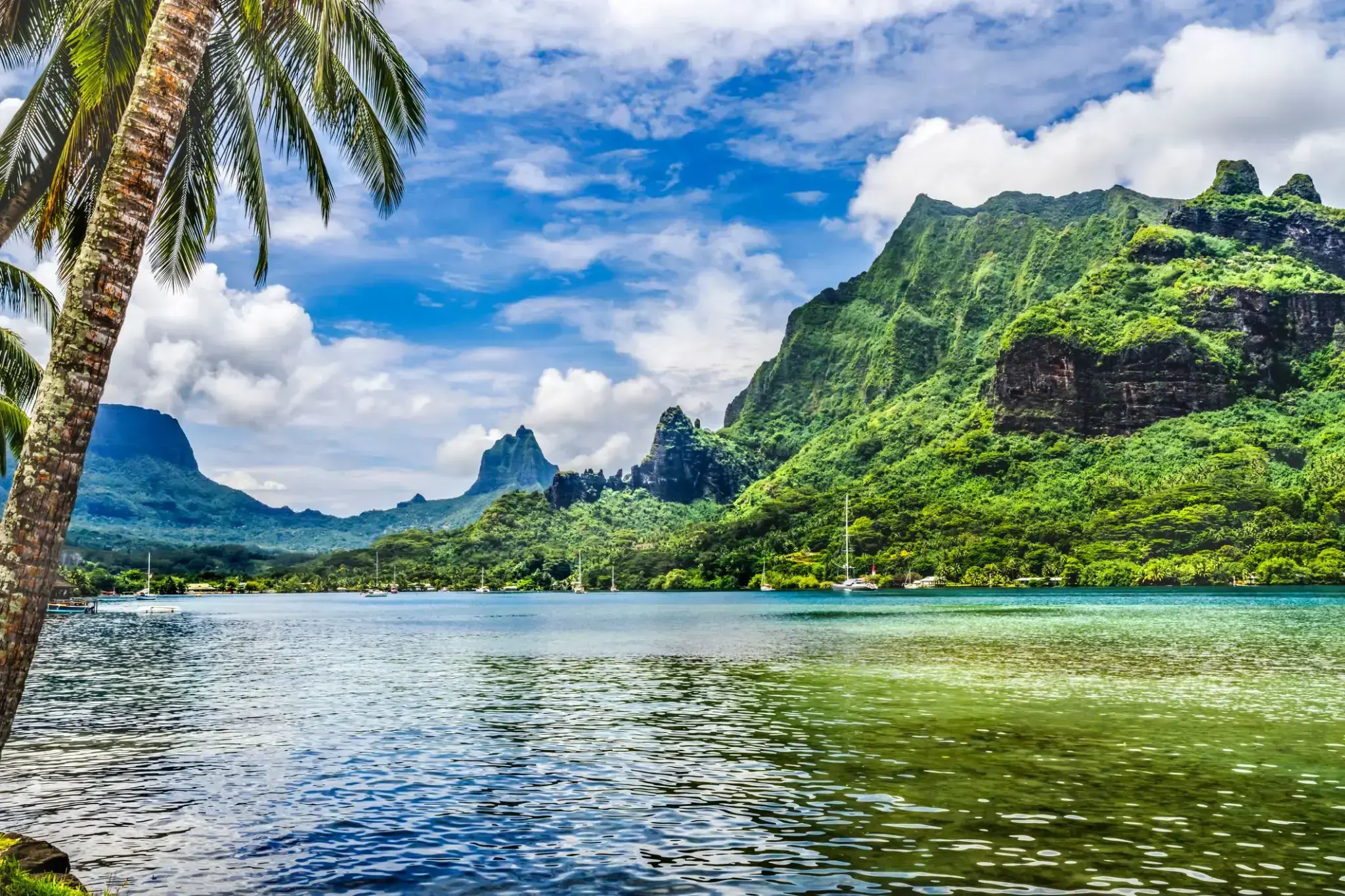
| 30 | 3.02 czw. | Moorea, Wyspy Towarzystwa / French Polynesia | 09:00 | |
| 31 | 4.02 pt. | Papeete Papeete / French Polynesia | 18:00 | |
| 32 | 5.02 sob. | Moorea, Wyspy Towarzystwa / French Polynesia | 15:30 | |
| 33 | 6.02 niedz. | Papeete Papeete / French Polynesia | 09:00 | 18:00 |
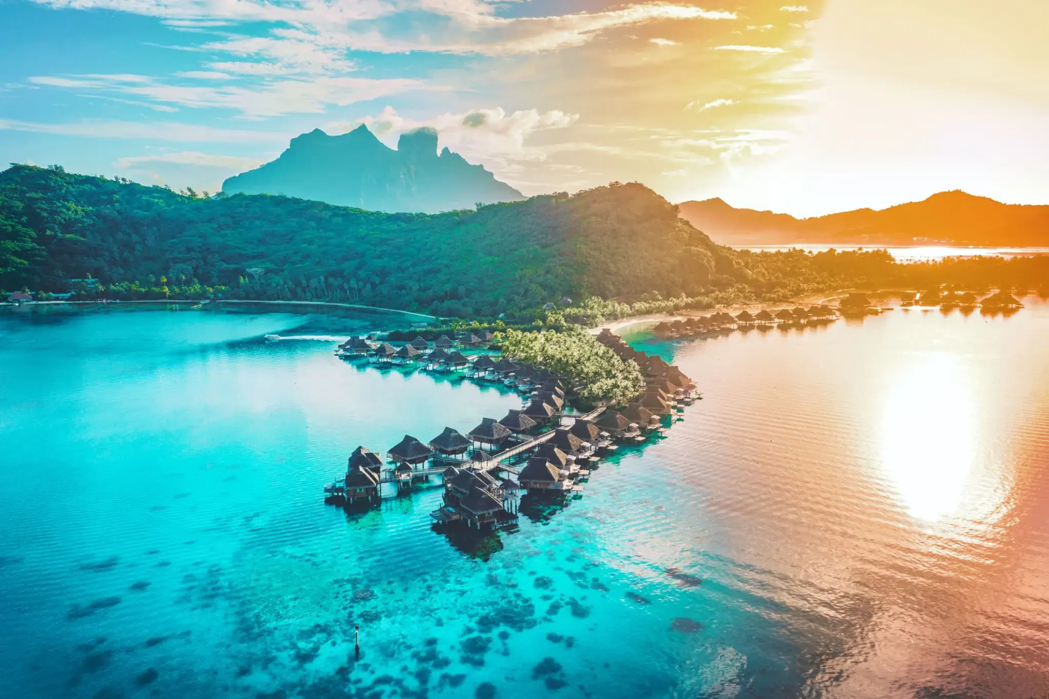
| 34 | 7.02 pon. | Bora Bora, Society Islands / French Polynesia | 08:00 | |
| 35 | 8.02 wt. | Bora Bora, Society Islands / French Polynesia | 18:00 | |
| 36 | 9.02 śr. | Dzień na morzu / Morze | 15:00 | |
| 37 | 10.02 czw. | Dzień na morzu / Morze | ||
| 38 | 11.02 pt. | Dzień na morzu / Morze | ||
| 39 | 12.02 sob. | Dzień na morzu / Morze | ||
| 40 | 13.02 niedz. | Dzień na morzu / Morze | ||
| 41 | 14.02 pon. | Dzień na morzu / Morze | ||
| 42 | 15.02 wt. | Dzień na morzu / Morze | ||
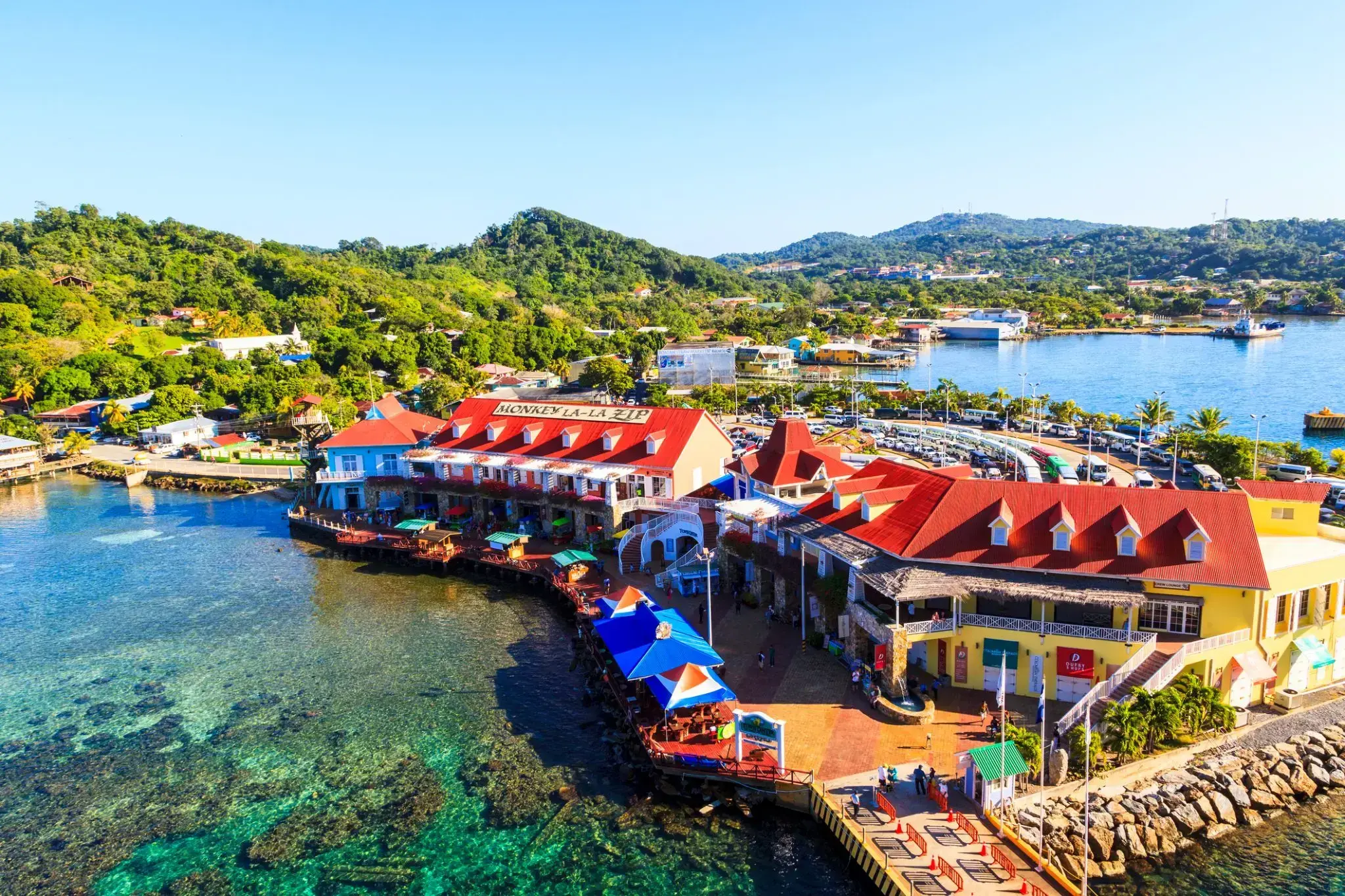
| 43 | 16.02 śr. | Kokcen-Houl / Honduras | 08:00 | 19:00 |
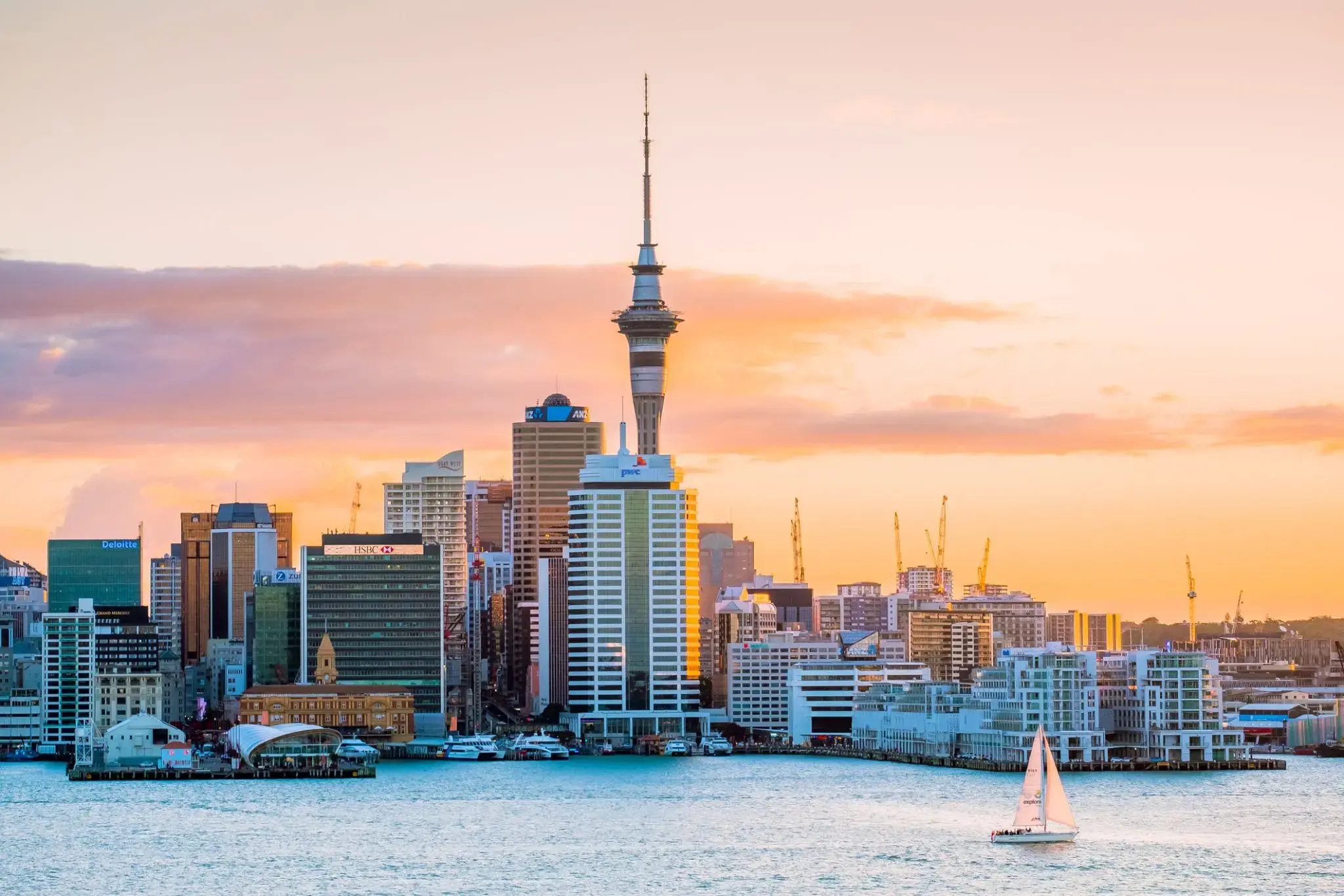
| 44 | 17.02 czw. | Okland / Nowa Zelandia | 07:00 | 18:00 |
| 45 | 18.02 pt. | Toranga / Nowa Zelandia | 08:00 | 18:00 |
| 46 | 19.02 sob. | Нейпир / Nowa Zelandia | 14:00 | 22:00 |
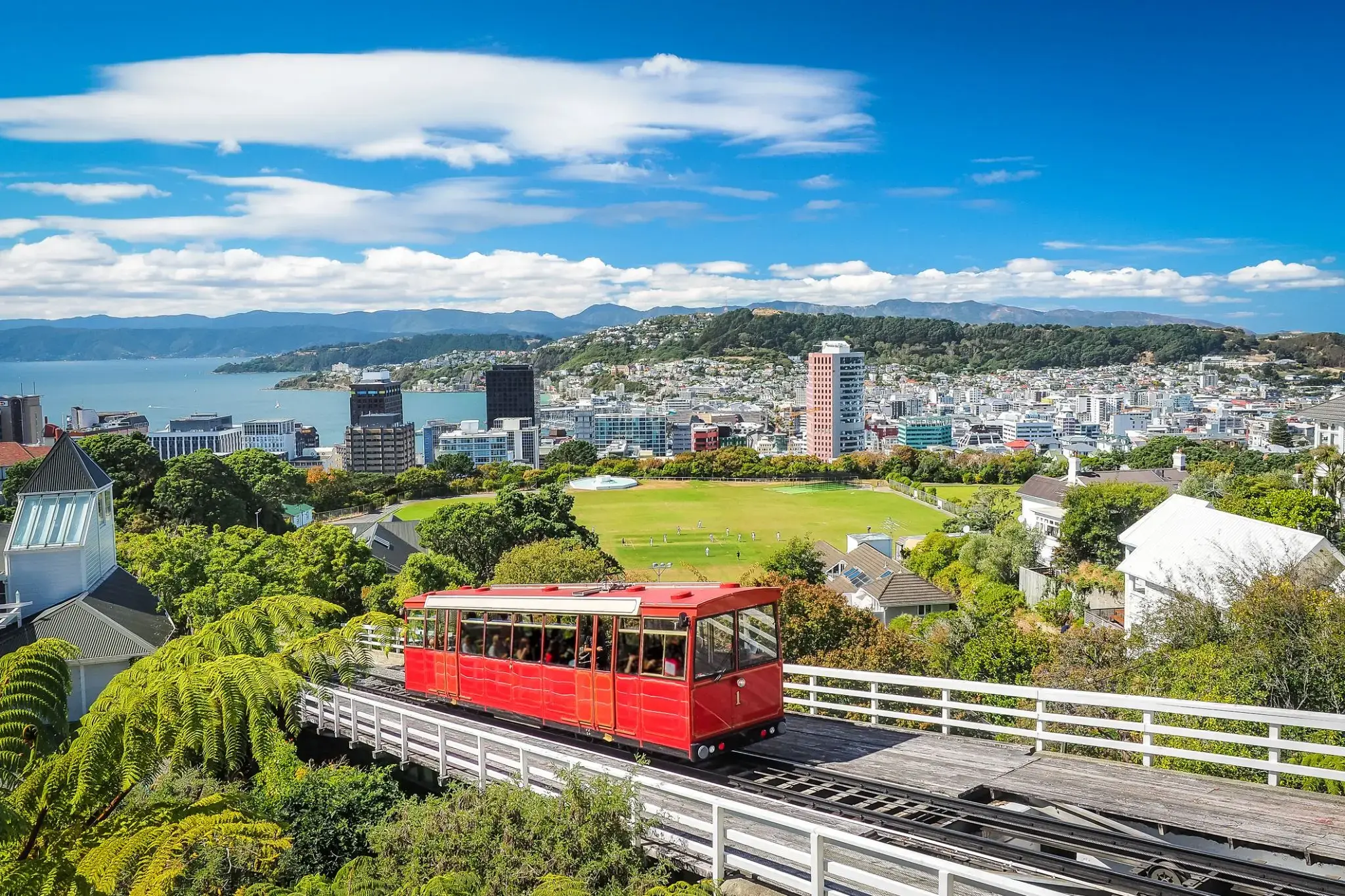
| 47 | 20.02 niedz. | Wellington / Nowa Zelandia | 13:00 | 22:00 |
| 48 | 21.02 pon. | Goal Goal / Australia | 08:00 | 17:00 |
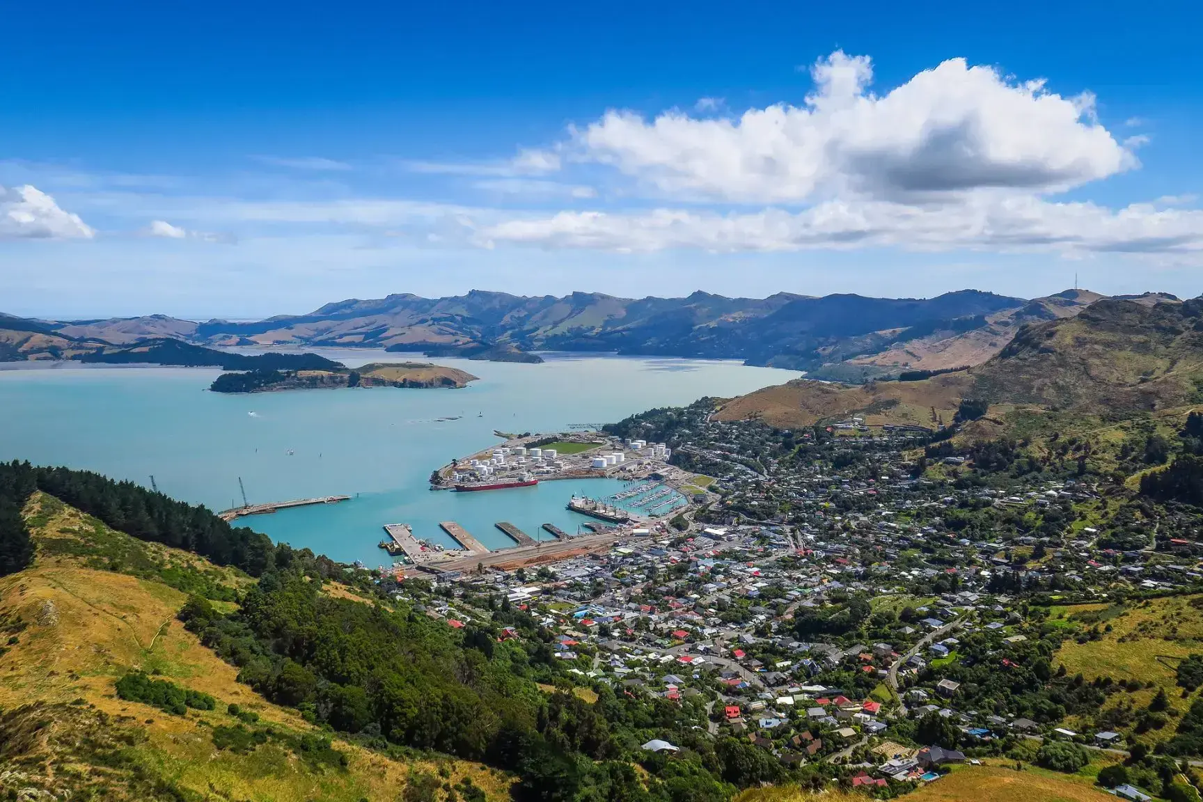
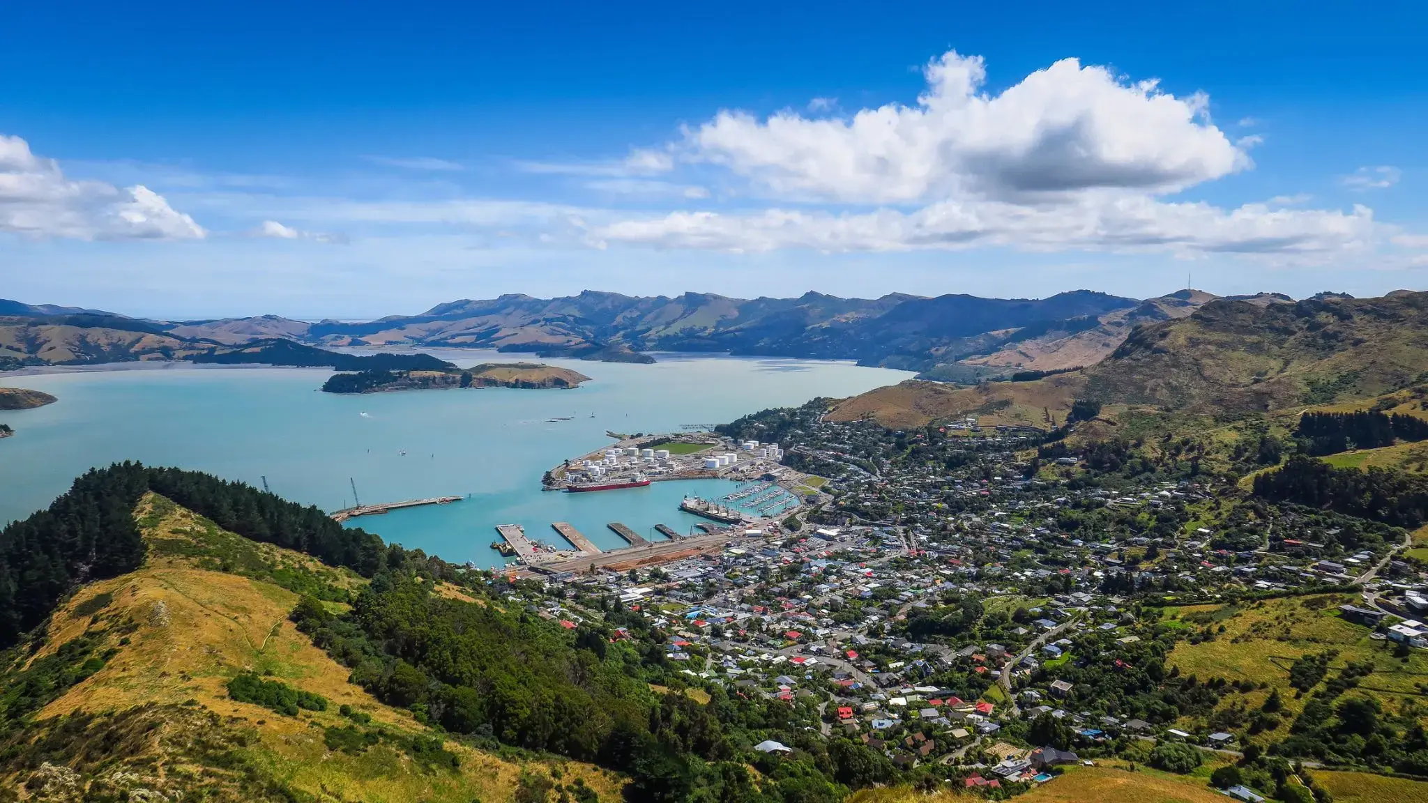
| 49 | 22.02 wt. | Christchurch / Nowa Zelandia | 07:00 | 18:30 |
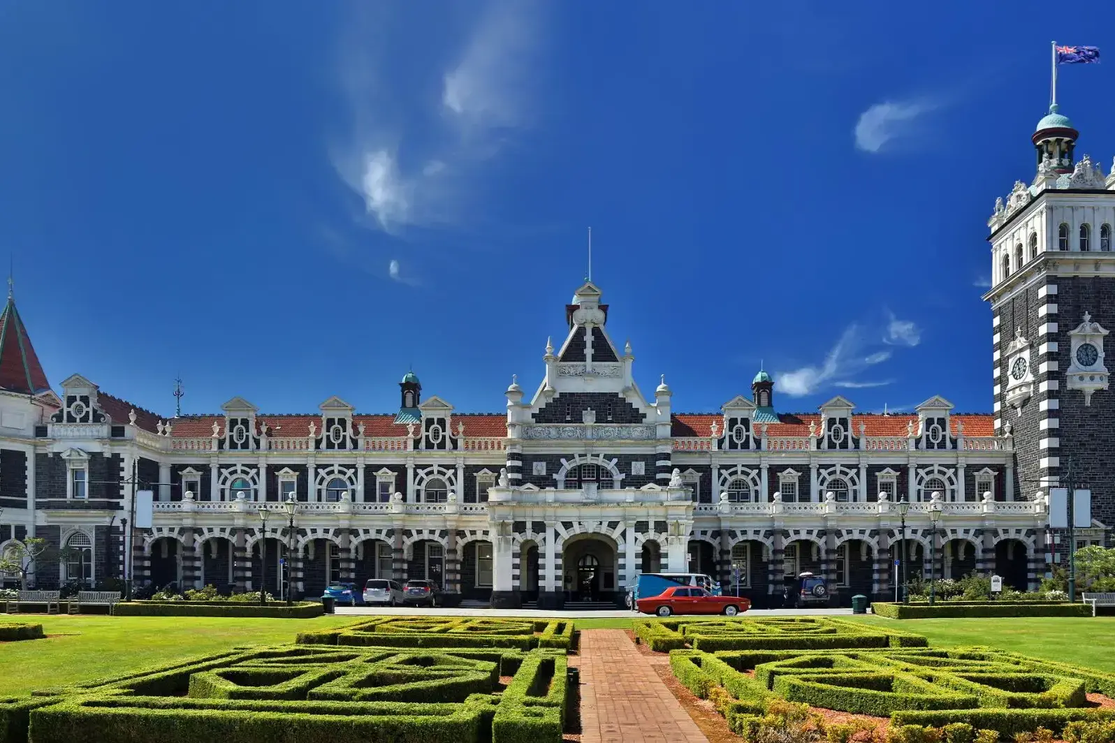
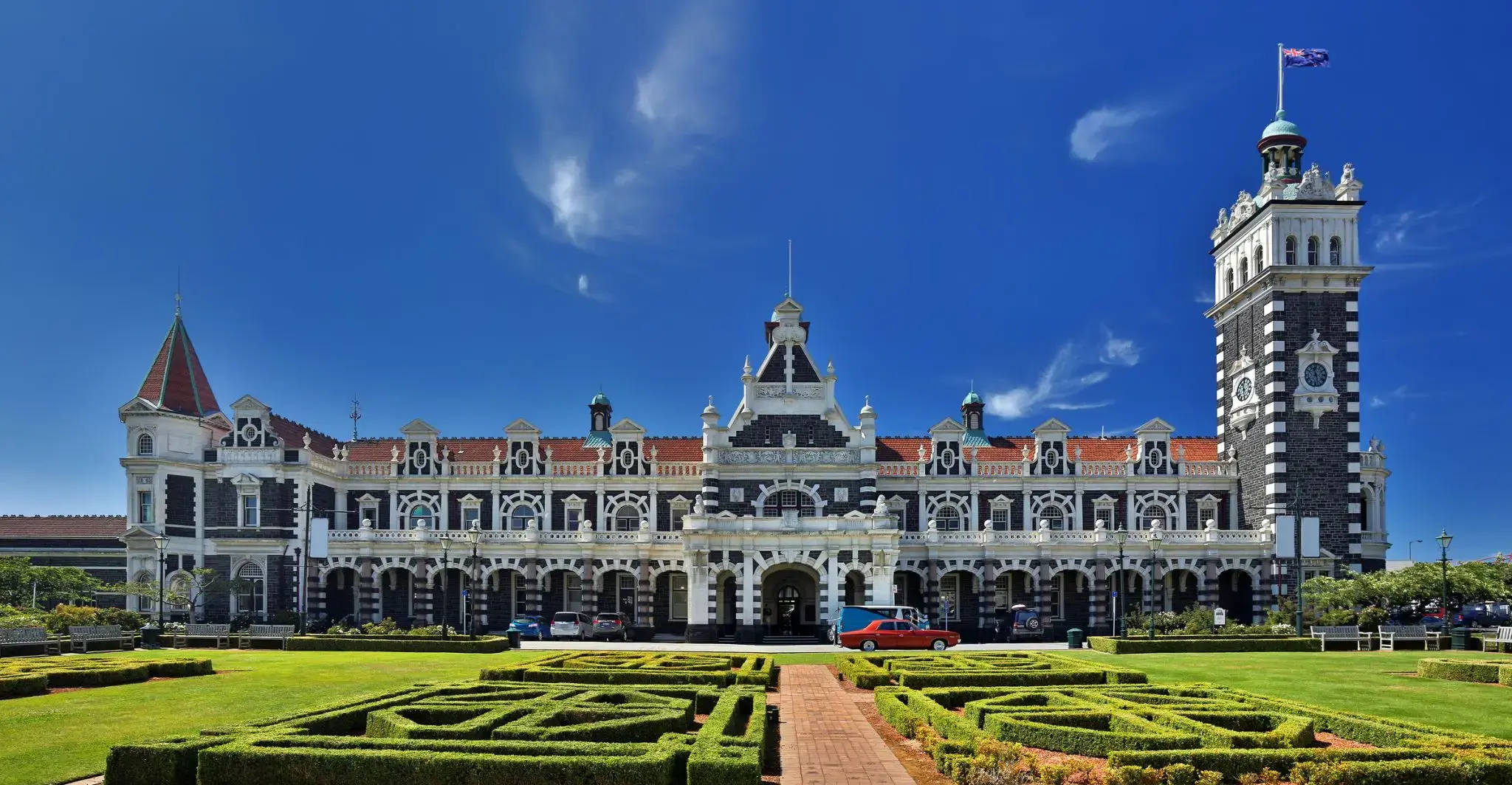
| 50 | 23.02 śr. | Danidin / Nowa Zelandia | 07:30 | 16:00 |
| 51 | 24.02 czw. | Milford-Sound / Nowa Zelandia | 16:00 | 19:00 |
| 52 | 25.02 pt. | Dzień na morzu / Morze | ||
| 53 | 26.02 sob. | Dzień na morzu / Morze | ||
| 54 | 27.02 niedz. | Gobarta na Tasmanii / Australia | 08:00 | |
| 55 | 28.02 pon. | Gobarta na Tasmanii / Australia | 22:00 | |
| 56 | 29.02 wt. | Dzień na morzu / Morze | ||
| 57 | 1.03 śr. | Eden Valley / Australia | 07:30 | 14:00 |
| 58 | 2.03 czw. | Sydnej / Australia | 08:00 | |
| 59 | 3.03 pt. | Sydnej / Australia | 09:00 |

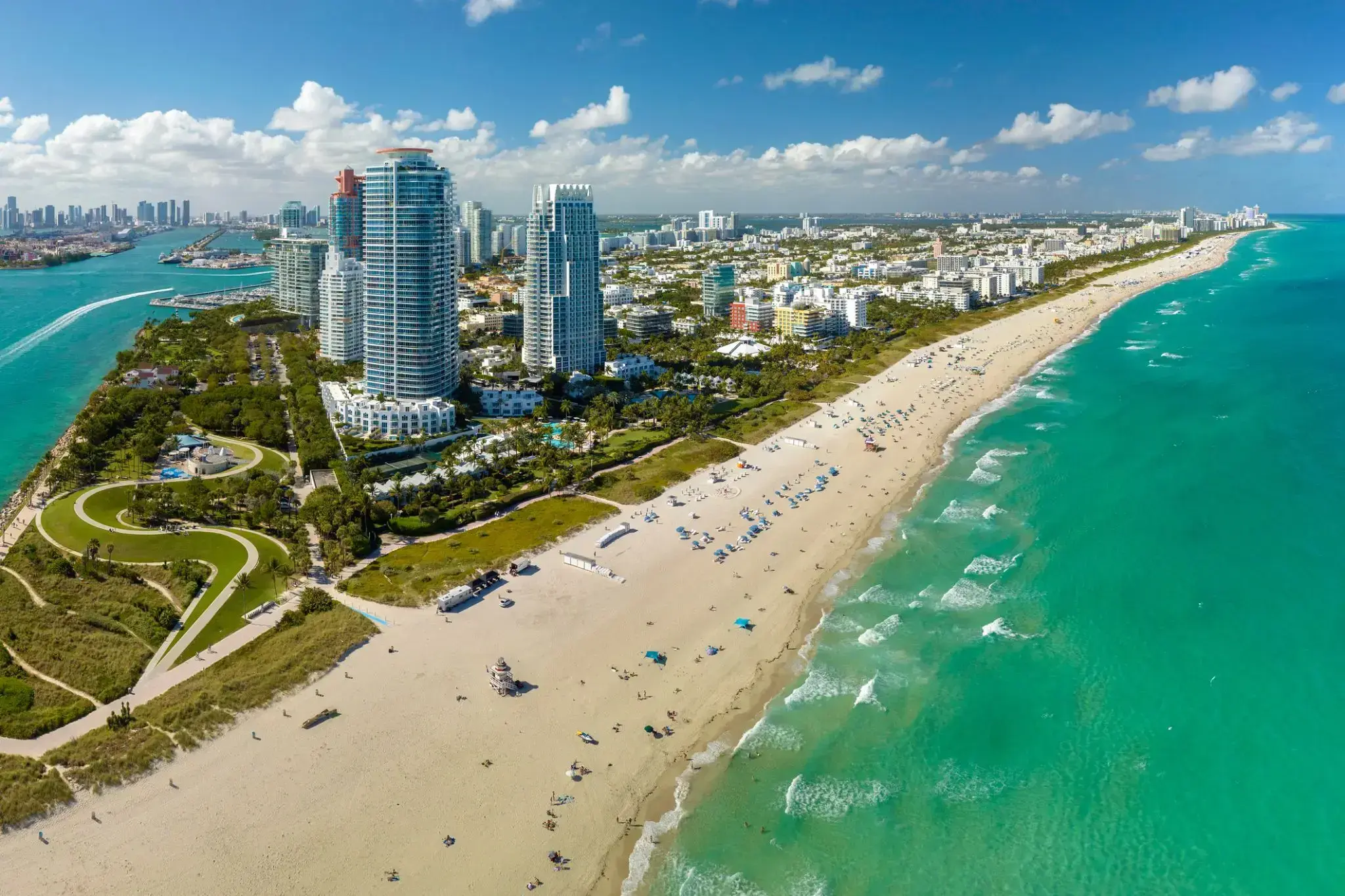
Miami, officially the City of Miami, is the cultural, economic and financial center of South Florida. Miami is the seat of Miami-Dade County, the most populous county in Florida. The city covers an area of about 56.6 square miles (147 km2), between the Everglades to the west and Biscayne Bay on the east; with a 2017 estimated population of 463,347, Miami is the sixth most densely populated major city in the United States. The Miami metropolitan area is home to 6.1 million people and the seventh-largest metropolitan area in the nation. Miami's metro area is the second-most populous metropolis in the southeastern United States and fourth-largest urban area in the U.S.
Miami is a major center, and a leader in finance, commerce, culture, media, entertainment, the arts, and international trade. The Miami Metropolitan Area is by far the largest urban economy in Florida and the 12th largest in the United States with a GDP of $344.9 billion as of 2017. In 2012, Miami was classified as an "Alpha−" level world city in the World Cities Study Group's inventory. In 2010, Miami ranked seventh in the United States and 33rd among global cities in terms of business activity, human capital, information exchange, cultural experience, and political engagement. In 2008, Forbes magazine ranked Miami "America's Cleanest City", for its year-round good air quality, vast green spaces, clean drinking water, clean streets, and citywide recycling programs. According to a 2009 UBS study of 73 world cities, Miami was ranked as the richest city in the United States, and the world's seventh-richest city in terms of purchasing power. Miami is nicknamed the "Capital of Latin America" and is the largest city with a Cuban-American plurality.
Greater Downtown Miami has one of the largest concentrations of international banks in the United States, and is home to many large national and international companies. The Civic Center is a major center for hospitals, research institutes, medical centers, and biotechnology industries. For more than two decades, the Port of Miami, known as the "Cruise Capital of the World", has been the number one cruise passenger port in the world. It accommodates some of the world's largest cruise ships and operations, and is the busiest port in both passenger traffic and cruise lines. Metropolitan Miami is also a major tourism hub in the southeastern U.S. for international visitors, ranking number two in the country after New York City.

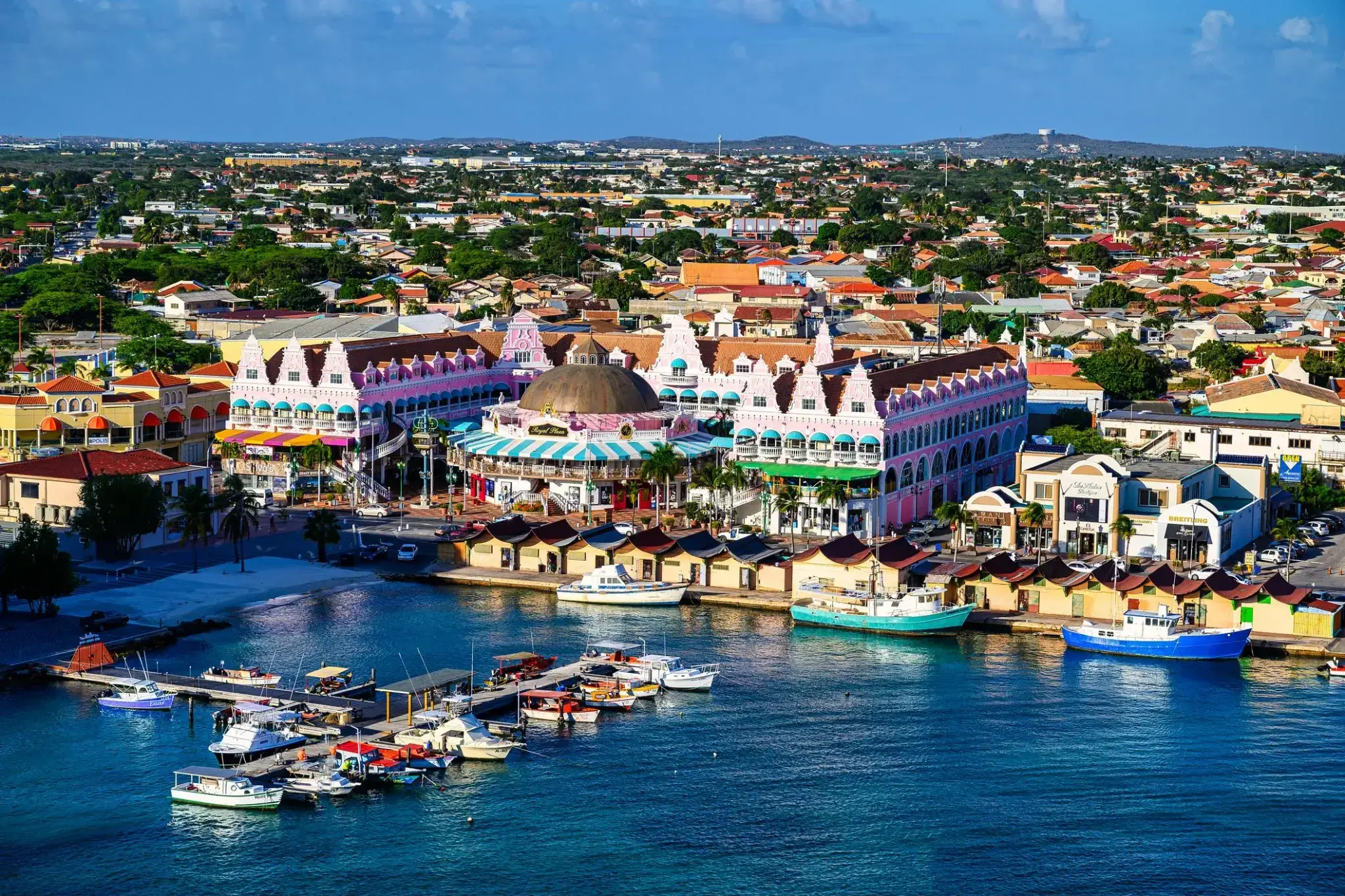
Aruba is an island and a constituent country of the Kingdom of the Netherlands in the southern Caribbean Sea, located about 1,600 kilometres (990 mi) west of the main part of the Lesser Antilles and 29 kilometres (18 mi) north of the coast of Venezuela. It measures 32 kilometres (20 mi) long from its northwestern to its southeastern end and 10 kilometres (6 mi) across at its widest point. Together with Bonaire and Curaçao, Aruba forms a group referred to as the ABC islands. Collectively, Aruba and the other Dutch islands in the Caribbean are often called the Dutch Caribbean.
Aruba is one of the four countries that form the Kingdom of the Netherlands, along with the Netherlands, Curaçao, and Sint Maarten; the citizens of these countries are all Dutch nationals. Aruba has no administrative subdivisions, but, for census purposes, is divided into eight regions. Its capital is Oranjestad.
Unlike much of the Caribbean region, Aruba has a dry climate and an arid, cactus-strewn landscape. This climate has helped tourism as visitors to the island can reliably expect warm, sunny weather. It has a land area of 179 km2(69.1 sq mi) and is densely populated, with a total of 102,484 inhabitants at the 2010 Census. It lies outside Hurricane Alley.
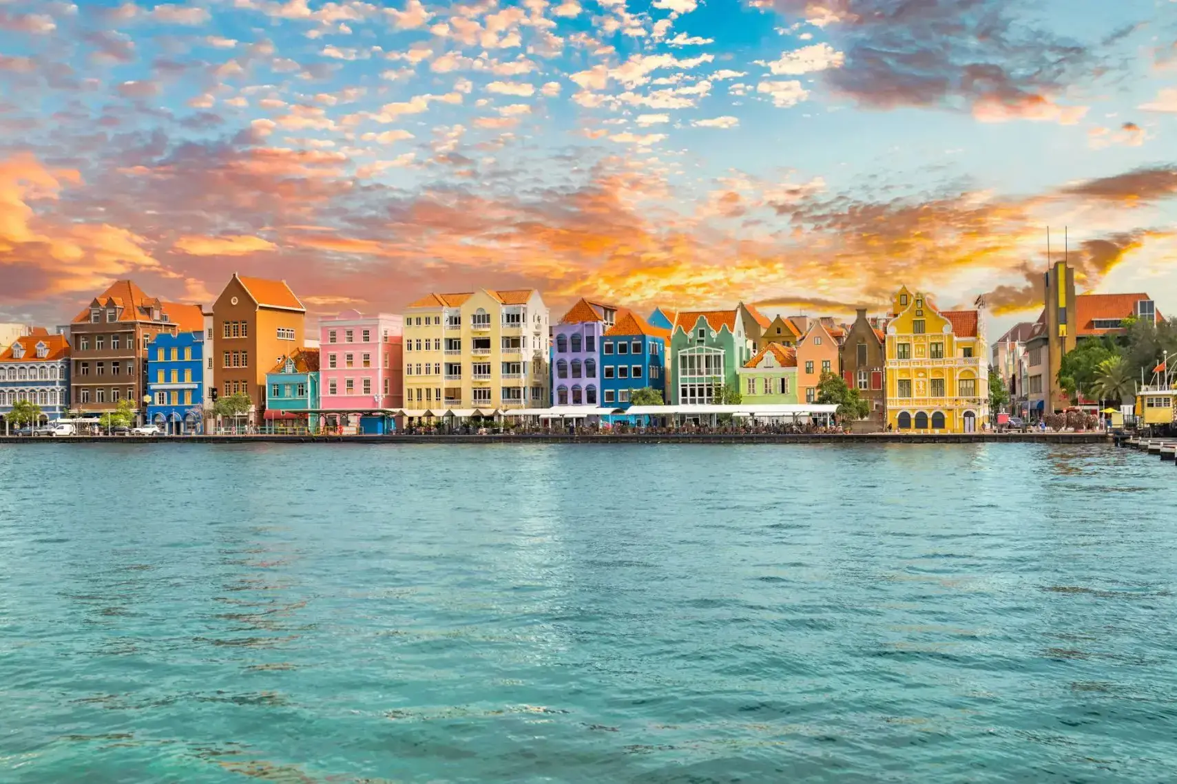
Curaçao jest wyspą w Małych Antylach na południowym Morzu Karaibskim i w regionie Karaibów Holenderskich, około 65 km (40 mil) na północ od wybrzeża Wenezueli. Jest krajem składowym (hol. land) Królestwa Niderlandów.
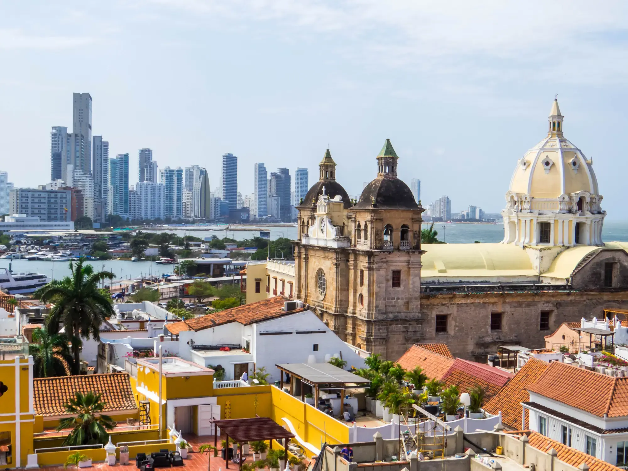
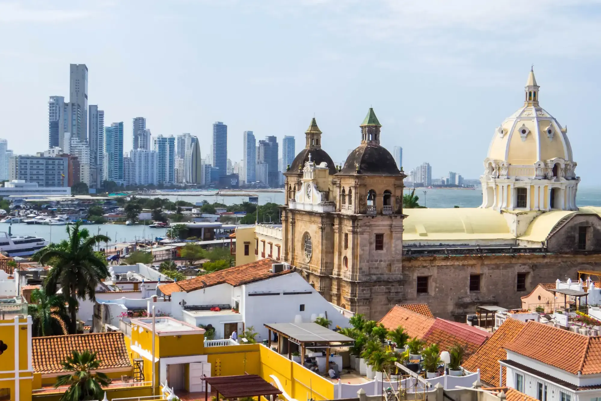
Starożytne mury forteczne, uliczni muzycy i karaibskie słońce tworzą niepowtarzalną atmosferę w Cartagenie (Bolívar) – perle kolumbijskiego wybrzeża. Miasto wpisane na listę światowego dziedzictwa UNESCO zachwyca kolonialną architekturą, uroczymi dziedzińcami i aromatem świeżo parzonej kawy z licznych kawiarni.
Zanurz się w tętniący życiem rytm Cartageny, spacerując brukowanymi uliczkami Starego Miasta, gdzie każdy zakątek kryje opowieści o piratach i hiszpańskich konkwistadorach. Zachód słońca przy starożytnej twierdzy Castillo San Felipe de Barajas to idealne zakończenie dnia pełnego kultury, historii i tropikalnego uroku.
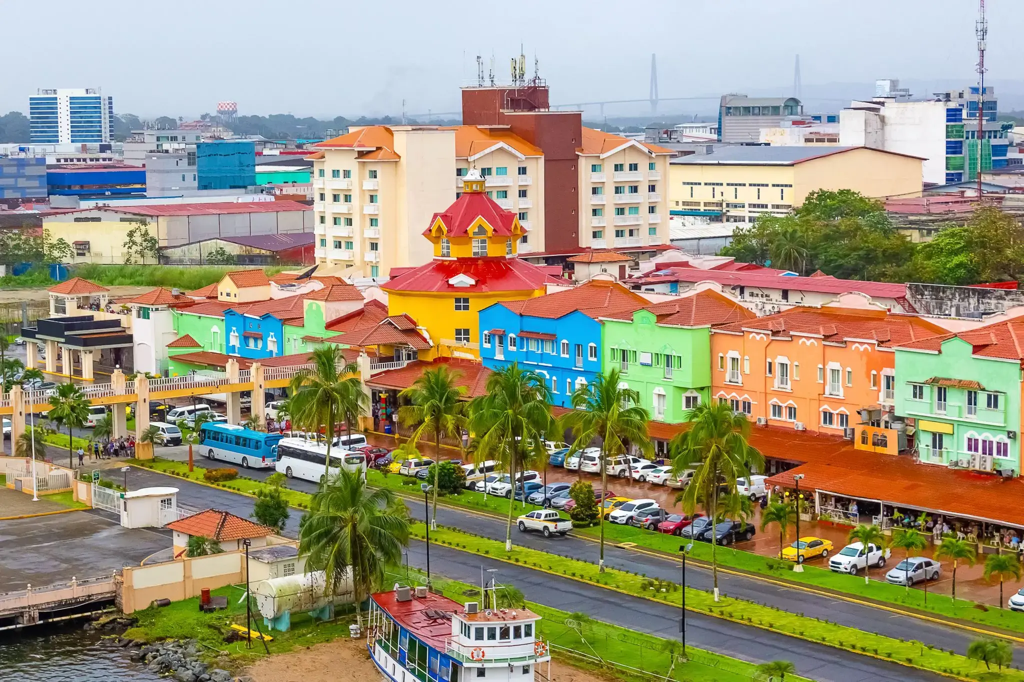
Colon
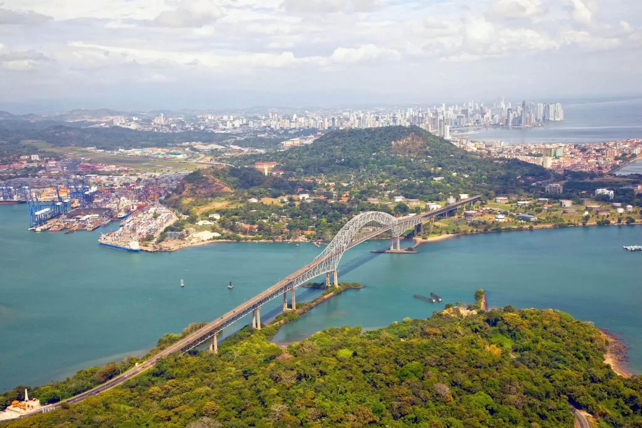
The Panama Canal is an artificial 82 km (51 mi) waterway in Panama that connects the Atlantic Ocean with the Pacific Ocean. The canal cuts across the Isthmus of Panama and is a conduit for maritime trade. Canal locks are at each end to lift ships up to Gatun Lake, an artificial lake created to reduce the amount of excavation work required for the canal, 26 m (85 ft) above sea level, and then lower the ships at the other end. The original locks are 34 m (110 ft) wide. A third, wider lane of locks was constructed between September 2007 and May 2016. The expanded canal began commercial operation on June 26, 2016. The new locks allow transit of larger, post-Panamax ships, capable of handling more cargo.
France began work on the canal in 1881, but stopped due to engineering problems and a high worker mortality rate. The United States took over the project in 1904 and opened the canal on August 15, 1914. One of the largest and most difficult engineering projects ever undertaken, the Panama Canal shortcut greatly reduced the time for ships to travel between the Atlantic and Pacific Oceans, enabling them to avoid the lengthy, hazardous Cape Horn route around the southernmost tip of South America via the Drake Passage or Strait of Magellan.
Colombia, France, and later the United States controlled the territory surrounding the canal during construction. The US continued to control the canal and surrounding Panama Canal Zone until the 1977 Torrijos–Carter Treatiesprovided for handover to Panama. After a period of joint American–Panamanian control, in 1999, the canal was taken over by the Panamanian government. It is now managed and operated by the government-owned Panama Canal Authority.
Panama City, położone na północno-zachodnim wybrzeżu Florydy, słynie z długich, białych plaż z miękkim, kwarcowym piaskiem i ciepłych, szmaragdowych wód Zatoki Meksykańskiej. To nadmorskie miasto jest popularne zarówno wśród rodzin z dziećmi, jak i miłośników sportów wodnych: można tu uprawiać kajakarstwo, parasailing, nurkowanie i wędkarstwo. Szczególną atrakcją jest promenada — Pier Park — gdzie znajdują się sklepy, restauracje i centra rozrywki.
Poza plażowaniem Panama City oferuje także unikalne atrakcje przyrodnicze. W pobliżu znajduje się rezerwat St. Andrews State Park, gdzie można obserwować delfiny, spacerować ścieżkami wśród wydm i lasów sosnowych lub wybrać się na wycieczkę na wyspę Shell Island, zachowaną w stanie nienaruszonym. Miasto łączy atmosferę kurortu z południowym urokiem, oferując spokojny, a jednocześnie pełen wrażeń wypoczynek.
Manta

The island was formed as a volcano 1.5 to 2.5 million years ago, the result of a Society hotspot in the mantle under the oceanic plate that formed the whole of the Society Archipelago. It is theorized that the current bays were formerly river basins that filled during the Holocene searise.
Mo'orea is about 10 miles in width from the west to the east. There are two small, nearly symmetrical bays on the north shore. The one to the west is called 'Ōpūnohu Bay, which is not very populated but many travelers have come into the bay. The main surrounding communes of the bay are Piha'ena in the east and Papetō'ai to the west. The one to the east is Cook's Bay, also called Pao Pao Bay since the largest commune of Mo'orea is at the bottom of the bay. The other communes are Piha'ena to the west and busy Maharepa to the east. The highest point is Mount Tohi'e'a, near the center of Mo'orea. It dominates the vista from the two bays and can be seen from Tahiti. There are also hiking trails in the mountains. The Vai'are Bay is another small inlet, smaller than the two main bays, on the east shore. This bay has been settled a lot and has a lot of business. The main village is located just south of the bay.
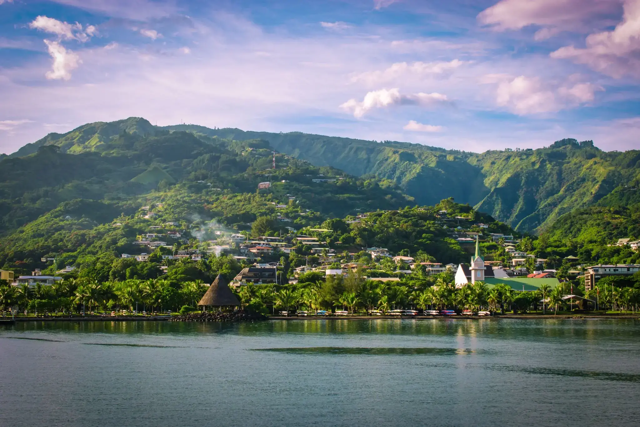
Papeete is the capital city of French Polynesia, an overseas collectivity of France in the Pacific Ocean. The commune of Papeete is located on the island of Tahiti, in the administrative subdivision of the Windward Islands, of which Papeete is the administrative capital. The French High Commissioner also resides in Papeete. It is the primary center of Tahitian and French Polynesian public and private governmental, commercial, industrial and financial services, the hub of French Polynesian tourism and a commonly used port of call. The Windward Islands are themselves part of the Society Islands. The name Papeete means "water from a basket".
The urban area of Papeete had a total population of 136,771 inhabitants at the August 2017 census, 26,926 of whom lived in the commune of Papeete proper.
The island was formed as a volcano 1.5 to 2.5 million years ago, the result of a Society hotspot in the mantle under the oceanic plate that formed the whole of the Society Archipelago. It is theorized that the current bays were formerly river basins that filled during the Holocene searise.
Mo'orea is about 10 miles in width from the west to the east. There are two small, nearly symmetrical bays on the north shore. The one to the west is called 'Ōpūnohu Bay, which is not very populated but many travelers have come into the bay. The main surrounding communes of the bay are Piha'ena in the east and Papetō'ai to the west. The one to the east is Cook's Bay, also called Pao Pao Bay since the largest commune of Mo'orea is at the bottom of the bay. The other communes are Piha'ena to the west and busy Maharepa to the east. The highest point is Mount Tohi'e'a, near the center of Mo'orea. It dominates the vista from the two bays and can be seen from Tahiti. There are also hiking trails in the mountains. The Vai'are Bay is another small inlet, smaller than the two main bays, on the east shore. This bay has been settled a lot and has a lot of business. The main village is located just south of the bay.
Papeete is the capital city of French Polynesia, an overseas collectivity of France in the Pacific Ocean. The commune of Papeete is located on the island of Tahiti, in the administrative subdivision of the Windward Islands, of which Papeete is the administrative capital. The French High Commissioner also resides in Papeete. It is the primary center of Tahitian and French Polynesian public and private governmental, commercial, industrial and financial services, the hub of French Polynesian tourism and a commonly used port of call. The Windward Islands are themselves part of the Society Islands. The name Papeete means "water from a basket".
The urban area of Papeete had a total population of 136,771 inhabitants at the August 2017 census, 26,926 of whom lived in the commune of Papeete proper.


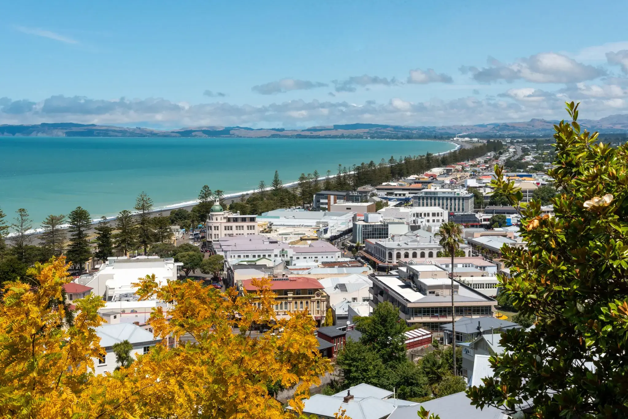
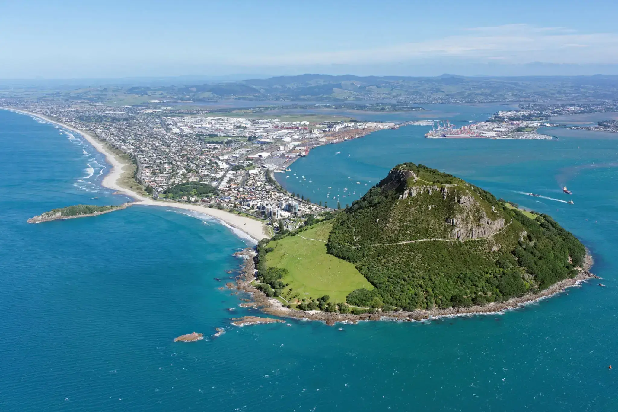
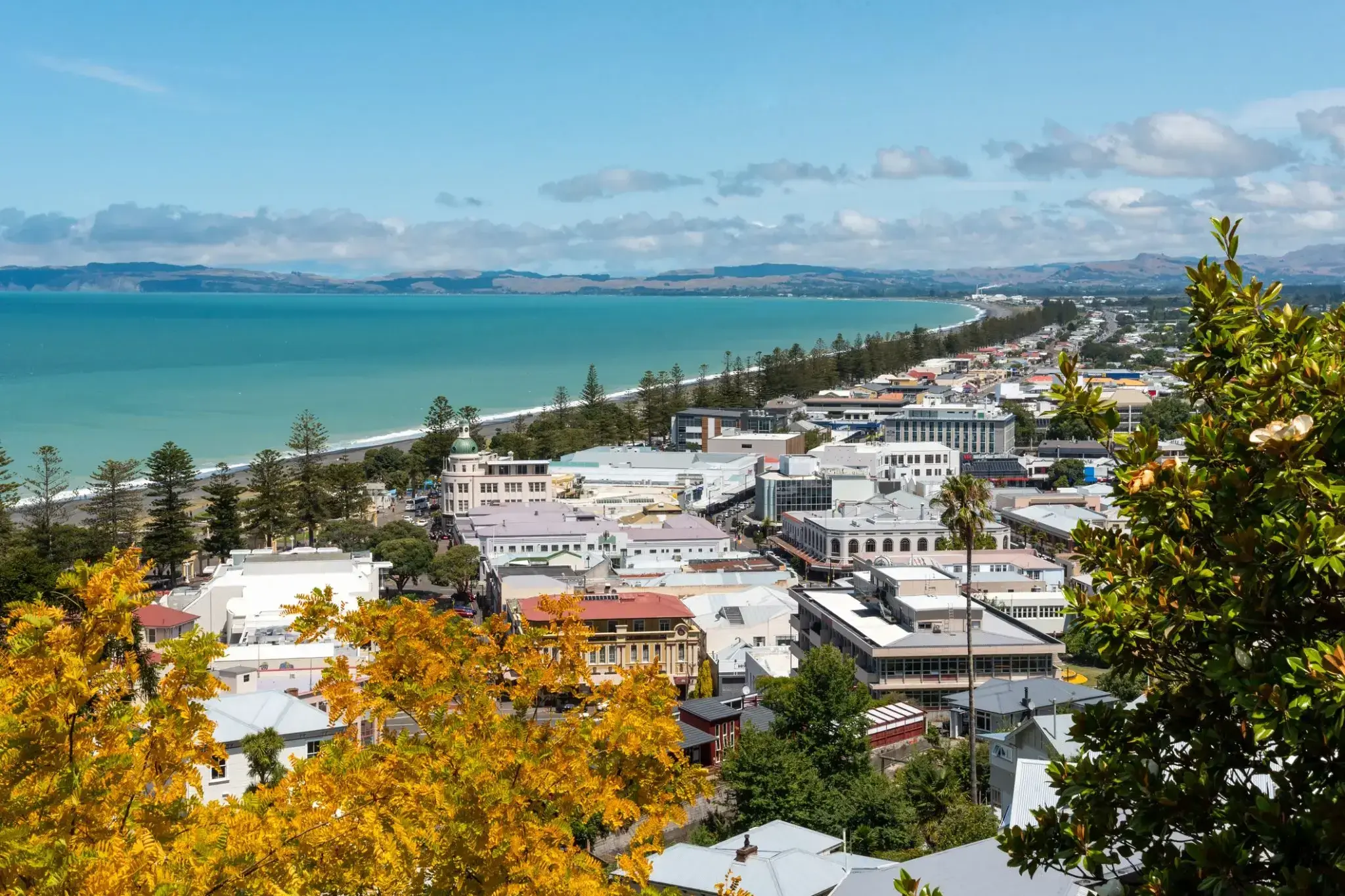
Napier is a New Zealand city with a seaport, located in Hawke's Bay on the eastern coast of the North Island. The population of Napier is about 63,900 as of the June 2018. About 18 kilometres (11 mi) south of Napier is the inland city of Hastings. These two neighbouring cities are often called "The Bay Cities" or "The Twin Cities" of New Zealand. The total population of the Napier-Hastings Urban Area is 134,500 people, which makes it the sixth-largest urban area in New Zealand, closely followed by Dunedin (122,000), and trailing Tauranga(141,600).
Napier is about 320 kilometres (200 mi) northeast of the capital city of Wellington. Napier (63,900) has a smaller population than its neighbouring city of Hastings (70,600) but is seen as the main centre due to it being closer in distance to both the seaport and the main airport that service Hawke's Bay, and Hastings' population figure includes 13,000 people living in Havelock North, which is often considered a town in its own right. The City of Napier has a land area of 106 square kilometres (41 sq mi) and a population density of 540.0 per square kilometre.
Napier is the nexus of the largest wool centre in the Southern Hemisphere, and it has the primary export seaport for northeastern New Zealand – which is the largest producer of apples, pears, and stone fruit in New Zealand. Napier has also become an important grape and wine production area, with the grapes grown around Hastings and Napier being sent through the Port of Napier for export. Large amounts of sheep's wool, frozen meat, wood pulp, and timber also pass through Napier annually for export. Smaller amounts of these materials are shipped via road and railway to the large metropolitan areas of New Zealand itself, such as Auckland, Wellington and Hamilton.
Napier is a popular tourist city, with a unique concentration of 1930s Art Deco architecture, built after much of the city was razed in the 1931 Hawke's Bay earthquake. It also has one of the most photographed tourist attractions in the country, a statue on Marine Parade called Pania of the Reef. Thousands of people flock to Napier every February for the Tremains Art Deco Weekend event, a celebration of its Art Deco heritage and history. Other notable tourist events attracting many outsiders to the region annually include F.A.W.C! Food and Wine Classic events, and the Mission Estate Concert at Mission Estate and Winery in the suburb of Taradale.
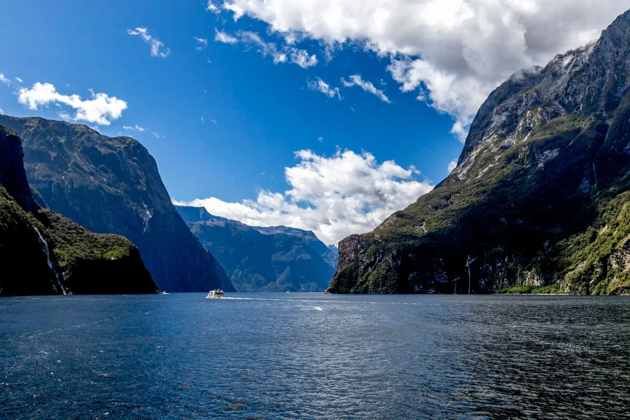
Trudno uwierzyć, że wśród tropikalnych lasów deszczowych i stromych klifów kryje się świat mglistych szczytów i lśniących wodospadów, które w Milford Sound w Nowej Zelandii spadają z wysokości ponad 150 metrów prosto do błękitnych wód fiordu. Ten zakątek Wyspy Południowej zaskakuje swoją mistyczną atmosferą: deszcze padają tu często, ale to one tworzą dziesiątki tymczasowych wodospadów, zamieniając Milford Sound w żywy obraz natury. W wodach fiordu można spotkać delfiny, foki i pingwiny, a przy dobrej pogodzie widać odbicie majestatycznego szczytu Mitre na spokojnej tafli wody.
Najlepszym sposobem, aby poczuć potęgę tego miejsca, jest rejs lub spływ kajakiem obok słynnego wodospadu Stirling i klifów wznoszących się setki metrów nad wodą. Dla bardziej kameralnych wrażeń turyści mogą wybrać się szlakiem Milford Track, jednym z najbardziej malowniczych szlaków pieszych na świecie, prowadzącym przez lasy deszczowe i wiszące mosty do zapierających dech w piersiach widoków na Milford Sound. Tutaj każdy deszcz staje się częścią magii, która pozostaje z wami długo po opuszczeniu tych brzegów.
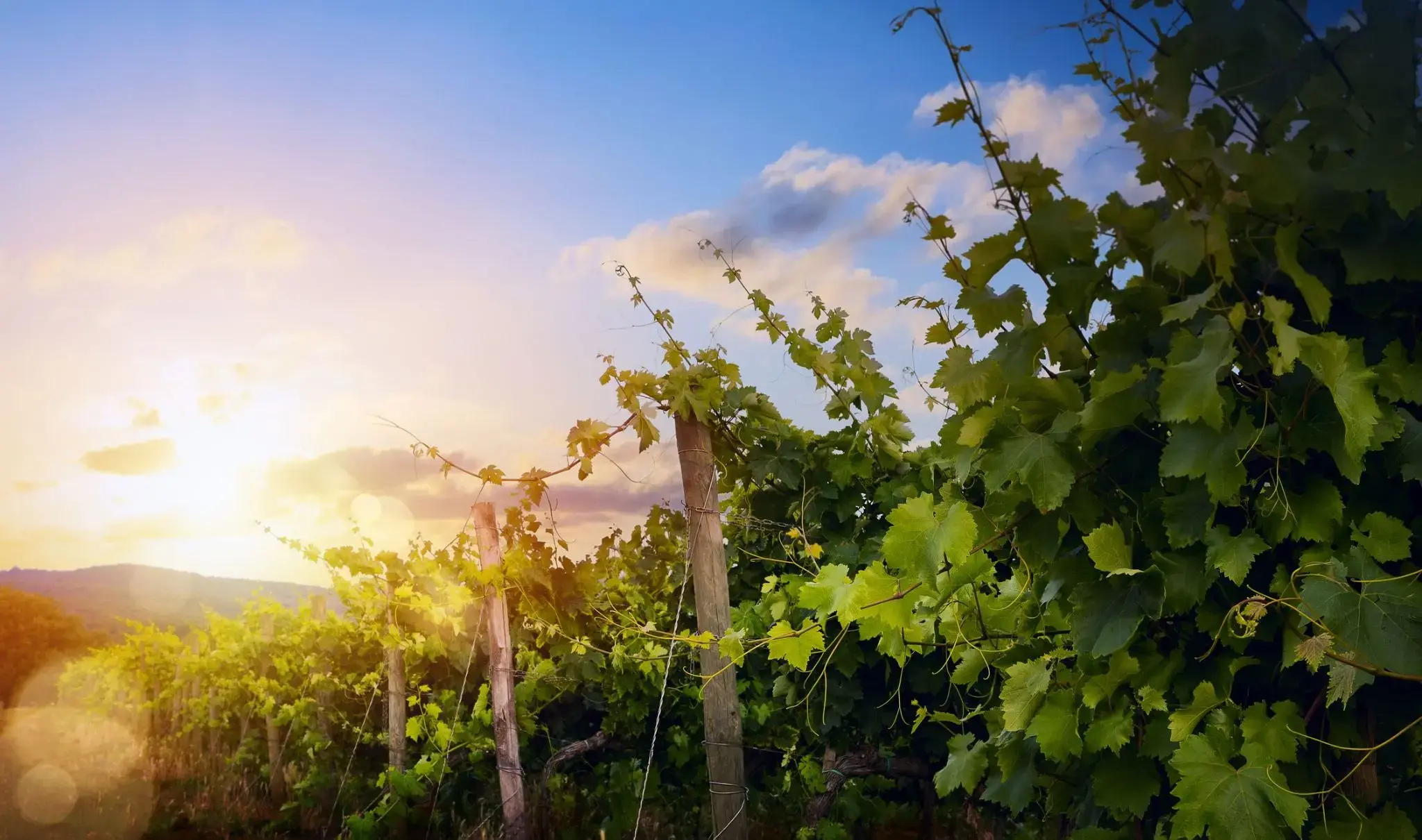
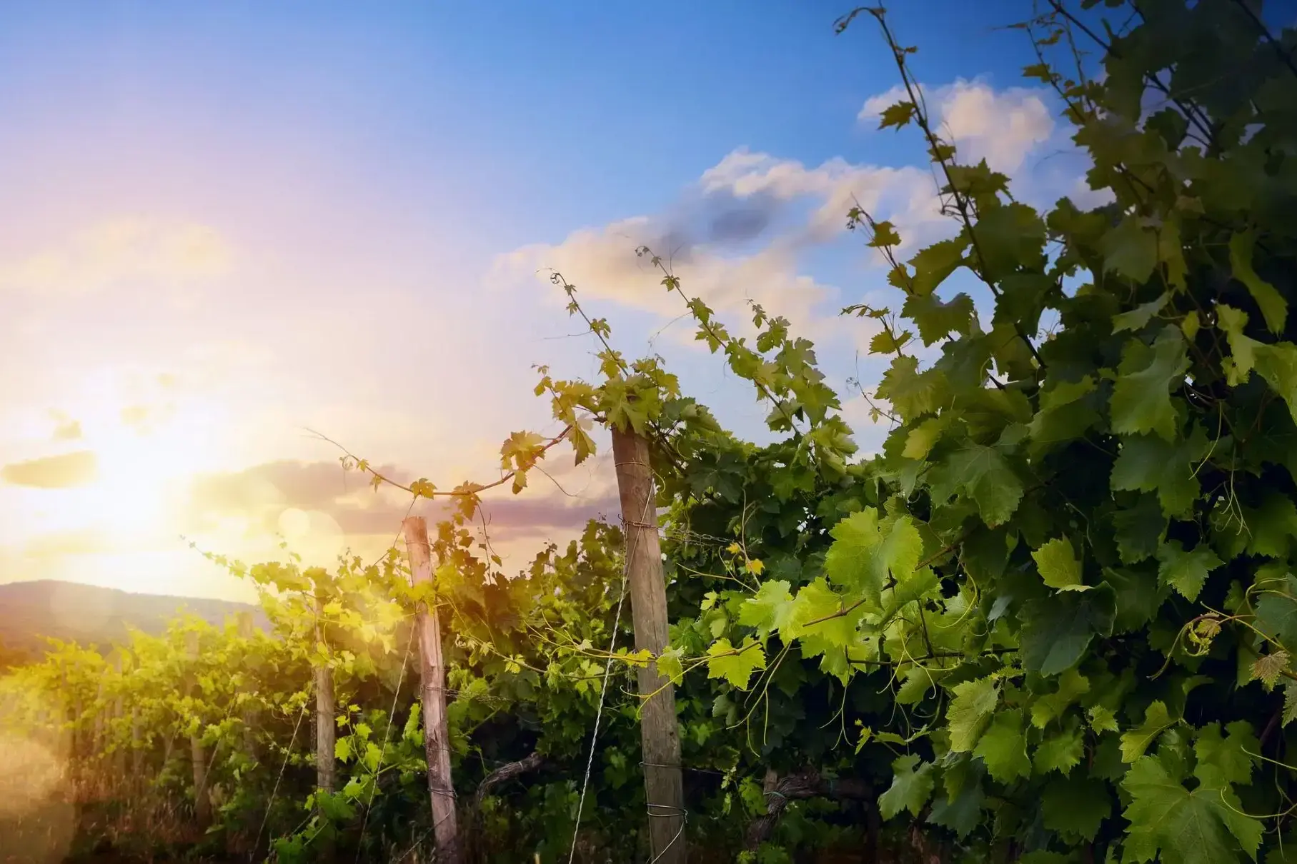
Eden Valley to malownicza dolina położona w sercu Australii, w stanie Południowa Australia. Miejsce to jest znane ze swojej unikalnej naturalnej urody, obfitości dzikiej fauny oraz żyznych ziem rolniczych. W dolinie znajdują się urodzajne gleby, na których uprawia się winorośle, a także produkowane są słynne lokalne wina. Krajobrazy Eden Valley zachwycają zarówno latem, jak i zimą, gdy pagórki pokrywają się zielenią, a na horyzoncie błyszczą ośnieżone szczyty. To także jeden z najlepszych regionów do wycieczek i degustacji win, gdzie turyści mogą nie tylko spróbować miejscowych win, ale również poznać proces ich produkcji.
Dla podróżnych Eden Valley oferuje nie tylko piękno natury, ale również szereg aktywnych zajęć na świeżym powietrzu. Region idealnie nadaje się do pieszych wędrówek, biwakowania i obserwacji dzikiej fauny. Można tu zobaczyć rzadkie gatunki zwierząt, takie jak koale i kangury, a także podziwiać wspaniałe widoki na dolinę z wysokości. Lato w Eden Valley to czas festiwali i wydarzeń kulturalnych, które przyciągają zarówno mieszkańców, jak i turystów. To miejsce dla tych, którzy szukają połączenia natury, przygód i kulinarnych przyjemności, nie oddalając się zbytnio od cywilizacji.
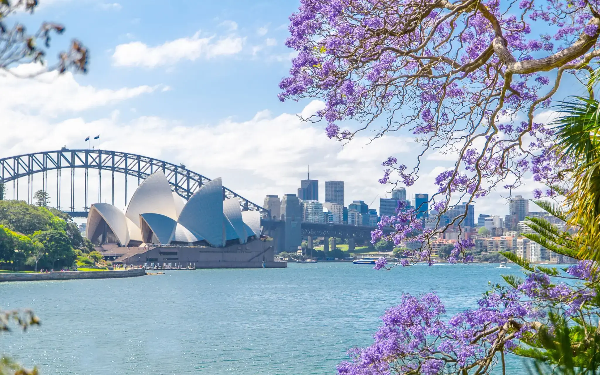
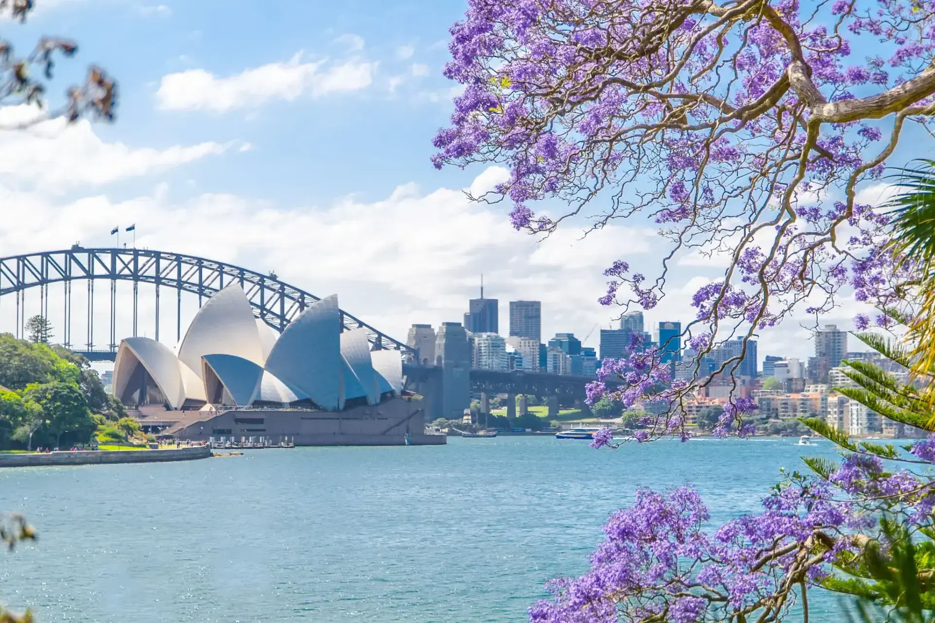
Sydney is the state capital of New South Wales and the most populous city in Australiaand Oceania. Located on Australia's east coast, the metropolis surrounds Port Jackson and extends about 70 km (43.5 mi) on its periphery towards the Blue Mountains to the west, Hawkesbury to the north, and Macarthur to the south. Sydney is made up of 658 suburbs, 40 local government areas and 15 contiguous regions. Residents of the city are known as "Sydneysiders". As of June 2017, Sydney's estimated metropolitan population was 5,131,326, and is home to approximately 65% of the state's population.
Sydney is the state capital of New South Wales and the most populous city in Australiaand Oceania. Located on Australia's east coast, the metropolis surrounds Port Jackson and extends about 70 km (43.5 mi) on its periphery towards the Blue Mountains to the west, Hawkesbury to the north, and Macarthur to the south. Sydney is made up of 658 suburbs, 40 local government areas and 15 contiguous regions. Residents of the city are known as "Sydneysiders". As of June 2017, Sydney's estimated metropolitan population was 5,131,326, and is home to approximately 65% of the state's population.