

Sea cruise · 05.01.2028 – 28.03.2028 · 83 nights
83 nights, from Miami
Route and cruise information
Premium- Miami
- Aruba (Oranjestad)
- Curaçao
- Cartagena (Bolívar)
- Cartagena (Bolívar)
- Column
- Panama Canal
- Panama City, Florida
- Manta rays
- Callao
- Callao
- Easter Island
- Easter Island
- oh. Pitcairn
- Fakarava
- Moorea Islands Society
- Papeete
- Moorea Islands Society
- Papeete
- Bora Bora, Society Islands
- Bora Bora, Society Islands
- Cocksen Hole
- Oakland
- Tauranga
- Napier
- Wellington
- Goal Goal
- Christchurch
- Dunedin
- Milford Sound
- Gobart Tasmania
- Gobart Tasmania
- Eden Valley
- Sydney
- Sydney
- Newcastle
- Mooloolaba
- Airlie Beach Queensland
- Cairns
- Cairns
- Darwin
- Darwin
- KOMODO ISLAND
- Tangjung Benoa
- Tangjung Benoa
- Chelukan-Bawang
- Sandakan
- Puerto Princesa
- Coron Island
- Manila
- Manila
- Limbe
- Limbe
| Date | Port | Arrival | Departure |
|---|---|---|---|
| 05.01.2028 |
Miami
USA
|
— | 18:00 |
| 06.01.2028 |
Day at sea
|
— | — |
| 07.01.2028 |
Day at sea
|
— | — |
| 08.01.2028 |
Aruba (Oranjestad)
Aruba
|
13:30 | 22:00 |
| 09.01.2028 |
Curaçao
Curacao
|
08:00 | 22:00 |
| 10.01.2028 |
Day at sea
|
— | — |
| 11.01.2028 |
Cartagena (Bolívar)
Colombia
|
08:00 | — |
| 12.01.2028 |
Cartagena (Bolívar)
Colombia
|
— | 13:00 |
| 13.01.2028 |
Column
Panama
|
08:00 | 16:00 |
| 14.01.2028 |
Panama Canal
Panama
|
16:05 | 23:59 |
| 15.01.2028 |
Panama City, Florida
USA
|
02:00 | 17:00 |
| 16.01.2028 |
Day at sea
|
— | — |
| 17.01.2028 |
Manta rays
Ecuador
|
08:00 | 13:30 |
| 18.01.2028 |
Day at sea
|
— | — |
| 19.01.2028 |
Callao
Peru
|
13:00 | — |
| 20.01.2028 |
Callao
Peru
|
09:00 | 17:00 |
| 21.01.2028 |
Day at sea
|
— | — |
| 22.01.2028 |
Day at sea
|
— | — |
| 23.01.2028 |
Day at sea
|
— | — |
| 24.01.2028 |
Day at sea
|
— | — |
| 25.01.2028 |
Day at sea
|
— | — |
| 26.01.2028 |
Easter Island
Chile
|
08:00 | — |
| 27.01.2028 |
Easter Island
Chile
|
— | 13:00 |
| 28.01.2028 |
Day at sea
|
— | — |
| 29.01.2028 |
Day at sea
|
— | — |
| 30.01.2028 |
oh. Pitcairn
|
09:00 | 17:00 |
| 31.01.2028 |
Day at sea
|
— | — |
| 01.02.2028 |
Day at sea
|
— | — |
| 02.02.2028 |
Fakarava
French Polynesia
|
09:00 | 14:00 |
| 03.02.2028 |
Moorea Islands Society
French Polynesia
|
09:00 | — |
| 04.02.2028 |
Papeete
French Polynesia
|
18:00 | — |
| 05.02.2028 |
Moorea Islands Society
French Polynesia
|
— | 15:30 |
| 06.02.2028 |
Papeete
French Polynesia
|
09:00 | 18:00 |
| 07.02.2028 |
Bora Bora, Society Islands
French Polynesia
|
08:00 | — |
| 08.02.2028 |
Bora Bora, Society Islands
French Polynesia
|
— | 18:00 |
| 09.02.2028 |
Day at sea
|
— | — |
| 10.02.2028 |
Day at sea
|
— | — |
| 11.02.2028 |
Day at sea
|
— | — |
| 12.02.2028 |
Day at sea
|
— | — |
| 13.02.2028 |
Day at sea
|
— | — |
| 14.02.2028 |
Day at sea
|
— | — |
| 15.02.2028 |
Day at sea
|
— | — |
| 16.02.2028 |
Cocksen Hole
Honduras
|
08:00 | 19:00 |
| 17.02.2028 |
Oakland
New Zealand
|
07:00 | 18:00 |
| 18.02.2028 |
Tauranga
New Zealand
|
08:00 | 18:00 |
| 19.02.2028 |
Napier
New Zealand
|
12:00 | 20:00 |
| 20.02.2028 |
Wellington
New Zealand
|
12:00 | 22:00 |
| 21.02.2028 |
Goal Goal
Australia
|
08:00 | 17:00 |
| 22.02.2028 |
Christchurch
New Zealand
|
07:00 | 18:30 |
| 23.02.2028 |
Dunedin
New Zealand
|
07:30 | 16:00 |
| 24.02.2028 |
Milford Sound
New Zealand
|
16:00 | 19:00 |
| 25.02.2028 |
Day at sea
|
— | — |
| 26.02.2028 |
Day at sea
|
— | — |
| 27.02.2028 |
Gobart Tasmania
Australia
|
08:00 | — |
| 28.02.2028 |
Gobart Tasmania
Australia
|
— | 22:00 |
| 29.02.2028 |
Day at sea
|
— | — |
| 01.03.2028 |
Eden Valley
Australia
|
07:30 | 14:00 |
| 02.03.2028 |
Sydney
Australia
|
08:00 | — |
| 03.03.2028 |
Sydney
Australia
|
09:00 | 22:00 |
| 04.03.2028 |
Newcastle
Great Britain
|
08:00 | 20:00 |
| 05.03.2028 |
Day at sea
|
— | — |
| 06.03.2028 |
Mooloolaba
Australia
|
08:00 | 20:00 |
| 07.03.2028 |
Day at sea
|
— | — |
| 08.03.2028 |
Airlie Beach Queensland
Australia
|
08:00 | 17:00 |
| 09.03.2028 |
Cairns
Australia
|
13:00 | — |
| 10.03.2028 |
Cairns
Australia
|
— | 20:00 |
| 11.03.2028 |
Day at sea
|
— | — |
| 12.03.2028 |
Day at sea
|
— | — |
| 13.03.2028 |
Day at sea
|
— | — |
| 14.03.2028 |
Darwin
Australia
|
08:00 | — |
| 15.03.2028 |
Darwin
Australia
|
— | 13:00 |
| 16.03.2028 |
Day at sea
|
— | — |
| 17.03.2028 |
KOMODO ISLAND
|
13:00 | 17:00 |
| 18.03.2028 |
Tangjung Benoa
Indonesia
|
13:30 | — |
| 19.03.2028 |
Tangjung Benoa
Indonesia
|
09:00 | 22:00 |
| 20.03.2028 |
Chelukan-Bawang
|
08:00 | 16:00 |
| 21.03.2028 |
Day at sea
|
— | — |
| 22.03.2028 |
Day at sea
|
— | — |
| 23.03.2028 |
Sandakan
Malaysia
|
08:00 | 17:00 |
| 24.03.2028 |
Puerto Princesa
Philippine Islands
|
10:30 | 17:30 |
| 25.03.2028 |
Coron Island
Philippine Islands
|
13:00 | 19:00 |
| 26.03.2028 |
Manila
Philippine Islands
|
09:30 | — |
| 27.03.2028 |
Manila
Philippine Islands
|
— | 14:00 |
| 28.03.2028 |
Day at sea
|
— | — |
| 29.03.2028 |
Limbe
Cameroon
|
08:00 | — |
| 30.03.2028 |
Limbe
Cameroon
|
09:00 | — |
-
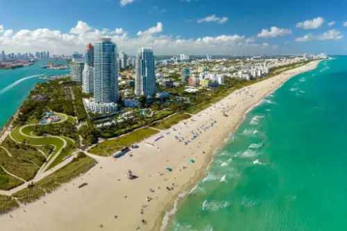 Day 1: 18:00
Miami / USA
Miami, officially the City of Miami, is the cultural, economic and financial center of South Florida. Miami is the seat of Miami-Dade County, the most populous county in Florida. The city covers an area of about 56.6 square miles (147 km2), between the Everglades to the west and Biscayne Bay on the east; with a 2017 estimated population of 463,347, Miami is the sixth most densely populated major city in the United States. The Miami metropolitan area is home to 6.1 million people and the seventh-largest metropolitan area in the nation. Miami's metro area is the second-most populous metropolis in the southeastern United States and fourth-largest urban area in the U.S.
Miami is a major center, and a leader in finance, commerce, culture, media, entertainment, the arts, and international trade. The Miami Metropolitan Area is by far the largest urban economy in Florida and the 12th largest in the United States with a GDP of $344.9 billion as of 2017. In 2012, Miami was classified as an "Alpha−" level world city in the World Cities Study Group's inventory. In 2010, Miami ranked seventh in the United States and 33rd among global cities in terms of business activity, human capital, information exchange, cultural experience, and political engagement. In 2008, Forbes magazine ranked Miami "America's Cleanest City", for its year-round good air quality, vast green spaces, clean drinking water, clean streets, and citywide recycling programs. According to a 2009 UBS study of 73 world cities, Miami was ranked as the richest city in the United States, and the world's seventh-richest city in terms of purchasing power. Miami is nicknamed the "Capital of Latin America" and is the largest city with a Cuban-American plurality.
Greater Downtown Miami has one of the largest concentrations of international banks in the United States, and is home to many large national and international companies. The Civic Center is a major center for hospitals, research institutes, medical centers, and biotechnology industries. For more than two decades, the Port of Miami, known as the "Cruise Capital of the World", has been the number one cruise passenger port in the world. It accommodates some of the world's largest cruise ships and operations, and is the busiest port in both passenger traffic and cruise lines. Metropolitan Miami is also a major tourism hub in the southeastern U.S. for international visitors, ranking number two in the country after New York City.
-
Day 2:
Day at sea / Sea
-
Day 3:
Day at sea / Sea
-
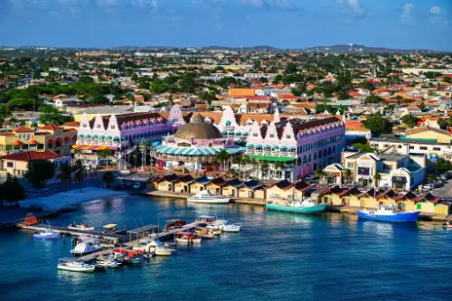 Day 4: 13:30–22:00
Aruba (Oranjestad) / Aruba
Aruba is an island and a constituent country of the Kingdom of the Netherlands in the southern Caribbean Sea, located about 1,600 kilometres (990 mi) west of the main part of the Lesser Antilles and 29 kilometres (18 mi) north of the coast of Venezuela. It measures 32 kilometres (20 mi) long from its northwestern to its southeastern end and 10 kilometres (6 mi) across at its widest point. Together with Bonaire and Curaçao, Aruba forms a group referred to as the ABC islands. Collectively, Aruba and the other Dutch islands in the Caribbean are often called the Dutch Caribbean.
Aruba is one of the four countries that form the Kingdom of the Netherlands, along with the Netherlands, Curaçao, and Sint Maarten; the citizens of these countries are all Dutch nationals. Aruba has no administrative subdivisions, but, for census purposes, is divided into eight regions. Its capital is Oranjestad.
Unlike much of the Caribbean region, Aruba has a dry climate and an arid, cactus-strewn landscape. This climate has helped tourism as visitors to the island can reliably expect warm, sunny weather. It has a land area of 179 km2(69.1 sq mi) and is densely populated, with a total of 102,484 inhabitants at the 2010 Census. It lies outside Hurricane Alley.
-
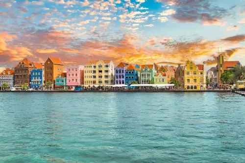 Day 5: 08:00–22:00
Curaçao / Curacao
Curaçao is a Lesser Antilles island in the southern Caribbean Sea and the Dutch Caribbean region, about 65 km (40 mi) north of the Venezuelan coast. It is a constituent country (Dutch: land) of the Kingdom of the Netherlands.
-
Day 6:
Day at sea / Sea
-
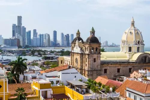 Day 7: 08:00
Cartagena (Bolívar) / Colombia
Ancient fortress walls, street musicians, and the Caribbean sun create an unforgettable atmosphere in Cartagena (Bolívar) — the gem of Colombia's coast. This city, listed as a UNESCO World Heritage Site, enchants visitors with its colonial architecture, charming courtyards, and the aroma of fresh coffee wafting from countless cafés.
Immerse yourself in the vibrant rhythm of Cartagena, strolling through the cobbled streets of the Old Town, where every corner holds tales of pirates and Spanish conquistadors. And the sunset near the ancient Castillo San Felipe de Barajas is the perfect ending to a day filled with culture, history, and tropical romance.
-
Day 8: 13:00
Cartagena (Bolívar) / Colombia
Ancient fortress walls, street musicians, and the Caribbean sun create an unforgettable atmosphere in Cartagena (Bolívar) — the gem of Colombia's coast. This city, listed as a UNESCO World Heritage Site, enchants visitors with its colonial architecture, charming courtyards, and the aroma of fresh coffee wafting from countless cafés.
Immerse yourself in the vibrant rhythm of Cartagena, strolling through the cobbled streets of the Old Town, where every corner holds tales of pirates and Spanish conquistadors. And the sunset near the ancient Castillo San Felipe de Barajas is the perfect ending to a day filled with culture, history, and tropical romance.
-
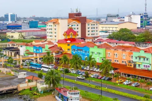 Day 9: 08:00–16:00
Column / Panama
Colon
-
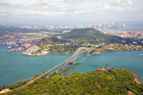 Day 10: 16:05–23:59
Panama Canal / Panama
The Panama Canal is an artificial 82 km (51 mi) waterway in Panama that connects the Atlantic Ocean with the Pacific Ocean. The canal cuts across the Isthmus of Panama and is a conduit for maritime trade. Canal locks are at each end to lift ships up to Gatun Lake, an artificial lake created to reduce the amount of excavation work required for the canal, 26 m (85 ft) above sea level, and then lower the ships at the other end. The original locks are 34 m (110 ft) wide. A third, wider lane of locks was constructed between September 2007 and May 2016. The expanded canal began commercial operation on June 26, 2016. The new locks allow transit of larger, post-Panamax ships, capable of handling more cargo.
France began work on the canal in 1881, but stopped due to engineering problems and a high worker mortality rate. The United States took over the project in 1904 and opened the canal on August 15, 1914. One of the largest and most difficult engineering projects ever undertaken, the Panama Canal shortcut greatly reduced the time for ships to travel between the Atlantic and Pacific Oceans, enabling them to avoid the lengthy, hazardous Cape Horn route around the southernmost tip of South America via the Drake Passage or Strait of Magellan.
Colombia, France, and later the United States controlled the territory surrounding the canal during construction. The US continued to control the canal and surrounding Panama Canal Zone until the 1977 Torrijos–Carter Treatiesprovided for handover to Panama. After a period of joint American–Panamanian control, in 1999, the canal was taken over by the Panamanian government. It is now managed and operated by the government-owned Panama Canal Authority.
-
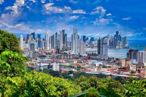 Day 11: 02:00–17:00
Panama City, Florida / USA
Panama City, located on the northwestern coast of Florida, is known for its long white beaches with soft quartz sand and the warm emerald waters of the Gulf of Mexico. This resort town is popular among both family vacationers and lovers of water activities: here you can enjoy kayaking, parasailing, diving, and fishing. One of the highlights is the local promenade — Pier Park — home to shops, restaurants, and entertainment venues.
In addition to beach relaxation, Panama City offers unique natural attractions. Nearby is the St. Andrews State Park, where visitors can watch dolphins, walk along trails through dunes and pine forests, or take a trip to Shell Island, a place of untouched nature. The city blends a resort atmosphere with Southern charm, offering a peaceful yet activity-filled vacation experience.
-
Day 12:
Day at sea / Sea
-
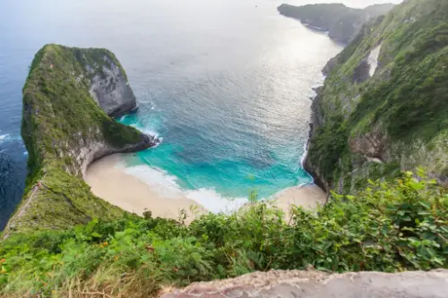 Day 13: 08:00–13:30
Manta rays / Ecuador
Manta
-
Day 14:
Day at sea / Sea
-
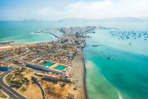 Day 15: 13:00
Callao / Peru
-
Day 16: 09:00–17:00
Callao / Peru
-
Day 17:
Day at sea / Sea
-
Day 18:
Day at sea / Sea
-
Day 19:
Day at sea / Sea
-
Day 20:
Day at sea / Sea
-
Day 21:
Day at sea / Sea
-
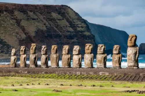 Day 22: 08:00
Easter Island / Chile
-
Day 23: 13:00
Easter Island / Chile
-
Day 24:
Day at sea / Sea
-
Day 25:
Day at sea / Sea
-
Day 26: 09:00–17:00
oh. Pitcairn
-
Day 27:
Day at sea / Sea
-
Day 28:
Day at sea / Sea
-
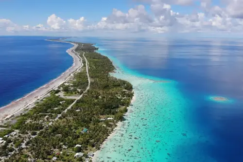 Day 29: 09:00–14:00
Fakarava / French Polynesia
-
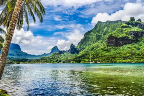 Day 30: 09:00
Moorea Islands Society / French Polynesia
The island was formed as a volcano 1.5 to 2.5 million years ago, the result of a Society hotspot in the mantle under the oceanic plate that formed the whole of the Society Archipelago. It is theorized that the current bays were formerly river basins that filled during the Holocene searise.
Mo'orea is about 10 miles in width from the west to the east. There are two small, nearly symmetrical bays on the north shore. The one to the west is called 'Ōpūnohu Bay, which is not very populated but many travelers have come into the bay. The main surrounding communes of the bay are Piha'ena in the east and Papetō'ai to the west. The one to the east is Cook's Bay, also called Pao Pao Bay since the largest commune of Mo'orea is at the bottom of the bay. The other communes are Piha'ena to the west and busy Maharepa to the east. The highest point is Mount Tohi'e'a, near the center of Mo'orea. It dominates the vista from the two bays and can be seen from Tahiti. There are also hiking trails in the mountains. The Vai'are Bay is another small inlet, smaller than the two main bays, on the east shore. This bay has been settled a lot and has a lot of business. The main village is located just south of the bay.
-
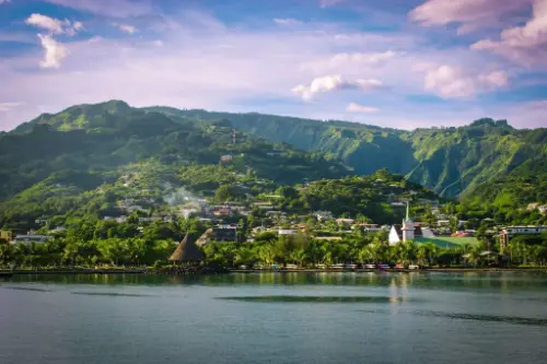 Day 31: 18:00
Papeete / French Polynesia
Papeete is the capital city of French Polynesia, an overseas collectivity of France in the Pacific Ocean. The commune of Papeete is located on the island of Tahiti, in the administrative subdivision of the Windward Islands, of which Papeete is the administrative capital. The French High Commissioner also resides in Papeete. It is the primary center of Tahitian and French Polynesian public and private governmental, commercial, industrial and financial services, the hub of French Polynesian tourism and a commonly used port of call. The Windward Islands are themselves part of the Society Islands. The name Papeete means "water from a basket".
The urban area of Papeete had a total population of 136,771 inhabitants at the August 2017 census, 26,926 of whom lived in the commune of Papeete proper.
-
Day 32: 15:30
Moorea Islands Society / French Polynesia
The island was formed as a volcano 1.5 to 2.5 million years ago, the result of a Society hotspot in the mantle under the oceanic plate that formed the whole of the Society Archipelago. It is theorized that the current bays were formerly river basins that filled during the Holocene searise.
Mo'orea is about 10 miles in width from the west to the east. There are two small, nearly symmetrical bays on the north shore. The one to the west is called 'Ōpūnohu Bay, which is not very populated but many travelers have come into the bay. The main surrounding communes of the bay are Piha'ena in the east and Papetō'ai to the west. The one to the east is Cook's Bay, also called Pao Pao Bay since the largest commune of Mo'orea is at the bottom of the bay. The other communes are Piha'ena to the west and busy Maharepa to the east. The highest point is Mount Tohi'e'a, near the center of Mo'orea. It dominates the vista from the two bays and can be seen from Tahiti. There are also hiking trails in the mountains. The Vai'are Bay is another small inlet, smaller than the two main bays, on the east shore. This bay has been settled a lot and has a lot of business. The main village is located just south of the bay.
-
Day 33: 09:00–18:00
Papeete / French Polynesia
Papeete is the capital city of French Polynesia, an overseas collectivity of France in the Pacific Ocean. The commune of Papeete is located on the island of Tahiti, in the administrative subdivision of the Windward Islands, of which Papeete is the administrative capital. The French High Commissioner also resides in Papeete. It is the primary center of Tahitian and French Polynesian public and private governmental, commercial, industrial and financial services, the hub of French Polynesian tourism and a commonly used port of call. The Windward Islands are themselves part of the Society Islands. The name Papeete means "water from a basket".
The urban area of Papeete had a total population of 136,771 inhabitants at the August 2017 census, 26,926 of whom lived in the commune of Papeete proper.
-
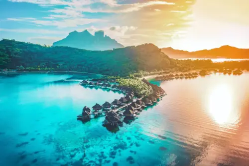 Day 34: 08:00
Bora Bora, Society Islands / French Polynesia
-
Day 35: 18:00
Bora Bora, Society Islands / French Polynesia
-
Day 36:
Day at sea / Sea
-
Day 37:
Day at sea / Sea
-
Day 38:
Day at sea / Sea
-
Day 39:
Day at sea / Sea
-
Day 40:
Day at sea / Sea
-
Day 41:
Day at sea / Sea
-
Day 42:
Day at sea / Sea
-
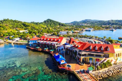 Day 43: 08:00–19:00
Cocksen Hole / Honduras
-
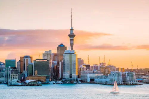 Day 44: 07:00–18:00
Oakland / New Zealand
-
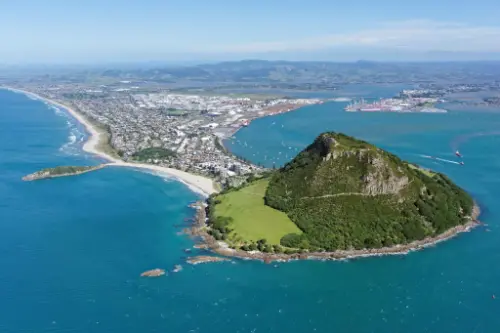 Day 45: 08:00–18:00
Tauranga / New Zealand
-
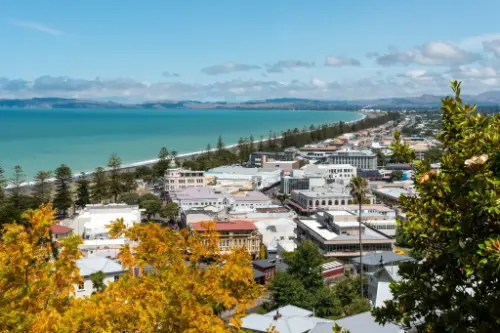 Day 46: 12:00–20:00
Napier / New Zealand
Napier is a New Zealand city with a seaport, located in Hawke's Bay on the eastern coast of the North Island. The population of Napier is about 63,900 as of the June 2018. About 18 kilometres (11 mi) south of Napier is the inland city of Hastings. These two neighbouring cities are often called "The Bay Cities" or "The Twin Cities" of New Zealand. The total population of the Napier-Hastings Urban Area is 134,500 people, which makes it the sixth-largest urban area in New Zealand, closely followed by Dunedin (122,000), and trailing Tauranga(141,600).
Napier is about 320 kilometres (200 mi) northeast of the capital city of Wellington. Napier (63,900) has a smaller population than its neighbouring city of Hastings (70,600) but is seen as the main centre due to it being closer in distance to both the seaport and the main airport that service Hawke's Bay, and Hastings' population figure includes 13,000 people living in Havelock North, which is often considered a town in its own right. The City of Napier has a land area of 106 square kilometres (41 sq mi) and a population density of 540.0 per square kilometre.
Napier is the nexus of the largest wool centre in the Southern Hemisphere, and it has the primary export seaport for northeastern New Zealand – which is the largest producer of apples, pears, and stone fruit in New Zealand. Napier has also become an important grape and wine production area, with the grapes grown around Hastings and Napier being sent through the Port of Napier for export. Large amounts of sheep's wool, frozen meat, wood pulp, and timber also pass through Napier annually for export. Smaller amounts of these materials are shipped via road and railway to the large metropolitan areas of New Zealand itself, such as Auckland, Wellington and Hamilton.
Napier is a popular tourist city, with a unique concentration of 1930s Art Deco architecture, built after much of the city was razed in the 1931 Hawke's Bay earthquake. It also has one of the most photographed tourist attractions in the country, a statue on Marine Parade called Pania of the Reef. Thousands of people flock to Napier every February for the Tremains Art Deco Weekend event, a celebration of its Art Deco heritage and history. Other notable tourist events attracting many outsiders to the region annually include F.A.W.C! Food and Wine Classic events, and the Mission Estate Concert at Mission Estate and Winery in the suburb of Taradale.
-
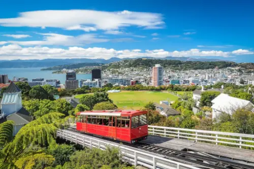 Day 47: 12:00–22:00
Wellington / New Zealand
-
Day 48: 08:00–17:00
Goal Goal / Australia
-
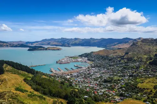 Day 49: 07:00–18:30
Christchurch / New Zealand
-
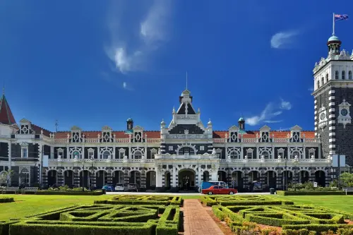 Day 50: 07:30–16:00
Dunedin / New Zealand
-
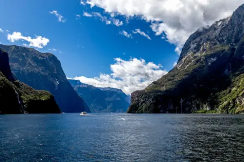 Day 51: 16:00–19:00
Milford Sound / New Zealand
It’s hard to believe that hidden among tropical rainforests and sheer cliffs, Milford Sound in New Zealand offers a world of misty peaks and shimmering waterfalls dropping over 150 meters straight into the fjord’s blue waters. This corner of the South Island surprises visitors with its mystical atmosphere: rain is frequent here, yet it creates dozens of temporary waterfalls that turn Milford Sound into a living painting. Dolphins, seals, and penguins inhabit the fjord’s waters, and on clear days, you can see the reflection of the majestic Mitre Peak on the calm surface.
The best way to feel the power of this place is to take a cruise or kayak, passing by the famous Stirling Falls and the towering cliffs that rise hundreds of meters above the water. For a more intimate experience, visitors can walk the Milford Track, one of the world’s most scenic hiking trails, leading through rainforests and suspension bridges to breathtaking views of Milford Sound. Here, every rainfall becomes part of the magic that stays with you long after you leave these shores.
-
Day 52:
Day at sea / Sea
-
Day 53:
Day at sea / Sea
-
Day 54: 08:00
Gobart Tasmania / Australia
-
Day 55: 22:00
Gobart Tasmania / Australia
-
Day 56:
Day at sea / Sea
-
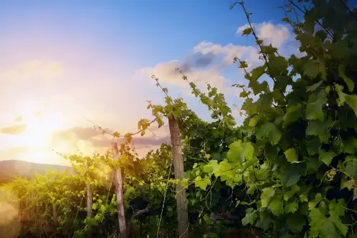 Day 57: 07:30–14:00
Eden Valley / Australia
Eden Valley is a picturesque valley located in the heart of Australia, in the state of South Australia. Known for its unique natural beauty, abundant wildlife, and fertile agricultural lands, this area is home to thriving vineyards and the production of famous local wines. The landscapes of Eden Valley are enchanting both in the warm seasons and during winter, when the rolling hills are covered in greenery, and snowy peaks glisten on the horizon. It is also one of the best regions for wine tours and excursions, where tourists can not only enjoy local wines but also learn about the winemaking process.
For travelers, Eden Valley offers not just natural beauty but a wide range of outdoor activities. The region is perfect for hiking, camping, and wildlife watching. Rare animals, such as koalas and kangaroos, can be spotted here, along with stunning panoramic views of the valley. Summer in Eden Valley is a time for festivals and cultural events, attracting both locals and visitors. It is a place for those seeking a blend of nature, adventure, and culinary delights without straying far from civilization.
-
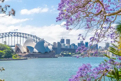 Day 58: 08:00
Sydney / Australia
Sydney is the state capital of New South Wales and the most populous city in Australiaand Oceania. Located on Australia's east coast, the metropolis surrounds Port Jackson and extends about 70 km (43.5 mi) on its periphery towards the Blue Mountains to the west, Hawkesbury to the north, and Macarthur to the south. Sydney is made up of 658 suburbs, 40 local government areas and 15 contiguous regions. Residents of the city are known as "Sydneysiders". As of June 2017, Sydney's estimated metropolitan population was 5,131,326, and is home to approximately 65% of the state's population.
-
Day 59: 09:00–22:00
Sydney / Australia
Sydney is the state capital of New South Wales and the most populous city in Australiaand Oceania. Located on Australia's east coast, the metropolis surrounds Port Jackson and extends about 70 km (43.5 mi) on its periphery towards the Blue Mountains to the west, Hawkesbury to the north, and Macarthur to the south. Sydney is made up of 658 suburbs, 40 local government areas and 15 contiguous regions. Residents of the city are known as "Sydneysiders". As of June 2017, Sydney's estimated metropolitan population was 5,131,326, and is home to approximately 65% of the state's population.
-
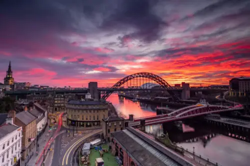 Day 60: 08:00–20:00
Newcastle / Great Britain
-
Day 61:
Day at sea / Sea
-
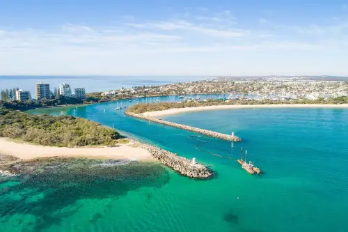 Day 62: 08:00–20:00
Mooloolaba / Australia
Mooloolaba is a picturesque coastal town on the Sunshine Coast in Queensland, Australia, known for its ideal conditions for beach holidays and water sports. The town boasts one of the region's most popular beaches, attracting tourists with its clean sand, calm waters, and excellent opportunities for surfing, swimming, and fishing. Mooloolaba is also famous for its beautiful promenade lined with cafes, restaurants, and shops where visitors can enjoy local cuisine and pick up souvenirs.
In addition to its beaches, Mooloolaba offers a variety of natural attractions. The surrounding area is home to the Mooloolaba National Park and a marine center where visitors can learn about the local flora and fauna, including dolphins and sea turtles. For those seeking seclusion and an opportunity to explore unique ecosystems, islands like Moreton Island are easily accessible. Mooloolaba is the perfect place for active outdoor activities and relaxing seaside moments.
-
Day 63:
Day at sea / Sea
-
Day 64: 08:00–17:00
Airlie Beach Queensland / Australia
-
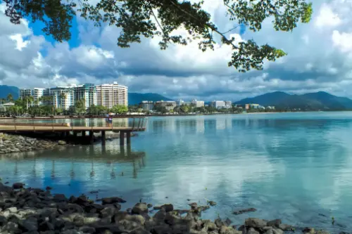 Day 65: 13:00
Cairns / Australia
Cairns City is the suburb at the centre of Cairns in the local government area of Cairns Region, Queensland, Australia.It can also be referred to as the Cairns Central Business District (CBD). In the 2011 census, the population of Cairns City was 2,737 people.
-
Day 66: 20:00
Cairns / Australia
Cairns City is the suburb at the centre of Cairns in the local government area of Cairns Region, Queensland, Australia.It can also be referred to as the Cairns Central Business District (CBD). In the 2011 census, the population of Cairns City was 2,737 people.
-
Day 67:
Day at sea / Sea
-
Day 68:
Day at sea / Sea
-
Day 69:
Day at sea / Sea
-
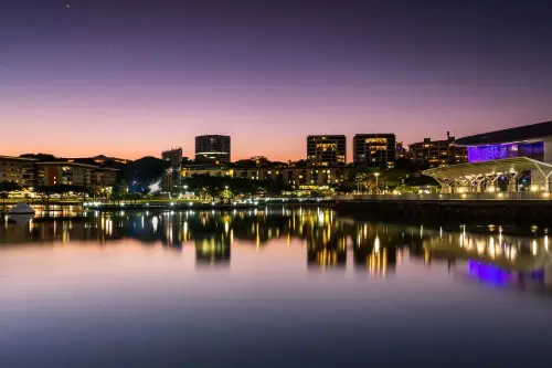 Day 70: 08:00
Darwin / Australia
Darwin is the capital city of the Northern Territory of Australia, situated on the Timor Sea. It is the largest city in the sparsely populated Northern Territory, with a population of 145,916. It is the smallest and most northerly of the Australian capital cities, and acts as the Top End's regional centre.
-
Day 71: 13:00
Darwin / Australia
Darwin is the capital city of the Northern Territory of Australia, situated on the Timor Sea. It is the largest city in the sparsely populated Northern Territory, with a population of 145,916. It is the smallest and most northerly of the Australian capital cities, and acts as the Top End's regional centre.
-
Day 72:
Day at sea / Sea
-
Day 73: 13:00–17:00
KOMODO ISLAND
-
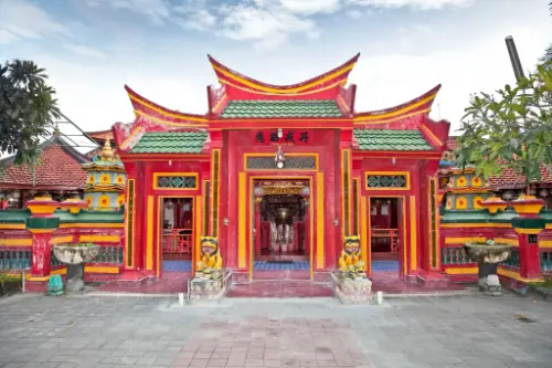 Day 74: 13:30
Tangjung Benoa / Indonesia
-
Day 75: 09:00–22:00
Tangjung Benoa / Indonesia
-
Day 76: 08:00–16:00
Chelukan-Bawang
-
Day 77:
Day at sea / Sea
-
Day 78:
Day at sea / Sea
-
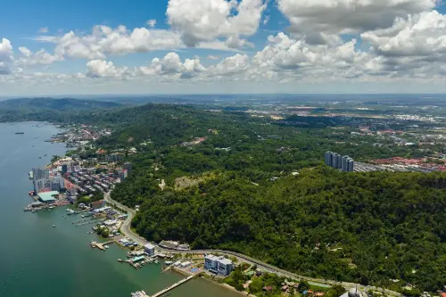 Day 79: 08:00–17:00
Sandakan / Malaysia
-
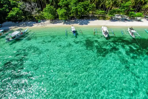 Day 80: 10:30–17:30
Puerto Princesa / Philippine Islands
Puerto Princesa is a city on the island of Palawan in the Philippines, widely known for one of the natural wonders of the world — the Puerto Princesa Underground River, a UNESCO World Heritage Site. This subterranean system of caves and rivers, passing through limestone formations, attracts travelers from around the globe with the opportunity to ride a boat along the river and see stalactites, stalagmites, and a unique ecosystem. The city also serves as a starting point for exploring the breathtaking nature of Palawan: tropical forests, coastlines, and nature reserves.
In addition to its natural attractions, Puerto Princesa is known for its clean streets, friendly atmosphere, and well-developed tourist infrastructure. Here you can taste fresh seafood, visit night markets, or go on island-hopping tours in Honda Bay. The city actively promotes ecotourism, maintaining a balance between development and environmental preservation. For travelers seeking a combination of adventure, relaxation, and immersion in Filipino culture, Puerto Princesa is becoming an increasingly attractive destination.
-
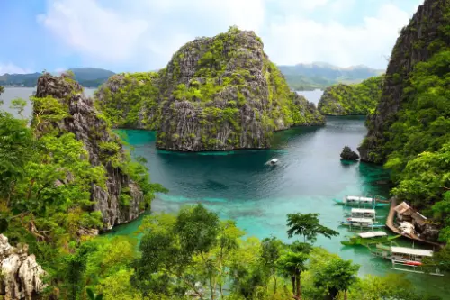 Day 81: 13:00–19:00
Coron Island / Philippine Islands
-
 Day 82: 09:30
Manila / Philippine Islands
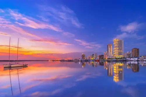
Manila, the capital of the Philippines, is located on the shores of Luzon Island and bordered by Manila Bay. Within the old city of Intramuros, built by the Spanish in 1571, you can find preserved Spanish architectural monuments and churches. The city is also home to the country's main port, which plays a vital role in the Philippine economy. Manila is famous for industries such as chemical, electronics, textiles, food production, and tobacco manufacturing.
For tourists, the Chinatown district is particularly interesting, where pearl and gold products can be purchased. Visitors can also explore various museums and basilicas and enjoy the beauty of Rizal Park. Moreover, Manila is a shopping paradise, offering all the world-famous brands at prices significantly lower than those in Europe.
-
Day 83: 14:00
Manila / Philippine Islands
Manila, the capital of the Philippines, is located on the shores of Luzon Island and bordered by Manila Bay. Within the old city of Intramuros, built by the Spanish in 1571, you can find preserved Spanish architectural monuments and churches. The city is also home to the country's main port, which plays a vital role in the Philippine economy. Manila is famous for industries such as chemical, electronics, textiles, food production, and tobacco manufacturing.
For tourists, the Chinatown district is particularly interesting, where pearl and gold products can be purchased. Visitors can also explore various museums and basilicas and enjoy the beauty of Rizal Park. Moreover, Manila is a shopping paradise, offering all the world-famous brands at prices significantly lower than those in Europe.
-
Day 84:
Day at sea / Sea
-
 Day 85: 08:00
Limbe / Cameroon
-
Day 86: 09:00
Limbe / Cameroon
Tour operator
Biznes i Turystyka Piotr Skupiewski
- ul. Łukowa 41, 32-823 Szczepanów
- NIP 8691148381
- REGON 850455159
- +48 576 977 555
- +48 570 700 273
The tour operator is entered in the Central Register of Tour Operators and Entrepreneurs Facilitating the Purchase of Linked Travel Arrangements. It holds UNIQA insurance guarantee no. 3800003856, valid from 5 May 2026 to 4 May 2027. The guarantee sum is PLN 379,404.00. The operator pays contributions to the Tourist Guarantee Fund and the Tourist Assistance Fund.
Still have a question?
We'll help you choose a cruise and answer your questions.